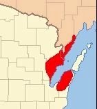
By I, Royalbroil plus Ruhrfisch via Wikimedia Commons
Extent of the Peshtigo Fire
| On Oconto Avenue (County Highway B) west of Ellis Avenue, on the right when traveling west. |
| On State Highway 140 at East State Line Road, on the right when traveling south on State Highway 140. |
| On Shake Rag Street east of Wisconsin Highway 23, on the right when traveling east. |
| On Lake Shore Drive West (U.S. 2) at Turner Road, on the right when traveling west on Lake Shore Drive West. |
| On U.S. 14, 0.1 miles east of Dover Lane, on the left when traveling east. |
| Near East 3rd Street / Great River Road (State Highway 35) 0.4 miles east of Chase Street (County Highway K), on the right when traveling east. |
| On Plank Road at Center Street on Plank Road. |
| On North Villa Louis Road north of Bolvin Street, on the left when traveling north. Reported permanently removed. |
| On County Road Q, 0.3 miles south of County Road B, on the left when traveling south. |
| On Vulcan Street at East North Island, on the right when traveling south on Vulcan Street. Reported permanently removed. |
| On County Road S at County Road J, on the right when traveling east on County Road S. |
| On State Highway 178, 0.1 miles south of 150th Avenue/Barn Road, on the right when traveling north. |
| On Harbor View Parkway/East Second Street (U.S. 53). |
| On County Highway C north of Interstate 90/94, on the right when traveling east. |
| Near County Highway A, 0.2 miles east of County Highway 144. Reported missing. |
| Near County Route F, 0.8 miles north of Cave of the Mounds Road, on the right when traveling north. |
| Near Park Road, 0.1 miles north of U.S. 12, on the right when traveling north. |
| On South Atwood Avenue at East Court Street, on the right when traveling north on South Atwood Avenue. |
| On U.S. 45, 1.3 miles south of County Highway B, on the right when traveling south. |
| On The Great River Road (State Highway 35) 1.2 miles south of County Highway JJ, on the right when traveling south. |
| On State Highway 171, 0.5 miles east of State Highway 131, on the left when traveling east. |
| On State Highway 11, 0.2 miles west of Big Cut Road, on the right when traveling east. |
| On Chicago Street at Main Street, on the left when traveling east on Chicago Street. |
| On County Highway A, 0.2 miles south of Hiawatha Drive, on the right when traveling south. |
| On Veterans Trail east of Punhoqua Street, on the left when traveling east. |
| On State Highway 13 west of Siskiwit Falls Road, on the left when traveling east. |
| On U.S. 51, 0.1 miles north of Loveland Road, on the right when traveling south. |
| On Main Street at Mill Street on Main Street. Reported missing. |
| On U.S. 14/61, 0.1 miles west of Brye Lane, on the right when traveling west. |
| On State Highway 55 north of State Highway 64, on the left when traveling north. |
| On Great River Road (State Highway 35) 2.5 miles north of Main Street (State Highway 82), on the right when traveling north. |
| Near County Road M, 1.3 miles south of County Road K, on the right when traveling south. |
| On The Great River Road (State Highway 35) 1.9 miles south of County Highway D, on the right when traveling south. |
| On West State Street, on the right when traveling east. |
| Near State Street, 0.1 miles east of Park Street. |
| On County Highway Y at Canyon Park Road, on the right when traveling west on County Highway Y. |
| On State Highway 27 / 70 at Valesh Street, on the right when traveling east on State Highway 27 / 70. |
| Near North Lake Street, 0.1 miles north of County Highway PP, on the right when traveling north. Reported permanently removed. |
| On S 57th St, W Hayes, W Fillmore, on the right when traveling east. |
| On State Highway 136, on the right when traveling north. |
| On West State Street at North 4th Street, West State Street on West State Street. |
| On Sauk Trail Road, 0.8 miles north of East Union Avenue (Wisconsin Highway 32), on the left when traveling north. |
| On South Watertown Street (Business State Highway 26) at Lincoln Street, on the right when traveling north on South Watertown Street. |
| Near State Highway 16, 2 miles County Route F. |
| On South Shore Drive (State Highway 22) 0.3 miles east of Cedar Avenue, on the left when traveling east. |
| On County Road B at Poygan Shores Lane, on the right when traveling west on County Road B. |
| On State Highway 13 north of Burlager/Bodin Road, on the right when traveling north. |
| On State Highway 27 north of North Portage Terrace, on the right when traveling south. |
| On U.S. 18, 0.2 miles west of Wisconsin Highway 67, on the right when traveling east. |
| On State Highway 13, 2 miles north of State Highway 77, on the left when traveling north. |
| On U.S. 8 at Kwe Da Kik Lane on U.S. 8. |
| On South Olde Oneida Street south of West Edison Avenue, on the right when traveling south. |
| On East Wells Street, 0.1 miles west of North Water Street, on the left when traveling east. |
| On State Highway 47 south of Cemetery Road, on the left when traveling north. |
| On Charles Street at Sunset Drive, on the right when traveling north on Charles Street. |
| Near Charles Street at Sunset Drive. |
| On State Highway 33, 0.2 miles west of County Highway F, on the left when traveling east. |
| Near Bay Settlement Road north of Van Laanen Road, on the right when traveling north. |
| On State Highway 33, 0.2 miles west of County Road F, on the left when traveling east. |
| On Main Street east of County Highway D, on the left when traveling east. |
| On South Lake Avenue (State Highway 13) north of Walnut Street, on the right when traveling north. |
| On State Highway 54, 4.5 miles east of Interstate 94, on the left when traveling east. |
| On Water Street at West Cumberland Street, on the left when traveling north on Water Street. |
| On Powell Street south of Saint Andrew Street, on the left when traveling south. |
| On State Highway 47/55, 0.6 miles north of Strauss Road, on the right when traveling north. |
| On State Highway 32, 0.5 miles north of State Highway 165, on the right when traveling north. |
| Near Durand Avenue at South Ohio Street. |
| On State Highway 110 at Schoneck Road, on the left when traveling south on State Highway 110. |
| Near Charles Street at Sunset Drive. |
| On County Route G at County Route B, on the right on County Route G. |
| On Great River Road (State Highway 35) 0.3 miles south of Main Street (State Highway 56), on the left when traveling south. |
| On State Highway 96 near Washington Street, on the left when traveling west. |
| On Brazeau Avenue (U.S. 41) 0.1 miles south of Charles Street (State Highway 22), on the left when traveling north. |
| On Lake Street (State Highway 33/82) 0.1 miles west of Elm Avenue, on the left when traveling west. |
| On U.S. 61 at Old 61, on the left when traveling south on U.S. 61. |
| Near State Highway 54 at McKeeth Road, on the right when traveling east. |
| On State Highway 32, 1.3 miles south of County Highway B, on the right when traveling south. |
| On North Main Street (U.S. 14/61) 0.1 miles south of County Highway BB, on the right when traveling north. |
| On Park Street at University Avenue, on the right when traveling north on Park Street. |
| On Granville Road, 0.2 miles south of Freistadt Road, on the right when traveling south. |
| On State Highway 54, 0.8 miles west of County Highway GG, on the right when traveling west. |
| On North Wisconsin Street (County Highway HH) north of West Julius Street (County Highway N), on the right when traveling south. |
| On North Superior Avenue (U.S. 12) north of Arthur Street, on the right when traveling north. |
| On U.S. 12, 1.2 miles north of Prairie Road (County Highway Z), on the right when traveling north. |
| On U.S. 8, 0.1 miles west of County Road F, on the left when traveling west. |
| On South Beaumont Road north of West Rice Street, on the right when traveling south. Reported permanently removed. |
| On State Highway 49, 2.7 miles east of County Highway I, on the left when traveling east. |
| On U.S. 51, 0.5 miles south of West Happy Hollow Road, on the right when traveling south. |
| Near West Shore Road, 0.3 miles north of County Highway E. |
| On Campus Lane, 0.1 miles west of Edgerton Road (Wisconsin Highway 106), on the left when traveling west. |
| On State Highway 27 / 70 at Reserve Road, on the left when traveling east on State Highway 27 / 70. |
| On State Highway 42 near Maple Heights Circle (unmarked private farm road). |
| On Riverside Drive (State Highway 106), on the left when traveling east. |
| Near Asmus Road (State Highway 108) 0.2 miles west of County Highway C, on the right when traveling north. |
| On State Highway 16 east of State Highway 108, on the right when traveling east. |
| On Memorial Circle south of 11th Street, on the right when traveling south. |
| On South Jefferson Street, 0 miles north of East Oak Street, on the right. |
| Near State Highway 13/16, 0.1 miles east of U.S. 12, on the right when traveling east. |
| Near Lost Dauphin Road (County Road D). |
600 entries matched your criteria. The first 100 are listed above.
Next 100 ⊳