Markers associated with the 240-mile long linear state park that runs between St. Charles and Clinton, Missouri, along the former Missouri-Kansas-Texas ("Katy") Railroad trackbed. It is the longest rail-trail in the US.
Katy Trail State Park is one of Missouri's premier attractions, drawing about 400,000 visitors from across the United States and other countries. Stretching 225 miles from St. Charles in the east to Clinton in the west, the trail is the longest . . . — — Map (db m46383) HM
1804...
Land Before the Town
Prior to its settlement, American Indians used the area we now call Rocheport. The closeness to the river, fertile soils, both salt and freshwater springs, and the protection given by the huge bluffs, rock . . . — — Map (db m46345) HM
From its inception and throughout its 20-year history, Katy Trail State Park has been one of the most successful rails-to-trail conversions projects in the United States. As the longest developed rail-trail in the United States, it has been . . . — — Map (db m46403) HM
1826
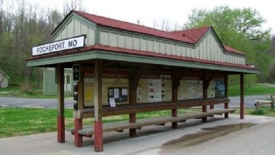
Cedar City's Prosperity
The town Hibernia exists in post office records from 1825. A wilder and wider Missouri River was a half mile closer then, and many people arrived by steamboat. While laying out a new town in 1872, David Kenney . . . — — Map (db m169401) HM
Missouri State Capitol and Museum
The Missouri State Capitol, built in 1918 of Carthage marble and standing 262 feet high, is a majestic site. On the first floor is the Missouri State Museum with one wing dedicated to the history of . . . — — Map (db m169402) HM
Here at the North Jefferson Trail Head, on Sept. 29, 1996, the east and west sections of the Katy Trail were joined, forging the final link uniting St. Charles and Sedalia via Katy Trail State Park. — — Map (db m169404) HM
Missouri was a beginning and end for the Lewis and Clark Expedition. Planned by President Thomas Jefferson and carried out by the two captains and a large crew, the expedition is a keystone American event. When the United States took ownership of . . . — — Map (db m169398) HM
From the time of the Louisiana Purchase and the expedition of Lewis and Clark, the 19th century saw Missouri and the nation journey from a rural frontier to an urban industrialized society. The dawn of the 20th century saw the recognition of a . . . — — Map (db m169403) HM
The distance from North Jefferson to Hartsburg is 10.4 miles. The trail passes through Claysville (milepost 149.8) and crosses Turkey, Cedar and Slate creeks. Bluffs are on the right side and a wide variety of habitats including farms and . . . — — Map (db m169399) HM
The distance from North Jefferson to Tebbetts is 12 miles. The trail passes through Wainwright (milepost 137.6), which was named after a St. Louis financier who helped establish the Missouri, Kansas & Eastern Railroad, later part of the Katy. . . . — — Map (db m169400) HM
The list of recorded floods on the Missouri River is long, but the most devastating in recent history was the Great Flood of 1993. The river at Jefferson City crested more than 15 feet above flood stage. Throughout the Midwest that year, two . . . — — Map (db m169406) HM
Big Business on the Missouri River
The fur trade was a booming business in the wilderness west of St. Louis. Trapping primarily took place on the upper Missouri River in the Dakotas and Montana. Furs were then sent down the river to St. Louis . . . — — Map (db m121229) HM
The Need
When the Missouri, Kansas and Texas (MKT) Railroad established a division in Franklin, Mo., a switching yard was located south of New Franklin. This switching yard contained seven sets of tracks plus the through line. Missouri . . . — — Map (db m46930) HM
From its inception and throughout its 25-year history, Katy Trail State Park
has been one of the most successful rails-to-trails conversions projects in the
United States. As the longest developed rail-trail in the United States, it
has been . . . — — Map (db m162217) HM
The McKittrick-Portland segment is 15.10 miles long.
After leaving McKittrick, the trail goes under Highway 19 and crosses the Loutre River. Hermann is visible across the river valley from around milepost 102. Deutschheim State Historic Site . . . — — Map (db m162215) HM
Katy Trail State Park users cover the longest
segment between trailheads on the entire trail from
McKittrick to Treloar: 16.10 miles. McKittrick is a former
Katy Railroad town, and remains of the depot foundation
and coal sheds are still . . . — — Map (db m162216) HM
1860...
Vision of Prosperity
Welcome to Sedalia, Pettis County seat and home of the Missouri State Fair. Sedalia, originally named Sedville, began as a vision in the mind and on the farm of George R. Smith. "Sed" was the nickname of . . . — — Map (db m85305) HM
From its inception and throughout its 25-year history, Katy Trail State Park has been one of the most successful rails-to-trail conversions projects in the United States. As the longest developed rail-trail in the United States, it has been . . . — — Map (db m85301) HM
The Sedalia Depot visitor center is the place to begin a Sedalia sightseeing tour. Building hours are posted on the door, and visitors are welcome to tour the historic building, discover the history of Sedalia's railroad culture and learn . . . — — Map (db m85311) HM
Clifton City, the next trail head east, is 11.7 miles by way of the old rail corridor. Due to an undeveloped section of trail immediately east of here, some travel over city streets is required, adding slightly to that distance. The grade is . . . — — Map (db m85314) HM
The Trail's End Project is an historical, educational and artistic tribute to the American spirit of opportunity, adventure and perseverance staged in the 1860's era of dynamic western development. The times were turbulent with political[,] . . . — — Map (db m85134) HM
From Augusta to Dutzow along Katy Trail State Park is 7.70 miles. Augusta has a strong German heritage like many other lower Missouri River towns. This area has several wineries open to the public. Founded in 1836, Augusta has preserved . . . — — Map (db m133204) HM
Katy Trail State Park runs for 5.70 miles from Augusta to Matson. The first four miles are away from roads, and trail users can enjoy the farm landscape and bottomland forest of the Missouri River floodplain, lined by increasingly taller . . . — — Map (db m133202) HM
When we think of American wine, California comes to mind, and perhaps Oregon, Washington or New York. But Missouri? Ja, absolutely. German immigrants settling on the lower Missouri River, and later, Italians coming to the St. James area, brought . . . — — Map (db m133207) HM
Welcome to Katy Trail State Park, one of 87 state parks and historic sites managed by Missouri State Parks. Whether you are beginning or ending your journey, Machens is the eastern terminus of the park. From this point, the Katy Trail . . . — — Map (db m169575) HM
Daniel Boone and his fellow travelers—his sons' and daughters' families, other relations, friends and family slaves—came to Missouri in 1799. Boone was 65 years old and already famous in America and Europe, thanks to his "autobiography" by John . . . — — Map (db m133211) HM
Katy Trail State Park runs for 5.70 miles from Matson to Augusta, Tavern Bluffs, seen across the river, were the scene of a dramatic episode from the Lewis and Clark Expedition: on May 23, 1804, Capt. Meriwether Lewis fell 20 feet before . . . — — Map (db m133210) HM
From Matson to Weldon Spring is 4.6 miles, one of the shortest distances between trailheads in Katy Trail State Park. Defiance, at milepost 58.9, is less than two miles from Matson. It received its name after preventing Matson from having the . . . — — Map (db m133209) HM
From its inception and throughout its 25-year history, Katy Trail State Park has been one of the most successful rails-to-trails conversions projects in the United States. As the longest developed rail-trail in the United States, it has been . . . — — Map (db m163853) HM
The distance from Greens Bottom to St. Charles is 6.20 miles. Traveling east toward St. Charles, the elevation remains almost constant. Greens Bottom (milepost 45.7) is named for the American Revolutionary War (1775-1783) veteran James Green, . . . — — Map (db m169568) HM
The distance from Greens Bottom to Weldon Spring is 10.30 miles. Trail users heading west pass between bluffs and bottomland farm fields in this wide, flat inside bend of the Missouri River. Between milepost 49 and the Weldon Spring . . . — — Map (db m169567) HM
1769
Les Petites Côtes, River Gateway
St. Charles stands on the banks of the Missouri River as the gateway to the Missouri River valley. First known as Les Petites Côtes (Little Hills), it was founded by Louis Blanchette in 1769 as a . . . — — Map (db m169194) HM
Missouri was a beginning and end for the Lewis and Clark Expedition. Planned by President Thomas Jefferson and carried out by the two captains and a large crew, the expedition is a keystone American event. When the United States took ownership of . . . — — Map (db m169204) HM
Picturesque St. Charles hugs the banks of the Missouri River. The mixture of French, early American and German influences and careful restoration to make this a unique historical town.
Main Street of St. Charles was recognized as a . . . — — Map (db m169202) HM
The distance from St. Charles to Greens Bottoms is 6.20 miles. Traveling west toward Greens Bottom, the elevation remains almost constant. In St. Charles, the route of Katy Trail State Park runs beside the Missouri River bluffs. The . . . — — Map (db m169210) HM
Via the Katy Trail, St. Charles to Machens is 12.6 miles. As you head east, the Missouri River emerges from its bluff-shrouded valley into the expansive bottomland of the Illinois-Missouri-Mississippi rivers. The bluffs around St. Charles . . . — — Map (db m169208) HM
Many Missourians may not be aware of the history of Weldon Spring. It was the country's largest explosives plant during World War II and a uranium-processing facility for Cold War nuclear weapons. There are also long-term efforts to clean up the . . . — — Map (db m169488) HM
The distance from Weldon Spring to Greens Bottom is 10.30 miles. From the trailhead, Katy Trail State Park runs through the 8,000-acre Weldon Spring Conservation area for five miles until milepost 51.2. Besides providing a scenic background . . . — — Map (db m169486) HM
From Weldon Spring to Matson is 4.60 miles, one of the shortest distances between trailheads in Katy Trail State Park. At milepost 56.7, less than a mile from the Weldon Spring trailhead is a junction with the Hamburg Trail, a converted haul . . . — — Map (db m169484) HM
From Dutzow to Augusta along Katy Trial State Park is 11.4 miles South from Dutzow trailhead, Katy visitors may take a side trip via highways 94 and 47 to the old German town of Washington, four miles one way. The bridge across the Missouri . . . — — Map (db m132891) HM
One of the shortest distances between Katy Trail State Park trailheads is the 3.7 miles from Dutzow to Marthasville. Dutzow is located in a large gap in the line of Missouri River bluffs. The Katy Trail runs along the base of the bluffs, while . . . — — Map (db m132892) HM
Daniel Boone was legendary while he was alive, thanks to his exploits in leading American settlers to Kentucky and both fighting and befriending American Indians. Outwardly simple—an accomplished hunter and woodsman, conspicuously brave yet . . . — — Map (db m132894) HM
From its inception and throughout its 25-year history, Katy Trail State Park
has been one of the most successful rails-to-trails conversions projects in the
United States. As the longest developed rail-trail in the United States, it
has been . . . — — Map (db m169253) HM
1799
The Village of La Charrette
Long before Europeans settled in this area, Native American tribes including the Missouria, Osage, Sac and Fox used this land as their home or hunting grounds. The French, followed by the Spanish, were . . . — — Map (db m169262) HM
From its inception and throughout its 20-year history, Katy Trail State Park has been one of the most successful rails-to-trail conversions projects in the United States. As the longest developed rail-trail in the United States, it has been . . . — — Map (db m61695) HM
Missouri was a beginning and end for the Lewis and Clark Expedition. Planned by President Thomas Jefferson and carried out by the two captains and a large crew, the expedition is a keystone American event. When the United States took ownership of . . . — — Map (db m61691) HM
One of the shortest distances between Katy Trail State Park trailheads is the 3.7 miles from Marthasville to Dutzow. Shortly after leaving Marthasville, trail users cross Tuque Creek on a 190-foot-long through-truss bridge.
The Tuque Creek . . . — — Map (db m61698) HM
The distance along Katy Trail State Park from Marthasville to Treloar is seven miles. The old Marthasville depot is next to the grain elevators near the Marthasville trailhead. Before the Highway 47 underpass at milepost 78.1, look right . . . — — Map (db m61700) HM
The Advent of the Grain Elevator
An entrepreneur named Joseph Dart, aided by engineer Robert Dunbar, invented a device in 1842 to speed up the grain moving process. The elevator mechanically used a system of ropes and pulleys to scoop grain . . . — — Map (db m169245) HM
1895
New Holstein
When a railroad passed through town, the community often adapted. Sometimes entire towns moved closer to the tracks or new towns grew around depots. At the railroad depot in the river bottoms south of Holstein, area . . . — — Map (db m169251) HM
Farm to Market
Today's modern shopper can walk through a grocery store and have every type of commodity they want within arm's reach, thanks in part to the railroad. We have come a long way since the frontier days when produce such as . . . — — Map (db m169252) HM
The distance along Katy Trail State Park from Treloar to Marthasville is seven miles. Peers, about halfway to Marthasville, was founded in 1893 when the railroad arrived. It was named for MKT attorney Charles Peers. The gap between the trail . . . — — Map (db m169247) HM
Katy Trail State Park users cover the longest segment between trailheads on the entire trail from Treloar to McKittrick: 16.10 miles. Treloar, another railroad town founded with the arrival of the Katy in 1892, has two old grain elevators as . . . — — Map (db m169249) HM