53 entries match your criteria.
Katy Trail State Park Historical Markers
Markers associated with the 240-mile long linear state park that runs between St. Charles and Clinton, Missouri, along the former Missouri-Kansas-Texas ("Katy") Railroad trackbed. It is the longest rail-trail in the US.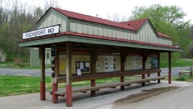
By William Fischer, Jr., April 11, 2011
Edward D. "Ted" and Pat Jones Marker
| 1 ► Missouri, Boone County, Rocheport — Edward D. "Ted" and Pat Jones — |
| 2 ► Missouri, Boone County, Rocheport — History of Rocheport — |
| 3 ► Missouri, Boone County, Rocheport — Katy Trail State Park 20th Anniversary — 1990 - 2010 — |
| 4 ► Missouri, Callaway County, Jefferson City — History of Jefferson City Area — |
| Near Katy Road, 0.9 miles north of Oilwell Road, on the right when traveling north. | |||
| 5 ► Missouri, Callaway County, Jefferson City — Jefferson City & Fulton Points of Interest — |
| Near Katy Road, 0.9 miles north of Oilwell Road, on the right when traveling north. | |||
| 6 ► Missouri, Callaway County, Jefferson City — Katy Trail State Park — |
| On Katy Road, 0.9 miles north of Oilwell Road, on the right when traveling north. | |||
| 7 ► Missouri, Callaway County, Jefferson City — Lewis and Clark in Missouri — |
| On Katy Road, 0.9 miles north of Oilwell Road. | |||
| 8 ► Missouri, Callaway County, Jefferson City — Missouri State Parks — |
| Near Katy Road, 0.9 miles north of Oilwell Road, on the right when traveling north. | |||
| 9 ► Missouri, Callaway County, Jefferson City — N. Jefferson to Hartsburg — Points of Interest — |
| On Katy Road, 0.9 miles north of Oilwell Road, on the right when traveling north. | |||
| 10 ► Missouri, Callaway County, Jefferson City — N. Jefferson to Tebbetts — Points of Interest |
| On Katy Road, 0.9 miles north of Oilwell Road, on the right when traveling north. Reported damaged. | |||
| 11 ► Missouri, Callaway County, Jefferson City — 5KTR-W004 — The Great Flood of 1993 — Milepost 143.2 — |
| On Katy Road, 0.9 miles north of Oilwell Road, on the right when traveling north. | |||
| 12 ► Missouri, Callaway County, Tebbetts — Fur Trading in Missouri — Milepost 131.3 — |
| On Olive Street (County Route 485) south of County Route 4011, on the left when traveling north. | |||
| 13 ► Missouri, Howard County, New Franklin — The New Franklin Viaduct — |
| On Missouri Street (Missouri Route 5) at Katy Trail State Park, on the left when traveling south on Missouri Street. | |||
| 14 ► Missouri, Montgomery County, McKittrick — 25th Anniversary — Katy Trail State Park — |
| On Sterline Road, 0.1 miles west of Walnut Street, on the right when traveling south. | |||
| 15 ► Missouri, Montgomery County, McKittrick — McKittrick to Portland — Points of Interest — Katy Trail State Park — |
| On Sterline Street, 0.1 miles west of Walnut Street, on the left when traveling west. | |||
| 16 ► Missouri, Montgomery County, McKittrick — McKittrick to Treloar — Points of Interest — Katy Trail State Park — |
| On Sterline Road, 0.1 miles west of Walnut Street, on the left when traveling west. | |||
| 17 ► Missouri, Pettis County, Sedalia — History of Sedalia — |
| On Thompson Avenue at 4th Street, on the left when traveling south on Thompson Avenue. | |||
| 18 ► Missouri, Pettis County, Sedalia — Katy Trail State Park 25th Anniversary — 1990 - 2015 — |
| 19 ► Missouri, Pettis County, Sedalia — Sedalia Points of Interest — |
| On Thompson Avenue at 4th Street, on the left when traveling south on Thompson Avenue. | |||
| 20 ► Missouri, Pettis County, Sedalia — Sedalia to Clifton City — Points of Interest — |
| On Thompson Avenue at 4th Street, on the left when traveling south on Thompson Avenue. | |||
| 21 ► Missouri, Pettis County, Sedalia — The Trail's End Project — America's 1st Trail's End — |
| On Limit Avenue (U.S. 65) south of 16th Street, on the left when traveling north. | |||
| 22 ► Missouri, St. Charles County, Augusta — Augusta to Dutzow — Points of Interest — |
| On Public Street south of Water Street, on the right when traveling south. | |||
| 23 ► Missouri, St. Charles County, Augusta — Augusta to Matson — Points of Interest — |
| On Public Street south of Water Street, on the right when traveling south. | |||
| 24 ► Missouri, St. Charles County, Augusta — Missouri Wine — |
| On Public Street south of Water Street, on the left when traveling north. | |||
| 25 ► Missouri, St. Charles County, Machens — Katy Trail State Park — Eastern Terminus — |
| On Machens Road, 0.4 miles south of State Highway 94, on the left when traveling south. | |||
| 26 ► Missouri, St. Charles County, Matson — Daniel Boone's Missouri Golden Years — |
| On Lucille Avenue east of Alice Avenue, on the left when traveling east. | |||
| 27 ► Missouri, St. Charles County, Matson — Matson to Augusta — Points of Interest — |
| On Lucille Avenue west of Missouri Highway 94, on the right when traveling west. | |||
| 28 ► Missouri, St. Charles County, Matson — Matson to Weldon Spring — Points of Interest — |
| Near Lucille Avenue west of Missouri Highway 94, on the right when traveling west. | |||
| 29 ► Missouri, St. Charles County, St. Charles — 25th Anniversary — Katy Trail State Park — 1990-2015 — |
| On South Riverside Drive east of Boone's Lick Road, on the right when traveling south. | |||
| 30 ► Missouri, St. Charles County, St. Charles — Greens Bottom to St. Charles — Points of Interest — |
| Near Greens Bottom Road, 1.3 miles west of Jungs Station Road, on the right when traveling west. | |||
| 31 ► Missouri, St. Charles County, St. Charles — Greens Bottom to Weldon Spring — Points of Interest — |
| Near Greens Bottom Road, 1.3 miles west of Jungs Station Road, on the right when traveling west. | |||
| 32 ► Missouri, St. Charles County, St. Charles — History of St. Charles — |
| On South Riverside Drive at Madison Street, on the right when traveling north on South Riverside Drive. | |||
| 33 ► Missouri, St. Charles County, St. Charles — Lewis and Clark in Missouri — |
| On South Riverside Drive at Madison Street, on the right when traveling north on South Riverside Drive. | |||
| 34 ► Missouri, St. Charles County, St. Charles — St. Charles Points of Interest — |
| On South Riverside Drive at Madison Street, on the right when traveling north on South Riverside Drive. | |||
| 35 ► Missouri, St. Charles County, St. Charles — St. Charles to Greens Bottom — Points of Interest — |
| Near South Riverside Drive at Madison Street, on the right when traveling north. | |||
| 36 ► Missouri, St. Charles County, St. Charles — St. Charles to Machens — Points of Interest — |
| Near South Riverside Drive at Madison Street, on the right when traveling north. | |||
| 37 ► Missouri, St. Charles County, Weldon Spring — Weldon Spring Site — |
| Near State Highway 94, 2.1 miles east of State Highway DD, on the right when traveling east. | |||
| 38 ► Missouri, St. Charles County, Weldon Spring — Weldon Spring to Greens Bottom — Points of Interest — |
| Near State Highway 94, 2.1 miles east of State Highway DD, on the right when traveling east. | |||
| 39 ► Missouri, St. Charles County, Weldon Spring — Weldon Spring to Matson — Points of Interest — |
| Near State Highway 94, 2.1 miles east of State Highway DD, on the right when traveling east. | |||
| 40 ► Missouri, Warren County, Dutzow — Dutzow to Augusta — Points of Interest — |
| On Katy Trail north of Missouri Highway 94, on the right when traveling north. | |||
| 41 ► Missouri, Warren County, Dutzow — Dutzow to Marthasville — Points of Interest — |
| On Katy Trail north of Missouri Highway 94, on the right when traveling north. | |||
| 42 ► Missouri, Warren County, Dutzow — Story and Legend of Daniel Boone — |
| On Katy Trail north of Missouri Highway 94, on the left when traveling south. | |||
| 43 ► Missouri, Warren County, Marthasville — 25th Anniversary — Katy Trail State Park — |
| On Depot Street at 1st Street (State Highway D), on the left when traveling west on Depot Street. | |||
| 44 ► Missouri, Warren County, Marthasville — History of Marthasville — |
| Near Depot Street at 1st Street (State Highway D), on the left when traveling west. | |||
| 45 ► Missouri, Warren County, Marthasville — Katy Trail State Park 20th Anniversary — 1990 - 2010 |
| On 1st Street south of Depot Street, on the left when traveling north. Reported permanently removed. | |||
| 46 ► Missouri, Warren County, Marthasville — Lewis and Clark in Missouri — |
| On 1st Street south of Depot Street, on the left when traveling north. | |||
| 47 ► Missouri, Warren County, Marthasville — Marthasville to Dutzow — Points of Interest — |
| On 1st Street south of Depot Street, on the left when traveling north. | |||
| 48 ► Missouri, Warren County, Marthasville — Marthasville to Treloar — |
| On 1st Street south of Depot Street, on the left when traveling north. | |||
| 49 ► Missouri, Warren County, Treloar — Historic Grain Elevators — MP 84.4 — Katy Trail State Park — |
| On Market Street just west of Texas, on the left when traveling west. | |||
| 50 ► Missouri, Warren County, Treloar — History of Treloar — |
| Near Market Street at Texas, on the left when traveling west. | |||
| 51 ► Missouri, Warren County, Treloar — The Iron Horse Cultivates America — |
| Near Market Street at Texas, on the left when traveling west. | |||
| 52 ► Missouri, Warren County, Treloar — Treloar to Marthasville — Points of Interest — |
| On Market Street at Texas, on the left when traveling west on Market Street. | |||
| 53 ► Missouri, Warren County, Treloar — Treloar to McKittrick — Points of Interest — |
| On Market Street at Texas, on the left when traveling west on Market Street. | |||