164 entries match your criteria. Entries 101 through 164 are listed.⊲ Previous 100
ASCE Civil Engineering Landmarks Historical Markers
More than 200 markers sponsored by the American Society of Civil Engineers recognizing historically significant local, national, and international civil engineering projects, structures, and sites.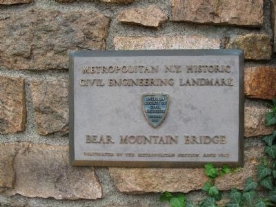
By Michael Herrick, September 17, 2011
Plaque on the Building
| 101 ► New York, Rockland County, Bear Mountain — Bear Mountain Bridge — |
| On U.S. 202, 0.2 miles east of U.S. 9W, on the right when traveling east. | |||
| 102 ► New York, Saratoga County, Waterford — Flight of Five Locks — |
| 103 ► New York, Saratoga County, Waterford — Waterford Bridges — National Historic Civil Engineering Landmark — |
| On Broad Street (New York State Route 4), on the right when traveling east. | |||
| 104 ► New York, Schoharie County, North Blenheim — Old Blenheim Bridge — |
| On Eastside Road, on the right when traveling south. | |||
| 105 ► North Carolina, Avery County, Linville — Linn Cove Viaduct — |
| Near Blue Ridge Parkway (at milepost 304.4), 1 mile north of Blowing Rock Highway (U.S. 221). | |||
| 106 ► North Carolina, Camden County, Camden, South Hills — Dismal Swamp Canal — 2362 Highway 17 — |
| On McPherson Road (State Highway 1231) 0.1 miles west of U.S. 17, on the right when traveling south. | |||
| 107 ► North Dakota, Barnes County, Valley City — High Above the Sheyenne — High Line Bridge — |
| Near 12th Street Northeast, 0.2 miles east of 6th Avenue Northeast (Chautauqua Boulevard), on the left when traveling east. | |||
| 108 ► North Dakota, Barnes County, Valley City — Northern Pacific High Line Bridge No. 64 — National Historic Civil Engineering Landmark — |
| Near 12th Street Northeast, 0.2 miles east of 6th Avenue Northeast (Chautauqua Boulevard), on the left when traveling east. | |||
| 109 ► Ohio, Gallia County, Gallipolis — Silver Bridge Collapse and Creation of National Bridge Inspection Standards (NBIS) — Point Pleasant, West Virginia — National Historic Civil Engineering Landmark — |
| On Ohio River Scenic Byway (Ohio Route 7) 0.2 miles north of Georges Creek Road (County Road 7), on the right when traveling north. | |||
| 110 ► Ohio, Hamilton County, Cincinnati — 26-31 — Cincinnati Union Terminal — |
| 111 ► Ohio, Logan County, Bellefontaine — First Concrete Pavement — National Historic Civil Engineering Landmark — |
| On East Court Avenue at South Main Street, on the left when traveling east on East Court Avenue. | |||
| 112 ► Ohio, Lucas County, Toledo, Southside — Don't Let This Bridge Leave You In Suspense! — |
| Near Middleground Metropark east of Ottawa Street. | |||
| 113 ► Ohio, Montgomery County, Vandalia — The Miami Conservancy District — |
| On W National Rd (U.S. 40) at Aullwood Road, on the left when traveling east on W National Rd. | |||
| 114 ► Ohio, Morgan County, Rokeby Lock — Muskingum River Navigation System — National Historic Civil Engineering Landmark — |
| Near Ohio Route 60 near Greer Road. | |||
| 115 ► Ohio, Summit County, Akron — 29-77 — Airdock — |
| On Triplett Boulevard (Ohio Route 241), on the right when traveling east. | |||
| 116 ► Oregon, Curry County, Gold Beach — Patterson Bridge — Rogue River Bridge — |
| On Harbor Way west of Oregon Coast Highway (U.S. 101), on the right when traveling west. | |||
| 117 ► Pennsylvania, Blair County, Altoona, Logan Township — Horseshoe Curve — National Historic Engineering Landmark — |
| On Veterans Memorial Highway, on the right when traveling west. | |||
| 118 ► Pennsylvania, Cambria County, Allegheny Portage Railroad National Historic Site — Allegheny Portage Railroad — |
| 119 ► Pennsylvania, Fayette County, Brownsville — Dunlap’s Creek Bridge — |
| On Market Street east of Bank Street, on the right when traveling east. | |||
| 120 ► Pennsylvania, Fulton County, Waterfall — Blue Star Memorial Highway — |
| 121 ► Pennsylvania, Lebanon County, Lebanon — Union Canal Tunnel — |
| On Tunnel Hill Road (Pennsylvania Route 4001). | |||
| 122 ► Pennsylvania, Lehigh County, Bethlehem — Waterworks — 1762 — |
| 123 ► Pennsylvania, McKean County, Mount Jewett — Commerce to Collapse — |
| Near Viaduct Road near Lindholm Road (County Route 3011). | |||
| 124 ► Pennsylvania, McKean County, Mount Jewett — Kinzua Viaduct — |
| Near Pennsylvania Route 3011, 0.5 miles east of U.S. 6. | |||
| 125 ► Pennsylvania, Northampton County, Easton — Connecting Communities Across the Delaware River — Karl Stirner Arts Trail — City of Easton, Pennsylvania — |
| On Larry Holmes Drive (Pennsylvania Route 611) at Northampton Street, on the right when traveling north on Larry Holmes Drive. | |||
| 126 ► Pennsylvania, Philadelphia County, Philadelphia, Fairmount Park — Philadelphia Municipal Water System — Fairmount Water Works 1815 - 1911 — National Historic Civil Engineering Landmark — |
| On Schuylkill River Trail, 0.1 miles south of Waterworks Drive, on the right when traveling south. | |||
| 127 ► Pennsylvania, Philadelphia County, Philadelphia, Fairmount Park — Rebirth & Renewal — |
| On Schuylkill River Trail, 0.1 miles south of Waterworks Drive, on the right when traveling south. | |||
| 128 ► Pennsylvania, Philadelphia County, Philadelphia, Logan Square — The City Plan of Philadelphia — |
| On Benjamin Franklin Parkway at Race Street on Benjamin Franklin Parkway. | |||
| 129 ► Pennsylvania, Philadelphia County, Philadelphia, William Penn Annex West — Philadelphia City Hall — National Historic Civil Engineering Landmark — |
| Near Germantown Avenue. | |||
| 130 ► Pennsylvania, Philadelphia County, Philadelphia, William Penn Annex West — Philadelphia Municipal Water System — 1801 - 1815 — National Historic Civil Engineering Landmark — |
| Near John F Kennedy Boulevard (Route 611) at North Broad Street (Pennsylvania Route 611), on the right when traveling east. | |||
| 131 ► Pennsylvania, Susquehanna County, Lanesboro — Starrucca Viaduct — |
| On Main Street at Grove Street on Main Street. | |||
| 132 ► Pennsylvania, Susquehanna County, Lanesboro — Starrucca Viaduct - The Bridge of Stone — |
| On Depot Street east of Starrucca Viaduct, on the right when traveling east. | |||
| 133 ► Pennsylvania, Wyoming County, Nicholson — Tunkhannock Viaduct — AKA Nicholson Bridge — National Historic Civil Engineering Landmark — |
| On State Street (Pennsylvania Route 92) 0.2 miles east of Lackawanna Trail (U.S. 11), on the right when traveling east. | |||
| 134 ► South Carolina, Bamberg County, Bamberg — Bamberg — |
| On East Railroad Avenue near North Street, on the right when traveling west. | |||
| 135 ► South Carolina, Charleston County, Charleston, Wraggborough — William Aiken House — |
| On King Street near Ann Street, on the left when traveling south. | |||
| 136 ► South Dakota, Brule County, Chamberlain — Missouri River Bridges of South Dakota — National Historic Civil Engineering Landmark — |
| Near Interstate 90 at milepost 263. | |||
| 137 ► South Dakota, Lawrence County, Deadwood — Black Hills Railroads — Historic South Dakota Civil Engineering Landmark — |
| Near Siever Street north of Pine Street, on the left when traveling north. | |||
| 138 ► South Dakota, Minnehaha County, Sioux Falls, North End East — First Concrete State Highway — South Dakota Historic Civil Engineering Landmark — |
| On North Drive, 0.1 miles east of 1st Avenue. | |||
| 139 ► Tennessee, Davidson County, Nashville, North Capitol — Tennessee State Capitol — National Historic Civil Engineering Landmark — |
| On Charlotte Avenue just west of 6th Avenue North, on the right when traveling west. | |||
| 140 ► Tennessee, Davidson County, Nashville, North Capitol — 3A 34 — Tennessee State Capitol — |
| On 600 Charlotte Avenue. | |||
| 141 ► Texas, Bexar County, San Antonio, Downtown — San Antonio's River Walk and Flood Control System — |
| 142 ► Texas, Bexar County, San Antonio, Hemisfair — 78 — Acequia Madre de Valero — |
| Near East Nueva Street north of Hemisfair Boulevard, on the left when traveling north. | |||
| 143 ► Texas, El Paso County, El Paso — 12851 — Bataan Memorial Trainway — |
| On West San Francisco Avenue, on the left when traveling east. | |||
| 144 ► Texas, Galveston County, Galveston — Galveston Seawall and Grade Raising — National Historic Civil Engineering Landmark — American Society of Civil Engineers 1852 — |
| Near Seawall Boulevard, 0.3 miles east of 53rd Street, on the right when traveling east. | |||
| 145 ► Texas, Nueces County, Corpus Christi — 18252 — 1941 Corpus Christi Seawall — |
| On North Shoreline Boulevard at Schatzell Street, on the right when traveling north on North Shoreline Boulevard. | |||
| 146 ► Texas, Panola County, Carthage — International Boundary Marker — Republic of Texas-United States — Historic Civil Engineering Landmark — |
| Near Farm to Market Road 31, 0.4 miles south of County Road 4557, on the right when traveling north. | |||
| 147 ► Utah, Box Elder County, Promontory Summit — Golden Spike — National Historic Site — |
| On North 22300th Street West, on the right when traveling south. | |||
| 148 ► Utah, Washington County, Springdale — Zion Mt. Carmel Tunnel and Highway, Utah — National Historic Civil Engineering Landmark — |
| On Zion Park Boulevard, 0.2 miles east of Zion Canyon Scenic Drive, on the right when traveling east. | |||
| 149 ► Virginia, Fairfax County, McLean — Great Falls Canal and Locks — |
| Near Old Dominion Drive at Georgetown Pike (Virginia Route 193). | |||
| 150 ► Virginia, Lynchburg, Riverside — Fink Deck Truss — National Historic Civil Engineering Landmark — |
| Near Riverside Street, 0.1 miles north of Rivermont Avenue. | |||
| 151 ► Virginia, Nelson County, Afton — Crozet Blue Ridge Tunnel — National Historic Civil Engineering Landmark — |
| On Blue Ridge Tunnel Trail, 0.6 miles west of Afton Depot Lane, on the right when traveling west. | |||
| 152 ► Virginia, Portsmouth, Hope Village — Norfolk Naval Shipyard — “Dry Dock 1” — Path of History Portsmouth, VA — |
| Near Lincoln Street east of 3rd Street, on the left when traveling east. | |||
| 153 ► West Virginia, Berkeley County, Martinsburg — Baltimore and Ohio Railroad Shop Complex — |
| On East Race Street east of North Spring Street, on the left when traveling east. | |||
| 154 ► West Virginia, Berkeley County, Martinsburg — Baltimore and Ohio Roundhouse and Shop Complex — |
| On East Race Street east of North Spring Street, on the left when traveling east. | |||
| 155 ► West Virginia, Mason County, Point Pleasant — Silver Bridge Collapse and Creation of National Bridge Inspection Standards (NBIS) — Point Pleasant, West Virginia — National Historic Civil Engineering Landmark — |
| Near Main Street at 6th Street, on the left when traveling north. | |||
| 156 ► West Virginia, Ohio County, Wheeling — Wheeling Suspension Bridge - 1849 — Historic National Road — |
| On 10th Street west of Main Street (U.S. 40), on the left when traveling west. | |||
| 157 ► Wisconsin, Milwaukee County, Milwaukee, Historic Third Ward — 18 — Hoffmann & Sons Co. Grocers — Historic Third Ward — |
| On East Buffalo Street at North Water Street, on the right when traveling east on East Buffalo Street. | |||
| 158 ► Wisconsin, Outagamie County, Appleton — First Edison Hydroelectric System in America — |
| Near South Lawe Street, on the right when traveling south. | |||
| 159 ► Wyoming, Park County, Cody — Buffalo Bill Dam — |
| On North Fork Hwy (U.S. 14) 1.3 miles east of Verner Road, on the right when traveling east. | |||
| 160 ► British Columbia, Peace River, Dawson Creek — Alaska Highway / La Route De L’Alaska — Completed in 1942 / Terminé en 1942 — International Historic Civil Engineering Landmark / Monument Historique International du Génie Civil — |
| On Alaska Ave (National Highway 2) near 8th Street, in the median. | |||
| 161 ► Québec, Communauté-Urbaine-de-Québec, Québec, Saint-Louis — The Québec Bridge — Le pont Québec — |
| Near Boulevard Laurier (Québec Route 175). | |||
| 162 ► Mexico, Querétaro, Santiago de Querétaro — The Aqueduct of Querétaro — |
| On Calle Ejército Repúblicano just south of Calle San Gremal, on the left when traveling west. | |||
| 163 ► United Kingdom, Scotland, Edinburgh, South Queensferry — The Forth Rail Bridge — |
| On B924. | |||
| 164 ► United Kingdom, Scotland, Falkirk — Forth & Clyde Ship Canal — International Historic Civil Engineering Landmark — |
| Near Lime Road. | |||
164 entries matched your criteria. Entries 101 through 164 are listed above. ⊲ Previous 100