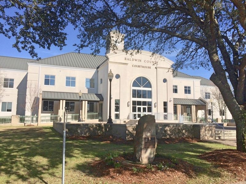
On Courthouse Square (U.S. 31) at Hand Avenue, on the left when traveling west on Courthouse Square.
Born and educated in England, Toulmin became a Unitarian Minister and fled persecution in 1793. In the U.S. he served as President of Transylvania University and Secretary of the State of Kentucky. In 1804 Thomas Jefferson appointed him as the first . . . — — Map (db m100850) HM
Rev. James J. Reeb, an Army Veteran and Unitarian minister from Casper, Wyoming, was working in Boston when Rev. Martin Luther King, Jr. appealed for clergymen of all faiths to come to Selma to protest the violence that occurred at the Edmund Pettus . . . — — Map (db m37683) HM
On Washington Street at Alabama Avenue, on the right when traveling north on Washington Street.
After the "Bloody Sunday" attack on Civil Rights marchers in Selma on March 7, 1965, Rev. Reeb joined the nationwide call from Dr. King's plea for ministers of all races and religions to convene in Selma. Rev. Reeb joined a march led by Dr. King on . . . — — Map (db m291369) HM
On 19th Street North at F L Shuttlesworth Drive, on the right when traveling north on 19th Street North.
One of the last major battles in the struggle for African American civil
rights came in Selma, Alabama. Despite the new Civil Rights Act of
1964, African Americans still faced difficulty voting. Although they
had the right to vote under the . . . — — Map (db m187587) HM
On Sen Claude Pepper Drive (Alabama Route 50) at Oak Street, on the left when traveling west on Sen Claude Pepper Drive.
The First Universalist Church of Camp Hill was the largest Universalist church in the southeastern United States in the first half of the 20th century. With roots in the European Enlightenment, Universalism was transplanted to the American . . . — — Map (db m92504) HM
On Pittman Avenue (State Highway 50) at Ward Circle, on the right when traveling west on Pittman Avenue.
Lyman Ward Military Academy was founded in 1898 as the Southern Industrial Institute by Dr. Lyman Ward, a Universalist minister from New York. Dr. Ward established SII to educate the poor children of Alabama, many of whom had few opportunities due . . . — — Map (db m25501) HM
Former First Unitarian Church
Completed in 1898
A.C. Schweinfurth, Architect
This Property Has Been Placed on the
National Register of Historic Places
by the U.S. Department of the Interior — — Map (db m283928) HM
On Fourteenth Street at Castro Street, on the left on Fourteenth Street.
Designed in 1889 by Walter J. Mathews, this solid masonry Romanesque church departed radically from California's traditional Gothic wood frame construction. Noted for its world famous stained glass windows produced by Goodhue of Boston, and for . . . — — Map (db m100561) HM
On Emigrant Trail at Consolation Street on Emigrant Trail.
The Thomas Starr King Bell was donated to the town of Volcano by Unitarian preacher Thomas Starr King in 1862, who was greatful to the town for its support for the Union and the election of Abraham Lincoln. The bell was originally located at the . . . — — Map (db m101341) HM
On Figueroa Street north of Olympic Boulevard, on the left when traveling north.
Variety Spices Life Of Arts Center
Its life has spanned purposes from good causes to good fun, and still, the Italian Renaissance Variety Arts Center remains as a monument to vaudeville and a testament to the pioneer clubwomen who built it. . . . — — Map (db m206663) HM
Near Haskell Avenue north of Plummer Street, on the right when traveling north.
Modern style. Frank Ehrenthal, architect.
Built 1964. Declared 2010, Historic-Cultural Monument No. 975, Cultural Heritage Commission, City of Los Angeles. — — Map (db m179250) HM
On Mission Inn Avenue at Lemon Street, on the right when traveling west on Mission Inn Avenue.
Building designed in Norman Gothic style by architect A.C. Willard and constructed with Arizona sandstone by A.W.Boggs. The founding pastor was George H. Deere. — — Map (db m303978) HM
Near L Street at 10th Street, on the right when traveling east.
Courageous and inspirational San Francisco minister, stalwart defender of the Union during the Civil War, advocate of racial justice, admired educator and pioneering nature writer.
Starr King was a Unitarian preacher credited with keeping . . . — — Map (db m90267) HM
Near Eglantine Avenue north of Pioneer Avenue, on the right when traveling north.
Dr. Nixon, tall and impeccably dressed with a silk hat, Prince Albert coat and carrying an elegant gold handled cane, could be seen in downtown Sacramento walking toward 13th and D Street to the Central Pacific Railroad Hospital where he was Chief . . . — — Map (db m227470) HM
Apostle of liberty, humanitarian, Unitarian minister, who in the Civil War bound California to the Union and led her to excel all other states in support of the United States Sanitary Commission, predecessor to the American Red Cross. His statue, . . . — — Map (db m91855) HM
On North 3rd Street south of East St. James Street, on the right when traveling north.
This building, designed by George W. Page in 1891, became the permanent home of a congregation that first met in City Hall in 1866. A version of Richardsonian Romanesque style, the innovative structure withstood the earthquake of 1906 and became a . . . — — Map (db m30126) HM
On Center Street, on the right when traveling south.
Santa Cruz County
1902
Progressive Baptist Hall & Parsonage
Built as All Souls Unitarian Parsonage
Edward Van Cleeck, Arch.
Historical Trust Landmark — — Map (db m203260) HM
On Ojai Road (California Route 150) at Royal Oaks Place, on the left when traveling north on Ojai Road.
Site of the W. L. Hardison Estate, established in 1884 by Wallace Libbey
Hardison with his wife Clara McDonald. Hardison, born in Maine in 1850, was
a Representative in the 104th Pennsylvania Legislature before coming to
Santa Paula in 1883 . . . — — Map (db m175487) HM
On Canterbury Road (Connecticut Route 169) at U.S. 6, on the right when traveling south on Canterbury Road.
Formerly Mortlake, first settled 1703, made a town on 2nd Thursday of May, 1786. Home of General Israel Putnam prior to and after the Revolution.
Town landmarks include:
Meeting House on the Green, built 1771 by First Ecclesiastical . . . — — Map (db m93440) HM
On Pleasant Valley Road (Connecticut Route 318) at Beach Rock Road, on the right when traveling north on Pleasant Valley Road.
This bell hung in the Hollow Church which was relocated during construction of the Compensating Reservoir. It was cast in Hartford, CT in 1834.
Dedicated 1997
These boulders were provided by the . . . — — Map (db m29848) HM
On Washington Street at Huntington Street, on the left when traveling east on Washington Street.
New London’s first English settlers, Puritans, did not consider religious tolerance a virtue. They would probably be dismayed to see the diversity that now prevails.
Reverend Jabez Swan
Rev. Jabez Swan, founding pastor of the . . . — — Map (db m216491) HM
On 16th Street, NW just south of Harvard Street, NW, on the right when traveling south.
Three dramatic religious structures dominate this corner. They are among some 40 religious institutions lining 16th Street between the White House and the Maryland state line.
Many serve as unofficial “embassies” representing the . . . — — Map (db m152206) HM
On 18th Street Northwest south of Columbia Road Northwest, on the right when traveling south.
The lively scene around you began with an arts movement in the 1950s. Musicians, dancers, and artists found centrally located 18th Street attractive as declining rents made it affordable.
Early on, jazz guitarist Charlie Byrd brought fame . . . — — Map (db m152207) HM
On 16th Street Northwest south of Harvard Street Northwest.
Straight ahead is All Souls Church, Unitarian, long known for its social activism, starting with abolitionism in the 1820s and ranging through nuclear disarmament and interracial cooperation. During the segregation era, All Souls was one of . . . — — Map (db m130753) HM
On 16th Street Northwest just north of S Street Northwest, on the right when traveling south.
This tower
dedicated to the ideal
of international justice
and world peace is a
loving and grateful
tribute to Owen D Young
who inspired by faith in the
constructive power of human
brotherhood contributed his
rare talents . . . — — Map (db m114772) HM
On S Street Northwest at 16th Street Northwest, on the right when traveling west on S Street Northwest.
What's happening Here?
Stormwater runoff (rainwater that flows off surfaces such as rooftops and parking lots) causes erosion in streambeds and carries harmful pollutants such as oil, sediment, trash and animal waste. The rain garden and . . . — — Map (db m240375) HM
On Grand Boulevard, on the right when traveling north.
The church before you traces its beginnings to 1885 when Rev. Henry D. L. Webster, Anson P. K. Safford, and John K. Cheyney, organized the Universalist Church of the Good Shephard, one of the earliest churches in Tarpon Springs. A wood church was . . . — — Map (db m267893) HM
On Gainesville Highway (Georgia Route 53) at Rockwell Church Road, on the right when traveling north on Gainesville Highway.
Organized 1839 — second oldest Universalist Church in Georgia. Located here near original site of Rockwell School, oldest school in this section, and Rockwell Masonic Lodge. Confederate Soldiers enlisted and drilled here 1861-1865. Church . . . — — Map (db m19548) HM
On Habersham Street near Macon Street, on the left.
James L. Pierpont (1822-1893), composer of "Jingle Bells", served as music director of this church in the 1850s when it was a Unitarian Church located on Oglethorpe Square. Son of the noted Boston reformer, Rev. John Pierpont, he was the brother of . . . — — Map (db m5817) HM
On South Mathews Avenue at West Oregon Street, on the left when traveling south on South Mathews Avenue.
The Channing-Murray Foundation, originally established in 1908 as the Unitarian Church of Urbana, was placed on the National Register of Historic Places May 13, 1991 by the United States Department of the Interior. — — Map (db m225573) HM
On West Green Street near South Birch Street, on the left when traveling west.
The need to repair or replace the original Universalist Church building, built in 1871 at the corner of Green and Birch Streets in Urbana, was discussed at the annual meeting of the Church Board on January 15, 1913. The Reverend E. V. Stevens . . . — — Map (db m226009) HM
On Mayfield Avenue north of Fulton Street, on the left when traveling south.
The Commission on Chicago Architectural Landmarks, by authority of the City Council of the City of Chicago, has designated this building as an architectural landmark
City of Chicago
Richard J. Daley, Mayor
February 11, 1960 — — Map (db m259562) HM
On Warren Boulevard at Damen Avenue, on the left when traveling east on Warren Boulevard.
A congregation named Church of the Redeemer commissioned nationally significant architect William Le Baron Jenney to design this monumental church in 1886. In addition to worship services, the Church of the Redeemer hosted lectures that reflected . . . — — Map (db m264155) HM
On Kenilworth Avenue just south of Lake Street, on the right when traveling north.
In 1905, the Unity Church of Oak Park, home to a Universalist congregation, was struck by lightning and burned to the ground. The congregation commissioned Frank Lloyd Wright to design a new building for them.
Wright's bold design with its . . . — — Map (db m227636) HM
On Lake Street 0.1 miles east of Kenilworth Avenue, on the right when traveling east.
Unity Temple, as part of the 20th-century architecture of Frank Lloyd Wright, has been inscribed on the World Heritage List.
Inscription confirms that this property deserves protection for the benefit of all humanity because of its . . . — — Map (db m227931) HM
Near Illinois Route 1 north of East 1900th Avenue, on the left when traveling south.
The original church was formed a few hundred yards north of this spot in 1871.
In 1924, the church moved to a new building in Hutsonville.
In 2008, the church building was razed. This cornerstone was removed and mounted here as a . . . — — Map (db m270569) HM
On East Grove Street west of South McLean Street, on the right when traveling west.
418 E. Grove St.
Ezra & Barbara
Prince House
Built c. 1855
Victorian Cottage
Ezra was a friend of Abraham Lincoln, and was a
co-founder of the McLean County Historical Society.
Pulitzer Prize winning brothers Paul and
Edgar . . . — — Map (db m183779) HM
On East Clinton Street near North Chicago Street, on the right when traveling west.
Originally a Unitarian Church with unique street level commercial space, the structure was designed by Joliet architect G. Julian Barnes. The Richardsonian Romanesque style structure was built in 1891 with local Joliet Limestone accented with . . . — — Map (db m157969) HM
On Lockport Street at Des Plaines Street, on the right when traveling west on Lockport Street.
First Plat of "Planefield"
Chester Ingersoll platted the "Town of Planefield" in August 1834 north of the settlement at Walker's Grove. It was a modified grid plan of thirteen nearly square blocks with a formal Public Square at the . . . — — Map (db m94140) HM
By 1874, what has been known as the Colored School opened in Center School here at Sixth and Washington Streets to serve African-American elementary students of Bloomington. An 1869 law had mandated education of colored children, with a separate . . . — — Map (db m47674) HM
On 4th Street NW near Market Street NW, on the right when traveling west.
This church was built by Thomas Mitchell. Thomas Mitchell was born in New Hampshire in 1816. he came to Iowa Territory in 1840, and in 1844 became the first white settler of Polk County. He built cabins and later inns to feed and shelter the . . . — — Map (db m44833) HM
On Esplanade Street at Shawnee Street, on the right when traveling north on Esplanade Street.
In 1859, Charles Fisher (aka Peter and Charley Fisher), an African American barber, was
kidnapped from his place of employment at the Planters Hotel. Fisher's choice to work at the
Planters Hotel was an interesting one as it was "a recognized . . . — — Map (db m286947) HM
On Main Street near 6th Street, on the left when traveling west.
The Library was an idea generated by the Seneca Women’s Club embroidery circle in 1908. As they worked, they often discussed books and the need for a town library. After collecting 300 books they persuaded a drug store to give them shelving space. . . . — — Map (db m55791) HM
On Dawson Springs Road (Kentucky Route 109) north of Consolation Loop, on the left when traveling north.
Near this site, the Consolation Universalist Church was organized by a traveling preacher, Wm. Lowe, in home of James E. Clark in May, 1819. It was first Universalist Church organized west of Allegheny Mountains. Early ministers were: L. T. Brasher, . . . — — Map (db m166010) HM
On York Street at South 4th Street, on the right when traveling east on York Street.
Founded in 1830, First Unitarian Church has been active in civil-rights movements as well as community-wide initiatives. Several fires have damaged the church. Including one in 1985 which left only the stone walls. Each time it has been rebuilt . . . — — Map (db m104729) HM
On West Broadway (U.S. 150) just west of South 3rd Street ( Route 1020), on the right when traveling west.
Constructed in 1925 as a live performance venue, the Brown Theatre was soon converted into a movie theatre in 1930 to respond to the changing economic realities of the Great Depression. Through the 1950s, the Brown served as a first-run movie . . . — — Map (db m178901) HM
On Congress Street at Temple Street, on the left when traveling north on Congress Street.
First Parish Church, Unitarian Universalist 425 Congress Street. A memorial plaque inside First Parish honors Prentis Mellen. Pews within the church are marked for the abolitionist Fessenden and Thomas families.
In 1832 William Lloyd . . . — — Map (db m96519) HM
Erected Dec 1, 1859
By a donation from the HON. FRANCIS O.J. SMITH, to honor and perpetuate the memory of REV. WILLIAM I. REESE who while pastor of the First Universalist Society, founded the Portland Widow’s Wood Society. . . . — — Map (db m50436) HM
On Main Street (Maine Route 15) west of Mechanic Street, on the right when traveling west.
Every town has that special house that captures the imagination. Linwood Cottage, built in 1855 for local jeweler and clockmaker James Emery, is a melding of architectural styles, including Gothic, Greek Revival, and Italianate, Emery's . . . — — Map (db m258742) HM
On Oak Street at Spring Street, on the right when traveling south on Oak Street.
Samuel Kidder Ehiting (1817-1882) was an investor in sailing vessels and a member of a large mercantile family with branches in Castine and Ellsworth. In 1822, Jarvis Whiting (Samuel's father) built a tavern on the site of the current S.K. Whiting . . . — — Map (db m260025) HM
On Main Street at Harbor Lane, on the right when traveling west on Main Street.
Wander Winter Harbor and find traces of our past. Our architecture tells a story of seafaring fishermen and traders, 19th century summer rusticators, grand public buildings, and
ongoing adaptation to new opportunities.
1.Channing Chapel . . . — — Map (db m184163) HM
On State Street (Maine Route 104) just north of Court Street, on the right when traveling north.
Abraham Lincoln's assassination in Washington on April 14, 1865, as the Civil War was ending plunged Augusta into sorrow. Businesses closed on the 19th and soldiers, civil authorities, and societies converged at the black draped . . . — — Map (db m186073) HM
On Cony Street at Bangor Street (U.S. 201/202), on the right when traveling west on Cony Street.
The Gothic style cottage, now used for business, was built by the Reverend Sylvester Judd as a home and parsonage. In 1840, Judd became minister of Augusta's Unitarian Church, the church of local elite. In 1841, Judd married Jane . . . — — Map (db m110891) HM
On Main Street (U.S. 1) at Summer Street (Route 9A/35), on the right when traveling south on Main Street.
This church was built in 1772-1773 on land donated by Colonel Joseph Storer, to house the congregation originally located at the Kennebunk Landing. The church was enlarged by Thomas Eaton in 1803 and the bell tower was constructed. . . . — — Map (db m186323) HM
On Main Street (Maine Route 9), on the left when traveling south.
Sarah Fairfield Hamilton was a founder of the local chapter of the Women's Educational and Industrial Union, and led that organization to create Saco's first kindergarten, a nursery for mill workers' children, summer park programs and other . . . — — Map (db m55721) HM
On West Preston Street just east of North Eutaw Street, on the left when traveling west.
Mount Vernon Cultural District
Mount Vernon Cultural District provides an unequaled richness of cultural experience. Since the founding of the Peabody Institute in 1857, Mount Vernon has enjoyed a continuing association with the arts. . . . — — Map (db m248771) HM
On Park Avenue at North Howard Street, on the right when traveling east on Park Avenue.
Mount Vernon Cultural District provides an unequaled richness of cultural experience. Since the founding of the Peabody Institute in 1857, Mount Vernon has enjoyed a continuing association with the arts. Nineteenth Century Philanthropist George . . . — — Map (db m194805) HM
On North Charles Street at Hamilton Street on North Charles Street.
Contrary to Baltimore’s 19th century conservative appearance, Baltimoreans created progressive, diverse communities that expanded the nation’s racial and religious freedom. By the time of the Civil War, Baltimore had the largest free African . . . — — Map (db m102390) HM
On Washington Place at East Mt. Vernon Place, on the right when traveling north on Washington Place.
Mount Vernon Cultural District provides an unequaled richness of cultural experience. Since the founding of the Peabody Institute in 1857, Mount Vernon has enjoyed a continuing association with the arts. Nineteenth Century Philanthropist George . . . — — Map (db m168789) HM
On North Calvert Street (Maryland Route 2), on the left when traveling north.
St. Ignatius Church opened August 15, 1856. Designed by Henry Hamilton Pittar and Louis L. Long, it was the second unit to be completed in the block-long complex that stretches from Madison to Monument Streets. In 1855, the porticoed central section . . . — — Map (db m6125) HM
On Franklin Street (U.S. 40) at Charles Street, on the right when traveling west on Franklin Street.
In 1817, when Baltimore Town boasted 60,000 inhabitants and Mount Vernon Place was still a forest, a group of leading citizens met in the home of Henry Payson "to form a religious society and build a church for Christians who are Unitarian and . . . — — Map (db m7168) HM
On North Caroline Street at East Oliver Street, on the right when traveling north on North Caroline Street.
Dedicated on February 21, 1864, St. Francis Xavier Catholic Church was the first black parish in the U.S. The church originated in the 1790s due to the efforts of the Sulpician Fathers and the Oblate Sisters of Providence to provide education and . . . — — Map (db m7563) HM
Near North Paca Street (Maryland Route 129) at George Street, on the left when traveling north.
Drawing of historic seminary chapel by Maximilian Godefroy, c. 1806
The historic chapel of St. Mary's Seminary & University (est. 1791) was built by the Sulpician Fathers and dedicated in 1808. It was designed by Maximilian Godefroy and is . . . — — Map (db m220047) HM
For its first 25 years, the burying ground remained a simple place characterized by plain grave markers. After 1810, tastes changed and First Presbyterian Church's leading public figures demanded the ornate.
The most dramatic change was a new . . . — — Map (db m6645) HM
On North Greene Street, on the left when traveling south.
Westminster's carriage gates, completed in 1815, were among the nation's first examples of Egyptian Revival architecture. Commissioned by the First Presbyterian Church, the gates were designed by Maximilian Godefroy (1765-ca.1840), a French . . . — — Map (db m6629) HM
On High School Road at Main Street, on the right when traveling south on High School Road.
Hyannis holds a special spot in the hearts of residents & visitors, who love to live, work & play in Cape Cod’s Downtown year round.
The carousel at 541 Main Street was built in 1957 by the Allen Herschell company, one of the . . . — — Map (db m264394) HM
Through Historic Events &
and ever changing times,
Hyannis Main Street
Continues to be a center
For recreation,
commerce & culture
The Mayflower Block
The block containing the Federated Church is known . . . — — Map (db m162615) HM
On Purchase Street at William Street, on the left when traveling north on Purchase Street.
On this site the former meeting house of the First Congregational and Unitarian societies was erected - 1795-97
These buildings were converted into Liberty Hall - 1839
Original Liberty Hall burned and rebuilt - 1854
Merchant National . . . — — Map (db m290015) HM
On South Main Street at Elm Street, on the right when traveling north on South Main Street.
From church to Town Hall and District Court to condominiums - the adaptive reuse of an historic building.
With its historic exterior largely intact, the former church that later became Town Hall and the District Court is now a residential . . . — — Map (db m253820) HM
Near Main Street (Massachusetts Route 10) at Masonic Street, on the right when traveling east.
By the mid 19th century the simple elegance of Northampton's buildings began to give way to the tastes and fashions of a new era of commercialism. William Fenno Pratt, who designed many of the Victorian buildings on Main Street, conceived of the . . . — — Map (db m138436) HM
On Massachusetts Avenue (Massachusetts Route 2A) at Holyoke Street, on the right when traveling west on Massachusetts Avenue.
In honor of
Thomas Shepard
Pastor of the
Church in Cambridge
1636 - 1649
Member of
the first Board
of Overseers
of Harvard College
1637 - 1649
It was with respect unto this vigilancy and the enlightening and powerful . . . — — Map (db m215393) HM
On Massachusetts Avenue (Massachusetts Route 2A) at Garden Street, on the right when traveling south on Massachusetts Avenue.
Old Cambridge
The Transformation of Old Cambridge
The Forces of Change and Growth
Before 1900, new public water supplies, sewers, and parks had opened the way for development in and around old Cambridge. Completion of the subway in . . . — — Map (db m215368) HM
On Dunster Street at Mount Auburn Street, on the left when traveling north on Dunster Street.
Here stood the original meeting house of the First Church in Cambridge.
Built in 1632 and the center of the civic and religious life of the town.
Here ministered 1633 - 1636
Thomas Hooker
a peerless leader
of
New England . . . — — Map (db m215326) HM
Near Packard Avenue south of North Hill Road, on the right when traveling south.
Hosea Ballou, II
Born in Guilford Vermont
First President
Tufts College
Overseer
Harvard University
Pioneer in
Universalist Church
Author, Scholar, Teacher
1796 — 1861 — — Map (db m250245) HM
On Summer Street at Spring Street, on the right when traveling west on Summer Street.
Built in 1827 by the Elliot Mfg. Co. & Newton Factories
Occupied by the U.F. Religious Society Unitarian - 1827
Became the First Methodist Church In Newton - 1832 — — Map (db m270558) HM
On Hancock Street at Washington Street, on the left when traveling south on Hancock Street.
Within this church are the tombs of two Presidents of the United States and their wives John Adams – Second President 1735 1826 Abigail Adams 1744 1818 their son John Quincy Adams – Sixth President 1767 1848 Louisa Catherine Adams 1775 . . . — — Map (db m18051) HM
On Main Street at Elm Street, on the right when traveling west on Main Street.
Erected in 1681, it is the oldest church structure in the United States to have been used continuously for public worship. Samuel Lincoln, original American ancestor of Abraham Lincoln, worshipped here regularly. — — Map (db m298457) HM
On Leyden Street at Water Street on Leyden Street.
Leyden Street, originally known to the first settlers as First Street, Great Street or Broad Street, is where the Pilgrims began building their houses in the winter of 1620-21, and it has been the heart of the town ever since. Extending from the . . . — — Map (db m75830) HM
On Town Square at Church Street, on the right when traveling west on Town Square.
This tablet is inscribedin grateful memory of the Pilgrims and of their successors who at the time of the Unitarian Controversy in 1801 adhered to the belief of the Fathers and on the basis of the original creed and covenant perpetuated . . . — — Map (db m107454) HM
On Arlington Street at Boylston Street, on the right when traveling south on Arlington Street.
Formerly
Federal Street Church
in which met the
Massachusetts Convention
that ratified the
Constitution
of the
United States
1788 — — Map (db m215040) HM
On Marlborough Street at Berkeley Street, on the left when traveling west on Marlborough Street.
First house of worship built in State St. AD 1632 • Second house in Cornhill AD 1639 • Burned to ashes • AD 1711 • Rebuilt on same site AD 1712 • Fourt house in Chauncy St AD 1809 • Fifth house on this site AD 1867 — — Map (db m215034) HM