Markers highlighting the expansion of rural electrification and how it has changed rural life. Many markers highlight the Rural Electrification Act of 1936, which provided federal loans to cooperative electric power companies for the installation of electrical distribution systems to serve isolated rural areas of the United States. The series also covers rural electrification efforts throughout the world.
On Alabama Route 10, 0.3 miles west of County Road 41, on the right when traveling west.
The Pea River Electric Membership Corporation was energized on this site on June 8, 1939. This rural electric cooperative was organized under an executive order signed by President F. D. Roosevelt on May 11, 1935.
Rural members of Barbour, Dale . . . — — Map (db m71804) HM
On Halso Mill Road (County Route 59) 0.1 miles south of Mt. Zion Road (County Road 65), on the left when traveling south.
The Butler County Electric Membership Corporation was formed as a rural electric cooperative in Greenville in July 1938. The first home receiving electricity from the cooperative was located near here.
The Cooperative's original Board of . . . — — Map (db m70756) HM
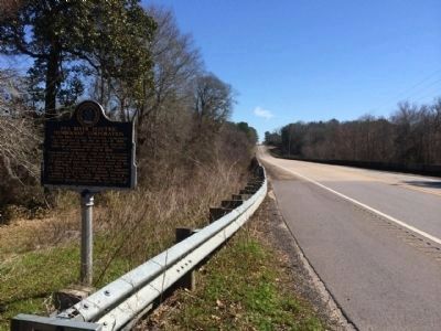
On U.S. 84 at River Street, on the right when traveling west on U.S. 84.
The Clarke-Washington Electric Membership Corporation was organized near this site on March 2, 1936, by some 83 members from Clarke and Washington Counties. This was the first rural electric cooperative organized in Alabama under an executive order . . . — — Map (db m80356) HM
On South Boulevard (U.S. 31) 0.1 miles south of Industrial Park Drive, on the right when traveling south.
The Southern Pine Electric Membership Corporation was energized at this site on September 12, 1939, sending electric power flowing into 75 homes and businesses in rural areas of Escambia, Conecuh, Monroe and Baldwin Counties for the first time. The . . . — — Map (db m84372) HM
On Donahue Drive, 0.3 miles south of West Samford Drive, on the right when traveling south.
On January 31, 1921, farmers gathered on the campus of Alabama
Polytechnic Institute (API), now Auburn University, to form the
Alabama Farm Bureau, now known as the Alabama Farmers Federation.
Former Alabama Extension Service Director Luther . . . — — Map (db m194773) HM
On County Road 5 north of County Road 28, on the left when traveling north.
South Alabama Electric Cooperative’s Goshen Substation provided the first electric energy to rural Pike County. The station was energized at 11:26 A.M. on April 4, 1938. The first 86 miles of electric lines served 170 members.
The cooperative . . . — — Map (db m38947) HM
Near 4th Street (U.S. 287) west of 7th Avenue, on the right when traveling west.
Sand Creek Massacre
At dawn on the morning of November 29 I was still in bed when I heard shouts and the noise of people running about the camp. I jumped up and ran out of my lodge. From down the creek a large body of troops was . . . — — Map (db m107245) HM
On Peanut Road (County Road 169) at 2nd Avenue, on the left when traveling south on Peanut Road.
This structure is a symbol of progress and a testament to those determined rural residents who, through electricity, helped bring this area into the 20th century. On May 30, 1936 President Franklin D. Roosevelt (1882-1945) signed into law the Rural . . . — — Map (db m74210) HM
On Porter Carswell Road at Bellevue Plantation Road, on the right when traveling north on Porter Carswell Road.
On August 5, 1936, an organizational meeting of the Planters Electric Membership Corporation was held in the Bellevue Plantation commissary building. Those present and elected to become officers were Porter W.
Carswell, President; Frank M. Cates, . . . — — Map (db m169037) HM
On Maple Street (Georgia Route 166) 0 miles east of W. Lake Drive, on the right when traveling west.
In 1936, a young attorney from the Victory community began investigating the possibility of bringing electric service to rural farms and homes in the West Georgia area. Together with rural merchants, farmers, a preacher and a mail carrier, they . . . — — Map (db m12804) HM
On Watson Boulevard (Georgia Route 247 Connector Road) at Myrtle Street, on the right when traveling west on Watson Boulevard. Reported missing.
Flint Electric Membership Corporation provided electrical service to Wellston, Georgia in 1939. Population: about 43 people. In 1943, when the name was changed to Warner Robins, a major commitment was made by Flint EMC to serve the electrical needs . . . — — Map (db m206548) HM
On U.S. 341, 0 miles south of Abbott Road, on the right when traveling south.
Dedicated August 11, 1938 by President Franklin D. Roosevelt Rededicated to service 1988
E.J. Martin, Jr., President
W.H. Averett, Jr., V. President
J.H. Gunnels, Secretary
H.B. Cromer, Treasurer
J.H. Barnes, Jr. J.C. Caldwell
F.C. . . . — — Map (db m28215) HM
On U.S. 341, 0.2 miles south of Abbott Road, on the right when traveling south.
REA Project 75 was chartered in February 1937 and was energized August 11, 1938, by President Franklin D. Roosevelt. It became Lamar Electric Membership Corporation. This day, January 23, 2005, as we change the name to Southern Rivers Energy, the . . . — — Map (db m28213) HM
On College Drive at Summersfield Drive, on the left when traveling north on College Drive.
On August 11, 1938, as many as 50,000 people gathered in the stadium of Gordon Military College for an address by President Franklin Roosevelt dedicating the Lamar Electric Cooperative, a project of the New Deal's Rural Electrification . . . — — Map (db m28214) HM
On U.S. 80 at 3rd Street, on the right when traveling west on U.S. 80.
To honor the founders whose vision transformed this rural area from darkness to the splendor of light; who serve as our reminder that no job is too difficult
if the cause is just and the people are determined. Incorporators:
Paul J. Jones . . . — — Map (db m14562) HM
On Crowell Road (Georgia Route 283) 0 miles south of Georgia Route 137, on the left when traveling south.
In 1936, a group of farmers in the Crowell area investigated the possibility of bringing electric service to the community. In 1937, they formed Taylor County Rural Electric Cooperative with a loan from the Rural Electrification Administration to . . . — — Map (db m14510) HM
On State Highway 24 at milepost 10 at North 374 Lane East, on the right when traveling east on State Highway 24.
An important pioneer federal reclamation dam and power plant provides water and electricity for farms and cities nearby.
Constructed 5 miles east of here between 1904 and 1906 at a cost of $675,000, Minidoka Dam diverts water into . . . — — Map (db m124027) HM
The Boone County REMC built Indiana's first electric cooperative line to the Clark Woody farm 5 miles west of this site with funds borrowed from the Rural Electrification Administration, July 22, 1935. — — Map (db m27673) HM
On 110th Street, 0.2 miles west of Olive Avenue, on the right when traveling west.
1936 The Rural Electrification Act (R.E.A.) signed by President Franklin Roosevelt provided loans for the purpose of construction of rural electrical generating plants.
1937, Feb. 10 - The Federated R.E.A. was incorporated forming together . . . — — Map (db m172575) HM
On Central Avenue (U.S. 73/159) at 17th Street, on the right when traveling north on Central Avenue.
Unquestionably the most widely published photograph in rural electrification history captures high drama and momentum as the last miles of line are pulled only the day before energization for the Brown-Atchison Electric Cooperative Association, . . . — — Map (db m63775) HM
On 15th Street (U.S. 73) near 5th Avenue East, on the right when traveling east.
At this site the first power pole for the Brown-Atchison Electric Cooperative was dedicated in special ceremony on November 10, 1937. Brown-Atchison was the first rural electric project to energize in Kansas financed by loan funds from the Rural . . . — — Map (db m63774) HM
On N. Jackson Highway (U.S. 31E) 0.1 miles north of Horton Rigdon Road, on the right when traveling north.
On Jan. 12, 1939, the Goodnight substation was energized. The circuit powered 107 homes along 51 miles of power line in Barren Co. This substation was the first in Farmers RECC service territory. Electricity improved rural life, increased . . . — — Map (db m96997) HM
On North Bragg Street, Harrodsburg Road (U.S. 68) north of Hardee Street, on the left when traveling south.
W. H. Rogers, president of Inter-County R.E.C.C., threw the switch at the Perryville substation on June 10, 1938, to energize 56 miles of line to 115 homes. In 2013, on the 75th anniversary of this event, Inter-County Energy served more than 25,000 . . . — — Map (db m68402) HM
On Lafayette Road (Kentucky Route 107) at Herndon Street, on the left when traveling north on Lafayette Road.
The dream of central-station electricity became a reality for 165 homes in the southern part of Christian County when a switch was thrown at this spot on the night of September 2nd, 1938. These 165 homes were the first members to be served by the . . . — — Map (db m123636) HM
On Lexington Rd (U.S. 60) 0.9 miles east of Venable Road, on the right when traveling west.
On July 7, 1941, thirteen of Kentucky's rural electric co-ops formed East Kentucky Power Cooperative to relieve the electric power shortage common in rural areas. In 1951, Hugh L. Spurlock became EKPC's first general manager. Construction began . . . — — Map (db m167030) HM
On U.S. 127, 0.2 miles north of State Highway 3102, on the left when traveling north.
Governor A. B. Chandler threw switch at New Liberty Substation, January 29, 1938, to energize some 130 miles and brought electricity to 370 homes and businesses by December. Owen County R.E.C.C. now includes 9 counties. Charter members, 1937, were: . . . — — Map (db m88068) HM
On Rennell Avenue West, 0.2 miles east of Willows Road, on the left when traveling east.
African Americans continued to migrate to Washington DC, Baltimore, and other urban centers during the worldwide economic depression of the 1930s. However, those who stayed behind working the farms, waterways, and serving as domestics may have . . . — — Map (db m181768) HM
Once a common sight in rural America, the windmill was primarily used to pump water. The mechanical energy generated by the windmill was also used to run machines to chop cornstalks for fodder shell corn, or grind grain into flour. With the advent . . . — — Map (db m174995) HM
On South Tate Street (Mississippi Route 145) south of Cardinal Drive, on the left when traveling south.
In 1934, a group of local businessmen and farmers
met in the back of a furniture store in Corinth
and created the Alcorn County Electric Power
Association (ACEPA). Chartered on January 17,
1934, ACEPA began operations on June 1.
With local . . . — — Map (db m219996) HM
On South Main Street at East Jefferson Street, on the right when traveling north on South Main Street.
Organized on September 30, 1933 at the Pontotoc County Courthouse, the Pontotoc County Electric Power Association was chartered on February 23, 1934, and began providing low cost TVA electricity to its rural customers on March 1, 1935. Of more than . . . — — Map (db m171663) HM
On George Norris Avenue near East G Street, on the right when traveling north.
George W. Norris, whose home is on Norris Avenue, McCook, Nebraska, served forty years in the Congress of the United States. Born in Ohio, he worked his way through college, followed the footsteps of the pioneers westward, settling in Nebraska. He . . . — — Map (db m79364) HM
On Lempster Street at Pitkin Road, on the left when traveling south on Lempster Street.
On nearby Allen Road on December 4, 1939, the New Hampshire Electric Cooperative set its first utility pole, an important event in bringing electric service to the farms, mills, and homes of the New Hampshire countryside. A group of citizens . . . — — Map (db m230344) HM
On Andrew Jackson Highway (U.S. 74) at South South Street, on the right when traveling west on Andrew Jackson Highway.
Governor of North Carolina, 1945 - 1949. State legislator. Promoted good roads and rural electrification. Grave is 3 miles S.E. — — Map (db m108789) HM
On South Main Street just south of West Caledonia Avenue, on the left when traveling south.
Nodak Rural Electric Cooperative, Inc., during North Dakota’s Centennial year, commemorates the pioneers of rural electrification and the community leaders who dared dream of a better way of life in the stark days of 1935 to 1940. As the State . . . — — Map (db m209452) HM
On November 14, 1935, the rural electrification movement got its start in Piqua with the installation of the first electric pole financed by the Rural Electrification Administration (REA). In partnership with the Miami Rural Electric Cooperative, . . . — — Map (db m17283) HM
On County Highway 1230 at County Highway 2000, on the left when traveling west on County Highway 1230.
In honor of the people who lived here from 1892 to 1957, and built this community.
Life in the community, which at one time included 2 general stores, a barber shop, blacksmith shop, grain grinding mills, church and family residences, centered . . . — — Map (db m209528) HM
On Biglerville Road (Pennsylvania Route 34) just south of South Avenue, on the right when traveling south.
In 1936 seventy-five percent of Pennsylvania farms had no electric service. During the next five years, with Federal support, 14 consumer-owned cooperatives were formed in this Commonwealth. Adams Electric Cooperative at Gettysburg, serving members . . . — — Map (db m26818) HM
On East Pitt Street at Clark Building Road, on the right when traveling east on East Pitt Street.
In 1936 seventy-five percent of Pennsylvania farms had no electric service. During the next five years, with Federal support, 14 consumer-owned cooperatives were formed in this State. Bedford Rural Electric Cooperative, which serves members in . . . — — Map (db m52665) HM
In 1936 seventy-five percent of Pennsylvania farms had no electric service. Over the next five years, in response to their needs, 14 consumer-owned cooperatives were formed in this State. Serving users in Bedford, Fulton and Huntingdon counties, New . . . — — Map (db m91087) HM
On Grand Army of the Republic Hwy (US 6) at Goff Road on Grand Army of the Republic Hwy (US 6).
In 1936 seventy-five percent of Pennsylvania farms had no electric service. During the next five years, with Federal support, 14 consumer-owned cooperatives were formed in the State. Claverack Rural Electric Cooperative, serving parts of eight . . . — — Map (db m90354) HM
On Pennsylvania Route 368 east of Terwilliger Road (Local Road 871), on the right when traveling east.
In 1936 seventy-five percent of Pennsylvania farms had no electric service. During the next five years, with Federal support, 14 consumer-owned cooperatives were formed in this State. Serving users in seven counties of western Pennsylvania, Central . . . — — Map (db m64235) HM
On Pennsylvania Route 198, 0.7 miles east of Center Street (Pennsylvania Route 86), on the right when traveling east.
Here on August 5, 1936, the State's first rural electric pole was placed by the Northwestern Rural Electric Cooperative Association. Incorporated on April 30, 1936, this was Pennsylvania's first such cooperative. By 1941, thirteen more had been . . . — — Map (db m60446) HM
On Fairgrounds Road (Pennsylvania Route 26) at Hordubay Road, on the right when traveling south on Fairgrounds Road.
In 1936 seventy-five percent of Pennsylvania farms had no electric service. During the next five years, with Federal support, 14 consumer-owned cooperatives were formed in this State. Valley Rural Electric Cooperative, serving seven counties from . . . — — Map (db m6754) HM
On Airport Road (Pennsylvania Route 1006) 0.2 miles east of Pennsylvania Route 286, on the left when traveling east.
In 1936 seventy-five percent of Pennsylvania farms had no electric service. During the next five years, with Federal support, 14 consumer-owned cooperatives were formed in this State. Southwest Central Rural Electric Cooperative Corporation, serving . . . — — Map (db m40568) HM
On Industrial Park Road at Drum Avenue, on the right when traveling south on Industrial Park Road.
In 1936 seventy-five percent of Pennsylvania farms had no electric service. During the next five years, with federal support, 14 consumer-owned cooperatives were formed in this State. Somerset Rural Electric Cooperative, serving four counties in . . . — — Map (db m142108) HM
On North Main Street (Business U.S. 15), on the right when traveling north.
In 1936 seventy-five percent of Pennsylvania farms had no electric service. During the next five years, with Federal support, 14 consumer-owned cooperatives were formed in the State. Tri-county Rural Electric Cooperative, serving much of . . . — — Map (db m14288) HM
On Commercial Avenue (U.S. 14) south of Cardinal Street, on the left when traveling south.
Wolsey: A Crossroad of the Heartland
Wolsey has been a crossroad of the heartland of South Dakota from its beginnings. In 1880 the Dakota Central Railway, a subsidiary of the Chicago & North Western, laid track following a wagon trail called . . . — — Map (db m123906) HM
On State Highway 50 east of 469th Avenue, on the right when traveling west.
On November 25, 1935, 17 farmers from Clay and Union counties held an historic meeting at the Manning/O'Connor store in Burbank, three miles south of this spot. Their purpose was to form a consumer-owned corporation which would allow the rural . . . — — Map (db m221237) HM
On State Highway 50 west of 469th Avenue, on the right when traveling east.
On November 25, 1935, 17 farmers from Clay and Union counties held an historic meeting at the Manning/O'Connor store in Burbank, three miles south of this spot. Their purpose was to form a consumer-owned corporation which would allow the rural . . . — — Map (db m179899) HM
Near W. 6th Avenue at S. Main Street, on the right when traveling east.
Site of the Tennessee Light and Power Company founded by Alonzo Frank Trimble. This company pioneered rural electrification in the following Tennessee counties: Benton, Carroll, Davidson, Robertson, Sumner, and Wilson. Also, operated in Logan . . . — — Map (db m84534) HM
On State Highway 95 at Linderman Road, on the right when traveling south on State Highway 95.
Although the town of Bartlett had regular electric service by 1905, farmers in the surrounding rural area were not supplied with electricity until thirty years later. On May 11, 1935, President Franklin Delano Roosevelt signed an executive order . . . — — Map (db m28816) HM
On Avenue F at Elm Street, on the left when traveling south on Avenue F.
E. Babe Smith was instrumental in the founding of Pedernales Electric Cooperative in the late 1930s. His vision, along with that of Congressman Lyndon B. Johnson and others, brought electric power to the farms and ranches of the Texas Hill Country. . . . — — Map (db m31095) HM
On South Avenue F south of East Elm Street, on the right when traveling north.
By the 1930s, many residents of cities across the U.S. were benefiting from the common use of electricity. However, a vast majority of rural areas lacked electric service, which compounded depression-era problems for farmers whose crop returns were . . . — — Map (db m126764) HM
On Avenue F at Elm Street, on the left when traveling south on Avenue F.
These plaques were first
installed on the original
Pedernales Electric
Cooperative, Inc.
headquarters building in 1939.
Pedernales Electric Co-operative
- Incorporated -
Erected 1939
Dedicated to the extension of
electric . . . — — Map (db m31093) HM
Just as Johnson City helped shape Lyndon Johnson, Lyndon Johnson helped shape the modern face of Johnson City. Throughout the town are buildings that reflect Johnson's quest to ease the hardships he knew here in his youth. The former LBJ Hospital - . . . — — Map (db m31128) HM
1900 - 1920
The Dawn of a New Century
The years following the turn of the century heralded sweeping changes in agriculture throughout Texas and the nation. Advances in technology led to improved irrigation and farming methods . . . — — Map (db m91053) HM
On Pleasant Shade Drive (U.S. 58) west of Carter Road (Virginia Route 649), on the right when traveling west.
Mecklenburg Electric Cooperative was chartered March 11, 1938, by a group of Mecklenburg County residents. The first office was located in Boydton, Virginia. The group's stated purpose was: "To advance the position of agriculture, to enrich the life . . . — — Map (db m48290) HM
On Q Road just south of A Road, on the right when traveling south.
Between 1933 and 1937, three different types of houses were built in Arthurdale. Fifty Hodsgon Houses were built in 1933-1934, seventy-five Wagner Houses in 1935, and forty Stone Houses in 1936-1937. Because Mrs. Roosevelt was an advocate of . . . — — Map (db m169946) HM
On 140th Street/REA Road north of 112th Avenue/Woodruff Avenue, on the left when traveling north.
On Sunday, May 2, 1937, Wisconsin Power Cooperative was organized by an assembly of farmers for the purpose of developing a generating and transmission facility to provide low-cost electric service for the rural areas of Buffalo, Chippewa, Clark, . . . — — Map (db m13798) HM
On East State Street (State Highway 82) near Oak Street, on the left when traveling west.
A Mauston native, lawyer, and World War I veteran, Loomis served in the state legislature (1929-1934), was first state director of the Rural Electrification Administration (1935-1936), represented Wisconsin at the World Power Conference (1936), and . . . — — Map (db m20386) HM
This farm was the first in Wisconsin to obtain central station electric power from a rural electric cooperative. The farm home was constructed and wired for electric service by James Hanold in 1917. The Richland Cooperative Electric Association, . . . — — Map (db m18887) HM
On South Main Street at Iola Street, on the right when traveling south on South Main Street.
Side 1 The Central Wisconsin Electric Cooperative celebrated its 75th anniversary in 2012. It dates to Peter M. Johnson, Ed A. Leer, William Selmer, and Erick Solberg – all of rural Iola – and K. M. Sannes of rural Scandinavia . . . — — Map (db m123206) HM