By Mark Hilton, February 16, 2014
JTE Whigham Bridge
GEOGRAPHIC SORT WITH USA FIRST Geographic Sort Title Sort Marker Number Sort Marker Number Sort N Marker Number Sort T Publication Order Sort Publication Order Sort A Erected Year Sort Most Viewed Sort Most Recent-Interest Sort Most Recently Changed Sort SEE FAQ #33 FOR DESCRIPTIONS
On Alabama Route 10, 0.3 miles west of County Road 41, on the right when traveling west.
On Halso Mill Road (County Route 59) 0.1 miles south of Mt. Zion Road (County Road 65), on the left when traveling south.
On U.S. 84 at River Street, on the right when traveling west on U.S. 84.
On South Boulevard (U.S. 31) 0.1 miles south of Industrial Park Drive, on the right when traveling south.
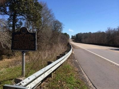
On Donahue Drive, 0.3 miles south of West Samford Drive, on the right when traveling south.
On County Road 5 north of County Road 28, on the left when traveling north.
Near 4th Street (U.S. 287) west of 7th Avenue, on the right when traveling west.
On Peanut Road (County Road 169) at 2nd Avenue, on the left when traveling south on Peanut Road.
On Porter Carswell Road at Bellevue Plantation Road, on the right when traveling north on Porter Carswell Road.
On Maple Street (Georgia Route 166) 0 miles east of W. Lake Drive, on the right when traveling west.
On Watson Boulevard (Georgia Route 247 Connector Road) at Myrtle Street, on the right when traveling west on Watson Boulevard. Reported missing.
On U.S. 341, 0 miles south of Abbott Road, on the right when traveling south.
On U.S. 341, 0.2 miles south of Abbott Road, on the right when traveling south.
On College Drive at Summersfield Drive, on the left when traveling north on College Drive.
On U.S. 80 at 3rd Street, on the right when traveling west on U.S. 80.
Paid Advertisement
On Crowell Road (Georgia Route 283) 0 miles south of Georgia Route 137, on the left when traveling south.
On State Highway 24 at milepost 10 at North 374 Lane East, on the right when traveling east on State Highway 24.
On 110th Street, 0.2 miles west of Olive Avenue, on the right when traveling west.
On Central Avenue (U.S. 73/159) at 17th Street, on the right when traveling north on Central Avenue.
On 15th Street (U.S. 73) near 5th Avenue East, on the right when traveling east.
On N. Jackson Highway (U.S. 31E) 0.1 miles north of Horton Rigdon Road, on the right when traveling north.
On North Bragg Street, Harrodsburg Road (U.S. 68) north of Hardee Street, on the left when traveling south.
On Lafayette Road (Kentucky Route 107) at Herndon Street, on the left when traveling north on Lafayette Road.
On Lexington Rd (U.S. 60) 0.9 miles east of Venable Road, on the right when traveling west.
On U.S. 127, 0.2 miles north of State Highway 3102, on the left when traveling north.
On Rennell Avenue West, 0.2 miles east of Willows Road, on the left when traveling east.
On Marsh Road, 0.3 miles Central Park Drive.
On South Tate Street (Mississippi Route 145) south of Cardinal Drive, on the left when traveling south.
On South Main Street at East Jefferson Street, on the right when traveling north on South Main Street.
On George Norris Avenue near East G Street, on the right when traveling north.
Paid Advertisement
On Lempster Street at Pitkin Road, on the left when traveling south on Lempster Street.
On Andrew Jackson Highway (U.S. 74) at South South Street, on the right when traveling west on Andrew Jackson Highway.
On South Main Street just south of West Caledonia Avenue, on the left when traveling south.
On U.S. 36, on the right when traveling east.
On County Highway 1230 at County Highway 2000, on the left when traveling west on County Highway 1230.
On Biglerville Road (Pennsylvania Route 34) just south of South Avenue, on the right when traveling south.
On East Pitt Street at Clark Building Road, on the right when traveling east on East Pitt Street.
On Brumbaugh Road (PA 869).
On Grand Army of the Republic Hwy (US 6) at Goff Road on Grand Army of the Republic Hwy (US 6).
On Pennsylvania Route 368 east of Terwilliger Road (Local Road 871), on the right when traveling east.
On Pennsylvania Route 198, 0.7 miles east of Center Street (Pennsylvania Route 86), on the right when traveling east.
On Fairgrounds Road (Pennsylvania Route 26) at Hordubay Road, on the right when traveling south on Fairgrounds Road.
On Airport Road (Pennsylvania Route 1006) 0.2 miles east of Pennsylvania Route 286, on the left when traveling east.
On Industrial Park Road at Drum Avenue, on the right when traveling south on Industrial Park Road.
On North Main Street (Business U.S. 15), on the right when traveling north.
On Commercial Avenue (U.S. 14) south of Cardinal Street, on the left when traveling south.
Paid Advertisement
On State Highway 50 east of 469th Avenue, on the right when traveling west.
On State Highway 50 west of 469th Avenue, on the right when traveling east.
Near W. 6th Avenue at S. Main Street, on the right when traveling east.
On State Highway 95 at Linderman Road, on the right when traveling south on State Highway 95.
On Avenue F at Elm Street, on the left when traveling south on Avenue F.
On South Avenue F south of East Elm Street, on the right when traveling north.
On Avenue F at Elm Street, on the left when traveling south on Avenue F.
Near Park Road 52, 0.2 miles north of U.S. 290.
On Pleasant Shade Drive (U.S. 58) west of Carter Road (Virginia Route 649), on the right when traveling west.
On Q Road just south of A Road, on the right when traveling south.
On 140th Street/REA Road north of 112th Avenue/Woodruff Avenue, on the left when traveling north.
On East State Street (State Highway 82) near Oak Street, on the left when traveling west.
On U.S. 14, 0.7 miles east of County Highway Z.
On South Main Street at Iola Street, on the right when traveling south on South Main Street.
On Patrick Street, 0.1 kilometers south of High Street/The Parade, on the right when traveling south.
Paid Advertisement