161 entries match your criteria. The first 100 are listed. ⊳
Former U.S. Presidents: #05 James Monroe Historical Markers
By Sandra Hughes, October 28, 2019
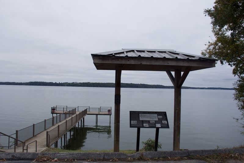
Killen and the Canal System Marker
| 1 ► Alabama, Lauderdale County, Killen — Killen and the Canal System — |
| On 6 Pence Rd. | |||
| 2 ► Alabama, Madison County, Huntsville — Alabama’s Constitution And Statehood — |
| On Gates Avenue at Franklin Street S.E. on Gates Avenue. | |||
| 3 ► Alabama, Madison County, Huntsville — Site The Huntsville Inn — A three-story brick building erected before 1817 — |
| On Eastside Square, on the right. | |||
| 4 ► Alabama, Monroe County, Monroeville — A County Older Than The State — Monroe County — |
| On North Alabama Avenue (State Road 21), on the left when traveling north. | |||
| 5 ► Alabama, Morgan County, Decatur — Old Decatur Historic District / Historic Depot — |
| On Railroad Street NW at Vine Street NW, on the left when traveling north on Railroad Street NW. | |||
| 6 ► Alabama, Morgan County, Decatur — Old Decatur Historic District / Old State Bank — |
| On Bank Street NE at Church Street NE on Bank Street NE. | |||
| 7 ► Arkansas, Benton County, Bella Vista — United States Commanders in Chief — |
| 8 ► Connecticut, Fairfield County, Stamford, Downtown — Freedom Shrine — |
| On Atlantic Street at Main Street, on the right when traveling north on Atlantic Street. | |||
| 9 ► Connecticut, New London County, New London, Fort Trumbull — The Third System — |
| Near East Street, on the left when traveling south. | |||
| 10 ► District of Columbia, Washington, Northeast Washington, Capitol Hill — The Old Brick Capitol — [Old Capitol Prison] — [U.S. Supreme Court Building National Historic Landmark] — |
| Near 1st Street Northeast south of Maryland Avenue Northeast, on the right when traveling north. | |||
| 11 ► District of Columbia, Washington, Northwest Washington, Columbia Heights — Campus to Army Camps and Back Again — Meridian Hill Park, National Historic Landmark — National Park Service, U.S. Department of the Interior — |
| Near 15th Street Northwest south of Euclid Street Northwest, on the left when traveling north. | |||
| 12 ► District of Columbia, Washington, Northwest Washington, Downtown — Home of James Monroe — |
| On I Street Northwest west of 20th Street Northwest, on the right when traveling west. | |||
| 13 ► District of Columbia, Washington, Northwest Washington, Foggy Bottom — Anniversary Park — The George Washington University — Washington D.C. — |
| On F Street Northwest east of 22nd Street Northwest, on the right when traveling east. | |||
| 14 ► District of Columbia, Washington, Northwest Washington, Foggy Bottom — Marquis de Lafayette Hall — |
| On I Street Northwest west of 21st Street Northwest, on the right when traveling east. | |||
| 15 ► District of Columbia, Washington, Northwest Washington, Foggy Bottom — Professors Gate — |
| On 21st Street Northwest north of G Street Northwest, on the right when traveling south. | |||
| 16 ► District of Columbia, Washington, Southeast Washington, Navy Yard — Marine Railway - Experimental Model Basin — |
| On Sicard Street Southeast at Dahlgren Avenue Southeast, on the right when traveling south on Sicard Street Southeast. | |||
| 17 ► Florida, Gadsden County, Chattahoochee — The Scott Massacre — |
| On South River Landing Road, 0.5 miles south of Washington Street (U.S. 90), on the right when traveling south. | |||
| 18 ► Georgia, Chatham County, Savannah, Historic District - North — 025-54 — Chatham Artillery's — "Washington Guns" — |
| On Bay Street, on the right when traveling west. | |||
| 19 ► Georgia, Chatham County, Savannah, Historic District - North — 025-35 — Independent Presbyterian Church — |
| On Bull Street near Oglethorpe Avenue, on the left. | |||
| 20 ► Georgia, Chatham County, Savannah, Historic District - North — 025-38A — Johnson Square — |
| On Bull Street near West Bryan Street. | |||
| 21 ► Georgia, Chatham County, Savannah, Historic District - North — 025-3 — SS Savannah and SS John Randolph — |
| On River Street near N Barnard Street, on the left when traveling south. | |||
| 22 ► Georgia, Chatham County, Savannah, Historic District - North — 025-44 — William Scarbrough — Promoter of the First Transatlantic Steamship — |
| Near East Oglethorpe Avenue. | |||
| 23 ► Georgia, Chatham County, Savannah, Yamacraw Village — 25-35 — William Scarbrough House — |
| On Martin Luther King Jr. Blvd. (West Broad Street) near West Congress Street, on the left when traveling north. | |||
| 24 ► Georgia, Chattooga County, Menlo — 027-1 — Last Indian Agent — |
| On State Highway 337. | |||
| 25 ► Georgia, Forsyth County, Cumming — 058-3 — Colonel William Cumming — |
| On Veterans Memorial Boulevard (Georgia Route 9) south of Main Street (Georgia Route 20), on the right when traveling south. | |||
| 26 ► Georgia, McDuffie County, Thomson — 094-7 — The Birthplace of George McDuffie — |
| On George McDuffie Road, 0.5 miles south of Augusta Road (U.S. 278), on the left when traveling south. | |||
| 27 ► Georgia, Monroe County, Forsyth — 102-3 — Monroe County — |
| On South Jackson Street at West Main Street (U.S. 41), on the left when traveling south on South Jackson Street. | |||
| 28 ► Georgia, Walton County, Monroe — 147-3 — James Monroe — |
| On South Broad Street (Georgia Route 11) 0 miles south of East Washington Street, on the right when traveling north. | |||
| 29 ► Illinois, Madison County, Alton — Freedom Shrine — |
| On Tavernier Way, 0.2 miles south of West MacArthur Drive (Illinois Route 111/140), on the left when traveling south. | |||
| 30 ► Indiana, Madison County, Anderson — 76000028 — Madison County Historic Home — |
| On Main Street at East 6th Street on Main Street. | |||
| 31 ► Indiana, Wabash County, Wabash — Quarters of Major General John Tipton — Indian Agent — |
| Near E. Market Street, 0.2 miles east of S. Allen Street. | |||
| 32 ► Kansas, McPherson County, Elyria — 33 — Kansas Indian Treaty — |
| On Old U.S. 81, 0.3 miles south of Comanche Road, on the right when traveling south. | |||
| 33 ► Kansas, Shawnee County, Topeka — Corridor of Flags — |
| Near NW Railroad Street near NW Curtis Street, on the left when traveling west. | |||
| 34 ► Kentucky, Franklin County, Frankfort — 1653 — Liberty Hall / John Brown (1757-1837) — |
| On Wilkinson Street, on the right when traveling south. | |||
| 35 ► Kentucky, Jefferson County, Louisville — 2376 — Croghans of Locust Grove / Major William Croghan — 1752-1822 — |
| Near Payne Street. | |||
| 36 ► Kentucky, Jefferson County, Louisville, Downtown — 1681 — Visitors at Louisville Wharf / Louisville’s Steamboat Era — |
| On Louisville Riverwalk just west of Clark Memorial Bridge. | |||
| 37 ► Kentucky, Lincoln County, Stanford — Isaac Shelby — |
| Near Isaac Shelby Road. | |||
| 38 ► Kentucky, Lincoln County, Stanford — Isaac Shelby Cemetery — |
| Near Isaac Shelby Road. | |||
| 39 ► Kentucky, Monroe County, Tompkinsville — 1093 — Monroe County - Tompkinsville — |
| On South Main Street (State Highway 100) at 3rd Street, on the right when traveling north on South Main Street. | |||
| 40 ► Kentucky, Nelson County, Bardstown — The Harrison-Smith House — Circa 1795 & 1815 — |
| On South Third Street (U.S. 31E/150), on the right when traveling north. | |||
| 41 ► Louisiana, West Baton Rouge Parish, Port Allen — Louisiana Purchase - West Baton Rouge Early History — |
| Near Court Street (County Route 987-4) at Route 987-5. | |||
| 42 ► Maine, Waldo County, Prospect — A Grand Plan — |
| 43 ► Maryland, Anne Arundel County, Annapolis — Lot 70 Is Historically Significant — |
| On West Street at Church Circle, on the right when traveling west on West Street. | |||
| 44 ► Maryland, Anne Arundel County, Annapolis — Mann's Tavern — Site of the Annapolis Convention — September 11-14, 1786 — |
| On Conduit Street near Gorman Street, on the left when traveling south. | |||
| 45 ► Maryland, Baltimore County, Dundalk — At Patapsco Neck — Star-Spangled Banner National Historic Trail — National Park Service, U.S. Department of the Interior — |
| On North Point Road. | |||
| 46 ► Maryland, Calvert County, St. Leonard — The Garden of Remembrance — |
| On St. Leonard Road (Maryland Route 765) 0.1 miles south of Calvert Beach Road, on the right when traveling south. | |||
| 47 ► Maryland, Charles County, Hughesville — War of 1812 — Benedict—Charles County, MD — Site of the First Foreign Invasion of the United States of America — |
| Near Teagues Point Road, 0.1 miles south of Fairfax Court. | |||
| 48 ► Maryland, Garrett County, Grantsville — Casselman River Bridge State Park — Bicentennial 1813-2013 — |
| Near Casselman Road, 0.1 miles National Road (Route Alt-40). | |||
| 49 ► Maryland, Garrett County, Grantsville — Casselman River Bridge State Park — Bicentennial 1813-2013 — |
| On National Pike (Route Alt-40) 0.3 miles east of Patton Lane, on the left when traveling east. | |||
| 50 ► Maryland, Garrett County, Grantsville — Mountain Maryland Gateway to the West — Garrett County, Maryland — |
| On Casselman Road, 0.2 miles west of National Pike (Alternate U.S. 40), on the left when traveling west. | |||
| 51 ► Maryland, Montgomery County, Brookeville — Madison House — |
| On Market Street, 0.1 miles east of North Street, on the left when traveling east. | |||
| 52 ► Maryland, Prince George's County, Aquasco — Alarming Sight — Star-Spangled Banner Historic Trail — |
| On Aquasco Road at Saint Mary's Church Road, on the right when traveling north on Aquasco Road. | |||
| 53 ► Maryland, Prince George's County, Bladensburg — Clearing the Way to Washington — Star-Spangled Banner National Historic Trail — National Park Service, U.S. Department of the Interior — |
| 54 ► Maryland, Prince George's County, Colmar Manor — Famous Footsteps — Battle of Bladensburg — Star-Spangled Banner National Historic Trail — |
| On Bladensburg Road (Alternate U.S. 1) east of 40th Avenue. | |||
| 55 ► Maryland, Prince George's County, Colmar Manor — Second Line Falls — Star-Spangled Banner National Historic Trail — National Park Service, U.S. Department of the Interior — |
| On Bladensburg Road (Alternate U.S. 1) when traveling west. | |||
| 56 ► Maryland, Prince George's County, Colmar Manor — Second Line Falls — Star-Spangled Banner National Historic Trail |
| On Bladensburg Road (U.S. 1) at 38th Avenue, on the left when traveling south on Bladensburg Road. Reported missing. | |||
| 57 ► Maryland, Prince George's County, Hyattsville — The Louisiana Purchase / Edison's Light Bulb Patent — |
| On Toledo Road just west of America Boulevard. | |||
| 58 ► Maryland, St. Mary's County, Piney Point — Piney Point — “Summer White House” — |
| On Lighthouse Road (SR 498). | |||
| 59 ► Missouri, Monroe County, Monroe City — James Monroe — Fifth President of the United States 1817-1825 — Author of the Monroe Doctrine / Namesake of Monroe City and Monroe County — |
| On Main Street (U.S. 24) south of 2nd Street, on the left when traveling south. | |||
| 60 ► Missouri, St. Charles County, St. Charles — First State Capitol of Missouri — City of St. Charles, 1821 • City of Jefferson 1921 — |
| On Madison Street at South Riverside Drive, on the right when traveling east on Madison Street. | |||
| 61 ► New Hampshire, Rockingham County, Northwood — 024 — LaFayette's Tour — |
| On U.S. 4. | |||
| 62 ► New Jersey, Morris County, Morristown — Thomas Paine — 1737 – 1809 — |
| On Washington Street (County Route 510), on the left when traveling west. | |||
| 63 ► New York, Clinton County, Rouses Point — Ezra Thurber’s Home — 1818 — |
| On Lake Street (New York State Route 9B) at Myers Street, on the right when traveling south on Lake Street. | |||
| 64 ► New York, Franklin County, Malone — Historic Malone — Star of the North — |
| On East Main Street (U.S. 11) 0.1 miles west of Elm Street (New York State Route 30), on the left when traveling west. | |||
| 65 ► New York, Jefferson County, Sackets Harbor — President James Monroe — |
| On Military Road at Hounsfield Street, on the right when traveling north on Military Road. | |||
| 66 ► New York, Monroe County, Rochester, Downtown — County of Monroe — |
| On Main St. W at Fitzhugh St, on the right when traveling east on Main St. W. | |||
| 67 ► New York, New York County, Manhattan, Alphabet City — Tompkins Square Park — 10.5 acres — |
| Near park path at St. Marks's Place at Avenue A, on the left when traveling east. | |||
| 68 ► New York, Orange County, Monroe — Town of Monroe — |
| On New York State Route 17M at New York State Route 208, on the right when traveling west on State Route 17M. | |||
| 69 ► North Carolina, Craven County, New Bern — First House of Worship of Colonial Craven Parish — |
| On Pollock Street at Middle Street, on the right when traveling west on Pollock Street. | |||
| 70 ► Ohio, Ottawa County, Marblehead — 18-62 — The Light / The Keepers of the Light — |
| On Lighthouse Drive east of East Main Street (Ohio Route 163), on the right when traveling east. | |||
| 71 ► Ohio, Washington County, Marietta — River Town / Sails and Steam / The Highway West — |
| 72 ► Ohio, Washington County, Marietta — 11-84 — The Northwest Ordinance, 1787 / The Ohio Company Purchase — |
| On Second Street at St. Clair Street, on the right when traveling south on Second Street. | |||
| 73 ► Ohio, Wayne County, Wooster — 4-85 — Barnhart Rice Homestead / Frederick Rice — |
| On Williams Road just east of Gossard Drive, on the right when traveling east. | |||
| 74 ► Ohio, Wood County, Perrysburg — 14-87 — Amos Spafford / Perrysburg — |
| On West Indiana Avenue (Ohio Route 65) near Fort Meigs Road, on the right when traveling south. | |||
| 75 ► Oregon, Klamath County, Worden — The 42nd Parallel — |
| Near U.S. 97, on the left when traveling south. | |||
| 76 ► Pennsylvania, Bucks County, New Hope, Solebury Township — Thompson-Neely House — |
| Near Aquetong Road, on the right when traveling east. | |||
| 77 ► Pennsylvania, Chester County, Malvern, Tredyffrin Township — Quarters of Major General William Alexander — Lord Sterling — Placed on the National Register of Historic Places • 1974 — |
| On Yellow Springs Road, on the right when traveling west. | |||
| 78 ► Pennsylvania, Philadelphia County, Philadelphia, William Penn Annex East — Commodore Uriah Phillips Levy — |
| On North 5th Street. | |||
| 79 ► Pennsylvania, Philadelphia County, Philadelphia, William Penn Annex East — The House & the People Who Worked & Lived In It — |
| On Market Street at South Independence Mall West (6th Street), on the right when traveling east on Market Street. | |||
| 80 ► Rhode Island, Newport County, Newport — Bay Islands Park — |
| Near Fort Adams Drive, on the left when traveling north. | |||
| 81 ► South Carolina, Beaufort County, Beaufort — Beaufort South Carolina Tricentennial — 1711-2011 300 — |
| Near Scott Street. | |||
| 82 ► South Carolina, Charleston County, Charleston, French Quarter — The Confederate Home — c. 1800 — |
| On Broad Street, 0.1 miles west of Church Street, on the left when traveling east. | |||
| 83 ► South Carolina, Charleston County, Charleston, South of Broad — Site of St. Andrew's Hall — |
| On Broad Street at Orange Street, on the left when traveling east on Broad Street. | |||
| 84 ► South Carolina, Charleston County, Mount Pleasant — 10-52 — Maybank Green / Hobcaw Plantation — |
| On North Shelmore Blvd. near Faye Lane, on the left when traveling west. | |||
| 85 ► South Carolina, Georgetown County, Georgetown — 22-4 — Prospect Hill — |
| On Ocean Highway (U.S. 17) south of Arcadia Plantation Drive. | |||
| 86 ► South Carolina, Pickens County, Clemson — Fort Hill Plantation Office — |
| On Fort Hill Street. | |||
| 87 ► Tennessee, Lawrence County, Loretto — Glen's Stand at Glen Rock — Andrew Jackson's Military Road — |
| On 2nd Avenue South at Mill Creek Drive, on the right when traveling west on 2nd Avenue South. | |||
| 88 ► Vermont, Chittenden County, Burlington, South End — Site of the American House — 1808 - 1893 — |
| On Main Street (U.S. 2) at St. Paul Street, on the right when traveling east on Main Street. | |||
| 89 ► Virginia, Albemarle County, Charlottesville — Ash Lawn - Highland — |
| Near Ashlawn-Highland Drive. | |||
| 90 ► Virginia, Albemarle County, Charlottesville — G-23 — James Monroe’s First Farm — Site of the University of Virginia — |
| On McCormick Road south of University Avenue (Business U.S. 250), on the left when traveling south. | |||
| 91 ► Virginia, Albemarle County, Charlottesville, Venable — I-3 — University of Virginia — |
| On University Avenue (Business U.S. 250) at Rugby Road on University Avenue. | |||
| 92 ► Virginia, Albemarle County, Charlottesville, Viewmont — GA-46 — Southern Albemarle Rural Historic District — |
| On Scottsville Road (Virginia Route 20) just south of Carters Mountain Road (Route 627), on the left when traveling south. | |||
| 93 ► Virginia, Albemarle County, Simeon — FL-8 — Ash Lawn – Highland — |
| On James Monroe Parkway (County Route 795) 0.8 miles south of Thomas Jefferson Parkway (Virginia Route 53), on the left when traveling south. | |||
| 94 ► Virginia, Alexandria, Old Town — Alexandria — A Place Through Time |
| Near North Union Street east of Fayette Alley, on the right when traveling north. Reported missing. | |||
| 95 ► Virginia, Arlington County, Arlington, Chain Bridge Forest — Pimmit Run and Chain Bridge — |
| On North Glebe Road (State Highway 120) at 41st Street, on the right when traveling south on North Glebe Road. | |||
| 96 ► Virginia, Caroline County, Hanover — E-115 — Gabriel’s Rebellion — |
| On Richmond Highway (U.S. 301) 3 miles south of Dawn Boulevard (Virginia Route 30), on the right when traveling south. | |||
| 97 ► Virginia, Charlottesville, Downtown Mall — President Monroe’s Local Homes — |
| On 5th Street NE at East Market Street, on the left when traveling south on 5th Street NE. | |||
| 98 ► Virginia, Charlottesville, Downtown Mall — Q-20 — Stone Tavern and Central Hotel — |
| On East Market Street west of 5th Street NE, on the right when traveling east. | |||
| 99 ► Virginia, Charlottesville, Jefferson Park Avenue — Fernando Símon Bolívar — 1810–1898 — |
| On Jefferson Park Avenue east of Emmet Street (Business U.S. 29), on the right when traveling east. | |||
| 100 ► Virginia, Charlottesville, North Downtown — A Bicentennial Tribute — |
| On Park Street at East Jefferson Street on Park Street. | |||
161 entries matched your criteria. The first 100 are listed above. The final 61 ⊳