A Church in a Changing Village
A priest and his parishioners greet a patriotic parade in the 1920s. The church was originally built in 1900 for a Baptist congregation and its rededication in 1914 as St. Stanislaus Kostka reflected . . . — — Map (db m193457) HM
A Lavish Private Garden
The Crystie Estate and its garden, photographed in 1924, was invaded in 1903 (inset) by a trolley car from Yonkers that failed to make the sharp turn from Broadway onto Main Street. The now-destroyed . . . — — Map (db m193458) HM
A Movie Theater and a Diner
The Hastings Theater (photographed in 1929) opened in December 1920 with a showing of The Mask of Zorro starring Douglas Fairbanks. It was not named for the village, but after its owner and . . . — — Map (db m193518) HM
A Saloon and a Mansion
Fegan's saloon, around 1910, on the east side of Maple Avenue (the stone house to its right still stands) was one of dozens of bars that lined the way to the waterfront. Inset: On the west side of the . . . — — Map (db m193512) HM
In the 1920s, legendary showman Florenz Ziegfeld lived here at Burkeley Crest with his wife actress Billie Burke, best remembered as the good witch Glinda in The Wizard of Oz. The estate included a private zoo (with buffalo, . . . — — Map (db m231259) HM
Grace Episcopal Church begins its journey up Main Street from here to its present location at the Five Corners in 1931. The Great Depression was at its height, and according to legend, the street was blocked for several days when the . . . — — Map (db m193524) HM
The German-born painter Carl Brandt (1831-1905) came to Hastings in the 1860s and settled in this Greek revival house on the western edge of the Chrystie estate. The man in the rocking char of this circa 1900 photograph may be . . . — — Map (db m193522) HM
Community Gardens in Zinsser Park
Across Broadway are the community vegetable gardens begun as Victory Gardens during World War I. The park was the estate of Frederick Zinsser, village mayor and owner of the local factory that . . . — — Map (db m193436) HM
Originally a private preserve then over seen by a nature conservancy and now a village park, this space (including the Observatory, headquarters of the Historical Society) came from the original John William Draper estate, and has . . . — — Map (db m193482) HM
Draper Terrace
One single family and two double-family frame houses in the Hudson Valley cottage style date from the early 1840s to the late 1850s. The double houses were built by the scientist and historian John William Draper . . . — — Map (db m193472) HM
Forge Cottage
This gardener's cottage (seen here in the 1870s before its 1905 renovation) contains remnants of what's been called the Neutral Forge, a Revolutionary War blacksmith's shop located—as was all of Hastings—in the . . . — — Map (db m193473) HM
Hastings' First High Rise
When the village's first apartment building, La Barranca ("The Ravine," in Spanish), opened in 1929 it was greeted with outrage because of its size and height, a staggering six stories. It was, by far, . . . — — Map (db m193469) HM
Welcome to Hastings
Hastings did not officially become a village until 1879. Compared to its Westchester neighbors that was very late. Even the local volunteer fire company is older. But with a population of 1,228, the community . . . — — Map (db m193432) HM
Welcome to Hastings
Hastings did not officially become a village until 1879. Compared to its Westchester neighbors that was very late. Even the local volunteer fire company is older. But with a population of 1,228, the community . . . — — Map (db m237829) HM
Welcome to Hastings
Hastings did not officially become a village until 1879. Compared to its Westchester neighbors that was very late. Even the local volunteer fire company is older. But with a population of 1,228, the community . . . — — Map (db m237830) HM
Welcome to Hastings
Hastings did not officially become a village until 1879. Compared to its Westchester neighbors that was very late. Even the local volunteer fire company is older. But with a population of 1,228, the community . . . — — Map (db m238050) HM
Henry Draper and His Observatories
From 1860, when he built his first observatory on his father's estate, until his death in 1882, Henry Draper photographed the heavens from this Hastings hilltop. In this 1880s image, the . . . — — Map (db m193479) HM
Industrial Hastings
The waterfront was the economic and industrial heart of the village from the 1830s to the 1970s. The English watercolorist George Harvey—who owned a marble quarry in Hastings and assisted Washington Irving . . . — — Map (db m193509) HM
In the 1910s and '20s this fashionable restaurant with a spectacular view was all many Manhattanites knew of Hastings. Located on this hilltop with its own golf course, Longue Vue's clientele included socialites, gangsters, and stars . . . — — Map (db m238448) HM
Municipal Building
Built on the site of the home of Joseph Treanor (inset), owner of the waterfront blue-stone yard, and designed by Shreve and Lamb, architects of the Empire State Building, the Village Hall was completed . . . — — Map (db m193506) HM
Old Broadway
An original section of narrow old Broadway, the Albany Post Road, lies opposite. The large house on its north end was once the Baker family's funeral home. A 1933 photograph shows it and Baker Lane. Inset: The . . . — — Map (db m193459) HM
The Hopkes, owners of the sugar refinery on the Hastings waterfront that burned to the ground in 1875, named their stone mansion on Hopke Avenue Olinda ("beautiful" in Portuguese) after the city in Brazil from which their raw sugar . . . — — Map (db m193467) HM
Protection Engine Company No. 1
In 1876, three years before Hastings officially became a village and five weeks after fires destroyed its waterfront, 37 men founded one of the first volunteer fire companies in the region. . . . — — Map (db m193520) HM
School Days
Farragut School, the oldest section of Hastings' present middle school-high school complex, was built in 1904 for all grades. It is seen here on Armistice Day, November 11, 1918, the end of World War I. Among the many . . . — — Map (db m193465) HM
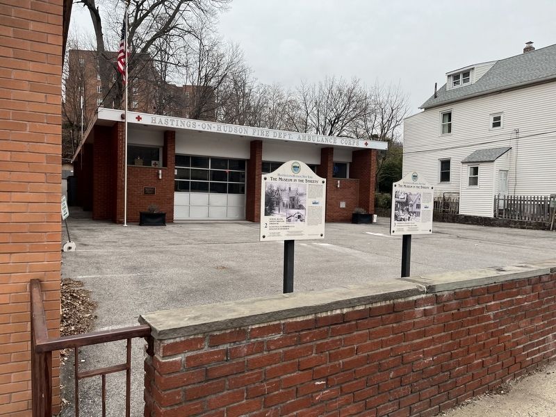
School, Blacksmith's Shop and Firehouse
Opposite is the Fraser Free School built in 1863 for the elementary grades (high school students journeyed to Yonkers) and later used as a library, civic center and, now a volunteer fire . . . — — Map (db m193456) HM
Ships and Shad
The Buccaneer, a five-masted barkentine painted to look like a pirate ship (photographed minus some masts in 1936 at Hastings' Tower Ridge Yacht Club), was a feature of the riverfront for decades. With its . . . — — Map (db m193526) HM
Squirrel Alley and Riverview Place
The squirrel at the entrance of the path to Riverview Place is the work of sculptor Raffaele Menconi (1877-1942), who also made the aluminum eagle for the Municipal Building and whose . . . — — Map (db m193515) HM
The "new" St. Matthew's Roman Catholic Church on the east side of Warburton Avenue was built in 1917 to replace an older chapel (interior and exterior pictured) built in 1870 on the current site of the Post Office. Warburton, . . . — — Map (db m193516) HM
The Kattenhorn Houses
Four similar "cottages" were built in the 1850s as homes for executives of Kattenhorn and Hopke's Hudson River Steam Sugar Refinery Several sugar mills opened along the river after the arrival of the . . . — — Map (db m193513) HM
The Local Soda Fountain
Todd's Drug Store caught the spirit of the 1909 Hudson-Fulton Celebration, when cities and towns all along the river observed the achievements of Henry Hudson and Robert Fulton. Inset: Hastings' own . . . — — Map (db m193455) HM
The Old Croton Aqueduct
The aqueduct, which in the 1840s first brought clean country water to Manhattan passes through Hastings. A 19th-century print shows an arch a few hundred yards south of here over which the aqueduct . . . — — Map (db m193483) HM
The Oldest Church
The red-brick Dutch Reformed Church—now simply the Reformed Church—was built in 1850 and is the oldest surviving non-domestic building in the village. Its design was based on sketches by A.J. Davis (inset), . . . — — Map (db m193463) HM
The Ravine, Looking East
Power generated by a fast-moving stream rushing through this ravine into an inlet (now a parking lot) on the river brought Hastings its first factory, William Saunders' axle plant, in the early 1840s. . . . — — Map (db m193527) HM
The Ravine, Looking West
The heart of the waterfront was photographed from the new Warburton Avenue Bridge soon after 1900. The railroad station is to the right, the National Conduit and Cable Company (predecessor of Anaconda) in . . . — — Map (db m193528) HM
The Tower Ridge Neighborhood
In the 1870s, Dr. Edward Huyler, a patent medicine manufacturer, built his home on the ridge above the river and added a since-destroyed chiming clock tower with four faces (no two of which were . . . — — Map (db m193514) HM
The Way to Work
A footbridge near the bottom of Washington Avenue once crossed over the train tracks. It was the way many workers, many of whom lived at the south end of the village, got to the waterfront factories. A 1914 . . . — — Map (db m193484) HM
Warburton Avenue
G.H. ("Gus") Wagner, who appears in his sleigh on sign #28, ran a newsstand and tobacco shop at 537 Warburton Avenue, on the west side of the street. He also sold gasoline and repaired bicycles and automobiles. . . . — — Map (db m193523) HM
Watering the Horses
The stone horse-watering trough that still remains on the east side of Broadway was once a regular stopping place on the main road north from New York City. A sign for the Farragut Inn above the already outdated . . . — — Map (db m193461) HM