For more than a century this has been one of the finest residential areas in New Jersey. Development began in the 1870s, and continued into the 1920s. The Ballantines, the Clarks and other families who had amassed fortunes in local industry created . . . — — Map (db m52172) HM
One of the oldest structures in Newark, built in the 18th Century, this house is a prime example of early American ingenuity in architecture — — Map (db m43925) HM
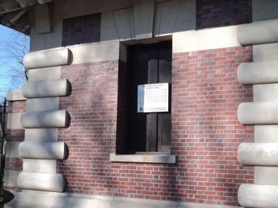
Built about 1710 by Plume family. Became House of Prayer Rectory, 1850. Rev. Hannibal Goodwin invented celluloid film here, 1887. — — Map (db m40709) HM
The first permanent settler who came here in 1678 and lived within the present day boundaries of West Orange. His home was located just a short distance from this location in current day Llewellyn Park nearly 177 years before the park was founded. . . . — — Map (db m137103) HM
In 1886 Thomas Edison bought Glenmont as a gift for his bride, Mina Miller. After moving in, Edison said that the 23-room Victorian mansion was “a great deal too nice for me, but it isn’t half nice enough for my little . . . — — Map (db m12011) HM
The Clement Oak which sheltered Lenape hunters 4 centuries ago and early colonists 3 centuries ago and children at play in later years is dedicated during the tercentenary of New Jersey as symbolic of the state's continuing growth.
Gloucester . . . — — Map (db m152087) HM
This property is registered on the National List of Historic Sites by the U. S. Dept. of the Interior. Built 1638-1643.
Harry L. & Doris A. Rink, Owners. — — Map (db m69776) HM
Home of Dr. Bodo Otto, Jr., noted surgeon, legislator, judge, and militia Colonel in Revolution. Born, 1748, in Germany. Died here, 1782. — — Map (db m69755) HM
Purchased on September 13, 1978, for $78,000.00 from the First National Bank of South Jersey. Named for Dr. William R. Hofer and Emily G. Ireland. Listed on Wikipedia List of New Jersey Museums. This building is open for school tours and private . . . — — Map (db m146777) HM
The Mullica House
Oldest House in
Mullica Hill, NJ
has been placed on the
National Register
of Historic Places
by the United States
Department of the Interior
circa 1704 — — Map (db m146781) HM
William Mullica House
32 North Main Street
has been placed on the
National Register
of Historic Places
by the United States
Department of the Interior
c. 1704 — — Map (db m146779) HM
James Whitall, a wealthy Quaker farmer and merchant, and his wife Ann Cooper built the main brick section in 1748. On April 16, 1777, the Pennsylvania militia commandeered the farm and built Fort Mercer in the northern apple orchard. Son Job . . . — — Map (db m13439) HM
History of Pitman Grove
A group of Methodist ministers searching for a summer camp meeting location established Pitman Grove in June 1871. The New Jersey Camp Meeting Association purchased land from the Jessup family for that purpose. They found . . . — — Map (db m167374) HM
To commemorate the 300th anniversary of Trinity "Old Swedes" Church and the visit of Her Royal Highness, Crown Princess Victoria of Sweden, April 4, 2003 — — Map (db m79407) HM
As early as 1638, Swedes settled, farmed along the Raccoon Creek. In 1703, Trinity Church was founded along Kings Highway as the first Swedish Church in New Jersey and the third Swedish Church in America. The original Swedish log cabin church was . . . — — Map (db m79406) HM
Henry Hudson’s “Half Moon” anchored off Communipaw in 1609. In 1633 the Dutch West India Company built the first house occupied by “John the Laugher.” A small colony of Dutch houses and farms developed along the shore where . . . — — Map (db m42415) HM
Jersey City’s oldest building, the Newkirk House was erected circa 1690 a few blocks northeast of the nearby Dutch settlement of Bergen Square (1660). Occupied for two centuries by the Newkirk family, the sandstone structure was sold by . . . — — Map (db m156027) HM
The Old Bergen Church, a Dutch Reformed Church, is a classic blending of Greek Revival details and form, with New Jersey Dutch influences. Originally founded in 1662 at Bergen Avenue and Vroom Street, the church has undergone two rebuildings on this . . . — — Map (db m6137) HM
After passing the Statue of Liberty and being processed at Ellis Island, where did the new Americans go? Once declared “clearly and beyond a doubt, entitled to land” almost two-thirds of the immigrants processed at Ellis Island . . . — — Map (db m49339) HM
The term “Historic Trilogy” is used to represent the role the Central Railroad of New Jersey (CRRNJ) Terminal, Ellis Island and the Statue of Liberty played in American history. It was these three historic structures that greeted most . . . — — Map (db m49344) HM
Known for his boldness and his strategic genius, Nathanael Greene was considered the most accomplished general of the American Revolution after George Washington.
While Greene is most noted for his command of the Southern Campaign of 1780, . . . — — Map (db m239406) HM
During the 1600's, the Van Vorst family owned most of the nearby lowland and marsh from the Hudson river to the hill that climbs up to the old medical center, which they used for farming and fishing. In 1835, the year that Cornelius Van Vorst . . . — — Map (db m239389) HM
Cornelius Van Vorst gave this hilly land to the Township of Bergen in 1835. He graded, landscaped and fenced it in 1851. From 1841 to 1856, this was Van Vorst Township. In latter years, it merged with Jersey City. Brownstones around this park built . . . — — Map (db m239384) HM
Erected by the town of Kearny Tercentenary Committee in memory of Major General Philip Kearny during the New Jersey Tercentenary year 1664 – 1964. — — Map (db m6744) HM
This monument is erected in recognition of the contributions made by all people of Scottish heritage to the development of the United States of America. God Bless America “Every line of strength in our history is a line coloured by . . . — — Map (db m90105) HM
Dedicated to the memory of Sir William Wallace The Great Scottish Patriot and Hero who fought for freedom for his countrymen and gave his life in this noble cause. David A. Wallace A Scottish immigrant who had served his community and . . . — — Map (db m90104) HM
In 1832, James Gore King (1791-1853), a New York banking magnate and son of statesman Rufus King, moved his family here to Weehawken, overlooking the Hudson. King was an early president of the Erie Railroad and served in the US Congress from . . . — — Map (db m66642) HM
Built west from Elizabeth and Jersey City in the 1830s, reaching Easton in 1852. This stop spawned the town of Clinton Station, renamed Annandale in 1873. — — Map (db m16926) HM
Settled by Baptists in the 1720s. One of the area's older towns astride the Old Kings Highway (now Rte. 519), it offered a tavern, stores, and various artisans. — — Map (db m16662) HM
Once Charlestown and Larisonville; renamed by 1859 after early resident. An 1823 tavern, blacksmith shop & several stores formed the town's business core. — — Map (db m30637) HM
Midpoint of the Musconetcong Mountain Range was named for 1761 "Jug" Tavern at the bottom of the hill to the west. The 4900' Lehigh Valley RR tunnel beneath was the longest in the East in 1875. Second tube opened in 1928. — — Map (db m62292) HM
Known earlier as California, its name dates to the gold rush days. By the 1870s, its water powered mills and the High Bridge RR brought growth. Post office est. 1878. — — Map (db m21811) HM
In 1760, a farmer named Asher Mott (1739-?) inherited a gristmill and a 45 acre "plantation" following the death of his father, William. The mill was located downstream from this point along Hollow Brook (also known as Mill Creek). Please note that . . . — — Map (db m41266) HM
Known earlier as Dogtown for the 1737 tavern built here. Named for the Cherry family in 1839. The church was organized in 1849, the post office in 1850. — — Map (db m21929) HM
The Town of Clinton Historic District encompasses most of the town's area, including more than 200 properties built between 1810 and 1930. The Town of Clinton was a prominent local commercial center during this period. It's two mills, numerous . . . — — Map (db m16673) HM
In the mid to late 1800s, Halstead Street was known as "Irish Town" because of the large community of Irish Immigrants who lived here. This tight-knit Irish Catholic community was anchored by the Mulligan family, originally from Belturbet, County . . . — — Map (db m103071) HM
Once Hunts Mills. Site of saw, grist and oil mills. Re-named Clinton in 1828 honouring Governor DeWitt Clinton, sponsor of the Erie Canal. Incorporated 1865. — — Map (db m16629) HM
Named after the Werts (Wearts) family and listed on National, State, and Twp. Registers of Historic Places. A log schoolhouse was built in 1747 in Wertsville District. Post Office established 1854. — — Map (db m161221) HM
Originally called Everitts Mill, the village once comprised of a mill, post office, schoolhouse, tavern, blacksmiths shop, tailor shop, two storehouses, and approximately 25 dwellings situated on the Nishisakawick Creek. Founded in 1759. — — Map (db m55266) HM
Known as Everitts Mills by 1759, then Everittstown by 1816. A post office served the town from 1848 until 1912, also a blacksmith shop, stores, a tailor, the grist and oil mill, plus the old tavern. — — Map (db m71544) HM
A neighborhood south of Croton. Got its name through legend of a chicken stealing family that lived there. When forced to move "Great" piles of chicken bones remained at this site. — — Map (db m22487) HM
The first house in the village, built by Samuel Fleming 1756.
This tablet is erected by Colonel Lowrey Chapter Daughters of the American Revolution, May 28, 1906. — — Map (db m33207) HM
Johann Kase purchased land from Penn family 1738. Built a log cabin with help of Chief Tuccamigan’s tribe. Stone mansion house built ca. 1798. — — Map (db m16690) HM
Lenape Chief Tuccamirgan helped early settler John Kase (Case) and his family survive the wilderness. Their respect for each other and the earth inspires all who walk here. — — Map (db m33208) HM
In 1729, Joseph King Sr. bought this property, built this "good stone dwelling-house", and a grist/saw mill. Joseph King Jr. owned them until 1768. The mill operated until c.1895 but was dismantled by 1930. — — Map (db m143357) HM
Top
Town takes its name from the many French families that followed Paul Henri Mallet-Prevost, a Swiss refugee from the French Revolution who moved here in 1794. Bottom
Called "Sunbeam" in 1759. Later Sherrard's Ferry. Present name for . . . — — Map (db m17079) HM
Originally known as Eveland's Tavern, the community of Glen Gardner was established in the early to mid 1700's. Early settlement relied heavily upon Spruce Run to power mills and the surrounding mountainside to mine ore. The addition of the Central . . . — — Map (db m16667) HM
Named In 1871 For Chair Factory Family Eveland’s Tavern In 1760, It Was Later Known As Sodom, And In 1820, Clarksville, After A Local Merchant. — — Map (db m17409) HM
In 1759 Phillip and John Grandin acquired 1,000 acres known as the Hamden Tract.
Hamden was home to the Grandin Grist & Fulling-Mills, a Blacksmith Shop, and Abbott's Tavern.
Dr. John Grandin's house was built in 1775 with pitch pine lumber that . . . — — Map (db m132105) HM
The meeting place of the NJ Central and DL & W RRs, earlier known as Junction. Extensive RR shops and a huge coal storage yard were sited here. — — Map (db m21189) HM
Known for years before 1909 as junction. Central RR of NJ & DL&W railroads met here. Site of extensive machine shops and a huge coal storage facility set up to get nearer the city areas to the east. — — Map (db m16702) HM
A Lenape village called Pelouesse was identified in 1715 across the Musconetcong River from Hampton, New Jersey. The name of the village, Pelouesse, as pronounced by the colonial Americans, derived from the Lenape words yapei, meaning "on the stream . . . — — Map (db m44337) HM
Home of Union Forge, maker of early farm equipment,
cannonballs for Continential Army. Factory, later known as Taylor Wharton ceased operations in 1971. — — Map (db m5039) HM
A log tavern on this site ca. 1764 offered shelter to travellers on the King’s Hwy. Later tavern ca. 1790 known for years as Johnson’s. — — Map (db m16829) HM
Named after Miller Kline who operated a Dry Goods store, Post Office, and Tavern. Tavern House dates to the mid-18th century. A place of considerable business, area was then known as Mount Carmel. — — Map (db m16681) HM
Earlier known as Coates' Ferry, then Coryell's Ferry.
The Lambert family settled here circa 1735, and gave the town its current name. — — Map (db m16860) HM
Originally named “Jacksonville” after Andrew Jackson.
Major stop on Easton-New Brunswick Turnpike from 1806. Town set off from Clinton Township in 1926. — — Map (db m16769) HM
Encompasses the 18th Century Hamlets of Linvale & Snydertown. Placed on the New Jersey & National Register of Historic Places in 1997. — — Map (db m17085) HM
Circa 1750. Settled by pioneer tenant farmers, Amsterdam developed by the mid-1800's into a hamlet featuring a general store, blacksmithy & shoe makers shop. — — Map (db m57591) HM
Established in 1880 by the Farley family, the Post stayed in the family for 100 years. It has served as Post Office, General Store and focal point for the Village of Mountainville. — — Map (db m16670) HM
Early taverns near the Musconetcong River Crossings
served travelers between Trenton and the Oxford furnaces. Birthplace of Daniel Morgan, one of Washington’s Generals. — — Map (db m16611) HM
Settled in 1700'S. By 1873 only a gristmill, sawmill,
post office and a few homes remained. Town named for oak forests surrounding it. — — Map (db m16691) HM
English settler John Taylor established a gristmill c. 1760 approximately 0.7 miles downstream on Taylor's Mill Road. The mill supplied flour to American troops during the Revolutionary War and continued to operate into the early 20th century. This . . . — — Map (db m20329) HM
Formerly known as Apgar's Corners, this settlement was renamed in honor of the Asst. Post Master General of the United States, Wilson Bissell. — — Map (db m20330) HM
Named for Rockhill family who lived here on 846 acres as early as 1731. Original stone arch bridge built c1867 by H. Johnson. Reconstructed 2013/ — — Map (db m70021) HM
Located at crossroads of the West Jersey Society’s boundary line and old Raritan Path. First German Lutheran Church in New Jersey was built here c. 1730. — — Map (db m16767) HM
Named for prominent Potter family, the village was known early as “Lamington Falls.” Three counties merge at the river, Hunterdon, Morris, Somerset. — — Map (db m16915) HM
Formerly "Greenville" named after Runkell Rea. He built a general store in 1834. Became first postmaster in 1850. This was a stop on the stage line to York, Pa. The first English Presbyterian Church was moved to this site in 1837. Village prospered . . . — — Map (db m97397) HM
Village named for John Ringo’s tavern, on the Old York Road. Sons of Liberty and Committee of Correspondence met here during the Revolutionary War. — — Map (db m16695) HM
Previous to 1817, known variously as Godley's Mills and Helltown for a rowdy tavern operating nearby. A grist mill and saw mill were built here about 1800. — — Map (db m21781) HM
Island in the river served as a site for clam bakes, picnics, and other public affairs. A flax mill located on the island in the mid-1800s. — — Map (db m60785) HM
The site of a Wheelwrights shop, six dwellings and J. Mattisons store. Just East of Flemigton. Located at Old York Road and Dory Dilts Road. — — Map (db m17246) HM
Daniel Sebring bought this land in 1711, and operated a tavern here by 1738. In 1769, it became the first overnight stage stop along the Old York Road
between NY and Philadelphia. — — Map (db m16739) HM
Early Indian trail known after 1711 survey as “The York Road,” later as “The Old York Road.” A third bridge added west of here in 1813 provided town’s official name in 1866. — — Map (db m16740) HM
Said to be the largest uncovered rock in the state. Named for land owner Hannah Quick. Legend says that during the Revolution, a shoemaker & ladder maker lived and worked their trades in a cave beneath. — — Map (db m62291) HM
Known as Jugtown for its 1761 "Jug" tavern, became Bethlehem by 1843 & West End by 1880 for its iron works. Named Ferndean & then West Portal by 1888. The 1870's 4900' LVRR tunnel was then the longest in the East. — — Map (db m62290) HM
567 entries matched your criteria. Entries 201 through 300 are listed above. ⊲ Previous 100 — Next 100 ⊳