Near NE Atlantic Street north of East Lincoln Street, on the left when traveling north.
Tullahoma, chartered in 1852, was laid out by a Town Company along the Nashville and Chattanooga Railroad line being built at the time. The street along the railroad was named “Atlantic” perhaps because the railroad made possible an . . . — — Map (db m172367) HM
On South Jackson Street (U.S. 41A) at West Volney Street, on the right when traveling south on South Jackson Street.
Withdrawing to this area after the Battle of Murfreesboro, Gen. Braxton Bragg established his command post near here. Other units went into defensive winter quarters at Bell Buckle, Shelbyville & Wartrace. Here they remained until late June, 1863, . . . — — Map (db m81378) HM
On South Jackson Street (Alternate U.S. 41) at West Decherd Street, on the right when traveling south on South Jackson Street.
Braxton Bragg's Headquarters – Public Square (now S. Jackson Civic Center grounds)
After the Battle of Stone's River, the Confederate Army of Tennessee moved to the Duck River Line extending from Spring Hill through Shelbyville, Tullahoma, . . . — — Map (db m172402) HM
On South Jackson Street (U.S. 41A) at West Volney Street, on the right when traveling south on South Jackson Street.
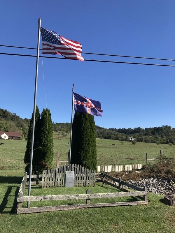
1 mile SW are buried 407 unknown Confederates. Many of these died in one of the hospitals established here when Tullahoma was headquarters for the Army of Tennessee during the first six months of 1863, following the Battle of Murfreesboro and . . . — — Map (db m24296) HM
On Maplewood Avenue, 0.1 miles north of West Waggoner Street, on the right when traveling south.
The cemetery holds the graves of over 500 Confederate soldiers who died from wounds, illness, or accidents while in Tullahoma. 404 soldiers have been identified from records located many years after the Civil War. Col. Matt Martin, CSA deeded the . . . — — Map (db m172408) HM
On Maplewood Avenue, 0.3 miles south of West Coffee Street, on the right when traveling south.
On this ground are buried 407 unknown Confederates. Many of these died in one of the hospitals established here when Tullahoma was headquarter for the Army of Tennessee during the first six months of 1863. Following the Battle of Murfreesboro and . . . — — Map (db m75311) HM WM
On East Fort Street near Ovoca Road, on the right when traveling east.
Fort Rains, a bastioned fort, was built by the Confederates during their six-months stay the early part of 1863 on the slight eminence along Fort Street between Ovoca Road and Forrest Drive, as they awaited a move by the Union Army. The fort was . . . — — Map (db m172355) HM
On NE Atlantic Street at East Grundy Street, on the right when traveling south on NE Atlantic Street.
(preface)
After the Battle of Stones River ended on January 2, 1863, Union Gen. William S. Rosecrans occupied Murfreesboro. Confederate Gen. Braxton Bragg withdrew south to the Highland Rim to protect the rail junction at Tullahoma, Bragg’s . . . — — Map (db m81382) HM
On South Jackson Street (U.S. 41A) at West Volney Street, on the right when traveling south on South Jackson Street.
Born near here, 1818. Was the only governor of Confederate State of Tennessee. In Congress 1849-51; elected governor, 1857-59-61. When U.S. forces captured Nashville, joined staff of Army of Tennessee for remainder of War. Fled to Mexico, 1865; . . . — — Map (db m61914) HM
On Tennessee Route 55, on the right when traveling east.
South of here, at Bobo's Crossroads, Col. Starnes, 4th Tennessee Cavalry, CSA, then commanding Forrest's Old Brigade, was killed in a skirmish while his brigade was screening the withdrawal of the Army of Tennessee from Tullahoma to the Chattanooga . . . — — Map (db m24188) HM
On South Jackson Street (Alternate U.S. 41) south of West Lincoln Street, on the right when traveling south.
The Field and Reynolds Livery Stable was located here in the 1800's. During the time from 1863 to 1867 when Tullahoma was occupied by soldiers and under martial law, troops were often gathered at this site by their commanders for instructions and . . . — — Map (db m172396) HM
Near Maplewood Avenue, 0.3 miles south of West Coffee Street, on the right when traveling south.
Tullahoma was the headquarters and logistics center of the Confederate Army of Tennessee for the first six months of 1863 after the Battle of Murfreesboro. At least three hospitals here treated soldiers wounded during Gen. Braxton Bragg’s 1862 and . . . — — Map (db m75310) HM
On South Jackson Street (Alternate U.S. 41) south of West Lincoln Street, on the right when traveling south.
Provost Marshall's Headquarters — On S. Jackson St., about middle of United Methodist Church parking lot. At the conclusion of the Tullahoma Campaign, the Federal government stationed troops to guard the city. Tullahoma was especially vital . . . — — Map (db m172394) HM
On South Jackson Street (U.S. 41A) at West Volney Street, on the right when traveling south on South Jackson Street.
No sooner did the North begin its invasion than slaves fled to Union lines seeking freedom. This presented problems for military commanders and President Lincoln. The political aims of the war did not initially include emancipation. Before Lincoln’s . . . — — Map (db m75324) HM
On South Jackson Street (U.S. 41A) at West Volney Street, on the right when traveling south on South Jackson Street.
In late June of 1863, Union Major General William S. Rosecrans launched a massive offensive from his base in Murfreesboro in an attempt to drive Confederate General Braxton Bragg’s 43,000-man Army of Tennessee from its entrenchments at . . . — — Map (db m75325) HM
On South Jackson Street (U.S. 41A) at West Volney Street, on the right when traveling south on South Jackson Street.
When the Union Army of the Cumberland captured Manchester on June 27th, Braxton Bragg’s Confederate forces retreated here to Tullahoma - a supply base and Army of Tennessee headquarters since January, 1863. Tullahoma, however, was tactically a . . . — — Map (db m81383) HM
On NE Atlantic Street at East Lincoln Street, on the right when traveling north on NE Atlantic Street.
Here stood the Verandah Hotel, one of several buildings, taken over as a hospital for troops during the Civil War. Opposite it was Tullahoma's first depot built by the Nashville and Chattanooga Railroad in 1852. Ammunition stored in the brick . . . — — Map (db m172365) HM
On North Bells Street (Tennessee Route 88) at West Main Street, on the right when traveling north on North Bells Street.
In 1861, this place was called Cageville, a small hamlet at an important West Tennessee crossroads. The residents here and at nearby Bells (then called Bells Depot) largely supported the Confederacy. In April 1861, 170 volunteers formed what would . . . — — Map (db m156331) HM
Near Interstate 40, 2.8 miles Exit 329 (Interstate 40), on the right when traveling west.
Samuel "Champ" Ferguson was the most notorious Confederate guerilla leader in the Upper Cumberland mountains. In 1861, he formed a company and began attacking Unionist partisans. Such irregular forces were common on both sides during the war, . . . — — Map (db m98849) HM
Near Interstate 40 at milepost 324,, 2.6 miles east of Peavine Road (Tennessee Route 101) when traveling east.
David “Tinker Dave” Beaty, a native of Fentress County, was the best-known Union partisan in the Upper Cumberland mountains. In 1862, he formed a group called Beaty's Company of Independent Tennessee Scouts, also variously called . . . — — Map (db m150754) HM
On South Main Street (U.S. 127) north of West 2nd Street, on the right when traveling south.
Divided loyalties in Tennessee produced a bitter and violent Civil War experience in Cumberland County, the only county that did not report a vote either for or against secession. Confederate supporters joined Co. B, Lt. Col. Oliver P. Hamilton’s . . . — — Map (db m69232) HM
On North Main Street (U.S. 127) south of 4th Street, on the right when traveling south.
Erected by The Sgt. William A. Hamby Camp 1750 Sons of Confederate Veterans and the SCV Ladies Auxiliary in honor of those from Cumberland County who served in the Civil War
Stone donated by the Rose family of Tennessee Building Stone in memory . . . — — Map (db m150214) WM
Near Office Drive at Pigeon Ridge Road (Tennessee Route 419).
When the war began, the residents of the Upper Cumberland Plateau were divided in their loyalties. In Cumberland County, for instance, the numbers of Confederate and Union enlistments were about equal.
Some Confederate supporters joined Co. B, . . . — — Map (db m107097) HM
Near Flynns Cove Cemetery Road at Flynns Cove Road.
During the Civil War, Richard Lafayette Flynn and his wife, Ezyiphia, ran an Underground Railroad stop in Cumberland County on Big Laurel Creek assisting Unionist refugees, slaves who had escaped, and soldiers, including Andrews' Raiders, from . . . — — Map (db m184526) HM
On East Main Street at Mayland Road, on the right when traveling east on East Main Street.
Less than half a mile west of here, on the Lewis Whitaker farm, the only engagement of the war in Cumberland County between regular Union and Confederate troops took place on December 9, 1863. Several companies of Col. Thomas J. Jordan’s 9th . . . — — Map (db m69228) HM
Melrose, former home of Gov. Aaron V. Brown. The Confederate works ran 200 yards south of the residence, thence turned west so as to pass in front of Berry home. — — Map (db m166474) HM
On Franklin Pike (Tennessee Route 31), on the right when traveling north.
In this neighborhood, late in the evening of his decisive defeat at Nashville, Hood reorganized his army for withdrawal southward. Lt. Gen. Stephen D. Lee's Corps, supported by Chalmers' Cavalry Division, covered the withdrawal, fighting . . . — — Map (db m54043) HM
Davidson County. Established 1783; named in honor of Brig. Gen. William Lee Davidson of North Carolina. Distinguished officer in the Revolutionary War. Served with the Army at Valley Forge. Killed in action at Cowan’s Ford, N.C., 1781.
. . . — — Map (db m2374) HM
On Rachel's Lane, on the right when traveling west. Reported permanently removed.
Although no Civil War battles were fought here, the war touched Andrew Jackson's farm in other ways. Jackson had been a firm Unionist, putting down Nullification and its potential for civil war during his presidency. However, after his death, his . . . — — Map (db m214555) HM
On Lebanon Pike (U.S. 70) 0.2 miles west of Shute Lane, on the left when traveling west.
Most of the 483 Confederate soldiers buried here were veterans who died while in the Confederate Soldiers' Home which stood about 1 mile north of here. Also buried here is Ralph Ledbetter, former slave and bodyguard to a Confederate officer during . . . — — Map (db m147676) HM WM
Near Rachels Lane east of Lebanon Pike (U.S. 70), on the right when traveling east.
Residents of the Tennessee Confederate Soldiers’ Home gained admission by proving that they served in the Confederate army honorably and that they could no longer provide for themselves. For most, an approved pension application or military record . . . — — Map (db m182543) HM
Near Rachels Lane east of Lebanon Pike (U.S. 70), on the right when traveling east.
After the Civil War, many soldiers struggled with poverty, mental health issues, and physical disabilities. The federal government, along with concerned citizens, provided pensions and group homes for Union soldiers. In the former Confederate . . . — — Map (db m182547) HM
On Lebanon Pike (U.S. 70), on the right when traveling east.
This crude, unhewn piece of everlasting granite
is here to mark the resting place of manly men
men like it: firm, solid, true men who, in support
of principle, uncomplainingly endured hunger,
cold and deprivation which history cannot . . . — — Map (db m182551) WM
On Tyne Boulevard, on the right when traveling east.
After the withdrawal from the main Confederate line at Peach Orchard Hill, Lt. Gen. Stephen D. Lee formed a battle line across Franklin Pike 400 yards east of here with 200 men from the remnants of Brig. Gen. Henry Clayton's division and two cannons . . . — — Map (db m53394) HM
On Granny White Pike, on the right when traveling south.
The Federal XVI Corps attacked southward along this road. After violent artillery bombardment, McArthur's Division took the hill to the west about 4:00 p.m., precipitating the rout of Hood's Army. This hill is named for Col. W. M. Shy, 20th Tenn. . . . — — Map (db m53351) HM
Near Harding Pike (U.S. 70S) 0.2 miles north of Leake Avenue, on the right when traveling north.
(overview)
In September 1864, after Union Gen. William T. Sherman defeated Confederate Gen. John Bell Hood at Atlanta, Hood led the Army of Tennessee northwest against Sherman’s supply lines. Rather than contest Sherman’s “March to . . . — — Map (db m68971) HM
Near Harding Pike (U.S. 70S) 0.2 miles north of Leake Avenue when traveling north.
Confederate Gen. William Hicks “Billy” Jackson (1835–1903), who acquired Belle Meade Plantation after the war, served with distinction throughout the Western Theater of the Civil War. He was an excellent horseman, a skill that . . . — — Map (db m68973) HM
Near Harding Pike (U.S. 70S) 0.2 miles north of Leake Avenue, on the right when traveling north.
William Giles Harding, the owner of Belle Meade Plantation, was an ardent Confederate supporter who provided thousands of dollars to help arm Tennessee’s Confederate forces. He served on the state’s Military Armaments Committee. In March 1862, he . . . — — Map (db m81481) HM
Home of Mary Benton, widow of Jesse Benton who left Nashville after a famous feud with Andrew Jackson in 1813. The Greek Revival house was built c. 1852 and stood between Union and Confederate lines during the Battle of Nashville in 1864. Prominent . . . — — Map (db m52851) HM
On Benton Smith Road, on the right when traveling south.
On this hill was fought the decisive encounter of the Battle of Nashville December 16, 1864. At 4:15 P.M. a Federal assault at the angle on top of the hill broke the Confederate line. Col. W. M. Shy 20th Tenn. Inf. was killed and Gen. T. B. Smith . . . — — Map (db m53393) HM
Near Benton Smith Road, 0.1 miles south of Harding Place, on the right when traveling south.
On Shy's Hill on December 16, 1864 Minnesota troops made what historians call the "Decisive Charge in the Decisive Battle of the Civil War" that led to the destruction of the Confederate army of Tennessee. The 5th, 7th, 9th, and 10th Minnesota . . . — — Map (db m87557) HM WM
On Lafayette Street west of Fairfield Avenue, on the right when traveling east.
Known as Cameron-Trimble, this was among Nashville's early African American neighborhoods. When the Union Army occupied Nashville in 1862, many enslaved African Americans risked their safety to seek freedom here. Twenty-seven hundred men, women, and . . . — — Map (db m246959) HM
On Clifton Avenue at 39th Avenue, on the left when traveling east on Clifton Avenue.
(side 1)
Preston Taylor was born a slave on November 7, 1849 in Shreveport, Louisiana. He served as a drummer boy in the Union Army during the siege of Richmond, Virginia. After the Civil War, he secured a contract to build several . . . — — Map (db m166305) HM
Near Farrell Parkway west of Stillwood Drive, on the right when traveling west.
Battle of Nashville
December 15-16, 1864
Following the bloody November 30, 1864 battle at Franklin, Union and Confederate forces met here, in Nashville, in the last major engagement of the Civil War in the West. Led by General John Bell Hood, . . . — — Map (db m215671) HM
Near Farrell Parkway, 0.5 miles east of Franklin Pike (U.S. 31), on the left when traveling east.
In September 1864, after Union Gen. William T. Sherman defeated Confederate Gen. John Bell Hood at Atlanta, Hood led the Army of Tennessee northwest against Sherman’s supply lines. Rather than contest Sherman’s “March to the Sea,” Hood . . . — — Map (db m74373) HM
On Church Street, 0.1 miles west of 4th Avenue North, on the left when traveling east. Reported missing.
Across the alley stood the first Masonic Hall in the state, designed by architect Hugh Roland in 1818. Marquis de la Fayette was entertained there in 1825 by Past Grand Master Andrew Jackson. The 17th General Assembly of Tennessee met there in 1827. . . . — — Map (db m188945) HM
On Church Street, 0.1 miles west of 4th Avenue North, on the left when traveling east.
On this site stood the Maxwell House Hotel built by John Overton in 1859. It was destroyed by fire on Christmas Day, 1961. After wartime use as a barracks, hospital and prison, it was formally opened as a hotel in 1869. Presidents Andrew Johnson, . . . — — Map (db m24145) HM
On 1st Avenue North north of Bank Street, on the right when traveling north.
Post-Emancipation Violence in America
After the Confederacy's defeat, the 13th, 14th, and 15th Amendments to the U.S. Constitution ended slavery and guaranteed newly emancipated black people constitutional rights of citizenship. Reconstruction . . . — — Map (db m147755) HM
In 1854, the Methodist Episcopal Church, South, selected Nashville as the site for its publishing house and converted a warehouse on the Public Square for that use. During the Civil War, the building was used by Union forces for government printing . . . — — Map (db m206229) HM
Erected by the State of Tennessee to Commemorate the Heroic Devotion and Self-Sacrifice of the Women of Tennessee During the War Between the States
Dedicated October 10, 1926
Belle Kinney, Sculptor — — Map (db m207179) WM
On Titans Way at Victory Avenue, on the right when traveling south on Titans Way.
On Feb. 25, 1862, Nashville became the first Confederate state capital to fall to Federal forces. Two days prior, the 4th Ohio Vol. Cavalry arrived from Bowling Green, KY and set up pickets along the east bank of the river. Gen. D.C. Buell arrived . . . — — Map (db m147722) HM
On 8th Avenue South (Tennessee Route 6) south of Alloway Street, on the right when traveling south.
The Federal defensive line ran NE & SW through here. Ft. Casino was on the hill to the west, Fort Negley to the northeast. Garrisoned on Dec. 2 by Schofield's XXIII Corps, it was occupied by Cruft's Provisional Division when the battle began. The . . . — — Map (db m151765) HM
On Edgehill Avenue, 0.1 miles west of Hillside Avenue, on the right when traveling west.
Edgehill's history dates from the decades before the Civil War, when country estates were located on and around Meridian Hill, now E.S. Rose Park. The construction and defense of Union fortifications during the Civil War drew many African Americans . . . — — Map (db m162478) HM
On 18th Street North at Jackson Street, on the right when traveling north on 18th Street North.
The Little Theatre, circa 1860, is the oldest structure on the Fisk University campus. Erected as part of a Union Army hospital barracks during the Civil War, it was known as the "Railroad Hospital." The interior was remodeled for use as the Fisk . . . — — Map (db m4506) HM
On Jefferson Street at Dr. DB Todd Jr. Boulevard, on the left when traveling west on Jefferson Street.
During the Civil War, the hill upon which Fisk University sits today (one of the highest points in Nashville) was a Confederate fort. Upon its capture by Union troops, it was used as an army barracks until after the war had ended, at which point . . . — — Map (db m213247) HM
On Lealand Lane north of Stonewall Drive, on the right when traveling north. Reported missing.
Loring's division of Stewart's Corps, Hood's Confederate Army of Tennessee, fought behind this stone wall Dec. 16, 1864. All Federal Attacks were beaten back until the Confederate line was broken a mile to the west. The division retreated south . . . — — Map (db m236947) HM
On Granny White Pike at Sewanee Road, on the right when traveling north on Granny White Pike.
Stewart's Corps, badly mauled during the first day, withdrew at night to a line extending eastward. Lee's Corps, forming the right wing, extended the line across Franklin Pike. Cheatham's Corps, on Stewart's left, extended the line westward, and . . . — — Map (db m53352) HM
On Granny White Pike, on the right when traveling north.
Dry-stack stone walls, a Scots-Irish building tradition adapted by slaves in the early 19th century, were common throughout middle Tennessee. During the 1864 Battle of Nashville, Brigadier General Henry Jackson was captured at this wall on the . . . — — Map (db m53354) HM
On Hillsboro Pike (U.S. 431) at Graybar Lane, on the right when traveling south on Hillsboro Pike.
On hills S.W. And N.E. of here stood the redoubts
of the line of Gen. John B. Hood, Dec. 15, 1864
Erected by
Gen. Wm. B. Bate Chap. U. D. C.
1940 — — Map (db m164097) HM
On Granny White Pike, on the right when traveling north.
Stewart's Corps, Army of Tennessee, held this part of Hood's original line, extending east about 1500 yards, and west and south about 1 mile to Hillsboro Pike. After the turning of his left, about 4:00 P.M., Stewart established a new position . . . — — Map (db m53345) HM
On Harding Road, on the right when traveling east.
In position from here northward along high ground, Ector's Brigade of French's Confederate Division commanded by Col. Daniel Coleman, outposted the left of Hood's line. Attacked by the Federal XVI Corps, supported by artillery and part of the . . . — — Map (db m52597) HM
On Hillsboro Pike (U.S. 431) at Burton Hills Boulevard, on the right when traveling south on Hillsboro Pike.
Hood's Redoubt No. 5 was on this hill. Couch's Division of the XXIII Corps, sweeping to the south of the route of Smith's XVI, captured it and the hills to the east late in the afternoon. Wilson's cavalry, crossing the highway about 2 miles south, . . . — — Map (db m53357) HM
On Hillsboro Pike (U.S. 431) at Hobbs Road, on the right when traveling south on Hillsboro Pike.
0.3 mi. west was Redoubt No. 4 in Hood's detached supporting works. Garrisoned by Lumsden's Battery of smoothbore Napoleons, supported by 100 men of the 29th Alabama Infantry under Capt. Foster, it was finally overrun by the assault of 12 infantry . . . — — Map (db m163075) HM
On Hillsboro Pike (U.S. 431), on the right when traveling north. Reported missing.
100 yards west was Redoubt No. 3 in the Confederate system of detached works beyond the main line. It was overrun by the enveloping attack of Wood's IV Corps from the northwest. — — Map (db m164057) HM
On Woodmont Boulevard at Hopkins Street, on the right when traveling west on Woodmont Boulevard.
Trenches about 20 ft. N of this point, held by Loring's Division, were the center of the Confederate main line before the Battle of Nashville. On Dec. 15, 1864, Redoubt No. 1, a key artillery salient 200 yds. NW, fired on Federal forces until . . . — — Map (db m52850) HM
On Battlefield Drive at Granny White Pike, on the right when traveling east on Battlefield Drive.
Battle
of
Nashville
1864
Oh, valorous gray, in the grave of your fate,
Oh, glorious blue, in the long dead years,
You were sown in sorrow and harrowed in hate,
But your harvest is a Nation's tears,
For the message you left . . . — — Map (db m76476) WM
On Clifton Lane at Granny White Pike, on the right when traveling west on Clifton Lane.
The Battle of Nashville Monument
The Statue
The Battle of Nashville Monument was commissioned by the Ladies Battlefield Association (Mrs. James E. Caldwell, President) and created by Giuseppe Moretti. (Look for his signature at the . . . — — Map (db m103211) HM
On Granny White Pike at Shackleford Road, on the right when traveling south on Granny White Pike.
After being outflanked by the advance of the Federal XVI Corps (Smith), Loring and Walthall put their divisions in a defensive line west of this road, facing westward. Here, their determined defense brought Federal advances against the Confederate . . . — — Map (db m53348) HM
On Benham Avenue, 0.1 miles north of Woodmont Boulevard (Tennessee Route 155), on the left when traveling north.
Major General Alexander Peter Stewart's corps was one of three Confederate infantry corps in the Battle of Nashville. Stewart was likely the most competent Confederate officer left in the Army of Tennessee. Captain William D. Gale, of nearby Gale . . . — — Map (db m151715) HM WM
On Foster Hill south of Abbottsford when traveling south.
Redoubt No. 4 lies before you, one of the last surviving features of the Battle of Nashville.
In early December 1864, C.S.A. General John Bell Hood brought the 25,000-man Army ofTennessee to Nashville, hoping to liberate the city and move into . . . — — Map (db m158271) HM
On Benham Avenue, 0.1 miles north of Woodmont Boulevard (Tennessee Route 155), on the left when traveling north.
The U.S. Army captured Fort Donelson in 1862, and pro-Confederate Nashville was surrendered without a battle. U.S. forces built a huge supply base, and ringed the south side of the city with forts. Citizens had to endure military rule, with little . . . — — Map (db m151734) HM
Dr. James Hoggatt, owner of the 1,500-acre Clover Bottom Farm, also owned sixty slaves here. One of them was John McCline, who lived here with his three brothers and his grandmother. McCline cared for the farm's horses and cattle among other tasks. . . . — — Map (db m147621) HM
On 21st Ave South (U.S. 431) at Bernard Avenue, on the left when traveling north on 21st Ave South.
Here the outer Federal Defensive line, which stretched 7 mi. around the city, crossed Hillsboro Pike. It was used at the commencement of the battle on Dec. 15 by Wood's IV Corps as a line of departure for the main attack. Faint traces of the old . . . — — Map (db m28420) HM
Towering 744 feet above sea level, this hill was known as Bald Hill in the early days of
settlement. During the Battle of Nashville, in December 1864, Union defense lines ran across Harding Pike near here, and earthworks may be seen nearby. . . . — — Map (db m166473) HM
On West End Avenue (U.S. 70S Spur) at Orleans Drive, on the right when traveling north on West End Avenue.
Supported by a division of Wilson's cavalry, A. J. Smith's Corps moved westward astride Harding Rd, displacing Ector's Confederate Brigade from positions across the pike northward to the west of Richland Creek. This brigade out posted the . . . — — Map (db m182712) HM
On 21st Avenue South at Loop Interstate 440, on the right when traveling north on 21st Avenue South.
500 yards east of here, Maj. Gen. T. J. Wood led an assault by his IV Corps against the Confederate skirmish line on the hill, eventually carrying it. Attacking the main line about 600 yards south, Wood was unable to take it by direct assault, the . . . — — Map (db m52302) HM
On 21st Ave South at Linden Ave, on the right when traveling north on 21st Ave South.
Using the defensive salient 500 yards east, Wood's Corps, with the XVI Corps on its right, swung southwest to envelop the left of the Confederate line, 1 1/2 miles south, and pushed it back in spite of determined resistance. The XXIII Corps . . . — — Map (db m28423) HM
On 12th Avenue South at Acklen Avenue, on the right when traveling south on 12th Avenue South.
The Federal defensive line ran northeast and southwest through here. It was garrisoned by Schofield's Corps on arrival here after the Battle of Franklin, Dec 2, and later became a line of departure for the advance into support positions: Cruft's . . . — — Map (db m53343) HM
On Woodland Street east of South 6th Street, on the right when traveling east.
After union successes to the north in TN and KY, Col. John Kennett, 4th Ohio Vol. Cavalry, ordered Cpt. H.C. Rodgers to Edgefield. They jet with Nashville Mayor R.B. Cheatham, Feb. 23, 1862, at the Edgefield home of the banker Charles Fuller, to . . . — — Map (db m145784) HM
On Jefferson Street, on the left when traveling east.
Born Potsdam, Prussia. Came to Nashville 1838. Lived in home on this site. Architect, Engineer & Builder; Designed Univ. of Nash. Main Bldg., Central State Hosp. Main Bldg., Suspension Bridge over Cumberland River. Masonic Leader; Adj. U.S. Army . . . — — Map (db m4512) HM
Near Gallatin Pike (U.S. 31E) 0.5 miles north of Briley Parkway (Tennessee Route 155).
Civil War Dead
An estimated 700,000 Union and Confederate soldiers died in the Civil War between April 1861 and April 1865. As the death toll rose, the U.S. government struggled with the urgent but unplanned need to bury fallen Union . . . — — Map (db m146936) HM
Near Gallatin Pike South (U.S. 31E), on the left when traveling north.
Fourscore and seven years ago our fathers brought forth on this continent a new nation, conceived in liberty, and dedicated to the proposition that all men are created equal.
Now we are engaged in a great Civil War, testing whether that . . . — — Map (db m146957) WM
Near Gallatin Pike South (U.S. 31E) 0.2 miles north of Walton Lane, on the left when traveling north.
In memory
of the 20,133 who served as
United States Colored Troops
in the Union Army
Dedicated 2003
Sculptor: Roy W. Butler • Model: William C. Radcliffe
Presented by: The African American Cultural Alliance • United Association . . . — — Map (db m198942) WM
On Harding Place, on the left when traveling east.
On Dec. 16, 1864, Gen. S.D. Lee's Corps, Army of Tennessee, held this right flank of Hood's defense line which ran south along the crest of this ridge. Violent artillery fire and infantry attacks by the corps of Wood and Steedman failed to dislodge . . . — — Map (db m25651) HM
On Franklin Pike (U.S. 31), on the right when traveling south.
Here, Stephen D. Lee's Corps, Army of Tennessee, bestrode the highway and railroad. Cheatham's Corps held the right of the line, which ran northeast about 2 miles to Rain's Hill. After the Confederate left was broken in the afternoon's fighting, . . . — — Map (db m52849) HM
On Franklin Pike (Tennessee Route 31) at Curtiswood Lane North, on the right when traveling north on Franklin Pike.
Lee's Corps held the right flank of the line in the final stages of the battle, linking with Stewart to the west. Here it extended east, then south around Peach Orchard Hill. Violent attacks by Steedman's brigades were repulsed bloodily: Lee did not . . . — — Map (db m81429) HM
Near 27th Avenue North at Parthenon Avenue, on the right when traveling north. Reported missing.
The hill to the west was a strong point in the system of permanent Federal defenses, started in 1862, which extended to the river on both sides of the town. Artillery was emplaced here from time to time. — — Map (db m84792) HM
On 15th Avenue North, 0.1 miles south of Charlotte Avenue (U.S. 70), on the right when traveling south.
The oldest known African-American congregation in Nashville, Capers Memorial Christian Methodist Episcopal Church was founded in a brick house near Sulphur Springs in 1832, as the "African Mission” of McKendree Methodist Episcopal Church. . . . — — Map (db m147462) HM
On 27th Avenue N north of Poston Avenue, on the right when traveling north.
[South side] Duty Done Honor Won 1861-1865
[East side] To the Heroism of the Private Confederate Soldier
[North side] Faithful to the End
[West side] Erected 1909 by
Frank Cheatham Bivouac Number 1 . . . — — Map (db m182135) WM
On 21st Avenue South at Medical Center Drive, on the right when traveling south on 21st Avenue South.
Near here, the interior defensive lines ran southwest to cross Harding Pike; the total length of these works was about 7 miles. First garrisoned by Wood's IV Corps, it was occupied Dec. 15 by Donaldson's Division of Quarter-master employees. Part of . . . — — Map (db m52145) HM
On 27th Avenue North at Parthenon Avenue, on the left when traveling north on 27th Avenue North.
The hill to the west was a strong point in the system of permanent Federal defenses, started in 1862, which extended to the river on both sides of town. Artillery was emplaced here from time to time. — — Map (db m61935) HM
On McMillin Street south of Charlotte Avenue (U.S. 70), on the right when traveling south.
This corner was part of the original prison ground for the first Tennessee State Penitentiary. The prison stood on 10 acres between Church Street and Cedar Street, now Charlotte Avenue, from 15th Avenue westward. The prison opened on January 1, . . . — — Map (db m151598) HM
Near 25th Avenue North, on the right when traveling south.
Chief Engr. Army of Tenn. C.S.A.; Construction Engineer on first R.R. Bridge in Nashville; City Engineer of Nashville and Member of American Society of civil Engineers; Director of Works at the Tennessee Centennial Exposition, 1897 & Co-Founder of . . . — — Map (db m4142) HM
These wheels used by the Confederacy to grind gunpowder at Augusta, Ga in 1863-1864 were made in Woolwich, England and were shipped on the blockade runner "Spray," via Mobile. After the war Gen. Miles purchased them for use at Sycamore Powder Mills, . . . — — Map (db m4144) HM
On South Street east of Music Square East, in the median.
Established during and after the Civil War, Edgehill became a vibrant African American neighborhood in the 20th century, drawing residents through its schools, churches and thriving local economy. Edgehill was home to leaders in government, . . . — — Map (db m160770) HM
On 7th Avenue North, on the left when traveling south.
"Boys, this will be short but desperate"
-Confederate General Otto Strahl to his men as they prepared to charge the open field. Strahl was one of five Confederate generals killed that day among 6.000 Confederate casualties. — — Map (db m215629) HM
On 7th Avenue North, on the left when traveling south.
"The blood of white and black men has flowed freely together..."
-Union General George Thomas, after the Battle of Nashville in which the US Army included a significant number of African American soldiers — — Map (db m215631) HM
Near 7th Avenue North north of Harrison Street, on the left when traveling south.
In the spring of 1862, Nashville became the first Confederate state capital to fall to Union forces. As the Union army took control, it established camps around the State Capitol building, including in this area, one of the most historic places in . . . — — Map (db m160531) HM
2644 entries matched your criteria. Entries 101 through 200 are listed above. ⊲ Previous 100 — Next 100 ⊳