By Michael Herrick, February 1, 2010
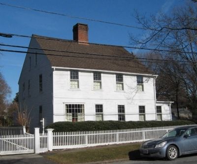
Isaac Tucker House
| On Beach Road, 0.1 miles west of Sunnieholm Drive, on the right when traveling west. |
| On Bronson Avenue, 0.1 miles north of Verna Hill Road, on the right when traveling north. |
| On Beach Road at Sunnieholm Drive, on the right when traveling west on Beach Road. |
| On Bronson Avenue, 0.1 miles Verna Hill Road, on the right when traveling north. |
| On Beach Road at Sunnieholm Drive, on the left when traveling west on Beach Road. |
| On Harbor Road at Center Street, on the left when traveling south on Harbor Road. |
| On East Putnam Avenue (U.S. 1) at Maple Avenue, on the left when traveling north on East Putnam Avenue. |
| On East Putnam Avenue (U.S. 1) at Park Place, on the left when traveling north on East Putnam Avenue. |
| On East Putnam Avenue (U.S. 1) at Old Church Road, on the left when traveling north on East Putnam Avenue. |
| On Monroe Turnpike (Route 111) at Moose Hill Road, on the right when traveling north on Monroe Turnpike. |
| On Church Hill Road (U.S. 6) at Queen Street, on the right when traveling east on Church Hill Road. |
| On Main Street (Connecticut Route 25) at Church Hill Road (U.S. 6), on the right when traveling south on Main Street. |
| On Church Hill Road (U.S. 6) at Queen Street, on the right when traveling west on Church Hill Road. |
| On France Street at Adams Avenue, on the left when traveling north on France Street. |
| On East Avenue, on the right when traveling north. |
| Near Seaside Place, on the right when traveling south. |
| On Hillside Place at Elmwood Avenue, on the right when traveling west on Hillside Place. |
| On Sunset Hill Avenue near East Avenue, on the right when traveling east. |
| On St. Paul’s Place, on the right when traveling west. |
| On Calf Pasture Beach Road, on the right when traveling east. |
| Near Putnam Park Road (Connecticut Route 58) at Connecticut Route 107, on the right when traveling south. |
| Near Putnam Park Road (Connecticut Route 58) at Connecticut Route 107, on the right when traveling south. |
| Near Putnam Park Road (Connecticut Route 58) near Connecticut Route 107, on the right when traveling south. |
| On Putnam Park Road (Connecticut Route 107) at Black Rock Turnpike (Connecticut Route 58), on the right when traveling west on Putnam Park Road. |
| Near Putnam Park Road (Connecticut Route 58) near Connecticut Route 107, on the right when traveling south. |
| Near Putnam Park Road (Connecticut Route 58) near Connecticut Route 107, on the right when traveling south. |
| Near Putnam Park Road (Route 58) at Connecticut Route 107, on the right when traveling south. |
| Near Putnam Park Road (Connecticut Route 58) at Connecticut Route 107, on the right when traveling south. |
| Near Putnam Park Road (Connecticut Route 58) at Connecticut Route 107, on the right when traveling south. |
| On Pocahontas Road, on the right when traveling west. |
| On Putnam Park Road (Connecticut Route 107) at Black Rock Turnpike (Connecticut Route 58), on the right when traveling west on Putnam Park Road. |
| Near Putnam Park Road (Connecticut Route 58) at Connecticut Route 107, on the right when traveling south. |
| Near Putnam Park Road (Connecticut Route 58) at Connecticut Route 107, on the right when traveling south. |
| Near Putnam Park Road (Connecticut Route 58) near Connecticut Route 107, on the right when traveling south. |
| Near Putnam Park Road (Connecticut Route 58) at Connecticut Route 107, on the right when traveling south. |
| On Black Rock Turnpike (Connecticut Route 58) at Cross Highway, on the left when traveling north on Black Rock Turnpike. |
| On Pocahontas Road, on the right when traveling west. |
| Near Putnam Park Road (Connecticut Route 58), on the right when traveling south. |
| Near Pocahontas Road, on the right when traveling west. |
| On Main Street at Prospect Street, on the right when traveling south on Main Street. |
| On Main Street, on the right when traveling north. |
| On Main Street, on the right when traveling north. |
| On Main Street (Connecticut Route 35) at King Lane, on the right when traveling north on Main Street. |
| On N Salem Road (Connecticut Route 116) 0.1 miles south of Tackora Trail, on the left when traveling north. |
| On Main Street (Connecticut Route 35) 0.1 miles West Lane, on the right when traveling north. |
| On N Salem Road (Connecticut Route 116), on the right when traveling south. |
| On Ridgebury Road at George Washington Highway, on the right when traveling south on Ridgebury Road. |
| On Ridgebury Road at George Washington Hwy., on the right when traveling south on Ridgebury Road. |
| On Main Street (Connecticut Route 35) at Branchville Road (Connecticut Route 102), on the left when traveling north on Main Street. |
| On Main Street, on the left when traveling north. |
| On Main Street, on the right when traveling north. |
| On Main Street (Connecticut Route 35) at Gilbert Street, on the right when traveling north on Main Street. |
| On Main Street (Connecticut Route 35) 0.1 miles north of Gilbert Street, on the left when traveling south. |
| On Main Street (Connecticut Route 33/35) just north of Market Street, on the right when traveling north. Reported damaged. |
| On Main Street (Connecticut Route 35) at Governor Street, on the right when traveling south on Main Street. |
| On Ridgebury Road at Old Stagecoach Road, on the left when traveling south on Ridgebury Road. |
| On Atlantic Street at Main Street, on the right when traveling north on Atlantic Street. |
| On Grove Street at Main Street, on the right when traveling north on Grove Street. |
| On Westover Road, on the right when traveling south. |
| On Westover Road, on the right when traveling south. |
| On Westover Road, on the right when traveling south. |
| Near West Broad Street at Beardsley Avenue. |
| On Academy Hill, 0.1 miles east of Main Street (Connecticut Route 113), on the left when traveling east. |
| On Church Hill Road (Connecticut Route 127) at Main Street (Connecticut Route 111), on the left when traveling north on Church Hill Road. |
| On White Plains Road (Connecticut Route 127) at Unity Road, on the right when traveling north on White Plains Road. |
| Near Compo Beach Road, 0.3 miles south of Soundview Drive, on the left. |
| On South Compo Road (Connecticut Route 136) at Post Road East (U.S. 1), on the left when traveling north on South Compo Road. |
| On Myrtle Avenue at Church Lane, on the left when traveling north on Myrtle Avenue. |
| On South Compo Road (Connecticut Route 136) at Post Road East (U.S. 1), on the left when traveling north on South Compo Road. |
| On Compos Road South at Compos Beach Road, in the median on Compos Road South. |
| Near Myrtle Avenue, 0.1 miles north of Avery Place, on the right when traveling north. |
| On Danbury Road (U.S. 7) 0.2 miles south of Cricket Lane, on the left when traveling south. |
| Near Ridgefield Road (Connecticut Route 33) 0.2 miles north of Belden Hill Road, on the left when traveling north. |
| On Old Ridgefield Road at Glen Side Road, on the left when traveling north on Old Ridgefield Road. |
| On Memorial Boulevard, 0.2 miles east of East Street, on the right when traveling west. |
| On Bellevue Avenue at Queen Street, on the left when traveling north on Bellevue Avenue. |
| On Albany Turnpike (U.S. 44), on the right when traveling west. |
| On Enfield Street (U.S. 5) at S. Road, on the left when traveling south on Enfield Street. |
| On Farmington Avenue (Connecticut Route 4) at Main Street (Connecticut Route 10), on the left when traveling east on Farmington Avenue. |
| On Main Street (Connecticut Route 10) at Hatters Lane, on the right when traveling north on Main Street. |
| On Hubbard Street at Green Cemetery Road, on the right when traveling west on Hubbard Street. |
| On Trinity Street south of Jewell Street, on the left when traveling north. |
| Near Main Street at Gold Street, on the right when traveling south. |
| On Capitol Avenue at Trinity Street, on the right when traveling west on Capitol Avenue. |
| On Main Street at Capitol Avenue, on the right when traveling north on Main Street. |
| Near Main Street near Central Row, on the right when traveling north. |
| On Main Street at Gold Street, on the right when traveling north on Main Street. |
| Near Main Street at Atheneum Square, on the right when traveling north. |
| On Trinity Street south of Jewell Street, on the right when traveling south. |
| Near Main Street near Central Row, on the right when traveling north. |
| On Central Row at Main Street, on the right when traveling west on Central Row. |
| On Main Street just north of Burr Mall, on the right when traveling north. |
| Near Main Street at Central Row, on the right when traveling north. |
| On Tower Square just west of Prospect Street, on the right when traveling west. |
| On American Row at Main Street, on the right when traveling west on American Row. |
| On Capitol Avenue at Broad Street, on the right when traveling west on Capitol Avenue. |
| On Capitol Avenue at Washington and Lafayette Streets, in the median on Capitol Avenue. |
| On Columbus Boulevard at Arch Street, on the right when traveling south on Columbus Boulevard. |
| On Center Street (U.S. 6) at Linden Street, on the right when traveling east on Center Street. |
| On Burritt Street at Broad Street, on the right when traveling north on Burritt Street. |
8490 entries matched your criteria. Entries 101 through 200 are listed above.
⊲ Previous 100 —
Next 100 ⊳