The site of St. Joseph's Catholic Church and Cemetery was determined after the new settlement of Rayne was established. Huge wooden wheels were made and the old church from the original Poupeville settlement was mounted on them and moved to this . . . — — Map (db m85307) HM
The site of this cemetery, being one of the highest spots in east Ascension Parish, was used to bury those who died during crevasses. About the year 1785, Joseph Dupuy donated it as a non-sectarian cemetery, including slaves and Indians.
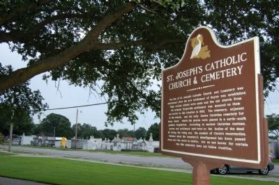
Joseph . . . — — Map (db m86105) HM
John Fogleman, a native of Virginia, was in this area in 1816, a witness to his sister's wedding in the St. Landry Courthouse. He married Polly Sandefur there Jan. 1, 1819. On Nov. 28, 1853, the estate of the deceased John Fogleman was sold in a . . . — — Map (db m107482) HM
Large story and a half Acadian style residence built by Alfred Greenhouse and his wife Cecilia Bontempt. Greenhouse was a farmer, cattleman, landowner and hunter who often cared for cattle kept in the lowlands during the winter months. Indian . . . — — Map (db m117693) HM
The two story plantation home of Judge Ralph Cushman was near this site. Cushman died of yellow fever in 1855, and is buried in this cemetery which bears his name. Other family cemeteries which were founded during this period include the Cannon . . . — — Map (db m120388) HM
One mile east is the Marksville prehistoric Indian ceremonial center. This site, occupied from 1-400 A.D., was related to the Ohio Hopewell Culture, and was noted for its elaborate trade networks and mortuary ceremonialism. — — Map (db m98269) HM
A Hub in the Woods
In a large clearing of virgin pines trees, men built the large logging camp of Hoy around 1910. Hoy was one of many camps established by Long Bell Lumber Company, which operated one of the largest sawmill
systems in the . . . — — Map (db m229079) HM
Main Panel A Waypoint through the Years
Old Campground stands near an ancient ford (a shallow place with good footing where a waterway can be crossed) on Sugar Creek, and the proximity of Old
Campground to this ford is not a coincidence, . . . — — Map (db m189246) HM
A memorial to the pioneers of Sugartown (early outpost of Southwest Louisiana), whose courage and fortitude helped subdue the historic "Neutral Territory" of the Sabine-Rio Hondo Strip, claimed and contended for by four nations - France, Spain, . . . — — Map (db m124845) HM
Facts about the MountainThe mountain was named for James Christopher Driskill. He was born in Hancock County, Georgia, on June 17, 1817. In 1840 he married Eugenia Irwin Walker. In October 1859, Mr. Driskill sold his land in Georgia, and moved . . . — — Map (db m166115) HM
Near this spot is the trailhead to Driskill Mountain, Louisiana's highest point and the Mt. Zion Presbyterian Church and Cemetery. James Christopher Driskill, the mountain's namesake. was born in Hancock County, Georgia, on June 27, 1817. On October . . . — — Map (db m234596) HM
Official burial ground for Bellevue, formerly Bossier Parish seat. At least two judges, four Bossier parish Sheriffs, and twenty-one Confederate soldiers are buried here Bellevue was first called Freedonia, then Society Hill. — — Map (db m181378) HM
Located a short distance down this road. Founded 1848 by Fillmore Methodist Church, once located on site. Buried here are Thomas D. Connell, founder of Connell's Cross Roads (now Fillmore), and W.P. Haughton. Also here is O.R. Gelette (1845-1944), . . . — — Map (db m181360) HM
The Hebrew Benevolent Assn. of Shreveport purchased a quarter acre of Oakland Cemetery from the city in July, 1858. The resulting Jewish cemetery was Shreveport's first and Louisiana's fifth. This cemetery was used exclusively from 1858-1886 and . . . — — Map (db m139944) HM
Oakland Cemetery, the oldest cemetery
in Shreveport, appeared in the film Mr. Brooks
starring Kevin Costner and Dane Cook. In
addition to citizens of the community, the
cermetery holds approximately 800 people who
died during the yellow fever . . . — — Map (db m141016) HM
Earliest tombstone dated 1842. Cemetery officially opened in 1847. At least 16 mayors are buried here as well as some 1,000 Confederate veterans & soldiers. Fence and walls erected 1905, the same year it began to be officially called "Oakland," . . . — — Map (db m140562) HM
When Shreveport was first laid out in 1836, the need for a cemetery was among the first considerations of the Shreve Town Company. The first cemetery was known as the Fannin Street Cemetery. Its use began almost as soon as the town came into being. . . . — — Map (db m142908) HM
Dating from the 1840s, this was once the family burial grounds of the Pickens family, planters, of Caddo Parish. Among those buried here is Israel Wilson Pickens, Caddo Parish Sheriff from 1862-1865, during which time Shreveport was Confederate . . . — — Map (db m140205) HM
Opened 1882 as city's Catholic Cemetery. Several priests who died in 1873 yellow fever epidemic rest here, including Father Jean Pierre, founding pastor of Holy Trinity Church. Also many pioneer members of Shreveport's French and Italian Societies . . . — — Map (db m143742) HM
Opened in 1883. City's first Black Cemetery established by and for Black citizens. Many prominent early African-American Shreveporters are buried here, From 1868 to 1874 this site was the campus of Shreveport University, a Baptist College. Entrance . . . — — Map (db m143748) HM
Established April 8, 1840 with the burial of Margaret Bilbo.
Burial site of John Jacob Ryan Jr. 1816-1899 Father of Lake Charles.
Earlier site of ancient Attakapa Indian village
U.S. Army Military post, Cantonment Atkinson, 1829-1832
. . . — — Map (db m147002) HM
While miraculously no one in Cameron Parish was killed, 38 of it's 40 cemeteries were breached and over 340 caskets and their remains were torn from the ground and scattered into marshes, tree tops, fields and canals from as far away as 30 miles. . . . — — Map (db m150683) HM
Within this enclosure are the remains of over 100 Confederate soldiers. Following the Battle of Mansfield, many were infirmed at old Keachie College, where a morgue was established on the second floor of the main building. — — Map (db m188236) HM
The Battle of Pleasant Hill Harper's Weekly May 7, 1864 Pleasant Hill, LA.
(Reverse)
A Tribute to Our Parents
Dr. C.E. "Gene" Poimboeuf established the Pleasant Hill Battlepark in 1994 to preserve the memory of . . . — — Map (db m178395) HM WM
After the Battle of Pleasant Hill the Confederate army, who had control of the battlefield, began burying the dead soldiers. One of the sites chosen was on the Childers Family property, a part of the battlefield. Here some of the soldiers killed in . . . — — Map (db m178081) HM
Civil War Baton Rouge
Control of the Mississippi River and New Orleans was vital to
the Union war effort. In April 1862, Union gunboats steamed
up the river. The vessels evaded the guns of Confederate-held
forts located below New Orleans, . . . — — Map (db m131637) HM
One of a group of mounds probably constructed about A.D. 1000 during the Cole Creek culture period. Surrounded by a large village area, such mounds served as foundations for sacred buildings and as platforms for the chief to address the tribesmen. . . . — — Map (db m87446) HM
Public service commissioner, then governor, finally U.S. senator, Huey Pierce Long went from obscure upstate lawyer to flamboyant national figure. Along the way, he built a political dynasty—as well as roads, bridges, hospitals and schools. . . . — — Map (db m87430) HM
Named for company member, John O. Bradford, Old Brad, the first service horse in the Baton Rouge Fire Department, is buried in front of his beloved Washington No. 1 Firehouse. He served 28 years, actively for 15. After retiring, he was allowed to . . . — — Map (db m158615) HM
Confederate soldier, Bynum's Co., 9th La. Batt. Survived the rigors of siege of Port Hudson, returned to his Highland Road Home, only to be killed by a stray bullet while asleep on his bed. Gravesite lost. — — Map (db m143692) HM
From New Orleans newspaper, ARGUS, on 8-14-1826: Baton Rouge, Aug. 9, 1826, 4 P.M. We stop the press to announce the death of MR. ANTHONY PENISTON who died this moment, his death occasioned by a stab of a poignard. He survived the blow but ten . . . — — Map (db m143868) HM
On Sept. 24, 1810, a group of West Floridians on horseback, led by Gen. Philemon Thomas and his military aide, Col. Benj. Parker Thomas, seized the old Baton Rouge Fort, ending 30 yrs. of Spanish control of West Florida.
The General's daughter . . . — — Map (db m92751) HM
This cemetery is a reproduction created as an example of early cemeteries. Each gravesite features wrought-iron or stone markers that once belonged to lost or flooded cemeteries. The iron crosses are typical of Spanish-French influences. The cast . . . — — Map (db m114086) HM
Daughter of post physician Henri Gerard of Pointe Coupée fort. Sister of Augustine Gerard, first wife of Armand Duplantier.Her mother, widowed in 1763, married 1771 Claude Trenonay, French uncle of Deplantier, and a plantation owner of Pointe . . . — — Map (db m143808) HM
French calvary officer who served as aide-de-camp to General Lafayette in Continental Army, 1781. Agent in selection of lands in Louisiana given by congress to Lafayette and host to the general on his 1825 visit to Louisiana. — — Map (db m143689) HM
This was in 1794-1825 the 800 arpent plantation of George Garig, a German settler from Maryland, "a resident of well nown[sic] honesty and one of the most skillful builders of cotton gins and presses in this territory."
Because families . . . — — Map (db m92852) HM
Private, 8th Regt, Meriam's Co., War of 1812. Capt., 11th Regt., La. Militia, 1836. Organizer of company of free black volunteers for Confederate States Army. Operator of first regularly established ferry service at Baton Rouge, beginning 1836. — — Map (db m143567) HM
In use since 1815. Interred here, among others, are Armand Allard Duplantier, Sr. (1753-1827), French officer who served with Lafayette in the American Revolution; his wife, Constance Rochon Joyce (1766-1841); and Pierre Joseph Favrot (1749-1824), . . . — — Map (db m86928) HM
Oldest surviving cemetery in Baton Rouge. Dedicated by George Garig as a burial ground in 1813 and deeded to St. Joseph Roman Catholic Parish in 1819. This cemetery holds the remains of American Revolutionary War soldiers Armand Duplantier and . . . — — Map (db m92878) HM
Corporal, Capt. Thomas Co., LA. Militia, War of 1812. Son of George Kleinpeter who was first to successfully grow sugarcane on these highlands; grandson of Johann George Kleinpeter, the original German settler of 1784, builder of first steam sugar . . . — — Map (db m92837) HM
Descendant of Alfonso I of Spain, also a 4th generation descendant of Don Manuel Andres Lopez Y Armesto, educated at Univ. of Madrid and sent by King to Spanish La. to set up Spanish schools. French colonists resisted Spanish culture and project . . . — — Map (db m143850) HM
Poetess, writer, artist. Fiancée of Lieut. Luis de Grand Pré, officer in command of the Spanish fort at Baton Rouge on the fateful might of its capture by West Floridians in 1810, and the only one receiving fatal wounds. She never married. — — Map (db m143795) HM
Served two years in the colonial Spanish military service, served in 7th Regiment Militia of Orleans Territory, and as a Major and Colonel of 8th Regiment Louisiana Militia, War of 1812.Became Judge of West Baton Rouge Parish, 1822. Became . . . — — Map (db m143554) HM
Francois Gardere, Treasurer of State of Louisiana 1823-1843, owned this plantation in 1826. Buried here in 1849 was Madame Riviere, his wife's mother, a brilliant member of Orleans society that included Gov. Carondelet and Baron Pontalba. — — Map (db m143690) HM
Not far from here is the route taken from Manchac to Baton Rouge by the Spanish forces of Bernardo de Galvez in Sept. 1779 in their historic ouster of the British from this territory and the beginning of 30 yrs. of Spanish Domination, 1779-1809. . . . — — Map (db m92836) HM
1st Lieut., 24th Infantry, U.S. Army, appointed by President Madison, 1812-1815. Judge of W. Baton Rouge parish. Mortally wounded in duel with another judge, fought with sabres at Pinckneyville, Miss. — — Map (db m143804) HM
Civil War Dead
An estimated 700,000 Union and Confederate soldiers died in
the Civil War between April 1861 and April 1865. As the death
toll rose, the US. government struggled with the urge but
unplanned need to bury fallen Union . . . — — Map (db m191260) HM
To the Memory of Genl. Philemon Thomas who was born in Orange County, VA. Feb. 9th, 1763 and died In Baton Rouge La. Nov. 18th, 1847. He was a soldier of "76, and of "14, a member of the Convention that framed the Constitution of Kentucky and . . . — — Map (db m131645) HM
In 1852 the town of Baton Rouge bought this property for a cemetery. On these grounds, August 5, 1862, the major action of the Battle of Baton Rouge took place. Louisiana novelist Lyle Saxon is among prominent Louisianians buried here. — — Map (db m87227) HM
Federal soldiers killed in the Battle of Baton Rouge, August 5, 1862, were buried on this site which became a National Cemetery in 1867. Among soldiers buried here is General Philemon Thomas, remembered for his attack on the Spanish fort at Baton . . . — — Map (db m87226) HM
A Lawyer and World War II U.S. Navy Veteran. Served Louisiana in the United States Senate for seven terms under eight different U.S. Presidents from 1948 to 1987. The son of legendary Louisiana Governor and U.S. Senator Huey Pierce Long and Rose . . . — — Map (db m141270) HM
In 1825 St. Joseph Church purchased this property for a graveyard. Remains of some of Baton Rouge's first settlers were moved here from the old Spanish Cemetery, or cemetery of the Church of Our Lady of Sorrows, which became St. Joseph's. Philip . . . — — Map (db m85156) HM
The first cemetery in Baton Rouge was the cemetery of La Yglesia de Los Dolores de la Virgin, Our Lady of Sorrows. Established in 1792 by order of King Carlos IV of Spain. This present cemetery was established in 1824 and the remains of Baton . . . — — Map (db m88564) HM
Civil War Dead
An estimated 700,000 Union and Confederate soldiers died in the Civil War between April 1861 and April 1865. As the death toll rose, the U.S. Government struggled with the urgent but unplanned need to bury fallen Union . . . — — Map (db m93325) HM
Fall of Port Hudson In May 1863, Union Gen. Nathaniel Banks landed 30,000 soldiers at Bayou Sara north of Port Hudson. A force of 7,500 men commanded by Confederate Gen. Franklin Gardner held the Mississippi River stronghold. General Banks' . . . — — Map (db m129210) HM
Julice is a 9-foot-tall mound that is 130 by 65 feet at the base. The mound is rectangular with a flat top. However, it was square before the east side was altered for the highway. Pottery found near the mound suggests Indians built it around AD . . . — — Map (db m89788) HM
Lt. Col. McKowen, 1st. La. Cavalry, C.S.A., who on June 3, 1863, with 5 men captured Brig. Gen. Neal Dow near here. Dow was later exchanged for Brig. Gen. W.H.F. Lee, son of Gen. Robert E. Lee. A former mayor of Portland, Me. Dow ran for president . . . — — Map (db m85778) HM
Centenary College minutes dated October 7, 1861 read, "Students have all gone to war. College suspended and God help the right." From 1861 to 1866 the college remained closed. Both Union and Confederate troops used and misused college buildings and . . . — — Map (db m85521) HM
Pioneer of Jackson and officer in the
State Militia. This area was commonly
called "Bear Corners" because of the
many black bears along Thompson Creek.
After Horton and Ficklin established
the town, it was named Buncombe after
their native . . . — — Map (db m227230) HM
"The Father of Jeanerette." Buried here September 12, 1816. One of the area’s first landowners. Town of Jeanerette grew up on site of his plantation. His descendants have been prominent in local history. — — Map (db m86628) HM
Established Mar. 24, 1838. Interred here are F.H. Duperier, incorporator of New Iberia, U.S. Senators Robert & Edwin Broussard, Lt. Gov. Emile Verret, James Beddell, designer of "The Shadows," & other prominent individuals. — — Map (db m85276) HM
West of this marker lies the grave site of a Union Soldier who was killed in a skirmish with Confederate soldiers at Bayou Goula on January 25, 1865. His name is believed to be Private David Ingraham, Third Rhode Island Calvary, Company H. He was . . . — — Map (db m91986) HM
A Memorial to Paulin Verret by his children in 1926. He was a free African-American wealthy planter in Bayou Goula prior to Civil War. Land donated was forty-eight feet wide and three arpents deep, for African-Americans of Iberville. — — Map (db m91983) HM
In 1723 Raphael of Luxemburg came to establish Missions at French Posts and among Indians. Served as Vicar-General of Louisiana Colony under Bishop of Quebec.
Built first St. Louis parish church and Catholic School in N.O. Thus began the . . . — — Map (db m85024) HM
Bayou Sorrel Indian Mound is one of the most prominent in Atchafalaya Heritage Area.
Archaeological investigation in 1913 by Clarence Moore
include artifacts from Tchefuncte, Marksville, Baytown,
Coles Creek or Plaquemine Period. After the . . . — — Map (db m121179) HM
On This Site Lie Buried Joseph Erwin Revolutionary Soldier, N.C. 1762-1829 Lavinia T. Erwin Wife 1763-1836 Eliza E. Wilson Daughter 1796-1834 — — Map (db m234218) HM
On March 13, 1889, Rev. Robert Morrison established the Nazarene Baptist Church one and one half miles north of this site on Australia Point where the community of Morrisonville developed. Due to levee setbacks in 1921 residents relocated to . . . — — Map (db m87258) HM
Settled by Indians,"Isle of the Chitamachas" was later owned by Francisco Caminada. Known as "Chico Isle", as "Chita", as Caminadaville. It was home to pirates, fishermen and farmers. On Oct. 1, 1893, a fast moving, late season hurricane from the . . . — — Map (db m62038) HM
Established by the Good Shepherd Family Burial Society of Kenner, around 1860, by a group of African-American men for religious, benevolent and literary purposes. The organization was chartered on December 14, 1898. The present site was purchased . . . — — Map (db m125334) HM
Established by the Love and Charity Benevolent Society in 1837, by a group of African-American men and women, for religious, benevolent and literary purposes. The organization was chartered on June 13, 1903. The present site was purchased on . . . — — Map (db m125302) HM
Established by the Fratellanza Italiana di Mutua Beneficenza Di Santa Rosalia in 1915. The organization, during a special meeting held on October 17, 1915, authorized the purchase of arpent lots 138 and 139 from Michele Centanni and his children. . . . — — Map (db m125261) HM
Washington Griffin's Cemetery. est. c. 1850, was the first Chackbay cemetery. Acquired by Bayou Heron Graveyard Association in 1883, it became the Grand Bayou, Trosclair, or Rodrigue Cemetery. — — Map (db m85063) HM
Land purchased from the State of Louisiana
June 28, 1860
Cemetery Recorded January 26,1882
Bartlin Schaubhut Sr.
Born in Baden Germany June 11, 1806
Died December 1, 1869
Bartlin Schaubhut Jr.
Born Baden Germany c. 1828
Died . . . — — Map (db m85471) HM
This church was founded in the mid-1800's when a small chapel was built at the juncture of Canal Harang and Bayou Lafourche. In 1873 a second church, which would serve the surrounding community of Larose and all of South Lafourche, was erected on . . . — — Map (db m85423) HM
On June 8, 1905, during the yellow fever epidemic, three Leeville residents: Joseph C. Picciola, Camille Rebstock and Adrien Lefort Purchased this plot of land from the Martin Family for the Leeville Cemetery Co. for $95. It became a large . . . — — Map (db m100120) HM
Holy Savior Cemetery was established in 1850 at the site of St. Andre's Chapel, which later became Holy Savior Church. The cemetery is one of the oldest in the southern half of Lafourche Parish. The priests' tomb, located in the center of the . . . — — Map (db m86018) HM
This cemetery was established circa 1797. Its presence preceded the church parish. Many of the early graves were ground burials, which were marked with wrought iron crosses. The St. Mary Pamela Corporation was later formed by the local congregation . . . — — Map (db m85757) HM
Born on Prince Edward Isl., Canada, Mackenzie graduated Queen's College, Kingston, Ontario, with two degrees. He then earned a doctorate with high honors in Divinity and Philosophy at Glasgow University, Scotland. After ordination in the Church of . . . — — Map (db m114104) HM
After his migration to Thibodaux from Kentucky in the early 1840s, Ewing practiced medicine with one of the founders of St. John's Episcopal Church, Dr. Thomas Williams. He took over Williams's practice upon the latter's death in 1849. In 1852, . . . — — Map (db m113361) HM
Born in Terrebonne Parish, Felix Grundy Winder was a member of a family originally from Tennessee. His mother, Martha Grundy, was a daughter of Felix Grundy, the distinguished Tennessee friend and political advisor of Andrew Jackson and Attorney . . . — — Map (db m114170) HM
Born in 1834, in Donaldsonville, Francis Nicholls attended West Point but turned to the law. He established his own law practice in Napoleonville in the late 1850s before entering the Army of the Confederacy as a Captain during the Civil War. . . . — — Map (db m114103) HM
Mississippi natives George Seth Guion and Caroline Lucretia Winder Guion moved to Thibodaux in 1831. Their Ridgefield Plantation included the land given to St. John,s Episcopal Church and Cemetery and the Guion Academy, two blocks away on Jackson . . . — — Map (db m114082) HM
Born in 1850 in Assumption Parish to the Englishman Lucius Suthon and Assumption Parish native Manette Blanchard, Georgiana Suthon became an Episcopal missionary to Japan. Although she initially taught the bible in Tokyo, her eventual mastery of . . . — — Map (db m114083) HM
From Uniontown, Pennsylvania, Frost migrated to Thibodaux in 1840, at the age of 26. He became one of the town's foremost building contractors and property owners. In 1842, Frost married Almira Ragan, a daughter of New York natives. In partnership . . . — — Map (db m113374) HM
James Mcallister was born in 1809 in Kentucky and practiced law in New Orleans until moving to Thibodaux in 1838. He was elected as the city's first mayor, serving for one year, after which Mcallister became Parish Judge. In that capacity, he . . . — — Map (db m112645) HM
John A. Lovell worked initially on railroads and in the timber industry before entering into surveying. As a surveyor and engineer in Lafourche Parish during the first half of the 20th century, Lovell gained fame for his knowledge of the region's . . . — — Map (db m114081) HM
Born in 1808 in Mason County, Kentucky, Beatty and his first wife, Charlotte Reid, moved to Lafourche Parish early in life. He initially practiced medicine but became an attorney and politician, was one of the first Trustees of Thibodaux, and . . . — — Map (db m112646) HM
Born in North Carolina in 1793, John Nelson was a veteran of the War of 1812 who moved to Tennessee and married Nancy Edwards of Davidson County in 1824. After her death, he migrated to Mississippi and married Maria Ann Robinson of Tennessee. He . . . — — Map (db m114169) HM
Born April 10, 1806
in Raleigh
North Carolina
Died June 14, 1864
at Pine Mountain
Georgia
First Bishop of
Louisiana
1841——1864
Organized Saint
John's Church — — Map (db m81142) HM
Born in Raleigh, North Carolina, in 1806, Polk attended the University of North Carolina before receiving an appointment to West Point, from which he graduated in 1827. He soon resigned his commission, however, was ordained an Episcopal priest, and . . . — — Map (db m113542) HM
During the renovation of St. John's Episcopal Church in 1856, a bell was installed in the new steeple which was built upon the church front. Made in Troy,New York, at Meneelys Foundry, and paid for by funds left by Marcus P. Zills, the bell is . . . — — Map (db m112711) HM
Mary King Fulford was a childhood sweetheart of U.S. Grant in Georgetown, Ohio. After her marriage to John D. Fulford, they moved to Memphis, then in 1845 to Thibodaux. She cared for seven children, of whom several died in childhood, and played a . . . — — Map (db m113377) HM
Established in 1880, this is one of the earliest African-American cemeteries in Thibodaux. It serves three church congregations: Moses Baptist Church, Allen Chapel AME Church , Calvary Methodist Church. — — Map (db m92135) HM
A son of a prominent Thibodaux merchant and a founder of St. John's Episcopal Church, Charles Armitage, Philip Armitage lived at the family home of the same name, om the Terrebonne Road south of Thibodaux. Possibly designed by one of Louisiana's . . . — — Map (db m114105) HM
Reverend Daniel McNair founded the Presbyterian Church of Thibodaux on June 6, 1847. It was the first Presbyterian congregation established west of the Mississippi River. A North Carolina native born in 1806, he was assigned to preach in the . . . — — Map (db m112695) HM
Richard Henry Allen was born in 1807, in Wilkes County, North Carolina. Following a career as a merchant in Yazoo City, Mississippi, in 1840 he moved to New Orleans and became a cotton factor. In 1859, Allen retired to Thibodaux, entered sugar cane . . . — — Map (db m114080) HM
Silas Grisamore arrived by steamboat from his native southern Indiana in the mid 1840s. He taught school in Assumption Parish, sold goods from flatboats on Bayou Lafourche, and eventually became a merchant in Thibodaux. During the Civil War, . . . — — Map (db m114078) HM
200 entries matched your criteria. The first 100 are listed above. Next 100 ⊳