By Cajun Scrambler, July 1, 2010
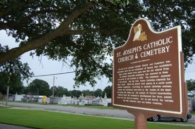
St. Joseph's Catholic Church & Cemetery Marker with the cemetery in background
| On South Adams Avenue (U.S. 90) at East Anding Street, on the right when traveling north on South Adams Avenue. |
| On Duplessis Road, 0.2 miles east of Old Jefferson Highway (Louisiana Highway 73), on the right when traveling east. |
| On State Highway 1176 north of Youngs Crossing, on the left when traveling north. |
| On Spring Bayou Road (State Road 1190) east of Andrus Street, on the right when traveling east. |
| On Tarelton Street, 0.1 miles west of North Monroe Street, on the right when traveling west. |
| On Tunica Drive East (State Highway 1) 0.1 miles north of Medic Drive, on the right when traveling north. |
| Near Old Hoy Cemetery Road, 0.3 miles north of Louisiana Highway 26, on the right when traveling north. |
| On Old Campground Cemetery Road, 0.5 miles east of Pentecostal Church Road (Parish Highway 370). |
| On Old Camp Ground Cemetery Road, 1 mile east of Pentecostal Church Road. |
| Near State Highway 507, 2.7 miles west of State Highway 147, on the right when traveling west. |
| On State Highway 507, 0.8 miles west of State Highway 797, on the right when traveling west. |
| On Bodcau Dam Road at Bellevue Cemetery Road, on the left when traveling east on Bodcau Dam Road. |
| On Fillmore Cemetery Road at State Highway 157, on the right when traveling west on Fillmore Cemetery Road. |
| On Sprague Street, 0.3 miles west of Douglas Street, on the left when traveling west. |
| Near Millam Street1 near Grand Avenue. |
| Near Milam Street near Grand Avenue. |
| Near Milam Street near Grand Avenue. |
| On St. Vincent Street south of West 74th Street, on the right when traveling south. |
| On Texas Avenue (U.S. 80) west of Levy Street, on the right when traveling west. |
| On Texas Avenue (U.S. 80) west of Levy Street, on the right when traveling west. |
| Near I-10 Service Road near Veterans Memorial Boulevard, on the right when traveling east. |
| On Smith Circle (Parish Road 3152) north of Marshall Street (State Highway 27/82), on the left when traveling north. |
| On Louisiana Route 172, 0.1 miles east of Lucky Lane, on the right when traveling east. |
| On Parish Road 1068 north of State Highway 175, on the right when traveling north. |
| Near Parish Road 1068, 0.2 miles north of State Route 175. |
| On Louisiana Route 175 at Parish Highway 1068, on the right when traveling north on State Route 175. |
| On Parish Road 1068 north of State Route 175, on the right when traveling north. |
| Near Capitol Lake Drive west of Capitol Access Road (Louisiana Highway 3045), on the left when traveling west. |
| Near State Capitol Drive west of North 5th Street, on the right when traveling east. Reported missing. |
| On North Fourth Street north of Laurel Street, on the right when traveling north. |
| Near Oxford Avenue north of Amherst Avenue, on the right when traveling north. |
| Near Oxford Avenue west of Amherst Avenue, on the right when traveling west. |
| Near Oxford Avenue, 0.1 miles south of East Parker Boulevard, on the left when traveling south. |
| Near Essen Lane (Highway 3064) south of Interstate 10, on the right when traveling south. |
| Near Oxford Avenue west of Amherst Avenue, on the right when traveling west. |
| Near Oxford Avenue north of Amherst Avenue, on the right when traveling north. |
| Near Oxford Avenue, 0.1 miles south of East Parker Boulevard, on the left when traveling south. |
| On Oxford Avenue north of Amherst Avenue, on the right when traveling north. |
| On Oxford Avenue north of Amherst Avenue, on the right when traveling north. |
| Near Oxford Avenue, 0.1 miles south of East Parker Boulevard, on the left when traveling south. |
| On Oxford Avenue, 0.1 miles south of East Parker Boulevard, on the left when traveling south. |
| Near Oxford Avenue west of Amherst Avenue, on the right when traveling west. |
| Near Oxford Avenue west of Amherst Avenue, on the right when traveling west. |
| Near Oxford Avenue north of Amherst Avenue, on the right when traveling north. |
| Near Oxford Avenue north of Amherst Avenue, on the right when traveling north. |
| Near Amherst Avenue at Emory Avenue, on the right when traveling west. |
| Near Oxford Avenue west of Amherst Avenue, on the right when traveling west. |
| On North 19th Street, on the right when traveling north. |
| Near North 19th Street north of Convention Street, on the right when traveling north. |
| On North 19th Street at Laurel Street, on the right when traveling north on North 19th Street. |
| On North 19th Street north of Convention Street, on the right when traveling north. |
| Near North Street near 40th Street. |
| On Main Street east of North 15th Street, on the left when traveling east. |
| Near Main Street east of North 15th Street, on the left when traveling east. |
| On Florida Boulevard (Business U.S. 190) at North 19th Street, on the right when traveling west on Florida Boulevard. |
| Near Port Hickey Road (State Highway 3113) 1.9 miles west of Samuels Road (U.S. 61), on the right when traveling west. |
| On Port Hudson Cemetery Road (State Highway 3113) at Port Hickey Road, on the right when traveling west on Port Hudson Cemetery Road. |
| On State Highway 581, 0.2 miles west of State Highway 881, on the right when traveling west. |
| On State Highway 951, 0.1 miles south of Charter Street (State Highway 10), on the left when traveling south. |
| Near College Street (State Highway 952) at Pine Street, on the right when traveling north. |
| On Church Street at Horton Street on Church Street. |
| On Main Street (State Highway 182) at Trappey Street, on the right when traveling north on Main Street. |
| On French Street south of West Washington Street, on the right when traveling south. |
| On River Road (State Highway 405) 0.7 miles south of Troxclair Drive, on the right when traveling south. |
| On State Highway 1 south of Cpl. Herman Brown Jr. Street, on the right when traveling north. |
| On State Highway 405, 0.5 miles south of Stewart Street, on the right when traveling south. |
| On Saint Louis Road near Louisiana Highway 1, on the right when traveling west. |
| On Warren Road (State Highway 988) 1 mile south of South River Road, on the right when traveling south. |
| On State Highway 1, on the right when traveling east. |
| On Decatur Street near 4th Street, on the left when traveling north. |
| On Decatur Street near Alton Street. |
| On Reverend Richard Wilson Drive (State Highway 48) east of Decatur Street, on the left when traveling east. |
| On State Highway 20 east of Farmer Lane, on the right when traveling east. |
| On State Highway 307, 2.2 miles east of Sanchez Road, on the right when traveling east. |
| On East Main Street. (State Highway 657) east of East 2nd Street, on the right when traveling west. |
| On Old Highway 1 south of Gateway to the Gulf Expressway (Louisiana Highway 1), on the right when traveling north. |
| Near Church Street at Francis Street, on the right when traveling east. |
| On State Highway 1 at Trahan Street, on the right when traveling south on State Highway 1. |
| Near Jackson Street south of Seventh Street, on the right when traveling south. |
| Near Jackson Street south of Seventh Street, on the right when traveling south. |
| On Jackson Street south of Seventh Street, on the right when traveling south. |
| Near Jackson Street south of Seventh Street, on the right when traveling south. |
| Near Jackson Street south of Seventh Street, on the right when traveling south. |
| Near Jackson Street south of Seventh Street, on the right when traveling south. |
| Near Jackson Street south of Seventh Street, on the right when traveling south. |
| Near Jackson Street south of Seventh Street, on the right when traveling south. |
| Near Jackson Street south of Seventh Street, on the right when traveling south. |
| Near Jackson Street south of Seventh Street, on the right when traveling south. |
| Near Jackson Street south of Seventh Street, on the right when traveling south. |
| On Jackson Street at West 7th Street, on the right when traveling south on Jackson Street. |
| Near Jackson Street south of Seventh Street, on the right when traveling south. |
| Near Jackson Street south of Seventh Street, on the right when traveling south. |
| On Jackson Street south of Seventh Street, on the right when traveling south. |
| On East 12th Street at Goode Street, on the left when traveling east on East 12th Street. |
| Near Jackson Street south of Seventh Street, on the right when traveling south. |
| Near Jackson Street south of Seventh Street, on the right when traveling south. |
| Near Jackson Street south of Seventh Street, on the right when traveling south. |
| Near Jackson Street south of Seventh Street, on the right when traveling south. |
200 entries matched your criteria. The first 100 are listed above.
Next 100 ⊳