Near Elmira Road, 1.6 kilometers south of Northside Road (Prince Edward Island Route 16), on the right when traveling south.
English:
The Elmira Branch of the P.E.I. Railway opened for business on 26 October 1912, one of the last expansions of rail service in the province. The terminus at Elmira was similar to other "ends," with an engine house and . . . — — Map (db m141203) HM
Near Elmira Road, 1.6 kilometers south of Northside Road (Prince Edward Island Route 16), on the right when traveling south.
English:
Elmira became the new eastern terminus of the P.E.I. Railway in 1912 when the main line was extended from Harmony. The early decades of the 1900s were the last period of expansion for the provincial railway. They were . . . — — Map (db m141204) HM
On Richmond Street close to West Street, on the left when traveling west.
English:
The railway and the steamship lines serving Prince Edward Island became major drivers to a new industry which became known as tourism. Realizing soon after the railway was open for service in 1875 that more and more of their . . . — — Map (db m80298) HM
On Station Lane just south of Cape Bear Road (Main Street) (Provincial Route 18), on the right when traveling south.
English:
The normal way to build a railway is to start at one end using an engine and flatcars to deliver materials to the end-of-track. The branch built between Charlottetown and Murray Harbour between 1901 and 1904 required a . . . — — Map (db m147962) HM
On Main Street (Prince Edward Island Route 18) just north of Westview Drive, on the right when traveling west.
English:
Murray Harbour began to achieve status as an important PEI port in the late 1700s. The earliest settlers in the area sustained themselves by fishing and farming but John Cambridge, the proprietor of Lot 64, was actively . . . — — Map (db m140239) HM
On School Street just west of Main Street (Prince Edward Island Route 4), on the left when traveling west.
English:
The original planners of the P.E.I. Railway in the early 1870s were very focused on connecting all of the major Island ports. The export of farm produce was at the heart of the economy. The railway made it easier for . . . — — Map (db m147965) HM
Near Commercial Street just west of Broadway Street North (Prince Edward Island Route 20), on the right when traveling west.
English: Being a stop along the PEI Railway route brought the possibility of prosperity. With construction about to begin, communities across the province were vying to have the tracks pass through their town or village. This . . . — — Map (db m148800) HM
Near Imperial Street just north of Commercial Street, on the left when traveling north.
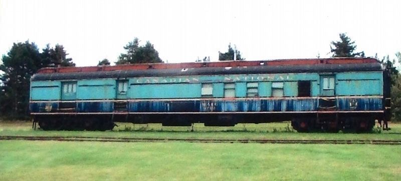
English: Built in 1960 by Montreal Locomotive Works… …Engine 1762 was first put into service as Engine 3859 at the Montreal Yard Diesel Shop. When Canadian National began changing its entire line to diesel, the engine was . . . — — Map (db m148806) HM
Near Commercial Street east of Imperial Street, on the left when traveling east.
English: With its debt in hand, there were other challenges in store for the PEI Railway. The Island's soil is excellent for farming, but makes a poor foundation for train tracks. Millions of tons of mainland gravel were . . . — — Map (db m148801) HM
Near Imperial Street just north of Commercial Street, on the left when traveling north.
English: On 16 November, 1990, Engine 1762 was relocated to Kensington… …where it stands today as an icon of PEI's Age of Rail. A payloader pushed the 125-ton engine along the tracks as far as New Annan where the rails had been . . . — — Map (db m148808) HM
Near Commercial Street east of Imperial Street, on the left when traveling east.
English: Joining the Confederation was as much a financial consideration… …for PEI as it was a matter of national pride. The fact was that the railway was only a little more than half finished when the money borrowed to build . . . — — Map (db m148802) HM
On Broadway Street North (Prince Edward Island Route 20) just north of Commercial Street, on the left when traveling north.
English:
In 1871 the Colony of Prince Edward Island embarked upon the construction of a circuitous 147-mile railway covering the 120-mile distance between Georgetown and Alberton. The high cost of building the line added . . . — — Map (db m139700) HM
Near Imperial Street just north of Commercial Street, on the left when traveling north.
English: With rail service a thing of the past, Summerside resident Lowell Huestis… …set about preserving mementos. Aided by the Summerside Chamber of Commerce, he arranged to have Engine 1762 moved from the Summerside . . . — — Map (db m148807) HM
Near Commercial Street just east of Imperial Street, on the left when traveling east.
English: By 1950, The Age of Steam was about to become The Age of Diesel. Steam engines burned coal to heat water, creating pressurized steam to drive the pistons. Crew members called Firemen performed the dangerous job of . . . — — Map (db m148804) HM
Near Commercial Street east of Imperial Street, on the left when traveling east.
English: Despite its challenges, the PEI Railway began operation on 25 May, 1875… …and Kensington Station was a major stop and switchyard. Before plans for the PEIR had been announced, Kensington had been little more than a . . . — — Map (db m148803) HM
Near Commercial Street east of Imperial Street, on the left when traveling east.
English: Recognized for its unique architecture and cultural significance… …Kensington Station was designated a National Historic Site in 1978. During a federal government survey in 1873, the original structure was found to be . . . — — Map (db m148809) HM
Near Anderson Road (Prince Edward Island Route 225) just east of Somerset Street (Prince Edward Island Route 109), on the right when traveling east.
English:
The poetry of Ireland is immediately evident in a name that explains much about the community in and around the village. Building the Anderson Road in 1832 opened up the district for farming. Irish families, experienced . . . — — Map (db m141170) HM
Near Veteran's Memorial Highway (Prince Edward Island Route 2) at Rafferty Road (Prince Edward Island Route 12), on the right when traveling west.
English: There are three old railway stations across the province that remain near the trail but which are on their last legs. They are in West Devon, Fredericton and York. None of the three belong to the trail, having been hauled . . . — — Map (db m151787) HM
On Western Road, 0.1 kilometers north of Macisaac Road (Prince Edward Island Route 127), on the right when traveling north.
English: About the time of Confederation, Wellington was a small rural community located around Goodwin's Corner on the western road. It was named after Arthur Wellesley, the Duke of Wellington; the British general who defeated . . . — — Map (db m151770) HM
On Water Street (Prince Edward Island Route 11) at Granville Street, on the right when traveling east on Water Street.
The Prince Edward Island Railway began operating in 1875. Its establishment was accomplished largely through the efforts of two Summerside brothers, James Colledge Pope, who was Premier when the Railway Bill was passed in 1871, and William Henry . . . — — Map (db m141019) HM
On Granville Street just south of Water Street (Prince Edward Island Route 11), on the left when traveling south.
The Prince Edward Island Railway was established in 1871. By 1874 there were 70 stations across the Island, including an open-ended "Terminal" Station about a mile north of the Summerside harbour. A track ran down to the waterfront where the . . . — — Map (db m141017) HM
On Weymouth Street at Water St, on the right when traveling north on Weymouth Street.
Built of Island and Wallace Sandstone, the Charlottetown railway station opened July 8, 1907. At a time when both people and goods travelled extensively by train, the station was a busy place indeed. Housing public facilities and administrative . . . — — Map (db m201323) HM
Near Water Street close to Hillsborough Street, on the left when traveling east.
English:
Built in 1876, this Island sandstone building was originally the office of the mechanical branch of the Prince Edward Island Railway. Later, it became the brass shop where brass parts required by the railway were fabricated. The . . . — — Map (db m80182) HM
On Prince Street close to Water Street, on the right when traveling south.
English:
On November 30, 1905 fire destroyed several of the wooden manufacturing shops at the Charlottetown rail yard. To reduce the risk of future fires, it was decided to rebuild the shops in brick. E.A. Wallberg of Montreal was the . . . — — Map (db m80181) HM
On Grafton Street at Water Street (Prince Edward Island Route 1), on the right when traveling east on Grafton Street.
English: The railway played a major role in shaping Canada and it played an important role in the development of Prince Edward Island. The sod was turned for the PEI Railway on October 5, 1871 just north east of where you are . . . — — Map (db m149897) HM
On Prince Street near Water Street, on the left when traveling south.
English:
The Prince Edward Island Railway brought Islanders together, put them to work, and even made them Canadians.
Before the Railway was built on Prince Edward Island you could live within ten miles of another village and hardly . . . — — Map (db m80185) HM
On Grafton Street at Water Street (Prince Edward Island Route 1), on the right when traveling east on Grafton Street.
English: The Railway Station stands not far from where you now stand. The air was once full of steam, the sound of train whistles and shunting rail cars. It was a busy place with the Western train, the Eastern train and the Murray . . . — — Map (db m149898) HM