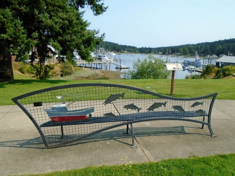
On nearby docks you can see some of Gig Harbor's fishing fleet.
The salmon-rich waters of Puget Sound made Gig Harbor an ideal home for fisherman. Founded largely by immigrants from Croatia in the late 1800s, this industry became the center . . . — — Map (db m179925) HM
This corner is rich in local history. When the first white men settled in Gig Harbor, they shared the bay with the Native American people who lived in a village on this corner. In the mid 1880s, the Indians permitted the use of one of their . . . — — Map (db m179889) HM
Harry Richard Thurston was born October 10, 1889, in Minnesota. He moved to Gig Harbor in 1919 from Tacoma. Thurston had been an electrical contractor in Minnesota. In Gig Harbor, he sold and serviced portable light plants, set up switchboards, . . . — — Map (db m179992) HM
In memory of the fishermen of Gig Harbor who have gone to sea
at great risk with passion and hard work, this statue is a tribute
to an industry upon whose labor our community was founded.
LOST AT SEA
John Ancich, Jr. • . . . — — Map (db m179979) HM
Settlers from Albert Lea, Minnesota, established Gig Harbor's first sawmill, the Gig Harbor Lumber Company, near this spot on the waterfront in 1887. The sawmill cut as much as 100,000 board feet of lumber daily. Its 450-foot wharf could . . . — — Map (db m179980) HM
In 1975, Peninsula High School was the first school in Washington State to initiate a salmon rearing program.
The students and faculty helped raise salmon for the Puget Sound and local streams, including Crescent Creek.
Project Key . . . — — Map (db m179915) HM
The People's Dock was established near here about 1890. At the time, it was one of three docks in the harbor servicing freight and passenger traffic on steamboats. In 1923, the People's Dock became the community's car ferry dock. It served . . . — — Map (db m180041) HM
SETTLING THE WATERSHED
Historically, Crescent Creek watershed was altered by human settlement through logging and farming. Today shoreline development continues to alter the watershed.
PHOTO: Dr. Hiram Herbert Rust on Crescent Creek . . . — — Map (db m179917) HM
"The Landing" draws from Gig Harbor's rich
maritime history. The name and form refer to the
landing of the captain's gig from the 1841 Wilkes
Expedition. It also recalls the time when rowboats were
a main form of transportation and pays . . . — — Map (db m180043) HM
Chum Salmon
[informational and not transcribed]
What's With All Those Barrels?
The barrels you see next to Donkey Creek are part of a Remote Site Incubator (RSI) system which was initiated by local commercial fishermen in . . . — — Map (db m179873) HM
From the Daily Ledger, Tacoma Washington, Sunday, June 15, 1913:
"The Browns Point bell was cast in 1855 by Bernard & Co. bell foundry in Philadelphia, and was brought around the Horn in 1857 by the first lighthouse tender to come to . . . — — Map (db m180046) HM
Documented history of Puget Sound began in 1792, when Captain George Vancouver, sailing for King George III of England, explored and charted this expansive waterway. He named the large inland waterway Puget Sound for his first mate, Peter . . . — — Map (db m180081) HM
The Boat House and Boat Ramp were built in 1905 for a surf boat that was necessary for a light keeper. Oscar Brown's primary means of transportation and communication was by rowboat. Several times per week he rowed to Tacoma for his mail, supplies . . . — — Map (db m197551) HM
The United States Lighthouse Service hung an acetylene, white light lens lantern from a post on this site December 12, 1887. A light keeper rowed out to Browns Point from Tacoma once a week to change the wick and polish the lantern, The light guided . . . — — Map (db m197215) HM
From the Daily Ledger, Tacoma, Washington, Sunday, June 15th, 1913
“ The Browns Point bell was cast in 1855 by Bernard & Co, bell foundry in Philadelphia, and was brought around the Horn in 1857 by the first lighthouse tender . . . — — Map (db m197552) HM
Captain Blackwood's Handsome Launch. Plying Between Bellingham and Anacortes. Two Trips Daily. The Handsomest and Most Commodius and Sea Worthy Boat of the Kind on Puget Sound. 1907 — — Map (db m74360) HM
A skipper and crew of up to 14 lived and worked on the W.T. Preston. River maintenance skills were cultivated and passed to the next generation. A diligent fireman could earn a license and work up to engineer. Deckhands were promoted to . . . — — Map (db m74110) HM
The W.T. Preston's steam-powered engines were first installed on the Swinomish in 1914, then transferred with most of the machinery to the new wood-hulled W.T. Preston in 1929, and to her steel-hulled replacement in 1939. . . . — — Map (db m74112) HM
THE NATURAL DYNAMIC
Ship Harbor was formed by natural forces over thousands of years. It is maintained as a natural landform by the continued dynamic balance of these same forces. Preservation of this area requires that physical, chemical, . . . — — Map (db m74126) HM
By 1882, Puget Sound's rivers were served by hundreds of steam paddlewheelers with such shallow drafts people joked they could "float on a heavy dew." Because their flat-bottomed hulls were easily punctured by submerged stumps and debris, . . . — — Map (db m74108) HM
Poets, painters, and travelers have been inspired by the rugged beauty of the Columbia River Gorge - beauty that was shaped in large part by a single series of cataclysmic events that ended just 12,000 years ago.
As the massive Cordilleran Ice . . . — — Map (db m158233) HM
The shriek of steam through a brass whistle, ringing across the Columbia's waters and echoing off the Gorge cliffs. signaled the approach of a steamboat. In early-day Stevenson, a sternwheeler arrival was a high point of a pioneer's day, often . . . — — Map (db m158230) HM
The rocks project into the river in many places and have the appearance of having fallen from the high hills…
This part of the river resembles a pond partly drained leaving many stumps bare both in & out of the water…
We can plainly hear the . . . — — Map (db m112268) HM
In the early 1900s, lush evergreen forests covered the rugged mountains on either side of the Columbia River, providing a wealths of fuel and building material. In this steep, wet country, water was a perfect conveyance.
Sawmills were located in . . . — — Map (db m158172) HM
This house, built in 1905-1906 as part of the Mukilteo
Light Station, was designed by Carl W. Leick. The first
family to occupy this house was that of the first
Assistant Lighthouse Keeper, David O. Kinyon.
The photo shows how the original light . . . — — Map (db m159828) HM
On May 30, 1792 Captain Vancouver and his party anchored off this point and came ashore the following morning. Commissioned by the British to survey the N.W. Coast of America, they named this area Rose Point for the many wild roses that grew here. — — Map (db m83866) HM
Welcome to a walking tour of Mukilteo Lighthouse Park and Mukilteo's historic light station. We hope you enjoy this walk, learning more about Mukilteo and its lighthouse. The tour is fully accessible, and restrooms are located here in the park. . . . — — Map (db m178833) HM
This property has been placed on:
The National Register of Historic Places
by the Department of the Interior and on
the Washington Heritage Register by
the Governor's Advisory Council on historic . . . — — Map (db m83865) HM
Use of the Spit in Mukilteo
This area is within the traditional territory of the Snohomish who, along with the Snoqualmie, Skykomish and other allied tribes and bands, are Salish-speaking indigenous peoples that lived along the shoreline . . . — — Map (db m178832) HM
"When you're on the water, you know that you're celebrating your ancestors and taking care of your spirit"
-Tulalip tribal member, Sydney Napeahl.
Cedar canoes are the traditional mode of transportation for Coastal Native American . . . — — Map (db m179260) HM
The Keeper's House, designed by Carl W. Leick, was
built in 1905-1906 along with the lighthouse and other
light station buildings. Peter N. Christiansen,
Mukilteo's first lighthouse keeper, lived here with his
family until 1925. Christiansen had . . . — — Map (db m159815) HM
Coast Salish peoples, here for thousands of years before settlers arrived, shared a strong belief in the existence of "myth age," when beings sharing both human and animal qualities roamed the earth. According to legend, a Changer . . . — — Map (db m179253) HM
In 1853, Washington's territorial governor Isaac Stevens identified 30 different Indian tribes in the Puget Sound area. A presidential order directed him to sign treaties with them. The Point Elliott Treaty, signed on this waterfront in 1855, . . . — — Map (db m179257) HM
Before the arrival of the railroads in 1889, the riverbank west of the Division Street Bridge to Park Street (now Browne) cut southward then turned west. Lumber in sheds and open stacks, and W.R. Marvin's Planing Mill & Sash and Door Factory crowded . . . — — Map (db m148681) HM
Its location on the banks of a major inland waterway, and its strategic access to annual salmon runs, have made the Spokane Falls a gathering place for thousands of years. The Spokane Indians who traditionally occupied the region around Spokane . . . — — Map (db m148641) HM
The riverfront near Spokane Falls has been used for Many purposes since Euro-Americans settled here in the 1870s. Reflecting the values and technologies of their times, people have used the area as a source of energy, a transportation and . . . — — Map (db m154292) HM
The Spokane River originates at Lake Coeur d'Alene, flowing about 112 miles through seven dams in its journey west to Lake Roosevelt and the Columbia. For native people, the river provided fish, spiritual sustenance and a gathering place. Today, the . . . — — Map (db m148679) HM
AS YOU ENTER BUDD INLET...
The Dofflemyer Point Lighthouse greets you. It sits seven miles
north of the Port of Olympia, near the Boston Harbor Marina.
This structure provides the southernmost light in Puget Sound.
‘A JOYFUL NOISE’ - The . . . — — Map (db m234058) HM
A seedling from the Gray's Harbor "Lone Tree"
which served as a maritime beacon since it
guided Captain Robert Gray into the harbor in 1792.
Placed in honor of Charles Tallmadge Conover
patriot, historian and writer, who dedicated
his life to . . . — — Map (db m58662) HM
This site, long the home and hunting ground of the Indian, was first sighted by white man in 1792 when Lt. Broughton was sent by Capt. Vancouver to verify the Gray’s reported discovery of the Columbia, and visited by Lewis and Clark in 1805 on . . . — — Map (db m116586) HM
Geology at Wallula
From 15,000-18,000 years ago what many geologists believe were the Earth's largest floods raced through Wallula Gap. Some of these floods were as many as twenty times as large as the combined discharge of all the world's . . . — — Map (db m182195) HM
Dedicated to Christopher Columbus
Italy’s illustrious son who gave to the world a continent. We shall be inclined to pronounce the voyage that led the way to this new world as the most epoch making event of all that have occurred since the . . . — — Map (db m129496) HM
Unable to rely on private carriers
to serve its far-flung canneries from
Southeast Alaska to the Aleutian
Islands, Pacific American Fisheries
built it's own shipyard to produce a
line of vessels to insure the transfer of
crew, materials and . . . — — Map (db m186507) HM
From 1942 to 1944, Pacific American
Fisheries leased its shipyard to the
Northwest Shipbuilding Company, which
formed in response to World War II to
construct military vessels for the US Army
and US Navy. The Northwest Shipbuilding
Company . . . — — Map (db m179196) HM
The historic link between
Fairhaven's shore and coastal Alaska
is long and enduring. The Bellingham
Cruise Terminal is built on the former
site of the Pacific American Fisheries
salmon canning complex which,
during the 1940's, was the . . . — — Map (db m179132) HM
Bellingham:
Homeport to the Historic Schooner Zodiac
The Schooner Zodiac is one of the largest working sailing vessels on the west
coast. She was launched in 1924 from the Hodgdon Brothers shipyard in East
Boothbay, Maine – the . . . — — Map (db m178230) HM
The first construction work to harness the Skagit River took place in 1924 in the gorge below. A low wood and rock spillway diverted water into a tunnel dug through the mountainside to a powerhouse in Newhalem. Bigger dams followed, culminating in . . . — — Map (db m129279) HM
A strong dam depends not just upon the concrete you see, but on the unseen structure beneath river level. During construction, engineers drilling to find bedrock encountered deep, unstable deposits of glacial silt – loose gravel and sand. . . . — — Map (db m129280) HM
150 entries matched your criteria. Entries 101 through 150 are listed above. ⊲ Previous 100