After filtering for Nebraska, 57 entries match your criteria.
Exploration Topic
By Cosmos Mariner, August 7, 2021
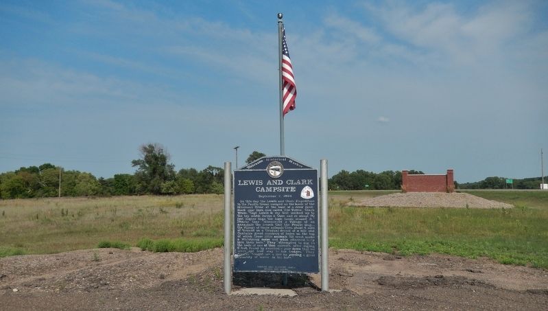
Lewis and Clark Campsite Marker
| 1 ► Nebraska, Boyd County, Lynch — 346 — Lewis and Clark Campsite — September 7, 1804 — |
| On Sampson Street just north of Outlaw Trail Scenic Byway (State Highway 12), on the right when traveling north. | |||
| 2 ► Nebraska, Buffalo County, Kearney — Kearney — From the Beginning — |
| On Central Avenue at 19th Street, on the left when traveling north on Central Avenue. | |||
| 3 ► Nebraska, Buffalo County, Kearney — Old Oregon Trail — |
| On Central Avenue at Railroad Street, on the right when traveling north on Central Avenue. | |||
| 4 ► Nebraska, Cedar County, Crofton — 167 — Historic Missouri Valley — |
| Near U.S. 81, 1.5 miles south of 898th Rd.. | |||
| 5 ► Nebraska, Cedar County, Crofton — Meeting the Yankton Sioux — |
| On U.S. 81, 1.5 miles south of 898th Rd. | |||
| 6 ► Nebraska, Cedar County, Hartington — 204 — Cedar County — |
| On South Broadway Avenue north of East Franklin Street (State Highway 84), on the right when traveling north. | |||
| 7 ► Nebraska, Dakota County, Homer — 013 — Tonwantonga — |
| Near U.S. 77, 0.9 miles north of 225th Street, on the right when traveling north. | |||
| 8 ► Nebraska, Dakota County, Jackson — 343 — Lewis and Clark Campsite — August 21, 1804 — Lewis and Clark Trail — |
| On U.S. 20 just west of Knox Boulevard, on the right when traveling west. | |||
| 9 ► Nebraska, Dawes County, Chadron — Paha Sapa — The heart of everything that is. |
| On Gold Rush Byway (U.S. 385) near Crazy Horse Memorial Highway (U.S. 20), on the left when traveling north. Reported missing. | |||
| 10 ► Nebraska, Dawes County, Chadron — 304 — The Fort Pierre-Fort Laramie Trail — |
| On U.S. 385 near U.S. 20. | |||
| 11 ► Nebraska, Dawes County, Crawford — 540 — Sea Level Bench Mark — |
| On Bridges to Buttes Byway (U.S. 20) 0.2 miles west of Soldier Creek Road, on the left when traveling west. | |||
| 12 ► Nebraska, Dawson County, Cozad — 17 — The 100th Meridian — |
| On U.S. 30 at North Meridian Avenue, on the right when traveling east on U.S. 30. | |||
| 13 ► Nebraska, Dixon County, Newcastle — 068 — The Ionia "Volcano" — |
| On State Highway 12 at Martha Avenue, on the right when traveling east on State Highway 12. | |||
| 14 ► Nebraska, Dixon County, Ponca — 270 — Ponca State Park — |
| On Highway 26 E Spur, 0.6 miles north of Highland Road. | |||
| 15 ► Nebraska, Dodge County, Fremont — 502 — Fremont, Nebraska — |
| On North Park Avenue at East 5th Street, on the right when traveling north on North Park Avenue. | |||
| 16 ► Nebraska, Dodge County, Fremont — 117 — Mormon Pioneer Trail — |
| On Military Avenue, on the right when traveling east. | |||
| 17 ► Nebraska, Dodge County, Fremont — Overland Emigrant Trails |
| On Military Avenue at D Street, on the left when traveling east on Military Avenue. Reported permanently removed. | |||
| 18 ► Nebraska, Douglas County, Omaha — John Pierre Cabanne's — |
| On John J Pershing Drive at Hummel Road, on the left when traveling north on John J Pershing Drive. | |||
| 19 ► Nebraska, Douglas County, Omaha — 340 — Lewis and Clark Campsite — July 27, 1804 — |
| Near Dodge Park Road, 0.6 miles east of John J. Pershing Dr.. | |||
| 20 ► Nebraska, Douglas County, Omaha, Downtown — Capt. Lewis…will…give us accounts of new things only — Thomas Jefferson, February 28, 1803 — |
| 21 ► Nebraska, Douglas County, Omaha, Downtown — endeavor to make yourself acquainted…with…the nations — Thomas Jefferson's instructions to Meriwether Lewis, June 20, 1803 — |
| 22 ► Nebraska, Douglas County, Omaha, Downtown — Nature exerted herself to butify the Senery — William Clark, July 4, 1804 — |
| 23 ► Nebraska, Douglas County, Omaha, Downtown — the Council was held — Sergeant Charles Floyd, August 3, 1804 — |
| 24 ► Nebraska, Douglas County, Omaha, Downtown — Westwardly by the Waters — Albert Gallatin letter to Thomas Jefferson, April 13, 1803 — |
| 25 ► Nebraska, Douglas County, Omaha, Downtown — 428 — Captain William Clark and Private Reuben Field — |
| Near Riverfront Drive, 0.1 miles north of Dodge Street, on the right when traveling north. | |||
| 26 ► Nebraska, Douglas County, Omaha, Downtown — People, Places, and Stories — |
| 27 ► Nebraska, Douglas County, Omaha, Downtown — 404 — William Henry Jackson — 1843 - 1942 |
| On Douglas Street near 14th Street, on the right when traveling east. Reported missing. | |||
| 28 ► Nebraska, Gage County, Beatrice — The De Roin & Oregon Trails — |
| On Court Street (U.S. 136) at 2nd Street, on the right when traveling west on Court Street. | |||
| 29 ► Nebraska, Garden County, Lewellen — 160 — Ash Hollow Geology — |
| On U.S. 26. | |||
| 30 ► Nebraska, Hall County, Grand Island — 172 — Grand Island — |
| On Interstate 80 at milepost 316.5, on the right when traveling west. | |||
| 31 ► Nebraska, Jefferson County, Fairbury — Kit Carson • Col. John Fremont — 1842 — |
| Near 710th Road east of 574th Avenue, on the right when traveling east. | |||
| 32 ► Nebraska, Keith County, Ogallala — 1 — The Great Platte River Road — 1813 - 1840 — |
| On East A Street at West Second Street on East A Street. | |||
| 33 ► Nebraska, Kimball County, Bushnell — Panorama Point — Elevation 5,424 — |
| Near Interstate 80 at Beech Avenue (in Pine Bluffs, Wyoming). | |||
| 34 ► Nebraska, Knox County, Lindy — 345 — Lewis and Clark Campsite — September 2, 1804 — |
| On Main Street, 0.1 miles west of 539 Avenue, on the right when traveling west. | |||
| 35 ► Nebraska, Knox County, Lindy — Reunited with Shannon! — Lewis and Clark National History Trail — George Shannon Trail — |
| On Main Street, 0.1 miles west of 539 Avenue, on the right when traveling west. | |||
| 36 ► Nebraska, Knox County, Niobrara — Life After the Expedition — Lewis and Clark National History Trail — George Shannon Trail — |
| Near Walnut Street (Outlaw Trail Scenic Byway) (State Highway 12) at Spruce Avenue, on the right when traveling east. | |||
| 37 ► Nebraska, Lincoln County, Brady — 194 — Road Ranches Along the Platte — |
| Near Interstate 80 at milepost 194,, 13.7 miles east of State Highway 56A, on the right when traveling east. | |||
| 38 ► Nebraska, Madison County, Meadow Grove — 069 — Meadow Grove — |
| On Main Avenue east of 4th Street, on the right when traveling east. | |||
| 39 ► Nebraska, Otoe County, Nebraska City — Barge / Keelboat (replica) — |
| 40 ► Nebraska, Otoe County, Nebraska City — Hunter, Watchdog and Faithful Friend — |
| 41 ► Nebraska, Otoe County, Nebraska City — The Missouri River — |
| 42 ► Nebraska, Phelps County, Elm Creek — 91 — Historic Platte Valley — |
| On U.S. 183, 0.3 miles south of Interstate 80, on the left when traveling south. | |||
| 43 ► Nebraska, Platte County, Columbus — The Columbus Quincentenary Belltower — |
| On 33rd Avenue (U.S. 30/81) near 7th Street, on the right when traveling south. | |||
| 44 ► Nebraska, Platte County, Columbus — The Road to Zion — |
| 45 ► Nebraska, Platte County, Columbus — 305 — The Villasur Expedition — 1720 — |
| On 33rd Avenue (U.S. 30/81) at 7th Street, on the right when traveling south on 33rd Avenue. | |||
| 46 ► Nebraska, Sarpy County, Bellevue — Astorian Expedition — |
| On Franklin Street, on the right when traveling north. | |||
| 47 ► Nebraska, Sarpy County, Papillion — 182 — The Original Union Pacific Mainline Through Papillion — |
| On North Washington Street north of East 2nd Street, on the right when traveling north. | |||
| 48 ► Nebraska, Scotts Bluff County, Gering — Pierre Papin Grave — |
| On County Road 20 at Peaceful Valley Road & County road 20, on the left when traveling south on County Road 20. | |||
| 49 ► Nebraska, Scotts Bluff County, Scottsbluff — Scott Memorial — |
| Near Old Oregon Trail, on the right when traveling west. | |||
| 50 ► Nebraska, Sioux County, Agate — Exploring the Niobrara — |
| Near River Road, 3.2 miles east of State Highway 29. | |||
| 51 ► Nebraska, Washington County, Blair — Lewis and Clark Campsite Area — |
| On DeSoto Lake Road near Lakeview Drive, on the left when traveling east. | |||
| 52 ► Nebraska, Washington County, Blair — 342 — Lewis and Clark Campsites — August 3 and 4, 1804 — |
| 53 ► Nebraska, Washington County, Blair — The Lewis and Clark Expedition — |
| On DeSoto Avenue, on the right when traveling south. | |||
| 54 ► Nebraska, Washington County, Blair — Up the Missouri — |
| On DeSoto Avenue, on the right when traveling south. | |||
| 55 ► Nebraska, Washington County, Fort Calhoun — 2 — Fort Atkinson — |
| On U.S. 75 at Monroe Street, on the left when traveling north on U.S. 75. | |||
| 56 ► Nebraska, Washington County, Fort Calhoun — 67 — Fort Atkinson — |
| Near Madison St, 0.8 miles east of U.S. 75. | |||
| 57 ► Nebraska, Washington County, Fort Calhoun — 341 — Lewis and Clark Campsite — July 30 - August 2, 1804 — |
| Near Madison St, 0.6 miles east of U.S. 75. | |||