After filtering for Oregon, 278 entries match your criteria. The first 100 are listed. ⊳
Industry & Commerce Topic
By Barry Swackhamer, June 28, 2017
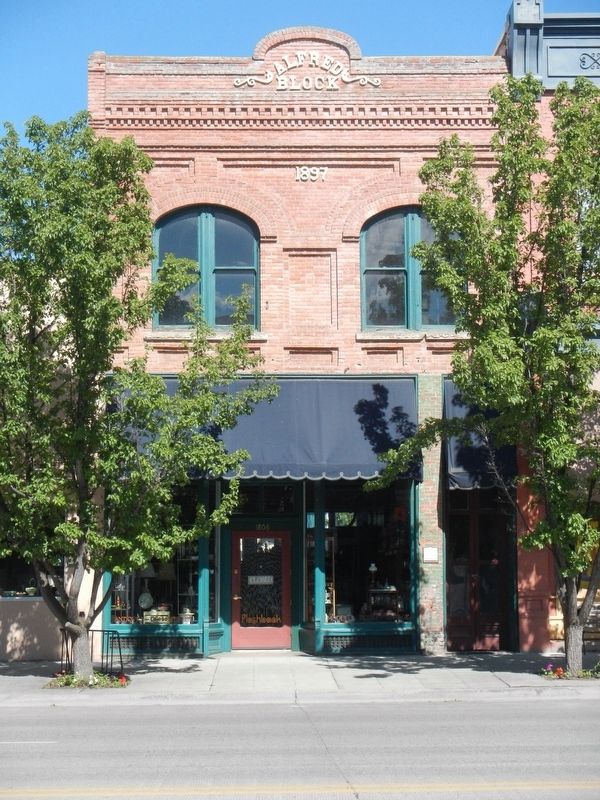
Alfred Block and Marker
| 1 ► Oregon, Baker County, Baker City — Alfred Block — Baker City Historic District — Established 1874 — |
| On Main Street (Oregon Route 7) near Valley Avenuee, on the right when traveling north. | |||
| 2 ► Oregon, Baker County, Baker City — Antlers Hotel — Baker City Historic District — Established 1874 — |
| On Washington Street at 1st Street, on the left when traveling west on Washington Street. | |||
| 3 ► Oregon, Baker County, Baker City — Baker Loan and Trust Building — Baker City Historic District — Established 1874 — |
| On Main Street (Oregon Route 7) at Broadway Street (U.S. 30), on the left when traveling north on Main Street. | |||
| 4 ► Oregon, Baker County, Baker City — Basche-Sage Hardware Co. Building — |
| On Main Street (Oregon Route 7) at Broadway Street, on the left when traveling north on Main Street. | |||
| 5 ► Oregon, Baker County, Baker City — Bishop Building — |
| On Main Street (Oregon Route 7) at Broadway Street, on the right when traveling north on Main Street. | |||
| 6 ► Oregon, Baker County, Baker City — First National Bank Building — Baker City Historic District — Established 1874 — |
| On Main Street near Court Avenue when traveling north. | |||
| 7 ► Oregon, Baker County, Baker City — Flynn Building — Baker City Historic District — Established 1874 — |
| On Valley Avenue near !st Street, on the left when traveling west. | |||
| 8 ► Oregon, Baker County, Baker City — Geiser Grand Hotel — Baker City Historic District — Established 1874 — |
| On Main Street (Oregon Route 7) near Washington Avenue, on the right when traveling north. | |||
| 9 ► Oregon, Baker County, Baker City — Gerstle-Solomon Building — Baker City Historic District — Established 1874 |
| Near Main Street near Court Avenue, on the left when traveling north. Reported missing. | |||
| 10 ► Oregon, Baker County, Baker City — Gwilliam Brothers Bakery — Baker City Historic District — Established 1874 — |
| On Main Street (Oregon Route 7) at Church Street, on the right when traveling north on Main Street. | |||
| 11 ► Oregon, Baker County, Baker City — Haskell Building — Baker City Historic District — Established 1874 — |
| On Main Street (Oregon Route 7) near Court Avenueu, on the right when traveling north. | |||
| 12 ► Oregon, Baker County, Baker City — J.C. Penney Building — Historic Oregon Trail — Established 1874 — |
| On Main Street near Valley Avenue, on the left when traveling north. | |||
| 13 ► Oregon, Baker County, Baker City — Jett Building — Baker City Historic District — Established 1874 — |
| On Valley Avenue at 1st Street, on the right when traveling west on Valley Avenue. | |||
| 14 ► Oregon, Baker County, Baker City — Kennedy Building — Baker City Historic District — Established 1874 — |
| On Main Street (Oregon Route 7) at Court Avenueu, on the right when traveling north on Main Street. | |||
| 15 ► Oregon, Baker County, Baker City — Log Cabin Saloon — Baker City Historic District — Established 1874 — |
| On Main Street (Oregon Route 7) near Valley Avenuee, on the right when traveling north. | |||
| 16 ► Oregon, Baker County, Baker City — Lynndale Building — Baker City Historic District — Established 1874 — |
| On Main Street (Oregon Route 7) near Broadway Street, on the right when traveling north. | |||
| 17 ► Oregon, Baker County, Baker City — Mann Block — |
| On Main Street at Valley Avenuee, on the right when traveling north on Main Street. | |||
| 18 ► Oregon, Baker County, Baker City — McCord House and Shop — Baker City Historic District — Established 1874 — |
| On Resort Street at Broadway Street, on the right when traveling north on Resort Street. | |||
| 19 ► Oregon, Baker County, Baker City — Miller Apartment Building — Baker City Historic District — Established 1874 — |
| On Washington Street near 1st Street, on the right when traveling west. | |||
| 20 ► Oregon, Baker County, Baker City — Miller's Lunch Building — Baker City Historic District — Established 1874 — |
| Near Main Street (Oregon Route 7) at Washington Avenue, on the left when traveling north. | |||
| 21 ► Oregon, Baker County, Baker City — Mint-Fox Building — Baker City Historic District — Established 1874 — |
| On Main Street (Oregon Route 7) near Court Avenueu, on the right when traveling north. | |||
| 22 ► Oregon, Baker County, Baker City — Rogers Hotel — Baker City Historic District — Established 1874 — |
| On 1st Street near Washington Avenue, on the right when traveling north. | |||
| 23 ► Oregon, Baker County, Baker City — Shoemaker Building — Baker City Historic District — Established 1874 — |
| On 1st Street at Court Avenueu, on the left when traveling north on 1st Street. | |||
| 24 ► Oregon, Baker County, Baker City — The Lure of Gold — Oregon Trail — Oregon History — |
| On Oregon Route 86 near Oregon Trail, on the right when traveling west. | |||
| 25 ► Oregon, Baker County, Baker City — The Smoke Shop — Baker City Historic District — Established 1874 — |
| On Main Street near Washington Street. | |||
| 26 ► Oregon, Baker County, Baker City — Weller-Henry Building — |
| On Main Street (Oregon Route 7) near Valley Avenuee, on the left when traveling north. | |||
| 27 ► Oregon, Baker County, Granite — Red Boy Mine — |
| On Forest Service Road 10 (County Road 24) 0.3 miles south of Federal Road 13, on the right when traveling west. | |||
| 28 ► Oregon, Baker County, Granite — The Fremont Powerhouse Historic District — History written by nature and people — |
| Near Forest Service Road 10 (County Road 24). | |||
| 29 ► Oregon, Baker County, Sumpter — A Golden History — Sumpter Valley Dredge — |
| On Austin Street, 0.1 miles west of Mill Street, on the right when traveling west. | |||
| 30 ► Oregon, Baker County, Sumpter — A Tale of the Tailings — Natural Recovery — |
| Near Austin Street near Mill Street, on the right when traveling south. | |||
| 31 ► Oregon, Baker County, Sumpter — A Working Dredge — The Ultimate Gold Mining Machine — |
| Near Austin Street. | |||
| 32 ► Oregon, Baker County, Sumpter — Floating in its own pond — Moving the dredge — |
| Near Austin Street. | |||
| 33 ► Oregon, Baker County, Sumpter — Site of Bank of Sumpter — Sumpter, Oregon — |
| On Mill Street (County Route 410) near Sumpter Street, on the right when traveling north. | |||
| 34 ► Oregon, Baker County, Sumpter — Sumpter, Oregon — |
| On Mill Street at Sumpter Highway (Oregon Route 410), on the right when traveling north on Mill Street. | |||
| 35 ► Oregon, Benton County, Corvallis — Benton County State Bank — |
| On SW Madison Avenue, on the right when traveling west. | |||
| 36 ► Oregon, Benton County, Corvallis — Early Town Development — The Corvallis Riverfront — |
| On SW 1st Street north of SW Jefferson Avenue, on the right when traveling north. | |||
| 37 ► Oregon, Benton County, Corvallis — First Congregational Church — 1918-1932 — |
| On SW 8th St at SW Madison Ave, on the right when traveling north on SW 8th St. | |||
| 38 ► Oregon, Benton County, Corvallis — Kings Valley Millstone — |
| 39 ► Oregon, Benton County, Corvallis — River Transport — |
| On SW 1st Street north of SW Jefferson Avenue, on the right when traveling north. | |||
| 40 ► Oregon, Benton County, Corvallis — Site of the Earliest Boat Landing — Lower Town, Marysville, 1851 — |
| On Northwest Van Buren Avenue. | |||
| 41 ► Oregon, Benton County, Monroe — Wilhelm Mill Water Wheel — Historical Site — |
| On Pacific Hwy W (Oregon Route 99), on the right when traveling west. | |||
| 42 ► Oregon, Clackamas County, Lake Oswego — George Rogers House - 1929 — |
| On Wilbur Street at Durham Street, on the left when traveling east on Wilbur Street. | |||
| 43 ► Oregon, Clackamas County, Lake Oswego — Green Street — |
| On Green Street at Furnace Street on Green Street. | |||
| 44 ► Oregon, Clackamas County, Lake Oswego — Iron Company Worker's Cottage — |
| On Wilbur Street west of Durham Street. | |||
| 45 ► Oregon, Clackamas County, Lake Oswego — Murphy Real Estate Building - 1940 — |
| On North State Street, 0.1 miles south of A Avenue, on the left when traveling south. | |||
| 46 ► Oregon, Clackamas County, Lake Oswego — Oswego Landing — |
| Near Old River Road at Green Street. | |||
| 47 ► Oregon, Clackamas County, Lake Oswego — Salamander — |
| Near Old River Road near Furnace Road. | |||
| 48 ► Oregon, Clackamas County, Lake Oswego — The Durham Mill — |
| On McVey Avenue west of South State Street, on the right when traveling west. | |||
| 49 ► Oregon, Clackamas County, Oregon City — Area Commerce — |
| Near South Gronlund Road near Carver Road, on the right when traveling west. | |||
| 50 ► Oregon, Clackamas County, Oregon City — Dr. Forbes Barclay — 1812 - 1873 — |
| On Center Street near 8th Street. | |||
| 51 ► Oregon, Clackamas County, Oregon City — Dr. John McLoughlin — "Father of Oregon" — |
| On McLoughlin Boulevard (Oregon Route 99) at S. 2nd Street, on the right when traveling south on McLoughlin Boulevard. | |||
| 52 ► Oregon, Clackamas County, Oregon City — Dr. John McLoughlin — 1784-1857 — |
| On Centre Street at 7th Street, on the left when traveling north on Centre Street. | |||
| 53 ► Oregon, Clackamas County, Oregon City — Dr. John McLoughlin — Father of Oregon — |
| Near Washington Street near Abernethy Road, on the right when traveling north. | |||
| 54 ► Oregon, Clackamas County, Oregon City — George Abernethy's Historical Significance — You are currently standing on Abernethy Green! — |
| Near Washington Street near Abernethy Road, on the right when traveling north. | |||
| 55 ► Oregon, Clackamas County, Oregon City — Joseph L. Meek — Born 1810 - Died 1875 — |
| On McLoughlin Boulevard (Pacific Highway) (State Highway 99) at 6th Street on McLoughlin Boulevard (Pacific Highway). | |||
| 56 ► Oregon, Clackamas County, Oregon City — McCald Building — Circa 1925 — |
| On Main Street, on the right when traveling west. | |||
| 57 ► Oregon, Clackamas County, Oregon City — McLoughlin House — National Historic Site — |
| On Center Street near 7th Street. | |||
| 58 ► Oregon, Clackamas County, Oregon City — OK Barber Shop — |
| On Main Street near 7th Street, on the right when traveling west. | |||
| 59 ► Oregon, Clackamas County, Oregon City — M12 — Oregon City Falls — Oregon History — |
| On McLoughlin Boulevard (Oregon Route 99) near S. 2nd Street, on the right when traveling south. | |||
| 60 ► Oregon, Clackamas County, Oregon City — Peter Skene Ogden House — |
| On McLoughlin Boulevard (Oregon Route 99) near South 2nd Street, on the right when traveling south. | |||
| 61 ► Oregon, Clackamas County, Oregon City — Sidney W. Moss — Hotel Keeper — |
| Near Washington Street near Abernethy Road, on the right when traveling north. | |||
| 62 ► Oregon, Clackamas County, West Linn — M15 — Dr. John McLoughlin 1784 - 1857 — Oregon History — |
| On Northbound Rest Area (Interstate 205), on the right when traveling north. | |||
| 63 ► Oregon, Clackamas County, West Linn — M14 — Willamette Falls — Oregon History — |
| On Northbound Rest Area (Interstate 205), on the right when traveling north. | |||
| 64 ► Oregon, Clackamas County, West Linn — M13 — Willamette Falls Locks — Oregon History — |
| On Northbound Rest Area (Interstate 205), on the right when traveling north. | |||
| 65 ► Oregon, Clackamas County, Wilsonville — Norris Young Machine Shop — |
| On SW Boones Ferry Rd at SW 5th St, on the left when traveling south on SW Boones Ferry Rd. | |||
| 66 ► Oregon, Clackamas County, Wilsonville — Site of Bill Flynn’s Saloon — |
| On SW Boones Ferry Rd, on the right when traveling south. | |||
| 67 ► Oregon, Clatsop County, Astoria — 14th Street Ferry Slip — Capt. Fritz Elfving and the Astoria-North Beach Ferry Co. — |
| On East Columbia River Highway (U.S. 30) at 14th Street, on the left when traveling east on East Columbia River Highway. | |||
| 68 ► Oregon, Clatsop County, Astoria — A Great Artery of Transportation — |
| Near East Columbia River Highway (U.S. 30) east of 16th Street, on the left when traveling east. | |||
| 69 ► Oregon, Clatsop County, Astoria — A Waterfront at Work — |
| Near East Columbia River Highway (U.S. 30) west of 16th Street, on the left when traveling east. | |||
| 70 ► Oregon, Clatsop County, Astoria — At Play on the River — |
| Near East Columbia River Highway (U.S. 30) west of 12th Street, on the left when traveling east. | |||
| 71 ► Oregon, Clatsop County, Astoria — Columbia River Bar — |
| On Marine Drive at 20th Street, on the left when traveling east on Marine Drive. | |||
| 72 ► Oregon, Clatsop County, Astoria — Columbia River Tugs And Towboats — High Efficiency Transportation System with a Low Profile — |
| Near East Columbia River Highway (U.S. 30) north of 14th Street, on the right when traveling west. | |||
| 73 ► Oregon, Clatsop County, Astoria — Crossroads of Cultures — |
| On Astor Street at 9th Street, on the left when traveling east on Astor Street. | |||
| 74 ► Oregon, Clatsop County, Astoria — Fire Station No. 2 — |
| On Marine Drive (U.S. 30) at 30th Street, on the right when traveling west on Marine Drive. | |||
| 75 ► Oregon, Clatsop County, Astoria — First on the Pacific: The Astoria Custom House — |
| On Leif Erikson Drive (U.S. 30) near 34th Street, on the left when traveling west. | |||
| 76 ► Oregon, Clatsop County, Astoria — Fort Astoria — |
| 77 ► Oregon, Clatsop County, Astoria — Gimre's Shoe Store — Oldest Family Shoe Store in OR — |
| On 14th Street south of Columbia River Highway (U.S. 30), on the left when traveling north. | |||
| 78 ► Oregon, Clatsop County, Astoria — Harvesting River & Sea — |
| Near East Columbia River Highway (U.S. 30) east of 11th Street, on the left when traveling east. | |||
| 79 ► Oregon, Clatsop County, Astoria — Imagine the Scene: Astoria's Custom House - 1849 — |
| On Leif Erikson Drive (U.S. 30) near 34th Street, on the left when traveling west. | |||
| 80 ► Oregon, Clatsop County, Astoria — Pilot Boat Peacock — |
| On Marine Drive (U.S. 30) at 20th Street, on the left when traveling east on Marine Drive. | |||
| 81 ► Oregon, Clatsop County, Astoria — Pilots on the Columbia River — Ship Safety Requires Knowledge of Local Conditions — |
| Near East Columbia River Highway (U.S. 30) north of 14th Street, on the right when traveling west. | |||
| 82 ► Oregon, Clatsop County, Astoria — Shively - McClure National Register Historic District — |
| On Jerome Avenue at 15th Street, on the left when traveling east on Jerome Avenue. | |||
| 83 ► Oregon, Clatsop County, Astoria — Site of Astoria's First Electric Generating Station — |
| On West Marine Drive (U.S. 30) near Hume Avenue, on the left when traveling west. | |||
| 84 ► Oregon, Clatsop County, Astoria — The Butterfly Fleet — |
| On Columbia Avenue at West Marine Drive (U.S. 30), on the right when traveling north on Columbia Avenue. | |||
| 85 ► Oregon, Clatsop County, Astoria — Why are Those Poles in the Water? — |
| Near Fort Clatsop Road near Warrenton-Astoria Highway (Business U.S. 101), on the right when traveling south. | |||
| 86 ► Oregon, Clatsop County, Seaside — Gilbert Inn - 1892 — Historic Home of Alexandre Gilbert — |
| On Beach Drive near Avenue A. | |||
| 87 ► Oregon, Columbia County, Clatskanie — "Captain" John West and Westport, Oregon — |
| Near Columbia River Highway (U.S. 30) near Clifton/Shingle Mill Road, on the right when traveling west. | |||
| 88 ► Oregon, Columbia County, Scappoose — Thomas McKay — Oregon History — |
| On Columbia River Highway (U.S. 30) at SW Old Portland Road, on the left when traveling north on Columbia River Highway. | |||
| 89 ► Oregon, Coos County, Coos Bay — 340 Year Old Tree — |
| On Oregon Coast Highway (U.S. 101) north of East Market Avenue, on the right when traveling north. | |||
| 90 ► Oregon, Coos County, Coos Bay — In Memory of Curtis Sause (1913-2001) — Tug IRENE donated by his wife, Margie Sause — September 2002 — |
| On Oregon Coast Highway (U.S. 101) north of East Market Avenue, on the right when traveling north. | |||
| 91 ► Oregon, Coos County, Coos Bay — Steam Engine No. 104 — |
| On Oregon Coast Highway (U.S. 101) north of Hall Avenue, on the right when traveling north. | |||
| 92 ► Oregon, Coos County, Coos Bay — The Changing Waterfront — (left panel) — |
| On Oregon Coast Highway (U.S. 101) north of Anderson Avenue, on the right when traveling north. | |||
| 93 ► Oregon, Coos County, Coos Bay — The Changing Waterfront — (center panel) — |
| On Oregon Coast Highway (U.S. 101) north of Anderson Avenue, on the right when traveling north. | |||
| 94 ► Oregon, Coos County, Coos Bay — The Changing Waterfront — (right panel) — |
| On Oregon Coast Highway (U.S. 101) north of Anderson Avenue, on the right when traveling north. | |||
| 95 ► Oregon, Coos County, Coos Bay — Transportation — (center panel) — |
| On Oregon Coast Highway (U.S. 101) north of Anderson Avenue, on the right when traveling north. | |||
| 96 ► Oregon, Coos County, Coos Bay — Transportation — (left panel) — |
| On Oregon Coast Highway (U.S. 101) north of Anderson Avenue, on the right when traveling north. | |||
| 97 ► Oregon, Coos County, Coos Bay — Welcome to the Oregon Coast — |
| On Oregon Coast Highway (U.S. 101) south of Central Avenue, on the right when traveling south. | |||
| 98 ► Oregon, Curry County, Gold Beach — First Fish Hatchery in Oregon — |
| On Jerry Flat Road (Oregon Route 595), on the left when traveling east. | |||
| 99 ► Oregon, Curry County, Gold Beach — Gold Beach — |
| On Ellensburg Avenue (U.S. 101) north of Gauntlett Street, on the right when traveling north. | |||
| 100 ► Oregon, Curry County, Port Orford — Toward a New Century — |
| Near Cape Blanco Road, 3.9 miles west of U.S. 101, on the right when traveling west. | |||
278 entries matched your criteria. The first 100 are listed above. Next 100 ⊳