Near Cape Blanco Road, 3.9 miles west of U.S. 101, on the right when traveling west.
For thousands of years, the Sixes River has been a source of food, transportation, and fun for all who have lived here.
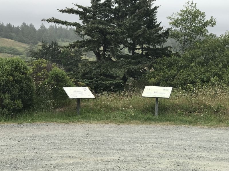
They called the river and the village at its mouth "Sekwetse," according to Coquille and Siletz Tribal sources. Sekwetse means . . . — — Map (db m176860) HM
Pilot Butte was a beacon for travelers.
On a day sometime in the year 1813, and Indian lookout, from one of several tribes summering in this vicinity, might have “hiked the butte” and from here observed an exploration party . . . — — Map (db m63090) HM
On Northwest Bond Street near Northwest Oregon Avenue, on the right when traveling north.
In 1905, the Aune brothers opened a livery stable and feed store on Bond Street and soon expanded it sot that by 1908, their large barn occupied one-half of the block on the east side of the street. The Aune brothers specialized in providing heavy . . . — — Map (db m157556) HM
On Northwest Bond Street near Northwest Minnesota Avenue.
Partners Floyd Dement and George Childs started a hardware business in 1912 and relocated to this building in 1918. The two worked together until 1935 when they had a falling out and dissolved their partnership. Neither one ventured too far, . . . — — Map (db m157560) HM
Near Northwest Brook Street near Northwest Oregon Avenue.
This plaque is all that is left of the homesite of Clyde McKay, a man who irrevocably shaped the destiny of Bend. McKay persuaded Eastern lumber interests to expand operations in Bend and join him in forming The Bend Company. This company purchased . . . — — Map (db m157705) HM
On Northwest Greenwood Avenue near Northwest Bond Street, on the left when traveling west.
For ladies traveling alone, the Cozy Hotel was the only respectable hotel in town. In those days, The Bend Bulletin printed the guest list of the three "higher class" hotels in town; the Cozy was among them. With its twenty-foot ceilings in . . . — — Map (db m157562) HM
On Northwest Bond Street near Northwest Greenwood Avenue, on the right when traveling north.
William P. Downing arrived in Bend in 1902, traveling from Bemidji, Minnesota. He got the idea of selling lunches to millworkers, and parlayed the operation into a restaurant on Bond Street. Following the American dream of expansion, he set his . . . — — Map (db m157558) HM
On Northwest Wall Street at Northwest Newport Avenue, on the right when traveling north on Northwest Wall Street.
Eddie Williamson was Bend's first major auto dealer. He arrived in Bend with his family as youngster in 1916. When he was still young, his family moved to Eugene, but Eddie stayed behind and learned the automobile business. After owning several . . . — — Map (db m157913) HM
Near SW Powerhouse Drive north of SW Columbia Street when traveling west.
To supply the lumber mills with logs, entire mobile towns were created in the woods to house the men and their families who cut down the trees. The towns were movable camps conveyed by railroad cars. From 1916, these temporary towns, or logging . . . — — Map (db m113935) HM
Near SW Columbia Street east of SW Shevlin Hixon Drive when traveling north.
The bustling marketplace you see today, filled with shops, theaters, restaurants, entertainment and recreation was once the site of the largest pine sawmills in the country.
Back in the 1920s, they were busy, noisy and dusty mills, each . . . — — Map (db m113931) HM
Near SW Powerhouse Drive north of SW Columbia Street when traveling west.
Trees were felled in the woods and hauled to the Deschutes River where they floated downstream to the mills.
The final steps of this log-to-lumber journey occurred as the wet lumber, known as green wood, exited the mill on the green chain.
As . . . — — Map (db m113933) HM
On Northwest Wall Street near Northwest Oregon Avenue, on the left when traveling north.
Nicholas Paul Smith's hardware store was a welcome sight in Bend because up until then supplies has to be brought in from Shaniko by stagecoach. Quick to spot a trend, Smith was the first to sell gasoline to the increasing number of automobile . . . — — Map (db m157652) HM
On Northwest Bond Street at Northwest Oregon Avenue, on the left when traveling north on Northwest Bond Street.
Hugh O'Kane, an illegal immigrant from Ireland, built the magnificent O'Kane Building. Regarded as the finest example of the Chicago Mercantile Style in Bend, it is still the largest commercial structure in downtown Bend.
O'Kane's role, as a . . . — — Map (db m157557) HM
On Northwest Harriman Street near NorthwestThough, on the left when traveling south.
Although Pete Pierson was the original blacksmith, he soon sold his business to Joe Egg, who ran the business for fifty years. As late as 1973, Egg was well-known in Bend and Redmond as an ace blacksmith. In that year, Egg told The Bulletin . . . — — Map (db m157708) HM
On Northwest Brooks Street at Northwest Oregon Avenue, on the left when traveling north on Northwest Brooks Street.
In 1936, partners Maren Gribskov and Eleanor Bechen were looking to expand their restaurant operation and build their own facility in the English Tavern style. They found the perfect location overlooking the Deschutes River. The named for the large . . . — — Map (db m157944) HM
Near SW Powerhouse Drive north of SW Columbia Street when traveling west.
Huge trees were felled in the woods and the logs were transported by railroad to town. They were then dropped into the Deschutes River to await their turn in the mill. The river was a perfect storage place for the logs. The natural flow of the . . . — — Map (db m113936) HM
Near SW Powerhouse Drive north of SW Columbia Street when traveling west.
From the woods to the Deschutes River, the log was hoisted by the bull chain into the mill from the river to the log deck.
It was then directed to the band saw in one of the three head rigs, where the process began.
It was the head sawyer's . . . — — Map (db m113919) HM
Near SW Powerhouse Drive north of SW Columbia Street when traveling west.
The mills may be gone, but their legacy is apparent all around us. The lumber companies spurred Bend's growth and they helped a lot of folks raise their families in this area. Today we see evidence of Mill B every time we look at the three iconic . . . — — Map (db m113932) HM
On Northwest Greenwood Avenue at Northwest Harriman Street, on the right when traveling east on Northwest Greenwood Avenue.
The railroad brought the outside world to Bend's doorstep, and the builders of what was then the Taggert Hotel knew exactly how to capitalize on it. Located just one block from the depot, the hotel was a modern, fireproof structure with electricity . . . — — Map (db m157946) HM
On East Cascade Avenue (U.S. 20) at North Fir Street, on the right when traveling west on East Cascade Avenue.
The hotel was built in 1912 by local businessman and Spanish American War veteran John Dennis. Hot and cold water was available to each of the original 19 guest rooms, and every room was supplied with heat from a hot air furnace located in the . . . — — Map (db m113631) HM
Near Blue Star Memorial/Dalles to California Highway (U.S. 97 at milepost 113), 1.2 miles north of Wimp Way, on the left when traveling north.
Peter Skene Ogden was born at Quebec in 1794. He explored Central Oregon for the Hudson's Bay Company in 1825 and in December of that year discovered Crooked River not far from this spot. He died at Oregon City in 1854.
Land for this park was . . . — — Map (db m80487) HM
On Elkton-Sutherlin Highway (Oregon Route 138) south of Mehl Creek Road, on the right when traveling south.
On the west bank and upstream is the site of Fort Umpqua.
Established in 1836 by the Hudson’s Bay Company, the fort was a twelve foot high and ninety foot square stockade with bastions at diagonal corners.
The fort served as a dwelling for . . . — — Map (db m113337) HM
On Oregon Coast Highway (U.S. 101) at Jewett Lane, on the right when traveling south on Oregon Coast Highway.
On October 1, 1850, the schooner "Bostonian” owned by a Boston merchant named Gardiner was sent to the Pacific coast in the interest of trade. The ship wrecked on the Umpqua River bar. Most of her cargo was salvaged and brought to this site, known . . . — — Map (db m176983) HM
Near Volunteer Way near SW 2nd Avenue, on the right when traveling east.
Used in the grist mill built in 1853-54 by Lazarus Wright. The mill was located next to the planked bridge crossing in the 'village' of Myrtle Creek near the current location of the Dairy Queen. The mill was managed by John Hall, the founder of . . . — — Map (db m114456) HM
On SE 2nd Street at SE Maple Street on SE 2nd Street.
Taken from a grist mill built in old town of Oakland by Dr. Dorsey S. Baker in 1851.
It turned the grinding stone that ground the grain to meal and flour. Shipped by boat around Cape Horn in the older days. — — Map (db m116841) HM
On Water Avenue at North 3rd Street, on the left when traveling east on Water Avenue.
A Big Piece of Reedsport History
Here, restored by citizens of Reedsport, is one of the largest steam donkeys to work the Oregon woods, the Smith and Watson 12 X 13 compound geared universal yarder. It was placed in service in 1915 . . . — — Map (db m113331) HM
On Walter Avenue at North 3rd Street, on the left when traveling east on Walter Avenue.
Oxen Replaced Mules And Donkeys –
Steam Donkeys Replaced Oxen
By the early 1900’s steam yarders or steam donkeys, as they came to be known, industrialized logging.
These large steel and cast iron steam machines . . . — — Map (db m113474) HM
On Vineyard Lane at Elgarose Road, on the left when traveling south on Vineyard Lane.
Oregon’s successful and widely recognized wine industry can be traced to this place, where Richard Sommer first planted Pinot noir grapes in 1961. The Umpqua and Willamette valleys’ climates and topographies are much like those of European wine . . . — — Map (db m114452) HM
On Umpqua Highway (Oregon Route 38) at Main Street, on the left when traveling west on Umpqua Highway.
Few Oregon communities have had a more colorful history than Scottsburg. It was named for Levi Scott, a pioneer of 1844, who homesteaded here and founded the town in 1850. There was a lower town at the head of tidewater on the Umpqua River which . . . — — Map (db m113510) HM
On Park Street at Highway 395, on the right when traveling east on Park Street.
Gold was discovered on Whiskey Flat in June, 1862; Canyon City quickly grew and became the County Seat by 1864. Scenes and Characters from the early years come alive in this 1996 mural by Larry Kangas.
This colorful history is celebrated at "62 . . . — — Map (db m96719) HM
On South Washington Street at Park Street, on the left when traveling south on South Washington Street.
In June 1862, a company of miners from northern California were heading east over the Strawberry Mountain Range, when one of the men discovered gold on Whiskey Flat, half a mile south of here. Miners from all over the area flocked into the area, and . . . — — Map (db m96722) HM
On Northwest Bridge Street just north of West Main Street (U.S. 26), on the right when traveling north.
The mining camp town of Canyon City sprang up soon after the discovery of gold in Canyon Creek in 1861 (Note: actually June of 1862).
When Grant County was formed in 1864 Canyon City became the county seat. Meanwhile, "Lower Town" . . . — — Map (db m107547) HM
Near Ing-Hay Way north of NW Canton Street, on the left when traveling north.
Has Been Designated a
National Historic Landmark
This property possesses national significance
in commemorating the history of the
United States of America
Kam Wah Chung Company Building is the best and earliest known . . . — — Map (db m112884) HM
Welcome to Kam Wah Chung
In 1890 you would be standing in the middle of a bustling Chinatown.Businesses and homes all around you, the temple in front, and Kam Wah Chung- the core of the community- would be to your left. Why is it the only . . . — — Map (db m112887) HM
On John Day Highway (U.S. 26), on the right when traveling east.
Imagine the American Indians first creating trails through these mountains hundreds of years ago. Later, in 1825 and 1826, Hudson Bay Fur Company trappers, led by Peter Skeene Ogden, crossed this very pass. In 1862 more people made this difficult . . . — — Map (db m107101) HM
Back in the early 1920's you may have left the dirt streets and wooden sidewalks of the town of Burns, to walk in these woods, where untouched ponderosa stood tall.
But in a few short years, one of the biggest ever timber sales in the . . . — — Map (db m108836) HM
When the railroad was being built the forest here was a busy place with trees being felled to make ties, and rock being blasted for ballast. In February 1927, forest ranger G. C. Blake reported:
"Yesterday I made the trip from . . . — — Map (db m108872) HM
On Oak Street (U.S. 30), on the left when traveling west.
Leslie and Truman Butler commissioned well-known Portland architect A.E. Doyle to design a bank of the Butler Banking Company, the business they founded in 1900. The Egyptian style building was completed in September 1924, and the grand opening . . . — — Map (db m112295) HM
On Oak Street (U.S. 30) near 2nd Street, on the left when traveling west.
Harry DeWitt built this new automobile garage in 1920 when the demand for new cars and service was high in Hood River. During the Great Depression of the 1930s, the garage was divided and used as the Greyhound Bus Station, a service garage, and a . . . — — Map (db m112235) HM
On Oak Street at 3rd Street, on the left when traveling west on Oak Street.
Designed to house several businesses, the E.L. Smith Building was constructed in 1904 for $10,000. The First National Bank, organized by entrepreneur and regional politician Ezra L. Smith in 1900, occupied the main storefront from 1904 to 1910 until . . . — — Map (db m112294) HM
On Oak Street (U.S. 30) near 3rd Street, on the right when traveling west.
Designed by Hood River architect R.R. Barely, the "new" First National Bank building was constructed in 1910 by contractors J.M. Wright and L.M. Bentley for a cost of $40,000. The building housed the bank on the first floor and the Commercial Club . . . — — Map (db m112264) HM
On Oak Street (U.S. 30) at 3rd Street, on the right when traveling west on Oak Street.
Constructed in 1907 under the management of J.M. Culbertson, the Hood River Banking and Trust Company represents one of the older brick buildings in downtown Hood River. Decorative features include the sheet metal cornice, arched windows with leaded . . . — — Map (db m116955) HM
On Cascade Avenue at 2nd Street, on the right when traveling west on Cascade Avenue.
In 1917, a modern Franklin touring car was delivered from Portland for the grand opening of the Hood River Garage. Similar one-story, concrete service garages proliferated throughout the Gorge after the Columbia River Highway was completed in 1916 . . . — — Map (db m112300) HM
On 2nd Street at Cascade Avenue, on the left when traveling north on 2nd Street.
Designed by The Dalles architect C.J. Crandall in 1904, the Hotel Waucoma was one of the earliest brick buildings constructed in downtown Hood River. Built for $14,000, the new hotel boasted of 27 guest rooms equipped with steam heat, porcelain . . . — — Map (db m112297) HM
On Oak Street (U.S. 30) near 3rd Street, on the left when traveling west.
A.S. Keir and C.A. Class erected the building in 1905 for use as a drug store, pharmacy, and soda fountain. Originally a one-story structure, a second floor was added when the building was remodeled in 1927 in the Art Deco style. The colorful tile . . . — — Map (db m112262) HM
On Oak Street (U.S. 30) near 3rd Street, on the right when traveling west.
Built in 1914, the original tenant of the building was the Garrabrant and Parker's Confectionary Store. Candy and cigars were sold in the store, and people often sat for hours at the popular soda foundation (sic). A game of billiards could be played . . . — — Map (db m112296) HM
On Oak Street (U.S. 30) near 1st Street, on the left when traveling west.
Prominent business person and leader of the fruit industry, Charles H. Sproat financed the construction of the Sproat Building in 1911 to house the E.A. Franz Furniture Company. Upon completion, the owners boasted of a buff colored brick exterior , . . . — — Map (db m112305) HM
On State Street near 2nd Street, on the right when traveling west.
William M. Stewart advertised his home furnishings and hardware business as Hood River's "Complete Homefurnisher." The one-story brick building on the east was erected in 1902 and the other two sections to the west were constructed in 1905. The . . . — — Map (db m112239) HM
On Oak Street (U.S. 30) near 1st Street, on the right when traveling west.
Constructed in 1909 by Samuel and Laurence Blowers, the building originally housed a hardware store and "modern playhouse" on the first floor and offices on the second floor. Laurence Blowers was one of Hood River's first mayors and was appointed . . . — — Map (db m112234) HM
On Oak Street at 2nd Street, on the right when traveling west on Oak Street.
Dr. Frampton Brosius was one of the town's early mayors and a community activist. Brosius constructed the building for use as a centralized location for doctor's offices; one of the first buildings in Hood River designed for this use. Constructed in . . . — — Map (db m112260) HM
On Oak Street at 2nd Street, on the right when traveling west on Oak Street.
The Eliot Building was financed by Portland minister T.L. Eliot in 1908 for use by the E.A. Franz Hardware Store. In 1906, the prominent Portland architect, A.E. Doyle, completed the architectural plans for the commercial building while studying . . . — — Map (db m112259) HM
On Oak Street (U.S. 30) near 2nd Street, on the left when traveling west.
Charles Hall, president of the Home Telephone Company, financed the construction of the building for $45,000 in 1909. Erected of "Newberg" pressed brick, the building housed a variety of businesses including the Butler Bank, Bragg Mercantile, and . . . — — Map (db m112261) HM
On East Port Marina Drive north of Interstate 84, on the left when traveling north.
Sternwheeler traffic on the Columbia River reached a fevered-pitch with the completion of Cascade Locks in 1896.
Steam-powered paddlewheelers provided a vital link between The Dalles and Portland.
The trip averaged six hours on a good day, and . . . — — Map (db m113947) HM
The Mt. Hood Hotel Annex, constructed in 1912-13, was built as an annex to the original wooden hotel which stood to the north. The first floor housed commercial businesses and the second story had apartments and additional hotel rooms. In 1926, the . . . — — Map (db m112232) HM
This Southern magnolia was planted in front of the home of Captain John M. and Mary Elizabeth “Lizzie” McCall in memory of their daughter, Elsie, who died in 1890. John McCall was a statesman and entrepreneur who opened many businesses including the . . . — — Map (db m244249) HM
This property has been placed on the National Register of Historic Paces by the Unted States Department of the Interior the Whittle Garage 1925 — — Map (db m96028) HM
On the National Register of Historic Places, the world famous Butte Creek
Mill is the only grist mill in Oregon still grinding flour.
Built on the banks of Little Butte Creek in 1872, under the name Snowy
Butte Mill, local farmers would bring . . . — — Map (db m113901) HM
On 2nd Avenue west of Dardanelles Street, on the right when traveling west.
Gold discovered on hill across Rogue River in 1860. Land for Gold Hill donated by Thomas & Rose Chavner in 1884. Railroad built in 1887. Town Inc. Feb. 12, 1895. First school in Methodist Church in 1889. Electricity came from Gold Rey Dam in 1904. . . . — — Map (db m99286) HM
On North River Road west of Oregon Route 99, on the right when traveling west.
J.B. White founded the small Community of Rock Point in the early 1850's. John fought in the Rouge Indian Wars. In exchange for his service he received land, and developed a homestead on the north side of the stage road. The land was sold to L. J. . . . — — Map (db m99258) HM
Portland Cement Association
Safety Trophy Awarded
Ideal Cement Company
Gold Hill, Oregon For a
Perfect Safety Record in 1959
Reawarded 1960
— — Map (db m116801) HM
(Marker 1)
In the 1860s the view from this spot on Main street would have looked much different than it does today. During the the Gold Rush boom of the 1850s, Jacksonville's early merchants and shopkeepers located their businesses along . . . — — Map (db m112901) HM
On North Oregon Street at E California St (Oregon Route 238), on the right when traveling south on North Oregon Street.
"Working Together"
as Partners in Communications and Education
A RESEARCH PROJECT BY GRIFFIN CREEK STUDENTS
SALUTES THE HISTORY OF LOCAL TELEPHONE SERVICE
First Phone Line - 1890
Sunset Telephone Company - 1898
Home Telephone Company - . . . — — Map (db m112894) HM
Near East California Street (Oregon Route 238) west of North Oregon Street.
Imagine a town hit by a citywide chair shortage. According to at least one pioneer of 1852 this happened in early day Jacksonville.
Word of situation must have reached Yreka, California, where carpenter and builder David Linn was mining for . . . — — Map (db m122887) HM
The first gold miners on this site in 1851 were in the right place at the right time. They found gold on Jackson Creek, possibly along the base of the hill across the parking lot. No one knows for certain; the route of the creek has changed . . . — — Map (db m112895) HM
On West C Street at N Oregon St, on the right when traveling west on West C Street.
Both horses and horsepower figure prominently in this site's past. In the 1860s, William J. Plymale (1837-1904) opened a livery stable at Oregon and "D" streets. He sold feed and kept horses and buggies on hand.
Steam Driven Horsepower . . . — — Map (db m112896) HM
Peter Britt was an extraordinary man of vision and accomplishment. His curiosity, motivation and experimental nature, matched with a keen business sense, allowed him to merge broad-ranging interests into a wide assortment of successful endeavors. . . . — — Map (db m122890) HM
On East California Street (Oregon Route 238) west of North Oregon Street.
Gold was first discovered on this portion of Jackson Creek in 1851. Mining continued at this site surrounding the Jacksonville Library for many years. During the 1930s, the decade of the Great Depression, Southern Oregon was a resurgence of its gold . . . — — Map (db m122886) HM
On North Central Avenue at East 6th Street on North Central Avenue.
The Cuthbert Building, constructed in 1910, was built by the Big Bend Milling Company. Franklin Cuthbert's furniture originally occupied the building. The building has housed a series of department stores. In 1920, the Golden Rule Mercantile Co., a . . . — — Map (db m92072) HM
On North Riverside Avenue (U.S. 99), on the right when traveling north.
This single-story concrete structure was built in 1926 for the Medford Auto Company, and is one of many similar structures built on this portion of the Pacific Highway referred to as "auto row" from 1925 to 1930. This building was home to the Buick . . . — — Map (db m112838) HM
On North Central Avenue south of East Main Street, on the left when traveling south.
With railroad access to distant markets, the orchard industry flourished. Hundreds of thousands of apple and pear trees were planted in the early 1900s, and commercial fruit became the Rogue Valley's major export.
Promoters widely . . . — — Map (db m120989) HM
Near U.S. 97, 0.4 miles south of SW Culver Highway, on the left when traveling north.
This park is named for Peter Skene Ogden, 1793-1854. In the fall of 1825, Ogden led a Hudston's Bay Company trapping party on the first recorded journey into central Oregon, crossing the country to the north and east into the Crooked River Valley . . . — — Map (db m67889) HM
On Parkdale Drive at Rogue River Hwy (U.S. 66) on Parkdale Drive.
On this site in 1916, the Oregon Utah Sugar Company erected a large beet factory. C.W. Nibley, director of the company and presiding bishop of The Church of Jesus Christ of Latter-day Saints (Mormons/L.D.S.), oversaw the project. Nibley's sons, . . . — — Map (db m112529) HM
On Coyote Creek Road near Bear Gulch Road, on the left when traveling east.
(Three panels are located at this information kiosk:)
Imagine carrying just a backpack and a pick and hearing the shouts of "Gold!" as they rang through this valley.
It's 1851. You've traveled hundreds of miles to make your . . . — — Map (db m115245) HM
On Front Street at Lower Wolf Creek Road, on the right when traveling south on Front Street.
Wolf Creek Tavern was built c. 1883 by Henry Smith, a highly successful and influential local entrepreneur. The establishment of the hotel, mercantile and post office occurred at the time the Oregon and California Railroad was being completed in . . . — — Map (db m47204) HM
Named for Abner Weed, Founder of Weed, CA
Twin cylinder Corliss steam engine supplied total power for Long-Bell Lumber Company's sawmilll, Weed. CA from 1917 thru 1964 (Long-Bell was acquired by International Paper). Seven boilers . . . — — Map (db m112526) HM
Formerly the halfway house, between Ashland and
Linkville (Klamath Falls). Henry Duncand first
owner 1871. Sold to Wm. S. Parker 1876.
Abandoned about 1915. — — Map (db m147734) HM
"To know the Oregon, California & Eastern Railway, one must imagine conditions in Oregon in the early 1900's." David F. Myrick, "Oregon, California & Eastern"
A century ago, the Klamath Basin held an inventory of nearly 35 billion . . . — — Map (db m112892) HM
This Memorial is Dedicated to George Nurse
Accomplishments
1867 - 1869 - 1878
Opened First Trading Post
Built the Bridge Across Link River
Platted Town and Called it Linkville
Donated the Land For the First Cemetery
The First . . . — — Map (db m113635) HM
On Main Street near Klamath Avenue, on the right when traveling west.
Rafted lumber down Upper Klamath Lake and
built first buildings on this site, 1867.
Registered first official plat of town, 1878.
Was Linkville's first hotel keeper, postmaster,
and livery stable operator. Gave building lots
to people who . . . — — Map (db m113638) HM
On South 5th Street, on the right when traveling south.
This building was erected in 1914 by the City of Klamath Falls with a $50,000 bond. Designed by Earl Veghte and constructed by the Cofer Brothers, the building housed all City departments; the basement housed a jail and heating plant, and the . . . — — Map (db m153530) HM
On Klamath Avenue at S 5th Street, on the right when traveling north on Klamath Avenue.
This building was erected in 1926 by the City of Klamath Falls. It replaced an earlier library, endowed by the Carnegie Foundation, built in 1913. Unfortunately the Carnegie Library was located too far from the center of the Klamath Falls . . . — — Map (db m153537) HM
Martin R. Frain born December 17, 1832 in New York, came west in 1850, arrived in Oregon Territory April 30, 1857 crossed Link river and camped under a ledge nearby. Established the first Trading Post at the present area of Payne Alley and Main . . . — — Map (db m100207) HM
Reub Long was a lifelong cowboy of the Oregon desert.
When Reub was two years old, his family moved from Lakeview to Christmas Lake (about 30 miles S.E. of Fort Rock).
By the time he was twelve, he and his horse "...were out doing a man's . . . — — Map (db m113573) HM
On North E Street just south of North 2nd Street, on the right when traveling north.
1887 - Joe Frankl sold land to the Lakeview Bank, the first bank established in Lake County. The owners, P.G. Chrisman & Andy McCallen built this building.
1898 - The Bank of Lakeview, chartered in 1897 by Dr. Bernard Daly, Marius Miller and . . . — — Map (db m147063) HM
Constructed in 1913 by W.P. and J.D. Heryford, pioneer cattlemen, the primary purpose being to provide space for the early Elks Club and office space to attract good doctors and business people. The ground floor and basement was occupied by a . . . — — Map (db m112553) HM
On North E Street at North 2nd Street, on the left when traveling north on North E Street.
The “Old Kentucky” Saloon was originally built at this location in 1896 by Peter Post & Jonas King. After the fire of 1900 that destroyed the majority of Lakeview's business district, the current brick structure was constructed in 1901, . . . — — Map (db m147065) HM
On North E Street at Center Street, on the left when traveling north on North E Street.
Original building was constructed in 1901 on a site formerly occupied by the Hopkins Hotel which burned in the fire of 1900.
At some later date the building was extended to the west property line. The main building housed the First National Bank . . . — — Map (db m147058) HM
On Fremont Highway (Oregon Route 31) at Chewaucan Street, on the right when traveling north on Fremont Highway.
Paisley was once the site of a seasonal Native American settlement. Northern Paiute and Klamath Indians came to the Chewaucan Marsh and River to harvest local resources, most notably the wapato, Silgittaria cuneata, a plant with . . . — — Map (db m113765) HM
Early industries in the Florence area were built on the natural resources that the Siuslaw River Valley had to offer. The rivers were filled with swarming salmon and the forests held acres of old growth timber. Those abundant natural resources . . . — — Map (db m93894) HM
On Bay Street west of Maple Street, on the right when traveling west.
Built in 1938 as the "Florence Theatre," the facade displays a stucco exterior. After an internal fire in 1957, it was refurnished and renamed the Harbor Theater. One of the last neighborhood theaters operating in Oregon, it continued dispensing . . . — — Map (db m113263) HM
The connection to the Pacific Ocean by way of the Siuslaw River made Florence a natural hub for industry. The shifting river channel and mouth made early navigation unpredictable. The lack of stable conditions made establishing a thriving harbor . . . — — Map (db m93912) HM