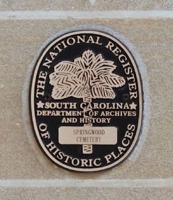
On East Bramlett Road (County Road 473) at Woodside Avenue (County Road 20), on the left when traveling west on East Bramlett Road.
Built in 1938 by the Works Progress Administration, it was a part of the largest WPA school project in the state of South Carolina. The auditorium was built at a cost of $50,000 and named for Thomas F. Parker, local mill executive. The dedication . . . — — Map (db m30316) HM
In the earliest of times the rock shoal upstream of the bridge was used as a ford until a flat bridge was built across Beaverdam Creek. In Monday, August 24, 1908 starting at 7:00 p.m., twenty inches of rain fell during the next twenty-four . . . — — Map (db m27555) HM
On South Main Street (State Highway 124), on the left when traveling south.
Near Reedy River Falls, stood the home, trading station, and grist mill of Col. Richard Pearis, first white settler of this section. He was a noted Indian trader and prominent Tory of the Revolution. — — Map (db m10428) HM
The Cherokees
Greenville County was Cherokee Territory before the Revolution. European settlers were forbidden to live here until 1777, when Native Americans were forced to cede this land to the new state. Most of modern day Greenville was . . . — — Map (db m14535) HM
Near University Street. Reported permanently removed.
Richard Pearis settled near this site in 1776, and built a trading post and grist mill by the falls. This early settlement eventually became the City of Greenville. — — Map (db m182124) HM
On Falls Street near Camperdown Way (South Carolina Highway 124).
Richard Pearis, Greenville's first white settler, was an Irish adventurer who had settled in Virginia with his wife and family by the middle of the eighteenth century. He developed good trade relationships with the Cherokee Indians, had a son by an . . . — — Map (db m8035) HM
On West Blue Ridge Drive (State Highway 253) at North Franklin Road, on the right when traveling east on West Blue Ridge Drive.
This early twentieth century suburb takes its name from Sans Souci, the nearby house and estate of Gov. Benjamin F. Perry (1805-1886). Perry, a prominent Unionist before the Civil War, was appointed provisional governor of S.C. by President . . . — — Map (db m15920) HM
The Reedy River, named for the "reeds" which once grew close around its banks, flows from Traveler's Rest southward for almost sixty miles. In the middle of Greenville, it tumbles into steep, narrow falls, and then meanders toward Conestee before . . . — — Map (db m28064) HM
On North Line Street at East Church Street, in the median on North Line Street.
This marks the eastern boundary (the present Greenville-Spartanburg county line) between the Cherokee Nation and the province of South Carolina from the end of the Cherokee War (1759-61) until 1777. In that year, the Treaty of DeWitt's Corner . . . — — Map (db m206349) HM
On Fork Shoals Road (State Highway 23-146) south of Old Hundred Road (State Highway 23-459).
This farm has been owned by the Hopkins family since 1834, when John Hopkins (1793-1837) purchased it from William Toney. The Greek Revival main house was built ca. 1840, with later additions ca. 1890 and ca. 1925. Hopkins' widow, Lucinda . . . — — Map (db m9068) HM
On South Main Street, on the left when traveling north.
Old Stage Road
The town of Simpsonville grew up around a stagecoach stop nearby operated by Thomas Goldsmith (1788-1868). Goldsmith's house, on the Old Stage Road from Laurens to Greenville, was near a crossroads where the Old Stage Road met an . . . — — Map (db m50569) HM
On Northeast Main Street (State Highway 14), on the right when traveling north.
[Front]:
This town grew up around a stagecoach stop from Laurens to Greenville. For many years the community was known as "Plain," the name given to its first post office, opened in 1838 with Jesse T. Cook as postmaster. It was later . . . — — Map (db m50525) HM
On North Tigerville Road at Route 414 on North Tigerville Road.
[Front]:
Tigerville got its name from early settlers who settled here shortly after the Revolution. They called bobcats they saw here "tygers," and named the nearby Tyger River, Head of Tyger Baptist Church, later Tyger Baptist Church, . . . — — Map (db m18044) HM
On County Road 182, on the left when traveling north.
President and Treasurer of the
Piedmont Manufacturing Company
President 1905-1923
Director 1896-1935
Industralist • Humanitarian • Friendly
Just — — Map (db m40137) HM
This bridge, built in 1909, is the last extant covered bridge in S.C. Built by Charles Irwin Willis (1878–1966), it was named for Alexander Lafayette Campbell (1836–1920), who owned and operated a grist mill here for many years. . . . — — Map (db m8507) HM
Many generations of area residents have treasured Campbell's Covered Bridge as a local icon and place to enjoy Beaverdam Creek on a hot day, meet neighbors while your corn is ground, or as a quiet place to court your sweetheart.
There are . . . — — Map (db m37498) HM
A native of NC who was brought to Greenville by Vardry McBee as a slave.
He worked after hours and bought his way out of slavery. Once a free man he soon owned a general store and tannery.
He served in the State House from 1868-1870.
. . . — — Map (db m30340) HM
On Fews Bridge Road (State Highway 113), on the right when traveling east.
Named in 1984 in honor
of
pioneer settler of Upper
Greenville County
who entered this state
from Georgia in 1787
and whose descendants
have lived on these lands
ever since.
Mr. Few is said to have
built the first bridge
and . . . — — Map (db m10706) HM
This town, established in 1823, grew up around a store owned by Matthew Young (1803-1876), who was also postmaster 1831-43. It was first called Pressly's Station, for the post office opened in 1823 with David Pressly (1764-1834) as postmaster. The . . . — — Map (db m9397) HM
70 feet south of this point was erected, 1820, the old "Record Building," designed by Robert Mills (1871-1855), famous Charleston architect, designer of the Washington Monument. This building of classic design was county courthouse until 1855; then . . . — — Map (db m7942) HM
On Poinsett Highway (State Highway 276) south of Furman Road, on the right when traveling south.
Named in honor of
Patrolman Anthony
who was killed near
nere March 10, 1973
while performing his duty
as a highway patrolman
and
in recognition of his life
of service as a conscientious
loyal and dedicated
law enforcement . . . — — Map (db m38780) HM
On State Highway 14 at Berry Mill Road, on the right when traveling north on State Highway 14. Reported missing.
On this site in 1820 John Weaver established a yarn mill. It changed owners several times until about 1900 when Spartan Commodor Berry tore down and built on the same foundation. Berry operated a cotton gin, grist mill and saw mill. In 1912 he . . . — — Map (db m7939) HM
On County Road 182, on the right when traveling north.
[West Inscription]
This monument
is erected by the
Piedmont
Manufacturing Company
in commemoration of
Henry Pinckney Hammett
its originator and for
eighteen years its
President and Treasurer
[South Inscription]
. . . — — Map (db m126267) HM
On North Main Street at East Washington Street, on the right when traveling south on North Main Street.
Civil Rights
The students of Sterling High School
were the driving force that promoted
the change of institutional
segregation in Greenville County.
During the 1950s and 1960s, Sterling
students held demonstrations,
marches . . . — — Map (db m16217) HM
On Mitchell Road at South Carolina Highway 146, on the left when traveling north on Mitchell Road.
On this site stood the third building erected by Whitefield Baptist Church. The building was used by the Congregation for worship and fellowship until 1957.
Erected as a memorial to God's blessings by his people at this sacred place. — — Map (db m36637) HM
On Church Street, on the right when traveling north.
First Baptist Church
Founded in 1823 as Edgefield Baptist Church, with Basil Manly, Sr., Pastor, Matthew Mims, Clerk, and Arthur Simkins, Moderator, this church led in the establishment here in 1826 of Furman Academy and Theological . . . — — Map (db m12671) HM
On Rutherford Street (State Highway 25) at Poinsett Highway and Shaw Street, on the right when traveling north on Rutherford Street.
"The Poplars"
This was approximately the center of the many acred estate and "seat of hospitality" of Elias Earle, pioneer Greenville settler who began acquiring property here as early as 1787. His home, "The Poplars," stood at the N.E. corner . . . — — Map (db m9084) HM
On Old Buncombe Road south of Morris Street, on the right when traveling north.
About 150 feet east of this point are buried some of Greenville's earliest settlers, including Elias Earle (1762-1823), State Representative and Senator and United States Congressman; George Washington Earle (1777-1821), wealthy planter and early . . . — — Map (db m71592) HM
On East Broad Street at South Main Street, on the left when traveling west on East Broad Street.
Roger C. Peace
(May 19, 1899 - August 20, 1968)
Reporter, Editor, Business Manager,
Publisher _ _ _ The Complete Newspaperman,
Who guided The Greenville News and The Greenville Piedmont to eminence among . . . — — Map (db m259663) HM
Built by Henry Middleton on land bought from Elias Earle in 1813, Whitehall served as his summer home until 1820 when it was sold to George W. Earle, whose descendants have occupied it ever since. Henry Middleton was son of Arthur Middleton, signer . . . — — Map (db m9085) HM
By 1820 one of the first cotton mills in Greenville County was located at these river shoals. Pelham Manufacturing Co. purchased a mill here sixty years later. — — Map (db m19061) HM
In Commemoration of the
1776
Battle of Round Mountain
(located Northwest of here)
in which Captain Thomas Howard
with his brave followers and
and faithful Indian guide, Skyuka,
won the battle against the Cherokee
Relocated by . . . — — Map (db m81159) HM WM
On Pendleton Street at South Calhoun, on the right when traveling west on Pendleton Street.
[Front]:
Sterling High School stood ¾ mi. southeast of here and served generations of African Americans in Greenville. Founded in 1896 by Rev. D.M. Minus and called Greenville Academy, it was first located in west Greenville. It moved . . . — — Map (db m10847) HM
On Jenkins Street at Maloy Street, on the left on Jenkins Street.
Established 1929
Destroyed by fire 1967
Past Principals
J.C. Martin •
R.L. Hickson •
Joseph E. Beck •
Harold O. Mims, Sr. •
Luke H. Chatman
Sponsored and erected by
Class of 1955 — — Map (db m10883) HM
On White Horse Road (U.S. 25) at West Lenhardt Road, on the right when traveling south on White Horse Road.
Named by action of
the General Assembly
and Highway Commission
in recognition of his
distinguished public
service during 24 years
as a member of
South Carolina
House of Representatives
and
in particular his role
in the . . . — — Map (db m19489) HM
On Elliott Street, on the right when traveling west.
Elisha Poinsett
————
Builder
His descendant,
Joel Roberts Poinsett
one time Ambassador
to Mexico, introduced
the Poinsettia
to the United States — — Map (db m50482) HM
Near Cedar Falls Road at Turner Road, on the right when traveling north.
Settled in the 1780’s, Fork Shoals was not a typical Southern textile mill village where residents earned their living solely at the mill. The community was primarily agrarian and the people supplemented their farm income by working at the mill. . . . — — Map (db m198572) HM
On Fairview Road (County Route 55) south of Knickerbocker Road (County Road 301), on the left when traveling north.
This house was built by T.C. Bolling c. 1840 near the old Indian boundary. C.B. Stewart, minister of nearby Fairview Presbyterian Church lived here 1859-1890. — — Map (db m239611) HM
On Ravenel Street west of Smythe Street, on the right when traveling west.
In early 1874, Oscar Sampson (1828-1904) and George Hall chartered Camperdown #1 mill. By June 1874, it was in full operation in the Vardry McBee brain mill. Camperdown #2 was in full operation by December 1875. By 1880, the Camperdown spinning . . . — — Map (db m198783) HM
On Buncombe Street (Pete Hollis Highway) (State Highway 183) at Rutherford Street (State Highway 25) when traveling north on Buncombe Street (Pete Hollis Highway).
1883 - 1978
It can be done
[North Face]:
Superintent of Parker District Schools.
Founded the first Adult Education Center in Greenville Coounty.
Introduced Vocational Education (Forerunner of Technical Education Colleges in South . . . — — Map (db m10182) HM
On West Broad Street at West McBee Avenue, on the left when traveling north on West Broad Street.
[East Face - Top Inscription]:
Prospect
Hill
Park
[East Face - Bottom Inscription]:
Established by
Greenville County
Historic Preservation
Commission
[North Face - Top Inscription]:
Site of . . . — — Map (db m11584) HM
On West Broad Street at West Washington Street, on the right when traveling south on West Broad Street.
The Saluda River, Greenville County's largest, falls 500 feet within the county. The Saluda is named for a Native American tribe that lived along its banks. In areas southeast of Greenville, physical evidence of human occupation on the Saluda dates . . . — — Map (db m135288) HM
The Civilian Conservation Corps (CCC) was established by President Franklin D. Roosevelt in 1933 as part of the comprehensive relief effort during the grim depression years. Three million men were involved in the CCC during its ten-year existence. . . . — — Map (db m21051) HM
On North Main Street just south of College Street (U.S. 25), on the right when traveling south.
New Beginnings
[Top Panel]:
It was 1919 and Greenville, South Carolina had emerged from World War I with a surge of patriotism and community spirit. Main Street was a center of activity and a building boom brought the Woodside . . . — — Map (db m26979) HM
On 11th Avenue West just north of 4th Street West, on the right when traveling north.
Palmetto Baptist Church. The Palmetto Baptist Church was organized on January 5, 1892, and a few months later its first building was erected on this site. The Reverend R.H. Whitehead, under whose leadership the church was constituted, became . . . — — Map (db m100920) HM
On Greenville Street (State Highway 20) near Beltline Road (County Road S-1-35).
[Front]:
This cemetery, sometimes called Upper Long Cane Cemetery, dates from 1760. It includes the graves of some of the most prominent families of this area from the Colonial era to the present. The first marked grave is the field . . . — — Map (db m50740) HM
On S Main Street (State Highway 124), on the left when traveling south.
City of Greenville
Renovation of this historic bridge was completed in 2001. The first of many projects planned for the new millenium with the goal of enhancing the public's enjoyment of the historic Reedy River Falls area.
Knox H. . . . — — Map (db m10721) HM
[Left Marker]
Samuel Slater
1768-1835
Founded
the first Cotton Mill
in America
1790
Founded
the First Sunday School
in America
1799
[Right Marker]
This Building
Dedicated
By H. Nelson Slater
To the . . . — — Map (db m21005) HM
On West Main Street (State Highway 20) at Minor Street, on the left when traveling west on West Main Street.
"Embraced by the gratitude of an entire community and held in the love and admiration of a descended family, here rests the earthen tabernacles of our beloved founder, West Allen Williams, and family. Reverently moved from a forgotten cemetery a . . . — — Map (db m19714) HM
On Main Street, on the right when traveling south.
Was built in 1841 at the request of Alexander
McBee son of Vardry McBee founder of Conestee, S.C.
This building was designed and laidout by
John Adams, Vardry McBee's millwright.
Mr. Adams designed the church in an octagonal shape
so as to . . . — — Map (db m9395) HM
On South Main Street (State Highway 14) at Victoria Street on South Main Street.
Discovered about 1930
by Henry Clark
near Frohawk Creek on property
belonging to J.T. Moon. Most likely
used to crack and grind corn and acorns
into meal by a band of Lower Cherokee,
this mortar is highly unusual because
of its massive . . . — — Map (db m30810) HM
Near Falls Street near Camperdown Way (South Carolina Highway 124).
Greenville's first post-bellum textile mill was founded by Massachusetts mill owners George Hall, George Putnam, and O.H. Sampson, who came south to start a textile business after a disasterous fire in Boston. In cooperation with Vardry McBee's . . . — — Map (db m87413) HM
On White Horse Road (U.S. 25) south of Old Easley Bridge Road.
Interchange Named in Honor of
Dr. Harold B. Sightler
1914-1995
Founder of:
Tabernacle Baptist Church
1952-1995
Christian Schools
Children's Home
Baptist College
Tabernacle Baptist Missions International
WTBI AM & FM . . . — — Map (db m24126) HM
On White Horse Road (U.S. 25) at Banner Drive, on the right when traveling north on White Horse Road.
One of the first stores in this section of the state stood near this spot. Its day book shows that it was in operation in 1794, three years before the founding of the town of Greenville. — — Map (db m9131) HM
On West Duncan Road (U.S. 25) at Exeter Way, in the median on West Duncan Road.
Lynching in America
Between 1877 and 1950, thousands of African Americans were victims of mob violence and lynching across the United States. Following the Civil War, many white Southerners fiercely resisted equal rights for African Americans . . . — — Map (db m206360) HM
Near State Highway 14 at East Phillips Road, on the right when traveling north.
• First Textile Mill in Greenville County. •
Site used for textile manufacturing from 1820-1935. • The mortared stone dam spanning the Enoree River was built with six sluice gates in the 1880's.
Rocky Field Creek runs from the North to the . . . — — Map (db m51061) HM
On South Main Street north of West Court Steeet, on the left when traveling north.
This granite basin stood over a spring on a toll road built in 1820 under the direction of Joel Poinsett, South Carolina's first Commissioner of Public Works. The road established the commercial links between South Carolina and the neighboring . . . — — Map (db m259665) HM
On West Broad Street at West Washington Street, on the right when traveling south on West Broad Street.
Cherokee in the Upcountry The watersheds surrounding Greenville County were long ago home to Pisgah societies (AD 1000-AD 1450) and their descendants, the Cherokee. Archeological evidence of the Pisgah societies has been found in abundance near . . . — — Map (db m135283) HM
On Fork Shoals Road south of Old Hundred Road (County Road 565), on the right when traveling north.
Here along the south side of the creek to Reedy River was fought, Dec. 22, 1775, the Battle of Great Cane Break, between a force of South Carolinians under Colonel William Thompson and a band of Tories under Patrick Cuningham. The Tories were . . . — — Map (db m97258) HM
On East Main Street Extension (U.S. 29) at Brooklyn Road, on the right when traveling west on East Main Street Extension.
In the latter part of the nineteenth century, the American textile industry began to move from New England into the South, particularly into South Carolina, North Carolina, and Mississippi, drawn by lower labor costs, close proximity to . . . — — Map (db m309291) HM
On West Duncan Road (U.S. 25) at Old White Horse Road (County Road 199), on the left when traveling north on West Duncan Road.
That part of U.S. 25
between Saluda Dam Road
and U.S. 276
Named in 1986 by action
of the General Assembly
and highway commission
in recognition of his
24 years of dedicated
service to Greenville
County and South Carolina
as . . . — — Map (db m17792) HM
Erected by
The Allen University Alumni
Club of Greenville County
November 1970
In Honor of
Payne Institute
Established in 1870 by
The African Methodist Episcopal Church
Moved to Columbia, South Carolina in 1860
And Renamed . . . — — Map (db m11094) HM
On McCarter Drive (State Highway 418) at Interstate 385, on the right when traveling north on McCarter Drive.
Named in 1985 by action
of the General Assembly
and Highway Commission
in recognition of his
many years of devoted
service to the people
of Greenville County
and of the state
Former Mayor, Fountain Inn
Member
House of . . . — — Map (db m40142) HM
On West McBee Avenue at Richardson Street, on the left when traveling west on West McBee Avenue.
Chartered September 23, 1974
Placed on the National Register
of Historic Places August 1977
Sanctuary designed by
Samuel Sloan of Philadelphia
Erected in 1857 and Dedicated February 21, 1858 — — Map (db m37591) HM
On Fairview Church Road (County Route 23-451) at Phillips Lane, on the left when traveling west on Fairview Church Road.
(Front): Settlers from the Nazareth area of Spartanburg County founded this Presbyterian church in 1786 on land ceded by the Cherokee Indians in the treaty of DeWitt's Corner, 1777. It is said that three buildings, two of logs and one of . . . — — Map (db m8946) HM
This building was erected by the citizens of the Greenville community as a tribute to that glorious heritage which inspired the development and formation of the American government and the freedoms to which it aspires and is dedicated to the men . . . — — Map (db m19197) HM WM
Agricultural plants that were grown and sold by farmers are important to Greenville's history. For many years, most families in Greenville made their living by farming.
Corn, Wheat and Oats
In the early 1800s, corn, wheat, and oats were . . . — — Map (db m31232) HM
On Murray Drive at West Butler Road (County Route 107), on the left when traveling south on Murray Drive.
The history of the Gosnell cabin originates 200 years ago. The cabin, with original dimensions of twenty-five by eighteen feet, was built out of twelve-inch thick by eight-inch wide beams of heart pine, and it was built to last.
Gresham . . . — — Map (db m30397) HM