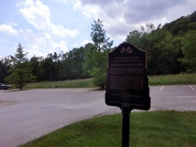
Casper Glattfelder and his family migrated from Glattfelden, Switzerland in 1743 and settled across this creek in Cordorus Township about 1747.
Through the generosity of Arthur J. Glatfelter and in cooperation with the Board of Directors of the . . . — — Map (db m84243) HM
Three
George Washington
Mount Vernon
Trees
American Holly
Red Maple
Tulip Poplar
and two
Homestead
Elms
are planted here by the
York County
250th
Anniversary Commission
[Reverse:] . . . — — Map (db m152313) HM
Founded in 1749, York County was the fifth county in Pennsylvania and the first to be formed west of the Susquehanna River. Convinced that the area had gained sufficient population, wealth, and the need for a local government, the provincial . . . — — Map (db m100699) HM
Formed August 19, 1749 from Lancaster County, it was Pennsylvania's fifth to be established. York, the county seat, was laid out in 1741. Continental Congress met in York, 1777-78. Here it adopted Articles of Confederation; ratified treaties with . . . — — Map (db m4576) HM
After a stunning victory at Chancellorsville in May 1863, Confederate Gen. Robert E. Lee led the Army of Northern Virginia through Maryland into Pennsylvania, marching east to threaten Harrisburg, Philadelphia, Baltimore, and Washington . . . — — Map (db m181230) HM
After a stunning victory at Chancellorsville in May 1863, Confederate Gen. Robert E. Lee led the Army of Northern Virginia through Maryland into Pennsylvania, marching east to threaten Harrisburg, Philadelphia, Baltimore, and Washington . . . — — Map (db m253466) HM
1703 - 1790
A Marylander
Settled on these Indian lands of
Conejohela in 1730
and held them for Lord Baltimore
against the Penn Proprietors
until 1736, when in the border war
he was burned out
of this log house or fort
near this . . . — — Map (db m226159) HM
From early industrialization to present-day uses, Codorus Creek has been an integral part of York's history and continues to be an important asset today and for centuries to come.
Settling Codorus Creek
Among the first . . . — — Map (db m205777) HM
A Royal Dispute
Throughout much of the 17th and 18th centuries the landscape around what is now the Zimmerman Center for Heritage was at the heart of a long border dispute between Maryland and Pennsylvania. In 1632, England's King Charles . . . — — Map (db m242835) HM
Here, Nov. 18, 1863, a special train carrying Abraham Lincoln and party to Gettysburg for dedication of National Cemetery changed railroads. Earlier in that year, wounded soldiers were transported from Gettysburg battlefield to this Junction, thence . . . — — Map (db m5874) HM
Mayhem and Melees In 1863, charming brick and wooden homes, many of them still standing, lined both sides of Frederick Street from Center Square to the Winebrenner Tannery and the Karl Forney Farm. The Karl Forney residence was . . . — — Map (db m197084) HM
By late June 1863, the Confederate Army had invaded Pennsylvania. After capturing York, the Rebels planned to take the state capital, Harrisburg, and possibly Philadelphia. To get there, they would need to cross the Susquehanna River at . . . — — Map (db m170239) HM
Completed in 1832, the North Central Railroad carried passengers and freight between Baltimore, York, and Harrisburg for 140 years. After the decline of the railroad, the railroad bed was converted to a rail trail in 1984. Today the Maryland portion . . . — — Map (db m53200) HM
An unusual combination of heavy snowpack, high winds, unseasonably warm temperatures, heavy rainfall, and ice jams resulted in a basin wide flash flood in the Susquehanna River Basin from January 19-21, 1996. The heavy accumulation of snow from . . . — — Map (db m220630) HM
Visitors are surprised and delighted to see an English looking castle standing in the heart of downtown Carlisle, but they wonder what it is and when it was built. For 130 years it was the Cumberland County Prison, and when it was constructed in . . . — — Map (db m19496) HM
During the June 1863 invasion of Pennsylvania, Confederate Lieutenant General James Longstreet explained to English observer Lieutenant Colonel Arthur Freemantle that the army planned to live off Northern land - and its citizens. But they would not . . . — — Map (db m22752) HM
The earliest settlers in this part of Markham Township, including several “Pennsylvania Dutch”, arrived on the Rouge River shortly after 1800. Within ten years Nicholas Miller had erected mills around which a community known as Markham Mills had . . . — — Map (db m254044) HM
At 13 years of age, Peter Faze traveled with his family in a one-horse wagon for five weeks from York County, Pennsylvania to settle in Allen County in 1833. Here, he met his first wife Aurelia McCullough, whose Conestoga wagon from a similar trip . . . — — Map (db m298274) HM
During the mid-nineteenth century, Columbia was a bustling transportation hub. Turnpikes, ferries, bridges, canals, wharves, and railroads made Columbia a major transshipment point in the movement of lumber, coal, grains, pig iron, and people. . . . — — Map (db m161072) HM
Built in 1892, this school was part of a movement to create schools for the education of black students by black teachers, and is representative of the national struggle for equal education, regardless of race. Named in memory of James Smallwood, . . . — — Map (db m4598) HM
Landmarks
❶ [Unreadable] Hospital of Philadelphia
[Unreadable] the 1860's to train women as doctors and nurses. It is now Sarah Allen Senior Housing Project.
❷ Pennsylvania Railroad YMCA
Originally the . . . — — Map (db m211003) HM
At 8:00 a.m. on June 30, the head of Gen. H. Judson Kilpatrick's Union Cavalry Division halted on Frederick Street outside community leader Jacob Wirt's home, which formerly stood in front of you at the site of the Hanover Theater. Kilpatrick . . . — — Map (db m312014) HM
The York Interlocking Tower, located in Poorhouse Yard, is the point where the Northern Central Railroad, Western Maryland, Pennsylvania Railroad, and Maryland & Pennsylvania all converged. The tower is located along York Street near N. Queen . . . — — Map (db m287210) HM
12. Michael P. Small (1831-1892): Uphill in the distance to your right is the grave of Michael Small. Small was born in York and was a son of John Small. A graduate of West Point class of 1855, he participated in the Harper's Ferry . . . — — Map (db m205742) HM
(North Side):Dedicated in honor of the Sons and Daughters of Lancaster and York Counties, Pennsylvania who have served in the wars of their country (South Side):Columbia-Wrightsville Bridge Built by Lancaster-York Intercounty Bridge . . . — — Map (db m234375) HM
"Hen" served as President of the Wrightsville Cemetery Association from Oct. 12, 1954 to the time of his death on March 5, 2000. It was through his efforts that major improvements were made to this cemetery. He received the Outstanding Cemeterians . . . — — Map (db m120188) HM
Lime Kilns such as these were used for burning limestone and turning it into lime. The lime was used for fertilizer, white-wash, plaster, and deodorant for outhouses. Quarried limestone was also used along with coal and iron ore to make pig iron in . . . — — Map (db m170237) HM
Virginia Germans
This log farmhouse was built in Rockingham County, Virginia in 1773 by a German immigrant. Many German farmers in the Valley of Virginia constructed similar homes in the 18th century. Later improvements to the house . . . — — Map (db m298906) HM
Andreas Gerberich arrived at port of Philadelphia from the parish of Michelreith, Lower Franconia, Bavaria, October 1, 1754. Settling near his brothers in Tulpehocken Township, Berks County, Pennsylvania, Andreas married Barbara Babb in 1758. . . . — — Map (db m262032) HM
A memorial to the Indians who formerly dwelt in the vicinity
Designed and built by John Edward Vandersloot who named it after a nearby fishing rock on the face of which the Indians had carved footholds
The Pennsylvania Water and Power . . . — — Map (db m170968) HM
Inspired by a Gold Star Mother's love for her fallen son, the Veterans Memorial Star Healing & Peace Garden is a thoughtfully designed commemorative arboretum dedicated to all who serve in the United States Armed Forces. This living monument is a . . . — — Map (db m108566) WM
The Homestead was built between 1823 and 1826 for Dr. John Simpson Bratton and his wife Harriet Rainey Bratton, the second generation of the Bratton family to live at Brattonsville. Bricks for the chimneys were made on the plantation. The two . . . — — Map (db m272030) HM
During the late 1800s, engineers started looking to the lower Susquehanna as a source of electric power.
From 1895 to 1931, as demand for electricity increased, four hydroelectric dams were
constructed on the river: at York Haven, Safe Harbor, . . . — — Map (db m173596) HM
Cannons Blast for Two Hours After the Confederates' initial surge and taking of the square, on June 30, 1863, the Union's swift, steady onslaught pushed the gray tide back from Broadway to where they came, down Frederick Street . . . — — Map (db m197085) HM
May 1958 the Hanover Eagles Aerie #1406 Fraternal Order of Eagles, erected the 10 Commandments Monument in Wirt Park, a Hanover Borough park.
April 2004 Hanover Borough Council petitioned the York County Orphan's Court for the right to sell . . . — — Map (db m224448) HM
May 1958 the Hanover Eagles Aerie #1406 Fraternal Order of Eagles erected the 10 Commandments Monument in Wirt Park, a Hanover Borough Park.
April 2004 Hanover Borough Council Petitioned the York County Orphan's Court for the right to sell . . . — — Map (db m22656) HM
After disengaging from the Union cavalry in the late afternoon of June 30, Confederate Gen. J.E.B. Stuart's cavalry division, bogged down by 125 fully loaded Union supply wagons and 600 mules saddled with Union materials, left Hanover. Stuart and . . . — — Map (db m197242) HM
You may not feel like you're standing on top of a towering mountain, but this is the Northern Central Railway's highest point between York and Baltimore. That's how this spot got its name, Summit Grove. It's 827 feet above sea level.
The average . . . — — Map (db m125196) HM
Near this site, Captain Michael Doudel's company of York County riflemen mustered on July 24, 1775, prior to their 600-mile journey to join General George Washington at the siege of Boston, Massachusetts. These frontier patriots were the first to . . . — — Map (db m259328) HM
[Marker is damaged and not legible.]
The Northern Central Railway was a major conduit for the transportation of troops and supplies from the North to the Virginia Theater. Early in the Civil War, raiding parties destroyed bridges along . . . — — Map (db m205750) HM
20. Dr. Alexander R. Blair (1826-1889): Directly off the path and slightly to your right, is the grave of Dr. Blair. He was a surgeon at the military hospital in York and accompanied the invalids east to Columbia as the Confederates . . . — — Map (db m205688) HM
In memory of the first person, a young girl whose name is unknown. Buried here about 1760. The story goes that she was visiting the Lesly family and died as a result of injuries sustained while they were making lye soap. John Lesly and his . . . — — Map (db m18756) HM
[Front]:
This cemetery, sometimes called Upper Long Cane Cemetery, dates from 1760. It includes the graves of some of the most prominent families of this area from the Colonial era to the present. The first marked grave is the field . . . — — Map (db m50740) HM
Immediately after the Battle of Bunker Hill in June 1776, a company of Hanover, York and Gettysburg area citizens marched to Boston to support their fellow colonists. Another local battalion responded to the British threat to Long Island and New . . . — — Map (db m181382) HM
Fitz Water Wheel
In the 19th century the I-X-L steel overshoot water wheel was developed and manufactured by Fitz Water Wheel Company of Hanover. The wheel superior efficiency made it widely used into the 20th century. By 1915, it was being . . . — — Map (db m181380) HM
Mason-Dixon Trail
A portion of the Native Lands Heritage Trail route follows the Mason-Dixon Trail, a 193 mile long hiking path that connects the Appalachian
Trail at Whiskey Spring, PA with the Brandywine Trail at Chadds Ford, PA passing . . . — — Map (db m225122) HM
Directly in front of you stands Hybla, which Jonathan and Susanna Mifflin, a Quaker couple, built about 1800. Mifflin, a Revolutionary War captain (afterward a colonel), and his wife hid freedom seekers on their estate and helped them escape across . . . — — Map (db m173061) HM
Historic Lebanon Church, located behind you at the intersection of two strategic highways, served both the Confederate and the Union armies during the Civil War. Soon after Confederate Col. John Bankhead Magruder began organizing the Peninsula’s . . . — — Map (db m10389) HM
Great Raid
July 4, 1863
Araminta Hiestand Chandler and her husband, Joseph Harrison Chandler, were living in this house, located a mile from Campbellsville on the Old Greensburg Road, during the Civil War.
Joseph H. Chandler was . . . — — Map (db m99301) HM
Not only does the Lower Susquehanna River have an impressive natural history, but a rich cultural history as well. From where you stand the famous explorer John Smith made it only a little farther up the river in his schooner. A fascinating group . . . — — Map (db m146988) HM
Dynamite was essential for expedient construction of the A&S. Rock cliffs on the Susquehanna River were blasted for months to create shelves that carried the rails northward, a lower route for the older Port Road and an upper route for the new . . . — — Map (db m122692) HM
Baltimore Street, just behind you, saw frequent Confederate cavalry traffic during four days at the end of June and beginning of July 1863. At that time, Dillsburg sat in the path of an invading army.
On June 28 a Confederate cavalry patrol . . . — — Map (db m256136) HM
Just north of the Mason-Dixon line, the divide between states where slavery was legal and free states like Pennsylvania, Hanover was a logical stop on the Underground Railroad. The Underground Railroad was the secret network of trails, homes, . . . — — Map (db m197078) HM
In 1855, George Holtzapple had been practicing medicine less than a year in his native Loganville when he received an urgent message that a 16-year old Frederick Gable was fighting for his life against pneumonia. "Give me breath!" the boy pleaded . . . — — Map (db m152318) HM
38. Arthur Briggs Farquhar (1838-1925): To your left, behind the bush, is the Arthur Briggs Farquhar monument. Farquhar was born and raised in Maryland. He arrived in York in 1856 and married Elizabeth Jessop. A young York businessman, . . . — — Map (db m205687) HM
[Front]:
Col. Frederick Hambright (1727-1817), a prominent militia officer of the American Revolution, lived his last 25 years in a house which stood 200 yds. NE. Hambright, born in Germany, emigrated to America as a boy, and settled in . . . — — Map (db m28236) HM
A short distance east is Rosegill. The house was built about 1650 by the first Ralph Wormeley; it became the summer home of the colonial governors, Sir Henry Chicheley and Lord Howard of Effingham. In 1776, the owner, the fifth Ralph Wormeley, was . . . — — Map (db m27005) HM
The History of the MA & PA Trail
The MA & PA Railroad stretched between Baltimore at North Avenue & Howard Streets, on to Towson, through Long Green Valley into Harford County. It ended at Market Street in York, Pennsylvania. Even by the . . . — — Map (db m104553) HM
Gateway to the West - Wrightsville was settled in the 1720s by Quakers, including the John Wright family. Wright established a ferry and Wrightsville became a major point of crossing the Susquehanna River by pioneers traveling west. In 1811 Jacob . . . — — Map (db m171286) HM
COAL DELIVERY
The railroad delivered hopper cars to the coal trestle, and dumped
the coal into the pockets below. Approximately 40 cars per year were
required to meet the school's needs. A portable conveyor transferred
the coal into . . . — — Map (db m279866) HM
1862-1878
Construction underway of a railway from Philadelphia to New York
City by the newly chartered Philadelphia, Newtown, and New York
Railroad (PN&NY). The railway never got farther than Lincoln Avenue in Newtown, a mile or so north . . . — — Map (db m279681) HM
The Susquehanna River's islands, wetlands, flood plain, and woodlands are unique
habitats that serve as a haven to rare plant and bird species. Over the centuries,
however, human impacts have harmed these sensitive areas.
This pristine area, . . . — — Map (db m170357) HM
The Rock Hill City Directory listing of businesses that were operating on West Black Street in the late 60s and early 70s.
1. Blue Bird Taxi Company (1972)*
2. Brown's Billiards (1971)
3. People's Undertaking Company (1972)
4. Mutt's . . . — — Map (db m175680) HM
Thin black lines indicate changes in relevance. Between each pair of lines entries are ordered geographically but all have the same relevance.
* Inflectional forms of words are their plurals, singulars, and possessives as well as gramatical tenses and similar variations.