THE HISTORICAL
MARKER DATABASE
“Bite-Size Bits of Local, National, and Global History”


26484 entries match your criteria. The first 100 are listed.                                               Next 100 ⊳


US Civil War Topic

 
By Mark Hilton, September 25, 2022
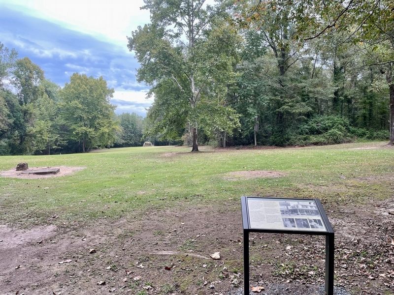
The Hospital Marker
1 ► Alabama, Autauga County, Marbury — The Hospital — 1904-1939 —
Near County Road 63 0.2 miles south of County Road 530, on the right when traveling south.
2 ► Alabama, Autauga County, Prattville — Mulbry Grove Cottage — McWilliams - Smith - Rice House —
On Main Steet at South Chestnut Sreet, on the right when traveling east on Main Steet.
3 ► Alabama, Autauga County, Prattville — Pratt Gin Factory — 1 mile —
On East Main Street at South Memorial Drive (U.S. 31), on the right when traveling east on East Main Street.
4 ► Alabama, Autauga County, Prattville — Prattville Dragoons —
On South Washington Street at East 4th Street, on the right when traveling north on South Washington Street.
5 ► Alabama, Autauga County, Prattville — Sidney Lanier / Prattville Male and Female Academy Site —
On Wetumpka Street (County Route 2) at South Washington Street, on the right when traveling east on Wetumpka Street.
6 ► Alabama, Autauga County, Prattville — The Prattville Dragoons —
Near South Washington Street at East 4th Street, on the left when traveling south.
7 ► Alabama, Baldwin County, Blakeley — Alabama —
On Washington Avenue south of Old Blakeley Road, on the right when traveling south.
8 ► Alabama, Baldwin County, Blakeley — Battle of Blakeley — April 9, 1865 —
On Washington Avenue south of Old Blakeley Road, on the right when traveling south.
9 ► Alabama, Baldwin County, Blakeley — Fort Blakeley (Blakely*) —
Near Battlefield Road 0.3 miles east of Green Street, on the right when traveling east.
10 ► Alabama, Baldwin County, Blakeley — Redoubt Six —
On Old Blakeley Road, on the right when traveling south.
11 ► Alabama, Baldwin County, Blakeley — The Battle of Fort Blakeley —
On Battlefield Road 0.3 miles east of Green Street.
12 ► Alabama, Baldwin County, Blakeley — The Battle of Fort Blakely —
On Battlefield Road 0.8 miles east of Green Street, on the right when traveling north.
13 ► Alabama, Baldwin County, Blakeley — The Siege of Fort Blakeley —
On Battlefield Road, on the left when traveling east.
14 ► Alabama, Baldwin County, Blakeley — The United States Colored Troops (USCT) at the Battle of Fort Blakeley —
On Battlefield Road, on the left when traveling east.
15 ► Alabama, Baldwin County, Blakeley — Union Artillery Batteries —
On Union Trail Loop west of Old Blakeley Road, on the left.
Paid Advertisement
16 ► Alabama, Baldwin County, Bon Secour — Stop 3 — Vicinity of Salt Works and Camp Anderson — “Salt Is Eminently Contraband” — Civil War Trail Battle for Mobile Bay —
On River Road 0.2 miles west of Bon Secour Highway, on the left when traveling west.
17 ► Alabama, Baldwin County, Daphne — Fuller Memorial Park —
On Patrician Drive W 0.1 miles north of Patrician Drive S, in the median.
18 ► Alabama, Baldwin County, Fairhope — Confederate Rest Cemetery —
On Pine Grove Drive near Confederate Rest Road, on the right when traveling west.
19 ► Alabama, Baldwin County, Fort Morgan — Colors of Significance: Historic Flags of Mobile Point —
Near Fort Morgan Road (Alabama Route 180) 2 miles west of Dune Drive, on the left when traveling west.
20 ► Alabama, Baldwin County, Fort Morgan — Noble Leslie DeVotie —
Near Dixie Graves Parkway (State Highway 180) when traveling west.
21 ► Alabama, Baldwin County, Fort Morgan — The Battery Bailey — Position of the 2nd Connecticut Light Artillery August 20-25, 1864 —
Near Fort Morgan Road (Alabama Route 180) 2 miles west of Dune Drive, on the right when traveling west.
22 ► Alabama, Baldwin County, Gulf Shores — "Damn The Torpedoes!" The Campaigns for Mobile, 1864 - 1865 —
On Fort Morgan Road (Alabama Route 180) 1.2 miles west of Dune Road, on the right when traveling west.
23 ► Alabama, Baldwin County, Gulf Shores — Stop C4 — "The Shells Were Bursting All Around Us" — The Siege of Fort Morgan: — Stop C4 —
Near Fort Morgan Road 1.4 miles Dune Road, on the left when traveling west.
24 ► Alabama, Baldwin County, Gulf Shores — 32 Pounder Sea Coast Defense Gun — On Barbette Carriage —
Near Fort Morgan Road (Alabama Route 180) 1.6 miles west of Dune Road, on the right when traveling west.
25 ► Alabama, Baldwin County, Gulf Shores — 6.4” (100 pounder) Parrott Rifle / 7” Brooke Rifle —
On Fort Morgan Road (Road 180) 1.7 miles west of Dune Drive, on the right when traveling west.
26 ► Alabama, Baldwin County, Gulf Shores — Camp Withers —
Near West Fort Morgan Road (Alabama Route 180) at Island Club Drive, on the right when traveling west.
27 ► Alabama, Baldwin County, Gulf Shores — Citadel (1825-1865) —
Near Fort Morgan Road (Alabama Route 180) 1.7 miles west of Dune Drive when traveling west.
28 ► Alabama, Baldwin County, Gulf Shores — Navy Cove / Pilot Town —
On Fort Morgan Road (Alabama Route 180) west of Pontoon Lane, on the right when traveling west.
29 ► Alabama, Baldwin County, Gulf Shores — The Battery Lincoln — Position of Company “C” of the 20th Iowa Infantry —
Near Fort Morgan Road (State Road 180) 1.3 miles west of Dune Drive, on the left when traveling west.
30 ► Alabama, Baldwin County, Gulf Shores — Stop C1 — The Battle of Mobile Bay — “A Deadly Rain of Shot and Shell” — Civil War Trail, Battle for Mobile Bay —
Near Fort Morgan Road (State Highway 180) 1.7 miles west of Dune Drive.
31 ► Alabama, Baldwin County, Gulf Shores — Stop C2 — The Battle of Mobile Bay — “Now I Am In The Humor, I Will Have It Out!” — Civil War Trail, Battle for Mobile Bay —
Near Fort Morgan Road (State Highway 180) 1.7 miles west of Dune Drive.
Paid Advertisement
32 ► Alabama, Baldwin County, Gulf Shores — Stop C3 — The Battle of Mobile Bay — “Damn the Torpedoes!” — Civil War Trail, Battle for Mobile Bay —
Near Fort Morgan Road (Alabama Route 180) 1.7 miles west of Dune Drive when traveling west.
33 ► Alabama, Baldwin County, Gulf Shores — The Citadel — (1821-1865) —
Near Fort Morgan Road (Alabama Route 180) 1.7 miles west of Dune Drive when traveling west.
34 ► Alabama, Baldwin County, Gulf Shores — The Overland Campaign — Storm Clouds Gather — Civil War Trail, Battle for Mobile Bay —
On Fort Morgan Road (State Road 180) 1.7 miles west of Dune Drive, on the left when traveling west.
35 ► Alabama, Baldwin County, Magnolia Springs — The Springs —
Near Magnolia Springs Highway (County Route 49) 0.1 miles east of Oak Street.
36 ► Alabama, Baldwin County, Montrose — The Village of Montrose / Montrose —
On Sibley Street 0.1 miles west of U.S. 98, on the left when traveling west.
37 ► Alabama, Baldwin County, Spanish Fort — “Damn The Torpedoes!” — The Campaigns for Mobile, 1864-1965 —
On Larry Dee Cawyer Drive.
38 ► Alabama, Baldwin County, Spanish Fort — 1st Division, U.S. Colored Troops —
On Speckle Trout Route 0.1 miles north of General Canby Drive, in the median.
39 ► Alabama, Baldwin County, Spanish Fort — Albert Carey Danner — 1843~1921 —
On Danner Circle west of Confederate Drive, in the median.
40 ► Alabama, Baldwin County, Spanish Fort — Caisson Trace —
On Caisson Trace at Spanish Main Street, on the left when traveling west on Caisson Trace.
41 ► Alabama, Baldwin County, Spanish Fort — Confederate Drive —
On Confederate Drive at Danner Circle, on the left when traveling south on Confederate Drive.
42 ► Alabama, Baldwin County, Spanish Fort — Confederate Main Line of Resistance — (The Battle of Spanish Fort, March 26-April 9, 1865) —
On Bull Run Road east of Spanish Main Street, on the right when traveling east.
43 ► Alabama, Baldwin County, Spanish Fort — Confederate Redoubt No. 3 / Gibson’s Brigade —
On General Gibson Road 0.1 miles west of Lancers Lane, on the right when traveling east.
44 ► Alabama, Baldwin County, Spanish Fort — Confederate Redoubt No. 4 / Holtzclaw's Brigade —
On Spanish Main Street west of Cavalry Charge, on the right when traveling west.
45 ► Alabama, Baldwin County, Spanish Fort — Confederate Redoubt No. 5 / Ector's Brigade —
On Artillery Range Street north of Yankee Trove, on the right when traveling north.
46 ► Alabama, Baldwin County, Spanish Fort — Fort McDermott —
On Confederate Drive, on the right when traveling north.
47 ► Alabama, Baldwin County, Spanish Fort — Fort McDermott —
On Spanish Main Street south of Cannonade Boulevard, on the right when traveling south.
Paid Advertisement
48 ► Alabama, Baldwin County, Spanish Fort — Ft. McDermott Confederate Memorial Park —
On Spanish Main Street south of Cannonade Boulevard, on the right when traveling south.
49 ► Alabama, Baldwin County, Spanish Fort — Red Fort —
On Lancers Lane east of Spanish Main Street, on the left when traveling west.
50 ► Alabama, Baldwin County, Spanish Fort — Site of the Naval Battery —
On Union Pass east of Spanish Main Street, on the left when traveling east.
51 ► Alabama, Baldwin County, Spanish Fort — Spanish Fort —
On Spanish Main Street north of Spanish Fort Boulevard (U.S. 31), on the right when traveling north.
52 ► Alabama, Baldwin County, Spanish Fort — Spanish Fort — Alabama —
Near Spanish Fort Boulevard at Blakeley Way (County Road 72).
53 ► Alabama, Baldwin County, Spanish Fort — Spanish Fort — Gateway to the Delta —
On Spanish Fort Boulevard (U.S. 90/98) at Spanish Main, in the median on Spanish Fort Boulevard.
54 ► Alabama, Baldwin County, Spanish Fort — Stop 7 Fort McDermott: — "The Men Dig,Dig,Dig" — Civil War Trail —
On Larry Dee Cawyer Drive.
55 ► Alabama, Baldwin County, Spanish Fort — Stop 8 The Eighth Iowa Line: — “The Very Air Was Hot” —
On Larry Dee Cawyer Drive.
56 ► Alabama, Baldwin County, Spanish Fort — The 8th Iowa Infantry — Battle of Spanish Fort —
On Monroe Lane north of Southern Way, in the median.
57 ► Alabama, Baldwin County, Spanish Fort — The Final Assault —
On Cora Slocomb Drive 0.3 miles north of General Canby Drive.
58 ► Alabama, Baldwin County, Spanish Fort — The Town of Blakeley / The Battle of Fort Blakeley —
On Alabama Route 225 at Upper Shay Branch Road, on the right when traveling south on Alabama Route 225.
59 ► Alabama, Baldwin County, Spanish Fort — The Union First Parallel / Union Siege Battery No. 16 —
On Southern Way north of Pirates Lane, on the right when traveling north.
60 ► Alabama, Baldwin County, Spanish Fort — Union Siege Battery No. 1 —
On Patrician Drive South west of Patrician Drive East, on the right when traveling south.
61 ► Alabama, Baldwin County, Spanish Fort — Union Siege Battery No. 21 / 3rd Brigade of Carr's Division —
On General Canby Loop 0.2 miles north of General Canby Drive, on the right.
62 ► Alabama, Baldwin County, Stockton — Sea Coast Mortar — Union Weapon from the Civil War —
Near Alabama Route 225, on the left when traveling north.
63 ► Alabama, Barbour County, Clayton — Comrades — To Our Confederate Dead —
On Eufaula Avenue at Court Square, in the median on Eufaula Avenue.
Paid Advertisement
64 ► Alabama, Barbour County, Clayton — Octagon House —
On North Midway Street, on the right when traveling north.
65 ► Alabama, Barbour County, Eufaula — Confederate Hospital — 1861 - 1865 —
On Riverside Drive at Front Street, on the right when traveling north on Riverside Drive.
66 ► Alabama, Barbour County, Eufaula — Fendall Hall / Young and Dent — The Young - Dent Home —
On West Barbour Street, on the left when traveling west.
67 ► Alabama, Barbour County, Eufaula — General Grierson’s March —
On West Broad Street, in the median.
68 ► Alabama, Barbour County, Eufaula — In Memory of the Known Confederate Soldiers Buried all over Fairview Cemetery —
On North Randolph Ave.
69 ► Alabama, Barbour County, Eufaula — Old Fairview Cemetery —
On North Randolph Avenue just south of East Browder Street, on the left when traveling south.
70 ► Alabama, Barbour County, Midway — Fort Browder / 15th Alabama Infantry —
On Woody Johnson Road 0.1 miles east of County Route 79, on the left when traveling east.
71 ► Alabama, Barbour County, Midway — Fort Browder / 15th Alabama Infantry —
On U.S. 82 close to County Road 79, on the left when traveling west.
72 ► Alabama, Barbour County, Midway — Unknown Soldiers —
Near Springhill Road west of County Road 49.
73 ► Alabama, Bibb County, Brierfield — Absalom Pratt House —
On Montevallo Road (State Highway 25) at County Road 62, on the left when traveling west on Montevallo Road.
74 ► Alabama, Bibb County, Brierfield — Bibb Furnace —
On Furnace Road (County Road 62) south of Montevallo Road (State Route 25).
75 ► Alabama, Bibb County, Brierfield — Bibb Naval Furnaces Brierfield Furnaces — — ½ mile → —
On Montevallo Road (State Highway 25) at County Road 62, on the left when traveling west on Montevallo Road.
76 ► Alabama, Bibb County, Centreville — Centreville Cemetery — Bibb County —
Near Mill Street 0.2 miles south of Walnut Street (State Route 25), on the right when traveling south.
77 ► Alabama, Blount County, Blountsville — Battle Royal — May 1, 1863 —
On Local Road 26 at Dunn Lane, on the right when traveling east on Local Road 26.
78 ► Alabama, Blount County, Blountsville — None — Blountsville Court Square Timeline —
On Lee Street (County Road 26), on the right when traveling west.
79 ► Alabama, Blount County, Blountsville — Exploit of Murphree Sisters — Incident of May 1, 1863 during Streight (USA) -Forrest (CSA) Campaign. —
On Local Road 26 at Dunn Lane, on the right when traveling east on Local Road 26.
Paid Advertisement
80 ► Alabama, Blount County, Blountsville — Federal Raid —
On Main Street (U.S. 231) 0.1 miles east of Bailey Street, on the right when traveling south.
81 ► Alabama, Blount County, Blountsville — Federal Raid — May 1, 1863 — 1 mile south
On Main Street (U.S. 231) north of Bailey Street, on the right when traveling south. Reported permanently removed.
82 ► Alabama, Bullock County, Midway — Confederate Memorial —
On Old Broadway Street (U.S. 82) at Main Street, on the right when traveling west on Old Broadway Street.
83 ► Alabama, Bullock County, Midway — Jefferson Davis Highway —
On Old Broadway Street (U.S. 82) at State Route 51, on the right when traveling south on Old Broadway Street.
84 ► Alabama, Bullock County, Union Springs — Log Cabin Museum / Old City Cemetery —
On U.S. 82 west of Prairie Street, on the right when traveling east.
85 ► Alabama, Butler County, Greenville — Greenville City Hall-Site of Public School / Confederate Park —
On East Commerce Street (Alabama Route 10) at South Park Street, on the left when traveling west on East Commerce Street.
86 ► Alabama, Butler County, Greenville — Our Confederate Dead Monument —
On Adams Street west of South Park Street, on the right when traveling west.
87 ► Alabama, Butler County, Greenville — Site of Confederate Hospital — 1861 – 1865 —
Near South Park Street north of Dunklin Street.
88 ► Alabama, Calhoun County, Anniston — Major John Pelham — Was born here → — September 7, 1838 —
On U.S. 431, on the right when traveling north.
89 ► Alabama, Calhoun County, Anniston — The Birthplace of the “Gallant Pelham” —
On Choctaw Street north of Tomahawk Trail, on the right when traveling north.
90 ► Alabama, Calhoun County, Jacksonville — 10th Alabama Volunteers — Army of Northern Virginia, C.S.A. —
On Public Square West (State Highway 21) south of Clinton Street Southwest, on the left when traveling south.
91 ► Alabama, Calhoun County, Jacksonville — Beauregard's Headquarters —
On Pelham Road (State Highway 21) at James Street SE, on the left when traveling north on Pelham Road.
92 ► Alabama, Calhoun County, Jacksonville — Confederate Hospital —
On Clinton Street Southeast, on the right when traveling west.
93 ► Alabama, Calhoun County, Jacksonville — Forney’s Corner —
On Public Square West (State Highway 21) south of Clinton Street Southwest, on the left when traveling south.
94 ► Alabama, Calhoun County, Jacksonville — General Leonidas Polk C.S.A. —
On Chinabee Avenue Southeast at Ladiga Street Southeast, on the right when traveling north on Chinabee Avenue Southeast.
95 ► Alabama, Calhoun County, Jacksonville — Jacksonville, Alabama — “Gem of the Hills” —
On Mountain Street Northwest west of Woodward Avenue Northwest, on the left.
Paid Advertisement
96 ► Alabama, Calhoun County, Jacksonville — John Horace Forney — 1829-1902 — Major General, C.S.A. —
On Public Square West (State Highway 21) near Clinton Street Southwest, on the left when traveling south.
97 ► Alabama, Calhoun County, Jacksonville — John Tyler Morgan — 1824-1907 —
On Public Square West (State Highway 21) east of Ladiga Street Southwest, on the left when traveling south.
98 ► Alabama, Calhoun County, Jacksonville — Maj. John Pelham — 1838-1863 —
On Pelham Road (State Highway 21) at James Street SE, on the right when traveling north on Pelham Road.
99 ► Alabama, Calhoun County, Jacksonville — Memorial to Confederate Hospital —
On Public Square West.
100 ► Alabama, Calhoun County, Jacksonville — Pelham —
On Church Ave SE at James St SE, on the right when traveling north on Church Ave SE.

26484 entries matched your criteria. The first 100 are listed above. Next 100 ⊳

 
 
CeraNet Cloud Computing sponsors the Historical Marker Database.
This website earns income from purchases you make after using our links to Amazon.com. We appreciate your support.
Paid Advertisement
Nov. 11, 2026