Near Fort Morgan Road (State Road 180) east of Mobile Street.
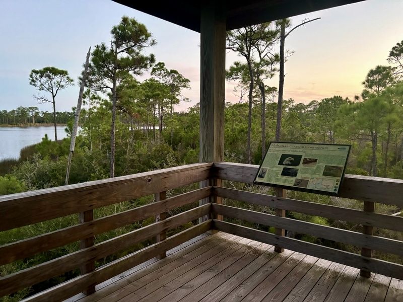
Little Lagoon is an eight mile long saltwater lagoon connected to the Gulf of Mexico by a man-made pass.
Major hurricanes periodically breach the southern shoreline of the Lagoon and create a new pass to the Gulf, which soon fills in naturally. . . . — — Map (db m258732) HM
On Spanish Fort Boulevard (U.S. 90/98) at Spanish Main, in the median on Spanish Fort Boulevard.
Spanish Fort is the gateway to the second largest delta in the United States. The Mobile-Tensaw, River Delta is 30 miles long and 12 miles wide. It covers more than 200,000 acres of swamps, river bottomlands and marshes and is considered the best . . . — — Map (db m285174) HM
On Rockville Road (County Road 15) at Stimpson Sanctuary Road, on the right when traveling south on Rockville Road.
William Bartram, America’s first native born artist-naturalist, passed through Clarke County during the Revolutionary era, making the first scientific notations of its flora, fauna and inhabitants. As the appointed botanist of Britain’s King George . . . — — Map (db m101568) HM
On Main Street (U.S. 84) at College Street, on the right when traveling north on Main Street.
In profound appreciation of the Boll Weevil and what it has done as the Herald of Prosperity this monument was erected by the Citizens of Enterprise, Coffee County, Alabama — — Map (db m30306) HM
Near Natchez Trace Parkway (at milepost 327.3), 2.7 miles east of N Pike (County Route 21), on the left when traveling east.
The Natchez Trace Parkway is designed to encourage leisurely exploration of the history and beauty of Old Southwest. Here are a few pointers to make your trip more enjoyable.
Regulations and Safety
Obey posted speed limits. Be alert for . . . — — Map (db m107254)
Near Natchez Trace Parkway (at milepost 327.3), 1.6 miles N Pike (County Route 21), on the left when traveling east.
Alabama’s Winter Waterfowl
The Tennessee River Valley is the winter home for thousands of waterfowl. These birds migrate from across the northern US and Canada down through the center of the continent to the Tennessee River.
Careful . . . — — Map (db m107253) HM
Many Kinds of Birds Call North Alabama Home
The northern tier of Alabama has two distinct landforms-the Tennessee River Valley and the Appalachian Plateau. A variety of terrain provides wonderful birding habitat and offers excellent . . . — — Map (db m150937) HM
Just downstream from Wilson Dam lies a series of trails maintained by the Tennessee Valley Authority. Starting at the Visitor Center, explore the trails as they meander along the riverbank and through the forest
1.Wilson Dam Visitor Center . . . — — Map (db m106186) HM
Gulls are a Diverse and Fascinating Group of Birds
Popularly known as sea gulls, these birds actually occur at the seashore and far inland as well. Each winter thousands of gulls gather along the Tennessee River. Three species form the . . . — — Map (db m106184)
Scan the wooded island just across the Tennessee River for numerous bundles of sticks scattered through the canopy. These bulky structures are the nest of Great Blue Herons. Dozens of these nests are scattered across the island, and each year Great . . . — — Map (db m106179) HM
The Muscle Shoals National Recreational Trail complex is a 17-mile paved and primitive trail and bikeway for public use located on TVA’s Muscle Shoals Reservation. This National Recreation Trail System connects numerous historical sites including . . . — — Map (db m106117) HM
Escape to an Earlier Time The giant trees of Northern Alabama's mature forest have stood throughout generations, witnessing considerable natural, historical, and cultural changes. Some probably witnessed the Civil War while others only date . . . — — Map (db m117058) HM
Alabama is one of the states with the most biodiversity.
In fact, Alabama ranks #1 when it comes to the number of freshwater critters!
Biodiversity refers to the total number of different plant and animal species.
Every organism from . . . — — Map (db m106105)
Birdwatching is a popular hobby for many in Alabama. Not only are birds fun to watch, but they also tell us a lot about environmental health.
Pileated Woodpecker • Red-tailed Hawk • Yellow-bellied Sapsucker • Cardinal • Bluebird • American . . . — — Map (db m106103) HM
Near New Hope Road (County Road 71/1809) north of County Road 1811, on the right when traveling north.
George Dempsey Holden and his wife Carrie Owen Holden settled 35 acres of this the farm in 1907. They chose to settle here because of the Joppa Normal Collegiate Institute nearby and they wanted their seven children to gain a college education. The . . . — — Map (db m290718) HM
Near Cahaba Road at Capitol Street, on the right when traveling north.
"Cahawba's magnificent churches,
splendid mansions and business houses
will become the habitations of owls and
bats," predicted a concerned citizen
in a letter to the editor of the Dallas
Gazette in February of 1857. He
warned . . . — — Map (db m245237) HM
Near Cahaba Road at Capitol Street, on the right when traveling north. Reported permanently removed.
"We by-and-by discovered...a pair of those
splendid birds, the Ivory-billed Woodpeckers
(Picus principalis). They were engaged in
rapping some tall dead pines, in a dense part of
the forest, which rang with their loud notes." . . . — — Map (db m112801) HM
On Museum Avenue at Main Street (U.S. 84), on the right when traveling south on Museum Avenue.
A mule trader for 65 years, was known throughout the nation for the slogan,"'Tolable' fair dealer". Opposite this site, on the southeast corner of East Main and Holman Streets stood one of the south's largest mule stables. Built in 1917, the . . . — — Map (db m83784) HM
On City Park Road south of Kentucky Avenue (Alabama Route 17), on the left when traveling south.
Alabama’s Winter Waterfowl
The Tennessee River Valley is the winter home for thousands of waterfowl. These birds migrate from across the northern US and Canada down through the center of the continent to the Tennessee River.
Careful . . . — — Map (db m106298) HM
On Cahaba Road at Park Lane, on the right when traveling north on Cahaba Road.
In 1822 William Pullen, Revolutionary War veteran, acquired this land from the Federal Government for farming. In 1889 his heirs sold the land to the City of Birmingham for use as the New Southside Cemetery which operated from 1889 to 1909 with . . . — — Map (db m27096) HM
The Forks of Cypress plantation was established in 1818 by James and Sarah Jackson. Its home, believed the design of William Nichols, was one of Alabama's great houses, featuring perhaps the earliest peristyle colonnades in America. Built by skilled . . . — — Map (db m83975) HM
On Jackson Road (County Road 41) 0.8 miles south of West Rasch Road (County Road 16), on the right when traveling south.
The Forks of Cypress plantation was established in 1818 by James and Sarah Jackson. This home, believed the design of William Nichols, was one of Alabama's great houses, featuring perhaps the earliest peristyle colonnades in America. Built by . . . — — Map (db m156982) HM
Near Hightower Place near Veterans Drive (Alabama Route 133), on the left when traveling south.
Often referred to as the most successful breeder of thoroughbred horses in America, James Jackson imported Glencoe and Leviathan to the U.S. in the early 1800's, leaving a permanent imprint on both the breed and American racing history. — — Map (db m219334) HM
When the Alabama Department of Conservation and Natural Resources began a Bald Eagle Restoration Project in 1984, Bald Eagles had not successfully nested in Alabama since 1949. Thanks to these restoration efforts, Bald Eagle populations increased . . . — — Map (db m107997) HM
On Lauderdale County 1 (County Route 1) 1.5 miles north of Lauderdale County 14 (County Route 14), on the left when traveling north.
When the Alabama Department of Conservation and Natural Resources began a Bald Eagle Restoration Project in 1984, Bald Eagles had not successfully nested in Alabama since 1949. Thanks to these restoration efforts, Bald Eagle populations increased . . . — — Map (db m105709) HM
On Lauderdale County 1 (County Route 1) 0.8 miles north of Lauderdale County 14 (County Route 14), on the left when traveling north.
Birds Come From All Directions to Enjoy the Tasty Treats Hidden Beneath the Mud
In the late summer. fall, and winter, reservoir levels in the Tennessee River Valley drop drastically to expose areas of mudflats. although unsightly to some, theses . . . — — Map (db m105713) HM
Near Alabama Route 33 0.2 miles south of County Route 67, on the left when traveling south.
A Special Place: for People and Birds
The forest of Bankhead have been here for many generations, witnessing considerable natural, historical and cultural changes. This area was home to native Americans for many years. The pioneers who live . . . — — Map (db m107295) HM
Near Alabama Route 33 0.2 miles south of County Route 67, on the left when traveling south.
Many Kinds of Birds Call North Alabama Home
The northern tier of Alabama has several district landforms including the Tennessee River Valley and the southern Cumberland Plateau. The variety of terrain and the large expanse of forest in the . . . — — Map (db m107297) HM
Near Alabama Route 33 0.2 miles south of County Route 67, on the left when traveling south.
Discover the Incredible Variety of Habitats and Birds in the Bankhead National Forest
1. Walston Ridge Road
The road along Walston Ridge provides a variety of forest habitats. Prescribed fire maintains the open oak-pine woodlands. . . . — — Map (db m107294) HM
On Wire Road 0.1 miles east of Shug Jordan Pkwy ( Route 147), on the right when traveling west.
Veterinary Science began at the Agricultural and Mechanical College, now Auburn University, in 1892 with the arrival of Dr. Charles Allen Cary. By 1907, Cary had built the program to a degree-granting school, and in 1922 the program began moving . . . — — Map (db m267369) HM
On Wire Road south of Heisman Drive, on the left when traveling west.
On this site in 1939, the Regional Laboratory for
Animal Disease Research (RLADR) was established at
Alabama Polytechnic Institute (API) during Dr. Luther
Duncan's presidency. The US Congressional Act of 1935
(PL 74-182) called for the . . . — — Map (db m294768) HM
Near North 5th Street north of Park Road, on the right when traveling north.
Opelika's Board of Parks and Recreation hired W.J. "Bill" Calhoun as its first director in 1951. His top priority was to develop a wooded area behind Northside School. Two adjacent parcels of land were donated by I.J. Scott, Sr. and Winston Smith . . . — — Map (db m210764) HM
On Nick Davis Road (County Road 44) 0.5 miles west of Sanderson Road (County Road 127), on the left when traveling west.
Born April 23, 1781 in Hanover Co. Virginia, married there to Martha Hargrave of a wealthy Quaker family. He served as U.S. Marshall and in other positions. Moved to Kentucky in 1808. Was a Captain in the War of 1812 and became a political . . . — — Map (db m29284) HM
The Alabama red-bellied turtle was placed on the U.S. Fish and Wildlife Service’s Endangered Species List in 1987 and is of the highest conservation concern.
Alabama red-bellied turtles live almost exclusively in the fresh and brackish water of . . . — — Map (db m144914) HM
Near Tranquility Base 0.5 miles west of Madison Pike, on the left when traveling west.
Able, an American-born rhesus monkey, and Baker, a South American squirrel monkey, were launched on May 28, 1959, aboard an Army Jupiter missile. Launched in the nose cone, the two animals were carried to a 300-mile altitude, and both were recovered . . . — — Map (db m239330) HM
On Cadillac Avenue west of Grant Street, on the right when traveling west.
John F. Porter, Jr. Goat Tree Reserve
John F. Porter, Ph.D. served as volunteer Executive Director of Dauphin Island Bird Sanctuaries, Inc. (incorporated as Friends of Dauphin Island Audubon Sanctuary) from its inception in 1992 until his . . . — — Map (db m151634) HM
Let all who read these words of gratitude and praise know that tens of thousands of America's fighting men and women owe their lives to the deeds and courage of war dogs and their handlers. Further, let it be known that many breeds of dogs, large . . . — — Map (db m74162) HM WM
On East Fifth Street at Jean Street, on the right when traveling east on East Fifth Street.
Side 1
Remount Depot
During World War I, in the summer of 1917 the U.S. Army opened a remount depot here to buy horses and mules for Camp Sheridan's 27,000-man 37th Division from Ohio. Despite the introduction of motor transport . . . — — Map (db m71340) HM
On State Street (Alabama Route 116) at McKee Street ( Route 39), on the right when traveling south on State Street.
Earliest known Morgan Horse in Alabama and one of the three major stallion sons sired by Justin Morgan, foundation sire of the breed. Woodbury was foaled in 1816 in Vermont, where he remained until sold to Norman Bugbee of Gainesville, Alabama, . . . — — Map (db m69710) HM
On North Norton Avenue at West 4th Street, on the left when traveling north on North Norton Avenue.
Founded in 1896 by brothers John Judge and Milton Graham Hightower, this small-town livery stable served the community and surrounding countryside until its closing in 1955. Originally located nearby, the business moved to this “New . . . — — Map (db m57763) HM
On Byler Road (County Road 1) 0.2 miles north of Lovers Lane, on the left when traveling north.
A major toll booth along the Byler Road, the Eldridge
Mallard Toll Booth was located about 2 miles north of
the present-day town of Eldridge. Eldridge's origins
date from 1822 after the Byler Road was completed,
making it older than Walker . . . — — Map (db m303061) HM
On West 4th Avenue at E Street, on the left when traveling east on West 4th Avenue.
The Raven whispers to the Bear, "I really enjoy
watching you fish for salmon in Ship Creek".
The Bear's large smile and tummy,
indicated that he loves it too!
This sculpture is dedicated to the
fun loving spirit of all Alaskans. . . . — — Map (db m254240)
Some Points about Quills:
*Porcupines have approximately 30,000 quills which cover every part of the body except the underside, face and ears.
*Quills are modified hairs that are barbed, lightweight, and filled with spongy substance. . . . — — Map (db m170937) HM
Good Clean Livin The largest bear enclosure in the United States is found here at the Alaska Wildlife Conservation Center. Solar electricity powers the electric fence that encloses 18 acres of land, and water is pumped into the pond by the . . . — — Map (db m170904) HM
Calves are born mid-May to early June. Cows give birth to twins 15 to 75 percent of the time and triplets occur about once in every 1,000 births.
Calves stand within minutes and begin eating vegetation a few days after birth.
Calves stay . . . — — Map (db m70720) HM
Top Predators
Eagles will prey on any animal they are capable of overtaking including ducks, gulls, porcupines, foxes and rabbits. The primary tool used to catch and kill prey are its feet. Equipped with needle sharp talons and powerful tendons, . . . — — Map (db m170902) HM
Widely used today on the Yukon and Copper Rivers, the fishwheel was introduced in Alaska near the turn of the 20th century. It is thought to have been prominent in the Pacific Northwest, particularly the Columbia River, prior to making its way to . . . — — Map (db m173903) HM
High above river valleys, at overlooks like this, Denali’s first human visitors watch for mammoth, giant bison, and caribou. Ridge tops made the best game launching platforms; herds tend to follow sheltered stream corridors.
Hunters had to . . . — — Map (db m69724) HM
On Bus Concessionaire Road at Murie Road, on the right when traveling west on Bus Concessionaire Road.
How did you imagine the park before you had seen it for yourself? In years past, travelers' expectations were shaped by railroad brochures
that touted the marvels of Alaska and portrayed the park as
a wonderland. The words below are from a . . . — — Map (db m283937) HM
On Railroad Depot Rd, on the right when traveling north.
The fortunes of the park and the railroad have long been linked.
It could be said that the coming of the railroad was a catalyst for the creation of the park. In January 1917 Stephen R. Capps of the U,S. Geological Survey reported that . . . — — Map (db m283594) HM
On George Parks Hwy (State Highway 3) west of Rexana Road.
The fish wheel is the major means of fishing the interior rivers, used by both the whites and the natives for commercial and subsistence purposes. It was developed in northern Europe, brought to New England, and then to the west coast, where fish . . . — — Map (db m282426) HM
Fish camps played an enormous role in the lives of native Alaskans. These small summertime
settlements were often set up about 30 miles from the village and served as the family's summer home. Salmon was caught using fishwheels, then were . . . — — Map (db m257597) HM
Each fall bull moose all over the world enter their mating season, known as the rut. During this time, the velvet layer of the bull's antlers begin to shed, and they begin to spar with one another as a way to practice their fighting skills. In . . . — — Map (db m257590) HM
WHY DO MOOSE FIGHT?
[Photo caption reads] Two rutting bull moose begin to fight.
Each fall bull moose all over the world enter their mating season, known as the rut. Moose are primarily solitary animals that have little . . . — — Map (db m257591) HM
This smokehouse is a typical building you would find at a traditional
Athabascan fish camp. The smokehouse was a key component of every
fish camp, as it was the only means for the Athabascans to preserve the
thousands of salmon they caught . . . — — Map (db m257593) HM
"I came to Alaska in 1975, hoping to find, my dream. I also found my challenge, the Iditarod."
-Susan Butcher
"I do not know the word 'quit." Either I never did, or I have abolished it."
-Susan Butcher
To . . . — — Map (db m257602) HM
Winter trapping was a considerable part of the Athabascans' subsistence lifestyle. Most trapping was done in the winter because that is when the animals had the warmest, thickest fur. The winter coats of so many different animals helped the . . . — — Map (db m257570) HM
In 1799, the Russian American Company (RAC) was established via a 20-year renewable charter
granting a monopoly over trading in Russia's North American holdings. The company focused
on exploiting fur resources in Alaska during the first charter . . . — — Map (db m256337) HM
Our cabins are built of fire killed wood harvested by the Nenana Lumber Company after the Great 10,000 Acre Tok Fire of 1990. Tok is a town of 1,400 near the Athabascan village of Tanacross, between the Tanana River and the Alaska Range, 200 . . . — — Map (db m257555) HM
Fairbanks Daily News Miner- April 2, 1924
"Some clever advertising man has shipped a glass parka on the "Klondike Cow," as many old timers call the red-and-white labeled can of Carnation milk. The old friend of sourdough and cheechaco . . . — — Map (db m257549) HM
The following story comes from the old mining camp of Chatanika which had a large population of miners, but no animal control, police or fire departments to call upon when things got out of hand with neighboring livestock.
Fairbanks Daily . . . — — Map (db m257538) HM
Probably more yarns are spun about Fannie Quigley, the "little witch of Denali," than any other female Alaska character. Here's the latest--and it's all wool and as wide as her won Kantishna Valley.
After felling a moose with a potshot from . . . — — Map (db m257553) HM
In the early days of our local history, a dog was a revered animal to many men. A good dog could help shoulder a load, provide an ear for a lonely miner, patrol mining camp perimeters and alerting of impending intrusion by either man or beast, . . . — — Map (db m257536) HM
The following story occurred around 1910 at a wood camp on the Yukon river about 30 miles above Circle. A boat loaded with tourists stopped and marveled at John the Bearhunter's apparent unconcern about the millions of mosquitoes that were . . . — — Map (db m257544) HM
In 1912 Pete Bucholz purchased a calf moose that was originally caught in the Salcha area. For the next couple of years, the moose, whose name was Dick, was a regular sight in the Fairbanks area. He was also the mascot for the Moose Lodge here . . . — — Map (db m257512) HM
Are they the same?
Reindeer and caribou look different, but they probably are the same species. Caribou are large, wild. elk-like animals which can be found above the tree-line in arctic North America. Because they can live on lichens in . . . — — Map (db m257471) HM
This is a picture of Whiskers who was an early canine resident of Fairbanks. His career began in a bear trap, where he was caught and held captive for several days. Later, he was introduced to the canine society of Fairbanks in the very early . . . — — Map (db m257548) HM
On Tall Spruce Road 5 miles Chena Pump Road when traveling north.
As nomadic hunter and gatherer people, the Athabascans relied on their ability to track and hunt herds of migrating caribou in order to survive Alaska's harsh climate. In the wild, caribou are migratory, traveling long distances each year from . . . — — Map (db m282375) HM
On 1st Avenue east of Cushman Street, on the left when traveling east.
The first people to inhabit this great land are now known as Athabascan Indians. Despite popular anthropological beliefs that describe man's migration to Alaska via a land bridge or from the southern hemisphere, Athabascan mythology contains many . . . — — Map (db m257312) HM
On 1st Avenue east of Cushman Street, on the left when traveling east.
ARCO discovered Prudhoe Bay, the nation's largest oil field, in 1968.
When work began on field development and construction of the trans Alaska pipeline, Fairbanks became the major construction and supply center for this immense and . . . — — Map (db m257409) HM
On 1st Avenue east of Cushman Street, on the left when traveling east.
No one knows for certain when the idea was first conceived to harness dogs for pulling sleds, although it is probable that dog traction has been around for at least a
thousand years. From the writings of the earliest European and . . . — — Map (db m257435) HM
On 1st Avenue east of Cushman Street, on the left when traveling east.
The Modern Sled Dog
The original sled dogs were chosen for their size, brute strength
and stamina, but modern sled dogs are generally mixed-breed
"Alaskan" huskies who have been bred for generations for their
endurance, strength, speed, . . . — — Map (db m257060) HM
On 1st Avenue just east of Cushman Street, on the left when traveling east.
With its challenging 1,000-miles of terrain and few checkpoints, the Yukon Quest International Sled Dog Race has been billed as the "world's toughest sled dog race." Conditions can include -60°F, rough jumble ice on the Yukon and fierce storms. . . . — — Map (db m257043) HM
Sled Dogs in Territorial Alaska
Sled dogs provided Alaskans their main method of winter travel in the 1800s and early 1900s. The Siberian Husky and Alaskan Malamute were preferred breeds. People traveled by dogsled to
hunt, trap, and haul . . . — — Map (db m257253) HM
Near Cannery Road 2 miles north of Second Street, on the left when traveling north.
Keet stands as a reminder of legendary moments In Icy Strait Point's history. Breaching forward over Brown Bear Bay, He welcome fishermen home and world travelers to Hoonah, Alaska
Keet is a sentinel of tomorrow's bright future. A gift to Huna . . . — — Map (db m282803) HM
On Glacier Spur Road, on the left when traveling north.
Plunging from the slopes of Thunder Mountain, Steep Creek rapidly makes its way to the Mendenhall Valley. The last 2,300 feet of this stream’s short journey to Mendenhall Lake has evolved into important habitat for sockeye and coho salmon. Steep . . . — — Map (db m311387) HM
On Auke Street, on the right when traveling south.
Meet one of Juneau's most loved and celebrated humpback whales.
Flame (SEAK ID 1538) was born in 2001. She winters off Maui, Hawaii, and
returns to Southeast Alaska each summer to feed. Flame is a local icon,
known for her loyalty to Juneau . . . — — Map (db m282867) HM
On Marine Way (Alaska Route 7), on the right when traveling south.
This sculpture was commissioned by Sealaska Corporation. It was designed by Ray Peck and
welded by Larry Sommers. The Raven on the left and the Eagle on the right, are the two major
moieties of the Tlingit tribe, which inhabits southeast . . . — — Map (db m258071) HM
Dedicated to the men and women who have given
their lives to the Alaska commercial fishing industry.
The purpose of this Memorial is to demonstrate support for the
commercial fishing industry by individuals, families, and . . . — — Map (db m257928) HM
Aquileans is a series of sculptures for the Juneau Waterfront whose origins are found in the archetypes of the Alaskan landscape. Its main images reside within two ecological characters whose spirits have long guided the people of this . . . — — Map (db m257975) HM
On Marine Way (Alaska Route 7) at Seward Street, on the right when traveling west on Marine Way.
[Totem pole effigies, top to bottom]
• EAGLE
• WOLF
• KILLER WHALE
• THUNDERBIRD
• BROWN BEAR
The Raven and Eagle totem poles honor the Raven and Eagle
clans that once were present among our Tlingit, Haida, and
Tsimshian . . . — — Map (db m258001) HM
Near South Franklin Street 0.1 miles south of Peoples Wharf, on the right when traveling south.
"After a while, no matter where you work in the cycle,
you can't get away from the fish. Catch a five minute rest
on a heap of wet raingear, close your eyes, and you
see fish. Fish tails, fish eyes, fish guts, fish
you dream about . . . — — Map (db m282807) HM
A square, white wooden tower housed the Guard Islands light, with a separate keeper's house nearby. When a reinforced concrete building replaced the old light tower in 1922, a second house was built so two keepers could live there with their . . . — — Map (db m181640) HM
[Totem pole effigies, top to bottom]
• CLAN MEMBER WITH HAT
• EAGLE
• FROG
• BEAVER
• BEAR
The Haida of Southeast Alaska, known as the Kaigani Haida,
migrated from Haida Gwaii in Canada to Southeast Alaska
in the late . . . — — Map (db m257960) HM
[Totem pole effigies, top to bottom]
• CLAN HAT WITH KILLER WHALE
• CLAN MEMBER
• KILLER WHALE
• EAGLE
• BEAR
The Kaagwaantaan, who are of the Eagle moiety, are identified
as the Wolf clan. They migrated northward from the . . . — — Map (db m257970) HM
[Totem pole effigies, top to bottom]
• STAR/LITTLE DIPPER HOUSE
• DOG SALMON
• LUCKY LADY
• CLAN MEMBER
• RAVEN WITH THE BOX OF DAYLIGHT
The L'eeneidí clan is of the Raven moiety. Their name derives from Teel' Héeni (Dog . . . — — Map (db m257981) HM
Ships arriving in Juneau in the 1930's could count on being met at the dock by a small, white dog named Patsy Ann. A local dentist, Dr. E.H. Kaser, brought the English bull terrier as a puppy from Portland, Oregon in 1929. Although loved and . . . — — Map (db m181734) HM
Fifty years after Patsy Ann met her last ship, admirers led by June Dawson organized the Friends of Patsy Ann. The group raised funds and commissioned a statue so Patsy Ann could once again greet visitors on the dock.
Sculpted by Ann Burke . . . — — Map (db m69663) HM
Near Marine Way (Alaska Route 7) south of Ferry Way, on the right when traveling south.
[Approach Guidelines are informational and not transcribed]
Unique and Valuable
Tidewater glacier areas are essential habitats for harbor seals in Alaska. Such habitats
are only available to seals in southcentral and . . . — — Map (db m257979) HM
"After a while, no matter where you work in the cycle, you can't get away from the fish. Catch a five minute rest on a heap of wet raingear, close your eyes, and you see fish. Fish tails, fish eyes, fish guts, fish mouths, fish. You talk about . . . — — Map (db m257912) HM
On Marine Way at Admiral Way, on the right when traveling south on Marine Way.
[Totem pole effigies, top to bottom]
• EAGLE
• BERNERS BAY MOUNTAIN
• SHARK
The Wooshkeetaan clan is of the Eagle moiety. A living history and legendary migration persists in the story of a name, Wooshdaxk'i Tláa (Mother . . . — — Map (db m257973) HM
If you look in the distance to the tall, salmon-colored building, you will see the Chief Johnson totem pole. This masterpiece of the carver's art tells the story of Fog Woman and her role in the annual return of salmon. Carved in 1989 by Israel . . . — — Map (db m258172) HM
Traditionally, Tlingit, Haida and Tsimshian relied on gifts from the sea. Much of their subsistence activity consisted of catching several species of fish, collecting an array of foods from the intertidal zone and hunting marine mammals. The bounty . . . — — Map (db m310931) HM
On Dock Street at Main Street, on the left when traveling east on Dock Street.
When 20-year old J.R. Heckman arrived from Nova Scotia in 1886, Ketchikan was just a dock, salmon saltery, general store, post office and scattering of small, rough houses. Nearby Metlakatla (pop.823), Klawock (287) and Loring (200) were bigger; . . . — — Map (db m258180) HM
[Totem pole effigies, top to bottom]
• Yeil (Raven)
• Sun
• Chief's Daughter
• Chief wearing a tall hat. Baby's face in the hat suggests Chief's Raven-ness
The Raven Stealing the Sun kootéeyaa (totem pole), commissioned by the . . . — — Map (db m258178) HM
Near Bawden Street, on the right when traveling north.
For the past 15,000 years – as the area’s glaciers have melted – untold numbers of salmon have made their way up Ketchikan Creek each summer, driven by deep biological forces to spawn in the grounds from which they came. Salmon you see here in . . . — — Map (db m310684) HM
WELCOME
You are standing in the traditional lands of the Taant'a Kwáan Tlingit, who have cared for this place from earliest human time. It would not survive in its richness and beauty without their stewardship. We are grateful for . . . — — Map (db m258175) HM
On South Valley Way at Elmwood Avenue, on the right when traveling south on South Valley Way.
Balto was the lead dog of Gunnar Casson's dog team.
This team was the final team of the diphtheria serum run
to Nome from the Railroad Station in Nenana in 1925.
This sculpture was made possible by the efforts of the
Butte Elementary . . . — — Map (db m254875) HM
Ice worms really do exist. Not only do
these tiny creatures live in Alaska
legends, they also live on many
Alaska glaciers.
What are they?
Ice worms are segmented annelids, similar to
earthworms. Two species are known to . . . — — Map (db m255280) HM
5210 entries matched your criteria. The first 100 are listed above. Next 100 ⊳