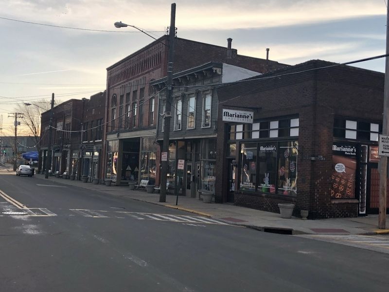
On Bridge Street (Ohio Route 531) east of Hulbert Avenue, on the right when traveling east.
The location of Gregory, Burwell & Company, furniture & undertakers, built in 1912 by Harbor Building & Loan Co.
1912-1952
Harbor Building and Loan Company
1912-1926
Gregory-askew & Company Undertakers
Adams Express . . . — — Map (db m132334) HM
On Bridge Street (Ohio Route 531) west of Hulbert Avenue, on the right when traveling east.
1889-1929
Thomas J. Rennick Meats, also pure Lake Erie ice
1930-1960
Rennick's Meat Market
1961-1962
The Miller-Anderson Company Meat Market — — Map (db m132335) HM
On Bridge Street (Ohio Route 531) west of Hulbert Avenue, on the right when traveling west.
Built in 1910 by M.A. Hanna
1910-1929
Marine National Bank
1931-1952
Marine Savings Bank Co.
Office of the City Treasurer
1953-1962
Farmer's National Bank & Trust
1964-1986
Board of . . . — — Map (db m132345) HM
On Bridge Street (Ohio Route 531) west of Hulbert Avenue, on the right when traveling east.
1898
W.L. Irish, commission merchant
1918
Holland and Condon Prosperity Store
1921-1934
Bernardo Shoe Repair
1951-1961
I and W Supply Company
1964
Electromation Inc.
1969 . . . — — Map (db m132336) HM
On Bridge Street (Ohio Route 531) west of Hulbert Avenue, on the right when traveling west.
1896-1897
Wood & Parks Dry Goods
1898-1907
Henry Carlisle Dry Goods
1912
Gluck Department Store
1921
John Dellerba, pool
1926-1931
John Martin, billiards
Mrs. Antoinette Martin, . . . — — Map (db m132344) HM
On Bridge Street (Ohio Route 531) west of Hulbert Avenue, on the right when traveling west.
The location of Squires Livery & Feed, built c. 1925
1926-1931
City Savings & Loan Company
John E. Glantz, attorney
1937-1945
John E. Salo, barber
1953-1962
Marine Cafe — — Map (db m132340) HM
On Walnut Boulevard east of Hulbert Avenue, in the median.
U.S. Maritime Service
Trained 268,000 Officers and Crewmen for the Wartime Fleet
604 Men and Women taken prisoner
60 Died in Prison Camps
142 Merchant Marine Academy Cadets were lost in action
Dedicated to the men and . . . — — Map (db m132375) WM
On Bridge Street at Morton Street, on the right when traveling west on Bridge Street.
Side A
When the Pittsburgh, Youngstown and Ashtabula Railroad was finished in 1873, Ashtabula's harbor became a direct route to ship iron ore to the booming steel mills of Youngstown and Pittsburgh. On the west side of the Ashtabula River, . . . — — Map (db m121521) HM
On Lake Avenue at West 27th Street, on the right when traveling north on Lake Avenue.
Near this site, an iron truss bridge collapsed into the Ashtabula River during a blizzard, plunging a passenger train with 160 on board into the gulf below. Nearly 100 people were killed in this, one of the worst train disasters in American history. . . . — — Map (db m121524) HM
On Walnut Boulevard east of Hulbert Avenue, on the right when traveling east.
The "Bascule" Lift Brdige, a medieval term for draw bridge, works on the same counterweight system that raised and lowered drawbridges over moats that surrounded fortresses in the 15th and 16th centuries. In 1850, a pontoon bridge had been . . . — — Map (db m132369) HM
On Main Avenue, 0.1 miles north of West 48th Street, on the right when traveling north.
Side A
The Hotel Ashtabula was built in 1920 during an economic boom that lasted most of that decade. Architecturally, it represents a combination of Second Renaissance Revival and Georgian Revival styles. The H.L. Stevens and Company of . . . — — Map (db m121527) HM
On Lakeshore Drive, 0.5 miles Ohio Route 531, on the right when traveling west.
At 440 feet in length, the Lakeshore Park Main Pavilion, now known as the Ashtabula Township Park Lakefront Pavilion, is thought to be the longest and oldest lakefront pavilion in continuous use on the Great Lakes. Built in 1919, the pavilion, with . . . — — Map (db m121509) HM
On Main Avenue north of West 44th Street, on the left when traveling north.
In Memoriam
Lance Corporal Kevin M. Cornelius,
USMC
"...First to fight for right and freedom
And to keep our honor clean
We are proud to claim the . . . — — Map (db m132286) WM
On Coyne Avenue at West 6th Street, on the left when traveling north on Coyne Avenue.
Mother of Sorrows
Church
has been placed on the
National Register
of Historic Places
by the United States
Department of the Interior
— — Map (db m132294) HM
On East Prospect Road (U.S. 20) at State Road, on the right when traveling east on East Prospect Road.
This land was donated to
Ashtabula Township
by
Peleg Sweet
Early settler and
Revolutionary Soldier
It was used as a
training ground for troops — — Map (db m132292) HM
On Walnut Boulevard east of Hulbert Avenue, on the right when traveling east.
Where you are standing on this high bluff, overlooking the entrance to Ashtabula Harbor is referred to as Point Park. For almost two centuries, people have traveled here to observe the business activity of Ashtabula Harbor. This vantage point of the . . . — — Map (db m132374) HM
On Walnut Boulevard east of Hulbert Avenue, on the left when traveling east.
Restoration of the Air Funnel made possible through a donation by Robert (Bob) Halman in Memory of his wife, Sara Halman.
A ship's air funnel is used to send cool air from the ships upper deck to the lower levels of the ship. It can be . . . — — Map (db m132377) HM
On Bridge Street (Ohio Route 531) at Morton Drive, on the right when traveling west on Bridge Street.
More than 400 years ago, the Iroquois and Algonquin Native American tribes settled in the Ashtabula River basin, and named the river "Hash-tah-buh-lah"—"river of many fish."
The Ashtabula River became a shipping hub over the following . . . — — Map (db m132365) HM
Near Walnut Boulevard east of Hulbert Avenue, on the right when traveling east. Reported unreadable.
This Operator Station, "Bucket", and about 1/3 of the "Arm" were saved from one of the Ashtabula Huletts. Acquiring this was the idea of Joseph L. Rose. It was donated by the A & B Dock Company to the Maritime Museum. Only "18 foot" of the original . . . — — Map (db m132366) HM
On Walnut Boulevard at West 1st Street, on the right when traveling west on Walnut Boulevard.
Built in the 1840s by William and Catharine Hubbard and known as "Mother Hubbard's Cupboard" or "The Great Emporium" by fugitive slaves, the Hubbard House was an important terminus on the fabled Underground Railroad in the years before the Civil . . . — — Map (db m121522) HM
On Walnut Boulevard east of Hulbert Avenue, on the left when traveling east.
In the summer of 2006, a "run away buoy" on Lake Erie washed up onto Walnut Beach in Ashtabula not far from our museum. Our Historian Ron McKinley received a call from city employee, Tony Tulino asking, "How would the museum like a . . . — — Map (db m132376) HM
On Main Avenue at West 44th Street, on the left when traveling north on Main Avenue.
This Veterans Memorial
honors
all men and women
of the United States
who served their country
Dedicated to
Those Who Served in
W.W. I
1917 - 1918
Served — 4,734,991 men — 21,480 women
Wounded — . . . — — Map (db m132288) WM
On Edgewood Drive at State Road, on the left when traveling east on Edgewood Drive.
Dedicated to the men & women of Ashtabula Township who serve, have served, or will serve in the Armed Forces of the United States of America — — Map (db m132293) WM
On Center Road (Ohio Route 45) 0.1 miles north of Lampson Road, on the right when traveling south.
Betsey Mix Cowles dedicated her life to fighting slavery and improving the status of women. Her desire for a formal education led her to Oberlin College, where she completed two years of study in 1840. An advocate of immediate abolition, Cowles . . . — — Map (db m121528) HM
On Western Reserve Greenway north of Ohio Route 307, on the right when traveling north.
Ashtabula County and The Western Reserve
Ashtabula County was part of the New Connecticut (or Western) Reserve, which spanned northeastern Ohio. Nearly two thirds of the early settlers in Ashtabula County came from Connecticut. Many took . . . — — Map (db m213959) HM
On Ohio Route 193 south of Grand Army of the Republic Highway (U.S. 6), on the right when traveling south.
To honor those who served in the armed forces of their country
World War 1
Clyde Boyle •
Bruce Burns •
Neil Hatch •
Dan Feffelfinger •
Natean Moschel •
Harold Rice •
Earl Robinson •
Charles Vaughn •
Omer Wolf •
Elmer . . . — — Map (db m202391) WM
On Mill Road west of Welton Road, on the right when traveling west.
Today, much more accurate information is known about the prehistoric occupation of Conneaut Fort thanks to scientific excavations conducted by a team from Case Western Reserve University in 1971. The styles of pottery and projectile points found . . . — — Map (db m213855) HM
On Mill Road west of Welton Road, on the right when traveling west.
The first Euro-American settlers arrived in the Conneaut area in 1798. As they began clearing the of prior Native American occupation of the area. Early settler Aaron Wright reported the existence of a graveyard containing some 2,000-3,000 . . . — — Map (db m213856) HM
On Depot Street at Sandusky Street, on the right when traveling west on Depot Street.
[Top plaque:]
The U.S. Dept.
of the Interior
has placed this
building on the
National Registry
of Historic Places
[Bottom plaque:]
This museum, which is housed in the former New York Central Depot, is dedicated as a . . . — — Map (db m132380) HM
On Buffalo Street at Main Street, on the right when traveling north on Buffalo Street.
This eagle is dedicated to the men and women of Conneaut, Ohio who served in the armed forces who wore the uniform proudly and to those who paid the ultimate sacrifice. Thank you for your service and protecting our way of life. You will not be . . . — — Map (db m213865) WM
On U.S. 20 east of Keyes Street, on the right when traveling east.
The viaduct of splendor that spans our winding stream,
Service untold will render and be the tourists' dream.
In the strength and beauty rising, our safety to insure
The friendship symbolizing, cemented to endure,
with hooks of steel we . . . — — Map (db m132381) HM
Near Depot Street at Sandusky Street, on the left when traveling east.
Hopper car and caboose donated by the Bessemer and Lake Erie Railroad Company to the City of Conneaut, Ohio in memory of those men of this community who contributed so much to the development of our country through the transportation of iron ore . . . — — Map (db m154536) HM
Near Depot Street at Sandusky Street, on the left when traveling east.
Nickel Plate Road Berkshire Locomotive No. 755, built in 1944, donated by the New York, Chicago, and St. Louis Railroad Company to the City of Conneaut, Ohio as a monument to the memory of those men in this community who contributed so much to a . . . — — Map (db m154534) HM
On Monroe Center Road (County Road 40) east of State Road, on the right when traveling east.
Built in 1824 by Caleb Blodgett, formerly: a coach stop, inn, tavern, dance hall, town meeting place, school, underground railroad station & safehouse, millinery shop, general grocery store, restaurant, ice cream parlor, as well as a general . . . — — Map (db m213868) HM
Near Depot Street at Sandusky Street, on the left when traveling east.
When ball is in the drum it meant “Stop”. When ball is raised high it was a signal to “Proceed” — better known as the “Highball”. — — Map (db m154535) HM
Erected in 1881 by a joint commission appointed by the states of Pennsylvania and Ohio to re-survey and re-mark the boundary line as established in 1786. — — Map (db m24070) HM
On Mill Road west of Welton Road, on the right when traveling west.
The prehistory of Ohio is generally divided into four major time periods: The Paleoindian, Archaic, Woodland, and Proto-historic periods. The Archaic and Woodland are each further sub-divided into Early, Middle, and Late time periods.
The . . . — — Map (db m214343) HM
On East Main Road (U.S. 20), on the right when traveling east.
The Western Reserve
Northeast Boundary Marker
of the Connecticut Western Reserve
conveyed to the United States, September 11, 1786
erected by
the Early Settlers Association
of the Western Reserve, Cleveland, Ohio
July 3, 1966
Early Settlers . . . — — Map (db m94754) HM
On Buffalo Street at Main Street, on the right when traveling north on Buffalo Street.
This war memorial is dedicated to all members of the armed forces who served their country honorably in the cause of freedom and liberty for our nation and the entire free world may they rest in peace. — — Map (db m213863) WM
On July 4, 1796, Moses Cleaveland and his survey party landed at the mouth of Conneaut Creek on the southern shore of Lake Erie in what is today Conneaut, Ohio. The Connecticut Land Company, a private land speculation enterprise, had hired General . . . — — Map (db m121508) HM
On State Road South (County Road 25) north of Plymouth Ridge Road, on the right when traveling west.
Volunteers staff most of these museums so the hours of operation vary. Some have admission fees. Please visit their website or call ahead of your visit for more information.
1. AC&J Railroad - Scenic Line
Experience as it once was and . . . — — Map (db m213956) HM
On State Road South (County Road 25) north of Plymouth Ridge Road, on the right when traveling west.
Indian Trails Park - Master Plan
Indian Trails Park Timeline ~1908-2010
November 7, 1908 First land purchased of Main Avenue in the river gulf (beginning of Indian Trails Park)
• Former riverside paths of Indians . . . — — Map (db m213953) HM
On State Road South (County Road 25) 0.3 miles north of Plymouth Ridge Road, on the right when traveling west.
At one time, hundreds of covered bridges dotted the northeast Ohio countryside. A popular construction in 18th century Connecticut, the early settlers of the (Connecticut) Western Reserve brought this charming architecture with them from New . . . — — Map (db m213951) HM
On State Road Street (County Road 25) 0.3 miles north of Plymouth Ridge Road, on the right when traveling west.
Ashtabula County is rich in history from Conneaut Township Park Beach to the Ashtabula Lighthouse and the Harbor's Bascule Lift Bridge. From Geneva-on the-Lake to the County seat of Jefferson, from Pymatuning Lake to the Grand Valley area. . . . — — Map (db m213952) HM
Near Lake Road East (Ohio Route 531) 0.1 miles east of Jolly Drive.
The automobile gave Americans the freedom to travel where and when they wanted, including to vacation spots. That changed the clientele and dynamics of the resort and created opportunity for those with mechanical skills and a knack for peddling . . . — — Map (db m175588) HM
On Harpersfield Road at State Road, on the left when traveling north on Harpersfield Road.
Replacing an earlier bridge that was carried away in a spring flood, the Harpersfield Covered Bridge was built in 1868 and spans the Grand River, a state-designated wild, and scenic river. This bridge, which currently carries County Road #154 . . . — — Map (db m121531) HM
On West Liberty Street west of South Broadway (Ohio Route 534), on the right when traveling east.
Welcome To Geneva, Ohio
The first covered bridges in Kentucky, Ohio and West Virginia were built by private stock corporations and were toll bridges. Geneva has carried this history forward by providing a toll booth at the Nation's Shortest . . . — — Map (db m214246) HM
Near Lake Road East (Ohio Route 531) at Golf Avenue.
Miniature Golf became popular in the United States during the 1920s. GOTL's course is based upon the design used by courses that New York City's millionaires had built on the rooftops of their penthouses when miniature golf was a faddish game for . . . — — Map (db m175590) HM
E.M. "Pop” and Martha Pera renamed their “Pera's Park” amusement-ride business to "Pera's Kiddieland” in 1955. The move reflected the business potential of marketing to the baby-boom generation and the types of rides that the park offered.
Pop . . . — — Map (db m175569) HM
Near Lake Road East (Ohio Route 531) at South Spencer Drive.
the short-lived Pergola Gardens and Green Lantern Restaurant stood at this location in the early 1920s. It was directly across from The New Inn and helped form the nucleus of the "New Lake Road" business district, or "Strip."
Originally . . . — — Map (db m175589) HM
Near Lake Road East (Ohio Route 531) at Golf Avenue.
The Pier Ballroom was built for E.M. "Pop” and Martha Pera in 1927. The grand ballroom was the finest of its kind between Cleveland and Buffalo. A contest was held to name the attraction, and "The Breakers” was chosen. But Martha Pera disliked the . . . — — Map (db m175584) HM
On U.S. 20, 0.1 miles west of North Eagle Street, on the right when traveling west.
Side A
Ransom E. Olds was born on this property on June 3, 1864. Olds co-founded the Olds Motor Vehicle Company, forerunner of the Oldsmobile Division of General Motors in Lansing, Michigan, on August 21, 1897. The curved dash model, built . . . — — Map (db m121529) HM
Near Lake Road East (Ohio Route 531) 0.1 miles west of Jolly Drive.
Hotel Shady Beach was built in 1896 by Warren and Ida Avis Putnam Spencer. Ida was the daughter of George C. and Mary "Polly” Temple Putnam, who owned the Fitch house and Grand View Farm to the west.
Arthur B. Bowers and his wife, Fannie, were . . . — — Map (db m175585) HM
Near Lake Road East (Ohio Route 531) 0.1 miles west of Golf Avenue.
The New Inn was built by Newton Mott and Gary Swan at North Spencer and the new Lake Road at the site of a former fast-food sandwich shop. Perhaps inspired by the success of the stand, Mott and Swan purchased the shop and expanded it into a hotel, . . . — — Map (db m175592) HM
Near Lake Road East (Ohio Route 531) 0.1 miles west of Jolly Drive.
The Popcorn Ball was one of the most novel structures to grace The Strip. Community directories from the 1930s place the snack shop on the south side of Route 531, between Golf and Spencer.
Owner William O'Neil sold popcorn, soda, candy and . . . — — Map (db m175583) HM
On East Jefferson Street at South Chestnut Street (Ohio Route 46/307), on the right when traveling east on East Jefferson Street.
World War II Honor Roll Jefferson Village & Township
Abbott, Tar •
Addicuit, Hey •
Allen, Arthin •
Rodrews, Arthur •
Balley, Umy •
Barchadowicz, Edward •
Barchadowicz, Heart •
Bartle, Harry •
Basar, Joho, A. •
Britles, Glena . . . — — Map (db m202389) WM
On East Jefferson Avenue, 0.1 miles east of Market Street, on the right when traveling east.
This building served as the law office to Joshua Reed Giddings, a Whig congressman who advocated for the abolition of slavery and an end to the domestic slave trade. Born in 1795, much of Giddings' young life was occupied by working on his . . . — — Map (db m232893) HM
On North Chestnut Street (Ohio Route 46) north of West Jefferson Street, on the left when traveling north.
Owen Brown, Son of John Brown, protected by the Black Strings, a secret society of over
1000 armed men, here described the Battle of Harper's Ferry, Va. the night after his father was hung at Charleston.
Owen Brown, Barclay Coppic, Francis . . . — — Map (db m202379) HM
On Ohio Route 193, 0.8 miles south of Interstate 90, on the left when traveling south.
(front)
In this house Albion Tourgée lived many of his formative years. He was born about 30 miles south in Williamsfield in 1838. His family moved here in 1847 and he attended Kingsville Academy, where he met his future wife Emma . . . — — Map (db m213852) HM
On Lake Street (Ohio Route 193) at Creek Road, on the right when traveling north on Lake Street.
Erected by
the citizens of Kingsville
to the memory of
those who served
from this community
and
those who gave their lives
in the service of
our country
— — Map (db m132284) WM
On South Maple Street (Ohio Route 45) at U.S. 322, on the right when traveling north on South Maple Street.
Adna R. Chaffee was born in Orwell on April 14, 1842, and grew up on the family farm. He left home in 1861 to pursue a career in the military, enlisting first in the 6th U.S. Cavalry for service in the Civil War. Distinguishing himself in many . . . — — Map (db m7238) HM
On Ohio Route 45 south of U.S. 6, on the right when traveling north.
In memory of those who served in the War of 1812, Spanish American War, and Civil War
World War I
Daniel Kampf •
William Curtiss •
Willard King •
Malcolm Smith •
Haywood Hostler •
Willard Albright •
Dorven Ernest • . . . — — Map (db m214401) WM
Near South Ridge Road (Ohio Route 84) at County Line Road.
On June 28, 1798
Colonel Alexander Harper
At the head of a party of 25
Landed at the mouth of Cunningham Creek
3 miles North of here
And founded here
The first permanent settlement in Ashtabula Co.
At the time of his arrival
There . . . — — Map (db m163110) HM
On U.S. 322 west of Ohio Route 193, on the right when traveling east.
Original mill stones used in first grist mill in Wayne Township. Weight 3540 pounds. Cut from native stone which proved too soft replaced by French Stone.
Grist mill built by Loomis and Brown on Pymatuning Creek, south of Underwood Rd., in . . . — — Map (db m202393) HM
On U.S. 322 west of Ohio Route 193, on the right when traveling east.
Upon this tablet are inscribed the names of those who left Wayne to serve this country
in the great World War 1914 - 1918
Charles Waldrich •
Paul B. Aldrich •
Earnest L. Burns •
Leroyt Burns •
Charles Hl. Hubbard •
Victor Whart • . . . — — Map (db m202394) WM
On U.S. 322, 0.1 miles west of Ohio Route 193, on the left when traveling west.
Upon this tablet are inscribed the names of those who left Wayne to serve this country in the Great World War 1914 1918. Upon this tablet are inscribed the names of those who left Wayne to serve this country in World War II. Upon this tablet . . . — — Map (db m107660) WM
Prehistoric Earthworks
Indians built a fortification across this neck of land sometime before 1650. A low wall is all that remains today of a stockade where earth had been piled at the base of posts. The stockade and the naturally steep . . . — — Map (db m224955) HM
Mother church of Ohio Episcopal Diocese. Built 1832 by the Solomon Criswold Society. Consecrated October 1 1833 by Bishop McIlvane, Leased to the Ashtabula County Historical Society 1955-75. Restored and museum added under supervision of Dr. John A. . . . — — Map (db m213831) HM
On Clinton Street at Washington Road, on the right when traveling west on Clinton Street.
Albany
The village of Albany was established in 1838 as a market center for the surrounding agricultural area, which saw its first white settlement in the early years of the nineteenth century. Education was always a major concern of Albany's . . . — — Map (db m52872) HM
On State Street (Ohio Route 550) 0.1 miles south of Main Street (Ohio Route 329), on the right when traveling east.
Ohio was an incredibly important state to railroads; one of the nation's first opened in 1839, the Mad River & Lake Erie (a future component of the New York Central), and key cities were located there offering substantial business for the . . . — — Map (db m247090) HM
On State Street (Ohio Route 550) at Franklin Street, on the right when traveling east on State Street.
Over the years he contributed generously for the betterment of the village. His last bequest of land, building and money made the creation of this park possible. — — Map (db m15538) HM
On State Street (Ohio Route 550), on the left when traveling east on State Street.
Pioneers began arriving in Ames Township in 1797, making it one of the earliest settlements in the Northwest Territory. As early as 1804, the village purchased enough books to create a library. It is known today as the Coonskin Library because it . . . — — Map (db m15537) HM
On State Street (Ohio Route 550) at Main Street (Ohio Route 329), on the right when traveling east on State Street.
When Congress established the Northwest Ordinance in 1787, one of the provisions forbid slavery in any new future state admitted to the Union, north of the Ohio River. Later, Congress added to that ordinance, a law that made it a federal crime to . . . — — Map (db m247089) HM
On State Street (Ohio Route 550), on the right when traveling east.
In the years leading to Ohio statehood in 1803, Ames Township citizens decided to establish a stock-owned circulating library. Since cash was scarce during Ohio's frontier era, some citizens paid for their $2.50 shares by the sale of animal pelts, . . . — — Map (db m15540) HM
On North Court Street north of Washington Street, on the right when traveling north.
The Berry Hotel, one of America’s premier hotels, stood here from 1892 to 1974. Athenian Edward Cornelius Berry, a free black who had been educated at the Albany Enterprise Academy, and his modest wife, Martha Jane (Mattie) Berry, built, owned and . . . — — Map (db m122455) HM
On Union Street, on the right when traveling east.
The People of Athens County
erect
this monument
in memory of those who volunteered
as
Soldiers and Sailors
in defense of the Union
and to perpetuate
Free Government.
The People
will ever remember how much of
our national . . . — — Map (db m15558) HM
On Court Street at Washington Street, on the right when traveling south on Court Street.
To honor and commemorate
the Revolutionary Soldiers
buried in Athens County, Ohio
Daniel Anderson •
Thomas Arnold •
Isaac Barker •
Ebenezer Barrows •
Hopson Beebe •
Alvan Bingham •
Silas Bingham, Sr. •
William Bodwell •
John Bowman . . . — — Map (db m15544) HM
On Court Street at Washington Street, on the left when traveling north on Court Street.
Dedicated to the memory of
the Athens County residents
who lost their lives in Vietnam
November 1990
Richard A. Anders … 23
Joseph A. Bodnar … 22
Charles L Boling … 22
John W. Boyer … 27
Ronald L. Calentine … 20
Virgil L. Castle . . . — — Map (db m15546) WM
9437 entries matched your criteria. Entries 301 through 400 are listed above. ⊲ Previous 100 — Next 100 ⊳