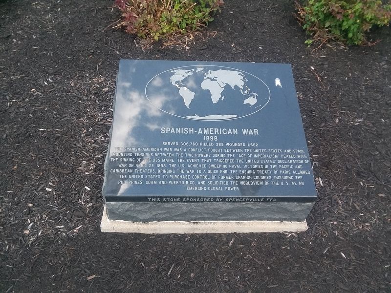
The Spanish-American War was a conflict fought between the United States and Spain.
Mounting tensions between the two powers during the "Age of Imperialism” peaked with
the sinking of the USS Maine, the event that triggered the United . . . — — Map (db m166602) HM
Side 1
U.S. Army
The army was created by the
continental congress in 1775 for the
defense of American liberty. It was
formally established within the
department of war in 1789.
"This we will defend"
Side 2
U.S. . . . — — Map (db m166623) HM WM
In loving memory of all our deceased Clowns from VFW Post 6772 Clown Unit dedicated to all our veterans who have served our great country in the Armed Forces of The United States of America — — Map (db m166586) WM
Do you see the little cemetery to the east, high on the west bank of the Auglaize? It's all that remains of Hartford, thriving town in the 1830's with, it was expected, a bright future, since the new Miami and Erie Canal would one day be serving . . . — — Map (db m236836) HM
After the defeat of french colonial forces at the hand of the Viet Mihn
in 1954, Vietnam was divided into 2 nations:
Communist North Vietnam and
Non-Communist South Vietnam. The United States became involved in Vietnam
because it believed if all . . . — — Map (db m166613) HM
Spencerville was platted in 1844 under the name "Spencer". In 1854, the name was changed to "Acadia", and was incorporated as Spencerville in 1866. The town was located on the banks of the Miami & Erie Canal, and its development as a commercial . . . — — Map (db m196325) HM
Canal boats carried either freight or passengers. The typical canal boat was 14 1/2 feet wide by 85 feet long and carried up to 100 tons of cargo. Each boat typically had a captain, members of his family, animal drivers, steersmen and a bowman. The . . . — — Map (db m196328) HM
Canal specifications called for the canal to be 28' wide at the bottom and 40' wide at the top. The water level was 4' deep and the tow path was 10' wide. A team of mules, donkeys or horses pulled the boat along by means of a 90 foot tow rope. — — Map (db m196329) HM
The War of 1812 was fought between the United States and the British Empire. It was an
indirect result of the Napoleonic Wars in Europe, as well as British support of Native
American hostilities against U. S. expansion. Fought across three . . . — — Map (db m166597) HM
World War I is also called "The Great War". The war was primarily fought
in Europe and the middle east.
The two military opponents were the allies
(Britain, France, Russia and the United States) and the central powers
(Germany, Austria-Hungary, . . . — — Map (db m166606) HM
The United States joined the allies (Britain, France, Russia, China) to fight
the axis powers (Germany, Italy, Japan) after the U.S. military was attacked
by the Japanese at Pearl Harbor in 1941. U.S. military forces saw action in
Asia, The . . . — — Map (db m166607) HM
Uses along the canal have changed dramatically over time. The main use of the canal was the transporting of commerce. However, the canal ran through many towns and places where populations needed recreation and an outlet from everyday life. This . . . — — Map (db m236377) HM
Welcome to the Robert K. Antibus Trail Access
Dr. Robert "Bob" K. Antibus has faithfully served the citizens of Allen County as a commissioner for the Johnny Appleseed Metropolitan Park District since January of 1993. He is the longest . . . — — Map (db m236413) HM
The Buckeye Trail and North Country Trails are located on the towpath of the Miami- Erie Canal, between the old canal and CR-66A, it then passes through Deep Cut Park, a 6,600 foot long, 50 foot deep, cut dug by hand. The Johnny Appleseed . . . — — Map (db m236414) HM
Welcome to Haver Ridge Metro Park
This 61 acre tract of land is dedicated to long time Park Director Kevin Haver. Kevin dedicated forty two (42) years of his life to public service for the citizens of Allen County. He saw the transformation . . . — — Map (db m238509) HM
This bell was hung in the old court house in 1853 and for 75 years served Ashland County truly & well. It's vibrant tones rang out the news of Lee's surrender, tolled the passing of the immortal Lincoln, pealed forth the victory of Admiral Dewey, . . . — — Map (db m25829) HM
To the heroic pioneers who braved the perils of the pathless wilderness to establish homes for their loved ones, and who laid the foundation of our commonwealth so broad and deep in this their new homeland that their descendants might freely enjoy . . . — — Map (db m25832) HM
Founding of Ashland College
The dream of establishing a college was born in the hearts of members of the German Brethren Church. In March 1877, a meeting was held at the Maple Grove Brethren Church to discuss the establishment of a college in . . . — — Map (db m97072) HM
Tensions between Native Americans and Euro-American settlers remained high on the Ohio frontier during the War of 1812. Grievances mounted rapidly following the removal of the Greentown Delawares to Piqua in the late summer of 1812. On September . . . — — Map (db m28800) HM
Erected in 1957 by George and Jessie Jones in loving memory of their son, Earl E. Jones, Ashland College student 1920-21, who died in 1921.
This terrace is dedicated to the pleasurable growth and development of the young people who attend . . . — — Map (db m25836) HM
Revolutionary War
John Tilton
Mexican War
John Campbell
War Of 1812
George Hanger •
Patrick Murray •
Wesley Richards •
Jacob Switzer •
James Kilgore
Civil War
Tobias Spiker •
John Bayer •
Solom . . . — — Map (db m231311) WM
This German cannon captured by American troops on French soil is presented Ashland County by the War Department as concrete evidence of victory November 11, 1918 — — Map (db m203921) HM WM
James Lake is a 4 1/2 acre lake that drains an 85 acre
area west of the village. The water enters James Lake through
3 private lakes.
The lake was a gift to the village from the Don and Mary
Ringler family and is called James Lake in honor . . . — — Map (db m166365) HM
The power for the light was provided from a home on the southwest corner of the lake. In 1958 the home was purchased by Earl and Eleanor Lemmel. The couple assumed responsibility for the electric bill and vowed to maintain it as long as they lived . . . — — Map (db m166366) HM
This building was a center of community life from the time of its construction in 1886 to the late 1930s. Once common, such combinations of governmental offices and commercial and entertainment space are today rare. The second floor opera house . . . — — Map (db m24286) HM
“Remembering a Brother”
18 Nov 47 - 19 Feb 68
CoC 3rd Bn/60th Inf (Riverine)
9th Inf Div. U.S. Army
KIA southeast of Can Tho City
Phong Dinh Province, Republic of Vietnam — — Map (db m25838) WM
A pioneer in automotive innovation. Charles Franklin Kettering (1876-1958) was born three miles north of Loudonville. He attended local schools and graduated from Ohio State University in 1904. He organizaed the Dayton Engineering Laboratories . . . — — Map (db m157069) HM
Clear Fork Gorge was formed when glacial meltwater cut through the sandstone bedrock that forms its steep walls fourteen to twenty-four thousand years ago. The gorge is one thousand feet wide and over three hundred feet deep. Its seclusion has . . . — — Map (db m24285) HM
To commemorate the names of our men
who answered their country's call and
served for liberty and democracy in the
world war ending November 1s, 1918.
★ Floyd Arnholt •
★ Samuel J. Covert •
★ James E. Danner •
★ . . . — — Map (db m166364) WM
George H. Baldner •
Glenn E. Black •
Russell W. Blakely •
William S. Brothers •
Merle Britton •
Paul E. Crow •
Lawrence W. Fockler •
Robert L. Frank •
Harold E. Kauffman •
George J. Minchofer •
Stephen G. Nestich Jr. •
Dennis . . . — — Map (db m166361) WM
Dedicated to those who lost their lives in the terrorist attack on America September 11, 2001 and to all victims of terrorism. May we find peace in the strength of the American spirit. — — Map (db m166358) WM
Construction
Known as the "Workman Cabin,” this log home was built between 1838 and by Morgan Workman.
It originally stood 3 miles
northeast of Loudonville along what was once the old Wooster-Mt.
Vernon Pike & Stage Route which . . . — — Map (db m166359) HM
A New Home In Central Park
In 1963 the cabin–by then unoccupied since 1915 and its logs hidden by lap siding-was given by Mr, and
Mrs. Gene Lifer, on whose land it stood, to the Mohican Historical Society to use as the . . . — — Map (db m166360) HM
In the 1800s, chickens provided eggs and meat, which was a vital source of protein for farm families. Chickens were allowed to roam freely for a most of the day, although they would return to the coop at night, allowing the farmer to protect them . . . — — Map (db m240031) HM
The place of the early mill in the community is worth noticing. They were places of assembly for the scattered inhabitants of the country, where they came not only to get their wheat and corn ground, but also to hear the news, to barter, to . . . — — Map (db m240027) HM
Almost every farm had a corn crib. Corn cribs housed the family's most important crop which fed both humans and livestock. After allowing corn to dry on the stalk, farmers stored it on the cob. The crib provided protection against weather and large . . . — — Map (db m240032) HM
Today the country mill, like the horse and wagon with which it is so closely associated, is a faded page in history. It has been replaced by large commercial mills which have refinements for processing flour economically beyond the reach of the . . . — — Map (db m240025) HM
The little wooden outhouse as we know it has been an architectural fixture of America since the 1700s, when it began to replace chamber pots. In the 1800s, outhouses were built discreetly behind homes, as the old joke goes: "too close in the . . . — — Map (db m240034) HM
Plowing was typically a two-person job. One would guide the plow, while the other would scrape soil build-up that stuck to the plow (every 10 to 15 feet). It wasn't until 1837 when John Deere introduced his self-scouring steel plow, that the . . . — — Map (db m240028) HM
The main purpose of the smokehouse was to preserve meat, so it would last for a longer period of time. Preservation was achieved in this two-step process: 1.) The fresh cuts were packed in tubs of coarse salt for about six weeks, the salt drawing . . . — — Map (db m240035) HM
Sorghum molasses, along with maple syrup and honey were frontier sweeteners of the 1800's. Most communities had a sorghum mill that farmers brought their cane stalks for processing. There the 6-to-12 feet stalks were crushed between rollers powered . . . — — Map (db m240029) HM
Milling in Ohio began in the late 18th century. Mills were used in many industries around the state, such as grist mills used to process grain. Built in 1831, the Wolf Creek (Pine Run) Grist Mill originally stood north of Loudonville at Wolf Creek. . . . — — Map (db m240024) HM
Side A
Mifflin was founded in 1816. Originally known as Petersburg, the name was changed in 1827 in honor of the settlers that moved here from Mifflin Township, Allegheny County, Pennsylvania. The first village jailhouse and crossroad . . . — — Map (db m97113) HM
A migration of Indians throughout Ohio began due to unstable conditions created by the American Revolution. The massacre of Christian Indians at the Moravian mission of Gnadenhutten in 1782 and Colonel William Crawford’s expedition against . . . — — Map (db m168811) HM
John “Appleseed” Chapman (b. September 26, 1774—d. March 18, 1845) was the first lessee of this 160 acre tract (NW ¼, S 20, T 20, R 16), when he secured it for 99 years from the Virginia Military District School Lands on April 10, 1815. This $320 . . . — — Map (db m46337) HM
Anderson, Robert B. 1839-1863, Company C, 1st Ohio Valunteer Infantry, Civil War • Applegate, Aaron H. 1835-1898, Company B, 120th Ohio, Volunteer Infantry, Civil War • Armstrong, James A. 1844-1865, Company B, 65th Ohio Volunteer Infantry, Civil . . . — — Map (db m239994) WM
Front:
To honor our veterans who have served
POLK
Back:
To those who served and returned ...
To those who served and were lost ...
Your contribution and sacrifice for our freedom is not forgotten.
We are eternally . . . — — Map (db m38799) HM
Near this spot in Sept. 1861 James Garfield, who later became 20th President of the Nation, recruited 50 members of Co. C for his regiment, the 42nd Ohio Volunteer Infantry, for Civil War service. — — Map (db m137858) HM WM
In 1895, this fire triangle was purchased for $12.00 from the city of Mansfield. It was used as a fire alarm and to announce village council meetings. It hung in a belfry over the council chambers. In 1933, it was moved to Academy Park. — — Map (db m202316) HM
This bell rang here at Savannah Academy from 1859 thru 1924. It was then moved to the new Savannah-Clear Creek School. In 1970, the bell was taken to Crestview High School. Finally, in 1993, it was returned to its home here in Academy Park. — — Map (db m202314) HM
The original bandstand was constructed in 1907. It stood over the town cistern at the northeast corner of public square. It was later moved to the back of the park. It was torn down in the late 1940's, this replica was reconstructed in 1992-93 by . . . — — Map (db m202313) HM
2nd World War
Korean War
Vietnam War
We dedicate this symbol to the men and women of this community who helped preserve the freedoms of humanity to keep forever living the freedom for which they died.
Let us forever remember and . . . — — Map (db m38953) WM
Pymatuning Wetlands The advancing and retreating mile-high glacial sheet of ice and snow shaped the countryside around this area. As the last of the ice masses melted, a great swamp developed, punctuated by towering white pines, bogs, and . . . — — Map (db m107661) HM
[counter clockwise from the south: five individual stones]U.S. Air Force U.S. Coast Guard U.S. Army U.S. Navy U.S. Marines U.S. Merchant Marine — — Map (db m107658) WM
The location of Shaffner-Knox Drugs, built for Doxsie Dairy Company
1935-1952
Doxsie Dairy Company
1957-1970
Commercial Testing and Engineering Company — — Map (db m132361) HM
Built in 1889 by A.J. Beckwith
1889-1908
A.J. Beckwith Dry Goods
1912-1927
Globe Clothiers
1930
Turner's Drug Store
1934-1940
The Great A & P Tea Company
1941-1945
England . . . — — Map (db m132359) HM
Burrill Block
The location of Edward H. Burrill Meat Market, the Burrill Block was built in 1900
1896-1921
Burrill's Meat Market
1926
Ragnvald Wary Billiards
1941-1953
Corner Restaurant . . . — — Map (db m132362) HM
Built in 1889 by John & Oliver Topky
1889-1950
Topky Brothers Hardware & Ship Chandler
1951-1978
The Topky Hardware Company
1979-1995
Topky-Cook's Hardware Company — — Map (db m132356) HM
The location of Edward H. Burrill Meat Market, the Burrill Block was built in 1900
1900-1908
H. Bieder Company, confectioner, ice cream, cigars, news dealer
1909-1962
Christiansen Confectionery Store
Upstairs . . . — — Map (db m132364) HM
The location of Cooper Butcher Shop, the Kunkle Block was built in 1900
1907-1918
F. J. Kempel Jeweler
1921
Century Club
1926-1931
Marine Sanitary Barber Shop
Wilfred Beauty Parlor
1944-1971 . . . — — Map (db m132295) HM
Built in 1889 by John & Oliver Topky
1895-1897
Mills and Burton Drugs
1898-1914
H.T. & L.T. Carlisle Department Store
1914-1927
George S. Eddy Department Store
1929-1931
John Dellerba, . . . — — Map (db m132355) HM
The location of Cooper Butcher Shop, the Kunkle Block was built in 1900
1907
Sperra Café
1912
Charlie Patchin's Restaurant
1921
Reuben Russack Clothing
1926
Elite Tonsorial Parlor . . . — — Map (db m132321) HM
The location of the Herrick Hotel, built in 1916 for Peter J. Kapsanis
1916-1961
Harbor Sugar Bowl
1967-1971
West Fifth Club Tavern — — Map (db m132322) HM
The location of the Herrick Hotel, the Petros Block was built in 1916
1916-1931
Frank Petros Confectionery
1934-1945
Petros Brothers Men's Furnishings
1946-1972
Paul's Bar & Restaurant
1973-1997 . . . — — Map (db m132323) HM
The location of the Herrick Hotel, the Petros Block was built in 1916
1916-1960
Benjamin's Barber Shop
1977-1980
Harbor Sales Notions Store
1988-1997
Leeward Lounge Expansion
Upstairs
1916-1960 . . . — — Map (db m132324) HM
1895-1912
I.H. Pardee, physician
J. Millard Chamberlain, attorney
Joseph J. Downey, insurance & real estate
Sullivan & Kullane, dressmakers
Mrs. Virginia T. Morell, dressmaker — — Map (db m132351) HM
Ducro Block
Built in 1901 by John Ducro
1901-1912
John Ducro's Son's Furniture, Undertaker & Ambulance Service
1915-1921
Harbor Post Office
1926
Frank Weiss Billiards
United Cigar Store
1931 . . . — — Map (db m132325) HM
1889-1899
Margaret Shanahan, billiards & saloon
Dennis Shanahan, cigars & tobacco
1907-1912
Ed Kennedy Saloon
Kennedy Hotel upstairs
1918
R.J. Wang
1930
Michael Moinar Pool Room . . . — — Map (db m132350) HM
Ducro Block
Built in 1901 by John Ducro
1901-1912
John Ducro's Sons Furniture, Undertaker & Ambulance Service
1915-1935
Max Karpel Clothing
1936-1956
Mollie Karpel Mens Clothing
1957-1965 . . . — — Map (db m132326) HM