On Dolores Street at 19th Street, on the right when traveling south on Dolores Street.
On the early morning of Sunday September 16th.; A.D. 1810, Miguel Hidalgo y Costilla rang the bell of his church in the town of Dolores, in the now state of Guanajuato, calling the people to mass and to bear arms against the . . . — — Map (db m162986) HM
On 136 King Street near Second Street, on the left when traveling north.
At this location, on July 3, 1934, a dramatic clash occured, one that eventually touched the nation. Longshoremen, sailors, teamsters, and other waterfront workers had closed down Pacific coast shipping since May, in what came to be known as "The . . . — — Map (db m21179) HM
On Point Lobos Avenue west of El Camino del Mar/48th Avenue.
The two-masted, 148-ton Parallel left San Francisco for Astoria, Oregon, with a mixed cargo & 42 tons of black powder & dynamite. Capt. W.C. Miller, fought against difficult winds for two days & finally gave up. The abandon-ship order put the 7-man . . . — — Map (db m48586) HM
Nineteen tablets embedded in the sidewalk line each side of Castro Street between Market Street and 19th Street.
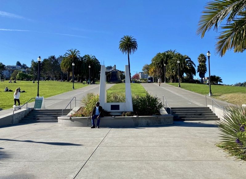
Before 1776 The native Yelamu people live nearby in the village of Hutchuei, relocating each winter to the bayside . . . — — Map (db m99828) HM
On South Manthey Road, on the right when traveling west. Reported missing.
The construction of the San Joaquin River Bridge completed the last link of the Transcontinental Railroad. Building had simultaneously proceeded from the Bay Area and Sacramento and met at the San Joaquin River. The first train crossed the bridge on . . . — — Map (db m11380) HM
On 7th Street at K Street, on the right when traveling south on 7th Street. Reported missing.
David S. Terry, former Chief Justice of the California State Supreme Court and duelist was shot to death by David Neagle on August 14, 1889 in the old railroad restaurant across the street. Neagle had been hired to protect US Supreme Court Justice . . . — — Map (db m197162) HM
The Rev. James W. Brier, Mrs. Juliette Brier, and their three sons, John W. Brier, Christopher Columbus Brier, and Kirk W. Brier, were among the ill-fated Gold Seekers who wandered into Death Valley over Christmas of 1849. Tagging along behind the . . . — — Map (db m220294) HM
In August 1844, the first settlers arrived at Rancho del Campo de los Franceses. One of the company, Thomas Lindsay, built the first dwelling, a tule hut, on this site. He was later murdered by Indians and buried here by travelers. The Point was . . . — — Map (db m15964) HM
On Waterloo Road (State Highway 88), on the right when traveling west.
On Nov. 9, 1861, near here, six local landholders tried to evict John Balkwill, a "squatter" from land claimed by Alymer Drullard. As Balkwill had fortified his cabin, a cannon was "borrowed" at night from Stockton, loaded with with scrap iron and . . . — — Map (db m193550) HM
On East Branch Street (California Route 227) at Crown Hill Street, on the left when traveling east on East Branch Street.
Side A (Facing the sidewalk):
This plaque marks the location of the
Pacific Coast Railway
Right-of-Way
As established on October 12, 1881, in Arroyo Grande, the Pacific Coast Railway ran from Avila to San Luis Obispo and Edna in . . . — — Map (db m66068) HM
During the Manila-Acapulco Galleon Trade Era from 1565 to 1815 Spanish galleons crossed the Pacific between the Philippines and Mexico.
On October 18, 1587, the Manila Galleon Nuestra Senora de Esperanza commanded by Pedro de Unamuno . . . — — Map (db m24732) HM
On October 29, 1960, a chartered aircraft carrying the Cal Poly Mustang Football Team crashed on takeoff at the Toledo, Ohio Airport. Sixteen Mustang football players, the team manager, and a Mustang booster were killed in the crash and twenty-two . . . — — Map (db m38511) HM
The famous duel that ended dueling in California was fought in a ravine east of here, near the shore of Lake Merced, in the early morning of September 13, 1859. The participants were U.S. Senator David C. Broderick and Chief Justice David S. . . . — — Map (db m220018) HM
United States Senator David C. Broderick and California Chief Justice David S. Terry
fought a duel on this ground in the early morning of Tuesday September 13, 1859.
Broderick's firearm discharged prematurely into the ground forcing him to . . . — — Map (db m245993) HM
Fought a duel on this ground in the early morning of Tuesday, September 13, 1859. Senator Broderick received a wound from which he died three days later. The affair marked the end of dueling in California.
Senator Broderick, facing west, . . . — — Map (db m219974) HM
On Crystal Springs Road at Woodbridge Road, on the left when traveling west on Crystal Springs Road.
Near this location on Aug.17, 1905, a masked desperado described as "nine feet high and armed with a small canon" stopped the Half Moon Bay Stagecoach. He angrily demanded driver Ed Campbell to throw down the Wells Fargo Co.'s treasure box, Levy . . . — — Map (db m126865) HM
On Marshall Street, on the right when traveling west.
On the evening of September 11, 1861, a group of concerned citizens met at the San Mateo County Courthouse. Their mission was to organize the Redwood Hose Company for the purpose of providing fire protection to the small settlement of Mezesville and . . . — — Map (db m202493) HM
On Arroyo Court west of Dartmouth Road, on the right when traveling west.
Here on the banks of San Mateo Creek Captain J. B. de Anza camped. March 29,1776, after exploring the peninsula and selecting the sites for the Mission and Presidio of San Francisco. Here also the party of families, soldiers, and priests, on the way . . . — — Map (db m18418) HM
On Anacapa Street at East Anapamu Street, on the right when traveling west on Anacapa Street.
In appreciation
of the choice of
Santa Barbara by
the first ruling
sovereign of Europe
to visit America,
Albert the First,
heroic King of the
Belgians - Queen
Elizabeth and the
Duke of Brabant
October 11-13-1919. — — Map (db m143975) HM
In commemoration of the historic meeting in Santa Barbara of the reigning monarch of the United Kingdom, Her Majesty Queen Elizabeth II, and His Royal Highness the Prince, Philip, Duke of Edinburgh with the President of the United States, Ronald W. . . . — — Map (db m135686) HM
On St. James Street at Julian Street on St. James Street. Reported permanently removed.
This statue of Captain Thomas Fallon was commissioned in 1988. It memorializes the raising of the U.S. flag in San Jose in 1846, when California was still part of Mexico. Scheduled to be installed in 1990, the statue generated an intense . . . — — Map (db m232903) HM
On South Market Street near Paseo de San Antonio Walk, on the left when traveling north.
Directly opposite this tablet was located the first State Capitol Building in which California’s first legislature assembled in December 1849. San Jose was the seat of government from 1849 to 1851. — — Map (db m3615) HM
On South Market Street at Post Street, on the right when traveling south on South Market Street.
On this site stood the Juzgado, or town hall, of the Pueblo de San José. Constructed of adobe in 1798, it housed the jail, the court and the offices of the comisionado and alcalde, and was the pueblo's primary governmental building. When Captain . . . — — Map (db m31152) HM
Near West San Fernando Street west of South 1st Street.
On this corner stood the Garden City Bank Building, where Charles D. Herrold established Station FN, the first radio broadcasting station in the world. As a pioneer in wireless telephony (radio), Herrold established the first station in 1909 to . . . — — Map (db m30327) HM
On Yerba Buena Road at San Felipe Road, on the right when traveling east on Yerba Buena Road.
Three-quarters of a mile northeast is Montgomery Hill, site of the 55 successful flights of the “aeroplane” of John Joseph Montgomery which demonstrated aerodynamic developments still indispensable to modern aircraft. Here the basic principles of . . . — — Map (db m7127) HM
On El Camino Real (California Route 82) at Lincoln Street, on the right when traveling south on El Camino Real.
Here, on January 8, 1847, Francisco Sanchez, leader of a California band surrendered himself and some American prisoners and arms to Lieut. Grayson thus ending the “Battle of Santa Clara” or the “Battle of the Mustard Stalks” of January 2, 1847. . . . — — Map (db m2627) HM
Posted as a sentry on the dark, damp night of November 17-18 1931,
Gordon Hampton, '35, a frosh of only six weeks on the
"Farm," stood under the adjacent oak tree to sound the alarm of any Cal
attempt to torch prematurely the tower of RR ties . . . — — Map (db m143594) HM
On Front Street near 3rd Street, on the right when traveling north.
Santa Cruz County
ca. 1886
Sunshine Villa
J.B. Smith Family Residence
Founders of Venetian Water Festival
Historical Trust Landmark
This building professionally Restored
Circa 1990 by
Michael O’Hearn . . . — — Map (db m212482) HM
Near here in Mountain Charlie Gulch on May 8, 1854, Charles Henry “Mountain Charlie” McKiernan and a friend named Taylor were attacked by a Grizzly Bear. The bear sprang from a thicket, both men fired; but the bear grabbed Mountain . . . — — Map (db m53478) HM
On Main Street (State Highway 152) north of West Lake Avenue, on the right when traveling south.
The Apple Annual was held in downtown Watsonville from 1910 to 1913. For the first event in 1910, William H. Weeks, renowned Watsonville architect, designed a pavilion to house the show exhibits which was located on Second Street, now the site of . . . — — Map (db m54881) HM
Near Main Street (State Highway 152) at East Beach Street.
To fire the first salute
(October 18th, 1850)
on the arrival of the news
in California
proclaiming
its admission to the union.
Remounted for the City of Watsonville, March 22, 1922 by the Watsonville Parlor, No, 65, Native Sons of the . . . — — Map (db m54899) HM
Near Eureka Way (California Route 299), on the right when traveling south.
This gallows is a restoration of the one on which John Baker and Charles Crouch were hanged on August 26, 1974, for the crime of murder. Before being hanged, and with permission of the officials, John Baker sang the following song: . . . — — Map (db m70428) HM
On Mountain House Road, on the right when traveling west.
On July 1st, 1887, an attempt was made to rob the Forest City Stage carrying a shipment of Gold from the Bald Mountain Extension Mine. Tom Davis, driver, Ben Treloar, shotgun, were ordered to halt, but were shot and "wounded" before the stage could . . . — — Map (db m65958) HM
Sierra County Sheriff's GallowsOn November 27, 1885, 20 year-old James O’Neill was hanged from this gallows for the August 7, 1884 murder of Webber Lake dairyman John Woodward. That execution, conducted by Sheriff Samuel C. Stewart, . . . — — Map (db m57828) HM
On Main Street east of Commercial Street (California Highway 49).
In the Fall of 1853 a miner known as “Muntz” knifed and fatally wounded “Baltimore Jack” over a game of cards in Forest City. Muntz was taken to Downieville and held upstairs in the Craycroft Building for want of a jail. The . . . — — Map (db m88345) HM
On Fort Jones Road near Moonlit Oaks Avenue, on the right when traveling south. Reported missing.
Untitled marker
Near this spot at 3:00 a.m. August 3, 1935 Clyde Johnson, native of Alabama, was lynched by a yet unknown group of masked men for the murder of Dunsmuir police chief Frank E. (Jack) Daw after robbing Padula’s bar in . . . — — Map (db m70189) HM
Near Camel Road, 0.1 miles west of Park Road. Reported missing.
These finely crafted sandstone buildings were originally constructed for use as warehouses. They gained their name and fame, however, during a brief period in 1863-64 when they were used to stable a herd of camels imported by the U.S. Army for . . . — — Map (db m155174) HM
On First Street, on the right when traveling south.
William Hamilton, the first Pony Express rider to reach Benicia on the final relay. Carrying the mail from St. Joseph, Missouri to California. Arrived in this city April 23, 1860, at 7 a.m. Thomas J. Bedford, a young Benician, took the mochila by . . . — — Map (db m16325) HM
[Marker mounted on front of base (Photo #1]
The birthplace of Mills College, founded in 1852 as the Young Ladies' Seminary of Benicia. Acquired from Mary Atkins by Cyrus and Susan Mills in 1865. It was moved to its present site in Oakland . . . — — Map (db m16312) HM
[Front of Marker]
Dedicated April 3, 1997
RIO VISTA
by
James Stretesky
The Dutra Group
Barrier Systems, Inc.
Rio Vista Chamber of Commerce
Pony Express Trail Association
Sponsors are listed on bottom of base . . . — — Map (db m18276) HM
On Merchant Street at Main Street, on the right when traveling north on Merchant Street.
[Front of Marker:]
IN SEARCH OF THE PONY EXPRESS
STATION MARKER
Dedicated April 23, 1997
GILLESPIE’S STORE
Added Station
Apr 23, 1860 – Sep 8, 1861
by
Dave & Buff Fleming
American Honda Motor Co., Inc.
Vacaville . . . — — Map (db m16833) HM
On Georgia Street near Sacramento Street, on the right when traveling west.
This clock was built by E. Howard of Boston in 1914. It was originally located in front of Burnett Brothers Jewelry Store on Market Street, San Francisco
The clock became nationally known after the San Francisco Preparedness Day Parade on July . . . — — Map (db m100491) HM
On Steelhead Boulevard near Moscow Road, on the right when traveling east.
On 3 August 1877 the Wells Fargo stage from Fort Ross to Duncans Mills was robbed by Black Bart (aka Charles E. Boles, Bolton, T.Z. Spaulding) using his feared command, “Throw down the box!” It was Black Bart’s fourth stage holdup and . . . — — Map (db m80693) HM
Near Old Winery Road east of Lovall Valley Road, on the left when traveling east.
On June 1st, 1863, two of our Count's sons: Attila and Arpad, married two daughters of the founder of Sonoma: General Mariano Vallejo. Attila married Natalia, and Arpad married Jovita. It was the Double Wedding of the Century, and both were true . . . — — Map (db m231508) HM
The Mission Trail marked the three hundred years of Spanish-Mexican settlement. It travelled as far south as Guatemala and traversed Mexico to advance through eleven of our present day United States. In 1823 Mission San Francisco Solano was founded, . . . — — Map (db m15294) HM
On Arnold Drive (California Route 121), on the right when traveling south. Reported permanently removed.
At this site, on July 4, 1823 Father Altimra set up a Camp Alter and planted the Holy Cross. The troops fired a volley, and the Padre sang in adoration of the cross. A Mass was celebrated in gratitude, and the place was named San Francisco Solano. . . . — — Map (db m15317) HM
The Hook and Ladder Fire Wagon was purchased in New York, by Knights Ferry and shipped around the Horn. Arriving in San Francisco in 1872. On arrival it was “claimed” by a S.F. Fire Company. A delegation from Knights Ferry liberated the . . . — — Map (db m12945) HM
On G Street at 11th Street, on the right when traveling east on G Street.
Graffiti Summer was named after the movie American Graffiti, the much-loved, coming-of-age classic made by Modesto native, George Lucas. Film critic Roger Ebert praised the film for being “not only a great movie, but a brilliant work of . . . — — Map (db m223773) HM
On 11th Street at G Street, on the right when traveling north on 11th Street.
Modesto was a one-high school town for 70 years. Modest high school opened in 1882 and was Modesto’s only high school until 1951. High school life in Modesto was very important. Many of the social activities were school related. The sporting events, . . . — — Map (db m223523) HM
On 15th Street at "I" Street, on the right when traveling south on 15th Street. Reported missing.
October 12, 1995
Betty Saletta, Sculptor
[Second Marker:]
For much of our community’s history, the young person who delivered The Modesto Bee to our homes has been an enduring symbol of initiative and pluck. The Paper Boy . . . — — Map (db m19507) HM
On Deadwood Street at Lewiston Turnpike Road on Deadwood Street.
On June 10, 1894, at 9:30 P.M., Edward William Jose’ was mortally wounded by his new freight driver, Frank G. Eddinger, who had robbed the freight wagon the day before on Browns Mountain. Walter Baker, Mart Van Matre and Jose’ were sitting on the . . . — — Map (db m56228) HM
A reservation was originally established in 1857. Indians from a widespread area were brought here. The natives of this vicinity were the Kuyeti Tribe toward the west and the Yaudanchi Tribe toward the east. Both were branches of the Yokuts Indians . . . — — Map (db m13237) HM
In March of 1860, Joseph R. Walker, leading a party of men across the Southern Sierra to prospect, was in Visalia to get supplies. The editor of the Visalia newspaper interviewed Mr. Walker regarding his route and learned surpisingly that he was not . . . — — Map (db m141822) HM
On East Main Street west of North Church Street, on the left when traveling east.
At this place, near midnight Oct. 8, 1858, Visalians greeted with an anvil salute, the first coach of the pioneer line to arrive from St. Louis. The Visalians' hearty welcome caused the only "through" passenger to remark "They ought to be remembered . . . — — Map (db m34511) HM
On State Highway 49, on the left when traveling south.
Near this site, now inundated by the waters of Don Pedro Reservoir, stood the historic town of Jacksonville. It was settled by Julian Smart who planted the first garden and orchard in the spring of 1849. Named for Colonel A. M. Jackson. In 1850 it . . . — — Map (db m5784) HM
On State Highway 49 at Rawhide Road (County Highway E5), on the right when traveling north on State Highway 49.
While they were crossing the plains with their families, five hundred Mormon men were inducted into the United States Army in July, 1846 to aid in the war against Mexico in California. The Mormon Battalion marched 2,000 miles from Council Bluffs, . . . — — Map (db m6842) HM
This marks the burial site of Columbia’s early Chinese miners and merchants, in keeping with their traditions. The remains have been disinterred and returned to their homeland. — — Map (db m12986) HM
On Sonora Pass Highway (State Highway 49/108) at Bell Mooney Rd, on the right when traveling east on Sonora Pass Highway.
Tuolumne County history begins here. Early in 1848 a party of Philadelphia prospectors under the leadership of James Woods discovered gold 500 feet south east of this marker, where the old road crosses the creek now bearing Woods’ name. James . . . — — Map (db m5782) HM
On Mono Way (Old State Highway 108) at Greenley Road, on the right when traveling east on Mono Way (Old State Highway 108).
Sonora was the goal of many emigrants traveling the various overland and sea routes.
The 1852 Clark-Skidmore Party of emigrants from Elizabethtown, Ohio and Lawrenceburg, Indiana struggled to force a wagon train up the Walker River and over the . . . — — Map (db m7566) HM
On Sonora Pass Highway (State Highway 108) 0.1 miles east of Middlecamp Road, on the right when traveling east.
Toll gate, fine hotel and stables near this spot 1850's. Jedediah Smith reputed to have been first white man to cross over or near Sonora Pass, 1827. Portion of road built by Tuolumne County Water Co., 1852. Surveyed to Bridgeport, Mono County, . . . — — Map (db m6884) HM
On Confidence-Tuolumne City Road (County Route E17) 0.1 miles north of Cherokee Rd., on the right when traveling north.
First placer camp in East Belt section of Mother Lode. Gold discovered here in 1853 by Scott brothers, descendants of Cherokee Indians. Scars of placer “diggings” in every little arroyo in Cherokee Valley healed over by Mother Nature . . . — — Map (db m6819) HM
Founded in the town of Washington (Broderick), Yolo County by Hapgood, Hume, and Company in 1864, California’s first salmon cannery was located on a barge moored here on the banks of the Sacramento River. This small canning operation was the . . . — — Map (db m17520) HM
Hydraulic gold mining was introduced in the 1850’s. Men with hoses blasted hillsides with powerful jets of water, which reduced the hills to mounds of gravel 20 times faster than with pick and shovel. Massive quantities of gravel and silt from . . . — — Map (db m15713) HM
This is the historic site of the first salmon cannery established on the Pacific Coast. Begun in 1864 by William and George Hume and Andrew Hapgood on a barge moored to the bank, the cannery processed salmon harvested along the rivers – with . . . — — Map (db m15724) HM
On Old River Road, on the right when traveling south.
Erected to the memory of Leonidas Taylor. Born in the city of Philadelphia on the 3rd of July 1832. He grew to manhood in the city of St. Louis and was killed by the explosion of the Steamer Belle opposite this spot on the 5th of February . . . — — Map (db m16355) HM
On 1st Street at D Street, on the right when traveling east on 1st Street.
Within these walls, on Jan. 22, 1896, Lord Sholto Douglas, theatrical entrepreneur, and son of the Marquis of Queensbury of Pugilistic fame, was initiated into the mysteries of ECV. Though Douglas went on to riches, subsequent publicity of his . . . — — Map (db m40152) HM
Near Railroad Street at Arapahoe Street, on the right when traveling west. Reported permanently removed.
A continuous chain of rails from Atlantic to Pacific -- long a vision of pioneer railroaders and frontier-tamers -- became reality at 3:00 P.M. on August 15, 1870. At a point 3,812 ft. east of the depot in what now is Strasburg, Colorado. Near . . . — — Map (db m17596) HM
On South Harrison Avenue south of East Simpson Street, on the right when traveling south.
Colorado's immense northern coal field, centered beneath these rolling hills, contributed to the early development and growth of Colorado and to the birth of nearby towns. Miners and mine owners in this area battled over issues of workers' . . . — — Map (db m120145) HM
On East Baseline Road (Colorado Route 7) 0.3 miles east of Mountain View Boulevard, on the right when traveling east.
Front
Colorado's Northern Coal Field: Lest We Forget
Colorado's immense northern coal field, centered beneath these rolling hills, contributed to the early development and growth of Colorado and to the birth of nearby towns. . . . — — Map (db m119521) HM
On Main Street (U.S. 50) north of 4th Street, on the right when traveling north.
Here stood the Farmers and Merchants Bank of which Andrew Trew Blachly was co-founder and cashier. Across Main Street was the Simpson Hardware Store. On September 7, 1893 the bank was held up by the notorious McCarty Gang. Blachly although covered . . . — — Map (db m159552) HM
Denver's Union Station was constructed to consolidate rail activity in the City and to replace the four separate stations serving the boom town. When completed in 1890 in an Italianate style of Colorado Rhyolite with sandstone trim, the station . . . — — Map (db m237358) HM
This masonry labor for this memorial is donated by Stephan Dach in loving memory of his father Alfred who perished in the early years of World War II in a Nazi Concentration Camp. May this be a reminder of him and all those others who have perished . . . — — Map (db m46101) HM
On Blake Street, on the right when traveling south.
The First National Bank of Denver made its first home here in 1866, with a building constructed for a cost of $45,000. The bank stayed at this location for 10 years, enlarging rooms, installing fancy gas lights, and in 1875, adding a third floor . . . — — Map (db m27508) HM
General Orders, No. 11, Headquarters Grand Army of the Republic, Washington D.C. May 5, 1868.
I. The 30th day of May, 1869, is designated for the purpose of strewing with flowers or otherwise decorating the graves of comrades who died in defense of . . . — — Map (db m46107) HM
Near 17th Street at Larimer Street, on the left when traveling south.
“Your ruffle shirts, standing collars and all kinds of fine clothing had better be left in your wardrobe at home. Discard all cotton or linen clothing; adapt yourself at once to woolen and leather; provide yourself with woolen underclothes. . . . — — Map (db m135351) HM
The controversy surrounding this Civil War Monument has become a symbol of Coloradans' struggle to understand and take responsibility for our past. On November 29, 1864, Colorado's First and Third Cavalry, commanded by Colonel John Chivington, . . . — — Map (db m6755) HM
Near 17th Street at Glenarm Place, on the left when traveling south. Reported missing.
On December 10, 1975, 17th Street celebrated its 25th year as a concrete street. Anniversary invitations were engraved in old English and former Governor John Love led the champagne toast.
In 1950, amid great City Council debate, 17th Street . . . — — Map (db m135544) HM
Near 17th Street south of Welton Street, on the right when traveling south.
November 18, 1997
While waiting for a bus on 17th Street, Oumar Dia was shot and killed because of the color of his skin. Jeannie Van Velkinburgh who came to his assistance was shot and paralyzed.
In response to the murder, thousands of . . . — — Map (db m135508) HM
Near 17th Street at California Street, on the left when traveling south.
Seventeenth Street is home to
many of Denver’s parades.
Annual parades include:
St. Patrick’s Day Parade
Memorial Day Parade
Veteran’s Day Parade
Parade of Lights
National Western Stock Show Parade
Special . . . — — Map (db m135525) HM
Near 17th Street at Curtis Street, on the left when traveling south.
Until 1911, Denver was the largest city in the nation where women could vote. Western states, including Colorado, were among the first to give women the right to vote.
In 1920, the 19th Amendment to the U.S. Constitution guaranteed full . . . — — Map (db m135444) HM
Erected by Pioneer Women of Colorado 1939 A.D. in memory of pioneers massacred by Indians. 1864 A.D. Hungate, Nathan W. and Ellen and Children Laura V., Florence V. 1868 A.D. Dietemann, Henrietta and son John, Louis Alma, Joseph Bledsoe — — Map (db m45748) HM
On Washington Avenue Bridge, on the right when traveling north.
During the Gold Rush, Rebecca Judkins and her sons William and Charles built a home near the northeast corner of 11th and Jackson Streets, just a block east of here. Bill Judkins was outside the day of June 6, 1869 when he saw something happen at . . . — — Map (db m49934) HM
On Washington Avenue Bridge, on the right when traveling north.
The earliest bicycles that were popular in Golden were called velocipedes. One daredevil rider, son of Judge Boyd, who was to become a pioneer farmer east of Golden, made the following news in the Colorado Transcript on May 19, 1869 for his stunt . . . — — Map (db m49933) HM
Near Washington Avenue, on the right when traveling south.
Seven members of the Boston Mechanics’ Mining & Trading Company, namely George West (President), Walter Pollard, James MacDonald (Business manager), Mark Leonardo Blunt (later Postmaster), James McIntyre, Lawrence Panton, and Joseph T. Bird arrived . . . — — Map (db m50180) HM
For many years, Golden’s people have respected the flood waters of Clear Creek above ground. However, it was the flood below ground that claimed the most lives. On September 9, 1889, water broke into the White Ash Mine beneath Clear Creek at the . . . — — Map (db m49900) HM
On April 20, 1999, in a senseless act of violence, twelve students and one teacher were killed, and many others injured at Columbine High School. It was a tragic event that shook the Columbine and metro Denver communities, horrified and saddened the . . . — — Map (db m46053) HM
Near State Highway 91, 11 miles south of Interstate 70, on the right when traveling south.
One of the most significant technological advances in Climax Mine history was the implementation of block-cave mining in 1927. It cut the production cost of molybdenum in half, keeping the mine open (and profitable) through the grim years of the . . . — — Map (db m122838) HM
A day of festivity was followed by one of the darkest in American Labor history.
The state militia was on guard
Because tensions between the strikers and the company had been steadily escalating, the state militia was stationed on . . . — — Map (db m100513) HM
On West Main Street (U.S. 160) at North Beech Street, on the right when traveling west on West Main Street.
In the late 1860s, directly across the street stood the Colorado Hotel, a two-
story adobe building fronted by a wooden arcade. It was the station for the Denver Santa Fe Stage Line and, for several days, the refuge of some 60 Anglo town residents . . . — — Map (db m100505) HM
On East Main Street (U.S. 160) at South Walnut Street on East Main Street.
During the miners' strike that began in September 1913, when the United Mine Workers of America was trying to unionize the coal mines of Colorado, their most effective public speaker, organizer and morale-booster was nationally famous Mary Harris . . . — — Map (db m100500) HM
On State Highway 145, on the right when traveling east.
Newspapers in 1889 reported this robbery to be the most brazen and daring bank robbery in the history of Colorado. It was the first robbery by two legends of the wild west. Matt Warner ( Willard Erastus Christiansen) would later pay his debt to . . . — — Map (db m119408) HM
On Victor Avenue at North 3rd Street on Victor Avenue.
Up In Flames
Victor was founded in 1893 at the foot of Battle Mountain – a stone’s throw from where the richest gold mines in the Gold Camp were eventually located. Underground mining was very labor intensive so, like many gold rush . . . — — Map (db m46798) HM
Thrill-seekers, fund-raisers, and publicity hounds have been attracted to Pikes Peak for decades. Daring adventurers have hang-glided and skied off the summit, and rock climbers have challenged steep rock faces. Here is the scoop on some of the . . . — — Map (db m45842) HM
Near Noble Avenue north of Crown Street, on the left when traveling north.
Our Big Cow was originally displayed at the Danbury Fair, one of the largest agriculture fairs in the country for many years.
Thank you to our Big Cow sponsor, Wade's Dairy.
The Big Cow has also become a Time Capsule to be opened in . . . — — Map (db m230931) HM
2918 entries matched your criteria. Entries 301 through 400 are listed above. ⊲ Previous 100 — Next 100 ⊳