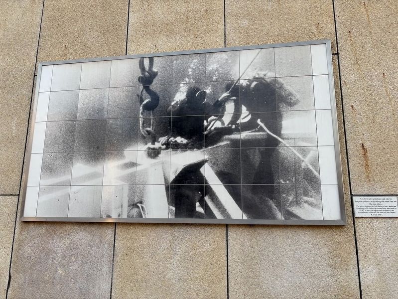
Underwater photograph shows deep-sea divers adjusting the tow line on the sea plow.
The plow, designed by Bell Labs to bury undersea telephone cable below the ocean floor, was used by AT&T to bury the shore-end sections of two transatlantic . . . — — Map (db m266350) HM
A cable repairman adjusts the Bell Solar Battery, a device used to pick up prevailing light, which was being used in experiments to develop more and better rural telephone service. The solar battery is an invention of Bell Labs. 1955 — — Map (db m266347) HM
Mounting Bell Laboratories 170 pound Telstar I Satellite to a Thor-Delta rocket for its journey into orbit in 1962. A great many Bell Laboratories achievements, including the transistor and the solar battery, made satellite communications possible. — — Map (db m266349) HM
The first air-to-ground and ground-to-air radio communications were accomplished by AT&T engineers at Langley Field. AT&T employees watch an early aircraft-radio test. July, 1917. — — Map (db m266312) HM
AT&T Bell Telephone Laboratories scientists John Bardeen, Walter Brattain, and William Shockley invented the transistor, the first solid state amplifier or switch. The three shared the Nobel Prize in Physics in 1956 for the achievement. — — Map (db m266342) HM
Charlotta Bass was an educator, newspaper publisher-editor, and activist. She also
focused on various other issues such as housing rights, voting rights, and labor rights, as
well as police brutality and harassment. In 1952, Bass became the first . . . — — Map (db m171824) HM
As a teacher, writer, editor, and activist, Idár preserved Mexican culture in South Texas
and encouraged women to pursue an education and push for equal rights. While
working as a journalist, she became the president of the newly-established . . . — — Map (db m171579) HM
The original flagpole was constructed from a single Oregon pine tree reaching a height of 113 feet. When first erected in the 1860's during a patriotic “Flag War” with the Central Pacific Railroad, it was considered to be the tallest . . . — — Map (db m136275) HM
At this location on January 8, 1863, Governor Stanford surrounded by politicians and locals, announced the start of the United States’ first transcontinental railroad. You are standing at Mile Marker 0, the origin of the Central Pacific Railroad . . . — — Map (db m149177) HM
This statue commemorates the glory of The Pony Express, which started here at 2:45 a.m. on April 4, 1860, when Sam Hamilton galloped into a blinding rainstorm on the first lap of the 1,966-mile trip to St. Joseph, Missouri. During its 18-month . . . — — Map (db m11326) HM
Delta Transmission Towers
The Delta area is home to four separate transmission towers which provide reception for television and radio stations serving the residents of Northern California. Three of the towers rival some of the tallest . . . — — Map (db m37390) HM
Wyatt Earp was born in Illinois March 19, 1848. In 1864 he came west with his family, settling near San Bernardino. He later served as lawman in Wichita and Dodge City, then came to Tombstone in 1879. After the gunfight at the O.K. Corral in 1881, . . . — — Map (db m78569) HM
The Integratron is the creation of George Van Tassel, and is based on the design of Moses' Tabernacle, the writings of Nikola Tesla, and telepathic directions from extraterrestrials. The domed structure 35 feet high and 55 feet in diameter, was . . . — — Map (db m78533) HM
Designed by renowned architect Paul Revere Williams, this former post office building was crafted in the Italian Renaissance Revival style with Spanish Colonial and Mission Revival style influences. The subtle details that await discovery include . . . — — Map (db m288150) HM
The Downtown Post Office was designed in a modern Spanish Revival architectural style by Los Angeles architect, Louis A. Simon, and constructed with funds from the Works Progress Administration (WPA). There are two vividly-colored murals in the . . . — — Map (db m288194) HM
After barnstorming across the United States from his native Wisconsin in 1914 and serving his country in World War I, the urge to homestead brought Bill Underhill to 29 Palms in 1928. He helped build roads and the first swimming pool, and was active . . . — — Map (db m165757) HM
Man of Vision
Land, Water and Power
Father of
The Model Colony
Sponsored by
Upland Sister Cities Association.
Upland's Sister City
Mildura, Australia,
was founded by
George and W.B. Chaffey.
John Edward Svenson, FNSS . . . — — Map (db m168) HM
Founder of Knox's Corners,
later the City of El Cajon
Owner of community's first business, the Knox Hotel on the southwest corner of Main and Magnolia; first Postmaster, County roadmaster; charter member of California's International Order of . . . — — Map (db m54383) HM
This building has also served as newspaper office, a bank, telephone company, a lodge, Farmers Institute and a meat market.
Purchased by the Weinstock family and served as an appliance and radio store
1932
Purchased & restored by . . . — — Map (db m54384) HM
A reconstruction (1934) of Vallecito Stage Station built in 1852 at the edge of the Great Colorado Desert. It was an important stop on the first official transcontinental route, serving the San Diego-San Antonio ('Jackass') mail line (1857-1859), . . . — — Map (db m51579) HM
Occupied in 1858 by Warren Hall, Divison Superintendent, Butterfield Overland Mail which operated between San Francisco and the eastern termini, St. Louis and Memphis, from September 15, 1858 to March 2, 1861. The first mail stage from the east . . . — — Map (db m51093) HM
This bronze statue of the first Emperor was created and cast in China by the famous sculptors Guo Xuanchang 郭宣昌 and Cheng Yunxian 程云贤 . The first Emperor unified China and standardized the written language, . . . — — Map (db m204226)
Established Aug. 1, 1890, Ballast Point Light Station was a fine example of “railroad Gothic” and lasted until 1866, when it was replaced by a light on top of a slender steel tower, and new quarters were built for the Coast Guard personnel who . . . — — Map (db m238819) HM
A few steps down this trail you will discover a small
structure that was part of a vast coastal defense system
embedded into Point Loma
Built by the United States Army in 1918, the radio
station helped to defend . . . — — Map (db m295510) HM
No lighthouse kept vigil over the harbor four centuries ago when Cabrillo sailed into the bay. There were no channel buoys, fog horns, or local charts to guide mariners safely to anchor. Today, however, the Coast Guard and Port of San Diego . . . — — Map (db m296420) HM
This lighthouse, built in 1854, was one of the first eight lighthouses on the Pacific Coast. It continued in use until 1891, when the new Pelican Point Lighthouse began operating. The Point Loma Lighthouse became the site of the Cabrillo National . . . — — Map (db m296421) HM
San Diego's first lighthouse guided ships along the coast and marked the entrance to the harbor for over 30 years. A captain reported seeing the light from as far as 39 miles (63km). For many years it was the highest coastal light in the country — . . . — — Map (db m296423) HM
Since ancient times, lighthouses have been integral to the development of maritime commerce around the globe. With each voyage, mariners staked their cargoes and, indeed, their very lives on these lights. The story of lighthouses in the United . . . — — Map (db m310924) HM
On 7 November 1989, Qualcomm publicly demonstrated a digital cellular
radio system based on Code Division Multiple Access (CDMA) spread spectrum
technology, which increased capacity, improved service quality, and extended
battery life. This . . . — — Map (db m193674) HM
Samuel Morse and his partner Alfred Vail tested the first forty-mile telegraph line, between Washington and Baltimore, on May 24 1844. In most accounts, a young woman provided the first message they sent:
[ Upper Plaque: ]
In 1958, here at 9416 Mission Gorge Road, then owner Lee Bartell built the KCBQ AM 1170 radio broadcast facility with its 50,000 watt transmitter and six two-hundred foot towers. For many years, KCBQ AM 1170 was San . . . — — Map (db m35120) HM
In 1844, Gov. Manuel Micheltorena granted 44,322 acres to Juan Jose Warner who built this house. Gen. Kearny passed here in 1846; Mormon Battalion in 1847. First Butterfield Stage stopped at this ranch on Oct. 6, 1858 enroute from Tipton, Mo. to San . . . — — Map (db m51084) HM
The Alcatraz water tower is one of the most visible landmarks in San Francisco Bay. As such, it was an ideal place for American Indians who occupied the island to broadcast their message of "peace and freedom" to the world. Standing on each . . . — — Map (db m133766) HM
The first Pony Express rider to reach San Francisco on the final relay carrying mail from St. Joseph, Missouri to California, arrived in this city Apr. 14, 1860 aboard the River Str. ‘Antelope’. Led by a band and several engine companies, a . . . — — Map (db m268110) HM
This was the site of the western business headquarters of Russell, Majors, and Waddell -- founders, owners, and operators of the Pony Express, 1860-1861. The firm's main office was in Leavenworth, Kansas. W.W. Finney was the western representative . . . — — Map (db m33775) HM
Golden Gate National Recreation Area
Deep channels make San Francisco’s protected harbor accessible to immense ships. On the other hand, swift currents, high winds, rocks and fog make navigating the narrow Golden Gate treacherous. Early mariners . . . — — Map (db m211172) HM
Deep channels make San Francisco’s remarkable harbor accessible to immense ships. On the other hand, a narrow entrance, swift currents, high winds, rocks, and fog make navigating the Golden Gate treacherous. Early mariners looked for on-shore . . . — — Map (db m48641) HM
[There are two markers mounted on opposite sides of the flagpole base in the Marina Green]
This plaque marks the site of the
Marina Air Field
The first terminus of the
United States Post Office Dept. . . . — — Map (db m70028) HM
Herb Caen published his first column in the San Francisco Chronicle July 5, 1938; he won the Pulitzer Prize in 1996. His last weekday column appeared January 10, 1997. When he moved to the San Francisco Examiner in 1950, 30,000 . . . — — Map (db m73492) HM
Nearby was the location of the Broadway Wharf. The wharf extended from Broadway and Davis Streets east to this location. All of the Pony Express mail that was delivered to and from San Francisco used this wharf. The Pony Express ran from April 3, . . . — — Map (db m63717) HM
This marker consists of six plaques arranged in a 2 X 3 pattern. The top left plaque is the title plaque and may contain some text. The top right plaque displayed an arrow which points in the direction of the named street. Other plaques contain . . . — — Map (db m72551) HM
In a simple laboratory on this site, 202 Green Street, Philo Taylor Farnsworth, U.S. pioneer in electronics,invented and patented the first operational all-electronic "television system" on September 7, 1927. The 21 year-old inventor and several . . . — — Map (db m20900) HM
During Gold Rush days a look-out stationed in a structure on this spot observed and signalled (sic) the arrival of incoming vessels. By adjusting movable arms high on a tall pole and by hoisting national colors, he identified the nature of the ship . . . — — Map (db m143441) HM
British cryptanalyst, logician, philosopher and mathematician widely recognized as a pioneer of artificial intelligence and the father of computer science
Alan Turing — — Map (db m98105) HM
Pioneer in gay journalism, co-founder
and longtime publisher of the Bay
Area Reporter, president of the
Tavern Guild and Meals on Wheels,
Emperor VII of the Imperial Court — — Map (db m308839) HM
Jane Warner spent two decades keeping the peace in the city's Castro, Noe Valley and Mission neighborhoods as a San Francisco Patrol Special Police Officer. To her many friends, she was simply known as "Officer Jane".
She was dedicated not only . . . — — Map (db m64229) HM
Influential author and journalist, the first openly gay reporter to cover LGBT issues for American mainstream media
Randy Shilts — — Map (db m98161) HM
On November 8, 1997, this Rainbow Flag was installed to commemorate the 20th anniversary of the election of Harvey Milk to the Board of Supervisors of voters of District 5. This victory by an openly gay man was a watershed for the Queer rights . . . — — Map (db m21083) HM
This historic building originally served as the headquarters of the Home Telephone Company, San Francisco’s first telephone exchange site.
Built
1908
Original Architect
Coxhead and Coxhead . . . — — Map (db m71944) HM
Founder of Hearst Newspapers began his newspaper publishing career with the San Francisco Examiner on March 4, 1887. Announcing: “The Examiner with this issue, has become the exclusive property of William R. Hearst, the son of its former . . . — — Map (db m71869) HM
With a strategic location in the center of the San Francisco Bay opposite the Golden Gate, Yerba Buena Island has been home to three branches of the U.S. Military – the Army, Navy and Coast Guard.
From 1867 to 1897 the Army used the island . . . — — Map (db m218468) HM
One of the last living Pony Express riders. His route of 104 miles ran from Cottonwood Springs to Box Elder near Fort Kearny in the Nebraska Territory. In 1883 he moved to Escalon where he became a community leader. — — Map (db m220288) HM
Pioneer Hill
It was on this hill that Dr. Dean Jewett Locke and his brother Elmer H. Locke built the first cabin of this section in 1851. Disturbed by grizzly bears, they spent their first nights in the oak trees. Dr. Locke, physician for the . . . — — Map (db m143490) HM
Gertie Deforce Cluff and her sister, Laure Deforce Gordon carved out careers originally followed exclusively by men. Gertie Became the publisher of the first newspaper in Lodi, "The Valley Review" and Laura, the first woman attorney in California . . . — — Map (db m243802) HM
The first newspaper in Lodi, "The Valley Review," debuted on July 20th, 1878. It was located on the west side of Sacramento St. between Pine and Elm. By 1883 it claimed the largest circulation of any weekly in San Joaquin Co. Its publisher, Gertie . . . — — Map (db m241692) HM
Built in 1890 as part of the original light station, this building combined the lighthouse (tower structure) and the residence/office of the head keeper and his family. — — Map (db m70052) HM
This first order fresnel lens was manufactured in 1850 in France by Henry LaPaute. The clock mechanism was built in 1872 and the lens you see here was installed atop the lighthouse at Piedras Blancas in 1874.
In 1949 the lens was removed . . . — — Map (db m68626) HM
On this site, the storied original Andrews Hotel stood. The grand opening of that remarkable structure was celebrated July 3, 1885. Nine and one half months later, on Palm Sunday, April 18, 1886 it burned to the ground. On the ashes, the present . . . — — Map (db m16502) HM
Architect
Resing & Mc Ginnes
Contractor H.H. Smith
**
Incorporated as Lawndale
In Aug. 1924. The Town’s name
was changed to Colma in Nov. 1941
Originally the Town Hall
served as a traffic court,
post office, health dept. and . . . — — Map (db m18401) HM
The decade of the 1870’s saw an influx of European immigrants into the Half Moon Bay area and over to the coast. Irish, German, Italian, and Portuguese made up the majority of the newcomers whose numbers included merchants, business people, dairy . . . — — Map (db m13747) HM
This brick lighthouse was built to incorporate a French first order Fresnel lens. Although no longer used, the lens is still operable in the lantern room. Previously the lens had been installed at Cape Hatteras, North Carolina. It first flashed over . . . — — Map (db m2541) HM
Portola Primary School was built in 1909. The bell was moved in 1893 from the abandoned Searsville School. The building served as the First town hall when the town of Portola Valley was incorporated in 1964. It was acquired by the town in 1976. . . . — — Map (db m25052) HM
Erected 1888
Deeded as use as a railroad depot
by John W. Brittan
Site of the first San Carlos Telegraph
Post Office and Library
An Historical Site
Dedicated 1976 — — Map (db m41451) HM
The South San Francisco Enterprise Journal covered
local news for more than a century. Starting in 1895, the
South City Printing Company began publishing the
Enterprise, a free local newspaper. In 1927, the
Enterprise was bought by the South . . . — — Map (db m176737) HM
The first Post Office in South San Francisco opened
on April 11, 1892, on the southwest corner of Miller
Avenue and San Bruno Road (now Airport
Boulevard). In 1892, it moved to the corner of
Grand and Linden Avenues. The current building . . . — — Map (db m176738) HM
On this site September 28, 1905 representatives of the Masonic Grand Lodge of California convened to place the cornerstone of the first Masonic temple in Santa Barbara County.
Among those famous representatives present were Edward H. Hart, acting . . . — — Map (db m162353) HM
Gilroy’s strategic location contributed to great economic growth beginning in the 1850s.
Inset Images:
In 1870 James Culp was a tobacco grower and owned a cigar factory. Over one million cigars were rolled and shipped monthly all . . . — — Map (db m219074) HM
Original site of Gilroy’s First Post Office
Later rebuilt for Wentz Pharmacy by William Radtke in 1928
Placed by: Gilroy Downtown Development Corporation and the Gilroy Historical Society — — Map (db m230450) HM
“Legacy of Gilroy” Commemorating the Historic Transportation District
Traveling north by foot, horse or cart along the El Camino Real was several days journey from the southern Santa Clara valley to the nearest town. Recognizing an . . . — — Map (db m230447) HM
A toll road was built over Pacheco Pass in 1857 by Andrew D. Firebaugh. Later in that same year he built a tavern near this site, which became a Butterfield transcontinental stage stop. In 1859 the Pacific and Atlantic Company built a telegraph line . . . — — Map (db m54036) HM
In 1899 this fire bell was cast in bronze in San Francisco by W.T. Garrett Company and weighs 2500 pounds. It was originally installed atop a 60 foot wooden tower which ironically burned down in the Great Fire of 1901. It was then reinstalled . . . — — Map (db m196042) HM
Retired Morgan Hill teacher Belle McCormick celebrated her 100th birthday on May 2, 2006. She brought the bell with her from Montana when she moved to Morgan Hill with her husband and daughters. It held a place of honor in front of her home from . . . — — Map (db m213055) HM
Commonly termed the "Mother of All Demos,” Douglas Engelbart and his team
demonstrated their oNLine System (NLS) at Brooks Hall in San Francisco on 9
December 1968. Connected via microwave link to the host computer and other
remote users at SRI . . . — — Map (db m182615) HM
From 1907 to 1925 this bell was used to summon the volunteer firemen of the town of Mayfield. First used at College Avenue and El Camino Real. The bell was transferred to the town hall at El Camino Real and California Avenue in 1921. When Mayfield . . . — — Map (db m91031) HM
This garage is the birthplace of the world’s first high-technology region, “Silicon Valley.” The idea for such a region originated with Dr. Frederick Terman, a Stanford university professor who encouraged his students to start up their . . . — — Map (db m3402) HM
Original site of the laboratory and factory of Federal Telegraph Company, founded in 1909 by Cyril F. Elwell. Here, with two assistants, Dr. Lee de Forest, inventor of the three-element radio vacuum tube, devised in 1911-13 the first vacuum tube . . . — — Map (db m2604) HM
In March 1863 the Supreme Court adjudged that the original Castillero claim to the New Almaden Mine was fraudulent and invalid. President Abraham Lincoln, acting on this judgment, sent a writ to U.S. Marshall C.W. Rand in San Francisco.
“I, . . . — — Map (db m12916) HM
On this site in 1909, Charles "Doc” Herrold aired the first
regularly scheduled radio programs, giving birth to
broadcasting. Initially identified as "This is San Jose calling,"
the station was later licensed as KQW before it became
KCBS. . . . — — Map (db m155118) HM
Charles Herrold, a pioneer in radio, was the first person to transmit radio programs of music and news to a listening audience. Beginning in 1909, three years before Congress’ Radio Act of 1912, Herrold broadcast from his College of Engineering and . . . — — Map (db m30335) HM
The San Jose Mercury News was first published, on this site, on June 20, 1851. Known as the San Jose Weekly Visitor, it was the city’s fist permanent newspaper. The paper changed owners and mastheads several times before becoming the San Jose Weekly . . . — — Map (db m52657) HM
On this corner stood the Garden City Bank Building, where Charles D. Herrold established Station FN, the first radio broadcasting station in the world. As a pioneer in wireless telephony (radio), Herrold established the first station in 1909 to . . . — — Map (db m30327) HM
On this site in 1909, Charles D. Herrold founded a voice radio station which opened the door to electronic mass communication. He conceived the idea of broadcasting to the public, and his station, the world’s first, has now served Northern . . . — — Map (db m193571) HM
Now a relic from the days when Monterey road served as cattle trail; stage route, and Mission road between San Francisco, Santa Clara, and Monterey, Coyote Post Office was once the oldest surviving and functioning post office in Santa Clara County . . . — — Map (db m42293) HM
This building, originally a residence, was built in 1884 in downtown San Jose at 91 North San Pedro Street near the corner of St. John Street. The neighborhood was an Italian American commercial district for one hundred years and the center of the . . . — — Map (db m52161) HM
Originally a residence, this building was constructed in the early 1880s and stood at 91 N. San Pedro Street near the corner of St. John Street. The popular Italianate style of architecture is seen in the top brackets and the decorative quoins at . . . — — Map (db m52160) HM
Named after Frank Gubser, a German immigrant and barber, Gubserville was an important stage, mail and teamster stop on the road between San Jose and Saratoga. Gubser served as the village's first and only postmaster, beginning July 5, 1882. . . . — — Map (db m2398) HM
History
The machine that you see inside is a fully functional weight-driven tower clock, commissioned by Jane Stanford in 1899 and built by the Seth Thomas Clock Company in 1901. It was originally housed in the dome above Memorial Church, . . . — — Map (db m232000) HM
These two artifacts were part of Sunnyvale's first City Hall, a
Spanish-style building located at the corner of South
Murphy Avenue and McKinley Avenue. Constructed in 1929,
the building was demolished in 1969. This City Hall Bell was
made by . . . — — Map (db m163130) HM