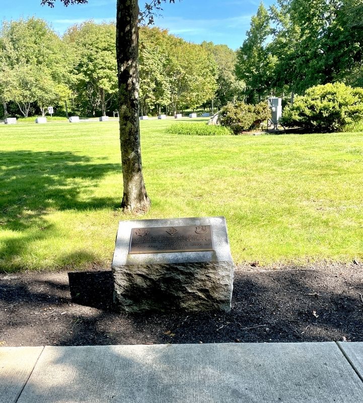
Near Memorial Circle at Bennington Boulevard, on the right when traveling east.
Dedicated in memory of all the officers and enlisted men of the 102nd Field Artillery who served in WWI and WWII
Erected by
Second Corps Cadets Veteran Assoc., Inc.
Organized 1785 — — Map (db m184215) WM
Dedicated to those who served and to
the Bravest of Men who made the
Supreme Sacrifice to preserve the
American way of life.
14th Air Force ~ Flying Tigers
China - WW II — — Map (db m183704) WM
Near Connery Avenue, 0.8 miles east of Massachusetts Route 28.
Four score and seven years ago our fathers brought forth on this continent, a new nation, conceived in Liberty, and dedicated to the proposition that all men are created equal.
Now we are engaged in a great civil war, testing whether that . . . — — Map (db m136466) HM
On Connery Avenue at Bennington Blvd on Connery Avenue.
Dedicated To Our
Brother Knights
Who Served Our Country
In Peace and War
Lest We Forget
Massachusetts Knights of Columbus
May 25, 2003 — — Map (db m183781) WM
Massachusetts Reserve Officers Association
of the United States
Department of Massachusetts
Cape Cod Chapter
Reserve Officers Association, Ladies Clubs, Cape Cod Club In Honor of Reserve Officers of the United . . . — — Map (db m183975) WM
In Memory of
Massachusetts World War One Veterans
“In Flanders Fields”
By John McRae
In Flanders fields
The poppies blow
Row on row
That mark our place;
And in the sky
The larks still bravely . . . — — Map (db m184045) WM
"A nation reveals itself not only by the men it produces but also by the men it honors, the men it remembers."
President John F. Kennedy — — Map (db m183323) WM
In Honor Of Those Who Gave The
Ultimate Sacrifice In Service To
The United States Of America And
The Families They Left Behind.
The Sacrifice Will Not Be Forgotten. — — Map (db m184343) WM
Near Memorial Circle at Bennington Boulevard, on the right when traveling east.
In Remembrance Of All Our Comrades
New England Chapter 3rd Div.
United States Marine Corps
Bougainville • Guam
Iwo Jima • Vietnam — — Map (db m183530) WM
Dedicated to the men and women who served on U.S. Cruisers, and to the many who are still on station, for they made the supreme sacrifice for God and country. May they never be forgotten.
Massachusetts Chapter May 2004 — — Map (db m183327) WM
On Bridge Road south of Homestead Road, on the right when traveling south.
This is the site of the Third Congregational Church. "The Old South Meetinghouse, Time Worn and Gray, That Stood Fronting East, by the King's Highway That Goeth To Billingsgate," so runs the phrase in quaint old records of olden days. Herman . . . — — Map (db m244044) HM
On Massachusetts Route 6 at Hay Road on State Route 6.
This is the site of the original Congregational Church in Eastham and in this churchyard are the marked graves of three Mayflower passengers.
Lt. Joseph Rogers 1608-1678
Constance Hopkins 1605-1677
Giles Hopkins 1607-1690
The successive . . . — — Map (db m244137) HM
Edmond Freeman Born in England 1590 Died in Sandwich 1682 A Founder of the Town of Sandwich in 1637 Assistant to Governor Bradford 1640 - 1647 — — Map (db m120748) HM
On Main Street (Massachusetts Route 6A) at Meetinghouse Way (Massachusetts Route 149), on the left when traveling west on Main Street.
In this Cemetery Lie
The Mortal Remains
of
Capt. John Percival
Known As 'Mad Jack'
Born Apr. 3, 1779
Died Sept. 17, 1862
In Command of
'Old Ironsides'
On 52,279 Mile Voyage
Around the World
1844 — 1846
Barnstable . . . — — Map (db m190412) HM
On Main Street north of Highbank Road, on the left when traveling north.
Ancient Cemetery
Seventeenth Century Burial Ground
For the First English Settlers of
The South Side of This Town, Near
The Site of a Pre-Historic
Native American Burial Ground — — Map (db m158348) HM
Erected by
George E. Sayles Post No 126
and
Womans Relief Corps No 160
of Adams Mass,
in loving remembrance of
Our Soldiers
who sleep in
unknown graves
1861 — 1865 — — Map (db m118613) WM
In Memory
of those members and associates of the East Hoosuck Society of Friends who, laying aside their religious scruples, took up arms, in the War for Independence in defense of their homes and liberties.
In the Friends Burial . . . — — Map (db m118632) WM
Built in 1782 by Quakers who had settled Adams (then East Hoosuc) from Smithfield, R. I. and Dartmouth, Mass. in 1769. Coming together from the farms in this valley, the Friends worshipped here for sixty years before the meeting was laid down upon . . . — — Map (db m118616) HM
On Maple Street west of Forest Park Avenue, on the right when traveling west.
Established c. 1767
Adams' first public burial ground
Begun by the Adams Friends
Designed in 1869 by Charles F. Sayles,
an East Chester native
Resting place of Adams laborers
civic leaders and industrialists
Listed on the National . . . — — Map (db m118615) HM
On North Street (Massachusetts Route 8) 0.2 miles north of Mountain Road/Church Street, on the left when traveling north.
This bas-relief, the original of which was erected on Bennington Battlefield on Walloomsac Heights in the State of New York by the Commonwealth of Massachusetts, was dedicated by
Eugene Bucklin Bowen
to the memory of the six hundred and more . . . — — Map (db m118586) HM WM
On Main Street (Massachusetts Route 8) at Jennings Avenue, on the right when traveling east on Main Street.
East Main Street Cemetery
has been placed on the
National Register of
Historic Places in 2000
by the United States
Department of the Interior — — Map (db m224562) HM
On Main Street (Massachusetts Route 8) east of Park Avenue, on the left when traveling east.
Main Street Cemetery
has been placed on the
National Register of
Historic Places in 2000
by the United States
Department of the Interior — — Map (db m224563) HM
Near South Egremont Road (Massachusetts Route 23/41) 0.1 miles south of Egremont Plain Road (Massachusetts Route 71), on the right when traveling south.
”We believe that the Negro people as a race have a contribution to make to civilization and humanity that no other race can make.” —W.E.B. Du Bois, “The Conservation of Races,” 1897 Du Bois travelled widely in Europe, Asia, and . . . — — Map (db m194759) HM
Near South Egremont Road (Massachusetts Route 23/41) 0.1 miles south of Egremont Plain Road (Massachusetts Route 71), on the right when traveling south.
You are entering the House of the Black Burghardts, as Du Bois called his grandparents' home, the place where he had lived as a child. Du Bois maintained a strong attachment to Great Barrington his entire life, and returned frequently to visit. . . . — — Map (db m194402) HM
To the memory of the men of
Williamstown who gave their lives
for their country in the World War
Francis Aubin, Cornay, France, October 20th, 1918
George W. Bryant, At Sea, February 23rd, 1919
Frederick A. Busby, Argonne Forest, France, . . . — — Map (db m118707) WM
To Perpetuate the memory of the Revolutionary War Soldiers buried in this Old Kirk Yard
William Balcom •
Jacob Balkom •
Hezekiah Bishop •
Zephanian Bishop •
Zephanian Bishop Jr •
Daniel Blanding •
Noah Blanding •
Darius Briggs • . . . — — Map (db m57933) HM
On Solomon St at Rondi Lee Terr., on the left when traveling north on Solomon St.
The family of Dr. James M. Solomon is buried here. An obelisk, where the names of the family members are listed, is in the burial yard. The earliest known burial was 1836. Dr. Solomon was the founder of Solomon Sanitarium which was located at the . . . — — Map (db m85875) HM
On Bay Road close to Turkey Farm Road, on the right when traveling north.
The First Burial Ground is the presumed buying place of Norton's pioneer settler's.
William Witherell, who died in September 1691, is buried in the West end of the burial ground. When the land was passed to Nathaniel Witherell by his father,the . . . — — Map (db m52379) HM
On Olympia Street, on the left when traveling north.
The land which comprises this cemetery dates back to June 1702, and is the original town common. Originally called "The Common," this land consisting of approximately five acres, is the first land set apart for common use in Norton. Situated on the . . . — — Map (db m56462) HM
On Bridle Path Road north of Carroll's Way, on the left when traveling north.
The Marine Hospital Cemetery
This cemetery was established in 1879 for burial of seafarers who perished at sea or
who died at the Marine Hospital after being injured or becoming ill onboard ships
calling at Martha's Vineyard. Most of the . . . — — Map (db m155774) HM
Near Douglass Lane north of Mortimer Drive, on the left when traveling north.
Established in 1820, this small burial ground is the final resting place of students, staff, faculty, trustees, and their families, of Phillips Academy (1778), the Andover Theological Seminary (1807), and Abbot Academy (1829). Here lie seven . . . — — Map (db m243106) HM
Near Douglass Lane north of Mortimer Drive, on the left when traveling north.
This cemetery is the family burial ground for the Woodbridge and Jenkins families. The burial ground and adjacent historic 1765 Benjamin Jenkins' farmstead date from the late 18th century colonial period. Colonel Benjamin Jenkins was a . . . — — Map (db m243104) HM
On Orne Street at Pond Street, on the left when traveling north on Orne Street.
Established in 1638, one of the oldest graveyards in New England. Site of first meetinghouse. Six hundred Revolutionary heroes and several early pastors were interred at the top of the hill. — — Map (db m48005) HM
On Beach Street, on the right when traveling south.
Original plot given by the first settler, Richard Tarr, who was buried here in 1732. Here lie most of the early settlers and many of the officers and soldiers of the French and Indian, Revolutionary and 1812 Wars. — — Map (db m48841) HM
On Main Street (Massachusetts Route 1A) south of Summer Street, on the right when traveling north.
Near this spot, their graves unmarked, lie buried
Maximilian and Joseph Jewett
sons of
Edward and Mary (Taylor) Jewett
of Bradford England
They came over in 1638 in the Company led by
Rev. Ezekiel Rogers
which settled the . . . — — Map (db m115313) HM
On Main Street (Alternate Massachusetts Route 1), on the right when traveling north.
The burial ground set apart at the settlement of the
town of Rowley in 1639. Here
are buried Ezekiel Rogers,
Samuel Phillips, Samuel
Shepard, Edward Payson and Jedediah Jewett, the earliest
ministers of the town, and
nearly all the original . . . — — Map (db m115314) HM
On Szetela Lane west of Settlers Way, on the right when traveling west.
In memory of those who lived and labored at the almshouses and hospitals on this land, and in honor of those known and unknown who are quietly resting here in unmarked graves. — — Map (db m233301) HM
Near Broad Street at Winthrop Street, on the right when traveling east.
Born in Salem Mass., March 1836. Died February 14th 1906
Captain Salem Light Infantry 1859
Entered the service of the United States as its captain.
The company being known as the "Salem Zouaves" April 18th 1861
Lieut. Colonel 19th Mass. . . . — — Map (db m220808) HM WM
Near Summer Streeet at Mt Vernon Street, on the left when traveling north.
Born in Salem, Massachusetts on December 17, 1821
An accomplished Soldier, Poet, Explorer, and Engineer who surveyed and completed the famed
Lander Trail and scouted the central route for the Union Pacific Railroad across the West. . . . — — Map (db m223344) HM WM
On Broad Street at Winthrop Street, on the right when traveling east on Broad Street.
Notable Internees:
George Corwin, Jr. d. 1696
High Sheriff during Salem Witch Trials
Jonathan Corwin d. 1718
Salem Witch Trial Judge
Capt. John Felt d. 1796
Played key role in Leslie's Retreat
Jonathan Haraden d. 1803
Legendary . . . — — Map (db m223343) HM
On Charter Street, on the right when traveling east.
National Register Of Historic Places
This historic burying ground is a place of honor and history.
Gravestones & tombs are fragile and their condition
is the result of time & the effects of weathering.
Preserve this site for future generations . . . — — Map (db m220841) HM
On Essex Street just east of North Pine Street, on the right when traveling west.
The Friends Burying Ground is Salem's third oldest and smallest cemetery. Its earliest existing gravestone is dated 1702 for Cestofor Foster. Members of the locally well-known Southwick family are also buried here. On this site in 1718 the Religious . . . — — Map (db m197170) HM
On Charter Street, on the right when traveling east.
Tomb •
Tomb •
Jonathan Ward
Lib'N Harvard College •
Nathaniel Silsbee •
Mary Corry
First Wife Of Ciles Corry
Of Witchcrait Times
1684 •
Mary Cromwell
1683 •
Doraty Cromwell
The Oldest Stone
1673 •
1781 Benjamin . . . — — Map (db m220842) HM
On St Peter Street, on the right when traveling north.
The first congregation of the Church of England gathered in Salem in 1626. Driven underground by the puritans, it re-emerged in 1733 as Saint Peter's Parish, built on land given by Philip English, one of the accused Salem witches. Just before the . . . — — Map (db m47989) HM
On Charter Street, 0.1 miles west of Hawthorne Boulevard (Massachusetts Route 1A), on the right when traveling east.
Here are buried
Capt. Richard More Mayflower Passenger · Justice John Hathorne of the Witchcraft Court
· Samuel McIntire Architect · Gov. Simon Bradstreet ·
Chief Justice Benjamin Lynde · Rev. John Higginson — — Map (db m51923) HM
On Charter Street, on the right when traveling east. Reported permanently removed.
The Oldest Burying Ground In
The City Of Salem
Here Are Buried
Capt. Richard More
Mayflower Passenger
Justice John Hathorne
Of The Witchcraft Court
Samuel McIntire
Architect
Gov. Simon Bradstreet
Chief Justice Benjamin Lynde
Rev. . . . — — Map (db m220840) HM
On Charter Street east of Central Street, on the right when traveling east. Reported permanently removed.
This Ground
the first place set apart in
Salem
for the burial of the dead,
and, since 1637, known as
The Burying Point.
Contains the graves of
Governor Bradstreet,
Chief Justice Lynde,
and others whose virtues,
honors, courage, . . . — — Map (db m220590) HM
Near Main Street at River Road, on the right when traveling south.
Massachusetts Veterans Memorial Cemetery
Agawam, Massachusetts
Dedication
May 21, 2001
The Massachusetts Veterans Memorial Cemetery is dedicated to the
Commonwealth’s Veterans and their families, as a lasting memorial and final resting . . . — — Map (db m111242) WM
On Bridge Street (Massachusetts Route 9) at Pomeroy Terrace, on the left when traveling west on Bridge Street.
Pomeroy Terrace Historic District has been placed on the National Register of Historic Places in 2018 by the United States Department of the Interior — — Map (db m194970) HM
On Garden Street west of Massachusetts Avenue (Massachusetts Route 2A), on the right when traveling east.
Erected by the City A.D. 1876, to the memory of John Hicks, William Marcy, Moses Richardson, buried here. Jason Russel, Jabez Wyman, Jason Winship, buried in vicinity.
Men of Cambridge who fell in defence of liberty of the people April 9, . . . — — Map (db m215344) WM
On Monument Street (Massachusetts Route 62), on the right when traveling north.
19 April 1775 Near this site was buried a British soldier of the 4th the King’s Own Regt. of Foot fatally wounded at North Bridge — — Map (db m18168) HM
On Monument Street, on the left when traveling north.
They came three thousand miles and died to keep the past upon its throne. Unheard beyond the ocean tide, their English mother made her moan. April 19, 1775 — — Map (db m18022) HM
On Monument Sq (Massachusetts Route 62) at Main Street, on the right when traveling north on Monument Sq.
On this Hill the Settlers of Concord built their Meeting House near which they were buried. On the southern slope of the ridge were their Dwellings during the first winter. Below it they laid out their first Road and on the summit stood the Liberty . . . — — Map (db m18556) HM
On Massachusetts Ave. (Massachusetts Route 4) at Hillside Ave., on the right when traveling west on Massachusetts Ave..
Originally part of the Samuel Winship farm, this land was deeded by his son in 1784 as a cemetery for the Robbins, Winship, Buckman, Bowman and other Lexington families. Stephen Robbins and his son Eli, who are buried here, operated a fur dressing . . . — — Map (db m19193) HM
On Main Street east of Curve Steet, on the left when traveling east.
Within these walls are the final resting places of eighty-nine Veterans of the Revolutionary War. Among these are the following Framingham Minutemen and Miltiamen who marched to Concord on April 19, 1775:
Joseph Bennett · Matthias Bent · . . . — — Map (db m244674) HM WM
On Grove Street south of Massachusetts Turnpike (Interstate 90), on the right when traveling north.
This tablet in honor of
John Nixon
Captain of Minute Men at Concord
Colonel at Bunker Hill
Brigadier General at Governor's Island
and Saratoga
On Council of War with Washington
Born Framingham March 1, 1727
Died Middlebury, Vt. . . . — — Map (db m122601) WM
Near Salem Street at River Street, on the left when traveling west.
In Commemoration of
Captain Isaac Hall
1739 - 1789
Commander Medford Minute Men
Lexington - Concord alarm
April 19, 1775
A businessman and resident of Medford.
Presented on January 24, 1977
Medford Company of Minutemen . . . — — Map (db m245266) HM WM
On River Street south of Salem St, on the left when traveling south.
This property, which is listed in the State and National Register of Historic Places, has received a matching grant from the Massachusetts Preservation Projects Fund through the Massachusetts Historical Commission, Secretary of the Commonwealth . . . — — Map (db m245265) HM
On Centre Street at Cotton Street, on the right when traveling north on Centre Street.
This property, which is listed on the National Register of Historical Places, has received a matching grant from the Massachusetts Preservation Project Fund through the Massachusetts Historical Commission, Secretary of the Commonwealth, William . . . — — Map (db m244808) HM
On Carriage Road north of Trapelo Road, on the right when traveling north.
Served Metropolitan State Hospital and the Fernald School
Burials from 1947 to 1970 - c. 310 burials
C on the tombstones indicates Catholic Burials (right side of cemetary from Carriage Rd.)
P on the tombstones indicates Protestant . . . — — Map (db m244496) HM
On Main Street (U.S. 20) east of Massasoit Street, on the right when traveling east.
Grove Hill Cemetery is the resting place for the family gravesite of Congressman, Mass. Governor, and Civil War General Nathaniel P. Banks.
The Hiram and Gardner Banks Family gravesites are nearby. There are also more than 100 other Civil War . . . — — Map (db m244983) HM
On Central Street (Massachusetts Route 140), on the left when traveling north.
In 1783, Nehemiah Carpenter, Samuel Baker and Jeremiah Hartshorn conveyed to the selectmen and their successors in office forever four acres of land on which the meeting house had been built for use as a town common. Mr. Carpenter also gave one . . . — — Map (db m55878) HM
On Cross Street, on the right when traveling east.
Not all patients of the Massachusetts Hospital for Dipsomaniacs and Inebriates or its successor, the Foxboro State Hospital, had known family contacts or families able to provide for their burial. To insure a proper final resting place, the . . . — — Map (db m55873) HM
Near South Street, on the right when traveling south.
Here in unmarked graves lie the poor, the destitute, the strangers known only to God. Struck down by death in our midst, they were afforded the decency of a proper burial by a caring community. Some were residents of the town's poor farm. Others . . . — — Map (db m38449) HM
On Main Street (Massachusetts Route 109) at Pleasant Street (North Street), on the left when traveling west on Main Street.
When Clarence Cutler was born in Newton, there were no cars, airplanes, movies, radios, recorded music, or Red Sox. Telephones and electric lights were new and only for the very, very rich. But by 1910, when he spoke as valedictorian about the . . . — — Map (db m218965) HM
On Main Street (Massachusetts Route 109) at South Street, on the left when traveling west on Main Street.
John Ross, a native of New York, moved with his family to Medfield in 1939. A month after he graduated with honors from Medfield High School in 1943, he joined the U. S. Coast Guard, and he eventually attained the rank of signalman third class. . . . — — Map (db m218980) HM
On Centre Street east of Randolph Avenue, on the right when traveling east.
Established in 1672. Milton's burying ground of 102 acres is an example of the garden style design and is on the National Register of Historic Places — — Map (db m244972) HM
Near Hancock Street at Coddington Street, on the right when traveling south.
Built in 1828, this church is the fourth edifice to house the town's earliest congregation and is the resting place of two United States Presidents and First Ladies. The building was endowed by John Adams, who specified it be a "Temple of stone" . . . — — Map (db m234475) HM
Near Hancock Street at Coddington Street, on the right when traveling south.
Here was buried
Colonel John Quincy
of
Mount Wollaston
1689 - 1767
From whom Quincy was named
1792
The Quincy Historical Society places this Memorial
1904 — — Map (db m234478) HM
On Southern Artery (Massachusetts Route 3A) north of Greenleaf Street, on the right when traveling north.
The International
H. C. B. and C.
Laborer's Union
of America
to
D. D'Alessandro
[Bronze bas-relief panels]
Domenico D’Alessandro
International H. C. B. and C.
Laborer's Union of America [seal]
Labor omnia vincit ["Work conquers . . . — — Map (db m119230) HM
Near Magnolia Avenue west of Cypress Avenue, on the right when traveling west.
Erected by
John Veader
in memory of his daughter
Etta M. Hutchins
wife of Samuel G. Hutchins
Died Feb. 20, 1901
aged 34 yrs.
This grave given my beloved neice [sic]
by her Uncle Joseph Veader
Her last request was
"I want . . . — — Map (db m122535) HM
On Hancock Street, on the right when traveling south.
Set apart after 1640 • • • • • Here lie buried The early settlers of the town the first minister the first teacher Rev. John Hancock (1702 – 1744) for whom this place is named Father of the patriot Henry Adams (1583 – 1646) and . . . — — Map (db m31249) HM
On Hancock Street at Coddington Street, on the right when traveling south on Hancock Street.
Hancock Cemetery dates from the earliest days of European settlement. For many years this was the town's only burial ground, and remained the main burial ground until the 1850s. Generations of the Adams, Quincy, and other prominent American . . . — — Map (db m234479) HM
On Hancock Street, on the right when traveling south.
Here lyeth the body of Henry Adams founder of the Braintree branch of the Adams family in America buried in this cemetery Oct. 8, 1646 — — Map (db m31253) HM
On Sea Street north of Southern Artery (Massachusetts Route 3A), on the left when traveling north.
In
grateful tribute
to the
Men of Quincy
who died in
the Korean War
Robert I. Adams • Thomas B. Bishop • Lawrence A. Bruno
Herman E. Buzbee • James H. Cameron • Howard E. Davis
Walter A. Della Chiesa • Robert J. Duffy • Kenneth . . . — — Map (db m119122) WM
On Hancock Street, on the right when traveling south.
In Grateful Remembrance of The Men of Quincy, Mass. formerly called Braintree who on land and sea fought to establish the independence of the United States of America in The Revolution of 1775-1783 Ebenezer Adams • Daniel Arnold • Hezekiah Bass • . . . — — Map (db m31244) HM
In memory of
Three Brothers
who lived and died
in the service
of their Country.
Sons of Thomas Boylston
and Ann Harrod Adams
————————————
Thomas Boylston . . . — — Map (db m119177) WM
On Hancock Street at Washington Street, on the left when traveling south on Hancock Street.
Within this church are the tombs of two Presidents of the United States and their wives John Adams – Second President 1735 1826 Abigail Adams 1744 1818 their son John Quincy Adams – Sixth President 1767 1848 Louisa Catherine Adams 1775 . . . — — Map (db m18051) HM