By Devry Becker Jones (CC0), April 23, 2021
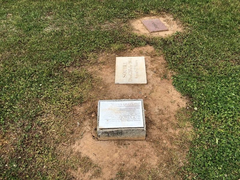
Squire's Grave
GEOGRAPHIC SORT Title Sort Marker Number Sort Marker Number Sort N Marker Number Sort T Publication Order Sort Publication Order Sort A Erected Year Sort Most Viewed Sort Most Recent-Interest Sort Most Recently Changed Sort SEE FAQ #33 FOR DESCRIPTIONS
On South Church Street just north of Race Street, on the right when traveling north.
On South Church Street just north of Race Street, on the right when traveling north.
On North New Hope Road (State Highway 279) at Lander Avenue, on the right when traveling north on North New Hope Road.
On Andrew Jackson Highway (U.S. 74) at South South Street, on the right when traveling west on Andrew Jackson Highway.
On Main Street (State Highway 37) at Court Street (State Highway 137), on the right when traveling north on Main Street.
Near Junaluska Road north of Morphew Street, on the right when traveling north.
On Martin Luther King Junior Avenue (State Highway 96) at Industry Drive, on the right when traveling north on Martin Luther King Junior Avenue.
Near Burlington Road (U.S. 70) at Palmer Farm Road, on the left when traveling west.
On New Garden Road west of Old Battleground Road, on the left when traveling west.
On North Church Street at Sixteenth Street, on the right when traveling north on North Church Street. Reported missing.
Near New Garden Road at Greenhurst Drive, on the left when traveling west.
Near Old Battleground Road, on the right when traveling north.
On New Garden Road at George Fox Road, on the left when traveling north on New Garden Road.
On Guilford Courthouse Auto Tour Road at Old Battleground Road, on the left when traveling west on Guilford Courthouse Auto Tour Road.
Near Guilford Courthouse Auto Tour Road, on the left when traveling west.
Paid Advertisement
Near New Garden Road at George Fox Road, on the left when traveling north.
Near Old Battleground Road, on the right when traveling north.
On South Elm Street north of West McGee Street, on the left when traveling north.
On Summit Avenue, 0.2 miles south of East Lindsay Street, on the left when traveling south.
On South Elm Street north of East Whittington Street, on the right when traveling north.
On R C Baldwin Avenue west of Meredith Street, on the right when traveling west.
Near Forrest Street at Mint Avenue.
On State Highway 68 just north of Alcorn Road, on the right when traveling north.
On Oak Ridge Road (State Road 150) 0.1 miles east of Sandylea Road, on the right when traveling south.
On Summerfield Road south of Centerfield Road, on the left when traveling south.
On North Carolina Route 561, 0.8 miles east of North Carolina Route 48, on the left when traveling east.
On St. David Street (Business U.S. 301) at King Street, on the right when traveling east on St. David Street.
On King Street at Market Street, on the right when traveling north on King Street.
On U.S. 258, 0.1 miles north of Mary Chapel Road (County Road 1117), on the right when traveling north.
On U.S. 258 at Mary Chapel Road (County Road 1117), on the right when traveling north on U.S. 258.
On U.S. 258, 0.1 miles north of Mary Chapel Road (County Road 1117), on the right when traveling north.
Paid Advertisement
On McLellon Road (State Highway 82), on the left when traveling south.
On Locust Street at Pennsylvania Avenue, on the left when traveling south on Locust Street.
On Hillview Circle at Veterans Circle, on the left when traveling south on Hillview Circle.
On Hillview Circle east of South Main Street (Business U.S. 23), on the left when traveling south.
On Greenville Hwy (U.S. 25) 0.1 miles north of Rutledge Dr..
On Hendersonville Rd (U.S. 25) at Fanning Bridge Rd. on Hendersonville Rd.
On 6th Ave. (U.S. 64) near Prince Dr..
On British Cemetery Rd., on the right when traveling north.
On Centre Church Road (State Road 1245) 0.1 miles south of Fairview Road, on the right when traveling south.
On West End Avenue (State Highway 90), on the right when traveling west.
On Witch Hazel Drive (State Highway 107) west of Witch Hazel Road, on the right when traveling south.
On Harper House Road east of Mill Creek Church Road, on the left when traveling east.
On Harper House Road (Local Route 1008) 0.2 miles east of Mill Creek Church Road, on the left when traveling east.
On Harper House Road, 0.2 miles east of Mill Creek Church Road, on the left when traveling east.
On West Market Street (Business U.S. 70) at South Front Street, on the left when traveling west on West Market Street.
Paid Advertisement
On Richlands Road (U.S. 258) near Measley Road, on the right when traveling north.
On Old Plank Road at Brevard Place Road (County Highway 1360), on the left when traveling north on Old Plank Road.
On S. Aspen Street close to S. Church Street.
On W. Congress Street close to S. Aspen Street.
On South Aspen Street south of Church Street, on the right when traveling north.
On Old Lincolnton Crouse Road, 0.1 miles north of North Carolina Route 150, on the left when traveling north.
On Startown Road (County Route 1005) at Andrews Drive, on the right when traveling south on Startown Road.
On North Cedar Street near East Pine Street.
Near Jeb Seagle Drive, 0.2 miles north of Linwood Drive, on the left when traveling north.
Near Jeb Seagle Drive, 0.2 miles north of Linwood Drive, on the left when traveling north. Reported unreadable.
Near West 6th Street, 0.2 miles west of North Graham Street, on the right when traveling west.
On West 5th Street just west of North Church Street, on the right when traveling west.
On West Trade Street at North Church Street, on the right when traveling west on West Trade Street.
On West 6th Street at North Poplar Street, on the right when traveling west on West 6th Street.
On West 5th Street just west of North Church Street, on the right when traveling west.
On West 5th Street at North Church Street, on the right when traveling west on West 5th Street.
Paid Advertisement
On West 5th Street just west of North Church Street, on the right when traveling west.
Near West 5th Street at North Church Street, on the right when traveling west.
On West 5th Street just west of North Church Street, on the right when traveling west.
On Pleasant Grove Road at Hutchinson Lane, on the right when traveling east on Pleasant Grove Road.
On Providence Church Lane, 0.1 miles south of Providence Road (North Carolina Highway 16), on the left when traveling south.
Near Sharon Road (State Road 3600) 0.2 miles south of Sharon View Road (State Road 3673), on the left when traveling south.
On North Main Street (State Highway 115) 0.1 miles north of Jackson Street, on the left when traveling north.
On Beatties Ford Road north of Sample Road, on the right when traveling north.
Near McCoy Road (State Road 2120) 0.5 miles north of Overhill Road (State Road 2122), on the right when traveling north.
On Ramah Church Road (State Road 2427) 0.2 miles north of Hiwassee Road (State Road 2426), on the left when traveling north.
Near Beatties Ford Road at Sample Road, on the right when traveling north.
Near Brief Road, 0.3 miles west of Quail Cove Court, on the right when traveling west.
Near James K. Polk Road (County Highway 3640) 0.1 miles east of Lancaster Highway.
On South Main Street (North Carolina Route 134) at East Main Street (Business North Carolina Route 27), on the right when traveling north on South Main Street.
Near Market Street (Business U.S. 17) just east of North 20th Street, on the left when traveling east.
On Market Street (Business U.S. 17) at South 8th Street on Market Street.
Paid Advertisement
On Market Street (Business U.S. 17) at North 15th Street, on the right when traveling west on Market Street.
On Market Street (Business U.S. 17) at South 21st Street, on the right when traveling west on Market Street.
Near Market Street (Business U.S. 17) just east of North 20th Street, on the left when traveling east.
Near Market Street (Business U.S. 17) just west of South 4th Street, on the right when traveling east.
On South 3rd Street (Business U.S. 17) at Orange Street, on the right when traveling south on South 3rd Street.
On South 3rd Street (U.S. 74) 0.1 miles south of Dock Street, on the right when traveling south.
On North 3rd Street (U.S. 74) at Dock Street, on the right when traveling north on North 3rd Street.
On Market Street (U.S. 17) at South 4th Street, on the right when traveling east on Market Street.
Near Market Street (U.S. 17) at South 4th Street.
On West Calhoun Street at North Church Street (State Highway 305), on the right when traveling west on West Calhoun Street.
On North Carolina Route 308, 0.4 miles north of Byrd Club Road, on the right when traveling north.
On Carr Store Road at Eno Cemetery Road, on the left when traveling west on Carr Store Road.
On South Road, 0.1 miles west of Country Club Road, on the right when traveling west.
On North Churton Street (Business U.S. 70) at West Tryon St, on the left when traveling north on North Churton Street. Reported permanently removed.
On West Tryon Street west of North Churton Street (North Carolina Highway 86), on the right when traveling west.
On Saint Marys Road at Pleasant Green Rd, on the left when traveling east on Saint Marys Road.
Paid Advertisement
Near St. Marys Road (County Road 1002) east of North Cameron Street, on the right when traveling east.
On North Churton Street (U.S. 70) at East Tryon Street, on the right when traveling north on North Churton Street.
On North Churton Street (Business U.S. 70) near West Tryon Street, on the left when traveling north.
Near West Tryon Street near North Churton Street.
On South Road Street at Cale Street, on the right when traveling south on South Road Street.
266 entries matched your criteria. Entries 101 through 200 are listed above.
⊲ Previous 100 —
The final 66 ⊳