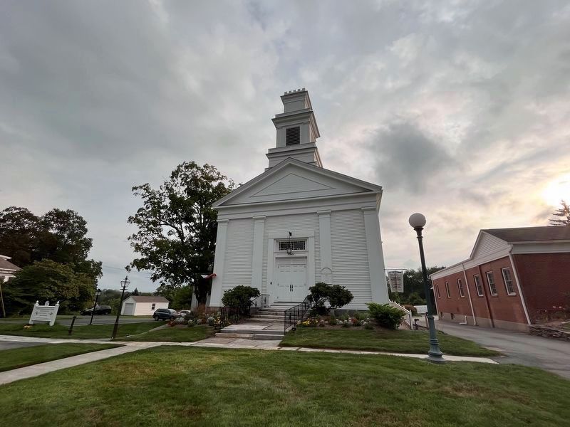
First settled by families from East Windsor in 1716 and originally a part of East Windsor and Bolton, the Town of Vernon was incorporated in 1808 by division of the Town of Bolton. In 1889 the City of Rockville, named from the Rock Mill, was . . . — — Map (db m111842) HM
In 1747 this oblong of land was given by Timothy Goodman to the West Hartford Parish of the Congregational Church for use as a parade ground of the local militia company. Still owned by the parish, it is maintained by the town. For nearly two . . . — — Map (db m53156) HM
Meeting House Corner
This park is the site of the first three meeting houses of the First Church of Christ, Congregational, organized in 1713. The parish of the west Division (West Hartford), the fourth in Hartford, was established in 1711. The . . . — — Map (db m53158) HM
Old Center Cemetery
The land for this cemetery, the oldest official burying ground in West Hartford was acquired in 1719 by the Town of Hartford for the benefit of its West Division Parish (West Hartford). It remained the principal place of burial . . . — — Map (db m97554) HM
Old North Cemetery
This graveyard was established in 1790, when Thomas Merrell of the West Division Parish (West Hartford) sold three quarters of an acre to the Town of Hartford. From time to time there were additions, the last in 1852. West . . . — — Map (db m97552) HM
West Hartford
In 1672-1677 Hartford created the West Division by sub-dividing a tract bounded by Quaker Lane, Mountain Road, and the towns of Bloomfield and Newington. Later this was enlarged by lands from Hartford and Farmington. Our first . . . — — Map (db m53370) HM
Nathaniel Foote
The Settler
Born In England 1593
Died In Wethersfield 1644
Erected By The
Foote Family Association
Of America
On The Original Home Lot
September 7, 1908 — — Map (db m46180) HM
To The Memory
Of The Adventurers From
Watertown, Massachusetts
Who Settled Wethersfield
In 1634
John Oldham • Robert Seeley • John Strickland • Andrew Ward • John Clarke • Leonard Chester • Nathaniel Foote • Abraham Finch • Robert Rose • . . . — — Map (db m46179) HM
This marks the road to Bissell’s Ferry, established by the General Court of Connecticut in 1641. Operated by the Bissell family for nearly one hundred years. Later leased to various townsmen and continuously operated until 1917. The original . . . — — Map (db m65727) HM
To the Founders of Windsor
and
The First Congregational Church
In Connecticut
Which Came to America
In the Mary and John With
Its Pastor – John Warham
May 30, 1635
Settled in Dorchester, Massachusetts
And Migrated To Windsor
In . . . — — Map (db m99589) HM
Major John Mason
Born 1600 in England
Immigrated to New England in 1630
A founder of Windsor, Old Saybrook and Norwich
Magistrate and Chief Military Officer of the Connecticut Colony
Deputy Governor and Acting Governor
A patentee of the . . . — — Map (db m306429) HM WM
On the brow of the hill overlooking the meadow
stood the Old Stone Fort or Stoughton House. It was
in two portions, one stone, probably the older, and one wood. At the north end was a door of heavy oak
timbers studded with iron spikes, which bore . . . — — Map (db m28364) HM
Original homestead of John and Thomas Hoskins,
father and son, who arrived on the Mary and John
from England in 1630. They were members of the
Dorcester party that settled Windsor north of the
Rivulet in 1632. Goodman John Hoskins served as
a . . . — — Map (db m28369) HM
1614 Six years before pilgrims land at Plymouth Rock, Dutch lawyer and sea captain, Adrian
Block (after whom Block Island is named) discovers and explores the Connecticut River
as far north as the Enfield Falls, where he is forced to turn back . . . — — Map (db m208605) HM
Bridgeport
"The Park City"
The area that is now Bridgeport was settled in the mid-17th century by farmers from the older towns of Stratford and Fairfield. Centers of settlement were Stratfield, present North Avenue; Pembroke, now Old Mill Green; . . . — — Map (db m91834) HM
Height at shoulder: 21 - 24 inches
Weight: 150 to 300 lbs
Habitat: Farms across Europe, Africa and the United States
Diet: Shrubs, weeds, bird eggs, mice grasshoppers, roots, tubers, even manure
Status: This . . . — — Map (db m230939) HM
Named for Narragansett Bay in Rhode Island, this is the oldest turkey variety developed in the United States. They originate from the breeding of native wild turkeys in New England to domesticated species brought here by European settlers. . . . — — Map (db m230944) HM
Wolves have been brought to near extinction, mainly due to conflicts with humans.
1630 - Present
Bounty Hunting for Wolves
In 1630, Massachusetts colonists passed the first wolf bounty law in America. They sought to eliminate wolves . . . — — Map (db m230845) HM
Size: about 3' tall at the shoulder, length of 6'-7'
Weight: 90 - 130 lbs for females, 130 - 220 lbs for males
Lifespan: up to 10 years in the wild, and up to 20 years in captivity
Diet: a wide variety of . . . — — Map (db m230895) HM
[ front ]
Easton
North Fairfield, a part of the town of Fairfield, was purchased from the Aspetuck Indians in 1670 for thirty pounds and an amount of trucking cloth. In 1762 the Connecticut General Assembly established the parish of . . . — — Map (db m30939) HM
In memory of
Andrew Ward
Born in England 1597
One of the founders of
Wethersfield and Stamford
———
An honored citizen of
Fairfield Conn.
where he died in 1659
———
Member of a Commission graunted to
sev'al p'sons to governe the . . . — — Map (db m27172) HM
Home Of
Thaddeus And Eunice Dennie Burr
Here
Dorothy Quincy and John Hancock
President
Of The Continental Congress
Were Married in 1775
Burned By British in 1779
Rebuilt in 1790 — — Map (db m27371) HM
This shallow depression in the middle of the Green was once a local landmark called Edward's Pond. The town filled in the pond around 1869, with the condition that no buildings be erected so the land would remain part of this public space in . . . — — Map (db m203397) HM
Marker front:
In 1639 Roger Ludlow and five companions, after serving in the Pequot War, purchased from the Indians a rich and abundant expanse of land which they called by the Indian name "Uncowaye." Shortly thereafter the name "Fairfield" . . . — — Map (db m27176) HM
This boulder commemorates
the settlement of Fairfield
by Roger Ludlow in 1639
and the burning of the Town
by the British July 8, 1779.
From the founding of the Town
the religious, military and civic life
of the people
has centered . . . — — Map (db m27227) HM
Welcome to Fairfield’s Historic Town Green
How Did This Green Come to Be? Most New England towns began with a central common "green." Where you are standing is Fairfield's historic center and is as old as the town itself. In 1639 Roger . . . — — Map (db m204367) HM
Connecticut's founding Puritans valued education. As early as 1650, towns with 50 or more families were required to teach children to read and write. The goal of education was to teach children how to read so they could gain a moral and spiritual . . . — — Map (db m203400) HM
In
memory of
Revd John Jones
AB MA
The Revd
John Jones
was born in
Southampton England
in 1595 and was a graduate of
Queens College Cambridge
A Puritan divine of the
Church of England he was
the first pastor of the . . . — — Map (db m27174) HM
Father of Connecticut, Author of the Fundamental Orders, Compiler of the Code of 1650, and Pioneer in the Development of American Constitutional Law.
Founded Fairfield and Made His Home Here from 1639 to 1654 — — Map (db m27141) HM
Connecticut’s Roger Sherman was the only person to sign all four of the founding documents of the United States. Ralph Earl painted this portrait in 1775.
Sherman was born in Massachusetts in 1721 and moved to New Milford, CT, at the age . . . — — Map (db m302454) HM
Site of "Verna"
Home of Timothy Dwight
Chaplain in Continental Army
Pastor of Greenfield
Founder of Academy
Poet of "Greenfield Hill"
President of Yale 1795 - 1815 — — Map (db m27421) HM
In memory
of
Thomas Sherwood
1586 – 1655
Puritan – Pioneer – Ancestor
A founder of New England
A first settler of Fairfield
Deputy to the General Court
Committeeman
Soldier of the Pequot War
and his wives . . . — — Map (db m27173) HM
In 1776, Connecticut needed money. The General Assembly directed Timothy Green to print this paper currency.
When the Revolutionary War began, the Connecticut Colony's economy was precarious. Coins were scarce. On June 7, 1776, the . . . — — Map (db m311725) HM
Site Of
Trinity Church
1790 – 1844
Rev. Philo Shelton
Rector for forty years
First to be ordained by
first American Bishop
Samuel Seabury — — Map (db m27376) HM
[ front ]
Monroe
On May 23, 1823 the General Assembly granted the incorporation of this town and named it in honor of the then President, James Monroe. The town’s roots, however, are much deeper as it was an offspring of the mother-town . . . — — Map (db m26096) HM
Traditional Landing Place of Stratford’s First Settlers in the spring of 1639 under leadership of the Rev. Adam Blakeman
On the right, at the inner end of the harbor stood the First Meeting House and burial ground, and across the harbor at . . . — — Map (db m48426) HM
Academy Hill
Historic District
Established April 14, 1988
First known as Watch House Hill, where the first settlers manned a blockhouse and a palisade to guard the town from threats of Dutch and Indian attack.
Renamed Meeting House . . . — — Map (db m25814) HM
Listed on the National Register of Historic Places
By the United States
Department of the Interior
May 1, 1985
This Estate Owned by the Boothe Family
For Many Generations Was Willed
To the Town of Stratford by
David Beach . . . — — Map (db m25907) HM
This 1820’s home was built over the original foundation of the 1683 house and has been altered four times since then. David and Stephen Boothe’s renovations of 1913 added stained glass windows, four safes in the walls, and several . . . — — Map (db m25911) HM
In Memory Of
Captain John Carpenter
Born in London, England, 1628
Settled In
Stratford, Connecticut
Before 1646
He commanded the Jamaica Fusiliers
In the Defense of Fort James, New
York, When the Dutch Fleet Of
William of Orange . . . — — Map (db m25766) HM
This Gate Is the Gift of Columbia University In the City of New York In Grateful Memory of Samuel Johnson the First President of King’s College In the Province of New York 1754 – 1763 A.D. And of His Son William Samuel Johnson the First . . . — — Map (db m25815) HM
[Left Plaque]
In honor of
the men and women
who planted in the wilderness
the early homes of Stratford,
who fought bravely and suffered patiently
in the War of the American Revolution,
and who left to their descendents
a . . . — — Map (db m26099) HM
The northwest farmers of Stratford formed the Village of Unity in October, 1725. They united in 1744 with the Long Hill parish of the Stratfield section of Stratford to become the Society of North Stratford. The Society controlled its own religious . . . — — Map (db m88049) HM
Chester
Chester is located on land known as Pattaconk or Pattyquounck in Indian deeds of the 1660's. Settled largely by families from Saybrook, it became the Fourth Ecclesiastical Society of the Saybrook Congregational Church in 1740 and was . . . — — Map (db m100313) HM
You are standing beside the Indian River in the heart of the 1663 settlement of Killingworth, sited on its protective harbor. In 1838, the shoreline portion parted from northern Killingworth and became Clinton.
Shipbuilding
The first . . . — — Map (db m100187) HM
1. Congregational Church
This Classic Rivival sanctuary dates from 1837 and is the fourth church building to have been located on Meeting House Hill. In front of the church stands in the monument honoring Abraham Pierson and the . . . — — Map (db m227288) HM
1. Indian River
At the center of the Colonial settlement, this stream winds south through salt marshes to the harbor. Shipyards stood on its banks in the 18th and 19th centuries. The bridge dates from the 1876, replacing an an earlier . . . — — Map (db m227290) HM
Settled in 1663 and then known as Homonoscitt Plantation, this shoreline and rural community soon thereafter was given the name Kenilworth and later Killingworth. In 1735 the First and Second Ecclesiastical Societies were established being the . . . — — Map (db m100158) HM
In honor of the founding of the Homenossitt Plantation which grew and prospered and became the Town of Clinton.
The week of July 28 - August 4, 1963 was set set aside for a townewide celebration embracing the many events of Clinton's . . . — — Map (db m227289) HM
The American Liberty elm was named after "The Liberty Tree": Our Country's First Symbol of Freedom. On the morning of August 14, 1765, the people of Boston awakened to discover two effigies suspended from an elm tree in protest of the hated Stamp . . . — — Map (db m264943) HM WM
This replica of the milestone placed here in the mid 1700s marks 25 miles to New Haven. Benjamin Franklin, then Colonial Postmaster General, determined the sites of these markers along the Post Road connecting New York and Boston.
Clinton . . . — — Map (db m242980) HM
The Work of the Salt Marsh
You are standing at the edge of an ancient marsh, above layers of peat forty feet deep. Once an inland freshwater lake, the Hammock estuary is now flooded twice daily by nutrient-rich salt tides.
Tidal salt . . . — — Map (db m272470) HM
The Earliest Senior Classes Of
Yale College
Were Taught Near This Spot By
Rector Abraham Pierson
1701 to 1707
( inscribed around the top )
I Give These Books For Founding A College
( back )
In Memoriam
Abraham Pierson . . . — — Map (db m100160) HM
Originally part of the Saybrook colony, the area now known as Ivoryton was annexed with the newly formed Essex in 1859. Thought of as the “wild country,” it soon developed into a prosperous manufacturing village. In the late 1700’s Phineas Pratt . . . — — Map (db m100239) HM
Cromwell
This area was settled in 1650 as a rural-farming community known as Middletown Upper Houses. It was incorporated and named Cromwell in 1851. The 18th century saw a thriving riverport. followed by brownstone quarrying and several factories . . . — — Map (db m99538) HM
Middletown Upper Houses
1650
Founders 1650 — 1680
John Clark · Samuel Hall · John Kirby · Anthony Martin · Thomas Renney · David Sage · John Savage · Samuel Stocking · Thomas Stow · John Warner · Nathaniel White · John Wilcox . . . — — Map (db m99547) HM
Durham
Coginchaug or “Long Swamp” was purchased from the Indians in 1673. A town plot was laid out in 1699, named Durham five years later, under a patent from King Charles II, and was confirmed by the General Assembly in 1708. It was . . . — — Map (db m94697) HM
This land was part of an original purchase from the Indians in 1662 for thirty coats – about $100. It included Machimoodus, “the place of noises”, so named from subterranean sounds formerly heard there. Layout of highways began in 1669. The first . . . — — Map (db m83886) HM
Side A 1714-1789
Near this Green was the site of
the General’s Farm, Store
and dwelling house
Side B
1714-1789
Officer in the French & Indian
and Revolutionary Wars
Delegate to the Continental Congress . . . — — Map (db m101985) HM
East Hampton
Incorporated 1767
East Hampton was first settled in 1710, when Gideon Goffe and is family located in an area along the Connecticut River which later became established as the parish of Middle Haddam. Families from the locality moved . . . — — Map (db m84010) HM
At the end of the 18th century and the beginning of the 19th century, this area served as the village center. The well-equipped general store owned by Ebenezer Hayden and the surrounding businesses of the Pratt Smithy, a bake house two doors up . . . — — Map (db m69410) HM
Originally called Potopaug by local Indians, Essex was named after England’s Essex County, whence some of its early settlers had come. As a part of Saybrook colony, the Essex area was first settled in 1648 by John Lay, William Pratt, and William . . . — — Map (db m65666) HM
The Onrust is a replica of one of the first sailing ships built in the New World and the first European vessel to explore the Connecticut River and Long Island Sound. On his fourth voyage to the New World (1613–1614), Dutch explorer Adriaen . . . — — Map (db m183090) HM
Haddam
In 1660 the General Court received a petition of “Severall members of this Collony prsenting their desires unto this Court of setling a Plantation at 30 Miles Island;” whereupon, a committee to view the land was appointed and . . . — — Map (db m66162) HM
In 1663 the General Court in Hartford founded the plantation of Hammonasset, encompassing the present-day towns of Killingworth and Clinton. The Court named the town Kenilworth in 1667 after the birthplace in England of Edward Griswold, one of . . . — — Map (db m100152) HM
This region was first settled about 1700 after Samuel Allen, Benjamin Miller, and Samuel Wetmore had reached an agreement with the Indians. It was incorporated as a parish in1744, a meeting house was erected, and the Congregational Church formed . . . — — Map (db m302006) HM
Near this spot in 1760 stood Timothy Bigelow's tavern, where travellers and local people gathered to drink rum, trade stories, and oonduct business. In 1776, Bigelow died suddenly, leaving his wife Elizabeth with four children to support. Widow . . . — — Map (db m98602) HM
north side
In 1639
Mattabeseck
Is First Mentioned in the Records
In 1650
The First English Settlement
Was Made Near This Spot
1n 1653
The General Court Changed the Name to
Middletown
In 1672 and 1673
The Title to the . . . — — Map (db m94206) HM
This fine post-and-beam house has been home to numerous prominent Middletown figures since it was originally built in the 1750s. In 1777, Jehosaphat Starr, Jr. left this house, his birthplace, to become a Revolutionary War soldier. Within a few . . . — — Map (db m310861) HM
Middletown
The area known as Mattabesett, home of the Wangunk Indian tribe, was settled by English colonists from Hartford and Wethersfield in 1650. Situated at the big bend in the Connecticut River, it was named Middletown because it lay halfway . . . — — Map (db m67814) HM
The Wangunks, Native American people, lived here at the great bend in the Connecticut River for countless generations before the first Europeans arrived. The Wangunks called their home Mattabeseck. Here they lived in communities of round-topped . . . — — Map (db m98585) HM
13406 entries matched your criteria. Entries 301 through 400 are listed above. ⊲ Previous 100 — Next 100 ⊳