Fort Kent has been designated a National Historic Landmark. This site possesses National significance in commemorating the history of the United States. — — Map (db m2088) HM
To mark the site of
1688 Fort Andross 1694
and
1715 Fort George 1737
Also the earliest burial place
where are buried
Benjamin Larrabee
Agent of the Pejepscot Proprietors and
Commander of Fort George. Also
Robert and . . . — — Map (db m51932) HM
The primary purpose of Fort Williams may have been for coastal defense, yet many men, women, and children also called it home. This self-sustaining community featured many of the buildings and services typical of an American town of the time . . . — — Map (db m25389) HM
This building was constructed in 1914 by the Quartermaster Corps for use as the Artillery Engineer Storehouse of Fort Williams. The structure housed the tools, equipments, and supplies used by the artillery engineer in maintianing and repairing the . . . — — Map (db m186112) HM
This building was constructed in 1914 by the Quartermaster Corps for use as the Artillery Engineer Storehouse of Fort Williams. The structure housed the tools, equipments, and supplies used by the artillery engineer in maintianing and repairing the . . . — — Map (db m186113) HM
This building was completed in 1909 for use by unmarried officers of the Coast Artillery Corps stationed at Fort Williams. Visiting officers or married officers without their families might also reside in the quarters. The structure was built to . . . — — Map (db m186117) HM
THis building was completed in 1909 for use by unmarried officers of the Coast Artillery Corps stationed at Fort Williams. Visiting officers or married officers without their families might also reside in the quarters. The structure was built to . . . — — Map (db m186116) HM
You are standing at the site of the
largest of six gun batteries built at
Fort Williams. Named for Francis P.
Blair, Jr., a veteran of the Mexican
and Civil wars, Battery Blair was
manned during World War I and the
early years of World War II. . . . — — Map (db m161815) HM
Battery Hobart was built in 1898 and named for Lieutenant Henry A. Hobart, one
of the first Maine graduates of the U.S. Military Academy, who was killed in action
during the War of 1812. The battery mounted one British-built six-inch gun, . . . — — Map (db m161822) HM
This building was completed in 1905 as the central powerhouse for Fort Williams by the Quartermaster Corps. The structure was built of reinforced concrete and sited in this sheltered spot to protect it from the fire of hostile vessels. Inside, . . . — — Map (db m186101) HM
After World War I, Fort Williams
was placed on caretaker status as a
coast artillery post, and became
home to the 5th Infantry Regiment
upon its return from occupation
duty in Germany in 1922. The 5th
remained at the fort until 1939,
longer . . . — — Map (db m161812) HM
This building was completed in 1911 under the direction of the Quartermaster Corps of the U.S. Army for use by a field officer (colonel, lieutenant colonel, or majro) of the Coast Artillery Corps and his family stationed at Fort Williams. It was . . . — — Map (db m186114) HM
This building was completed in 1911 under the direction of the Quartermaster Corps of the U.S. Army for use by a field officer (colonel, lieutenant colonel, or majro) of the Coast Artillery Corps and his family stationed at Fort Williams. It was . . . — — Map (db m186115) HM
This building was completed in 1911 by the U. S. Army Quartermaster Corps as a fire station for Fort Williams at a cost of $3,586. It was constructed of brick on a concrete foundation and the roof and tower, used for drying hoses, are slated. The . . . — — Map (db m205625) HM
This former military installation, begun in 1873 and known as The Battery at Portland Head, was a sub-post of Fort Preble until 1898 when it became a separate independent fort. It was designated Fort Williams in honor of Brevet Major General Seth . . . — — Map (db m23389) HM
From the 1750s, Portland Harbor was of economic importance as the closest American harbor to Europe and of strategic importance as a protected anchorage for the navy. As part of an upgrading of the harbor defenses in 1873, construction began on a . . . — — Map (db m25385) HM
The Goddard Manson was completed in 1858 for John Goddard (1811-1870) to an Italianate villa design prepared by Portland architect Charles Alexander, who planned other prominent buildings in the area. It was built of native stone and was one of the . . . — — Map (db m161828) HM
This building was completed in 1934 for the 240th Coast Artillery Regiment of the Maine National Guard by the Quartermaster Corps. The shed was used to house two of the regiment's four mobile 155mm guns and the large Holt crawler tractor used to . . . — — Map (db m186105) HM
This building was completed in 1934 for the 240th Coast Artillery Regiment of the Maine National Guard by the Quartermaster Corps. The shed was used to house two of the regiment's four mobile 155mm guns and the large Holt crawler tractor used to . . . — — Map (db m186106) HM
The Militia Storehouse was built in 1915 by the Quartermaster Corps and was assigned to the Maine National Guard. The concrete building was used by the 240th Coast Artillery Regiment for storage of tents, bunks, and other equipment required during . . . — — Map (db m186107) HM
The Militia Storehouse was built in 1915 by the Quartermaster Corps and was assigned to the Maine National Guard. The concrete building was used by the 240th Coast Artillery Regiment for storage of tents, bunks, and other equipment required during . . . — — Map (db m186111) HM
The 240th Coast Artillery Regiment
of the Maine National Guard was
created to assist the 8th Coast
Artillery Regiment in time of war.
In 1930, a formal National Guard
camp was laid out at the fort with
mess halls and concrete slabs for
tents. . . . — — Map (db m161816) HM
Erected by the Colonists in 1680
Captured by the French and Indians
in 1690. Entire English
settlement destroyed
————
To the memory of these
brave defenders
this tablet placed by
The Daughters of the American Colonists
November . . . — — Map (db m50448) HM
In 1866, a year after the Civil War ended, these guns (technically, called 4.5-inch Siege Rifles) were cast in Pittsburgh by the Fort Pitt Foundry. They could fire a 25-to 30-pound ball 3,200 — nearly 2 miles! In the early 1900s, they were . . . — — Map (db m186367) HM
The importance of Portland harbor over two centuries is clear from the fortifications you see from here. Behind you, lies Fort Allen — an 1814 earthworks. Three granite Civil War forts remain visible. Fort Gorges rises in the harbor. Fort . . . — — Map (db m186376) HM
Fort Sumner Park, located behind you acros North Street, began its history in 1775 during the Revolutionary War. Initially referred to as The Great Fort, and later, as The Citadel, it was commissioned in 1794 as the first . . . — — Map (db m186400) HM
Dedicated to the men and women of the Coast Artillery Corps who defended Portland Harbor at Fort Preble in five wars from 1808 through 1945. — — Map (db m186123) HM WM
Near this hallowed ground our earliest settlers erected in 1722 a garrison-meeting house for worship and protection. This was the beginning of the First Congregational Church of South Portland, which was established on November 10, 1734. . . . — — Map (db m55603) HM
Built on Hog Island Ledge, Fort Gorges was named after Sir Ferdinando Gorges, colonial proprietor of the Province of Maine. The fort's site allowed it to provide supplemental fire to both Forts Preble and Scammel. Its location at the head of the . . . — — Map (db m55627) HM
This area is the site of Fort Preble, also known as Fort Hancock during the Revolutionary War, a temporary fort. Fort Preble was begun in 1808 during the administration of Pres. Jefferson and completed before the War of 1812. It was named for . . . — — Map (db m55568) HM
Construction of Fort Knox began in 1844 and was halted while still unfinished 25 years and $1 million later. The Fort has never seen any military action. The largest of 133 total cannons fired a 315 pound shell 4,680 yards. The granite was quarried . . . — — Map (db m55114) HM
Battle on the River
In 1779, the early settlers of Bucksport witnessed a devastating military defeat for the Americans during the Revolutionary War. A fleet of 44 warships and support vessels from the Continental Navy Fleet set out on a . . . — — Map (db m183880) HM
This Fortress, originally known by its garrison as FORT PENOBSCOT and named by Admiral Sir George Collier in his reports FORT CASTINE received its present designation from its builder, British general Francis McLean upon its completion in December . . . — — Map (db m77148) HM
This fort, originally known by its garrison as “Fort Penobscot” and named by Admiral Sir George Collier in his reports “Fort Castine” received its present designation from its builder, British general Francis McLean upon its . . . — — Map (db m77147) HM
An expedition under
Colonel Benedict Arnold
for the capture of Quebec
marched from this place
in September 1775
☆☆☆☆☆☆☆☆☆☆☆☆☆
To record . . . — — Map (db m110856) HM WM
On June 8, 1834, Judge Daniel Cony's home was consumed by fire. Judge Cony had erected the frame of that house on October 17, 1797, on the 20th anniversary of the capture of General Burgoyne's army. Cony was a Massachusetts militia . . . — — Map (db m186064) HM
Welcome to Augusta
Indigenous people occupied the Augusta area for thousands of years before European explorers arrived. Little evidence remains of their time here, but patches of forested land along the Kennebec give us a glimpse . . . — — Map (db m186068) HM
[Historical information excerpt at bottom of marker]
Old Fort Western and downtown Augusta sit on the site of ancient Cushnoc, the Abenaki word signifying the head of tide on the Kennebec River. Although according to the archaeological . . . — — Map (db m110823) HM
In commemoration of the first trading voyage of the Pilgrims of Plymouth to the ancient Indian village at Cushnoc on the Kennebec River, 1625, and on this site the establishment of their fur trading post with the Indians, 1628, Jown Howland in . . . — — Map (db m110858) HM
As part of the strategy to expand and strengthen Massachusetts' territorial claims along the Kennebec River, a Boston-based land company, the Kennebec Proprietors, built Fort Western in 1754. Commanded by James Howard, the Fort . . . — — Map (db m110822) HM
Old Fort Western was built in 1754 at Cushnoc, an Abenaki name for the site of an important 17th-century Plymouth Colony trading post. The Old Fort's main house (barrack) is New England's oldest surviving wooden fort building and a symbol of . . . — — Map (db m111208) HM
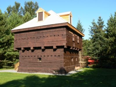
This blockhouse is the only building that remains of a larger fort complex, built by British-Americans in 1754-1755, to defend the upper Kennebec River Valley from possible attack by the French and their Native American allies.
The . . . — — Map (db m116133) HM
Native Americans inhabited this site at the confluence of the Kennebec and Sebasticook Rivers from at least 5000 years ago, until 1692.
A pilgrim trading post was also located on this site in the 1650s.
Located within Fort Halifax Park is . . . — — Map (db m116136) HM
This fort was built by patriotic donors in 1907 to honor veterans of the Grand Army of the Republic. It was rebuilt in 1985 with funds bequeathed by Luther H. Peirce, a member of the Second Maine Regiment of Volunteers in the Civil War. . . . — — Map (db m110720) WM
Eight soldiers were needed to fire each of the huge cannons that were once here, including a chief of detachment (who gave the commands), a gunner, and six cannoneers.
The steps in firing the cannon are shown here. The gunner is indicated by . . . — — Map (db m52117) HM
Since construction commenced in 1861, the entrance to the Kennebec River has been guarded by Fort Popham, a Civil War era fort that was built to protect the shipbuilding interests in the upriver City of Bath, as well as the state capital in . . . — — Map (db m52096) HM
Fort Popham is a Third System style granite fort built by the U.S. War Department beginning in 1862. Modifications were made and the fort was used again in the Spanish American War and in World War 1. Another fort, probably wooden, existed here and . . . — — Map (db m52097) HM
Since before Columbus discovered the New World, the Kennebec River has been the scene of settlement and conflict. While Fort Halifax represents the most northern military outpost in the region, it is only one of more than twenty forts that have . . . — — Map (db m52195) HM
Honorable
Percival P. Baxter
Governor of Maine
who arranged for the purchase of this and other forts from the Federal Government.
Fort Popham, with 6,73 acres of land was valued at $6,600.
Fort Baldwin, with 45.13 acres of . . . — — Map (db m52196) HM
1. Joseph Berry's Fort - West Bath; 2. Col. Noble's Fort - Pleasant Cove, built in 1734, a stockade with a guard house at each corner and another within the enclosure. "Without its protection the farmers did not dare work their fields."; 3. Clarke . . . — — Map (db m52199) HM
Like most other masonry forts built in the United States during the middle 1800s, Fort Popham is made up of a series of casemates. These are large enclosed spaces with high, arched ceilings and places for cannons to fire through wall openings. All . . . — — Map (db m52116) HM
The idea of a fort on the Penobscot was not new when the U.S. government purchased land for Fort Knox in 1844. The Board of Engineers, established and charged by the Secretary of War to make a plan for the defense of the United States, had listed a . . . — — Map (db m55135) HM
The United States planned Fort Knox to prevent another attempt by the English to control Maine lands east of the Penobscot, as they had successfully done in the American Revolution and War of 1812.
Fort Knox's construction had not yet begun when . . . — — Map (db m55136) HM
People, machines, and animals all played a part in the slow process of raising the walls that shaped Fort Knox. But before these walls could be built, people, machines, and animals also worked to prepare the site by earth, blasting ledge, and . . . — — Map (db m55239) HM
Eight soldiers were needed to fire a 10-inch Rodman, including a chief of detachment (who gave the commands), a gunner, and six cannoneers.
The steps in firing the cannon are shown here. The gunner is indicated by "G" and the other six . . . — — Map (db m55337) HM
Fort Knox's roof, or terreplein, has emplacements for thirty cannons. These cannons would have been smaller than the guns planned for the casemates on the main level below.
The 30 gun circles on the terreplein were all laid and ready for guns in . . . — — Map (db m55338) HM
The nation's Third System forts, including Fort Knox, all shared similar design features. These features combined to guard against attack by ships, make it impossible for the fort to be taken quickly, [and] provide protection from a land-based, . . . — — Map (db m55137) HM
If you were to visit the nation's masonry forts built during the Fort Knox era, you would see many features common to most of them. One such feature is the casemate, a large enclosed space with a high, arched ceiling and places for cannons to fire . . . — — Map (db m55278) HM
Fort Knox's thick granite walls were designed to deflect cannon fire from ships passing through the Narrows of the Penobscot River. These walls also enclosed a pentagon-shaped center that contained the heart and soul of the fort.
All of the . . . — — Map (db m55237) HM
Fort Knox never had soldiers living within its walls, except for a few weeks during the Spanish American War (1898) when some Connecticut Volunteers probably camped on the parade ground or in adjacent rooms. During the Civil War, when the largest . . . — — Map (db m55210) HM
Fort Point Light — An Early River Beacon Established in 1836 to aid the growing number of ships navigating the Penobscot between Bangor and Castine, Fort Point Light Station was built as the first river light in Maine. In 1857, the . . . — — Map (db m170845) HM
Erected and named by Gen Thomas Pownall 1759 • • • Gen Samuel Waldo for whom Waldo County was named was buried here Removed to Kings Chapel Boston • • • Erected by John Cocran Chapter D.A.R. 1916 — — Map (db m170848) HM
In 1759, Massachusetts Governor Thomas Pownall sought to plug the mouths of Maine's key rivers so as to keep the French and Indians well inland. In January 1758, he wrote to William Pitt, Prime Minister of England about the advantages of this site, . . . — — Map (db m170846) HM
The Indians burned the township of Saco in 1688. Fort Saco was built on the future site of the Laconia Mills to protect the settlers in 1693. The fort served as stables during the construction of the Laconia mills in 1841. Yo Cat Gully . . . — — Map (db m55718) HM
Near this spot stood the Larrabee Garrison which was constructed between 1714 - 1722 by William and Stephen Larrabee. It embraced more than an acre of ground and had thick timber walls. Within the walls were five houses. During times . . . — — Map (db m186347) HM
Fort Foster was built at the dawn of the 20th century, in an effort to shore up coastal defenses following the Spanish-American War. Today the site provides a unique platform to appreciate Maine’s coastal beauty.
Major Gen. John G. Foster . . . — — Map (db m185012) HM
A: Blockhouse (1844)
B: Riflemen's House (1808-1812)
C: Magazine (early 1800s)
D: Lower Battery (early 1800s)
E: Granite Outer Wall (Civil War era, unfinished)
The site at Kittery Point has been used for defensive purpose since 1689. . . . — — Map (db m161810) HM
Large coastal forts like this one were built to defend against the increasingly powerful cannons that could be mounted on naval vessels in the mid-1800s. Among them were guns designed by Admiral John Dahlgren who became known as the "father of . . . — — Map (db m161811) HM
Forts at this site have protected Portsmouth Harbor since 1689 when some earthworks and a small blockhouse were built here at what was then called Pepperrell's Garrison after the area's most prominent settler, William Pepperrell. In 1715, the . . . — — Map (db m161809) HM