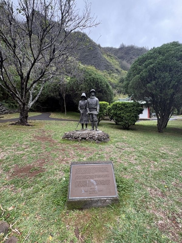
Near Iao Valley Road west of Aulii Drive, on the left when traveling west.
One hundred years ago the first government contract immigrants from Japan set foot on these shores and entered the banks of the sugar industry labor force. By 1924, when Japanese immigration was effectively ended by a new American immigration . . . — — Map (db m292743) HM
Near Iao Valley Road 0.1 miles west of Aulii Drive, on the left when traveling west.
In commemoration of the 100th Anniversary of the XinHai Revolution,
which marks the birth of Modern China. The Sun Yat-sen Foundation
for Peace & Education proudly dedicates this bronze statue in memory
of Dr. Sun Yat-sen, who was once a . . . — — Map (db m292745) HM
Near Iao Valley Road west of Aulii Drive, on the left when traveling west.
A century has elapsed since the first Korean emigrants who left jemulpo Port, arrived in the port of Honolulu, Hawaii on January 13, 1903. The emigration was a historic moment for the Korean people, who had never experienced a world outside of . . . — — Map (db m292726) HM
Near Iao Valley Road west of Aulii Drive, on the left when traveling west.
The people who lived in this kind of house in the early 1800's were mostly from New England. They came to Hawai'i either as traders and merchants or as missionaries sent by the American Board of Commissioners for Foreign Missions (ABCFM) of . . . — — Map (db m292725) HM
Near Iao Valley Road just west of Aulii Drive, on the left when traveling west.
From islands in the Atlantic to islands in the Pacific, Portuguese came. This miniature house, representing the architecture of Portugal, commemorates Hawai'i's Portuguese immigrants. Settlers from the Portuguese islands of Madeira and Azores . . . — — Map (db m292722) HM
Near Iao Valley Road west of Aulii Drive, on the left when traveling west.
In commemoration of the centennial anniversary of the October 10th, 1911 Xinhai Revolution,
which marks the founding of Modern China, the Maui Chinese Community have gather together
to celebrate the memory and legacy of Dr. Sun Yat-sen, who was . . . — — Map (db m292747) HM
On North 15th Street, on the right when traveling north.
West panel of monument
Oregon Trail Memorial
This is the historic pathway of the Oregon Trail through the city of Boise. Follow the footsteps of Native Americans, fur traders, pioneers, soldiers, and entrepreneurs, from our past to . . . — — Map (db m305803) HM
On State Highway 21 at milepost 95, 1.4 miles north of Grandjean Road, on the right when traveling north. Reported missing.
An immigrant from Denmark where he had studied forestry, he came to this part of Idaho in 1883 to mine, hunt and trap.
Before Idaho became a state in 1890, he built a winter cabin below Grandjean Peak on a site later occupied by Grandjean Ranger . . . — — Map (db m22638) HM
On Main Street near Riverside Street, on the right when traveling north.
James J. Hill realized his vision of a northernmost transcontinental railroad in 1892, after the 1889 discovery of the Marias pass in Montana. The gentle grade and wide valley of the 5,213 ft. pass through the Rocky Mountains contrasted with the . . . — — Map (db m122715) HM
Near Railroad Avenue near Main Street and Park Avenue.
Looking upon a pristine wooded basin in what was considered wilderness in the early 1900’s, Sir Hugh Bovill of England knew he was home. Bovill with his wife Lady Charlotte, and his two daughters Gwendolyn and Dorothy were seeking a better life. . . . — — Map (db m113704) HM
On State Highway 33 at Plano Road, on the right when traveling east on State Highway 33.
This park is named for "Beaver Dick," a mountain man of late fur trade days, who lived on in this locality until 1899.
He was born in England, and his real name was Richard Leigh. He came west as a trapper, but the real fur trade was . . . — — Map (db m103902) HM
On Western Avenue north of Old Western Avenue, on the right when traveling south.
[Text on the north-facing side:]
Ripacandida/Castrolibero
In 2006, Blue Island welcomed as its Sister City the town of Ripacandida, located in the Basilicata region of Southern Italy.
In 2024, Blue Island welcomed as its Sister City the . . . — — Map (db m274445) HM
On York Street at Maple Avenue, on the right on York Street.
Conrad Kich arrived in Blue Island in 1849 at age 11. His father, Peter, was among the first Germans to settle in Blue Island. Kich worked as a "section boss" for the Chicago, Rock Island & Pacific Railroad. He was also a volunteer fireman, and . . . — — Map (db m275014) HM
Henry and Catherine Doehler came to Blue Island from Bavaria in 1851, making them some of the earliest residents here, as Blue Island was still a small town of fewer than thirty-five buildings and more than twenty years away from officially . . . — — Map (db m274439) HM
On South Western Avenue south of New Street, on the right when traveling south.
The Woolworth Building was built by William F. and John C. Klein, who were members of one of Blue Island's most prominent families. The Klein family established themselves in Blue Island in 1849, and were part of the German influx that changed Blue . . . — — Map (db m297896) HM
Described in the book The First Hundred Years - A Historical Review of Blue Island as a "high spot" during this area's popular market days in the late 1800s, a tavern has operated on this corner almost continuously since the 1870s. A wood . . . — — Map (db m274365) HM
Historien Om
[the story of]
The story of Andersonville begins as a cherry orchard In the 1850s and evolves throughout the years, adding several layers of identity: first as a Swedish settlement on the outskirts of . . . — — Map (db m235738) HM
On West George Street west of North Central Park Avenue, on the left when traveling west.
[Front panel:]In honor of the 499 men of St. Hyacinth Parish who served in World War I
[Right side panel:]
Chateau-Thierry
Argonne
✝
Our Hero Dead
Baczkowski S. • Budnik M. • Drisch Ed. • Kaminski J. • Kowalewski K. • . . . — — Map (db m273192) WM
On West Exchange Avenue east of South Peoria Street, on the left when traveling east.
The Union Stock Yard and Transit Company, Chicago's legendary livestock market and slaughterhouse, opened at this site on Christmas Day, 1865. Here, 320 acres of swampland lying between Pershing Avenue, Halsted Street, 47th Street, and Ashland . . . — — Map (db m244189) HM
On West Marquette ROad east of South Washtenaw Street, on the right when traveling east.
[Lithuanian text on the base:]
A.A.
Kun. Antanas Staniukynas
Gimė gegužio 4, 1865
Mirė gruodžio 15, 1918 M.
Jis mirė, bet jo darbai gyvena
R.I.P.
Šv. Kazimiero seserų vienuolijos steigėjas
[English . . . — — Map (db m314315) HM
On Oak Park Avenue 0.2 miles north of West Irving Park Road (Illinois Route 19), on the left when traveling north.
This plaque commemorates those individuals buried within Cemetery No. 3, formerly associated with the Cook County Poor Farm, later known as the Read-Dunning Institutional complex, and later Chicago State Hospital. This Cemetery was platted on . . . — — Map (db m245999) HM
On Shakespeare Street east of Newland Avenue, on the right.
The image depicts a plan for Rutherford Sayre Park that renowned landscape architect, Jens Jensen, created in 1909. Jensen, who was born in Denmark, immigrated to the United States in 1884 and found his way to Chicago to work for what was then known . . . — — Map (db m265218) HM
Near 134th Place at St. Lawrence Avenue, on the right when traveling east.
Although Illinois was established as a "free" state in 1818, federal laws that had been enacted since 1793 permitted the recapture and return of runaway enslaved people within U.S. territory. Beginning in the 1830s, freedom seekers were . . . — — Map (db m261062) HM
On Columbus Drive at Roosevelt Road, on the right when traveling north on Columbus Drive. Reported permanently removed.
[Inscription on the shaft holding up the statue:]
To Christopher Columbus
Discoverer of America
[Text on the pedestal's east side:]
By the grace of God and in the name of Her Majesty Queen Isabella has taken possession of this land . . . — — Map (db m310596) HM
On West Ogden Avenue at South Damen Avenue on West Ogden Avenue.
[English-language text on the west-facing side of the marker:]
The Main Street of America
In 1916, Cook County Hospital emerged as an important establishment for the Tri-Taylor neighborhood in Chicago. This imposing structure, characterized . . . — — Map (db m251638) HM
On West Wrightwood Avenue at North Hampden Court on West Wrightwood Avenue.
The August Dewes House is one of a pair of architecturally complimentary houses built by two German-born brothers who were executives of the Standard Brewery in Chicago. With its handsomely-detailed stone facades and distinctive mansard root, the . . . — — Map (db m261270) HM
On North Boulevard, on the right when traveling west.
Knonawen
The Potawatomi word for connected (the act of talking to others)
La palabra Potawatomi para la conexión (el acto de platicar con otros)
A Crossroads and Gathering Place
For thousands of years, Native people . . . — — Map (db m242495) HM
On North Clark Street near West La Salle Drive (Illinois Route 64), on the right when traveling north.
[Text on front side:]
Wizhgéndëmowen
The Potawatomi word for resilient (the act of having strong thoughts)
La palabra potawatomi para la resistencia (el acto de mantener pensamientos fuertes)
Chicago in Ashes, Chicago Reborn
The . . . — — Map (db m242487) HM
On Wrightwood Avenue at Hampden Court on Wrightwood Avenue.
The exuberant baroque detailing of the Dewes House reflects the European background of the original owner and his two architects. The house is a monument to old-world splendor, an example of the eclectic architecture popular in Chicago after the . . . — — Map (db m261265) HM
On South Union Avenue south of West James M. Rochford Street, on the right when traveling south.
(full title: The Maxwell Street Market was established on Chicago's Near West Side in 1912)
As the city's official open-air market, Maxwell Street teemed with shops, pushcarts and street stands where vendors and merchants pitched their . . . — — Map (db m257710) HM
On 26th Street east of Troy Street, on the right when traveling east.
Del pueblo de México a la Comunidad Mexicana de Chicago.
Este reloj, fabricado en Zacatlán, Puebla, fué obsequiado por los Gobiernos de Durango, Guerrero, Jalisco, México, Michoacán, Nuevo León, Puebla, Querétaro, San Luis Potosí y . . . — — Map (db m258353) HM
On 26th Street east of Troy Street, on the right when traveling west.
This Arch marks the eastern gateway to West 26th Street, Little Village's vibrant retail corridor which has been referred to as the "Mexican capital of the Midwest." The Arch is unique in Chicago as the only example of a street gateway inspired . . . — — Map (db m258347) HM
[Text on the top plaque:]
Hector Duarte
Lead Assistant: Maria Gaspar • Assistants: Roxana Licona, Antonio Martinez, Krystal Pacheco, Jose F. Rios, Julia Sowles, Ginny Sikes, Anna Zotigh • Co-fabrication of Butterflies: Jerry Lang
2004
. . . — — Map (db m263191) HM
On Western Avenue at Archer Avenue, on the left when traveling north on Western Avenue.
McKinley Park, which was dedicated in 1902, is one of the first "neighborhood parks" in the country. Named in honor of President William McKinley, who had been assassinated one year earlier, McKinley Park proved to be an instant success. The park's . . . — — Map (db m258380) HM
On South Paulina Street at 38th Street, on the left when traveling south on South Paulina Street.
[Polish language text at top]
Z Bogiem.
O Wolnosc Narodow
Nasi Bohaterzy
Anno Domini 1917 – 1918
[Polish text below the names]
Ofiarowalo Tow Dziewic Rozancowych Ks M. Kotecki
[English . . . — — Map (db m258401) WM
On West Erie Street east of North Orleans Street, on the left when traveling west.
In 1899, the Catholic Church summoned Mother Frances Xavier Cabrini, known for her mission work in New York, to Chicago in order to build and lead Assumption School. The school marks the westward expansion of her mission work and it coincided with . . . — — Map (db m252392) HM
On West Roosevelt Road west of South Western Avenue, on the right when traveling east.
This rare-surviving example of an ethnic athletic club was built by the Turnverein Vorwaerts (Forwards Turners), a German organization which promoted athletics and worked to advance the social and political status of Chicago's German working-class . . . — — Map (db m249324) HM
On Canfield Road 0.1 miles north of Talcott Avenue, on the right when traveling north.
John Wingert was one of a number of immigrants who, seeking refuge from religious persecution in Germany, created a settlement called Canfield on the prairie frontier. One of the few surviving early farmhouses, within the Chicago city limits, the . . . — — Map (db m255127) HM
Settled in the 1850s by German immigrants, this area was virtually destroyed by the Fire of 1871. Most of these wood cottages and brick and stone townhouses date to the last decades of the 19th century. After World War II, this area became the focus . . . — — Map (db m261187) HM
On West Saint Paul Avenue west of Wells Street, on the left when traveling east.
Settled in the 1850s by German immigrants, this area was virtually destroyed by the Fire of 1871. Most of these wood cottages and brick and stone townhouses date to the last decades of the 19th century. After World War II, this area became the focus . . . — — Map (db m242471) HM
On Wells Street near Menomonee Street, on the right when traveling south.
This area was settled in the 1850's by German Immigrants whose community life centered around St. Michael's Church, founded in 1852. Small cottages, larger houses of wood or brick, and narrow tree-lined streets contribute to the charm of the Old . . . — — Map (db m261158) HM
On North Hermitage Avenue south of West Leland Avenue, on the left when traveling north.
Hog Butcher for the World. Tool Maker, Stacker of Wheat, Player with Railroads and the Nation's Freight Handler; Stormy, husky, brawling. City of the Big Shoulders...
The first five lines from Sandburg's 1914 poem . . . — — Map (db m234538) HM
On Erie Street east of State Street, on the left when traveling east.
Dedicated to the men and women of the United Brotherhood of Carpenters and Joiners of America
Our great union was formed here in Chicago in 1881 by Irish immigrant Peter J. McGuire, "Father of Labor Day" and leader in the fight for the . . . — — Map (db m262700) HM
On State Street north of Superior Street, on the right when traveling north.
Motivated by the love of the Sacred Heart, Mother Cabrini came to the U.S. from Italy in 1889 to serve the neediest of her time, especially the immigrant. With missionary zeal, she traveled the Americas for the next 28 years opening schools, . . . — — Map (db m265211) HM
On South Prairie Avenue 0.1 miles south of East 18th Street, on the right when traveling south.
Servants were essential to the successful operation of large 19th century households. Smaller homes would employ 1 or 2 servants who performed a broad variety of household tasks. The largest homes had a staff of 12 or more each with specific duties. . . . — — Map (db m308691) HM
On Chicago Riverwalk east of North Michigan Avenue.
Kin Link is the fourth artist project in this series of temporary mural banners for the Riverwalk. The artists and artworks in this series show the strength and diversity of Chicago, a city whose vitality comes from the variety of peoples . . . — — Map (db m256563) HM
Kin Link is the fourth artist project in this series of temporary mural banners for the Riverwalk. The artists and artworks in this series show the strength and diversity of Chicago, a city whose vitality comes from the variety of peoples . . . — — Map (db m256565) HM
On Leavitt Street at Cortez Street, on the right when traveling south on Leavitt Street.
This well-preserved collection of workers cottages, single-family houses, Chicago-style flat buildings, and small apartments form a distinctive residential streetscape that tells the story of German, Polish, and, ultimately, Ukrainian immigrants who . . . — — Map (db m234579) HM
On West Cortez Street near North Oakley Boulevard.
This well-preserved collection of workers cottages, single-family houses, Chicago-style flat buildings, and small apartments form a distinctive residential streetscape that tells the story of German, Polish, and, ultimately, Ukrainian immigrants who . . . — — Map (db m234581) HM
On Damen Avenue west of Haddon Street, on the right when traveling north. Reported damaged.
This well-preserved collection of workers cottages, single-family houses, Chicago-style flat buildings, and small apartments form a distinctive residential streetscape that tells the story of German, Polish, and, ultimately, Ukrainian immigrants who . . . — — Map (db m260398) HM
On Thomas Street near Damen Avenue, on the left when traveling east.
This well-preserved collection of workers cottages, single-family houses, Chicago-style flat buildings, and small apartments form a distinctive residential streetscape that tells the story of German, Polish, and, ultimately, Ukrainian immigrants who . . . — — Map (db m260399) HM
On Haddon Avenue at Hoyne Avenue, on the right when traveling west on Haddon Avenue.
This well-preserved collection of workers cottages, single-family houses, Chicago-style flat buildings, and small apartments form a distinctive residential streetscape that tells the story of German, Polish, and, ultimately, Ukrainian immigrants who . . . — — Map (db m260401) HM
On Leavitt Street near Haddon Avenue, on the left when traveling south.
This well-preserved collection of workers cottages, single-family houses, Chicago-style flat buildings, and small apartments form a distinctive residential streetscape that tells the story of German, Polish, and, ultimately, Ukrainian immigrants who . . . — — Map (db m260402) HM
This well-preserved collection of workers cottages, single-family houses, Chicago-style flat buildings, and small apartments form a distinctive residential streetscape that tells the story of German, Polish, and, ultimately, Ukrainian immigrants who . . . — — Map (db m260405) HM
This well-preserved collection of workers cottages, single-family houses, Chicago-style flat buildings, and small apartments form a distinctive residential streetscape that tells the story of German, Polish, and, ultimately, Ukrainian immigrants who . . . — — Map (db m260406) HM
This well-preserved collection of workers cottages, single-family houses, Chicago-style flat buildings, and small apartments form a distinctive residential streetscape that tells the story of German, Polish, and, ultimately, Ukrainian immigrants who . . . — — Map (db m260407) HM
This well-preserved collection of workers cottages, single-family houses, Chicago-style flat buildings, and small apartments form a distinctive residential streetscape that tells the story of German, Polish, and, ultimately, Ukrainian immigrants who . . . — — Map (db m260408) HM
On Walton Street at Leavitt Street on Walton Street.
This well-preserved collection of workers cottages, single-family houses, Chicago-style flat buildings, and small apartments form a distinctive residential streetscape that tells the story of German, Polish, and, ultimately, Ukrainian immigrants who . . . — — Map (db m260409) HM
On Walton Street at Oakley Boulevard on Walton Street.
This well-preserved collection of workers cottages, single-family houses, Chicago-style flat buildings, and small apartments form a distinctive residential streetscape that tells the story of German, Polish, and, ultimately, Ukrainian immigrants who . . . — — Map (db m260410) HM
This well-preserved collection of workers cottages, single-family houses, Chicago-style flat buildings, and small apartments form a distinctive residential streetscape that tells the story of German, Polish, and, ultimately, Ukrainian immigrants who . . . — — Map (db m260412) HM
On West Iowa Street east of North Oakley Boulevard.
This well-preserved collection of workers cottages, single-family houses, Chicago-style flat buildings, and small apartments form a distinctive residential streetscape that tells the story of German, Polish, and, ultimately, Ukrainian immigrants who . . . — — Map (db m260413) HM
This well-preserved collection of workers cottages, single-family houses, Chicago-style flat buildings, and small apartments form a distinctive residential streetscape that tells the story of German, Polish, and, ultimately, Ukrainian immigrants who . . . — — Map (db m260414) HM
This well-preserved collection of workers cottages, single-family houses, Chicago-style flat buildings, and small apartments form a distinctive residential streetscape that tells the story of German, Polish, and, ultimately, Ukrainian immigrants . . . — — Map (db m260415) HM
On North Hoyne Avenue north of West Augusta Boulevard, on the left when traveling north. Reported damaged.
This well-preserved collection of workers cottages, single-family houses, Chicago-style flat buildings, and small apartments form a distinctive residential streetscape that tells the story of German, Polish, and, ultimately, Ukrainian immigrants who . . . — — Map (db m299316) HM
On North Hoyne Avenue near West Thomas Street, on the left when traveling north.
This well-preserved collection of workers cottages, single-family houses, Chicago-style flat buildings, and small apartments form a distinctive residential streetscape that tells the story of German, Polish, and, ultimately, Ukrainian immigrants who . . . — — Map (db m299318) HM
On West Jackson Boulevard (Old U.S. 66) east of Kennedy Expressway (Interstate 90/94), on the left when traveling east.
A.B. Dick 1902-1949
Architect Alfred S. Alschuler, 1926
Hart, Schaffner & Marx/Hartmarx- 1949-1994
Haberdasher Square Lofts- 1995-
Architect - Pappageorge Haymes- Adaptive Re-use
Originally built in 1926 by architect Alfred S. . . . — — Map (db m294723) HM
On West Monroe Street east of Ashland Avenue, on the right when traveling east.
Robert C. Berlin, architect (1907, 1912)
Shattuck & Hussey, architects (1916)
Perkins, Chatten & Hammond, architects (1928)
Robert DeGolyer, architect (1931)
Constructed in phases between 1907 and 1931and stretching over two city blocks, . . . — — Map (db m293425) HM
On Honore Street north of Augusta Boulevard, on the left when traveling north.
This ensemble of worker's cottages and two- and three-flats was originally home to German, Polish and other European immigrants who settled in the area in the late 19th century. The district forms one of Chicago's earliest-surviving working-class . . . — — Map (db m258252) HM
On Winchester Avenue north of Chicago Avenue, on the left when traveling north.
This ensemble of worker's cottages and two- and three-flats was originally home to German, Polish and other European immigrants who settled in the area in the late 19th century. The district forms one of Chicago's earliest-surviving working-class . . . — — Map (db m260396) HM
On Augusta Boulevard 0.1 miles east of Ashland Avenue, on the right when traveling west.
This building is a handsomely-designed school building, exemplifying the importance of public education in the history of Chicago. It has stately terra-cotta ornament, including a foliate-detailed panel bearing the school's name. Peabody was built . . . — — Map (db m258254) HM
This Renaissance Revival-style public school building embodies school design concepts that prevailed in Chicago in the late nineteenth century. It was built to relieve existing over-crowded schools in the West Town community area, the population of . . . — — Map (db m261141) HM
On Augusta Boulevard at Noble Street on Augusta Boulevard.
One of Chicago's most important contributions to American social reform was the settlement house, which provided the poor with educational and recreational programs. This particular institution, one of the city's earliest, aided Polish immigrants. . . . — — Map (db m258256) HM
On North Hoyne Avenue north of West Crystal Street, on the left when traveling north.
Featuring a mix of elaborate residences built by affluent residents and more modest homes typical of the period, this community of German, Eastern European, and Scandinavian immigrants was home to merchants and labor activists alike in the late 19th . . . — — Map (db m299271) HM
On Ashland Avenue at Division Street, on the left when traveling north on Ashland Avenue.
This neighborhood bank building exemplifies the critical role that banks played in the history and development of Chicago neighborhoods in the late 19th and 20th centuries. Built in the heart of Chicago's historic "Polish downtown, this monumental . . . — — Map (db m258260) HM
On Division Street east of Bosworth Avenue, on the right.
This Art Deco-style institutional building combines Art Deco-style rectilinear forms and abstract ornament with "Modern Classical" pilasters. It was built by the Polish National Alliance, historically the largest ethnic-Polish fraternal organization . . . — — Map (db m258261) HM
On West Evergreen Avenue at North Hoyne Avenue, on the left when traveling east on West Evergreen Avenue.
Featuring a mix of elaborate residences built by affluent residents and more modest homes typical of the period, this community of German, Eastern European, and Scandinavian immigrants was home to merchants and labor activists alike in the late 19th . . . — — Map (db m233603) HM
On North Hoyne Avenue south of North Avenue (Illinois Route 64), on the left when traveling north.
Featuring a mix of elaborate residences built by affluent residents and more modest homes typical of the period, this community of German, Eastern European, and Scandinavian immigrants was home to merchants and labor activists alike in the late 19th . . . — — Map (db m299263) HM
On North Hoyne Avenue at Le Moyne Street, on the left when traveling north on North Hoyne Avenue.
Featuring a mix of elaborate residences built by affluent residents and more modest homes typical of the period, this community of German, Eastern European, and Scandinavian immigrants was home to merchants and labor activists alike in the late 19th . . . — — Map (db m299264) HM
On Cermak Road (22nd Street) east of Austin Boulevard, on the right when traveling east.
Central Federal was founded in 1892 as the Jungman Building and Loan Association by seven Czech-Americans in Chicago's Pilsen neighborhood to serve the needs of their fellow immigrants in a new land. Surviving the Great Depression, it relocated to . . . — — Map (db m291042) HM
On 24th Street west of 53rd Avenue, on the right when traveling east.
Mary Queen of Heaven Parish was founded in 1911 when more than 100 families of Czech descent living in the middle of Cicero petitioned the Archdiocese of Chicago for a new church.
A building on the northwest corner of 24th Place and 53rd Avenue . . . — — Map (db m245075) HM
On West 22nd Place at 57th Avenue, on the left when traveling west on West 22nd Place.
Named to honor the first President of an independent Czechoslovakia, the Thomas G. Masaryk Czech School opened at this site amidst elaborate ceremonies on September 4, 1921. It was established by the Freethinkers Bohemian School Association, a group . . . — — Map (db m245073) HM
On 57th Avenue south of 22nd Place, on the right when traveling south.
Named to honor the first President of an independent Czechoslovakia, the Thomas G. Masaryk Czech School opened at this site amidst elaborate ceremonies on September 4, 1921. It was established by the Freethinkers Bohemian School Association, a group . . . — — Map (db m245074) HM
Near Biesterfield Road near Leicester Road, on the right when traveling east.
European immigrants brought the age-old concept of four square gardens to America. The dense prairie sod and the clay-filled soil had its limitations for growing plants. The garden design is simple - four squares with intersecting paths, the size . . . — — Map (db m259785) HM
Near Van Buren Street 0.2 miles south of Madison Street, on the right when traveling south.
[Text in German:]
Von warmer menschenlieb durchgluht schlug froh sein herz der wegt entgegen und tief aus innerstem gemüth lebt seiner mitwelt er zum segen
Dem deutschen manne
Dem freunde der armen
Dem schützer der bedrängten
Aus . . . — — Map (db m249506) HM
Near Van Buren Street 0.2 miles south of Madison Street, on the right when traveling south.
[German language text:]
Zum gedaechtniss an
Maria Werkmeister
Gruenderin des Altenheims langjaehrice praesidentin des Frauenvereins des Deutschen Altenheims
Wer den Besien seme Zeit genug gelhan, Der hat gelebt fuer alle . . . — — Map (db m249514) HM
Near Harlem Avenue (Illinois Route 43) south of Greenberg Road, on the right when traveling south.
Dedicated to our parents, brethren and kinsmen who perished as martyrs under Nazi tyranny in the ghetto of Chenstochow, Poland-and around during the years 1939-1945 by the Chenstochower Society of Chicago
May the memory of our beloved ones linger . . . — — Map (db m259281) HM WM
On Tripp Avenue 0.2 miles south of Roosevelt Road, on the right when traveling south.
[South-facing side, etched into the stone:]
Born Feb. 5, 1896, Alachata, Asia Minor.
Killed in action near Belleau Woods, France, July 18, 1918.
Pvt. 1st Cl. Co. H 103rd Inf.
26th Div. U.S. Army A.E.F.
Posthumously awarded the . . . — — Map (db m239679) WM
1676 entries matched your criteria. Entries 201 through 300 are listed above. ⊲ Previous 100 — Next 100 ⊳