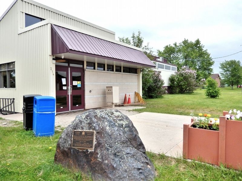
[English]Official twinning of the Township of Atikokan and the Town of Schefferville May 15, 1968 Welcome to the delegates from Schefferville [Français]Jumelage officiel de la ville . . . — — Map (db m309995) HM
As early as 1897 the presence of hematite boulders on the shores of Steep Rock Lake led geologists to suggest that beneath its waters lay a substantial iron ore body. It was not, however, until 1938 that a drill set up on the ice by Julian Cross of . . . — — Map (db m261099) HM
Erected to the Honored
Memory of
the men from the
municipality
of Chapple
who gave their lives
in the Great War
1914- 1918
Pte F. Stafford 5th Btn ·
H. Shaw ·
R. Wensley 44 ·
J.W. Foy ·
A.W. Hubbard 28 ·
E.J. . . . — — Map (db m203545) WM
In 1869, after the Louis Riel uprising of the breed, the Calders migrated east from the Red River settlement in Manitoba. Their heritage was the mixed blood of Orkney men and Indian maidens. As employees of the Hudson’s Bay Trading Company, William . . . — — Map (db m203492) HM
Two Nations Share Common History Northwestern Ontario and Northeastern Minnesota share the waters of Rainy Lake and Rainy River. The sister communities of Fort Frances and International Falls also share a common history that, for many years, . . . — — Map (db m261996) HM
[English] In 1970, Dianna Boileau (c. 1930s-2014) became the first Canadian to receive gender-affirming surgery. The catalyst for Dianna’s transition was Dr. Harold Challis, a British physician at La Verendrye . . . — — Map (db m261683) HM
The Montreal Fur Trade (1780-1821) Based in Montreal, the fur trade route followed the St. Lawrence-Great Lakes route west. The North West Company established headquarters on Lake Superior, first at the Grand Portage and later at Fort William . . . — — Map (db m309899) HM
The ‘Frances’ in the Fort Traveling on her honeymoon with her husband Sir George Simpson, Governor of the Hudson Bay Company, Frances Simpson describes the fort in her diary, 1830; “The rain fell in torrents all night, and until 9 A.M. . . . — — Map (db m309949) HM
John Robert Nicholson Pither Born in Montreal, J. R. N. Pither came to the country in a birch bark canoe joining the Hudson's Bay Company in 1846. While in charge of Fort Frances between 1853 and 1864, he lived on a point of land where the . . . — — Map (db m309994) HM
Community Roots in Fur Trade History The Calder Clan boasts a heritage of mixed blood of Orkney men and First Nations women — the Métis. As employees of the Hudson’s Bay Company, the ancestors of many community members served as traders, . . . — — Map (db m309897) HM
Fishing below the falls has always been a popular past-time. Oldtimers atest that the old bamboo pole, a staple in all hardware stores, a piece of linen line, a hook and a minnow produced lovely catches of Walleye. The first nations had long . . . — — Map (db m261992) HM
Seeing the Trees in the Forest The Crossroute Forest, managed by the pulp and paper company for the Crown, covers 1,338,415 hectares (3,221,471 acres) — 68 per cent productive forestland. Forest management activities include long-term . . . — — Map (db m309799) HM
Constructed 1875-1878, during Alexander Mackenzie's administration, as part of a larger project intended to improve communication with the West, the Fort Frances Canal provided unbroken communication between Rainy Lake and Lake of the Woods. In . . . — — Map (db m261797) HM
Erected on or near this site some time between 1775 and 1787 by the North West Company, and abandoned in 1821 at the union with the Hudson’s Bay Company. The establishment included “Athabaska House”, the depot where, owing to the distances to be . . . — — Map (db m309800) HM
[English] The first post on Rainy Lake was Fort Tekamanigan, built by Robutel de La Noue in 1717, but soon abandoned, probably because of the Sioux hostility. In 1731 the Sieur de la Jemeraye, La Vérendrye's nephew . . . — — Map (db m261700) HM
The 33 metre Tower (100 foot) was originally constructed at Pal Lake, near Atikokan, Ontario, as part of the Early Radar Detection system of defense established during the Cold War. It was part of the PineTree Line, a series of radar stations . . . — — Map (db m262093) HM
Pathfinders Maps David Thompson, an English Canadian fur trader, surveyor, and map-maker entered an apprenticeship in 1784 with the Hudson's Bay Company and later joined the North West Company. Thompson surveyed much of the Canada-U.S. boundary . . . — — Map (db m261993) HM
[English] Jacques de Noyon was the first white man to explore this region. Born in Trois-Rivieres. Noyon worked in the fur trade as a coureur de bois. In 1688 he led an expedition beyond Lake Superior into territory . . . — — Map (db m261686) HM
The upper Rainy River has been the centre of activity for centuries. The waterway was traveled by the First Nations and later the fur traders traveled the route to reach trading posts located on the lower river. Ship builders, docks and . . . — — Map (db m262226) HM
[English] The Hudson's Bay Company established Lac La Pluie House on this site to compete for furs with the North West Company's Fort Lac La Pluie. After the two companies merged in 1821, only Lac La Pluie House . . . — — Map (db m261687) HM
Lady Frances Ramsay Simpson, as a bride of the Governor of the Hudson’s Bay Company. Sir George Simpson visited the Hudson’s Bay Company Post here on June 1, 1830. In September 25, 1830, the post was renamed “Fort Frances” in her honour. — — Map (db m262100) HM
In October 1984, while constructing a parking lot, the Boise Cascade Paper Company unearthed the remains of men and women from the old cemetery of the Fort Frances Hudson’s Bay Company Post (1814-1870). In 1998, the men and women were again laid to . . . — — Map (db m261997) HM
The Voyageur's Highway The waterway through the Rainy River Region was an important part of the 3,000 mile canoe route from Montreal to the Athabaska country. The geography of the region created a navigable chain of rivers and lakes — a . . . — — Map (db m309863) HM
Paddles and Canoes The development of the fur trade was based on the ability to transport the required goods and furs along the numerous waterways during the short ice-free season. The Canoe, a portable watercraft adapted to interrupted . . . — — Map (db m309876) HM
Castor Gras The best furs were taken in the winter when the beaver were at their prime “…a ‘castor gras d'hiver’, a worn pelt, with guard hairs worn off was most in demand.” The symbol of the Beaver The Beaver is the national . . . — — Map (db m309887) HM
Prior to 1900 wealthy business men had begun to arrive to take excursions through the area for relaxation, fishing, and hunting. By the early 1900's steam boats for travel were prevalent on the upper Rainy River and Rainy Lake. Seeing the . . . — — Map (db m261995) HM
Born in Montreal, Pither joined the Hudson’s Bay Company in 1846. While in charge at Ft. Frances, 1853-56 and 1858-64, he lived in this vicinity (now Pither’s Point). On his retirement from the company in 1869, he served as Indian Agent at Fort . . . — — Map (db m203422) HM
Pierre Gaultier de Varennes, Sieur de La Vérendrye, was born at Trois Rivières and saw military service in North America and Europe before entering the fur trade. While stationed at Lake Nipigon in 1727 he heard stories of the “Western Sea” which . . . — — Map (db m203413) HM
English Fur Traders ‘A Company of Adventurers’ Organized as an imperial trading company, the Bay men were noted for being sober, persistent, cautious and inflexible in the face of competition. The London-based Hudson's Bay Company (HBC) stayed . . . — — Map (db m309885) HM
The first 150 recruits and officers of the North-West mounted Police passed through Fort Frances in October, 1873. They travelled by foot, birch-bark canoe, rowboats, and by open barges towed by steam tugs along the Dawson Route, from . . . — — Map (db m203384) HM
In 1942, the Shevlin Clarke Sawmill was moved, leaving the Shevlin Wood Yard in its place. The available land north of “Shevlin Yard” was sold for homes, schools, government and recreational facilities. The full capacity of Shevlin Yard is 75,000 . . . — — Map (db m309798) HM
In 1912, the Shevlin Clarke Company located their large twin milling facilities at the site of the Reid Sawmill. A major employer in the community, the company took advantage of the vast timber resources and waterway provided by the upper Rainy . . . — — Map (db m262089) HM
This two-mile portage around rapids in the nearby French River was among the most difficult on the Kaministiquia canoe route to the west, first recorded in 1688 by Jacques de Noyon and later used extensively by French and British fur traders. After . . . — — Map (db m261100) HM
The Great Fire Of 1910 started on October 4, 1910 in Williams, Minnesota and spread quickly throughout many Townships. On October 7, 1910 the fire reached Baudette, Minnesota. At this time the railroad and Rainy River citizens used railway . . . — — Map (db m254935) HM
On July 30, 1960 the International Bridge was officially opened between Rainy River, ON and Baudette, MN. Before the creation of the bridge, citizens used a ferry to travel between the two communities. Crossing was a slow process because the . . . — — Map (db m254941) HM
The 4008 steam locomotive was used to haul freight from Rainy River in the 1950's. The 4008 was donated to the Rainy River and District Chamber of Commerce on July 30, 1960 by R.J. McMillan, V.P. of the C.N.R. The original site location for the . . . — — Map (db m254921) HM
The dedication of this flag is in commemoration of those who served and paid the supreme sacrifice in World War I 1914-1918 World War II 1939-1945 Korea 1950-1953 We will remember them. Lest we forget Dedicated November . . . — — Map (db m254948) WM
Incorporated in 1899 under the leading railway promoters Sir William Mackenzie and Sir Donald Mann, the Canadian Northern undertook construction of a line from Winnipeg to Port Arthur. Avoiding Lake of the Woods, the rail line left Manitoba at . . . — — Map (db m254914) HM