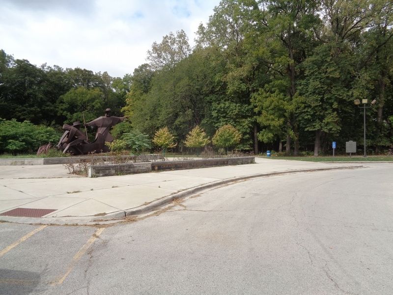
Near South Harlem Avenue (Illinois Route 43) south of Forest View Terminal Drive.
Here you stand at the west end of a 7.5 mile long water and overland travel route across a continental divide between the St. Lawrence and Mississippi River systems, known as the Chicago Portage. Well-known to Native Americans, the route was first . . . — — Map (db m157109) HM
Near 134th Place at St. Lawrence Avenue, on the right when traveling east.
Although Illinois was established as a "free" state in 1818, federal laws that had been enacted since 1793 permitted the recapture and return of runaway enslaved people within U.S. territory. Beginning in the 1830s, freedom seekers were . . . — — Map (db m261062) HM
Wolf Road Prairie Nature Preserve has been formally dedicated as a sanctuary for native plants and animals. It is being maintained and restored to its natural condition so that present and future generations can see the Illinois landscape as it . . . — — Map (db m246221) HM
On West Ogden Avenue at South Damen Avenue on West Ogden Avenue.
[English-language text on the west-facing side of the marker:]
The Main Street of America
In 1916, Cook County Hospital emerged as an important establishment for the Tri-Taylor neighborhood in Chicago. This imposing structure, characterized . . . — — Map (db m251638) HM
On 35th Street near Shields Avenue, on the right when traveling east.
This magnificent ball park was built all union under an historic project labor agreement and stands in tribute to the vision and unprecedented cooperation of those who crafted the agreement and to the many tradesmen and tradeswomen whose skill . . . — — Map (db m235429) HM
On South Main Street (Illinois Route 159) south of West Schwartz Street, on the right when traveling south.
Charles Samuel Deneen, Illinois' 23rd governor, was born in Edwardsville in 1863. Deneen was raised in nearby Lebanon, where he graduated from McKendree College (now McKendree University) in 1882. He later attended Union College of Law in Chicago . . . — — Map (db m182840) HM
On South Street at Willie Dixon Way, on the right when traveling east on South Street.
Willie Dixon, often called “the poet laureate of the blues,” was born in Vicksburg on July 1, 1915. As a songwriter, producer, arranger, and bass player, Dixon shaped the sound of Chicago blues in the 1950s and '60s with songs such as “Seventh . . . — — Map (db m69778) HM
On West Monroe Street at South Sangamon Street, on the right when traveling east on West Monroe Street.
This park is named for Mary Bartelme (1866-1954), a pioneering Illinois Lawyer. Bartelme became the first female judge in Illinois (1923) and the second female judge in the United States. Born at Fulton and Halsted Streets in Chicago, she became a . . . — — Map (db m132021) HM
On 31st Street 0.2 miles west of Wolf Road, on the right when traveling west.
Wolf Road Prairie Nature Preserve has been formally dedicated as a sanctuary for native plants and animals. It is being maintained and restored to its natural condition so that present and future generations can see the Illinois landscape as it . . . — — Map (db m245391) HM
Near The Illinois Prairie Path near South 1st Avenue ( Route 171), on the left when traveling west.
Praire Insects
This native garden is only a small fraction of the prairie that was once here. However, the bright colors and nectar of the forbs (wide-leaved flowering plants) and the shelter and food that the grasses provide, attract many . . . — — Map (db m235083) HM
On Midway Plaisance North near Stony Island Avenue, on the right when traveling west.
The Cheney-Goode Memorial honors two accomplished women who lived on the city's south side, Flora S. Cheney and Kathrine H. Goode.
Flora Sylvester Cheney (1872-1929) was a political activist, reformer, and legislator. She worked to secure . . . — — Map (db m314147) HM
On Wolf Road 0.2 miles north of 31st Street, on the right when traveling south.
Wolf Road Prairie Nature Preserve has been formally dedicated as a sanctuary for native plants and animals. It is being maintained and restored to its natural condition so that present and future generations can see the Illinois landscape as it . . . — — Map (db m253985) HM
July 1832
General Winfield Scott camped near this spring on way to Blackhawk War.
June 7, 1834
Election of Jean Babtiste Beaubien as 1st Colonel of Militia of Cook County, known as 60th Illinois Militia. In celebration of the . . . — — Map (db m236101) HM
Near South Harlem Avenue (Illinois Route 43) at Portage Trail, on the right when traveling south.
ca. 14,000 to 12,000 years ago - Glacial Lake Chicago drains through the Chicago outlet ca. 12,000 years ago - First humans in the Midwest ca. 4,000 years ago - The Nipissing Stage of the Great Lakes drains through the Chicago outlet . . . — — Map (db m254802) HM
On Barrypoint Drive west of 39th Street, on the right when traveling south.
Built in 1908 for George Hofmann, Jr., in a style fashioned after European Castles
Village of Lyons Landmark Illinois State Landmark - September 1978
National Register of Historic Places - December 1978
The Hofmann Tower Museum and . . . — — Map (db m293687) HM
On High Street east of Greenwood Avenue, on the right when traveling east.
Joshua P. Young was the second proprietor of the American House, a hotel built in Blue Island in 1844 which had originally been constructed in 1836 in Liverpool, Indiana to house the Lake County courthouse and post office. Young later became a major . . . — — Map (db m297931) HM
On William Street north of West Broadway (State Road 100), on the right when traveling south.
The Illinois State Penitentiary at Alton was the first institution built with public funds in Illinois. Previously, prisoners sentenced in county courts were incarcerated in crude buildings, often constructed of logs that were inadequate for the . . . — — Map (db m211622) HM
On Western Avenue north of York Street, on the left when traveling south.
Blue Island sits atop a 6-mile long glacial ridge, left behind 14,000 years ago when the 5000-foot thick Laurentide ice sheet melted and retreated, also scraping out the basin of Lake Michigan, to a depth of 340 feet below sea level.
In . . . — — Map (db m297904) HM
On South King Drive, on the right when traveling south.
Oscar DePriest
Politician
1871-1951
Shrewd, smart and street savvy, Oscar
DePriest was a natural politician. He
became Chicago’s first black alderman
and the first black congressman elected
from a northern state.
Born in . . . — — Map (db m181271) HM
Near South 5th Street at East Jackson Street, on the left when traveling north.
Chicago architect and builder
John M. Van Osdel (1811-1891)
designed the Illinois Governor's
Mansion which was constructed
beginning in 1853.
A Baltimore native who through apprenticeship
achieved the status of master builder, Van . . . — — Map (db m285785) HM
On Jefferson Street (U.S. 30) west of Chicago Street, on the right when traveling east.
Erected and dedicated to the memory of the soldiers and sailors of Will County
[Battle names on the base and obelisk:]
Winchester • Atlanta • Gettysburg • Nashville • Shiloh • Vicksburg • Appomattox • Fort Donelson • Chickamauga — — Map (db m304311) WM
In the beginning, Charles Wacker, head of the Chicago Plan Commission expressed, exactly what the District sought in its acquisition of its land holdings:
"Think of the benefits, educational, recreational, and financial, which a . . . — — Map (db m285567) HM
In the beginning, Charles Wacker, head of the Chicago Plan Commission expressed, exactly what the District sought in its acquisition of its land holdings:
"Think of the benefits, educational, recreational, and financial, which a . . . — — Map (db m228935) HM
On West Grace Street east of North Kostner Avenue, on the right when traveling west.
Constructed around 1856, this farmhouse was built by Phebe and John Gray on what was once a large farmstead in Jefferson Township, prior to annexation by the City of Chicago. The Grays were early settlers to the area who moved to Illinois from . . . — — Map (db m309067) HM
On South Western Avenue south of New Street, on the right when traveling south.
The Woolworth Building was built by William F. and John C. Klein, who were members of one of Blue Island's most prominent families. The Klein family established themselves in Blue Island in 1849, and were part of the German influx that changed Blue . . . — — Map (db m297896) HM
Near South Michigan Avenue north of East Ida B. Wells Drive, on the right when traveling south.
At this site on November 18, 1915, was founded the American Medical Women's Assoc., dedicated to the support of women physicians and women's health. As its founder and first president, Bertha Van Hoosen, M.D., demonstrated her dedication to the . . . — — Map (db m237431) HM
On South 50th Avenue just north of 25th Place, on the right when traveling north. Reported missing.
The Town Hall of the Town of Cicero stood here more than a century following the separation of Berwyn and Oak Park from Cicero in 1902. The original building was greatly expanded in the late 1930's. A further addition to it was made in the . . . — — Map (db m237843) HM
Near Van Buren Street 0.2 miles south of Madison Street, on the right when traveling south.
[Text in German:]
Von warmer menschenlieb durchgluht schlug froh sein herz der wegt entgegen und tief aus innerstem gemüth lebt seiner mitwelt er zum segen
Dem deutschen manne
Dem freunde der armen
Dem schützer der bedrängten
Aus . . . — — Map (db m249506) HM
On Court Place south of Benton Avenue, on the right when traveling south.
Abraham Lincoln was 30 years old in 1839, Storytelling and humor defined Lincoln's reputation as he grew from chopping wood, storekeeping and "riding" the Eighth Circuit, to leading a divided nation. He and Joe Naper, our city's founder, served in . . . — — Map (db m290309) HM
On Knoch Knolls Road 1.2 miles east of 95th Street, on the right when traveling east.
Founded in 1830 by Stephen J. Scott, his wife, Hadassah, son, Willard Sr., and other children in the family.
While on a hunting trip with his son Willard Sr., Stephen J. Scott discovered the DuPage River near what is now Plainfield. Impressed . . . — — Map (db m308677) HM
On North Narragansett Avenue 0.1 miles north of West Addison Street, on the left when traveling north.
In memory of
Henry Horner
1878 – 1940
Judge of the Probate Court of Cook County
1914 – 1933
Governor State of Illinois
1933 – 1940
He Had Clean Hands And A Pure Heart — — Map (db m246005) HM
On Narragansett Avenue south of Montrose Avenue. Reported unreadable.
The garden in front of you includes representative species of plants that once thrived in the Chicago [unreadable, likely "area before"] settlement began. [A few unreadable words] histories of Chicago that describe plants like these as far as the . . . — — Map (db m267935) HM
On West Grace Street east of North Kostner Avenue, on the right when traveling west.
John and Phebe Gray were distinguished by their generosity and social conscience. In 1857 they donated land to build a township hall at Milwaukee and Irving Park Road. In 1888, they donated land to build St. John's Episcopal Church one block north . . . — — Map (db m309130) HM
Near Des Plaines Avenue 0.2 miles south of Eisenhower Expressway (Interstate 290), on the right when traveling south.
[Plaque on east-facing side of monument:]
In loving memory
of past commander Wilbur F. Crummer
and his comrades here buried
of other comrades of the post buried
in Forest Home Cemetery
of all deceased comrades of the post wherever . . . — — Map (db m241587) WM
On Wisconsin Avenue north of 31st Street, on the left when traveling south.
The Berwyn Park District became a special unit of local government commonly known as a park district on May 10th 1920 when the Honorable James T. Burns, Judge of the County Court of Cook County issued Judicial Order 43897 approving a petition to . . . — — Map (db m255466) HM
On 31st Street near Home Avenue, on the right when traveling west.
The Berwyn Park District became a special unit of local government commonly known as a park district on May 10th 1920 when the Honorable James T. Burns, Judge of the County Court of Cook County issued Judicial Order 43897 approving a petition to . . . — — Map (db m255512) HM
On Oak Park Avenue 0.2 miles north of West Irving Park Road ( Route 19), on the left when traveling north.
This plaque commemorates those individuals buried within Cemetery No. 3, formerly associated with the Cook County Poor Farm, later known as the Read-Dunning Institutional complex, and later Chicago State Hospital. This Cemetery was platted on . . . — — Map (db m245999) HM
On South Martin Luther King Drive at East 47th Street, on the right when traveling north on South Martin Luther King Drive.
The Honorable Harold Washington
(1922-1987)
Chicago's First Black Mayor
Harold Washington was a consummate politician, a
political genius that rose through the rough and tumble
political landscape to become the first . . . — — Map (db m180735) HM
On Church Street at Orrington Avenue on Church Street.
The first house of worship in Evanston, dedicated July 27, 1856, stood on this site.
For years the most notable gatherings of the people were held in this building. Here, just after the Battle of Bull Run, at a war meeting, many Evanston men . . . — — Map (db m273722) HM
On Leon Cook Road 0.4 miles south of Santa Fe Drive.
[West-facing sign:]
Railroads & Prairies?
Many of our surviving prairie remnants are located along railroad tracks, because railroads limited development along their right-of-ways.
The Burlington Northern and Santa Fe Railway Co., whose . . . — — Map (db m262323) HM
On Division Street at Elmwood Avenue, on the right when traveling west on Division Street.
Jens Jenson
Originally named "North Park" when purchased by the Park District of Oak Park in 1912, this 11.75 acre park site was later renamed after Park District Commissioner Henry A. Taylor. The park sits atop one of several continental . . . — — Map (db m226510) HM
On Nuttall Road north of Bartram Road, on the right.
F.F. Tomek House
has been designated a
National Historic Landmark
This house possesses national significance in commemorating the history of the United States of America — — Map (db m245386) HM
Near Constitution Drive 0.1 miles west of Wolf Road.
Wolf Road Prairie Nature Preserve has been formally dedicated as a sanctuary for native plants and animals. It is maintained in its natural condition so that present and future generations can see the Illinois landscape as it appeared in the past. . . . — — Map (db m246229) HM
On Archer Avenue (Illinois Route 171) west of Willow Springs Road, on the right when traveling east.
In 1994, the Willow Springs Historical Society (WSHS) was approached by the Civilian Conservation Corps (CCC) Alumni Chapter 77 requesting assistance in restoring some of the area once occupied by CCC Camp Chicago-Lemont #612. Their intent was to . . . — — Map (db m295881) HM
On West 4th Street (Illinois Route 156) just east of South Church Street ( Route 156), on the left when traveling west.
The Waterloo City Hall is situated on Lots 75 and 76 at 100 West Fourth Street in the southerly block between Main Street and Church Street.
In 1816, George Forquer purchased a tract of land that is now part of the City of Waterloo. Forquer and . . . — — Map (db m144219) HM
On Washington Boulevard west of Thatcher Avenue, on the right when traveling west. Reported missing.
The preservation and restoration of this oak savanna remnant is a tribute to the Illinois savanna that existed prior to settlement in this area. Its unique ecological system is characterized by trees and shrubs, rare wild flowers, and diverse . . . — — Map (db m236961) HM
On 25th Street at Karlov Avenue, on the left when traveling west on 25th Street.
Rudy Lozano's short life was characterized by passionate community activism. He strove to empower workers and forge coalitions among Latinos, African Americans, and other minorities.
Lozano's activism began at a young age. While a student at . . . — — Map (db m237840) HM
On South Wabash Avenue north of Balbo Avenue, on the right when traveling north.
For over a half century, this building housed the headquarters of the Company which has come to be known as Brunswick Corporation. Then called the Brunswick-Balke-Collender Company, it moved here in 1913 after a fire destroyed its previous home. The . . . — — Map (db m237407) HM
On Center Avenue, on the right when traveling north.
In memory of
Allan Pinkerton,
born in Glascow, Scotland,
August 25th 1819.
Died in Chicago, Illinois,
July 1st 1884.
Aged 65 years.
A friend to honesty
and a foe to crime,
devoting himself for a generation to the prevention . . . — — Map (db m61986) HM
Thin black lines indicate changes in relevance. Between each pair of lines entries are ordered geographically but all have the same relevance.
* Inflectional forms of words are their plurals, singulars, and possessives as well as gramatical tenses and similar variations.