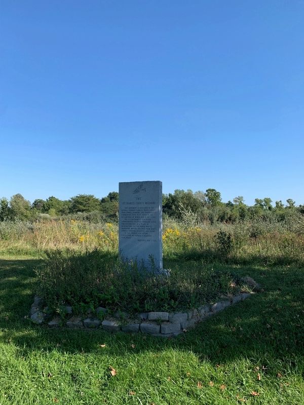
On State Highway 94 0.2 miles east of Miller School Road, on the left when traveling west.
This monument is dedicated to the several hundred families whose exodus from Howell, Hamburg, and Toonerville-y communities took place prior to the declaration of World War II., Dec 7, 1941. The Government purchased approximately eighteen thousand . . . — — Map (db m182626) HM
On South Main Street north of Water Street, on the right when traveling north.
In 1764, France ceded the Louisiana territory to Spain. That same year, Pierre Laclede and a group of associates anxious to expand local trade, founded St. Louis near the confluence of the Mississippi and Missouri Rivers. St. Louis grew quickly and . . . — — Map (db m238828) HM
The Hamburg Trail is an eight-mile hiking and biking trail which links the Katy Trail to the August A. Busch Memorial Conservation Area Headquarters. The trail was created as part of a cooperative effort between the Missouri Department of . . . — — Map (db m260491) HM
On Missouri Route 161 at Boonslick Road, on the right when traveling east on Missouri Route 161.
Missouri achieved statehood in 1821 as a result of the famous "Missouri Compromise." It was decreed that Missouri be admitted as a slave state, but thereafter no state north of the 36º 30' North latitude in the Louisiana Territory would be . . . — — Map (db m44280) HM
On Strecker Road at Church Road, on the right when traveling west on Strecker Road.
This predominantly African-American community, whose history is linked to that of the Union Baptist Church and the families of former slaves, was settled c. 1879, but its future inhabitants had a much longer history in the area. In 1797, Daniel . . . — — Map (db m241112) HM
With the advent of the Louisiana Purchase, St. Charles became part of the Missouri territory. Meriwether Lewis and William Clark started out from St. Charles in 1804 to explore the rest of the Louisiana Purchase. St. Charles County was one of the . . . — — Map (db m163859) HM
On Dames Park Drive at State Highway P, on the right when traveling north on Dames Park Drive.
"Bold, courageous, genial and inventive, James H. Audrain was a man in his times almost larger than life. No frontier constrained him. He was in step with many of the men we know from the history books and countless others." . . . — — Map (db m169536) HM
Near Olive Street 0.1 miles east of North 2nd Street (State Highway 94), on the left when traveling east.
The Missouri River has been flooding ever since it was created by massive glaciers melting at the end of the last ice age 10,000 years ago. In recorded history, the greatest Missouri River flood struck St. Charles in August 1993, after heavy . . . — — Map (db m150984) HM
On Main Street north of Earl Garrett Street, on the right when traveling north.
Kentucky native James Kerr, the son of a Baptist minister, was reared in Missouri. Kerr fought in the War of 1812 and was later sheriff of St. Charles County, Missouri. He married Angeline Caldwell in 1818 and served in the Missouri Senate and . . . — — Map (db m111223) HM
First permanent settlement on the Missouri River, known as Les Petites Cotes (Fr. Little Hills) until after dedication of Church of St. Charles Borromeo, 1791. Though 1780 is given as date of founding French-Canadian Louis Blanchette first . . . — — Map (db m138183) HM
On Market Street near Main Street, on the right when traveling south.
Daniel Boone, universal symbol of the American frontier, was 65 when he came to Upper Louisiana, now Missouri, 1799. His wife Rebecca was 60. The Spanish lieutenant governor granted Boone 845 acres nearby here on Femme Osage Creek.
Boone did . . . — — Map (db m42564) HM
On Lucille Avenue west of Highway 94, on the right when traveling west.
Katy Trail State Park runs for 5.70 miles from Matson to Augusta, Tavern Bluffs, seen across the river, were the scene of a dramatic episode from the Lewis and Clark Expedition: on May 23, 1804, Capt. Meriwether Lewis fell 20 feet before . . . — — Map (db m133210) HM
On West Drive at Lucas Road, on the right when traveling south on West Drive.
Great Rivers Greenway is the public organization leading the development of a region-wide system of interconnected greenways, parks and trails, known as the River Ring. The River Ring will join two states and cover an area of 1,216 square miles. . . . — — Map (db m218973) HM
New Franklin, known as the city where four trails meet, owes its place in history to the Lewis & Clark Expedition of 1803-1806; the blazing of the Boonslick Trail pioneered by Daniel Boone from Kentucky to the original historic rivertown of . . . — — Map (db m46460) HM
On Walnut Street at Ferry Street, on the right when traveling east on Walnut Street.
The river landing was a popular Indian trail, and a campsite for French fur traders. Leonard Harold, follower of Daniel Boone, came from Virginia to Missouri in the late 1700's and settled the river front area that would later become . . . — — Map (db m169477) HM
On Missouri Route 161 at Boonslick Road, on the right when traveling east on Missouri Route 161.
You are standing on the site of the Danville Female Academy, and at your front is the sole surviving building of the Academy, the chapel and dormitory.
The Female Academy was founded in 1853 by the Reverend James H. Robinson at a time when . . . — — Map (db m42744) HM
On Public Street south of Water Street, on the right when traveling south.
Katy Trail State Park runs for 5.70 miles from Augusta to Matson. The first four miles are away from roads, and trail users can enjoy the farm landscape and bottomland forest of the Missouri River floodplain, lined by increasingly taller . . . — — Map (db m133202) HM
On State Highway 94 at Darst Bottom Road, on the right when traveling north on State Highway 94.
Around the time of the Civil War, southwestern St. Charles County was a rural and isolated community. By 1888, the Missouri-Kansas-Texas Railroad negotiated to extend its line through the region. As the railroad moved in, two towns sprung up . . . — — Map (db m133233) HM
On Missouri Avenue (State Highway 94) at Walnut Springs Drive, on the right when traveling north on Missouri Avenue.
Baseball has played an important role in the lives of St. Charles County residents. According to the St. Charles News, the first recorded local game was played July 1, 1875 between the St. Charles Browns and the St. Charles Acadia. . . . — — Map (db m169482) HM
On Mill Street (State Highway F) just south of State Highway D, on the right when traveling north.
The St. Paul Lutheran Church stands directly on the ridge of Missouri and Mississippi River watersheds. Rainwater from the west side of the roof eventually flows into the Mississippi River, and water from the east side finds its way into the . . . — — Map (db m169510) HM
On North Linn Avenue at East Allen Street, on the right when traveling north on North Linn Avenue.
Tobacco was grown here since the 1820's.
Wentzville's seven big factories started
producing and selling products before the
Civil War. The largest of them, Dula & Carr, sold their factory in 1884-1885. Tobacco was still grown by local farmers . . . — — Map (db m278153) HM
On Grant's Trail just west of Sappington Road, on the right when traveling west.
Sappington House
• The Sappington House is the historic home of Thomas Sappington. Thomas was one of the seventeen children of John and Jemima Sappington, early pioneers of the area. John and Jemima Sappington moved to this area in 1804 . . . — — Map (db m140976) HM
Near Greens Bottom Road 1.3 miles west of Jungs Station Road, on the right when traveling west.
The distance from Greens Bottom to St. Charles is 6.20 miles. Traveling east toward St. Charles, the elevation remains almost constant. Greens Bottom (milepost 45.7) is named for the American Revolutionary War (1775-1783) veteran James Green, . . . — — Map (db m169568) HM
1797 - James Mackay granted land including the salt spring by Spanish authorities in St. Louis.
1799 - Daniel Boone and his family arrive in Missouri and receive land grants in St. Charles County from the Spanish authorities.
. . . — — Map (db m248767) HM
Near South River Road east of Hemsath Road. Reported unreadable.
Rolling Along the Katy Trail
• The Missouri-Kansas-Texas (MKT) railroad rolled along this route from 1870 to 1988. Locomotives of every era traveled here, tracing the path of the Missouri River, from the early, wood-burning steam engines, . . . — — Map (db m150851) HM
On South Riverside Drive at Madison Street, on the right when traveling north on South Riverside Drive.
Picturesque St. Charles hugs the banks of the Missouri River. The mixture of French, early American and German influences and careful restoration to make this a unique historical town.
Main Street of St. Charles was recognized as a . . . — — Map (db m169202) HM
Near Rue St. Francois 0.1 miles west of North St. Charles Street, on the right when traveling west. Reported unreadable.
A Fertile Valley
You are standing in one of Missouri's oldest settlements. In the last half of the 18th century, French trappers following the Riviere le Biche (Cold Water Creek) came upon this rich, fertile valley and settled here. Spanish . . . — — Map (db m288772) HM
On Krumm Road 0.2 miles south of Meramec Bottom Road.
Welcome
Welcome to the Meramec Greenway Trail at the I-55 Trailhead. The next trailhead is located 2.0 miles upstream at the Lower Meramec Trailhead. This multi-use asphalt trail is a joint effort between Great Rivers Greenway and the Saint . . . — — Map (db m157252) HM
On Jessup Drive West just south of Fort Drive, on the left when traveling north.
When the City of O'Fallon purchased Fort Zumwalt Park for $1 from the Missouri Department of Natural Resources in 1978, it acquired about 48 acres, the ruins of a War of 1812 settler fort and a brick house built circa 1884-86. What took . . . — — Map (db m169558) HM
On Heritage Landing south of South St. Peters Parkway, on the right when traveling north.
Cribbin's Home
• This park, historically known as the Cribbin's Home, Kuhlmann's Grove, and even Cedar Grove in 1875, features a well-known home built in the mid-1800s.
• The home was built by Lawrence Cribbin (sometimes spelled . . . — — Map (db m150854) HM
On North Leonor K Sullivan Boulevard at Biddle Street, on the right when traveling north on North Leonor K Sullivan Boulevard.
Jefferson National Expansion Memorial
Gateway Arch
• The Gateway Arch is a 630 feet tall stainless steel structure designed by famous architect Eero Saarinen. It symbolizes St. Louis's role as the gateway to the west.
• A tram takes . . . — — Map (db m144261) HM
Near East Grand Avenue. Reported permanently removed.
Industry on the River
• The St. Louis riverfront is a working industrial and shipping center for the only area in the country that produces six basic metals: iron, lead, zinc, copper, aluminum and magnesium.
• The City of St. Louis . . . — — Map (db m165761) HM
On Riverview Drive south of Scranton Avenue. Reported permanently removed.
Wildlife in Urban Environments
Wildlife Area
• While urban and industrial areas seem harsh and forbidding to wildlife, nature endures with a wide array of flora and fauna.
• Many wild creatures
• The area is home to many wild . . . — — Map (db m145730) HM
Near Delmar Boulevard near DeBaliviere Avenue, on the right when traveling west. Reported permanently removed.
The Ruth C. Porter Mall commemorates the life and legacy of Ruth C. Porter, a tireless activist who left an indelible mark on St. Louis and her home, the West End neighborhood.
At great personal sacrifice, she dedicated her life to eradicating . . . — — Map (db m141906) HM
On 2nd Street west of Club Road, on the right when traveling east.
Park History
• This area was originally named Meramec Bend for the "big bend" the Meramec River makes to the south.
• Nearby salt springs attracted early Native Americans and the valley's first European settlers. Numerous tribes . . . — — Map (db m194343) HM
On Schell Road at Augusta Bottom Road, on the right when traveling north on Schell Road.
1832 - Julius Mallinckrodt arrived from Dortmund, Westphalia, Prussia. Mallinckrodt purchased land from Ludwig Eversmann, and married Mary McClenny. The Mallinckrodts dreamed of a new Dortmund.
1835 - Mallinckrodt asked Alexander . . . — — Map (db m169475) HM
On East Main Street at South Talley Street, on the left when traveling east on East Main Street.
In 1855, William M. Allen donated land to establish a new community in St. Charles County. Allen laid-out the town, which consisted of a narrow tract of ground seven blocks long, lying east and west, and established a train station to serve the . . . — — Map (db m169519) HM
On Bald Hill Road 0.1 miles north of Weber Drive, on the right when traveling north.
Located just south of downtown Eureka, Lions Park is named for the Eureka Lions Club and honors its community service and fundraising efforts for the Eureka area. Lions Club's generous donation helped established the athletic fields within the . . . — — Map (db m157385) HM
Near South Riverside Drive at Madison Street, on the right when traveling north.
The distance from St. Charles to Greens Bottoms is 6.20 miles. Traveling west toward Greens Bottom, the elevation remains almost constant. In St. Charles, the route of Katy Trail State Park runs beside the Missouri River bluffs. The . . . — — Map (db m169210) HM
On Jungermann Road at Willott Road, on the right when traveling south on Jungermann Road.
Lest we forget Freedom is not free
Korean War veterans can stand tall
The Korean War was the most important event of the 20th century it was the first time United states used force in implementing its policy of the containment of Communism . . . — — Map (db m227064) WM
Thin black lines indicate changes in relevance. Between each pair of lines entries are ordered geographically but all have the same relevance.
* Inflectional forms of words are their plurals, singulars, and possessives as well as gramatical tenses and similar variations.