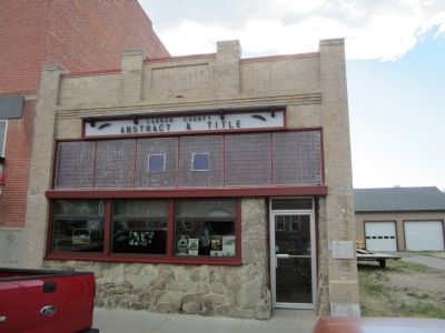
On North Broadway Avenue (Route 212) south of 9th Street, on the right when traveling south.
Local physician Dr. Samuel Souders owned this commercial lot in 1909 when Dan Davis, an advocate for the construction of a fancy opera house, proposed it for the construction of his vision. The newspapers reported weekly for several months on Davis’ . . . — — Map (db m45384) HM
On Hauser Avenue North near 5th Street West, on the right.
The manager of the Red Lodge Brewery, Paul Lehrkind, purchased this lot in 1920, likely with the intent of building a home. However, despite efforts to survive Prohibition by manufacturing the “near beer” Bud-O (“Always on Top”), Lehrkind was forced . . . — — Map (db m190277) HM
On North Broadway Avenue (U.S. 212) south of 11th Street, on the right when traveling south.
A combination moving picture theater and boarding house were the original tenants of this two-story masonry building, completed in 1908. Several directors managed the rather short-lived Alcazar, including Steve Roman, whose family long monopolized . . . — — Map (db m45387) HM
On Hauser Avenue North near 7th Street West, on the left when traveling north.
Over a quarter of the houses in the elite “Hi Bug” neighborhood were built between 1900 and 1901, including this one-and-one-half-story home, erected as a real estate investment by Red Lodge merchant Walter R. Hall and his wife Louisa. After leasing . . . — — Map (db m190244) HM
On North Broadway Avenue (U.S. 212) north of 10th Street, on the right when traveling north.
Americans organized much of their social life around fraternal groups at the turn of the twentieth century. The Benevolent and Protective Order of Elks provided an important social and charitable outlet for Red Lodge's professionals, who circulated . . . — — Map (db m45395) HM
On North Broadway Avenue (U.S. 212) at 10th Street, on the right when traveling north on North Broadway Avenue.
Butte architect P. J. Donahue drew the plans for the 1899 landmark after fire destroyed its predecessor. Situated at the busy northern end of the commercial district, the building today provides an excellent example of restrained, classically . . . — — Map (db m45402) HM
On North Broadway Avenue (U.S. 212) at 9th Street, on the right when traveling north on North Broadway Avenue.
When prominent local physician and surgeon Dr. Samuel Souders built this magnificent hospital in 1909, it was considered “state-of-the-art.” Amenities included a central heating system, wide doorways and hallways, an elevator, and . . . — — Map (db m45404) HM
On Hauser Avenue North near 3rd Street West (State Highway 78), on the left.
Forty-five guests enjoyed a sumptuous dinner and housewarming at the home of John and Alphia Chapman on November 12, 1903. Begun in 1902, completion of the residence was delayed when contractor Walter S. Smith suffered a serious fall from the porch . . . — — Map (db m190278) HM
On North Broadway Avenue (U.S. 212) south of 11th Street, on the right when traveling south.
This two-story building was under construction in 1907, and for a short time housed part-owner Charles Antilla’s dry goods store. In 1912, new owners Ed Ricketts and C. V. Lucas located their Okay Meat Market, later the Red Lodge Meat Market, on the . . . — — Map (db m45388) HM
On 3rd Street West near Airport Road, on the left when traveling west.
A natural springs and pond provided ice and water for a brewery established here in the early 1890s. In 1894, arson destroyed the ice house and brewery buildings, but a small, one-room log residence escaped the blaze. Dan Davis purchased the . . . — — Map (db m190562) HM
On Hauser Avenue North at 5th Street West, on the left when traveling north on Hauser Avenue North.
Architect Seth Hunneywell designed and built this Colonial Revival two-and-one-half-story home for Alfred and Ruth Flager, who lived here from 1902 to 1911. Costing approximately $3,500 to build and boasting “all the modern conveniences,” its “eight . . . — — Map (db m190274) HM
On North Broadway Avenue (U.S. 212) at 11th Street, on the right when traveling south on North Broadway Avenue.
On Sept. 18, 1897, The Sundance Kid (Harry Longbaugh), Kid Curry and others of the "Wild Bunch" rode into Red Lodge after escaping from jail in Belle Fourche, S.D., and announced their intention of making an unauthorized withdrawal from the Carbon . . . — — Map (db m80188) HM
On 6th Street West near Word Avenue North, on the right when traveling west.
Prominent lumber merchant C. C. Bowlen purchased this lot in 1901. Two years later, when attorney George Pierson decided to build a larger home, Bowlen purchased Pierson’s front-gable residence and moved it a block south to this location. . . . — — Map (db m190559) HM
On North Broadway Avenue (U.S. 212) north of 10th Street, on the left when traveling north.
Photographer Mark E. Hawkes and his son Charley built a photography studio at this location where much of Red Lodge’s history was documented in pictures. Charley later struck out for Great Falls, and son Harry joined Mark. Hawkes & Son sold the . . . — — Map (db m45405) HM
Near Beartooth Highway (U.S. 212) 8.2 miles west of Rock Creek Road, on the right when traveling east.
Lieutenant General Philip Sheridan and 124 men forged the first documented passage over the Beartooth Mountains in 1881. Once thought impassible, the route was later modified by E. E. Van Dyke - a miner from coal rich Red Lodge, Montana. His route . . . — — Map (db m45244) HM
On North Broadway Avenue (U.S. 212) at 11th Street, on the right when traveling north on North Broadway Avenue.
In the 1920s Italian shoemaker Ludovico Iarussi (later changed to Jarussi) owned this property containing his shop and several frame commercial buildings. In 1929 Iarussi razed the older shops and constructed the present building. Financially . . . — — Map (db m45409) HM
On U.S. 212 near Two Mile Bridge Road, on the left when traveling north.
Finnish immigrant Ephraim Kent settled in Red Lodge in the early 1900s to work in the coal mines while his wife, Fiina, began a small dairy business. It was a family venture from the start, with all the children pitching in to deliver raw milk in . . . — — Map (db m190567) HM
On North Broadway Avenue (U.S. 212) at 8th Street, on the right when traveling north on North Broadway Avenue.
Red Lodge Miner’s Local No. 1771 had grown to more than a thousand members when this labor temple was built in 1909. The United Mine Workers of America organized nationally in 1896 and by 1898, Local No. 1771 had 200 members. The building is a . . . — — Map (db m45412) HM
On Broadway Avenue North near 3rd Street East, on the left when traveling north.
This log cabin was the home of one of Montana's most notorious citizens - John "Liver-Eating" Johnston, a sobriquet he earned in 1869 while cutting wood for the Missouri River steamboats in north central Montana. After a battle with the Lakota, he . . . — — Map (db m190093) HM
On Broadway Avenue South (U.S. 212) near 11th Street West, on the left when traveling north.
Early Red Lodge businessmen James Blackburn and Dominic Marino jointly built this fine two-story commercial building circa 1905 to house a mercantile business. A series of saloons later occupied the ground floor. An upstairs boarding house, first . . . — — Map (db m190220) HM
On 7th Street West at Word Avenue North, on the right when traveling west on 7th Street West.
A four-square plan, tapered porch pillars, and flared overhanging eaves reflect the Craftsman style influence that affords this distinctive home a more modern appearance than its contemporary neighbors. Decorative cresting and leaded glass add . . . — — Map (db m190440) HM
On Hauser Avenue North at 6th Street West, on the left when traveling north on Hauser Avenue North.
Rocky Fork Town and Electric Company sold this lot and the one next door to F. P. Musser for $84 in 1896. Immediate resale to real estate agent T. P. McDonald for $177 netted Musser a handsome profit. This four-square cottage was either moved or . . . — — Map (db m190247) HM
On Hauser Avenue North near 5th Street West, on the right when traveling north.
The sloping roof of this one-and-one-half-story house once shaded an open porch. The curved roofline and shed dormer add Craftsman style elegance to the home, constructed on a double lot after 1907. The interior also reflected Craftsman ideals with . . . — — Map (db m190276) HM
On Broadway Avenue South (U.S. 212) near 12th Street East, on the right when traveling north.
These two turn-of-the-twentieth-century wood-frame commercial buildings with a tiny shop sandwiched in between today share one façade. In 1900, Biagio Sconfienza opened a bakery in the one-story building. In 1903, as the business prospered, Biagio . . . — — Map (db m190225) HM
On South Broadway Avenue (U.S. 212) at 13th Street, on the right when traveling south on South Broadway Avenue.
German-born Victor and Otto Neithammer first established their meat market on North Broadway in 1912, raising their own livestock to supply this and other local family-run stores. Because the Neithammers' employees represented many ethnic groups, . . . — — Map (db m45415) HM
On Word Avenue North at Adams Avenue North, on the left when traveling north on Word Avenue North.
One of nine remaining homes on Nutting Row, this foursquare cottage features a hip-roofed main block with ornate dormers with shingles in an imbricate pattern. The design and plan of this 1907 home reflects William B. Nutting’s role in the . . . — — Map (db m190448) HM
On Hauser Avenue North at 3rd Street West, on the left when traveling north on Hauser Avenue North.
Irish immigrant Daniel G. O’Shea arrived in Carbon in 1887. The eager eighteen year old took a position with the Rocky Fork Coal Company, serving as paymaster and bookkeeper until 1899 when he was appointed manager. He resigned from RFCC in 1903 to . . . — — Map (db m190438) HM
On Hauser Avenue North near 7th Street West, on the left when traveling north.
“Coziness” was the watchword of progressive builders in the early twentieth century. Small, well-designed houses proliferated after 1900 in part to compensate for the expense of such modern conveniences as indoor plumbing. Plans for . . . — — Map (db m190227) HM
On North Broadway Avenue north of 11th Street, on the right when traveling north.
Designed by Red Lodge carpenter and amateur architect Frank A. Sell and built by W. T. Pernham in 1902, this impressive brick commercial building was home to the Red Lodge Picket and, after 1918, the Picket-Journal, the primary news . . . — — Map (db m45416) HM
On Hauser Avenue North near 6th Street West, on the left when traveling north.
Michigan-born attorney George Pierson and his wife Loretta moved to Red Lodge in 1894. Soon thereafter they purchased this lot, where they lived in a one-story cottage. After the Piersons decided to build this “Free Classic” Queen Anne style . . . — — Map (db m190248) HM
On 6th Street West near Word Avenue North, on the left when traveling west.
During the summer of 1887, Ben F. Pippinger became Red Lodge’s first teacher, hired to teach the children of the Rocky Fork Coal Company miners opening the area’s first coal mines. Pippinger later ran the Cloverdale Dairy on a ranch north of town. . . . — — Map (db m190453) HM
On Broadway Avenue North near 3rd Street East, on the left when traveling north.
"The buffalo gone and freedom denied him, the Indian was visited by two equally hideous strangers, famine and tuberculosis. The could cope with neither. His pride broken he felt himself and outcast, a beggar in his own country. It was now that . . . — — Map (db m190094) HM WM
On North Broadway Avenue (U.S. 212) at 12th Street, on the left when traveling north on North Broadway Avenue.
High transom windows that provide interior light for a mezzanine commercial display area are an interesting design feature of this well-constructed commercial building. The simple chain-patterned ornamentation of buff brick across the tall parapet . . . — — Map (db m45419) HM
On North Broadway Avenue (U.S. 212) at 11th Street, on the right when traveling north on North Broadway Avenue.
The Rocky Fork Coal Company constructed this hotel, originally the Spofford, which welcomed its first guests on July 4, 1893. This architectural landmark, built before the commercial district was platted, originally had its main entrance on 11th . . . — — Map (db m45390) HM
On South Broadway Avenue (U.S. 212) at South Hauser Avenue, on the right when traveling east on South Broadway Avenue.
Coal was discovered in the Rock Creek Valley nearly two decades before Red Lodge was established as a mail stop on the Meeteese Trail in 1884. In 1887, the Rocky Fork Coal Company opened the first large-scale mine at Red Lodge sparking the . . . — — Map (db m45250) HM
On 2nd Street East at Haggin Avenue, on the right when traveling west on 2nd Street East.
Pure Rock Creek water and a ready market of thirsty coal miners struck Bozeman beer baron Julius Lehrkind as a recipe for success. With nephews Fred and Paul, Julius incorporated the Red Lodge Brewing Company in 1910, hiring the prominent . . . — — Map (db m190564) HM
On 12th Street at North Broadway Avenue (U.S. 212), on the right when traveling west on 12th Street.
Rapid growth of the young town of Red Lodge coincided with the arrival of the Northern Pacific Railroad’s branch line in 1889. The area became Montana’s leading coal mining region. Town lots were platted by the secretary of the Rocky Fork Town and . . . — — Map (db m45386) HM
Near State Highway 78 0 miles north of Lower Continental Drive, on the left when traveling north.
The Consolidated Mausoleum Company made the case for constructing a communal mausoleum in a full-page newspaper advertisement in 1921. “The present high state of civilization demands for the masses a more humane and sanitary method of taking care of . . . — — Map (db m190570) HM
On Word Avenue North at 7th Street West, on the left when traveling north on Word Avenue North.
Prominent Red Lodge businessman William B. Nutting subdivided this northwestern neighborhood as the Nutting Addition circa 1899. Beginning in 1900 with this home, he built five cottages north of his own residence that became known as Nutting Row. J. . . . — — Map (db m190443) HM
On Hauser Avenue North at 5th Street West, on the right when traveling north on Hauser Avenue North.
A steep-roofed gable-front cottage with a wraparound porch stood on this lot by 1901. Sometime before 1907 Rose Robbins—who owned the one-and-one-half-story home along with many other lots in the neighborhood—expanded the residence, adding a rear . . . — — Map (db m190275) HM
On Broadway Avenue South near 13th Street East, on the right when traveling north.
Original rusticated and ashlar concrete blocks and the 1935 ROMAN marquee distinguish the façade of this early movie theater. Austrian immigrant Steve Roman built the theater in 1917. One of fourteen sons, nineteen-year-old Roman came to Red Lodge . . . — — Map (db m190222) HM
On Hauser Avenue North near 5th Street West, on the left when traveling north.
Real estate speculation abounded after the Northern Pacific Railroad constructed a branch line to Red Lodge to take advantage of the area's rich coal deposits. In 1891 Nathan Smethurst purchased this lot for $36, selling it for a profit the same . . . — — Map (db m190249) HM
On Hauser Avenue North near 7th Street West, on the left when traveling north.
A prestigious corner site contributes much to the elegance of this Queen Anne style cottage, built by rancher and businessman Louis Sichler in 1902. The steep and asymmetrical roofline, projecting gables, and two-storied bay epitomize the Queen Anne . . . — — Map (db m190245) HM
On Hauser Avenue North near 3rd Street West, on the right when traveling north.
W. A. Talmage arrived in Red Lodge in 1888 to manage a branch of a Billings mercantile. By 1894, the ambitious businessman owned his own large hardware and farm implements store on Billings Avenue. Undoubtedly, his business connections helped . . . — — Map (db m190436) HM
On Hauser Avenue North at 6th Street West, on the left when traveling north on Hauser Avenue North.
According to an oral tradition handed down in the Crockett family, this gable-front cottage was moved here from “Old Town.” It was remodeled circa 1901 when it is first recorded on this lot. At that time, prominent merchant W. A. Talmage owned the . . . — — Map (db m190246) HM
On South Broadway Avenue (U.S. 212) at South Hauser Avenue, on the right when traveling east on South Broadway Avenue.
The Beartooth Plateau contains some of the oldest exposed rocks on Earth and provides a unique window into the history of our planet. About 55 million years ago, this massive block of metamorphic basement rock pushed its way upward nearly two . . . — — Map (db m45251) HM
On North Broadway Avenue at 11th Street, on the left when traveling north on North Broadway Avenue.
Originally intended as a meeting hall with storefront space, tenants Byton Down and Robert Pryde redesigned the building’s ground floor before its completion for use as a theater. When the Iris opened in 1925, residents viewed it as welcome . . . — — Map (db m45410) HM
On South Broadway Avenue (U.S. 212) at South Hauser Avenue, on the right when traveling east on South Broadway Avenue.
According to tradition, a band of Crow Indians left the main tribe and moved west into the foothills of the Beartooth Range many years ago. They painted their council tepee with red-clay and this old-time artistry resulted in the name Red Lodge. . . . — — Map (db m45247) HM
On North Broadway Avenue (U.S. 212) at 10th Street, on the left when traveling north on North Broadway Avenue.
A keen sense of the town’s future prompted businessman William Talmage to move his hardware business away from the busy commercial center a few blocks south to this building in 1894. When other businesses began to move to the newly platted main . . . — — Map (db m45420) HM
On Broadway Avenue South near 12th Street West, on the left when traveling north.
This fine example of masonry architecture, with its unusually preserved storefront and recessed entry, appears almost as it did in 1900 when Walter Hall opened his first-floor grocery. Sandstone banding, corbelled arches, and original stained glass . . . — — Map (db m190221) HM
The Bozeman Trail was located ten miles south of here. John Bozeman pioneered the trail in this area in July 1864. After crossing the Bighorn River eight miles below the opening of the Bighorn Canyon, he led his wagon train northwest to the . . . — — Map (db m4326) HM
Near Interstate 90 at milepost 419, on the right when traveling west.
Columbus, located ten miles west of here, has a rich and colorful history. In 1874, whiskey trader Horace Countryman built a trading post a few miles west of the future site of Columbus. The Crow Reservation was then on the south side of the . . . — — Map (db m190922) HM
On 5th Street just north of East 5th Avenue North, on the left when traveling north.
”I deturmined to have two Canoes made out of largest of those trees and lash them together — had handles put in three Axes and after Sharpening them with a file fell the two trees — those appeared tolerably Sound and will make Canoes of 28 feet . . . — — Map (db m252996) HM
On West 1st Avenue North at Quarry Street, on the right when traveling west on West 1st Avenue North.
Italian stonemason Michael Jacobs built this outstanding Eclectic style house for his family in 1907. Born Michelangelo Jacobucci, Jacobs apprenticed in Vinchiaturo, Italy, before joining his brother Gabriel in the United States circa 1878. The . . . — — Map (db m190743) HM
Near Interstate 90 at milepost 419, on the right when traveling east.
In 1878, a local farmer named Alonzo Young established a boat landing on the Yellowstone River several miles east of here. In addition to the boat landing, Young and his wife operated a stage station on the road to Coulson and Fort Keogh. In . . . — — Map (db m190926) HM
On Interstate 90 at milepost 419, on the right when traveling east.
For over sixty million years during the Cretaceous Period, much of eastern Montana was underwater, covered by an vast inland sea. As the Rocky Mountains formed to the west, it created a broad, flat coastal plain that was home to many different . . . — — Map (db m190925) HM
Near Interstate 90 at milepost 419, on the right when traveling west.
Fighting escalated between the Lake and Northern Cheyenne Indians and American miners and settlers in early 1876. Increasing pressure from non-Indians in the region, coupled with a desire by the Indians to live free on the northern Great Plains, . . . — — Map (db m190923) HM
On Interstate 90 at milepost 419, on the right when traveling east.
Fighting escalated between the Lake and Northern Cheyenne Indians and American miners and settlers in early 1876. Increasing pressure from non-Indians in the region, coupled with a desire by the Indians to live free on the northern Great Plains, . . . — — Map (db m190928) HM
Near Montana Avenue (Business U.S. 90) near North 29th Street, on the right when traveling west.
In the years leading up to Prohibition, more than a dozen local shops sold cigars and tobacco. In 1917, Billings claimed five cigar factories.
When Prohibition outlawed alcohol and shut down saloons, it indirectly undercut the tobacco industry . . . — — Map (db m165960) HM
On Highland Park Drive near Whittier Place, on the left when traveling north.
When Evelyn and Arnold Graf purchased this property in 1938, the area was still predominantly wild, covered with native grasses and scrub cedar. The roads were mostly unpaved and hayfields and pastures lay to the north. Graf designed and built this . . . — — Map (db m166734) HM
Near 2nd Avenue North near North Broadway, aka North 28th Street, on the right when traveling east.
Constructed in 1907 during a period of robust city growth, the Babcock replaced the original Billings Opera House, which was destroyed in a catastrophic fire. Owners first planned a four-story commercial block, then a seven-story building, but only . . . — — Map (db m166403) HM
On Montana Avenue near North 28th Street, aka North Broadway, on the left when traveling east.
The Stebbins, Post and Mind Bank opened its door on Minnesota Avenue in 1883. It served as Billings' only financial institution until 1886, when Edward Bailey and Parmly Billings established the town's second private bank across the tracks on . . . — — Map (db m166022) HM
On 6th Avenue Bypass 0.1 miles south of E. Airport Road, on the left when traveling south.
Named Boothill because so many of its occupants went to their deaths with their boots on, this cemetery was the burying ground for Coulson, Yellowstone River town existing from 1877-1885 on the edge of what was to be Billings. Most famous buried . . . — — Map (db m28939) HM
On North Broadway near 2nd Avenue North, on the right when traveling north.
Billings was but a fledgling townsite along the Northern Pacific Railroad’s route when the Billings Water Company brought the first electrical current into the settlement in 1887. By 1908, Billings had the lead as a busy agricultural hub. Arrival of . . . — — Map (db m166402) HM
On North 30th Street just north of 4th Avenue North, on the right when traveling north.
Suffrage leader in National Woman’s party. Picketed White House 1917 for right to vote. Former home and family’s jewelry store located nearby. — — Map (db m250347) HM
On Montana Avenue (Business Interstate 90) near North 29th Street, on the left when traveling east.
John Losekamp brought boots and shoes to Billings by mule train in 1882, when a cluster of tents and a few log cabins defined the business district. The pioneer merchant purchased this lot around 1890, constructing a two- story brick business block . . . — — Map (db m166046) HM
With its four-story tower, strict symmetry, Gothic-arched front entry, decorative symbolic pendants, and tall narrow windows, McMullen Hall references the Collegiate Gothic style. First employed by Ivy League schools emulating the architecture of . . . — — Map (db m166660) HM
On Avenue F at North 32nd Street, in the median on Avenue F.
Austin and Hattie North established the North Elevation Subdivwalking distance of McKinley Elementary and Billings’ downtown, “the Elevation” was a commonsense extension for the Yellowstone River Valley’s fastest growing city. The Elevation Company, . . . — — Map (db m166718) HM
On Montana Avenue near North 30th Street, on the left when traveling east.
Situated in the heart of the extended commercial railroad corridor that developed in the 1910s, this vernacular Western Commercial style building on its prominent corner anchors the historic district. Built circa 1916, Howard J. Pouder and his wife . . . — — Map (db m165805) HM
The Coulson "Boothill" Cemetery
Residents of the town of Coulson, established along there banks of the Yellowstone River in 1877, buried their dead at the Coulson "Boothill" Cemetery, just below the Place of the Skulls. The cemetery was . . . — — Map (db m167883) HM
On Montana Avenue (Business Interstate 90) near North 28th Street, aka North Broadway, on the left when traveling east.
The Stockman, known as the place "where men meet men," was more than a café. It also featured a bar, recreation parlor, barbershop and sporting goods store. — — Map (db m166047) HM
Near Montana Avenue (Business Interstate 90) near North 27th Street (State Highway 3), on the right when traveling east.
The Oliver Building was part of an early 20th century downtown development boom along the railroad tracks parallel to Montana Avenue. Constructed in an area that generally marketed manufactured, agricultural and wholesale goods, the building is a . . . — — Map (db m166314) HM
On Montana Avenue (Business Interstate 90) near North 27th Street, on the left when traveling east.
The Billings Opera House, an elegant theater at 1217 Montana Avenue, presented its debut performance in 1896. After a fire left the building in ashes in 1906, owner A.L. Babcock built a new theater on Second Avenue North, which featured boxing . . . — — Map (db m166048) HM
On Montana Avenue near North 28th Street, aka North Broadway, on the left when traveling east.
Chapple Drug, founded in 1893 by Drs. Henry and James Chapple and their brother Charles, opened on the northeast corner of Broadway and Montana Avenue in the Belknap Block, Billings' first permanent commercial block. Chapple Drug served as the local . . . — — Map (db m166023) HM
On Montana Avenue (Business Interstate 90) at North 29th Street, on the left when traveling east on Montana Avenue.
The Clark Hotel, another architectural landmark along Montana Avenue, was demolished in 1968, and the site is now a parking lot. The hotel, built around 1906 across from the Parmly Billings Library, featured an elaborate facade with pressed brick . . . — — Map (db m165964) HM
Near South Billings Boulevard (State Highway 416) 0.8 miles south of Interstate 90, on the left when traveling south.
Joseph Cochran settled here in 1877. He was the first white settler near present-day Billings. Six Indians burned his first home, a tent, and killed two trapper guests. The warriors were strays from the main body of Chief Joseph’s Nez Perce who . . . — — Map (db m308896) HM
On North 29th Street near 6th Avenue North, on the right when traveling north.
The number of motels in Billings grew rapidly as the national economy boomed after World War II. Millions of Americans took to the road on vacations and for business trips, creating a tremendous need for roadside accommodations. Among all the motels . . . — — Map (db m166427) HM
On Montana Avenue (Business Interstate 90) near North 27th Street, on the left when traveling east.
The Billings Daily Gazette was formed in May of 1885 by the consolidation of three newspapers: The Billings Herald, the Daily Rustler, and the Billings Post. Celebration of the merger gave way to despair when the Gazette's newspaper offices went up . . . — — Map (db m166058) HM
On Montana Avenue (Business Interstate 90) near North 29th Street, on the left when traveling west.
John D. Losekamp came to Billings in 1884 and established a boot and shoe store on Montana Avenue. The business grew into a gentlemen's clothing store, and he freely gave credit to cowboys and range riders from the surrounding area. The sign on his . . . — — Map (db m165967) HM
On Montana Avenue (Business U.S. 90) near North 29th Street, on the right when traveling east.
The Parmly Billings Memorial Library was a gift from the Frederick and Julia Parmly Billings Estate in more of their eldest child, Parmly. Parmly spent four years in Billings and died unexpectedly on a return trip back to this home in Vermont in . . . — — Map (db m165955) HM
On 6th Avenue Bypass 0.1 miles south of East Airport Road, on the left when traveling south. Reported permanently removed.
In 1837-38 a smallpox epidemic spread from the American Fur Trading Company steamboat St. Peter which had docked at Fort Union. The terrible disease for which the Indians had no immunity eventually affected all Montana tribes. A story is told among . . . — — Map (db m28814) HM
Near Bench Boulevard at Lake Elmo Drive, on the right when traveling east.
In 1837-38 a smallpox epidemic spread from the American Fur Trading Company steamboat St. Peter which had docked at Fort Union. The terrible disease for which the Indians had no immunity eventually affected all Montana tribes. A story is told among . . . — — Map (db m252983) HM
Near this spot (Theodore Roosevelt) delivers his last address on a college campus,
October 5-1918
"This is the kind of school that builds character and trains for the highest type of leadership. It is out from there vast open spaces of . . . — — Map (db m166849) HM
On Clark Avenue at 1st Street West, on the right when traveling west on Clark Avenue.
Ignatius D. O’Donnell came to Montana Territory from Michigan in 1882 to seek his fortune. A pioneer in crop development and irrigation methods, O’Donnell came to be called the “Alfalfa King,” introducing both alfalfa and the sugar beet . . . — — Map (db m166720) HM
Near Division Street near Yellowstone Avenue, on the right when traveling south.
When Preston B. Moss built this red sandstone mansion in 1902-1903, it was some distance from the growing city of Billings. The 25-room structure was home to Mr. and Mrs. Moss, their six children, the grandparents, and a staff of three. Designed by . . . — — Map (db m166732) HM
With schools “crowded to suffocation,” the Billings School District decided to construct a new four-room school on the city’s West Side in 1909 for an estimated $28,000. For the building’s design, Billings architect Curtis Oehme chose a . . . — — Map (db m166721) HM
On North 31st Street near 11th Avenue North, on the left when traveling north.
Dubbed one of Billings’ “pioneer building contractors,” Emanuel Lindstrom waited until age thirty-eight to marry twenty-two-year-old Radina Holen, a fellow immigrant from Norway. In 1913, the Lindstroms moved into this Prairie style . . . — — Map (db m166436) HM
On North 31st Street at 11th Avenue North, on the left when traveling north on North 31st Street.
Noted Billings architect J. G. Link designed this two-story residence circa 1921. It is one of only four architect-designed homes in the North Elevation Historic District. A classic American Foursquare, or “Prairie Box,” the house . . . — — Map (db m166509) HM
On North 31st Street near 11th Avenue North, on the right when traveling north.
Built in 1915 at the height of Craftsman style popularity, this two-story home features the style’s characteristic exposed rafter tails and inviting front porch. Less typical is the way the porch extended over the driveway to create a sheltered . . . — — Map (db m166510) HM
On North 32nd Street near Parkhill Drive, on the right when traveling north.
Lawyer Arthur J. Cunningham and his wife Edna built this remarkably well-reserved Craftsman style bungalow in 1915 for $3,300. The house retains nearly all its original materials, including the narrow wood clapboard siding and wide wood trim, open . . . — — Map (db m166708) HM
On North 31st Street near 11th Avenue North, on the left when traveling north.
A near twin to a home designed by renowned architect Percy Bentley in La Crosse, Wisconsin, this two-story Prairie style residence was built circa 1912 for Louis and Sarah Dousman. The Dousmans had close connections to La Crosse, where Sarah was . . . — — Map (db m166574) HM
On North 31st Street near 11th Avenue North, on the right when traveling north.
The full-width front porch, low-pitched roof with wide overhangs, and prominent corbelled (stepped) brick chimney are key elements of this 1913 Craftsman bungalow. Multi-pane sidelights flanking the door match the transom atop the main window and . . . — — Map (db m166528) HM
On North 32nd Street near 11th Avenue North, on the right when traveling north.
Built c. 1916, this one-and-one-half-story bungalow still looks much as it did when card parties and club luncheons filled its owners’ social calendars. As is typical with the Craftsman style, knee braces ornament wide overhanging eaves, and a . . . — — Map (db m166663) HM
On North 31st Street near 11th Avenue North, on the right when traveling north.
The prominent brick chimney that dominates the façade of this one-story clapboard home pays homage to the Tudor style. The open front porch, wide overhanging eaves, and exposed roof beams are common Craftsman style features. Frieda Kohn lived here . . . — — Map (db m166531) HM
On North 31st Street near 11th Avenue North, on the right when traveling north.
Simplicity, honesty, functionality, and efficiency were the architectural watchwords of the 1910s. Craftsman style bungalows like this one embodied the era’s minimalist aesthetic, and the style took the nation—and Billings—by storm. . . . — — Map (db m166576) HM
On North 31st Street near 11th Avenue North, on the right when traveling north.
The first owner of this one-and-one-half-story home, Matthew Barry, owned the Barry Motor Company, a car garage and “livery”—or rental service. Perhaps that’s why he built a garage (recently replaced) to match the home. Both house . . . — — Map (db m166578) HM
On North 31st Street near 12th Avenue North, on the right when traveling north.
This classic example of an American Foursquare house with Prairie style details was completed by 1916 when photographer Frank Crosby was hired to capture the fashionable new North Elevation subdivision. The term Foursquare describes the house’s . . . — — Map (db m166647) HM
On North 32nd Street near Parkhill Drive, on the right when traveling north.
Wayne and Ethel Gordon's 1939 home is one of two Cape Cod style homes in the North Elevation Historic District. The steep side-gable roof, gabled dormers, and elegant front door entablature are key stylistic elements. After completing medical school . . . — — Map (db m166707) HM
233 entries matched your criteria. The first 100 are listed above. Next 100 ⊳