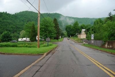
On 3rd Street (Pennsylvania Route 120) at Chestnut Street ( Route 555), on the right when traveling east on 3rd Street.
Famed Civil War volunteers departed from this point for Harrisburg, April 1861, where they were mustered into State service. A monument, erected in their honor, is just south of here. This highway and a State park are named for the Bucktails. — — Map (db m42898) HM
On Driftwood Avenue (Pennsylvania Route 555), on the left when traveling south.
(Front):This Monument at the instance of the people of Cameron County was erected by The State of Pennsylvania on April 27, 1908 Colonel Edward A. Irvin Corporal Firmin F. Kirk Sergeant William H. Raugh commissioners
(Side): . . . — — Map (db m40048) HM
Near Bucktail Trail Highway (Pennsylvania Route 120) 1.5 miles north of Chestnut Street ( Route 555), on the right when traveling south. Reported missing.
One of the earliest Indian paths through the Allegheny Mts. followed this valley. It connected the Upper Allegheny River with the Susquehanna. In 17th century the Senecas used it in war against the Susquehannocks. — — Map (db m88279) HM
On Low Grade Road (Pennsylvania Route 555) 2.1 miles west of Castle Garden Road, on the right when traveling east.
The famous cowboy star of cinema and circus was born here, January 6, 1880. A soldier during the Spanish-American War, he won renown for his "wild west" roles in hundreds of motion pictures - both silent and sound - between 1910 and 1935. Tom Mix . . . — — Map (db m76762) HM
On CCC Memorial Highway (Pennsylvania Route 120) at Sizerville Road & East Allegheny Avenue, on the right when traveling south on CCC Memorial Highway.
The 23-mile crossing from Susquehanna West Branch to the Allegheny River began at a "canoe place" near this point. Indians and pioneers went north to Portage Creek, and at present Port Alleghany resumed travel by canoe. — — Map (db m65623) HM
On East 5th Street 0.1 miles east of North Cherry Street, on the right when traveling east.
Formed March 29, 1860 from Clinton, McKean, Potter and Elk counties. Named for Sen. Simon Cameron. County seat, Emporium, was incorporated 1864. Lumbering was of early importance, and flagstone at Tomb of the Unknown Soldier was later quarried here. — — Map (db m65621) HM
Near West Creek Recreational Trail at East 2nd Street.
Emporium grew with the advent of the railroads. The Pennsylvania Rail Road was completed to Emporium on October 20, 1863 and opened the entire length by 1864. The Buffalo, New York and Philadelphia Railroad was completed to Emporium on December . . . — — Map (db m158128) HM
On East CCC Memorial Highway (Pennsylvania Route 120) 1.5 miles north of Steam Mill Road, on the right when traveling south.
An Indian path ran up the valley of the Sinnemahoning Creek to Canoe Place, now Emporium Junction, and on to the Seneca villages at the Big Bend of the Allegheny. Early settlers in Clinton, McKean, Cameron, and Potter Counties used this path. — — Map (db m65622) HM
Near West Creek Recreational Trail near Poplar Street.
Sylvania as was many of the early manufacturing industries, born and financed by the end of the lumbering era. The first building used by the company was owned and used by the C. B. Howard Lumber Company. It started out as a Novelty Incandescent . . . — — Map (db m217013) HM
On West 4th Street (Pennsylvania Route 120) at Poplar Street, on the right when traveling east on West 4th Street.
During WWII, produced critical electrical components including vacuum tubes for proximity fuzes, a key military device that improved the precision of artillery shells. Founded in 1907, the workforce was composed of primarily women, prompting . . . — — Map (db m174332) HM
On 1st Fork Road (Pennsylvania Route 872) 3 miles north of Main Street ( Route 120), on the right when traveling south.
Seven teenage Civilian Conservation Corps enrollees and a forestry foreman lost their lives attempting to extinguish a 134-acre wildfire here. The crew had insufficient experience and training and were exhausted from fighting a previous fire. The . . . — — Map (db m99936) HM
Aaron Levy, a Jewish immigrant who founded this village in 1786, donated ground for Lutheran and Reformed congregations here and presented them with a pewter communion set. In remembrance of his generosity, 30,000 people gathered in Aaronsburg on . . . — — Map (db m91035) HM
On South Allegheny Street (Pennsylvania Route 144) at West Cherry Street, on the right when traveling south on South Allegheny Street.
Governor of Pennsylvania, 1861-67, was born on this site. He brought about the establishment of State Normal Schools; organized the famed Pennsylvania Reserve Corps; obtained funds for the erection of State Orphan Schools. — — Map (db m65581) HM
On High Street, on the right when traveling north.
First woman registered as an architect by the state (1920), this Bellefonte native, inventor, Cornell grad & women's suffrage advocate designed numerous buildings, including the Plaza Theatre here. She served as Special Agent, Army Intelligence, . . . — — Map (db m204704) HM
On High Street at Allegheny Street ( Highway 144), in the median on High Street.
Laid out by James Dunlop and James Harris, 1795. Named by Talleyrand for "beautiful fountain". Early center of the iron industry. One-time home of five of Pennsylvania's governors. — — Map (db m19544) HM
On Willowbank Street (State Highway 550), on the right when traveling east.
Laid out by James Dunlop and James Harris, 1795. Named by Talleyrand for "beautiful fountain". Early center of the iron industry. One-time home of five of Pennsylvania's governors. — — Map (db m19674) HM
On Bishop Street (State Highway 550) at School Street, on the right when traveling east on Bishop Street.
The initial stop on the first scheduled west-bound air mail flight was made here by Pilot Leon D. Smith on December 18, 1918. The site for the field was chosen by pioneer aviator Max Miller and was in regular use for air mail until 1925. — — Map (db m32177) HM
To honor the seven governors who at one time lived, worked, and learned in Bellefonte.
William Bigler
1813-1880
Gov. Pennsylvania
1852-1854.
William F. Packer
1807-1870
Gov. Pennsylvania
1858-1860.
John Bigler
1805-1856 . . . — — Map (db m76792) HM
On West High Street east of Dunlap Street, on the right when traveling east.
To honor the seven governors
who at one time lived, worked,
and learned in Bellefonte
Andrew Gregg Curtin
1815 — 1894
Gov. Pennsylvania
1861 — 1866
James A. Beaver
1837 — 1914
Gov. Pennsylvania . . . — — Map (db m134705) HM
Near South Water Street (Pennsylvania Route 550) south of West High Street, on the right when traveling south.
Welcome to Bellefonte, the county seat of Centre County and one of the "Gateways" into the Lumber Heritage Region of Pennsylvania. The history of lumbering in Centre County can be divided into four phases. The earliest lumbering operations were . . . — — Map (db m134708) HM
On South Allegheny Street (Pennsylvania Route 144) south of West High Street, on the right when traveling south.
This property has been
placed on the
National Register
of Historic Places
by the United States
Department of the Interior
circa 1866 — — Map (db m134696) HM
On Allegheny Street (State Highway 144) at High Street, on the right when traveling north on Allegheny Street.
Formed on Feb. 13, 1800 from Huntingdon, Mifflin, Lycoming and Northumberland counties. Named for its location in the State, and home of The Pennsylvania State University. Five governors of Pennsylvania lived in Bellefonte, county seat laid out in . . . — — Map (db m190682) HM
On South Allegheny Street (Pennsylvania Route 144) at East High Street, on the right when traveling north on South Allegheny Street.
To Those Who Died To Keep The Nation Whole
This Memorial Is Dedicated In Grateful Appreciation
First Defenders—April 18, 1861, for 3 months.
2nd Reg't. PA. Vols.—April 20, for 3 months.
Eagle Guards, Co. H. 4th PA. Three-Months . . . — — Map (db m134824) WM
On Dunlap Street north of West High Street, on the left when traveling north.
In 1795, much of the land now called Bellefonte was nothing but wilderness. A young man by the name of John Dunlop came here and liked the iron ore in the ground. He went back to Chambersburg, PA, where he was from, and persuaded some of the . . . — — Map (db m134706) HM
Near South Water Street (Route 550) south of West High Street, on the right when traveling south.
Welcome to the Lumber Heritage Region of Pennsylvania, a celebration of our history, our people, and our forest. From the onset of early exploration and settlement, when the region was blanketed in virgin timber, to the days when streams and . . . — — Map (db m134712) HM
A prominent African American journalist, as editor at Billboard magazine, Jackson promoted black theater during the 1920s Harlem Renaissance. He later fostered African American business activities for the US Dept. of Commerce. He was born and raised . . . — — Map (db m91073) HM
On East Lamb Street at North Ridge Street, on the right when traveling east on East Lamb Street.
Baseball pioneer, born in Bellefonte, grew up here. Played for Providence, N.Y. Giants, Brooklyn, 1878-94. Pitched professional baseball's 2nd perfect game, 1880. Formed first players' union, 1885, & Players' League, 1890. In Baseball Hall of Fame. — — Map (db m190674) HM
Honored by the Veterans of Centre County as a true patriot. In sunshine or rain, cold or snow, Lucinda with her flags walked to this station from Bald Eagle Valley to salute the departure of thousands of Centre Countians as they boarded the “New . . . — — Map (db m190683) WM
On Willowbank Street (State Highway 550) at Phoenix Avenue, on the right when traveling west on Willowbank Street.
One of the nation's leading producers of wooden matches during the first half of the 20th century; founded 1899 by Bellefonte entrepreneurs. The factory buildings opened in 1900, using the vast resources of the surrounding lumber region. By World . . . — — Map (db m19588) HM
On West Linn Street (Pennsylvania Route 144) west of North Allegheny Street, on the right when traveling west.
Reynolds Mansion
1885
has been
placed on the
National Register
of Historic Places
by the United States
Department of the Interior — — Map (db m134702) HM
On West Bishop Street (Pennsylvania Route 550) at South Allegheny Street, on the right on West Bishop Street.
The Cadillac Building was built in 1916 as a car dealership. The building contained a first floor showroom, a second floor auto repair shop and a third floor office and living space. It was designed by Bellefonte architect Anna Keichline when she . . . — — Map (db m134695) HM
Grandfather, William H. Mills, a local Jubilee Singer, had a barber shop here, 1871-1931. Father, John H., went to Ohio. Four sons, born there, formed first vocal group to overcome racial barriers, gaining a mass audience. Father was its bass, . . . — — Map (db m19585) HM
During the first decade of
transcontinental airmail,
pilots flew over the Alleghenies
with a fueling stop in Bellefonte.
Unpredictable weather and
changing winds cost the lives
of 34 valiant young pilots in
this most dangerous leg . . . — — Map (db m144734) HM
On East Howard Street, on the right when traveling east.
First burial here as early as 1808. Cemetery chartered in 1856. Here lie three Governors of Pennsylvania and their wives - Andrew Gregg Curtin (1815-1894), who served 1861-67, and Katharine Wilson Curtin (1821-1903); James Addams Beaver . . . — — Map (db m19586) HM
On South Allegheny Street (Pennsylvania Route 144) south of West Cherry Lane, on the right when traveling south.
This property has been
placed on the
National Register
of Historic Places
by the United States
Department of the Interior
circa 1869 — — Map (db m134694) HM
On Buffalo Run Road at Rock Road on Buffalo Run Road.
The ironmaster's home was at Rock. Here also were the first forge, 1794, and a nail and slitting mill. A founder of Bellefonte; leader in Centre County affairs until his death in 1832 — — Map (db m91075) HM
On North Eagle Valley Road (Pennsylvania Route 150) 0.1 miles west of Marsh Creek Road ( Route 1002), on the right when traveling east.
The Indian highway from Shamokin, now Sunbury, to Kittanning, left the Bald Eagle Valley to follow Marsh Creek and Little Marsh Creek. It crossed the Allegheny Mt. by way of Snow Shoe and Moshannon. — — Map (db m65597) HM
On Church Street at Boal Avenue (Business U.S. 322), on the right when traveling south on Church Street.
This monument owes its existence to
the singular vision and persistent
efforts of
Col. James V. & Margaret C. Dearing
This Memorial Day monument commemorates
the birth of a national tradition of remembrance.
In October 1864, three . . . — — Map (db m264918) HM WM
On Church Street, on the right when traveling south.
In memory of the men
from Boalsburg and vicinity
who gave their lives in
World Wars I-II
Alvin Bohn • Robert Ross • Paul Stoner
Guyer Durst • Leslie Meckley • William Weber
Alfred Witmer • George Meckley • Eugene Homan
William . . . — — Map (db m264927) WM
On North Church Street at Boal Avenue ( Route 45), on the right when traveling south on North Church Street.
An American village on the National Historic Register
Birthplace of Memorial Day
The custom of decorating soldiers graves was begun here in October, 1854, by Emma Hunter, Sophie Keller, and Elizabeth Myers.
Named for David Boal who settled . . . — — Map (db m177904) HM
About the Eastern Bluebird
The Eastern Bluebird is the most widespread of the North American bluebirds-a group of medium-sized; mostly insectivorous or omnivorous birds that can be found from Canada's southern provinces in the north to as . . . — — Map (db m288102) HM
On Old Boalsburg Road at Boal Estate Drive, on the right when traveling south on Old Boalsburg Road.
This simple cross, found broken in the debris of an
obliterated French village through which our troops
passed, is erected to the memory of our comrades
Hayes M. Wilson • Bromley R. Smith • Eugene R. Davis • Michael A. Miller
James . . . — — Map (db m288104) WM
On Boalsburg Road north of Linden Hall Road, on the right.
The land for this park was donated to The Mount Nittany
Conservancy, Inc., in 1985 in memory of
John Campbell Gilliland
and
Miriam Forsythe Gilliland
by their loving children and grandchildren. Mr. Gilliland
purchased the . . . — — Map (db m282641) HM
On Boal Avenue (U.S. 322) near Boalsburg Pike, on the right when traveling east.
(First Plaque):107th United States Field Artillery 53rd Brigade 28th Division American Expeditionary ForcesThis monument was erected by the Veterans Association of the 107th Field Artillery in memory of the faithful sons of Pennsylvania . . . — — Map (db m27741) HM WM
On Boalsburg Pike 0.1 miles Boal Avenue (U.S. 322), on the right when traveling south.
(Front):World War I Champagne Oise-Aisne Lorraine Meuse-Argonne Ypres-Lys World War II Normandy Northern France Ardennes Rhineland Central Europe (Back):Organized Dec. 11, 1840 1st Vol. Inf., 102nd of the line 2nd Infantry, Nov. . . . — — Map (db m27422) WM
On Boal Avenue (U.S. 322) at Boalsburg Pike, on the right when traveling east on Boal Avenue.
(Front):109th United States Infantry Twenty-Eighth Division "They Preserved the Nation" Service in World War I Champagne-Marne Champagne • Aisne-Marne Oise-Aisne • Lorraine Meuse-Argonne Service in World War II Normandy • Ardennes . . . — — Map (db m27751) WM
On Boalsburg Pike 0.1 miles north of Boal Avenue (U.S. 322), on the right when traveling south.
(Front):One Hundred Ninth Machine Gun Battalion Twenty Eight Division Hq Co. Allentown A Co. Lancaster B Co. Columbia C Co. Allentown D Co. Lebanon Major John W. Foos, commander They belong to history Killed in Action Lieutenants . . . — — Map (db m27455) WM
On Boalsburg Pike 0.1 miles north of Boal Avenue (U.S. 322), on the right when traveling south.
(Front):In remembrance of those members of this Regiment who lost their lives defending their country's honor fighting against tyranny and for justice and liberty of all nations, the weak as well as the mighty 111th Infantry 1917 - 6th . . . — — Map (db m27436) WM
On Boalsburg Pike 0.1 miles north of Boal Avenue (U.S. 322), on the right when traveling south.
(Front):112th Infantry Twenty Eighth Division Forever Honored Forever Mourned For God and Country (Back):Dedicated to the honor of the men who served in this regiment Civil War Spanish American War Mexican Border Service World War . . . — — Map (db m27327) WM
On Old Boalsburg Road at Old Boalsburg Road (U.S. 322), on the right when traveling north on Old Boalsburg Road.
(Front):In Memoriam to the men who served in the 112th Machine Gun Co. 28th Division 1917 - 1919 (Back):112th Machine Gun Co. Campaigns Dates - 1918 Champagne June 28 - July 14 Champagne-Marne July 15-July 18 Aisne-Marne July 19 - . . . — — Map (db m27308) WM
On East Boal Avenue (Business U.S. 322) at Old Boalsburg Road, on the right when traveling west on East Boal Avenue.
Dedicated to heroic dead of Pennsylvania's famed 28th in two world wars. The Division was created Sept., 1917. The Shrine was founded by Col. Theodore Boal and made a State memorial in 1932 — — Map (db m19339) HM
On Boal Avenue (U.S. 322) just north of Boalsburg Pike, on the right when traveling east.
Dedicated to the honor and the men and women of the 28th Signal Battalion and the lineage organizations 103rd Field Signal Battalion 28th Signal Company They have proudly served since 1908 demonstrating skills as soldiers and communicators during . . . — — Map (db m27755) WM
On Boal Avenue (U.S. 322) just north of Boalsburg Pike, on the right when traveling east.
(Lower Plaque)In loving memory of the 33 men of the 109th Field Artillery killed in the train wreck Sept. 11, 1950 in Coshocton, Ohio (Upper Plaque Listing Names): Capt. Arthur J. Thomas Warrant Officers Wm. M. Wellington - . . . — — Map (db m27777) HM
On Old Boalsburg Road at Boal Avenue (U.S. 322) on Old Boalsburg Road.
Memorial to the men who served with this organization and to those who gave their lives while in service during the First World War — — Map (db m27304) WM
On Boalsburg Pike 0.1 miles north of Boal Avenue (U.S. 322), on the right when traveling south.
In 1919, the Boal Troop dedicated a monument to their fallen comrades, elsewhere on Col. Boal's estate. In the 1920s, other units of the 28th Infantry Division erected memorials in this area and began referring to it as the "Shrine." By 1971, . . . — — Map (db m27456) HM
On Old Boalsburg Road 0.1 miles north of Boal Avenue (U.S. 322), on the right when traveling north.
The M114A2 howitzer, introduced in 1942 as the M1, served in World War II, Korea, and Vietnam with the Army and Marine Corps. It also served with the National Guard into the 1980s. Its 11-man crew could fire forty rounds per hour, lobbing each . . . — — Map (db m20350) HM
On Old Boalsburg Road, on the left when traveling north.
Nearly 50,000 M4 Sherman tanks saw service in all theaters of World War II and in Korea. They served as the main battle tank of the United States Army and Marine Corps. Pennsylvania foundries in Coraopolis, Eddystone, Lebanon, Sharon, Bernham, . . . — — Map (db m20310) HM WM
On Old Boalsburg Road, on the right when traveling south.
Open topped half-track personnel carriers in use during World War II did not adequately protect occupants from small arms fire and shrapnel. The U.S. Army developed APCs, or armored personnel carriers, to solve the problem. These sturdy vehicles . . . — — Map (db m20246) HM
Near Old Boalsburg Road, on the right when traveling north.
No tank performed longer than the M60 series. First introduced in 1961, the M60 series, with its advanced weapon control and mighty engine, served under the administrations of nine U.S. Presidents. The brawny tank's thick armor eventually . . . — — Map (db m20427) HM
On Old Boalsburg Road, on the right when traveling south.
British commanders who has fought in the Boer War in South Africa, 1899 to 1903, were impressed with the success of the enemy's howitzers. After five years, the British army approved its own new howitzer. The 4.5-inch howitzers remained in . . . — — Map (db m20208) HM
On Boal Avenue (U.S. 322) just north of Boalsburg Pike, on the right when traveling east.
This place of remembrance honors 28th Division veterans of World Wars I and II. The grounds of the Shrine and the park surrounding it once belonged to the estate of Colonel Theodore Davis Boal (1867-1938). Convinced that the United States would . . . — — Map (db m27752) HM
On Boal Avenue (U.S. 322) 0.1 miles north of Boalsburg Pike, on the right when traveling east.
The Boal Troop was accepted as a provisional unit of the Pennsylvania National Guard, the Machine Gun Troop of the 1st Pennsylvania Cavalry. The troop first served in Texas, protecting the border against possible Mexican aggression In April . . . — — Map (db m27754) HM
On Boal Avenue (U.S. 322) just north of Boalsburg Pike, on the right when traveling east.
(Left Wing): The Pennsylvania Military Museum The Pennsylvania Military Museum honors the Commonwealth's military men and women past and present. It preserves the history of their significant service to the state and the nation through . . . — — Map (db m27776) HM
Near Boal Avenue (U.S. 322) just north of Baolsburg Pike, on the right when traveling east.
By the time the M42 "Duster" anti-aircraft weapon system was deployed in 1953, the Soviet Union had developed high-speed aircraft that were too fast for the Duster to track. The Duster, however, found its role in the dense jungles of Vietnam. Its . . . — — Map (db m27813) HM
Near Penns Cave Road (Pennsylvania Route 2012) 0.2 miles south of Brush Valley Road ( Route 192).
The Legend of Penn's Cave, as told by Isaac Steele, an aged Seneca Indian, in 1892. In the early eighteenth century, long before settlements reached west of Sudbury, PA, a young Frenchman from Lancaster County, Malachi Boyer, set out to explore . . . — — Map (db m122700) HM
On Porter Road north of College Avenue ( Route 26), on the left when traveling north.
This trail passes through what was once the streambed of Thompson Run, a tributary of Spring Creek. The stream powered waterwheels that operated air bellows at the furnace and ran a gristmill and a sawmill.
Thompson Run was relocated off . . . — — Map (db m226625) HM
Inspiration for the present plantings comes from a time when gardeners began shifting from formal, geometric designs to more natural landscapes.
Andrew Jackson Downing (1815-52)
was an important influence in the American landscape . . . — — Map (db m226718) HM
Members of Boy Scout Troop 367, as part of a 2009 Eagle Scout project, installed this tree and shrub border.
The involvement of local businesses, organizations and individuals has been central to the success of the Centre Furnace Mansion . . . — — Map (db m226701) HM
On Curtin Road (Pennsylvania Route 1003) 0.1 miles south of Eagle Valley Road ( Route 150), on the left when traveling south.
IN APRIL 1834, ROLAND CURTIN joined a dozen other
Centre County businessmen-including fellow
ironmasters James Irvin, Joseph Miles, William
Thomas, and Bond Valentine-in organizing the
Bald Eagle and Spring Creek Navigation Company
(BE&SCN). . . . — — Map (db m275276) HM
On Curtin Road (Pennsylvania Route 1003) 0.2 miles south of Eagle Valley Road ( Route 150), on the left when traveling south.
1764 Future Eagle Iron Works founder and Curtin Mansion
builder Roland Curtin is born in Dysert, County Clare, Ireland,
first of Austin and Mary (O'Loghlin) Curtin's nine children.
1795 After studying briefly for the . . . — — Map (db m275190) HM
On Curtin Road (Pennsylvania Route 1003) 0.1 miles Eagle Valley Road ( Route 150), on the left when traveling south.
KEY DATES AND DEVELOPMENTS
1810 Roland Curtin and business partner Moses Boggs
establish Eagle Forge on a seven-acre tract acquired from
miller Philip Antes; for the next eight years, Eagle Forge
refines pig iron obtained from . . . — — Map (db m275231) HM
On Curtin Road (Pennsylvania Route 1003) 0.2 miles south of Eagle Valley Road ( Route 150), on the left when traveling south.
1810 Irish immigrant Roland Curtin Sr. and Cumberland
County native Moses Boggs establish Eagle Forge (iron refinery)
near Philip Antes' grist-and-lumber mills 1,000 feet northwest
of this spot, on the south side of Bald Eagle . . . — — Map (db m275201) HM
1031 entries matched your criteria. The first 100 are listed above. Next 100 ⊳