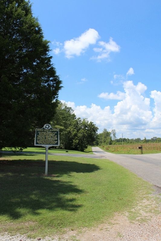
On Huggins Road (County Highway 514) 0.5 miles east of County Road 529, on the left when traveling west.
A.B. Dilworth (1814-1894) served in the Mississippi House of Representatives (1846-1850), secretary of state (1855-1860), and state auditor (1861-62). During the Civil War, Dilworth served as quartermaster general in Iuka and negotiated the release . . . — — Map (db m155403) HM
On New Hope Road (County Road 513) 0.4 miles west of U.S. 45, on the right when traveling west.
New Hope Presbyterian Church was organized in 1838 when six members began meeting in a school house near Troy, later renamed Danville. Rev. James B. Stafford served as the first pastor or the church from 1838 to 1854. The first sanctuary was a log . . . — — Map (db m155410) HM
On North Fillmore Street at Cruise Street, on the right when traveling south on North Fillmore Street.
Tents, army wagons and soldiers crowd the area around the railway depot and Tishomingo Hotel in this view. Over the course of the war it is estimated that about 300,000 troops served in Corinth or passed through this railroad junction. Civilians, . . . — — Map (db m51752) HM
On Jackson Street at Cruise Street, on the right when traveling south on Jackson Street.
On the morning of October 4, 1862, nearly 20,000 Confederates under Maj. Gen. Earl Van Dorn launched a massive assault on Maj. Gen. William S. Rosecrans' 20,000 Federal soldiers defending the interior line of Corinth's entrenchments. Attacking from . . . — — Map (db m63296) HM
On Polk Street at East Linden Street, on the right when traveling north on Polk Street.
“A fearful hand-to-hand fight was raging in the heart of the town – around the railroad depot, the Tishomingo Hotel, the Corinth House, and even in the yard around the headquarters of General Rosecrans, the old Duncan . . . — — Map (db m155254) HM
On Polk Street at East Linden Street, on the right when traveling north on Polk Street.
The famous long distance railroads intersecting in Corinth in 1862 formed two links in a shaky network of rails crisscrossing Mississippi and her neighboring states. This network proved critical when General Albert Sidney Johnston began . . . — — Map (db m155252) HM
On Polk Street at East Linden Street, on the right when traveling north on Polk Street.
“I was in the battle of Shiloh from the opening gun to the close; and while I was very young, the impressions made on my mind are vivid and lasting.”
Here in his boyhood home Thomas Dudley Duncan penned the story of those . . . — — Map (db m155251) HM
Near Wick Street west of North Fillmore Street, on the right when traveling west.
The firefighting apparatus displayed is a 1924 American LaFrance Type 75 triple combination pumper, chemical tank and hose car. Manufactured by the American LaFrance Company of Elmira, New York, it was delivered to the Corinth Fire Department by . . . — — Map (db m183952) HM
On Cemetery Drive at Horton Street, on the left when traveling north on Cemetery Drive.
Civil War Dead
An estimated 700,000 Union and Confederate soldiers died in the Civil War between April 1861 and April 1865. As the death toll rose, the U.S. government struggled with the urgent but unplanned need to bury fallen Union troops. . . . — — Map (db m219989) HM
On Franklin Street, on the right when traveling north.
Dedicated to the memory of all those from Alcorn Co. who gave their lives in service of our country
ARMY - MARINES - NAVY - AIR FORCE
World War I
Perry A. Johns
John O. Power
Roy D. Todd
Oscar D. Wells
World War II . . . — — Map (db m184612) WM
Near South Johns Street at Horton Street, on the right when traveling north.
And be it further enacted, That any person who shall willfully destroy, mutilate, deface, injure, or remove any monument, gravestone, or other structure, or shall willfully destroy, cut, break, injure, or remove any tree, shrub, or plant within . . . — — Map (db m89097) HM
On Polk Street at East Linden Street, on the right when traveling north on Polk Street.
William Lane Duncan moved his dry goods operation to Corinth in 1858. Already a local leader, the South Carolina native had twice won elections as Tishomingo County sheriff.
To accommodate his growing family, Duncan built this house at the . . . — — Map (db m155261) HM
On Bitner Road at Scenic Lake Drive, on the right when traveling north on Bitner Road. Reported missing.
Only extant redan of six built in 1862 by U.S. troops as outer defense south and west of town. Taken on Oct. 3, 1862, by C.S. forces after fierce fighting. Battle resumed on Oct. 4, but C.S. troops forced to withdraw. — — Map (db m66613) HM
On North Fulton Road 0.3 miles north of South Tate Street (Mississippi Route 145), on the left when traveling north.
Site of Battery Williams. On Oct. 4 the cannonade from here devastated the Confederate troops attacking Battery Robinette. The advance failed, forcing Gen. Van Dorn to withdraw his forces. — — Map (db m50324) HM
On Bitner Road at Scenic Lake Drive, on the right when traveling north on Bitner Road.
The South suffered a strategic disaster when Corinth and its railroads fell to Union forces on May 30, 1862. The destruction of the Union force garrisoned in Corinth and recapture of this rail center quickly became vital Confederate objectives. In . . . — — Map (db m66676) HM
On Taylor Street north of Third Street, on the right when traveling north.
Site of Battery Powell, one of the chain of seven redoubts built by Union troops to anchor the interior defensive line about the city. Captured briefly at noon on October 4 by CS Army forces after fierce fighting. — — Map (db m285753) HM
On Wick Street at North Fillmore Street, on the right when traveling west on Wick Street.
Genre-spanning keyboardist and songwriter
Bobby Emmons, a Corinth native, embarked upon
a music career in his teens. As a member of the
revered American Sound Studio house band in
Memphis, his Hammond organ both anchored
and enlivened pop, . . . — — Map (db m285747) HM
S. 3/10 mi. to rear of school. Of unique circular design, about 50 ft. in diameter, this pit was one of series built in 1862 as second line of defence against U.S. troops advancing from Shiloh. — — Map (db m50318) HM
On North Fillmore Street north of Wick Street, on the left when traveling north.
The caboose was built in 1970 by the International Car Company of Kenton, Ohio. It operated on the Gulf, Mobile and Ohio Railroad until 1972 when the G,M & O merged with the Illinois Central Railroad forming the Illinois Central Gulf Railroad. In . . . — — Map (db m107788) HM
On Westview Drive at Cemetery Drive, on the right when traveling west on Westview Drive.
Earliest evidence of Corinth's
settlement. Oldest cemetery
in city with first burial
dated 1842. The city owned
the site from 1874 to 1940
when deeded to City Cemetery
Association, endowed by
Shelby H. Curlee. — — Map (db m220000) HM
On Taylor Street at Foote Street, on the left when traveling north on Taylor Street.
Dedicated to the recipients' of this Nation's oldest military decoration "The Purple Heart"
My stone is red for the blood they shed the medal I bear is my country's way to show they care. If I could be seen by all mankind maybe peace will . . . — — Map (db m184195) HM
On North Parkway Street, on the right when traveling north.
The Corinth Contraband Camp offered former slaves the first step toward self-sustainability and freedom through profitable farming. These men, women and children grew 300 acres of cotton and 400 acres of vegetables. All of the crops were sold, and . . . — — Map (db m153404) HM
On N Fillmore Street, on the left when traveling north.
Began 1854 as Cross City. Proximity to Tennessee River and the railroads made it of great strategic value during Civil War. Battle of Corinth fought here, Oct. 3-4, 1862. — — Map (db m21305) HM
On Main Street (State Highway 145) at Fillmore Street (State Highway 145), in the median on Main Street.
Began 1854 as Cross City. Proximity to Tennessee River and the railroads made it of great strategic value during the Civil War. Battle of Corinth fought here, Oct. 3-4, 1862. — — Map (db m66533) HM
On Franklin Street at East Waldron Street, on the left when traveling south on Franklin Street.
(front)
Col. W.P. Rogers
2nd Texas Reg't.
Killed at Ft. Robinette
Oct. 4, 1862.
As long as courage, manliness and
patriotism exist, the name of
Rogers will be honored among
men. He fell in the front of
battle in the . . . — — Map (db m89036) WM
Near Jackson Street at Cruise Street, on the right when traveling south.
This view of Corinth appeared in Frank Leslie's Illustrated Newspaper, June 21, 1862, not long after the Union army captured the town. Despite some inaccuracies, it depicts a scene familiar to many thousands of troops from both armies. . . . — — Map (db m51758) HM
On Jackson Street at Cruise Street, on the right when traveling south on Jackson Street.
On the morning of October 4, 1862, in an effort to retake Corinth's critical railroad junction, Confederate forces under Major General Earl Van Dorn launch a massive assault on Major General William Rosecrans's Union garrison. For a brief, . . . — — Map (db m183989) HM
On County Road 106 north of County Road 187, on the right when traveling north.
Organized before 1848. Here in 1853 M.P. Lowery was ordained & in 1885 John Allen was dubbed "Private". Town destroyed in Civil War & abandoned because R.R. by-passed it. — — Map (db m155237) HM
Corinth's oldest church bldg.; erected 1871 by Cumberland Presbyterian Church, the First church est. in Corinth. 1906~1976 served as Fillmore St. Pres. Ch. Now used as chapel by First United Methodist Church. — — Map (db m28472) HM
On South Tate Street (Mississippi Route 145) south of Cardinal Drive, on the left when traveling south.
In 1934, a group of local businessmen and farmers
met in the back of a furniture store in Corinth
and created the Alcorn County Electric Power
Association (ACEPA). Chartered on January 17,
1934, ACEPA began operations on June 1.
With local . . . — — Map (db m219996) HM
On Polk Street at East Linden Street, on the right when traveling north on Polk Street.
On May 10, 1863, troops of the Corinth garrison stacked their arms and gathered near the Verandah House for a speech by U.S. Army Adjutant General Lorenzo Thomas. At its former location just around the corner, Duncan House would have been an ideal . . . — — Map (db m155259) HM
On N. Fillmore Street (State Highway 145) at Linden Street, on the left when traveling north on N. Fillmore Street.
W. 1/2 mi. Now Confederate Park. Here, Oct. 5, 1862, during Battle of Corinth, occurred a C.S.A. charge as heedless of cost as those of Pickett at Gettysburg and Light Brigade at Balaclava. — — Map (db m66738) HM
On Jackson Street north of Childs Street, on the right when traveling south.
Built about 1857 for Hamilton Mask. Used in Civil War as Hq. of Generals Braxton Bragg, H.W. Halleck, and John B. Hood. Donated to Corinth in 1960 by S.H. Curlee family. — — Map (db m66558) HM
On Jackson Street, on the right when traveling south.
Site of hq. of Gen. Ulysses Simpson Grant in June, 1862. In mid-July Grant removed to plantation home of F. E. Whitfield, Sr., about 1 mi. S. of Corinth. — — Map (db m238370) HM
On N. Polk Street (State Highway 145) at Woodlawn Drive, on the right when traveling north on N. Polk Street.
Founded in 1879 by the Milton B. Henry family on land sold by the Chickasaws to the U.S. government in 1832. Henry purchased 160 acres in 1856. Robert Henry Young, an infant grandson of M.B. Henry, was the first person buried here. The Henry . . . — — Map (db m66591) HM
On Fillmore Street, on the right when traveling south.
Site of hq. of Gen. Albert Sidney Johnston, April 1~4, 1862. After his death at Shiloh, April 6, body was brought here where it lay in state, April 7, 1862. — — Map (db m29280) HM
On South Tate Street 0.1 miles north of South Harper Road, on the left when traveling north.
Explored 1540-1, by De Soto. Colonized first by French, 1699. Became a colony of British, 1763; Spanish, 1779. Territory organized by U.S., 1798. Became 20th. state, 1817. — — Map (db m235748) HM
On Fillmore Street (State Highway 145) north of Bunch Street, on the right when traveling north.
Built in 1857 for Judge W.H. Kilpatrick. Used in Civil War as headquarters of General Leonidas Polk. Bought in 1866 by Mrs. Thomas Quincy Martin and occupied continuously by her descendants. — — Map (db m66557) HM
On N. Fillmore Street (State Highway 145) south of Gloster Street, on the right when traveling north.
Judge W.H. Kilpatrick of Corinth had Oak Home built in 1857 by Tom Chesney, a local house designer and builder. Mr. M.S. Miller, a civil engineer working in Corinth shortly before the war, made this sketch in 1860, the only known Civil War vintage . . . — — Map (db m66700) HM
On North Fillmore Street at Foote Street, on the right when traveling north on North Fillmore Street.
William H. Moss received a tavern license in 1857 for his new inn, the Moss House Hotel. After the Battle of Shiloh, the Moss House, like Corinth's other hotels and public buildings, was pressed into service as a hospital. When Union troops occupied . . . — — Map (db m183650) HM
On Polk Street at East Linden Street, on the right when traveling north on Polk Street.
This now deactivated artillery round was recovered from the western side of the October 1862 Corinth battlefield. Called spherical case, this hollow projectile contained a small bursting charge of gunpowder, surrounded by 450 balls, each of .69 . . . — — Map (db m155257) HM
On Bitner Road at Scenic Lake Drive, on the right when traveling north on Bitner Road.
This 5-gun Union battery stood between the attacking Confederates and Corinth's inner defenses. As the Battle of Corinth progressed, Confederate troops of Brig. Gen. Dabney H. Maury's division crossed the railroad and attacked from the north; Maj. . . . — — Map (db m66689) HM
On Fillmore Street, on the right when traveling south.
Among Corinth’s countless stories of personal wartime tragedy is that of General Albert Sidney Johnston, Confederate Commander of the War in the West, who made his headquarters in Rose Cottage. After Johnston received a fatal wound at the Battle of . . . — — Map (db m29291) HM
On North Parkway Street, on the right when traveling north.
(Main Plaque): Here a newly freed people took their unswerving first steps on the long road to full citizenship. (Side Plaque): "This is a great opportunity afforded your race. Will you improve it?" --Lorenzo Thomas, Adjutant General, . . . — — Map (db m182915) HM
On North Fillmore Street at Cruise Street on North Fillmore Street.
The Corinth House stood in the distance, facing the historic railroad crossing and the Tishomingo Hotel. This photograph shows it after the Union Army occupied Corinth.
In the exciting months before Corinth fell to the Union Army in 1862, . . . — — Map (db m51757) HM
On Childs Street at Jackson Street, on the right when traveling east on Childs Street.
Corinth City Hall now occupies this site, but early in the war the Houston Mitchell family lived in this spacious home. A favorite house among the general officers who served in Corinth at various times, the Mitchell residence was used as . . . — — Map (db m88942) HM
On N. Fillmore Street (Route 145) at Foote Street, on the left when traveling north on N. Fillmore Street.
The Moss House, one of Corinth's popular hotels, stood across this intersection. When the Union army occupied Corinth in 1862, the Provost Marshal established headquarters in the building. Army officers who served as provost marshal had the . . . — — Map (db m66739) HM
On Polk Street at East Linden Street, on the right when traveling north on Polk Street.
Confederate and Union armies occupied Corinth throughout the war and whether planning battles or attending to the details of garrison life, staff officers were a frequent presence in this home. Col. Thomas Jordan, Beauregard’s chief-of-staff and the . . . — — Map (db m155260) HM
On Polk Street at East Linden Street, on the right when traveling north on Polk Street.
With the outbreak of the Civil War, the NE Miss. Village of Corinth assumed a strategic value surpassing all but a few Southern cities. Here the South’s two longest railroads met. The junction of the Memphis and Charleston (the South’s only E-W . . . — — Map (db m155231) HM
On West Linden Street, on the left when traveling west.
(Front): Texas remembers the valor and devotion of its sons which served at Corinth and its surrounding environs during the Western Campaign of 1862.
Here in the days following the retreat of Southern forces from the battlefield of . . . — — Map (db m42632) HM
"The heavy artillery will be placed in best positions to command the roads and approaches from the quarter of the enemy." P.G.T. Beauregard, April, 1862. The important railroad junction at Corinth had to be protected. In the spring of 1862 . . . — — Map (db m153498) HM
On Jackson Street at Childs Street, on the right when traveling south on Jackson Street.
One of Corinth's founders, surveyor Hamilton Mask, built this Greek Revival home in 1857, pictured above as it appeared about 1862. It became known as the "Verandah House" because of its porches and served as headquarters for both Union and . . . — — Map (db m88943) HM
On Polk Street north of Bunch Street, on the right when traveling north.
Built in 1857 by William L. Duncan, the Duncan House was the headquarters of Confederate general P.G.T. Beauregard after the Battle of Shiloh. In June 1862, Union general William Rosecrans made the house his headquarters during the Battle of . . . — — Map (db m155235) HM
On Polk Street north of Bunch Street, on the right when traveling north.
Built shortly before the Battle of Corinth by W.L. Duncan, this five-room frame house originally stood on Jackson Street, around the corner from here. Several remodelings give the house a newer look than is shown in the 19th century sketch above, . . . — — Map (db m155236) HM
On Polk Street at East Linden Street, on the right when traveling north on Polk Street.
The Historic Corinth Railroad Junction is, and always has been, 1500 feet south of this location.
The rails here were used at the junction and replaced in the course of time. Here they serve as a reminder of the importance of the railroads to . . . — — Map (db m155250) HM
On North Fillmore Street at Cruise Street, on the right when traveling south on North Fillmore Street.
Here, at the hub of activity in 1862, stood the Tishomingo Hotel. The railway station (hidden by the train) is at the crossing of the Mobile & Ohio and Memphis & Charleston railroads. The Tishomingo was popular as an unofficial railway station and . . . — — Map (db m51753) HM
On Jackson Street at Cruise Street, on the right when traveling south on Jackson Street.
In 1991, the Secretary of the Interior designated sixteen Civil War historic sites in and around Corinth, Mississippi, as the Siege and Battle of Corinth National Historic Landmark District.
A National Historic Landmark (NHL) is officially . . . — — Map (db m183967) HM
On Jackson Street at Childs Street, on the right when traveling north on Jackson Street.
This unusual Civil War photograph captures a news event as it is happening, rather than recording its aftermath. In the middle of the scene is a canvas topped speakers platform from which Union Adjutant General Lorenzo Thomas is speaking to . . . — — Map (db m89030) HM
On North Fillmore Street at Cruise Street, on the right when traveling south on North Fillmore Street.
Not a "spit and polish" outfit, but tough and practical fighters. A Civil War photographer caught this group in a candid mode. Before the 1850s, the public's conception of battle formed mostly from romanticized drawings and paintings. Photography . . . — — Map (db m51755) HM
On North Fillmore Street, on the right when traveling south.
Looking northwest in this view along the right-of-way of the Memphis & Charleston RR, you can see the earthworks of Battery Williams to the left of the tracks. Battery Robinett lies in the distance to the right. One of the many military tent camps . . . — — Map (db m29273) HM
On Polk Street at East Linden Street, on the right when traveling north on Polk Street.
For six months in 1862, the fight to control Corinth’s crucial railroad crossover made the young town second only to Richmond in military importance.
Noting her location at the junction of the two longest railroads in the South, General Ulysses . . . — — Map (db m155253) HM
Near Jackson Street at Cruise Street, on the right when traveling south.
For six months in 1862, the fight to control Corinth’s crucial railroad crossover made the young town second only to Richmond in military importance.
Noting her location at the junction of the two longest railroads in the South, General Ulysses . . . — — Map (db m183991) HM
On East Waldron Street at Polk Street, on the right when traveling west on East Waldron Street.
"The array of modern machinery, representing a vast outlay of capital, the little army of men and women - chiefly the latter - working together in concentration and harmony that denote superb administration, the high-ceilinged, . . . — — Map (db m183943) HM
On West Linden Street at Sharp Street, on the left when traveling west on West Linden Street.
(front)
Rogers
Erected by the Texas Div.
United Daughters of the
Confederacy
the surviving members of the
family,
and admiring friends
August 15, A.D. 1912.
(back)
William P. Rogers
A native of Alabama . . . — — Map (db m89042) HM WM
On County Highway 106 0.1 miles south of Kendrick Road, on the left when traveling south.
—Three weeks after its victory at Shiloh on April 6-7, 1862, the Union army continued its advance on Corinth.
Farmington village stood here when the war arrived at Corinth in 1862. Its residents felt the first impact of battle. . . . — — Map (db m285754) HM
On County Route 364 at County Route 356, on the right when traveling north on County Route 364.
E. 9 mi. Founded 1836 as seat of “Old” Tishomingo, including present Alcorn & Prentiss counties. Named for battle of San Jacinto. Courthouse dates from 1854. Lost county seat, 1870. Home of Sen. E.W. Carmack. — — Map (db m77399) HM
On Main Street (State Highway 2) at College Street (County Highway 512), on the right when traveling east on Main Street.
Settled in 1840 as New Hope. Name changed to Kossuth in 1853 to honor Hungarian patriot Louis Kossuth. Home of Col. M.P. Lowery, found of Blue Mountain College. A skirmish occurred here during the Civil War. Alcorn Agricultural High School was . . . — — Map (db m155411) HM
On South Front Street (State Highway 356) north of Main Street, on the right when traveling north.
(Side 1)
Samuel L. Neely (19) enlisted April 30th, 1861 at Corinth, Mississippi in Co. A (Tishomingo Riflemen) 2nd Reg't Mississippi Volunteers. Neely was in 16 battles and wounded in 7. He died August 21st, 1864, two days after he was . . . — — Map (db m155401) HM WM
On County Road 262 east of High Street (State Route 145), on the right when traveling east.
Established just prior to the Civil War. St. John became part of the Colored Methodist Episcopal Church, which was organized in 1870, and later joined the United Methodist Church. St. John also served as a school for African American children in . . . — — Map (db m287031) HM
Near Dunns Falls Road (County Road 375) 2.4 miles north of Gunn Drive (U.S. 11), on the left when traveling north.
Irish immigrant John Cooper Dunn resettled in this
area and surveyed the land on the Chunky River
near Meridian, Mississippi. The river's clay bluffs
provided material used in a ceramic factory
that supplied the family's livelihood. Later . . . — — Map (db m287275) HM
On Gunn Drive (U.S. 11) at Old Mill Creek Road, on the right when traveling north on Gunn Drive.
Center of early trade on Chickasawhay River with Gulf Coast. Served during Civil War as location of hospital and prison camp and temporary refuge of the State Government. — — Map (db m84213) HM
On U.S. 11 at County Route 286, on the right when traveling north on U.S. 11.
Running along the west side of this highway to Pachuta & unchanged in its old course. Was original route between Mobile and Paulding, former county seat & prosperous antebellum town in Jasper Co. — — Map (db m100974) HM
On S. Archusa Avenue (State Highway 145) at Church Street, on the right when traveling north on S. Archusa Avenue.
To the Confederate
Soldiers
Though Your Ranks
Now Fast are Melting
and the Stars and
Bars are Furled,
Yet the South
Will Live Forever
In the Glory
Of Your World.
Clarke County’s
Tribute to
The Noble Men
Who Marched . . . — — Map (db m84239) WM
On S. Archusa Avenue (State Highway 145) at Church Street, on the right when traveling north on S. Archusa Avenue.
Lest We Forget
Dedicated
To the Memory
Of
All Persons
Of
Clarke County, Mississippi
Who Gave Their Lives
In the Service
Of
Our Country
World War I Army
Bartee, George A. PVT • Boutwell, Lewis L. PVT • Butler, . . . — — Map (db m84241) WM
On West Lynda Street at North Thompson Avenue, on the left when traveling west on West Lynda Street.
This park was named in 2021 for the former Shirley-Owens Vocational High School, established in 1948. With roots in the Pearlie Grove Church. the school was named for William Shirley, the White superintendent of Clarke County schools, and Samuel . . . — — Map (db m287030) HM
On High Street (Mississippi Route 145) south of West Eucutta Street, on the right when traveling south.
The Shubuta Methodist Episcopal Church, South, was established circa 1843 by Rev. Samuel Jones and Rev. Elijah Gilmore. The first sanctuary built in 1860 was replaced by this Carpenter Gothic-style structure built in 1890, one of two such styled . . . — — Map (db m287033) HM
On West Eucutta Street at Station Street, on the right when traveling east on West Eucutta Street.
On December 20, 1918, a White mob seized two Black sisters, Maggie and Alma Howze, and two Black brothers, Major and Andrew Clark, from the Shubuta jail and hanged them from a river bridge one mile north of town. The quadruple lynching, followed . . . — — Map (db m287115) HM
On Erwin Road (Mississippi Route 513) at Mill Road, on the right when traveling east on Erwin Road.
Here, in 1868, was established one of the first industries in Mississippi. Named to honor Maj. Gen. T. J. "Stonewall" Jackson, C. S. A. Acquired in 1962 by Burlington Industries and since enlarged. — — Map (db m287025) HM
On Mississippi Route 47 0.3 miles west of Pruitt Road, on the right when traveling west.
A trade town for local
cotton farms during the
19th century. Est. 1846 and
incorp. 1852. Declined
following shifts in trade to
the town of West Point on
the M. & O. R. R. and to the
nearby village of Abbott. — — Map (db m235115) HM
On Alternate U.S. 45 0.4 miles south of Truman Creek Road, on the right when traveling north.
Excavated June 1934 by
Mississippi Department of Archives and History
Dunbar Rowland, LL.D., Director
Jordan B. Chambers, Archeologist
— Marked 1934 by —
Horseshoe Robertson Chapter
Daughters of the American . . . — — Map (db m107820) HM
On East Broad Street west of East Street, on the right when traveling west.
Front
Erected 1927 by Horse-Shoe Robertson Chapter Daughters of the American Revolution in tender memory of Clay County World War Veterans.
West Point Army Officers:
Navy - Marine
{List of names}
Clay County Army . . . — — Map (db m107332) WM
On East Broad Street east of Commerce Street, on the right when traveling east.
One of the giants of post-World War II Chicago blues, Chester Arthur Burnett, aka “Howlin’ Wolf,” was born in White Station, just north of West Point, on June 10, 1910. In his early teens Burnett began performing in the Delta and was later a pioneer . . . — — Map (db m50299) HM
On Alternate U.S. 45 0.4 miles south of Truman Creek Road, on the right when traveling south.
Marked 1934 by
Israel Miller Society
Children of the American Revolution
— Members —
{Listing of members and titles}
Built by A.J. Pearson & Sons — — Map (db m107821) HM
On Mississippi Route 50 at Fagan Boulevard, on the right when traveling west on Mississippi Route 50.
Named for Mary Holmes of Rockford, Illinois, who dedicated her life to education, this school was founded in Jackson in 1892 by the Presbyterian Church (U.S.A.) Board of Missions for Freedmen as a seminary for African American women. Mary Holmes . . . — — Map (db m107537) HM
On Alternate U.S. 45 0.5 miles south of Truman Creek Road, on the right when traveling north.
Constructed ca. 100 B.C.-A.D. 400 for the burial of high-status members of an unknown local tribal group. An associated village site lies across the highway to the Southwest. — — Map (db m107534) HM
On Mississippi Route 50 west of Hillside Drive, on the right when traveling west.
Front
In memory of
those who fought to
liberate West Point
Feb. 21, 1864
Their actions resulted
in victory against
a vastly superior
Federal army. Their
bravery will always
be remembered.
Rear . . . — — Map (db m107823) WM
On State Highway 45, on the right when traveling north.
E. 10 mi. Plantation home built c. 1852 by Geo. H. Young. Octagonal cupola. Gen. N.B. Forrest visited here during the Civil War. National Fox Hunters Assn. organized here. — — Map (db m50160) HM
On Commerce Street at East Broad Street, on the left when traveling south on Commerce Street.
County seat of Clay (formerly Colfax ) County. Chartered November 20, 1858, one year after the arrival of the Mobile and Ohio Railroad. — — Map (db m50298) HM
On Oak Street at Summer Street, on the right when traveling east on Oak Street.
In 1898, E.E. Bolen established a nursery and orchard company in George County. Other wholesale nurseries were established in the early 1900s. The production of ornamental plants, trees and shrubs has since become a thriving commercial industry . . . — — Map (db m56545) HM
Near Mill Street just north of Oak Street, on the left when traveling north.
On Nov. 11 at 11:00 AM the sun will spotlight the plaque commemorating the date and time of the signing of the Armistice ending WW1. The citizens of Lucedale wish to thank all of our veterans for their service and sacrifice. Erected by . . . — — Map (db m286313) HM WM
Near River Street 0.1 miles east of McLeod Avenue, on the right.
In November 1864, Union Brig. Gen. John
Davidson led an expedition from Baton
Rouge toward the Mobile & Ohio R.R. On
December 10, part of his force crossed
the Chickasawhay River and met two
Confederate cavalry regiments at McLeods
Mill. . . . — — Map (db m122344) HM
On Main Street (Mississippi Route 63) at Dietz Avenue, on the right when traveling east on Main Street.
Born in Crystal Springs, Byron Patton
Harrison (1881-1941) came to Leakesville
and taught in the local high school from
ca. 1900 until 1902, when he opened
his first law practice near this area.
Appointed as the town's first Marshall, . . . — — Map (db m122345) HM
On Main Street (Mississippi Route 63/57) at Lafayette Avenue, on the right when traveling west on Main Street.
This monument is dedicated to a large group of
men that was formed here. These men were
common men with an uncommon valor in war
they fought for their homes, families and a
constitutional government most were early
settlers of Greene . . . — — Map (db m122702) WM
On Old Avera Road 0.1 miles south of Kate James Road, on the right when traveling north.
The Clark Cemetery was established by
W.M.B. Clark (1809-1881) in 1879 with
the burial of С.С. McInnis, born in 1804.
It is the final resting place of a number
of Greene County businessmen, legislators,
county officials and . . . — — Map (db m122334) HM
On East Owens Street east of South Rose Street, on the right when traveling east.
This home was built of hand-hewn, heart-of-pine lumber ca. 1836, and purchased in 1844 by John Tannehill. An 1887 remodeling added a second floor and a kitchen on the back connected by a breezeway. Also known as the Orr House, it is one of Fulton's . . . — — Map (db m102620) HM
513 entries matched your criteria. The first 100 are listed above. Next 100 ⊳