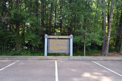
On Natchez Trace Parkway (at milepost 176.3), 0.1 miles south of County Road 3122, on the right when traveling north.
About half a mile northwesterly, Bethel, meaning “House of God” was opened in 1822 as one of thirteen Choctaw mission stations. Indians, slaves, and other men “labored hard during four weeks ... frequently till 10 o’clock at night, . . . — — Map (db m87479) HM
On Natchez Trace Parkway (at milepost 175.6), 0.8 miles south of County Road 3122, on the right when traveling north.
Forests are fascinating places – whole new worlds unfold to anyone who takes time to explore them.
Across Cole Creek you will find a typical mixed hardwood forest. Here you can discover for yourself the many marvels in a bottomland . . . — — Map (db m87477)
On County Road 3041 0.1 miles north of State Route 35, on the left when traveling north. Reported damaged.
Established before the Civil War,
this cemetery was part of a large
plantation owned by Boley J. and
Annie Traweek Conner. The earliest
burial is that of Burwell Traweek,
a veteran of the War of 1812. The
cemetery also contains the graves
of . . . — — Map (db m244502) HM
On West Washington Street (Business Mississippi Route 12) west of North Jackson Street, on the left when traveling west.
Founded 1833; named after Chateaubriand's Indian heroine. Buried in county are 1st senator, Gordon Boyd, and 1st representative, Wm. Dodd, who named the county seat after Thaddeus Kosciusko. — — Map (db m140800) HM
On Tipton Street at East South Street, on the right when traveling north on Tipton Street.
Opened in 1925, the Attala County Training
School stood here. The school provided
vocational education for African American
students. Built mainly with local labor
and funds, the school also received
assistance from the Rosenwald Fund. . . . — — Map (db m244504) HM
On West Jefferson Street (State Highway 12) at North Madison Street, on the right when traveling west on West Jefferson Street.
(Front)
In memory of those killed in action serving our country
World War I
Charley W. Malone • James M. Harris • Thomas S. Wasson • Thomas F. Wasson • Robert W. Stonestreet • Earle W. Boyett • Roy Jones • Jesse Ivy
World War . . . — — Map (db m171687) WM
On West Washington Street west of North Jackson Street, on the right when traveling west.
(side 1) World-renowned harmonica virtuoso Charlie Musselwhite was born in Kosciusko on January 31, 1944. His great uncle, Lamar Coalson, once owned the store that occupied this site. Musselwhite began playing in Memphis and rose to . . . — — Map (db m130064) HM
On Natchez Trace Parkway (at milepost 164.3), 1.3 miles south of Highway 12, on the left when traveling north.
Plants need water as much as men need money. Some are satisfied with little; some cannot flourish unless they have a lot; the majority can live contentedly with medium amounts.
From here, a trail descends to the vegetation that thrives in the . . . — — Map (db m87476)
On East Washington Street at North Huntington Street, on the right when traveling west on East Washington Street.
"Redbud Springs" in Indian days. Later named for Polish-American patriot. Chartered, 1836. On Natchez Trace near geographical center of state. Trade activity gave it title, "Beehive of the Hills." — — Map (db m140798) HM
On South Jackson Street at West Jefferson Street, on the left when traveling north on South Jackson Street.
The Mississippi Federation of Women’s Clubs was founded here on May 25, 1898. Organized by Mrs. Fannie Clark Coleman of Kosciusko, charter clubs included Clarksdale, Jackson, Verona, Sallis, Okolona, Vicksburg, and Meridian. Mrs. D.N. Hebron was . . . — — Map (db m72683) HM
On Mississippi Route 12 at Route 429, on the right when traveling east on Mississippi Route 12.
South 4 mi. Founded, 1846. Here, July 22, 1855, first Mississippi Lutheran Synod was organized. The Rev. G.H. Brown, pastor, served as first Synod president. — — Map (db m140802) HM
On Mississippi Route 7 at Avalon Road (County Road 41), on the right when traveling south on Mississippi Route 7.
John S. Hurt (1893-1966) was a
pioneer blues and folk guitarist.
Self-taught, Hurt rarely left his
home at Avalon, where he worked
as a farmer. Although he recorded
several songs in 1928, including
"Avalon Blues" and "Frankie,
he lived in . . . — — Map (db m160396) HM
On County Road 41 0.3 miles east of County Road 254, on the right when traveling east. Reported damaged.
World-renowned master of the acoustic guitar John Hurt, an important figure in the 1960s folk blues revival, spent most of his life doing farm work around Avalon in Carroll County and performing for parties and local gatherings. Hurt . . . — — Map (db m160397) HM
On U.S. 82 at Lexington Street, on the right when traveling west on U.S. 82.
Home of James Z. George & Hernando D. Money. Friends and neighbors; buried here in Evergreen Cemetery. Both statesmen served long in public life as lawyers, jurists, and U.S. senators. — — Map (db m170284) HM
On Lexington Street just south of Magnolia Street, on the left when traveling north.
Chartered in 1838, Carrollton Lodge No. 36 is among the oldest Masonic lodges in the state. Built in 1899, the lodge hall is the second oldest in Mississippi in continuous use. Prominent citizens of Carroll County who were members include U.S. . . . — — Map (db m229039) HM
On Jackson Street east of Lexington Street (State Route 17), on the right when traveling east.
Born in Carrollton in 1921, Elizabeth Spencer aspired to be a writer
early on. After receiving encouragement from writer Eudora Welty,
whom she met while attending Belhaven College in Jackson, Spencer
obtained a master's degree from Vanderbilt . . . — — Map (db m170313) HM
On U.S. 82 at Lexington Street, on the right when traveling west on U.S. 82.
Northwest 9 miles is site of plantation mansion of Greenwood Leflore, chief
of Choctaws, statesman and planter. Home burned, 1942. His grave is near the site. — — Map (db m170285) HM
On Jackson Street east of Lexington Street (State Route 17), on the right when traveling east.
Blending blues and old-time dance tunes,
fiddler William T. Narmour (1889-1961) and
guitarist Shellie W. Smith (1895-1968) became an
influential duo with forty-eight recordings for
Okeh and Bluebird records from 1928 to 1934 that
often . . . — — Map (db m170375) HM
On George Street (Mississippi Route 17) south of McCain Street, on the right when traveling south.
The Carroll County Tabernacle
was established in 1922 when
T.N. Bloodworth donated nearly
two acres of land to organize a
Methodist revival meeting place.
Funds were raised in 1929 to
erect a meeting place that could
seat 1.000 attendees. The . . . — — Map (db m170283) HM
On County Road 430 1.1 miles east of County Road 16, on the left when traveling east.
The Applewhite Cemetery, dating
from before the Civil War, was
established by James Applewhite
(1792-1872), a Methodist minister.
Included among the burials here,
the earliest of which is 1856,
are veterans of the War of 1812,
Civil War, and . . . — — Map (db m219768) HM
On Front Street (U.S. 51) at East Herring/Greensboro Street (County Road 430), on the right when traveling north on Front Street.
E. 150 ft. Organized at Old Shongalo, 1mi. W., by Clinton Presbytery, Aug. 29, 1835. Rev. A.C. Dickerson was first minister. Present structure completed 1875. Upper story built and used by Masons. — — Map (db m179027) HM
On Main Street at Highway 15, on the right when traveling west on Main Street.
Chartered February 16, 1884, upon the arrival of the Canton, Aberdeen, & Nashville Railroad, and named for the company's president, William K. Ackerman. Since 1896 County Seat of Choctaw County. — — Map (db m51200) HM
On Mississippi Route 15 0.1 miles South Pickle Street, on the right when traveling south.
First established as the Ackerman Colored School in the late 1920s, this school was part of the county board of education's plan to consolidate nearly thirty smaller community-based schools from 1931 to 1958. The school's name was changed to the . . . — — Map (db m140791) HM
On East Quinn Street just east of South Louisville Street, on the right when traveling east.
To the memory of those who served in World War II and these, our dead, in honored glory rest. Rhubert H. Allen • Neubern Atkinson • Herman P. Bennett • William T. Biggers • James B. Blanton • Wade H. Boggan • William J. Cook • . . . — — Map (db m228698) WM
On State Highway 12 at Fentress-Panhandle Road, on the right when traveling east on State Highway 12.
On Yockanookany, 1/2 mi. S., was built in 1836 water mill of W.R. Coleman of Fairfield Co. S.C., first white settler after Choctaw cession in Treaty of Dancing Rabbit Creek. — — Map (db m51198) HM
On South Commerce Street at East Main Street, on the left when traveling south on South Commerce Street.
James Plemon "J.P." Coleman was born in 1914 in Ackerman. A graduate of George Washington University, he served as district attorney for the Fifth Judicial District from 1940 to 1946 and as a judge from 1947 to 1950. Coleman served as a Mississippi . . . — — Map (db m140790) HM
On South Commerce Street at East Main Street, on the left when traveling south on South Commerce Street.
A fourth generation Choctaw countian, Ray Mabus grew up in Ackerman. In 1987 he was elected governor, the youngest in more than 150 years. Appointed Secretary of the Navy in 2009, he served until 2017, the longest tenure since WWI and the third . . . — — Map (db m140788) HM
On East Main Street 0.1 miles east of South Commerce Street, on the right when traveling east. Reported damaged.
[Front]
Choctaw County fiddler Hoyt Ming (1902-1985) led the lively string band recorded as “Floyd Ming & His Pep Steppers” at a Memphis Victor session in 1928. His “Indian War Whoop,” with its fiddling “holler,” became an old-time country . . . — — Map (db m140731) HM
Near Natchez Trace Parkway (at milepost 193.1), 2.4 miles south of Highway 9.
On February 15, 1934, while serving as U.S. Congressman from Mississippi, Thomas Jefferson Busby (1884-1964) introduced a bill authorizing a survey of the Old Natchez Trace. Four years later the historic road was designated a unit of the National . . . — — Map (db m87481) HM
Near Lebannon Road 0.2 miles north of South Union Road, on the right when traveling north.
Begun in 1840 by Rev. William A.
Gray. First building destroyed
by tornado in 1883 and
rebuilt on same site in 1887.
Known for its campmeetings,
held here annually since before
the Civil War. — — Map (db m244510) HM
On Mississippi Route 12 1.4 miles west of Scott Road, on the right when traveling west.
Established ca. 1836, Shiloh Methodist Church was disbanded by 1875. Remaining members joined other churches in area, including Mt. Airy, Chestnut Grove, and Bethel. Frederick and Margaret Crawford Bagwell, early settlers of Choctaw County are . . . — — Map (db m140785) HM
On South Union Road 0.1 miles Lebannon Road, on the right when traveling west.
During the War between the States there was a “great revival” of religious fervor through the Holy Spirit. In 1865, several Choctaw County Christian families knelt together in prayer and asked for God's guidance to direct them in His way, believing, . . . — — Map (db m244506) HM
On South Union Road 0.1 miles west of Lebannon Road, on the right when traveling west.
Church begun 1865. Campmeeting begun 1872 on land
donated by William Parham
Pollard, 1830s pioneer. Summer
worshippers camped in wooden
tents surrounding the tabernacle.
Cemetery dates to 1840. — — Map (db m244505) HM
Near Natchez Trace Parkway (at milepost 193.1), 2.4 miles south of Highway 9.
(Marker #1)
The Great Eastern Hardwood Forest
Before Columbus, the world of the eastern Indian was one of a vast continuous forest stretching from Canada to the Gulf coast. A mature forest, it changed little over the centuries, and . . . — — Map (db m87480) HM
On East Main Street east of South Commerce Street, on the right when traveling east.
"Two Steps From the Blues" might refer to Choctaw County's location, a bit off the path from the well-known blues highways and byways of Mississippi, but it is also the title of a classic blues song written by a native of Ackerman, "Texas" Johnny . . . — — Map (db m51199) HM
On State Highway 413 at LeFleur Circle, on the left when traveling east on State Highway 413.
President pro tem of the state Senate, 1857-65. Defeated by W. McWillie in governor’s race, 1857. Delegate to Charleston Dem. Convention, 1860. Son and grandson of Rev. soldiers. House moved here, 1981, and restored. — — Map (db m87486) HM
On Natchez Trace Parkway (at milepost 180.7), 0.1 miles south of Highway 413, on the right when traveling north.
Louis Leflore first traded with the Choctaw Indians at a bluff now part of Jackson Mississippi. About 1812 he established his stand 900 feet to the northeast on the Natchez Trace.
Because of the storekeepers nationality, the area was often . . . — — Map (db m87485) HM
On Natchez Trace Parkway (at milepost 180.7), 0.1 miles south of Highway 413, on the right when traveling north.
This memorial marks a stage on the “Natchez Trace.” The first highway opened through the lower South, by the Treaty of Dancing Rabbit Creek in 1830, between the American government and the Choctaw Indians. The surrounding country became . . . — — Map (db m87495) HM
On Natchez Trace Parkway (at milepost 203.5), 0.6 miles south of U.S. 82, on the right when traveling north.
Pigeon Roost Creek, to your left, is a reminder of the millions of migrating passenger pigeons that once roosted in trees in this area. The species has been completely destroyed.
One mile east where the Natchez Trace crossed the creek, . . . — — Map (db m87484) HM
On Natchez Trace Parkway (at milepost 198.6), 3.1 miles north of Highway 9, on the right when traveling north.
In the early 1800's many thoughtful Americans believed that isolation and the difficulties of communication would force the Mississippi Valley settlements to form a separate nation. Hoping to hold the frontier, Congress in 1800 established a post . . . — — Map (db m87483) HM
On Concord-Bethsalem Road 0.1 miles north of Highpoint-Weir Road.
Begun ca. 1839 by Rev. James
Martin. Present building of
virgin pine erected in early
1840s. Known as “a mother of
churches,” it supported a session house, a school, and an
annual campmeeting. — — Map (db m244513) HM
On Main Street at Front Street, on the right when traveling north on Main Street.
Choctaw County’s blues history is distinguished by the accomplishments of two artists in particular, both of them singers, songwriters, and guitarists; Levester “Big Lucky” Carter, who was born in Weir and raised on his family’s farm in French Camp, . . . — — Map (db m205436) HM
Built 1878. this was the home of Col. John Weir (1833-1900), who was twice wounded during the Civil War. Col. Weir, for whom the town of Weir was named, established a water and saw mill complex near here in 1870. Descendants of John and Emily Weir . . . — — Map (db m205434) HM
On Gladney Road 0.1 miles west of McGee-Thompson Road, on the left when traveling west.
Established 1841, this cemetery
served both Concord Baptist Church
and the now extinct community of
New Prospect, founded in the early
1830s. The church moved to a new
location in 1876. Among those
buried here are Dr. Robert Brown,
New . . . — — Map (db m244512) HM
On U.S. 51 at Camp McCain Road, on the right when traveling north on U.S. 51.
First U.S. Army Division to achieve "Expert Infantry" recognition while training here at Camp McCain November, 1943 to July, 1944.
Distinguished World War II Service in European Theater Campaigns:
Northern France • Ardennes-Alsace
Rhineland • . . . — — Map (db m89898) HM
On U.S. 51 at Camp McCain Road, on the right when traveling north on U.S. 51.
Established 1942 as a training facility for the United States Army during the Second World War and used until 1946. Named for Carroll Co. Miss. native, Major-General Henry Pinckney McCain (1861-1941). — — Map (db m89901) HM
On James H. Biddy Road south of Willis Road, on the right when traveling south.
The “Golden Acorn” Div. was reactivated at Camp McCain, Miss., Dec. 15, 1942, and trained here in 1943. The Div. distinguished itself in the Ardennes, Rhineland & Central Europe during the Battle of the Bulge, assault of the Sauer, Moselle & Rhine . . . — — Map (db m219774) HM
On West Pearl Street at Water Street, on the left when traveling west on West Pearl Street.
Organized ca. 1868, Belle Flower
M. B. Church, one of the oldest
Black Baptist churches in
Grenada, served as a headquarters
and meeting place for a number of
organizations during the Civil
Rights movement. From its pulpit
such leaders as . . . — — Map (db m173971) HM
On Loop State Highway 333 at E J Henry Road, on the right when traveling north on State Highway 333.
Main defensive position on Yalobusha River line held by Gen. Pemberton in fall of 1862 to repel Gen. Grant, whose army of 25,000 was moving to attack Vicksburg. — — Map (db m89894) HM
On College Boulevard east of South Line Street, on the right when traveling east.
Lawyer, soldier statesman.
Maj. Gen. in Confederate
Army. U. S. Senator from
1885 to 1898. Made home
here from 1871 to death.
House built shortly before
outbreak of Civil War. — — Map (db m173961) HM
On Dr Martin Luther King Jr Boulevard at Sunset Drive (State Route 8), on the right when traveling north on Dr Martin Luther King Jr Boulevard.
Established July 4, 1836
by union of the towns of
Pittsburg and Tullahoma.
Federal plans to attack
Confederates here stopped
by Gen. Van Dorn's raid on
Holly Springs, Dec., 1862. — — Map (db m173958) HM
Near L D Boone Airport Road 0.7 miles north of Old Highway 7 (State Route 332), on the left when traveling north.
The Grenada Army Air Field was built
with civilian labor in 1942. It served
the 443rd Air Support Command, 63rd
Troop Carrier Group, 877th Airborne
Engineering Battalion, 10th Troop
Carrier Group, and 809th Air Force Unit.
Following the war, . . . — — Map (db m173915) HM
On 1st Street at Green Street, on the right when traveling east on 1st Street.
Grenada County-bred blues has long been an influential force in popular music. Musicians whose talents were nurtured in the Grenada area have included St. Louis bluesmen Walter Davis, a major blues recording artist of the 1930s, and Big George . . . — — Map (db m90022) HM
On South Main Street at 1st Street, on the right when traveling south on South Main Street. Reported permanently removed.
Front
To the noble men
who marched neath
the flag of the
Stars and Bars,
and were faithful
to the end.
Glorious
in life,
death sublime.
Back
Jefferson Davis,
June 3, 1808,
Dec. 6, 1889. . . . — — Map (db m90264) WM
On Scenic Mississippi Route 333 0.1 miles north of Grenada Lake Visitor's Center, on the right when traveling north.
The Great Mississippi River Flood of 1927
affected an area of 27,000 square miles.
More than 130,000 homes were lost
and 700,000 people were displaced.
Congress took action, passing the Flood
Control Act of 1936. The U.S. Army
Corp of . . . — — Map (db m219775) HM
On 2nd Street north of Kershaw Street, on the left when traveling north.
The Grenada Depot was jointly constructed
by the MS Central and TN MS Railroads in
1870. Two previous depots were burned during
the Civil War in 1863 and 1865. The second
story and sheds were added by Illinois
Central in 1926.
Due to the . . . — — Map (db m173966) HM
On Springhill Road 0.2 miles east of Sunset Drive (State Route 8), on the right when traveling east.
In 1862 the Confederate army built
forts throughout Grenada in response to
General Ulysses S. Grant's Mississippi
Central Railroad Campaign to capture
Vicksburg. This small fort was placed
to guard the approach to Grenada from
the south, along . . . — — Map (db m173975) HM
On 1st Street at South Main Street, on the right when traveling west on 1st Street.
J. Augustine Signaigo, born in 1835 in Italy, founded the Grenada Sentinel in 1854. A poet, he wrote the libretto of a hit Civil War operetta, "The Vivandiere." He served as president of the Mississippi Press Association in 1869. He died in . . . — — Map (db m89888) HM
J. Augustine Signaigo, born in 1835 in Italy, founded the Grenada Sentinel in 1854. A poet, he wrote the libretto of a hit Civil War operetta, "The Vivandiere." He served as president of the Mississippi Press Association in 1869. He died in 1876 and . . . — — Map (db m89891) HM
On Holmes Drive 0.2 miles north of State Route 8, on the left when traveling north.
Magic Sam (Samuel Maghett) was one of the
most dynamic and gifted blues musicians
during his short lifetime (1937-1969). Born
few miles northeast of this site, Maghett began
his performing career in Grenada and lived in
this house until he . . . — — Map (db m174060) HM
On Union Street 0.2 miles west of Dr Martin Luther King Jr Boulevard (U.S. 51), on the right when traveling west.
Front
Morris "Magic Slim" Holt, who developed a raw, hard-hitting guitar style that made him a favorite on the international blues club and festival circuit from the late 1970s well into the twenty-first century, was born in Torrance . . . — — Map (db m90020) HM
On Cemetery Street west of Dr Martin Luther King Jr Boulevard, on the right when traveling west.
Established circa 1840. this is
Grenada's oldest cemetery. Buried
here are many prominent, early
citizens, including Rev. Abraham
Lucas, who performed the "marriage
of Pittsburg & Tullahoma" on
July 4, 1836, forming Grenada.
Also buried here . . . — — Map (db m173957) HM
On Dubard Road (Mississippi Route 35) at Blanch Road, on the right when traveling south on Dubard Road.
Organized here in 1818 by
the Rev. Cyrus Kingsbury.
The 1st in a series of 13
missions for the education
of the Choctaws into western
culture, it was closed in 1832
due to removal of many
Choctaws to Oklahoma. — — Map (db m173979) HM
On North Jackson Street south of State Route 12, on the left when traveling north.
W. 3 mi. Mineral springs created popular health spa prior to Civil War. Girls boarding school organized, 1854. In 1862, wounded from Shiloh treated here. Now Y.M.C.A. state camp. — — Map (db m140831) HM
On North Jackson Street (U.S. 51), on the right when traveling south.
Founded, 1858. Named for Louis Durant, a nearby Choctaw chief. Lockhart's Store, 4 mi. W., was first Holmes County post office, dating from 1849. Town later merged with Durant. — — Map (db m140836) HM
On Ebenezer Road at Route 14, on the right when traveling south on Ebenezer Road.
Born in 1928 in Holmes County, Robert G.
Clark Jr. was the first African American
elected to the Mississippi Legislature in
the 20th century. Elected in 1967, Clark
became chair of the House Education
Committee in 1977 and played a key role . . . — — Map (db m244497) HM
On Mississippi Route 17 at State Park Road (County Road 417), on the right when traveling north on Mississippi Route 17.
During Brig. Gen. Benjamin Grierson's raid in the late winter of 1864-1865, a small Confederate brigade under the command of Gen. Wirt Adams attacked the rear guard of one of Grierson's columns at Franklin Church on January 2, 1865. Among the . . . — — Map (db m140860) HM
On U.S. 51 at Church Street, on the right when traveling north on U.S. 51.
Built in 1921 with assistance from the
Rosenwald Fund and known locally as the
Goodman School for Negroes, the Goodman School
served African American students in the first
through eighth grades in the Goodman-Pickens
area. Local Black citizens . . . — — Map (db m219758) HM
On Court Square at Wall Street (State Route 17), on the left when traveling east on Court Square.
Charles Harrison Mason (1864-1961) began his ministry in 1893 in Preston, Arkansas. Shunned by the African American Baptist community in Jackson during the 1890s due to his teachings on holiness, Mason brought his revival to Lexington in 1897. He . . . — — Map (db m140839) HM
On Mississippi Route 17 0.1 miles south of Old Wire Road, on the left when traveling south.
Dr. Arenia Mallory (1904-1977), a native
of Jacksonville, Illinois, was a graduate
of Jackson State University and the
University of Illinois and was awarded a
Ph.D. from Bethune-Cookman College. In
1926, Mallory came to Lexington, where . . . — — Map (db m219761) HM
On Newport Road (County Road 415) 3.9 miles west of State Route 17, on the left when traveling west.
[Front]
The cemetery of the Newport Missionary Baptist Church is the final resting place of Elmore James (1918-1963), often described as the "king of the slide guitar." James' electric style built on the approach of Robert Johnson and later . . . — — Map (db m140748) HM
On Yazoo Street (Mississippi Route 17) north of Mulberry Street, on the left when traveling north.
Hazel Brannon Smith (1914-1994), a journalist and
publisher, was the owner and editor of four weekly
newspapers, including the Lexington Advertiser. An
advocate for racial justice, Smith condemned the
state's Sovereignty Commission and . . . — — Map (db m219759) HM
On Court Square (Mississippi Route 12/17) south of Oak Street, on the left when traveling south.
Created by an act of the legislature on 2/19/1832.
Because Gov. Scott opposed the creation of the new
county, a two-thirds vote of the legislature was necessary
for approval. Originally, part of a vast territory known as
Hinds County, which was . . . — — Map (db m184579) HM
On Yazoo Street (Mississippi Route 17) at Elder James Rodgers Street, on the right when traveling north on Yazoo Street.
[Front]
Holmes County has been a significant contributor to the legacy of African American blues and gospel music in Mississippi. Heralded blues artists born or raised in the Lexington area include Elmore James (a native of Richland, . . . — — Map (db m140751) HM
On Court Dquare (Mississippi Route 12) at Oak Street, on the left when traveling south on Court Dquare.
To the Holmes County
soldiers of 1861—1865,
and members of Holmes
County Camp No 398 U.C.V.
in memory of their
patriotism and heroism
and to commend their
example to future
generations.
Their deeds, proud deeds.
shall . . . — — Map (db m184582) WM
On Court Square at Wall Street (State Route 17), on the left when traveling east on Court Square.
Began in 1820s as trading post. Incorporated in 1836. County seat of Holmes County since 1834. In 1907 the first Corn Club in the United States was organized here by W.H. (Corn Club) Smith. — — Map (db m140843) HM
On Ebenezer Road at State Route 17, on the right when traveling south on Ebenezer Road.
Milton Lee Olive III, a native of Chicago, moved to Holmes County and attended school in Lexington. During the Vietnam War, Olive served in Co. B, 2nd Bttn. (Airborne), 503rd Infantry. Near Phu Cong, on October 22, 1965, Olive saved the lives of . . . — — Map (db m140856) HM
On Tchula Street at Church Street, on the right when traveling north on Tchula Street.
St. Mary's is the successor to Calvary Parish,
organized in 1851 at “Wannalaw,” the home of
William Eggleston. Built in 1852-53 and
consecrated by Bishop William Mercer Green in
1855, the Calvary property was sold in 1878 to
build St. Mary's. . . . — — Map (db m219762) HM
On Mississippi Route 17 at Torrey Creek Road, on the right when traveling north on Mississippi Route 17.
St. Paul Church of God in Christ (COGIC) was organized in 1897 by Bishop Charles Harrison Mason, the founder of the COGIC denomination. St. Paul has served as "Mother Church for the COGIC since its construction here in 1906. Saints Academy. formerly . . . — — Map (db m140853) HM
On Mississippi Route 17 0.1 miles east of Acona Road, on the right when traveling north.
The church was built on three acres of land purchased in 1874 from
Mrs. A.T. Landfair for $25. Lumber for the building was shipped by
rail from Tennessee to Vaiden, then hauled to Acona by wagon.
The church was erected by John Hamilton. The . . . — — Map (db m219764) HM
On U.S. 51 at Lexington Road, on the right when traveling south on U.S. 51.
Born in 1835 in Alabama, Edmund Scarborough
became a successful farmer in Pickens. He
served in the Mississippi Legislature in 1870-1871
and organized what would become Union
Memorial UMC. John B. Scott, born near Pickens
in 1853, attended . . . — — Map (db m219757) HM
On Mississippi Route 17 0.2 miles south of Route 14, on the right when traveling south.
Here in 1849, Robert Morris, Mason, schoolmaster, began movement that resulted in creation of the Order of the Eastern Star. Schoolhouse has also housed Masons and Co. C 15th Miss. Inf. C.S.A. — — Map (db m140863) HM
On Martin Luther King Drive (U.S. 49E) at Main Street, on the right when traveling south on Martin Luther King Drive.
Front
Many blues performers who gained fame in the Delta, Jackson, and Chicago and on the southern soul circuit have lived in or near Tchula, including Elmore James, Hound Dog Taylor, Jimmy Dawkins, Jesse Robinson, Lewis "Love Doctor" . . . — — Map (db m121121) HM
On Martin Luther King Drive (U.S. 49E) at East Main Street, on the right when traveling north on Martin Luther King Drive.
Settled by Charles Land, 1826. Early settlers came by Rockport Road, built by Indians from Tchula Lake to Natchez Trace. Town was trade & shipping center for planters of this area. — — Map (db m121048) HM
Near Interstate 55 (Interstate 55 at milepost 163), on the right when traveling north.
James O. Eastland
November 28, 1904 - February 19, 1986
United States Senator From Mississippi
June 30 -
September 28, 1941
and
January 3, 1943 - December 27, 1978 — — Map (db m301849) HM
On South Van Buren Street north of East Henderson Street, on the right when traveling north.
In 1836 when the city of Carthage was laid out, two lots were reserved for a graveyard. The first burials were in 1837, and the Carthage City Cemetery eventually grew to contain over 300 extant burials and several unmarked grave sites. Among these . . . — — Map (db m171675) HM
On East Franklin Street at North St. Matthew Street, on the right when traveling east on East Franklin Street.
The Carthage United Methodist Church was established in 1846 when Mrs. Joseph Eads became the first member during a revival held by a Methodist circuit rider. Rev. Alexander S. Parker was appointed as the first pastor in 1847. The first sanctuary, . . . — — Map (db m140927) HM
On North Van Buren Street 0.2 miles north of East Franklin Street, on the left when traveling north.
Colonel Joseph D. Eads (1817~1899) settled in Leake County in 1843. An attorney, Eads practiced law in Carthage for fifty three years and kept records of all county land transactions. This house, built ca. 1860, was sold to Joseph Mansell in 1905. . . . — — Map (db m171676) HM
Near Natchez Trace Parkway (at milepost 145.1), 1.2 miles south of Highway 429, on the left when traveling north.
(Marker #1)
Meet the Beaver
A member of the rodent family that has adapted itself to work and live both on land and in the water.
Beavers are large, weighing up to 60 pounds in Mississippi. Squat and with a low center of . . . — — Map (db m87489)
On Natchez Trace Parkway (at milepost 140) at Red Dog Road, on the left when traveling north on Natchez Trace Parkway.
The road to your left, running to Canton, Mississippi, was opened in 1834 and named for Choctaw Indian Chief Ofahoma or Red Dog. Like other Choctaw, he had accepted the way of his European neighbors and had become a farmer.
Chief Ofahoma . . . — — Map (db m87488) HM
On Natchez Trace Parkway (at milepost 135.5), 0.1 miles north of Old Robinson Road, on the right when traveling north.
The road crossing the Parkway follows the Robinson Road which was built in 1821; nearly all of it passing through the country of the Choctaw Indians. It joined Jackson, Mississippi, and Columbus, center of the “settlements on the . . . — — Map (db m87487) HM
On Spruce Street at Reeves Avenue, on the left when traveling north on Spruce Street.
On December 17, 1860, the McNair family deeded four acres of land in “Old” Walnut Grove to the Methodist Episcopal Church South. Shortly thereafter the first sanctuary was constructed and the Rev. Levi P. Meador was appointed as the . . . — — Map (db m171680) HM
On Forest Grove Road at Greenwood Chapel Road, on the left when traveling north on Forest Grove Road.
In 1860 thirty~one members of the Camden Presbyterian Church petitioned the Presbytery of Central Mississippi to organize a church close to their homes near the Forest Grove Academy. After the petition was granted on November 23, 1860, Rev. R.E. . . . — — Map (db m171682) HM
On South State Street (U.S. 51) north of South Binford Avenue, on the right when traveling north.
Lucie Eddie Campbell (1885-1963) was
born in Duck Hill. After her father was
killed in a railroad accident, she moved
with her family to Memphis at an early
age.
A graduate of Rust College, she
became a teacher and was active in
state and . . . — — Map (db m179056) HM
Near U.S. 82 at Legion Road, on the right when traveling west.
Four score and seven years ago our fathers brought forth on this continent, a new nation, conceived in liberty, and dedicated to the proposition that all men are created equal. Now we are engaged in a great civil war, testing whether that nation, . . . — — Map (db m228700) WM
On South Depot Avenue at West Main Street, on the right when traveling south on South Depot Avenue.
Riley B. King, who was born in the Delta fifty miles west of here in 1925, spent many of his formative years in Kilmichael in the 1930s and ‘40s before achieving stardom as “B. B.” King. His first mentor on the guitar was the Reverend Archie . . . — — Map (db m90016) HM
Near U.S. 82 at Legion Road, on the right when traveling west.
The Mississippi Carillon shall stand forever in symbolic repose to honor our nation’s heroes who lie beneath this sacred earth. Her steel represents the strength and resolve of those who defend our great nation. Her bell represents the liberty . . . — — Map (db m228933) WM
On U.S. 82 at Stewart-Lodi Road, on the right when traveling west on U.S. 82. Reported missing.
This trust fund, est. in honor
of timberman E. H. Sumners of
Stewart by his wife in 1979,
provides college tuition to
students in 5 Miss. counties,
offering wider access to higher
education to thousands. — — Map (db m170377) HM
182 entries matched your criteria. The first 100 are listed above. The final 82 ⊳