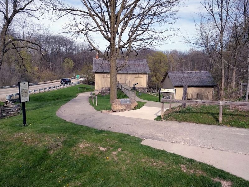
On Geddes Road 0.2 miles east of North Dixboro Road, on the right when traveling east.
Centuries ago, Indian trails crossed the landscape of Washtenaw County. These paths connected Indian villages to fertile hunting and fishing grounds throughout Michigan. When settlers arrived in the County during the 19th century, these same . . . — — Map (db m104642) HM
On Sharon Hollow Road, on the right when traveling north.
Native Americans in Washtenaw. Long before Europeans set foot in Michigan, Native Americans made their homes here. When the French arrived in the late 1600s a number of Native American tribes lived in lower Michigan, including the Miami, . . . — — Map (db m229550) HM
On North River Street at East Cross Street, on the right when traveling north on North River Street.
The Barracks
When the Civil War began in 1861, this corner site housed a commercial building called the Norris Block. Its location across the street from the railroad station made it an ideal place for short-term lodging for enlistees . . . — — Map (db m101216) HM
On East Huron Street at Main Street, on the left when traveling east on East Huron Street.
On this site, in 1836, delegates from all parts of Michigan met in Washtenaw County's first courthouse to consider a proposal by Congress for settling the boundary dispute between Michigan and Ohio. Both claimed a narrow strip of land, including . . . — — Map (db m156703) HM
On North Union Street 0.3 miles north of Railroad Street, on the right when traveling west.
Centuries ago, Indian trails crossed the landscape of Washtenaw County. These paths connected Indian villages to fertile hunting and fishing grounds throughout Michigan. When settlers arrived in the County during the 19th century, these same . . . — — Map (db m208349) HM
On Maiden Lane at Freesia Court, on the right when traveling east on Maiden Lane.
In 1832 a small group of Baptist worshipers were meeting in a room above Anson Brown's new store in the Exchange Block on Broadway. Anson's 27-year-old brother Daniel and Daniel's wife, Ann Vickery Brown, were baptized that year. Daniel was . . . — — Map (db m181966) HM
The Problem
The river front is a much loved aspect of the Arboretum. But there was trouble in paradise. Heavy use, lack of vegetation, concrete and the natural flow of the river all contributed to severe degradation of the banks. Without a . . . — — Map (db m161701) HM
On East First Street at Washington Street on East First Street.
Monroe County was established in July, 1817, as one of the first steps in the organization of Michigan Territory after the War of 1812.
Then the old settlement of Frenchtown which centered upon this square took the name of Monroe and became the . . . — — Map (db m27634) HM
On Geddes Road 0.1 miles west of Sheldon Road, on the right when traveling west.
Side 1 In 1829 the Territorial Legislative Council of Michigan moved to survey land to create a road from the east side of Michigan Territory to the west. The act stated that the road would start at “Sheldon’s Inn,” a business . . . — — Map (db m173173) HM
Near Ann Arbor Street (State Highway 52), on the right when traveling west.
This historical plaque is located on the former site of the Detroit, Hillsdale and Indiana Railroad depot, built in 1870 when Manchester's second railroad was constructed. Railroads were essential to commerce and growth in 19th century towns, and . . . — — Map (db m209791) HM
On Geddes Road 0.2 miles east of North Dixboro Road, on the right when traveling east.
Starting a New Life
William Q. Parker and his bride Mary came from England in 1861 to begin a new life. They purchased land in Washtenaw County and by 1872 were well-established farmers. Here, on the ruins of the old Fleming . . . — — Map (db m104677) HM
Near Wall Street near Canal Street, on the right when traveling west.
In the 1880 Birdseye map (above right), Lower Town looked prosperous with mills, factories, and a sizable residential neighborhood surrounding its Broadway commercial center. The town's second railroad, the Toledo and Ann Arbor, built a wooden . . . — — Map (db m271877) HM
On Webster Church Rd at Farrell Road, on the right when traveling north on Webster Church Rd.
In 1834 construction began on Webster Church, the oldest church building in continuous use in Washtenaw County. Built on land donated by Hannah Williams Kingsley, it was completed in 1835 after Moses Kingsley secured donations from Daniel Webster . . . — — Map (db m60515) HM
On Mooreville Road 0.5 miles west of Platt Road, on the right when traveling west.
Lovatus Chapman Allen moved to the Milan area from Vermont in 1849. "L.C." as he was known, was born in Vermont in 1816. L. C.'s older brother, Harmon Allen, came to Michigan many years earlier and was one of the founders of Milan in 1831. L. . . . — — Map (db m106197) HM
On Old Dixboro Road 0.1 miles south of South Dixboro Road, on the right when traveling south.
Founded in 1832 by John and Robert Geddes, the agricultural milling hamlet of
Geddesburg illustrates the tradition of water-power economic opportunity which spurred westward expansion in 19th century America. Traversed by two Native American . . . — — Map (db m171187) HM
On Ann Arbor Street (State Highway 52) at East Main Street, on the left when traveling north on Ann Arbor Street.
Our village began with land surveys ordered by the Federal Government beginning in 1815, and the sale of land parcels beginning in 1820. John Mudget Mack of Pontiac was hired to survey several townships in western Washtenaw . . . — — Map (db m205615) HM
On North Division Street at Catherine Street, on the right when traveling north on North Division Street.
St. Andrew’s Episcopal Church had been organized by the spring of 1828. It incorporated under an act of the Territory of Michigan in 1833. One year later the congregation bought land on this site from newspaper editor George Corselius for $105. The . . . — — Map (db m181730) HM
On Grand Street at Broad Street, on the left when traveling west on Grand Street.
Forest Lawn Cemetery was part of a parcel owned by Samuel Dexter, who came to Michigan in 1824 from New York State. He purchased 926 acres of land that was incorporated as the village of Dexter. For years, Dexter offered cemetery plots free to . . . — — Map (db m171679) HM
On East Main Street north of Adrian Street, on the left when traveling south.
The intersection of Main and Adrian Streets is considered the "heart" of downtown Manchester, and the first commercial buildings were constructed here in 1832-1833.
Why is Manchester Located . . . — — Map (db m206190) HM
On Dickerson Street north of South Street, on the left when traveling south.
Fred Rider was the grandson of Captain Ira Rider, an early settler (1831) and first Postmaster in the township (1832). An early road map of Washtenaw County (1839) shows only one location in the Township, "Riders".
Fred Rider, an excellent . . . — — Map (db m170578) HM
On North Ann Arbor Street, on the right when traveling north.
"The land abounds with a most fertile and healthy description and the climate is particularly adapted to our eastern constitution. The tide of immigration has just begun..." stated Saline founder, Orange Risdon in an advertisement in the Detroit . . . — — Map (db m236176) HM
Born in Littleton, Massachusetts, in 1796, John Dix played a significant role in American and state history. As a teenager, he served aboard a privateer during the War of 1812. He was engaged in capturing the English brig Don Dossack, which . . . — — Map (db m182938) HM
On North River Street at East Clark Road, on the left when traveling south on North River Street.
The parish of St. John the Baptist Catholic Church in Ypsilanti was founded by Father Thomas Cullen in 1844. The parish built a small wooden Catholic Church on the corner of Cross and Hamilton Streets. In 1858 a brick church replaced the wooden . . . — — Map (db m174345) HM
Near Waterloo-Pinckney Hiking Trail 0.2 miles north of North Territorial Road.
Did you know that all of Michigan was completely covered with ice 20,000 years ago? The glacial ice in our region was as much as one mile thick! As its enormous weight scraped across the ground, the glacier easily collected boulders, stone, . . . — — Map (db m243843) HM
On North Delhi Road south of West Huron River Drive, on the right when traveling south.
(side 1)
The Delhi Bridge was one of many Pratt through truss iron bridges built to order by the Wrought Iron Bridge Company of Canton, Ohio, between 1876 and 1899 to span the Huron River. It was listed in the National Register of Historic . . . — — Map (db m60228) HM
Near Terhune Road at Lillian Road, on the right when traveling east.
Terhune Memorial Park contains the gravestones of John Terhune, Sarah Vreeland
Terhune, and Emily Whitmore. The stones were moved to this location from the
cemetery at the corner of Packard and Burton Roads by the Daughters of the American . . . — — Map (db m198487) HM
On Maiden Lane at Freesia Court, on the right when traveling east on Maiden Lane.
David T. McCollum was thirty-three years old when he arrived in Ann Arbor from New York State in 1832 with a wife and five children.. The following spring he became the bookkeeper for Anson Brown & Co. McCollum was a leader in the Methodist . . . — — Map (db m181980) HM
Near Marsh Road 0.3 miles north of Central Park Drive, on the left when traveling north.
The Farmstead
Meridian Township was primarily settled by German families. The Grettenbergers, Unruhs, Brays, and Proctors came to an area covered in forests and wetlands. The tree needed to be cut down in order to get seed in the ground. . . . — — Map (db m174993) HM
On South Center Street east of South Clinton Street (Michigan Highway 106), on the left when traveling north.
In early 1834, David and Mary Ann Rogers moved from New Jersey to Michigan. While living with Mary Ann's father in Lima, Washtenaw county, they bought land in Ingham county. By March, Rogers had built the frame for a house. He then moved it and . . . — — Map (db m213473) HM
On Observatory Street at Geddes Avenue, on the right when traveling north on Observatory Street.
Benjamin Woodruff was born on November 26, 1744, in Hanover Township, Morris County, New Jersey. He enlisted at
age 32 and first served in 1776 as a drummer.
He later served as a Sergeant in the Morris
County, New Jersey Militia where he . . . — — Map (db m264571) HM
Near Waterloo-Pinckney Hiking Trail 0.2 miles north of North Territorial Road.
For centuries, Native Americans hunted and fished in the area known today as Lyndon Township. The numerous lakes and ponds provided an abundance of food for its earliest inhabitants. European settlers began to arrive in 1833, nearly a decade after . . . — — Map (db m243846) HM
On North Washington Street at Railroad Street, on the right when traveling north on North Washington Street.
What is This?
Manchester's original cemetery is located north of this sign, on the gradual hill north and east of the Washington Street and condominium driveway intersection. This cemetery has been referred to as "the old . . . — — Map (db m208579) HM
On East Main Street at Adrian Street, on the left when traveling east on East Main Street.
Overview
The central business district of Manchester is historically referred to as "Exchange Place", a term deriving from the 1837 Second Plat of Manchester, and applied to what is now labelled "Main Street". Stephen . . . — — Map (db m205773) HM
On Ann Arbor Street (State Highway 52) at East Main Street, on the right when traveling south on Ann Arbor Street.
This historical sign focuses on the corner piece of land bounded by the River Raisin Mill Pond on the west, Main Street on the south, Ann Arbor Street (M-52) on the east, and the former railroad rail bed on the north, now a part of the Manchester . . . — — Map (db m208423) HM
On West Main Street at North Washington Street, on the right when traveling west on West Main Street.
John Gilbert's Founding VisionJohn Gilbert, the founder of the Village of Manchester, was born in Lenox Massachusetts in 1774, and grew up with the presence of a central public square in his town, where . . . — — Map (db m205902) HM