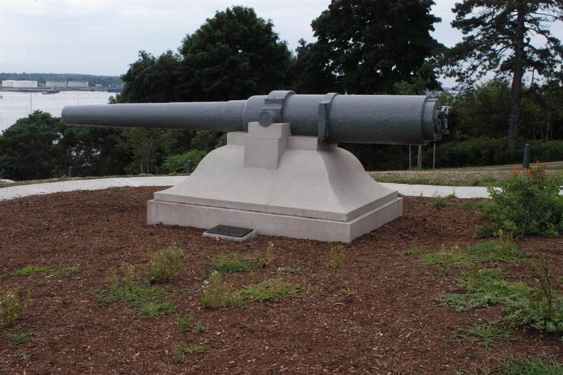
On Depot Street at Summer Street (Maine Route 9A/35), on the right when traveling north on Depot Street.
This depot was constructed in 1872 when the Boston & Maine Railroad operated a branch line between Portland and South Berwick, Maine. It is an example of Stick-style architecture. During the late 1800, tourists to the area were met . . . — — Map (db m186335) HM
On State Street (U.S. 201) at Union Street, on the right when traveling south on State Street.
Six of the seven batteries of mounted light artillery raised by the State of Maine beginning in 1861 were mustered into service and trained in Augusta. They encamped in an expanse of high ground immediately southwest of the State . . . — — Map (db m186062) HM
On Winthrop Street at Wyman Street, on the right on Winthrop Street.
Charlotte Holand Vance Morrill could hold a grudge. When in 1869, her husband Lot lost his seat in the U.S. Senate to Hannibal Hamlin, she blamed James G. Blaine, who from then on she refused to allow in her house. Lot Morrill served . . . — — Map (db m186078) HM
On Wright Avenue at Sykes Avenue, on the right when traveling west on Wright Avenue.
(Front):Twentieth Maine Third Brig. - First Div. Fifth Corps (Left):Here the 20th Maine Regiment. Col. J. L. Chamberlain Commanding, forming the extreme left of the national line of battle on the 2nd day of July 1863. Repulsed the . . . — — Map (db m9578) HM WM
On Auburn Riverwalk 0.1 miles north of Court Street (U.S. 202), on the left when traveling north.
Loss of Maine Farmland
According to the 2017 National Agricultural Statistics Service (NASS) of the USDA Census (a survey done every 5 years), Maine lost a significant amount of farmland between 2012 and 2017.
On County Highway 45 south of County Highway 74, on the right when traveling north.
The Township was Named After the State of Maine by the First Settlers
"Maine" The Name
Organized on September 5, 1871, Maine Township received its name at the request of Roswell Adley, one of the first settlers who came . . . — — Map (db m260200) HM
Near Siege Road 1.6 miles south of East Washington Street (Virginia Route 36).
(front)
Maine.
First Heavy Artillery
in memory of
604 brave members who fell
charging here
June 18, 1864
Union
Maine - Virginia
Peace
(rear)
Members of the
First Maine Heavy Artillery
who were . . . — — Map (db m37412) HM
On Hancock Avenue at Pleasonton Avenue, on the left when traveling north on Hancock Avenue.
Position of 17th Maine Infty. July 3, 1863. Losing here killed 2. Wounded 10. This regt. fought July 2 in the Wheatfield as shown by monument there losing 120. — — Map (db m16525) HM WM
On Howe Avenue 0.1 miles east of Taneytown Road (Pennsylvania Road 194), on the right when traveling west.
6th Maine Infantry 3rd Brigade 1st Div. 6th Corps.
Held this position July 3, 1863. in afternoon moved to support of centre. Then to Big Round Top. — — Map (db m256002) HM WM
On Hanover Road (Pennsylvania Route 116) at East Cavalry Avenue, on the right when traveling west on Hanover Road.
(Front): This monument commemorates the services of the First Maine Cavalry on this battle-field, July 3, 1863 Col. C. H. Smith. Commanding. 3rd Brigade, 2nd Division, Cavalry Corps
(Back): Middletown - Winchester Cedar Mountain - . . . — — Map (db m9129) HM
On JF Kennedy Blvd. north of W 39th Street, on the right when traveling north.
In Memoriam U.S.S. Maine Destroyed in Havana Harbor February 15th 1898 This tablet is cast from metal recovered from the U.S.S. Maine — — Map (db m54632) HM
On Buchanan Avenue west of N West End Avenue, on the right when traveling west.
In Memoriam U.S.S. Maine Destroyed in Havana Harbor February 15th 1898. This tablet is cast from metal recovered from the U.S.S. Maine rear marker: 1898 – 1902 Erected by General Wm. S. McCaskey Camp United Spanish War . . . — — Map (db m54400) HM
On Park Drive near Police Plaza, on the left when traveling east.
As blues has spread from Mississippi to the far corners of the country and the world, the state of Maine has assumed an active role in the presentation and promotion of the music to appreciative local audiences ever since Mississippi born blues . . . — — Map (db m77146) HM
Near Little River Turnpike (U.S. 50) west of Zulla Road (Virginia Route 709), on the left when traveling west.
To the men of the
1st Maine Cavalry
who fought to victory
at the Battles of
Aldie, Middleburg and Upperville
June 17, 19, 21 1863
And to the memory of those who fell in
the service of our country
Col. Calvin S. Douty . . . — — Map (db m250388) WM
On Winthrop Street at Blaine Avenue, on the right when traveling west on Winthrop Street.
Augusta in the Civil War
Civil War was now inaugurated: fifty years of dispute over slavery came to a contest of arms with the firing on Fort Sumter in Charleston Harbor by forces of the new Confederate States of America. News of . . . — — Map (db m186091) HM
On Union Street 0.2 miles east of State Street (U.S. 201), on the right when traveling east.
Augusta in the Civil War
Civil War was now inaugurated: fifty years of dispute over slavery came to a contest of arms with the firing on Fort Sumter in Charleston Harbor by forces of the new Confederate States of America. News of . . . — — Map (db m186097) HM
At forty minutes past nine, on the evening of the 15th of February 1898, the United States Battleship Maine was ripped by a sudden and devastating explosion, demolishing the entire forward section and sending the ship to the bottom of Havana Harbor. . . . — — Map (db m12520) HM
On U.S. 1 0.4 miles south of Perkins Road, on the left when traveling north.
You are part of Northern Maine’s Aroostook County 40-mile long scale model of the Solar System. At this scale, one mile along U.S. Route 1 equals the distance from the Earth to the Sun, known as an “astronomical unit”. The Sun is located . . . — — Map (db m58942) HM
On Sickles Avenue at Warren Avenue, on the right when traveling south on Sickles Avenue.
(Front):4th Maine Infantry Colonel Elijah Walker (Left Front Facing):3d Corps. 1st Division. 2d Brigade. (Left Rear Facing): 22 killed and died 38 wounded 56 missing (Right Rear Facing):Erected by the State of Maine . . . — — Map (db m15079) HM WM
On Lincoln Way West at Philadelphia Avenue, on the left when traveling west on Lincoln Way West.
In Memoriam U.S.S. Maine Destroyed in Havana Harbor February 15th 1898 This tablet is cast from metal recovered from the U.S.S. Maine
In memoriam to Walter S. Sellers, pharmacist, who lost his life in the sinking of the Battleship Maine, Feb. . . . — — Map (db m34375) HM
In Memoriam - U.S.S. Maine - Destroyed in Havana Harbor - February 15th, 1898 This tablet is cast from metal recovered from the USS Maine — — Map (db m229415) WM
In Memoriam - U.S.S. Maine - Destroyed in Havana Harbor - February 15th, 1898 This tablet is cast from metal recovered from the USS Maine — — Map (db m229416) WM
On Bergen Avenue at Montgomery Street, on the left when traveling south on Bergen Avenue.
In Memoriam - U.S.S. Maine - Destroyed in Havana Harbor February 15, 1898.
This tablet is cast from metal recovered from the U.S.S. Maine.
Presented to the People of Jersey City, N.J. by General Joseph Wheeler - Post No. 4 A.V.F.S. . . . — — Map (db m6102) WM
On McDonald Street at Franklin Street, on the right when traveling north on McDonald Street.
Perched atop Oak Hill, East Maine Conference Seminary (EMCS) took advantage of Bucksport's busy port to attract students from across the region. Founded by a group of Methodists from eastern Maine and beyond, the school welcomed its first . . . — — Map (db m258743) HM
The Province of Maine Originally extended from the Merrimac to the Kennebec Rivers, was granted August 10, 1622 to Sir Ferdinando Gorges and Captain John Mason by the Council for New England established at Plymouth by King James I, in 1620. This . . . — — Map (db m85516) HM
On Outer Line Road, on the right when traveling west.
To commemorate the officers and men from that part of New England now known as the State of Maine who served in Massachusetts regiments in the Continental Army under Washington at Valley Forge in the winter of 1777 – 8 sharing the hardships . . . — — Map (db m28837) HM WM
Near Wadsworth Street south of William King Street, on the right when traveling south.
In the decades following 1923 many improvements and additions were made including a new Commissary, Segregation Unit, Chapel, Gymnasium, and Deputy Warden's Office.
In 1992 the Segregation Unit closed and a new "Super Max' facility opened in the . . . — — Map (db m259589) HM
On Main Street (U.S. 1) at Knox Street, on the right when traveling east on Main Street.
Welcome to Thomaston, Maine, the town that went to sea
Thomaston is known for its historic white houses. Both Main and Knox Streets are on the National Historic Register. Of the slightly more than 700 homes in town, approximately . . . — — Map (db m55531) HM
Near Capitol Street east of Chamberlain Street, on the right when traveling east.
This reproduction of the Liberty Bell was presented to the people of Maine by direction of The Honorable John W. Snyder Secretary of the Treasury
As the inspirational symbol of the United States Savings Bonds Independence . . . — — Map (db m128550) WM
On Eastern Promenade at Morning Street, on the right when traveling north on Eastern Promenade.
February 15, 1898 • Havana Harbor, Cuba
U.S.S. Battleship Maine explodes killing 260
The event is used by hawkish Assistant Secretary of the Navy, Theodore Roosevelt to pressure President McKinley into the Spanish-American . . . — — Map (db m186370) HM
Near Cedar Avenue south of Olive Avenue, on the left when traveling south.
In Memoriam - U.S.S. Maine -
destroyed in Havana Harbor
February 15th 1898.
This tablet is cast from metal recovered from the U.S.S. Maine. — — Map (db m226377) WM
On Doubleday Avenue at Mummasburg Road, on the right when traveling south on Doubleday Avenue.
Position held July 1, 1863, at 4 o'clock, p.m., by the 16th Maine Infantry. 1st Brig. 2nd Div. 1st Corps, while the rest of the division was retiring, the regiment having moved from the position at the left where its monument stands, under . . . — — Map (db m15422) HM WM
On Sedgwick Avenue, on the left when traveling north.
5th Maine Infantry 2nd Brig. 1st Div. 6th Corps Occupied this position from evening of July 2nd until close of battle. Mustered into the U.S. service Portland, Me. June 24, 1861. Served with the Army of the Potomac in the field from 1st Bull Run . . . — — Map (db m15939) HM WM
Not painlessly doth God recast
and mould anew the nation
Second Maine Regiment
of Volunteers
Battle Record • July 1861 - May 1863
Bull Run · Yorktown · Hanover Court House
Gaines' Mill · Malvern Hill · Manassas-2nd Bull Run . . . — — Map (db m110628) WM
On Soundview Drive at Monument Drive, on the left when traveling west on Soundview Drive.
In Memoriam
U.S.S. Maine
Destroyed in Havana Harbor
February 15th 1898
This tablet is cast from metal recovered from the U.S.S. Maine — — Map (db m27128) HM
On State Street at West 4th Street, on the right when traveling south on State Street.
In Memoriam - U.S.S. Maine - Destroyed in Havana Harbor - February 15th 1898
This tablet is cast from metal recovered from the U.S.S. Maine.
Presented to the City by the John Stanton Chapter — D.A.R. — — Map (db m176306) WM
On Hancock Avenue, on the left when traveling north.
19th Maine Inf'y Reg't. 1st Brigade, 2d Division, 2d Corps In the Evening of July 2d this Regiment at a position on the left of Batt'y C, 5th U.S. helped to repel the enemy that had driven in Humphreys' Division, taking one battle flag and . . . — — Map (db m16289) HM WM
On Birney Avenue at Emmitsburg Road (Business U.S. 15), on the left when traveling east on Birney Avenue.
(Front):3rd Maine Inft'y 2nd Brigade 1st Division 3rd Corps Strength of regiment morning of July 2nd 14 officers and 196 men (Left): Detached from the Brigade. Fought here in the afternoon of July 2nd, 1863. Having been engaged in the . . . — — Map (db m13074) HM WM
On Sykes Avenue, on the right when traveling north. Reported missing.
"At that crisis, I ordered the bayonet. The word was enough. It ran like fire along the line, from man to man, and rose into a shout...." Col. Joshua L. Chamberlain, U.S.A. Commander, 20th Maine Volunteers Late on the second day, the 358 men of the . . . — — Map (db m14990) HM
Near South Confederate Avenue, on the right when traveling north.
The 20th Maine Reg't, 3d Brig, 1st Div, 5th Corps Colonel Joshua L. Chamberlain captured and held this position on the evening of July 2d, 1863, pursuing the enemy from its front on the line marked by its monument below. The reg't lost in the battle . . . — — Map (db m17837) HM WM
On Church Street east of Main Street, on the right when traveling west.
Welcome to Belfast
In the spring of 1770 Belfast was settled by Scots-Irish families from Londonderry, New Hampshire.
Legend has it that the name Belfast, after the Northern Ireland city, was chosen by a coin-toss.
Fear of . . . — — Map (db m116117) HM
On Long Beach Avenue (U.S. 1A) north of Oceanside Avenue, on the right when traveling north.
The Importance of Natural Coast Barriers
The changing environmental conditions are predicted to raise sea levels, waves, and winds over the next 100 years. Coastal sand dunes are a fragile, yet, dynamic resource and are a natural defense . . . — — Map (db m263417) HM
On State Highway 15 south of County Road 8, on the left when traveling north.
Here in 1856 settlers from Maine established a community that grew into a vigorous pioneer village including three churches & stores, two lodge halls, blacksmith shop, cheese factory – all built near the site of a 2½-story tamarack fort used . . . — — Map (db m70766) HM
On Shore Avenue at Audrey Avenue, on the right when traveling west on Shore Avenue.
In Memoriam U.S.S. Maine Destroyed in Havana Harbor February 15th 1898 This tablet is cast from metal recovered from the U.S.S. Maine — — Map (db m65087) HM
On Highland Cross at Lincoln Ave, on the right when traveling west on Highland Cross.
In Memoriam
U.S.S. Maine
Destroyed in Havana Harbor
February 15th 1898
This tablet is cast from metal recovered from the U.S.S. Maine
Pro Patria
Erected by the school children and citizens of Rutherford under the auspices . . . — — Map (db m6823) HM
On John Street at Riverside Drive, in the median on John Street.
In Memoriam
U.S.S. Maine
Destroyed in Havana Harbor
February 15, 1898
This tablet is cast from metal
recovered from the U.S.S. Maine — — Map (db m126379) HM WM
On Main Street (U.S. 4) near South Street, on the right when traveling north.
Established in 1864 as Maine's first public institution of higher
education, the "Western State Normal School", as it was originally
called, was dedicated to the professional training of teachers.
Today, Farmington may be best known . . . — — Map (db m285793) HM
Near West South Street at Saint John Place, on the left when traveling east.
In Memoriam
U.S.S. Maine
Destroyed in Havana Harbor
February 15th, 1898
This tablet is cast from metal recovered from the U.S.S. Maine
Tablet secured for Richard Westnedge Camp No-16, United Spanish War Veterans by past Commander . . . — — Map (db m30387) HM
On Main Street (U.S. 202) at Lincoln Street, on the right when traveling west on Main Street.
When the U.S.S. Maine was commissioned in 1895, it was the first modern American battleship, and the first modern U.S. Navy warship to be built in an American shipyard of materials and components manufactured in the United States. The Maine . . . — — Map (db m186041) HM WM
On Main Street (Maine Route 4A) at School Street, on the right on Main Street.
Erected by the citizens of Sanford to the memory of Thomas Goodall founder of the Sanford Mills and the Goodall Worsted Company. Born in Dewsbury Yorkshire England 1823 Died in Sanford Maine 1910
The . . . — — Map (db m276186) HM
Near Norcross Circle 0.1 miles west of White Mountains Road (U.S. 302).
In 1914 the Pullman Company built this all steel car as a 87 seat coach-smoker for the Maine Central Railroad. It started out as Maine Central No. 252, and was later renumbered 209 with seating capacity reduced to 73, with 11 seats in the smoking . . . — — Map (db m78343) HM
On Union Blvd. at Paterson Avenue, in the median on Union Blvd..
In Memoriam U.S.S. Maine Destroyed in Havana Harbor February 15th 1898 This tablet is cast from metal recovered from the U.S.S. Maine — — Map (db m74377) HM
The United States Battleship MAINE exploded and sank in Havana Harbor, Cuba on February 15, 1898. The rallying cry, "Remember the MAINE" swept the nation, inciting public opinion and precipitating the Spanish-American War. In March, . . . — — Map (db m10977) HM
On Touhy Avenue east of Dee Road, on the right when traveling east.
Prominent gateway to Park Ridge
Chartered 1858
Alfonso Iannelli, Designer, Gatehouse
Resting place of Civil War soldiers and many prominent Park Ridge residents. — — Map (db m260762) HM
On 2nd Street (State Highway 9) west of Elm Street, on the right when traveling west.
In remembrance of the
officers and men who
lost their lives in the
destruction of the
USS Maine at
Havana Cuba harbor,
February Fifteenth,
MDCCCXCVIII — — Map (db m79146) WM
On Mulberry Street east of Arthur Avenue, on the left when traveling east.
This ten inch shell and bronze port cover
recovered from the wreck of
The Battleship Maine
after having been submerged fourteen years
in the waters of Havana harbor
are here mounted as a memorial to the
brave officers . . . — — Map (db m116763) HM WM
On Maine Street (Maine Route 24) at Pleasant Street, on the right when traveling north on Maine Street.
This monument commemorates the founding of the Maine Medical Association on April 28, 1853. On that date, and near this site, at what was then the Tontine Hotel, 27 physicians met to organize the association which has existed continually to this . . . — — Map (db m51926) HM
On Congress Street just north of Kellogg Street, on the right when traveling north.
One of the earliest marine signal stations in the United States, this tower is unique in its engineering design and construction and contributed to the prosperity of Portland Harbor as a vital center of maritime commerce during the "Golden Age of . . . — — Map (db m186397) HM
On Doubleday Avenue, on the right when traveling south.
16th Me. Inf'y 1st Brig. 2d Div. 1st Corps. July 1st, 1863, fought here from 1 o'clock until 4 p.m. when the division was forced to retire, by command of Gen. Robinson to Col. Tilden, the Regiment was moved to the right, near the Mummasburg Road, as . . . — — Map (db m15405) HM WM
On Hancock Avenue, on the right when traveling north.
(Right):July 3 in support here Captain Edwin Libby In Command (Left):July 2 engaged at Devils Den Colonel Elijah Walker in command wounded — — Map (db m16178) HM WM
U.S. ARMY — AIR FORCE
1ST LT Adelbert Ames • SGT James E Baily • PVT Thomas Belcher
SGT Alonzo Bowman • SGT Brian L. Buker • COL Joshua L. Chamberlain
PVT John F. Chase • LT Charles A. Clark • SGT Clarence M. Condon
2ND LT Edward C. . . . — — Map (db m236284) WM
About 1840, a canal connecting Johnson and South Bays was dug in North Lubec and a dam constructed there to harness tidal energy to power plaster mills. Gypsum (the raw product used to make plaster) and grindstones from the Maritimes were important . . . — — Map (db m54995) HM
On Sullivan Street at Rochester Street, on the left when traveling north on Sullivan Street.
To the living, a memory.
To the dead, a tribute.
For posterity,
an emblem of loyalty.
1861-1865
To the soldiers of Berwick.
1776-1911 — — Map (db m256611) WM
Near Greenmanville Avenue at Bruggeman Place, on the right when traveling south.
Maine Sloop Boat Estella A Built: R.E. (Rob) McLain Long Island, ME, 1904 Length: 34'5" Beam: 11'9" A century ago, there were hundreds of sail-powered lobster boats like this one, swinging from moorings in nearly every Maine harbor. The . . . — — Map (db m263855) HM
Near Sykes Avenue at Wright Avenue, on the right when traveling north.
Late on the second day, the 386 men of Col. Joshua L. Chamberlain's 20th Maine Volunteers found themselves anchoring the southern end of the Union line. If they could not stop the Confederate attack here, Little Round Top might be lost. For more . . . — — Map (db m255591) HM
On Cony Street just west of Arsenal Street, on the left when traveling west.
Welcome to Augusta
Indigenous people occupied the Augusta area for thousands of years before European explorers arrived. Little evidence remains of their time here, but patches of forested land along the Kennebec give us a glimpse . . . — — Map (db m186068) HM
On Chess Street at 4th Street, on the right when traveling east on Chess Street.
In Memoriam U.S.S. Maine Destroyed in Havana Harbor February 15th 1898 This tablet is cast from metal recovered from the U.S.S. Maine — — Map (db m163726) HM WM
Near Averrell Avenue at Artifact Avenue, on the right when traveling north.
Dedicated to the
gallant men from the
State of Maine
who served in
Major General Philip Sheridan's
Army of the Shenandoah
at the
Third Battle of Winchester
September 19, 1864.
Sixth Army Corps
Brig Gen George W.
Getty's . . . — — Map (db m204204) WM
On Harrison Avenue NW at 13th Street NW, on the right when traveling south on Harrison Avenue NW.
This large piece of steel was once a part of the proud USS Battleship Maine. The ship was commissioned in 1895 and was part of the “Great White Fleet.” The Maine sailed into Havana Harbor on January 25, 1898. The ship had been sent . . . — — Map (db m88563) HM
Capital-Augusta
John Cabot probably explored Maine for the English in 1498, and in 1607 a temporary English colony was established on the Kennebec River. In 1622 Sir Ferdinando Gorges and John Mason received a land grant in the area. After a . . . — — Map (db m194680) HM
Near Siege Road 1.6 miles south of Oaklawn Boulevard (Virginia Route 36), on the right when traveling south.
At 4:30 PM on June 18, 1864, roughly 900 soldiers of the 1st Maine Heavy Artillery charged toward Colquitt's Salient. Having guarded the forts outside of Washington since August 1862, this was just their second significant combat action. The veteran . . . — — Map (db m266869) HM
Welcome to Bucksport’s Museum in the Streets Historic Walking Tour
This place where the Penobscot River meets Penobscot Bay has been the homeland of the Penobscot people and their Wabanaki relations for thousands of years. Penobscot . . . — — Map (db m249541) HM
On Summer Street (Maine Route 9A/35) at Elm Street, on the right when traveling east on Summer Street.
Welcome to Kennebunk
The Native American word “Kennebunk” means “long cut bank” and likely refers to Great Hill at the mouth of the Mousam River which would have been an important landmark to those traveling the coast in their . . . — — Map (db m186327) HM
On Main Street (Route 1) at Water Street, on the left when traveling west on Main Street.
Welcome to Kennebunk
The Native American word “Kennebunk” means “long cut bank” and likely refers to Great Hill at the mouth of the Mousam River which would have been an important landmark to those traveling the coast in their . . . — — Map (db m186306) HM
Near White Street at Balmforth Avenue, on the right when traveling east.
Boston & Maine ALCO 2-6-0 Mogul 1455
This steam locomotive was built by the American Locomotive Company in 1907 for the Boston and Maine Railroad, eventually ending up on the Cape Cod Railroad. It was still pulling commuter trains from Boston’s . . . — — Map (db m89544) HM
On Maine Avenue Southwest at Market Square Southwest, on the right when traveling east on Maine Avenue Southwest.
Opened in 1805, the Maine Avenue Fish Market is the oldest continuously operating fish market in the United States, 17 years older than New York City's Fulton Fish Market. — — Map (db m130605) HM
On Mustang Drive north of Maple Ridge Road (New York State Route 31), on the left when traveling north.
In Memoriam - U.S.S. Maine - destroyed in Havana Harbor February 15th 1898.
This tablet is cast from metal recovered from the U.S.S. Maine. — — Map (db m236593) HM WM
On 3rd Street near Clay Street, on the left when traveling south.
In Memoriam - U.S.S. Maine - Destroyed in Havana Harbor - February 15th 1898
This tablet is cast from metal recovered from the U.S.S. Maine — — Map (db m248300) WM
On Pearl Street at Federal Street, on the right when traveling north on Pearl Street.
Friends (Quaker) Meeting House, Corner of Federal and Pearl Streets. Famous abolitionist William Lloyd Garrison started the Maine anti-slavery movement with a speech given here in 1832.
Garrison advocated "immediate emancipation without . . . — — Map (db m96520) HM
2013 entries matched your criteria. The first 100 are listed above. Next 100 ⊳
Thin black lines indicate changes in relevance. Between each pair of lines entries are ordered geographically but all have the same relevance.
* Inflectional forms of words are their plurals, singulars, and possessives as well as gramatical tenses and similar variations.