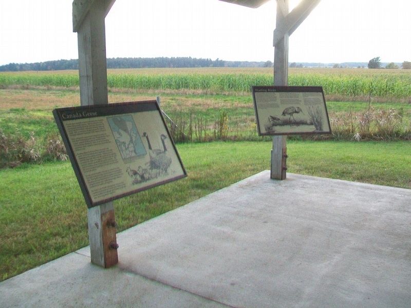
On Vermont Route 17W 1.7 miles west of Route 22A, on the left when traveling west.
Canada geese assemble at Dead Creek from many locations within eastern North America. They are attracted to this management area because of the protection offered by the refuge and the excellent combination of forage fields and water. Fall . . . — — Map (db m109247)
On Vermont Route 125 at Route 17, on the right when traveling east on Vermont Route 125.
This strategic point on Lake Champlain was occupied by Native Americans for thousands of years. In 1690 Jacobus deWarm build a small stone fort here. The French build a wooden stockade in 1731, erecting Fort St. Frederic across the lake in 1734. . . . — — Map (db m85414) HM
On Vermont Route 17 1.4 miles north of Route 125, on the left when traveling north.
General John Strong was a Revolutionary War patriot and a prominent early citizen of Addison County. He served as a judge, state legislator and represented Addison at the State Convention, which adopted the Constitution of the United States and . . . — — Map (db m85231) HM
On Vermont Route 17, on the right when traveling north.
Near this spot
on the shore of the lake was the
Northern Terminal of the
Crown Point Military Road
built by
Gen. Amherst, in 1759 — — Map (db m109079) HM
On Vermont Route 17W 1.7 miles west of Route 22A, on the left when traveling west.
Snow geese are relatively new to the Dead Creek refuge, having begun to use the area as recently as 1981. Their numbers have continued to increase annually, and peak populations present here in mid-October exceed 20,000 birds.
Snow geese do not . . . — — Map (db m109245) HM
On Vermont Route 17W 1.7 miles west of Route 22A, on the left when traveling west.
The Dead Creek Wildlife Management Area (WMA) was established in 1950 to provide breeding and migrational habitat for waterfowl. It is owned by the State of Vermont and managed by the Fish and Wildlife Department. Acquisition and development . . . — — Map (db m109246) HM
On Vermont Route 22A at Route 17W, on the right when traveling south on Vermont Route 22A.
(front)
Addison Remembers
Her Heroes
1771 - Revolutionary War - 1778
[Honor Roll of Veterans]
1812 - War With England - 1814
[Honor Roll of Veterans]
1861 - Civil War - 1865
[Died in Service]
Joseph Arno • Joseph . . . — — Map (db m109277) WM
On Vermont Route 17W 1.7 miles west of Route 22A, on the left when traveling west.
As the name implies, "wetlands" are wet areas characterized by soils that are permanently or seasonally saturated with water. They contain a variety of plants, shrubs and trees which have adapted to living in a wet environment. Wetlands are also . . . — — Map (db m109244) HM
On Vermont Route 125 at Basin Harbor Road, on the left when traveling west on Vermont Route 125.
Erected c. 1864, this one-room schoolhouse served hundreds of children in Bridport for nearly a century. Originally founded as the first district school in Bridport, it later became known as Hathorne School, reflecting the name of a nearby . . . — — Map (db m96475) HM
On West Street (Vermont Route 17) at North Street, on the right when traveling west on West Street.
Bristol remembers
1917 — World War — 1919
Victory Peace
Army
Atkins Erwin L •
Betts Leighton H •
Bingham Leon B •
Blanchard Edward F •
Blanchard John F •
Booska Wallace J . . . — — Map (db m294421) WM
On Lincoln Road south of Route 116, on the right when traveling south.
This land was given to the Town of Bristol
by Irving J. Wasley Sr. in memory of
his son, Pvt. Norman E. Wasley of the
341st. Engineers Co.D. He died in an
explosion while fighting a fire in Dawson
Creek, B. C. on the Alcan Highway.
1/27/1924 . . . — — Map (db m159845) HM
On Vermont Route 30 at Fisher Street, on the right when traveling south on Vermont Route 30.
South Side inscription:
Died in Hospital:
Sergt. Romeo R. Peck
Nelson Baxter
Loyal Darling
Adams H. Potter
Emerson Mayo Ja's E. Fenton
Hung by Guerillas
Alva K. Barlow
North and West side inscriptions . . . — — Map (db m136370) WM
On Seth Warner Memorial Highway, on the right when traveling north.
William Slade was one of Vermont’s great public servants and an ardent abolitionist. Born when Vermont was an independent republic, he died just before the Civil War.
A graduate of Middlebury College admitted to the bar in 1810, Slade was a . . . — — Map (db m135841) HM
Here in 1833, Rowland E. Robinson was born of Quaker parentage. He became a popular illustrator and interpreter of nature and Yankee dialect. "Rokeby" was a station on the "Underground R.R." Here are the blind author’s memorabilia. Open to the . . . — — Map (db m75967) HM
No Vermont farm would be complete without dairy cows. In the early 20th century, dairy quickly became Rokeby's most important agricultural product and, eventually, the only one. The Robinsons' dairy barn stood on this site for over 100 years but . . . — — Map (db m281211) HM
"Situated on a beautiful site, it is high up on a hill away from the traffic of the road and offering a most beautiful view of the lake and the mountains."
— Elizabeth Donoway Robinson, 1936
In the late 1830s, Rowland . . . — — Map (db m281225) HM
Each generation of the Robinson family left a mark on Rokeby's history. Here are a few of the family members who contributed to the rich history of Rokeby.
Thomas Richardson Robinson (1761-1851) and Jemima Fish Robinson (1761-1846) . . . — — Map (db m281221) HM
Frederick Douglass delivered a fiery abolitionist speech here in July 1843. Born in slavery in Maryland, Douglass freed himself by escaping to the north, where he became a tireless crusader for African American freedom and equality. He was among . . . — — Map (db m95449) HM
At the heart of Rokeby Museum is the family that cherished this place as its home.
Throughout the Robinsons' ownership of Rokeby, several additions and changes were made to the house. In 1814, Thomas R. Robison expanded the late . . . — — Map (db m281207) HM
The Robinson family settled this property in 1793, two years after Vermont because a state. Four consecutive generations of Robinsons lived and worked here as farmers, artists, writers, naturalists, and radical abolitionists until 1961 when . . . — — Map (db m281217) HM
We invite you to explore the landscape that has been shaped over time by both human and natural forces.
The Robinson family first came to this property in 1793, two years after Vermont became a state. For more than 150 years, the family . . . — — Map (db m281227) HM
Why is it called Rokeby?
The Robinsons began calling their home Rokeby after a best-selling novel of that name
by Sir Walter Scott. Scott set his story of an epic battle at Rokeby Park, the home of
his good friend J.B.S. Morritt in . . . — — Map (db m281223) HM
On Post Office Hill north of Route 100, on the left when traveling north.
The one-room Corner School, established here at “Codfish Corners,” operated from 1871 to 1951 for grades 1 through 8. Previously, G.V. Wilson’s blacksmith shop (1860-69) and the I.H. Archer Store (1869-74) stood at this site. Granville once had 10 . . . — — Map (db m196206) HM
On Vermont Route 100 at Taylor Meadow, on the right when traveling north on Vermont Route 100.
(center tablet)
To Honor Those Who Served
(left tablet)
World War I Veterans
Abar, F. •
Andress, J. E •
Blair, W. T. •
Eaton, E. D. •
Farley, I. J. •
Fiske, C. P. •
Goodyear, J. A. •
Lewis, E. L. •
March, . . . — — Map (db m274668) WM
Near Main Street (State Highway 30) 0.1 miles south of Seymour Street, on the right when traveling south.
Vermont is crossed by a complete system of ancient major routes from the Lake Champlain Valley to the Connecticut River Valley leading eventually to the sea. Paths were first made by migrating herds of animals searching for salt, and later by . . . — — Map (db m294650) HM
On Court Street (U.S. 7) at Creek Road, on the right when traveling south on Court Street.
Born in Middlebury on October 4, 1887, Ray Lyle Fisher grew up on farms along Otter Creek and Creek Road. Ray starred in baseball and football at Middlebury High School and Middlebury College before joining the New York Yankees in 1910. He pitched . . . — — Map (db m294651) HM
On North Pleasant Street (U.S. 7) at Main Street, on the right when traveling north on North Pleasant Street.
In this house, the home of
Samuel Miller, Esq. September 30, 1798 Timothy Dwight, President of Yale College, counseled with Gamaliel Painter and other citizens of Middlebury concerning the founding of Middlebury College. This conference led . . . — — Map (db m294653) HM
Near North Pleasant Street (U.S. 7) north of High Street, on the right when traveling north.
Today
Mountain bikers, hikers, runners, and nature lovers enjoy the approximately 132 acres and five miles of trails that weave through Chipman Hill. The Middlebury Area Land Trust's Trail Around Middlebury (TAM) passes over the hill and is . . . — — Map (db m273339) HM
On Seymour Street at North Pleasant Street (U.S. 7), on the left when traveling west on Seymour Street.
The Congregational Church, shown here in a photograph from the 1870s, has long held pride of place in
downtown Middlebury. Construction of the church began in 1806 and was completed three years later at a cost
of $9,000. Designed by Lavius . . . — — Map (db m273543) HM
Near Court Square (Route 7) west of Washington Street, on the right when traveling south.
From 1796 to 1814 Court Square was the site of the first Addison County Courthouse, which also served as the seat of the Vermont Legislature (1800, 1806), and home of Middlebury’s first female academy (1800). Here in June 1804 a New York . . . — — Map (db m294654) HM
On South Main Street (Vermont Route 30) 0.1 miles north of Porter Field Road, on the right when traveling north.
Emma Hart came to Middlebury in 1807 to take charge of the Female Academy. After her marriage to Dr. John Willard, the town’s first physician, she gave the earliest collegiate instruction for women in America at a Seminary in her home, during the . . . — — Map (db m294655) HM
On Court Square (U.S. 7) at South Pleasant Street, on the left when traveling west on Court Square.
On July 13-14, 1843, in the Addison County Courthouse, Frederick Douglass and other prominent abolitionists of the New England Anti-Slavery Society launched their six-month 100 Conventions tour to generate anti-slavery sentiment in Vermont, New . . . — — Map (db m273540) HM
On Merchants Row at Main Street ( Route 30), on the right when traveling west on Merchants Row.
Prior to 2020, standing here at
Merchants Row looking north, you
would have seen the railroad trench
constructed in 1849 for the Rutland
and Burlington Railroad. This trench
cut through the western portion
of the Village Green, creating . . . — — Map (db m273538) HM
On Maple Street near Printers Alley, on the right when traveling east.
If you could dig down where you're standing, you would find marble. You can see chunks of it along the banks of the Otter Creek, where the first marble quarries in Middlebury were located. By the time the Marble Works was in operation, smaller . . . — — Map (db m273560) HM
On Main Street 0.1 miles south of Mill Street, on the right when traveling south.
John Deere learned the blacksmith trade here as an apprentice in the shop of Capt. Benjamin Lawrence from 1821 to 1825. The shop was located below this spot on Mill Street, in what is known as "Frog Hollow". In 1836 Deere removed to Grand Detour, . . . — — Map (db m294657) HM
On Main Street (Vermont Route 30) north of Merchants Row, on the left when traveling north.
Lazarus Park was created in 2021
as part of the Middlebury Bridge
& Rail Project through a unique
partnership between the Town
of Middlebury, the National Bank
of Middlebury, the Marble Works
Partnership, and the Vermont
Agency of . . . — — Map (db m273547) HM
Near Mill Street just west of Park Street, on the right when traveling west.
The Marble Works Memorial Bridge was constructed and generously donated by the Marble Works Partnership to the citizens of the town of Middlebury for their use and enjoyment.
The bridge is dedicated to the memory of the mechanics of Middlebury . . . — — Map (db m273636) HM
On Maple Street west of Printers Alley, on the right when traveling west.
The Marble Works Memorial Bridge was constructed and generously donated by the Marble Works Partnership to the citizens of the town of Middlebury for their use and enjoyment.
The bridge is dedicated to the memory of the mechanics of Middlebury . . . — — Map (db m273637) HM
On Main Street (Vermont Route 30) at Seymour Street, on the right when traveling south on Main Street.
Built in 1816-1817
by Horito Seymour L.L.D.
(1778-1857) as his residence
Given February 9, 1938 by his great
granddaughter Jessica Stewart Swift
and great grandson Philip Battell Stewart
for the use and benefit of the
people of the . . . — — Map (db m273545) HM
On Maple Street west of Printers Alley, on the right when traveling east.
Otter Creek flows north for 112 miles, from Peru, Vermont, to Lake Champlain in Ferrisburgh. For thousands of years, it provided fresh water, food and transportation for the native Abenaki, who ate its fish and farmed on its shores. French trappers . . . — — Map (db m273585) HM
On Maple Street at Printers Alley, on the left when traveling west on Maple Street.
Mill Street, on the opposite bank, has run through Frog Hollow since the early days, but the "hollows" were not created until tons of beautiful gray-veined white marble were quarried from here. Starting in 1802—long before the Marble Works were . . . — — Map (db m273573) HM
Near Court Street (U.S. 7) at Court Square, on the left when traveling west.
Middlebury
In The
1861—Civil War—1865
Joseph Alexander • Henry W. Bennett • Merrill Bentley
Bertrand W. Billings • John Brunelle • Michael Burke
John Caffrey • Roderick A. Champlin • Olney A. Comstock . . . — — Map (db m294659) WM
On Maple Street at Printers Alley, on the right when traveling east on Maple Street.
If you were standing here in the 1800s, you would be deafened by the noise and surprised by the activity as burly workers and pious mill girls made their livings on the banks of Otter Creek. Middlebury Falls provided the waterpower to make the new . . . — — Map (db m273581) HM
On Maple Street west of Printers Alley, on the right when traveling west.
The Brandon Italian Marble Company became the largest firm in Middlebury, employing 175 men by 1904. In 1910 just over half of the workers were born in America, while the rest were Italian, French Canadian, Irish, Hungarian, Swedish and Russian. . . . — — Map (db m273558) HM
On Main Street (Vermont Route 30) north of Merchants Row, on the left when traveling south.
The Middlebury Village Green was
established around 1790 on land
donated by village co-founder,
Gamaliel Painter. In 1849, the
construction of the Rutland and
Burlington Railroad through Middlebury
resulted in the truncation of the
Village . . . — — Map (db m273434) HM
On North Pleasant Street (U.S. 7) at Main Street, on the right when traveling north on North Pleasant Street.
In this house, the home of Samuel Miller, Esq., Timothy Dwight, president of Yale College, counseled with Gamaliel Painter and other citizens of Middlebury concerning the founding of Middlebury College.
This conference led to the granting of . . . — — Map (db m294660) HM
On Main Street (Route 30) at College Street, on the right when traveling south on Main Street.
(Plaque)
The bench is presented by the
MHS/MUHS Alumni Association in 2016
to sit and remember
Site of Middlebury High School
Educating students
1911 to 1957
(panel next to the marker)
Middlebury High School (MHS), . . . — — Map (db m273425) HM
On Maple Street at Printers Alley, on the right when traveling east on Maple Street.
Middlebury Falls was a great source of power, but it was also an impediment to transportation, preventing the movement of goods and customers. The first Middlebury settlers could only cross the Creek on "Hop" Johnson's ferry. In 1787, mill owner . . . — — Map (db m273564) HM
Near Vermont Route 125 east of Old Chapel Road, on the left when traveling west.
Made possible through the generosity of David G. Storrs '81 in honor of Seth Storrs, a founder of both the town of Middlebury and its college. Storrs gave the land on which stand Painter Hall, Old Chapel and Starr Hall - "Old Stone Row" - as well . . . — — Map (db m246607) HM
On Court Street (U.S. 7) near Washington Street, in the median.
In 1792, the Vermont Legislature ensured Middlebury’s future prominence by choosing it as the site for Addison County courts. Three courthouses have been built in this area. The original clapboard courthouse shown on the right in the photograph, . . . — — Map (db m294661) HM
On Main Street at Merchants Row, on the left when traveling south on Main Street.
Built from the Ashes
Middlebury's Main Street has been the commercial center of the town since its founding, but its character has changed many times, largely due to that great public enemy of the era-fire. In the first half of the 19th . . . — — Map (db m294662) HM
On Main Street (Vermont Route 30) at Printers Alley, on the right when traveling south on Main Street.
Commemorating the pivotal role of
Robert J. Duclos in the acquisition
and renovation of this historic
Middlebury landmark and his 54
years of outstanding service as
cashier and president of the
National Bank of Middlebury upon
his retirement . . . — — Map (db m273891) HM
On Cross Street at Main Street ( Route 30), on the right when traveling west on Cross Street.
The Shire Town
Middlebury was chartered in 1761 as one of New Hampshire Governor Benning Wentworth’s land grants. The first settlers claimed land in the town in 1766, but were forced back to southern New England during the Revolutionary War. . . . — — Map (db m294664) HM
On Vermont Route 125 west of North Branch Road, on the right when traveling east.
This iron furnace or "bloomery" was built in 1831. The mill operated three forges and produced about three tons of wrought iron per day. During the Civil War years (1861-1865) the mill produced over 2,100 tons of iron. When it closed in 1890 this . . . — — Map (db m274134) HM
On Mill Street west of Route 30, on the right when traveling west.
For 3 Centuries The Middlebury Falls Powered A Bustling Mill District
First Came Waterwheels...
A waterwheel is a machine for extracting power directly from the flow of water. Waterwheels
have been in use for centuries. The most . . . — — Map (db m246606) HM
Near Mount Independence Road, on the right when traveling south.
“I have also provided timber for two Blockhouses.” - Col. Anthony Wayne, February 4, 1777 In the summer and fall of 1776 American forces concentrated on fortifying the northern point of the rocky Mount Independence . . . — — Map (db m19321) HM
Near Mount Independence Road, on the right when traveling south.
“Blockhouses, none of them finished.” - Lt. John Starke, Royal Navy, September 1777 After the British captured Mount Independence on July 6, 1777, their military engineers decided to build six new blockhouses to augment . . . — — Map (db m19332) HM
Near Mount Independence Road, on the right when traveling south.
“ . . . this Day there was two men Buried from our Regt.” - Lt. Jonathan Burton, October 4, 1776 This small stone, engraved “N. Richardson of Staddard Eng died 1760,” may mark the only identified grave on . . . — — Map (db m17849) HM
Near Mount Independence Road, on the right when traveling south.
“ … a perfect mousetrap.” - Col. Alexander Scammell, September 21, 1777
From here are seen nearly all the powerful forces of nature that made this spot on Lake Champlain the Gibraltar of the North as well . . . — — Map (db m17846) HM
Near Mount Independence Road, on the right when traveling south.
This is one of the best-preserved stone foundations on Mount Independence. It was built during the Revolution, but historic maps and documents do not refer to it. Who built it? Did the Americans have time to build it during the two weeks in June . . . — — Map (db m19441) HM
Near Mount Independence Road, on the right when traveling south.
“ . . . the new Hospital . . . 250 long & 24 wide.” - Rev. Enos Hitchcock, June 14, 1777 This shallow, dry-laid stone foundation was for the largest building at Mount Independence – a 250-foot long by 24-foot wide, . . . — — Map (db m19319) HM
Near Mount Independence Road, on the right when traveling south.
“Our men built huts out of boards to protect themselves from the cold weather.” - Lt. Von Hille, October 22, 1777 During the American occupation from July 1776 to July 1777, soldiers constructed a breastwork of logs and . . . — — Map (db m19436) HM
Near Mount Independence Road, on the right when traveling south.
“Some of the intrenchments are still visible.” – John Disturnell, 1857 After the American Revolution, numerous visitors curious to see the places that figured so prominently in the war for independence visited Mount . . . — — Map (db m19501) HM
Near Mount Independence Road, on the right when traveling south.
“ . . . the possession of every thing here depends upon keeping the Command of the Water.” - Maj. Gen. Horatio Gates, July 16, 1776 In front of you is Lake Champlain, at 120 miles long the sixth largest lake in the United . . . — — Map (db m19440) HM
Near Mount Independence Road, on the right when traveling north.
Fortification was begun in June of 1776, and the name Mount Independence was bestowed following the Declaration of Independence. Lieut. Col. Jeduthan Baldwin was the chief construction engineer. Here the exhausted American Army, Northern Department, . . . — — Map (db m9275) HM
On Vermont Route 22A at Main St (County Route 73), on the right when traveling south on Vermont Route 22A. Reported permanently removed.
After Ethan Allen seized Fort Ticonderoga, the Americans built Fort Mt. Independence, northwest from here on the Lake. Following Burgoyne’s invasion, Gen. St Clair evacuated the Forts, retreating across these hills to Hubbardton. Vermont . . . — — Map (db m9232) HM
On Vermont Route 22A at Route 73, on the right when traveling south on Vermont Route 22A.
This vital American military road to the south of here was built on the September 7, 1776, orders of Gen. Horatio Gates to connect Mount Independence, a new Revolutionary War fortification on Lake Champlain, to Hubbardton, Rutland, and Fort No. 4 . . . — — Map (db m97307) HM
Near Mount Independence Road, on the right when traveling south.
“ . . . some of the officers have good framed houses.” - Dr. Lewis Beebe, September 30, 1776 This fifteen-foot square, well-defined stone foundation may be the remains of quarters for one or more American officers in the . . . — — Map (db m17863) HM
Near Mount Independence Road, on the right when traveling south.
“began the works at 3 places on Mount Independence.” - Col. Jeduthan Baldwin, June 20, 1777 On June, 1777, American Chief Engineer Jeduthan Baldwin wrote in his journal, “in the afternoon went with Col. Kosiusko . . . — — Map (db m19437) HM
On Mount Independence Road, on the left when traveling south.
This walkway is a loop approximately 0.2 mile long with stairs and gentle slopes. It leads you past the remains of a blockhouse (near the parking area), provides a look at the Mount’s rock formations, and provides a vista of the lake south of the . . . — — Map (db m19536) HM
Near Mount Independence Road, on the right when traveling south.
“ordered a large Stoer House to be built.” - Col. Jeduthan Baldwin, August 17, 1776 At least one of the storehouses constructed on Mount Independence during the Revolution stood in this area. Portions of the remaining . . . — — Map (db m19366) HM
Near Mount Independence Road, on the right when traveling south.
“we are Building a Large & Long Breast work on the South Side.” - Pvt. Thomas Killam, August 19, 1776 When the American Northern Army arrived at Ticonderoga in mid-July 1776, the 300-acre peninsula opposite on the Vermont shore was a . . . — — Map (db m310137) HM
Near Mount Independence Road, on the right when traveling south.
“The Generals have Fix’d on a spot . . . to be fortified.” - Lt. Col. Matthias Ogden, July 19, 1776 On July 5, 1777, Thomas Anburey, who was traveling with British Lt. Gen. John Burgoyne on Lake Champlain, observed as they . . . — — Map (db m19480) HM
On Vermont Route 73, on the left when traveling east.
(front)
These We Honor
Dedicated to the following from the
Town of Orwell
who served in the Armed Forces of our country
World War II
William H. Murray • Franklin F. Phelps
Charles D. Wright • George B. Wright
[Died . . . — — Map (db m109307) WM
On Main Street (Vermont Route 73), on the left when traveling east.
In honor of the Boys of
the Town of Orwell
who served in the World War
Theron D. Bishop • Charles D. Collette
Linas W. Duffany • Harry M. Fitzgerald
Roy G. Phelps • Lawrence H. Ross
[Died in Service]
[Honor Roll of . . . — — Map (db m109279) WM
On Arnold Bay Road 0.2 miles north of Pease Road, on the right when traveling south.
Near this spot on the afternoon of October 13, 1776 in the first important naval engagement of the War for Independence BENEDICT ARNOLDafter a battle in which he had displayed great boldness, gallantry and sagacity ran ashore and burned the . . . — — Map (db m76010) HM WM
On Vermont Route 125 north of College Cross Road, on the right when traveling north.
Summer Residence and Gift of
Trustee Joseph Battell, Class of 1860.
Home of the Bread Loaf School of English,
established in 1920 and the
Bread Loaf Writers' Conference,
established in 1926. — — Map (db m294395) HM
On Vermont Route 125, on the right when traveling west.
In 1819 Esther Everts Pier, her husband Calvin Pier, and son
Edward settled here. Originally in Goshen, the Piers became
Ripton residents in 1820 when Ripton annexed 6,000 acres.
The Piers' house was the first framed building in Ripton
and . . . — — Map (db m294415) HM
On Vermont Route 125 east of Lincoln Road, on the right when traveling west.
Daniel (1765-1850) & Eleutheria
Hedge (1776-1866) Chipman House
Built in 1828
Oldest in village
Daniel Chipman
Lawyer • U.S. Congressman • Vt Representative
Co-founded Middlebury College
Partner, Ctr. Turnpike Co. (Built 1st Ripton . . . — — Map (db m274391) HM
On Robert Frost Road 0.6 miles north of Route 125.
Summer home of Robert Frost
1939-1963
Owned and Maintained as a
memorial
by
Middlebury College
If the Custodians are not present, visitors may
view the cabin where Frost lived and worked by
walking straight up the lane and looking . . . — — Map (db m294399) HM
On Vermont Route 125 just west of Frost Road, on the left when traveling east.
A distinguished American poet by recognition and a Vermonter by preference, Robert Frost was Poet Laureate of Vermont and for many years “First Citizen” of the Town of Ripton. He was long associated with the Middlebury College School of . . . — — Map (db m37171) HM
Near Vermont Route 125 0.5 miles south of Goshen Road, on the right when traveling south.
(left side)
Robert Frost, a four-time Pulitzer
Prize winner in
poetry, celebrated
the fields and
forests of New
England in his work. Having
spent the majority of his young adult life living in Massachusetts and New Hampshire, Frost . . . — — Map (db m294392) HM
On Vermont Route 125 at Robert Frost Road, on the right when traveling west on Vermont Route 125.
"Whose woods these are I think I know.
His house is in the village though;
He will not see me stopping here
To watch his woods fill up with snow."
-Robert Frost, "Stopping by Woods on a Snowy Evening" (1-4)
from The Poetry of Robert . . . — — Map (db m246604) HM
Near Vermont Route 125 at Robert Frost Road, on the right when traveling west.
"Something there is that doesn't love a wall
That sends the frozen-ground-swell under it......"
"Mending Wall" -Robert Frost
This recreation area is dedicated to the memory of the American poet, Robert Frost. Frost often spent . . . — — Map (db m246605) HM