After filtering for United States of America, 87 entries match your criteria.
Historical Markers and War Memorials in Indianapolis IN 46202
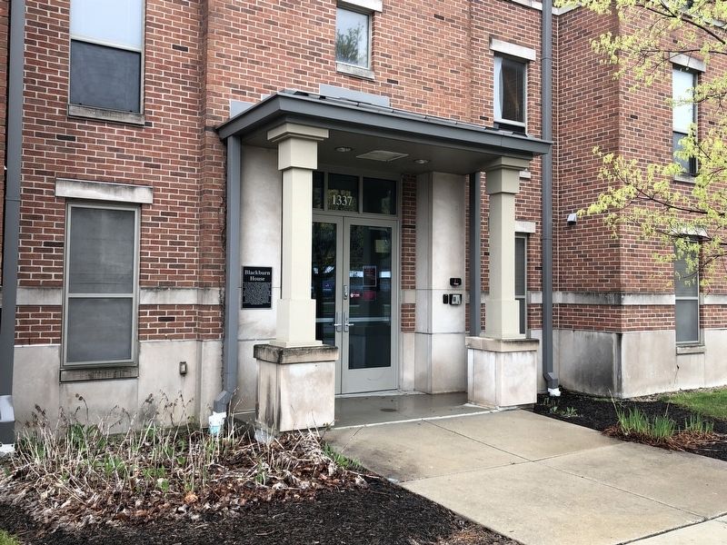
By Devry Becker Jones (CC0), April 19, 2019
Blackburn House Marker
| 1 ► Indiana, Marion County, Indianapolis, Downtown — Blackburn House — |
| On West Michigan Street west of Limestone Street, on the right when traveling east. | |||
| 2 ► Indiana, Marion County, Indianapolis, Downtown — Blackford House — |
| On West Michigan Street west of Limestone Street, on the right when traveling east. | |||
| 3 ► Indiana, Marion County, Indianapolis, Downtown — Boaz House — |
| On Limestone Street north of Hine Street, on the right when traveling south. | |||
| 4 ► Indiana, Marion County, Indianapolis, Downtown — Civil War Training Camp — First State Fairgrounds to Camp Sullivan — |
| On North Blackford Street at Wabash Street, on the right when traveling north on North Blackford Street. | |||
| 5 ► Indiana, Marion County, Indianapolis, Downtown — Clarke House — |
| On West Vermont Street west of Limestone Street, on the right when traveling west. | |||
| 6 ► Indiana, Marion County, Indianapolis, Downtown — Coleman Hall — |
| On Medical Drive east of Riley Hospital Drive, on the right when traveling east. | |||
| 7 ► Indiana, Marion County, Indianapolis, Downtown — 49.1992.1 — Crispus Attucks High School — |
| On Dr. Martin Luther King, Jr. Street. | |||
| 8 ► Indiana, Marion County, Indianapolis, Downtown — Development of Fluoride Toothpaste — |
| On West Michigan Street west of Barnhill Drive, on the right when traveling east. | |||
| 9 ► Indiana, Marion County, Indianapolis, Downtown — 49.2022.1 — Dr. Amelia Keller — 1871-1943 — |
| On West Walnut Street west of Hadley Drive, on the right when traveling east. | |||
| 10 ► Indiana, Marion County, Indianapolis, Downtown — Emerson Hall — |
| On Hadley Drive south of West Walnut Street. | |||
| 11 ► Indiana, Marion County, Indianapolis, Downtown — Fox House — |
| On West Vermont Street west of Limestone Street, on the right when traveling west. | |||
| 12 ► Indiana, Marion County, Indianapolis, Downtown — Garrett House — |
| On Hine Street west of Limestone Street, on the right when traveling east. | |||
| 13 ► Indiana, Marion County, Indianapolis, Downtown — Hardrick House — |
| On Limestone Street south of Vermont Street, on the right when traveling south. | |||
| 14 ► Indiana, Marion County, Indianapolis, Downtown — Herron School of Art and Design — |
| On West New York Street east of Blake Street, on the right when traveling east. | |||
| 15 ► Indiana, Marion County, Indianapolis, Downtown — Hine Street — |
| On Hine Street west of Limestone Street, on the right when traveling west. | |||
| 16 ► Indiana, Marion County, Indianapolis, Downtown — Indiana's Mazzini — Louis Y. Mazzini — |
| On West Michigan Street west of Barnhill Drive, on the right when traveling east. | |||
| 17 ► Indiana, Marion County, Indianapolis, Downtown — International House — |
| On Limestone Street north of Porto Alegre Street, on the right when traveling south. | |||
| 18 ► Indiana, Marion County, Indianapolis, Downtown — 49.2011.1 — Isaac Blackford — |
| On N. Blackford Street near W. New York Street, on the right when traveling north. | |||
| 19 ► Indiana, Marion County, Indianapolis, Downtown — Jones Tabernacle A.M.E. Zion Church Site — |
| On North Blackford Street at West Michigan Street, on the right when traveling south on North Blackford Street. | |||
| 20 ► Indiana, Marion County, Indianapolis, Downtown — 49.2018.3 — Lincoln Hospital — 1909-ca. 1915 — |
| On North Senate Avenue at 11th Street, on the right when traveling north on North Senate Avenue. | |||
| 21 ► Indiana, Marion County, Indianapolis, Downtown — Madame C.J. Walker Timeline — |
| On Indiana Avenue west of North West Street, on the right when traveling west. | |||
| 22 ► Indiana, Marion County, Indianapolis, Downtown — Mary Cable / School No. 4 Site — |
| On North Blackford Street north of West Michigan Street, on the right when traveling north. | |||
| 23 ► Indiana, Marion County, Indianapolis, Downtown — McCormick House — |
| On Hine Street east of Limestone Street, on the right when traveling east. | |||
| 24 ► Indiana, Marion County, Indianapolis, Downtown — 49.1968.1 — Milestones in Nursing — |
| On West 10th Street. | |||
| 25 ► Indiana, Marion County, Indianapolis, Downtown — Mill Race Site — |
| On Barnhill Drive (Route Barnhil) at West Vermont Street, on the right when traveling north on Barnhill Drive. | |||
| 26 ► Indiana, Marion County, Indianapolis, Downtown — Montgomery House — |
| On Hine Street east of Limestone Street, on the right when traveling east. | |||
| 27 ► Indiana, Marion County, Indianapolis, Downtown — Morton-Finney House — |
| On West Vermont Street west of Limestone Street, on the right when traveling west. | |||
| 28 ► Indiana, Marion County, Indianapolis, Downtown — Normal College of the American Gymnastics Union — |
| On University Boulevard south of West New York Street, on the left when traveling south. | |||
| 29 ► Indiana, Marion County, Indianapolis, Downtown — Orvis House — |
| On Hine Street east of Porto Alegre Street, on the right when traveling east. | |||
| 30 ► Indiana, Marion County, Indianapolis, Downtown — Ransom House — |
| On Limestone Street north of Vermont Street, on the right when traveling south. | |||
| 31 ► Indiana, Marion County, Indianapolis, Downtown — Robert W. Long Hospital — |
| On Medical Drive west of Barnhill Drive, on the right when traveling west. | |||
| 32 ► Indiana, Marion County, Indianapolis, Downtown — 49.1998.1 — Romanian Orthodox Church |
| Near North Blackford Street, 0.2 miles south of West New York Avenue. Reported permanently removed. | |||
| 33 ► Indiana, Marion County, Indianapolis, Downtown — Rubins House — |
| On Limestone Street south of Hine Street, on the right when traveling south. | |||
| 34 ► Indiana, Marion County, Indianapolis, Downtown — Sewall House — |
| On Hine Street west of Limestone Street, on the right when traveling west. | |||
| 35 ► Indiana, Marion County, Indianapolis, Downtown — Sigma Theta Tau International — |
| Near West North Street at North California Street. | |||
| 36 ► Indiana, Marion County, Indianapolis, Downtown — Stewart House — |
| On Hine Street west of Limestone Street, on the right when traveling west. | |||
| 37 ► Indiana, Marion County, Indianapolis, Downtown — Stout House — |
| On Hine Street west of Limestone Street, on the right when traveling west. | |||
| 38 ► Indiana, Marion County, Indianapolis, Downtown — Talking Wall — |
| On North Blackford Street north of West Michigan Street, on the right when traveling north. | |||
| 39 ► Indiana, Marion County, Indianapolis, Downtown — The College Inn Site — |
| On West Michigan Street at Barnhill Drive, on the right when traveling east on West Michigan Street. | |||
| 40 ► Indiana, Marion County, Indianapolis, Downtown — The Plague Cemetery — |
| On Barnhill Drive north of Medical Drive, on the right when traveling north. | |||
| 41 ► Indiana, Marion County, Indianapolis, Downtown — This Tablet Marks the Homestead of Isaac Wilson, Pioneer and Patriot. — |
| On Barnhill Drive south of West Walnut Street, on the right when traveling north. | |||
| 42 ► Indiana, Marion County, Indianapolis, Downtown — Walker House — |
| On Porto Alegre Street east of Vermont Street, on the right when traveling west. | |||
| 43 ► Indiana, Marion County, Indianapolis, Downtown — Wilson House Site — |
| On Barnhill Drive south of West Walnut Street, on the right when traveling north. | |||
| 44 ► Indiana, Marion County, Indianapolis, Fountain Square — Crossing of the National and Michigan Roads — Indiana Statehood Centennial — |
| On Old National Road (U.S. 40) at Southeastern Avenue (U.S. 421), on the left when traveling west on Old National Road. | |||
| 45 ► Indiana, Marion County, Indianapolis, Lockerbie Square — 49.2018.1 — James Whitcomb Riley Home — |
| On Lockerbie Street east of East Street, on the left when traveling east. | |||
| 46 ► Indiana, Marion County, Indianapolis, Lockerbie Square — 40.2017.1 — Little Sisters of the Poor — |
| On East Vermont Street east of East Street, on the left when traveling east. | |||
| 47 ► Indiana, Marion County, Indianapolis, Lockerbie Square — 40-2007.3 — St. Vincent’s Infirmary — |
| On East Vermont Street east of East Street, on the left when traveling east. | |||
| 48 ► Indiana, Marion County, Indianapolis, Martindale - Brightwood — 49.2022.2 — John Hope School No. 26 — |
| On East 16th Street at Columbia Avenue, on the left when traveling west on East 16th Street. | |||
| 49 ► Indiana, Marion County, Indianapolis, Meridian Highland — 49.2023.1 — Andrew “Bo” Foster / Andrew Foster, 1919-1987 — |
| On North Illinois Street at Fosters Place, on the right when traveling south on North Illinois Street. | |||
| 50 ► Indiana, Marion County, Indianapolis, Meridian Highland — 49.2019.3 — Lt. Col. Joseph H. Ward, M.D. — 1872-1956 — |
| On West 21st Street at Boulevard Place, on the right when traveling west on West 21st Street. | |||
| 51 ► Indiana, Marion County, Indianapolis, Mile Square — 49.2009.2 — Bethel African Methodist Episcopal Church — |
| On W. Vermont Street at West Vermont Street, on the left when traveling north on W. Vermont Street. | |||
| 52 ► Indiana, Marion County, Indianapolis, Mile Square — 49.2006.1 — Calvin Fletcher — |
| On Virginia Avenue at East Street on Virginia Avenue. | |||
| 53 ► Indiana, Marion County, Indianapolis, Mile Square — Greek Orthodox Church — |
| On North West Street at West New York Street on North West Street. | |||
| 54 ► Indiana, Marion County, Indianapolis, Mile Square — 49.1994.2 — Indiana Avenue — |
| On Indiana Avenue at N. West Street, on the right when traveling north on Indiana Avenue. | |||
| 55 ► Indiana, Marion County, Indianapolis, Mile Square — 49.1998.2 — Lockerbie Square — |
| On East Street at Lockerbie Street, on the left when traveling south on East Street. | |||
| 56 ► Indiana, Marion County, Indianapolis, Mile Square — 49.2016.2 — Senate Avenue YMCA |
| On West Michigan Street at North Senate Avenue, on the right when traveling east on West Michigan Street. Reported missing. | |||
| 57 ► Indiana, Marion County, Indianapolis, Mile Square — September 11, 2001 — We Will Never Forget — |
| On West Ohio Street, on the right when traveling east. | |||
| 58 ► Indiana, Marion County, Indianapolis, Mile Square — The Indiana 9/11 Memorial — |
| On West Ohio Street, on the right when traveling east. | |||
| 59 ► Indiana, Marion County, Indianapolis, Mile Square — The Survivor Tree — Ground Zero 360 — Never Forget — |
| On West Ohio Street just east of North West Street, on the right when traveling east. | |||
| 60 ► Indiana, Marion County, Indianapolis, Mile Square — Timothy J. Maude — |
| On West Ohio Street east of North West Street, on the right when traveling east. | |||
| 61 ► Indiana, Marion County, Indianapolis, Near Northside — America's Hoosier President — |
| On North Delaware Street at East Alley 1200 North, on the left when traveling north on North Delaware Street. | |||
| 62 ► Indiana, Marion County, Indianapolis, Near Northside — 49.1963.1 — Brig. General Benjamin Harrison — 1833-1901 — |
| On North Delaware Street north of East 11th Street, on the left when traveling north. | |||
| 63 ► Indiana, Marion County, Indianapolis, Near Northside — 49.1962.1 — Camp Morton — 1861–65 — |
| On North Alabama Street. | |||
| 64 ► Indiana, Marion County, Indianapolis, Near Northside — First Home of The Children’s Museum — |
| On East 14th Street west of North Delaware Street, on the right when traveling west. | |||
| 65 ► Indiana, Marion County, Indianapolis, Near Northside — 49.2017.4 — First Lady Caroline Harrison — |
| On North Delaware Street north of East 12th Street, on the left when traveling north. | |||
| 66 ► Indiana, Marion County, Indianapolis, Near Northside — Home of Benjamin Harrison — |
| On North Delaware Street south of East 13th Street, on the left when traveling north. | |||
| 67 ► Indiana, Marion County, Indianapolis, Near Northside — 49.1997.1 — Indiana Federation of Colored Women’s Clubs — |
| On North Capitol Avenue. | |||
| 68 ► Indiana, Marion County, Indianapolis, Near Northside — 49-2009-4 — Indianapolis Propylaeum — |
| On North Delaware Street north of East 14th Street, on the left when traveling north. | |||
| 69 ► Indiana, Marion County, Indianapolis, Near Northside — 49.20204 — Meredith Nicholson — 1866 - 1947 — |
| On North Delaware Street just north of East 15th Street, on the left when traveling north. | |||
| 70 ► Indiana, Marion County, Indianapolis, Near Northside — 49.1992.3 — North Western Christian University — |
| On North College Avenue north of East 13th Street, on the right when traveling north. | |||
| 71 ► Indiana, Marion County, Indianapolis, Near Northside — 49.2007.2 — Ovid Butler, Sr. — |
| On 13th Street at Park Street, on the right when traveling east on 13th Street. | |||
| 72 ► Indiana, Marion County, Indianapolis, Near Northside — 49.2005.1 — Robert F. Kennedy Speech on Death of Martin L. King — |
| Near East 17th Street at Broadway Street. | |||
| 73 ► Indiana, Marion County, Indianapolis, Near Northside — 49.2015.2 — T.C. Steele Studio and Herron — |
| On East 16th Street east of North Pennsylvania Avenue, on the left when traveling east. | |||
| 74 ► Indiana, Marion County, Indianapolis, Near Northside — The Historic Old Northside — |
| On North Delaware Street at East Alley 1200 North, on the left when traveling north on North Delaware Street. | |||
| 75 ► Indiana, Marion County, Indianapolis, Near Northside — 434 — The Home of Caroline Scott Harrison — National Historic Landmark — American Presbyterian and Reformed Historical Site — |
| On North Delaware Street at East 11th Street, on the left when traveling north on North Delaware Street. | |||
| 76 ► Indiana, Marion County, Indianapolis, Near Northside — 49.1995.4 — The Old Northside — |
| On Central Avenue near East 15th Street, on the right when traveling south. | |||
| 77 ► Indiana, Marion County, Indianapolis, Near Northside — 49.1995.5 — The Old Northside — |
| On North Delaware Street at East 12th Street on North Delaware Street. | |||
| 78 ► Indiana, Marion County, Indianapolis, Near Northside — Welcome to the Home of an American President — |
| On North Delaware Street at East Alley 1200 North, on the left when traveling north on North Delaware Street. | |||
| 79 ► Indiana, Marion County, Indianapolis, Near Northside — 49.2003.1 — Widows and Orphans Friends’ Society — |
| On Capitol Avenue. | |||
| 80 ► Indiana, Marion County, Indianapolis, Near Northside — World War II Memorial — |
| Near North Delaware Street south of East 13th Street, on the left when traveling north. | |||
| 81 ► Indiana, Marion County, Indianapolis, Old Northside — Washington Elm — |
| Near North Talbott street south of East 13th Street, on the right when traveling north. | |||
| 82 ► Indiana, Marion County, Indianapolis, Ransom Place — 49.2022.5 — Felrath Hines, Jr. — |
| On Doctor Martin Luther King Jr. Street at 11th Street, on the right when traveling south on Doctor Martin Luther King Jr. Street. | |||
| 83 ► Indiana, Marion County, Indianapolis, Ransom Place — Historic Ransom Place — |
| On West St Clair Street at Camp Street, on the left when traveling east on West St Clair Street. | |||
| 84 ► Indiana, Marion County, Indianapolis, Ransom Place — 49.1993.1 — Ransom Place Historic District — |
| On West St Clair Street at Camp Street, on the left when traveling east on West St Clair Street. | |||
| 85 ► Indiana, Marion County, Indianapolis, Riverside — Boyle Racing Headquarters — |
| On Rembrandt Street at West 17th Street, on the right when traveling south on Rembrandt Street. | |||
| 86 ► Indiana, Marion County, Indianapolis, St. Joseph Historic Neighborhood — The University Club — |
| On North Delaware Street at Puryear Street, on the left when traveling north on North Delaware Street. | |||
| 87 ► Indiana, Marion County, Indianapolis, Upper Canal — 49-2016-1 — James Overall |
| On North West Street just south of Indiana Avenue, on the right when traveling south. Reported damaged. | |||