7466 entries match your criteria. Entries 301 through 400 are listed.⊲ Previous 100 — Next 100 ⊳
Historical Markers and War Memorials in Maryland
By Devry Becker Jones (CC0), March 2, 2018
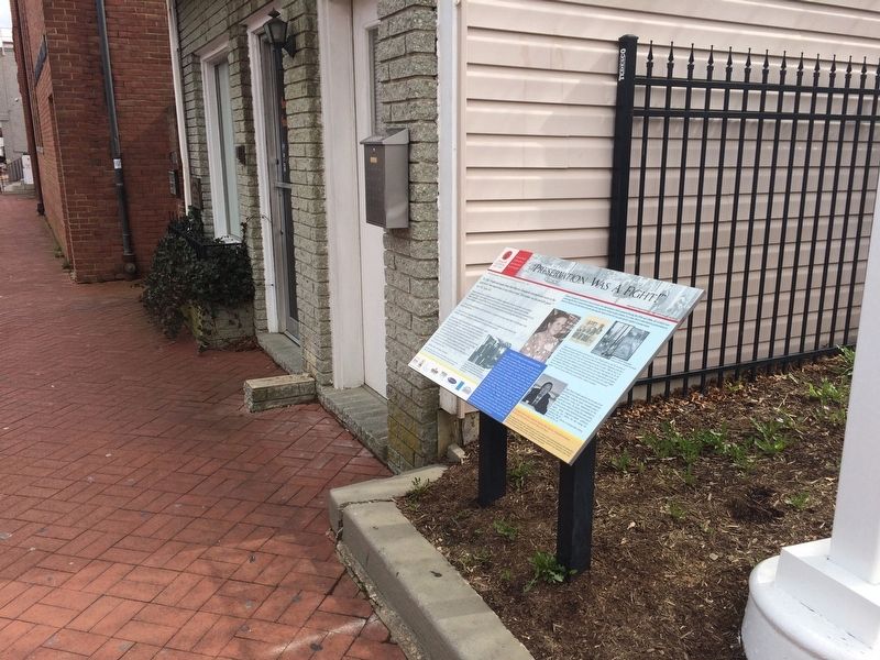
"Preservation Was A Fight!" Marker
| 301 ► Maryland, Anne Arundel County, Annapolis — "Preservation Was A Fight!" — Annapolis Charter 300 1708-2008 — Commemorating the 1708 Royal Charter under Queen Anne to the City of Annapolis — |
| On West Street (Maryland Route 450) east of Lafayette Avenue, on the right when traveling east. | |||
| 302 ► Maryland, Anne Arundel County, Annapolis — 14cm 3.5 inch Gun — |
| On Maryland Avenue at Blake Road, on the right when traveling south on Maryland Avenue. | |||
| 303 ► Maryland, Anne Arundel County, Annapolis — 159 Main Street — |
| On Main Street east of Conduit Street, on the right when traveling east. | |||
| 304 ► Maryland, Anne Arundel County, Annapolis — 163 Main Street — |
| On Main Street near Conduit Street, on the left when traveling north. | |||
| 305 ► Maryland, Anne Arundel County, Annapolis — 167 Main Street at Conduit Street — |
| On Conduit Street, on the right when traveling north. | |||
| 306 ► Maryland, Anne Arundel County, Annapolis — 41 Cornhill Street — |
| On Cornhill Street, on the right when traveling south. | |||
| 307 ► Maryland, Anne Arundel County, Annapolis — 64 Franklin Street — Annapolis Emergency Hospital — |
| On Franklin Street south of Cathedral Street, on the right when traveling north. | |||
| 308 ► Maryland, Anne Arundel County, Annapolis — A Community Legacy — West Street — The Banneker-Douglass Museum — |
| On West Street (Maryland Route 450) west of Church Circle, on the right when traveling west. | |||
| 309 ► Maryland, Anne Arundel County, Annapolis — A National Cemetery System — |
| Near West Street (Maryland Route 450) west of Taylor Avenue (Maryland Route 435), on the right when traveling west. | |||
| 310 ► Maryland, Anne Arundel County, Annapolis — A Story of Preservation — Market House — Annapolis Historic District — |
| On Market Space at Main Street on Market Space. | |||
| 311 ► Maryland, Anne Arundel County, Annapolis — Albert Cabell Ritchie — |
| Near Ritchie Highway (Maryland Route 450) 0.3 miles Waveland Farms Road, in the median. | |||
| 312 ► Maryland, Anne Arundel County, Annapolis — Alfred A. Hopkins Plaza — |
| On Market Space at Main Street, on the left when traveling west on Market Space. | |||
| 313 ► Maryland, Anne Arundel County, Annapolis — An Environmental Perspective — Annapolis Charter 300 1708-2008 — Commemorating the 1708 Royal Charter under Queen Anne to the City of Annapolis — |
| On West Street (Maryland Route 450) east of Park Place, on the right when traveling west. | |||
| 314 ► Maryland, Anne Arundel County, Annapolis — Annapolis & The Maryland Signers — Annapolis Charter 300 1708-2008 — Commemorating the 1708 Royal Charter under Queen Anne to the City of Annapolis — |
| On West Street (Route 450) near Munroe Court, on the right when traveling west. | |||
| 315 ► Maryland, Anne Arundel County, Annapolis — Annapolis Depicted — City Dock — Public Art In Annapolis — |
| On Dock Street east of Craig Street. | |||
| 316 ► Maryland, Anne Arundel County, Annapolis — Annapolis During The Civil War — Annapolis Charter 300 1708-2008 — Commemorating the 1708 Royal Charter under Queen Anne to the City of Annapolis — |
| On Taylor Avenue (Maryland Route 435) at Westgate Circle, on the right when traveling north on Taylor Avenue. | |||
| 317 ► Maryland, Anne Arundel County, Annapolis — Annapolis National Cemetery — |
| Near West Street (Maryland Route 450) west of Taylor Avenue (Maryland Route 435), on the right when traveling west. | |||
| 318 ► Maryland, Anne Arundel County, Annapolis — Annapolis: Capital of Commerce — |
| Near Dock Street, 0.1 miles east of Market Space. | |||
| 319 ► Maryland, Anne Arundel County, Annapolis — 6 — Anne Catharine Green — Annapolis Charter 300 1708-2008 — |
| On West Street (Maryland Route 450) west of Westgate Circle, on the left when traveling west. | |||
| 320 ► Maryland, Anne Arundel County, Annapolis — Art in Annapolis — Annapolis Charter 300 1708-2008 — Commemorating the 1708 Royal Charter under Queen Anne to the City of Annapolis — |
| On West Street (Maryland Route 450) west of Colonial Avenue, on the right when traveling east. | |||
| 321 ► Maryland, Anne Arundel County, Annapolis — Asbury United Methodist Church — |
| On West Street (Maryland Route 450) at West Washington Street, on the right when traveling east on West Street. | |||
| 322 ► Maryland, Anne Arundel County, Annapolis — Baron Johann de Kalb, 1721 - 1780 — Revolutionary War Hero — |
| On State Circle. | |||
| 323 ► Maryland, Anne Arundel County, Annapolis — Bates: The Center of Community Life — 1931 - 1966 — |
| On Smithville Street, 0.1 miles east of South Villa Street, on the left when traveling west. | |||
| 324 ► Maryland, Anne Arundel County, Annapolis — Bates: The Community Commitment — 1966 - 2006 — |
| On Smithville Street, 0.1 miles east of South Villa Avenue, on the left when traveling west. | |||
| 325 ► Maryland, Anne Arundel County, Annapolis — Battle of the Severn — |
| On Ritchie Highway (Maryland Route 450) at Chase Road, on the left when traveling south on Ritchie Highway. | |||
| 326 ► Maryland, Anne Arundel County, Annapolis — Between Morning and Midnight — Maryland Fire Rescue Services Memorial Sculpture — |
| On Calvert Street at Bladen Street (Maryland Route 70), on the right when traveling south on Calvert Street. | |||
| 327 ► Maryland, Anne Arundel County, Annapolis — Beyond the Bridge — City Dock — The Neighborhood of Eastport — |
| On Dock Street at Craig Street on Dock Street. | |||
| 328 ► Maryland, Anne Arundel County, Annapolis — Blessed Francis Xavier Seelos C.Ss.R. — January 11, 1819 - October 4, 1867 — |
| Near Duke of Gloucester Street at Newman Street, on the right when traveling east. | |||
| 329 ► Maryland, Anne Arundel County, Annapolis — Brown-Leanos Memorial Park — |
| On West Street (Maryland Route 450) at Spa Road (Maryland Route 387), in the median on West Street. | |||
| 330 ► Maryland, Anne Arundel County, Annapolis — Burning of the Brig "Peggy Stewart" — |
| On Holloway Road at Simms Road, on the right when traveling south on Holloway Road. | |||
| 331 ► Maryland, Anne Arundel County, Annapolis — Butler in Annapolis — |
| On Holloway Road at Simms Road on Holloway Road. | |||
| 332 ► Maryland, Anne Arundel County, Annapolis — Centennial of the United States Navy Submarine Force — |
| On Buchanan Road at Blake Road, on the right when traveling east on Buchanan Road. | |||
| 333 ► Maryland, Anne Arundel County, Annapolis — Charles Carroll House North Porch — |
| Near Duke of Gloucester Street. | |||
| 334 ► Maryland, Anne Arundel County, Annapolis — 6 — Chase-Lloyd House — The Naval War of 1812 in Annapolis — Don't Give Up the Ship — |
| On Maryland Avenue at King George Street, on the left when traveling east on Maryland Avenue. | |||
| 335 ► Maryland, Anne Arundel County, Annapolis — Class of 1956 Memorial Plaza — |
| Near Taylor Avenue (Maryland Route 435) north of Melrose Street, on the right when traveling south. | |||
| 336 ► Maryland, Anne Arundel County, Annapolis — Clay Street Community Montage — Annapolis Charter 300 1708-2008 — |
| On Clay Street west of Calvert Street. | |||
| 337 ► Maryland, Anne Arundel County, Annapolis — Coastal Evolution — Market House — The Shoreline of Annapolis — |
| On Main Street at Compromise Street, on the right when traveling south on Main Street. | |||
| 338 ► Maryland, Anne Arundel County, Annapolis — Colonial Annapolis — |
| On Duke of Gloucester Street, on the left when traveling south. | |||
| 339 ► Maryland, Anne Arundel County, Annapolis — Commander William Lewis Herndon — 1813 - 1857 — Naval Officer - Explorer - Merchant Captain — |
| On Blake Road, on the right when traveling east. | |||
| 340 ► Maryland, Anne Arundel County, Annapolis — Commodore John Barry — Commission Number One United States Navy — |
| On Prince George Street west of Craig Street, on the right when traveling west. | |||
| 341 ► Maryland, Anne Arundel County, Annapolis — Commodore John Barry — Annapolis Charter 300 1708-2008 — Commemorating the 1708 Royal Charter under Queen Anne to the City of Annapolis — |
| Near Prince George Street east of Craig Street, on the left when traveling east. | |||
| 342 ► Maryland, Anne Arundel County, Annapolis — Congress Was Here — West Street — At the End of the Revolution — |
| On West Street (Maryland Route 450) west of Church Circle, on the right when traveling west. | |||
| 343 ► Maryland, Anne Arundel County, Annapolis — Cornhill & Fleet Streets — |
| On State Circle at Cornhill Street, on the right when traveling north on State Circle. | |||
| 344 ► Maryland, Anne Arundel County, Annapolis — Draketail Peg Wallace — Annapolis Maritime Museum — |
| Near Bay Shore Avenue east of 2nd Street, on the right when traveling east. | |||
| 345 ► Maryland, Anne Arundel County, Annapolis — Dred Scott, 1799 - 1858 — Freedom Denied by the United States Supreme Court — |
| On State Circle. | |||
| 346 ► Maryland, Anne Arundel County, Annapolis — El Neptuno — |
| 347 ► Maryland, Anne Arundel County, Annapolis — First Presbyterian Church of Annapolis — Founded May 2, 1846 — |
| On Duke of Gloucester Street, on the left when traveling south. | |||
| 348 ► Maryland, Anne Arundel County, Annapolis — First Synagogue in Annapolis — |
| On Duke of Gloucester Street near Conduit Street, on the right when traveling east. | |||
| 349 ► Maryland, Anne Arundel County, Annapolis — Foremast of the U.S.S. Maine — |
| On Turner Joy Road, on the left when traveling west. | |||
| 350 ► Maryland, Anne Arundel County, Annapolis — Fort Severn and the United States Naval Academy — |
| Near Cooper Road, 0.1 miles south of Santee Road. | |||
| 351 ► Maryland, Anne Arundel County, Annapolis — Framework of History — Main Street — Maryland Avenue and State Circle — |
| On Main Street at Francis Street on Main Street. | |||
| 352 ► Maryland, Anne Arundel County, Annapolis — From this spot, you can see 1672 - Providence: Settlement on the Severn — Annapolis Maritime Museum — |
| Near 2nd Street south of Bay Shore Avenue, on the right when traveling north. | |||
| 353 ► Maryland, Anne Arundel County, Annapolis — From this spot, you can see 1774 - The "Annapolis Tea Party" — Annapolis Maritime Museum — |
| Near 2nd Street south of Bay Shore Avenue, on the right when traveling north. | |||
| 354 ► Maryland, Anne Arundel County, Annapolis — From this spot, you can see 1887 - The Age of Steam — Annapolis Maritime Museum — |
| On 2nd Street south of Bay Shore Avenue. | |||
| 355 ► Maryland, Anne Arundel County, Annapolis — From this spot, you can see 1919 - Oysters: The Bay's "White Gold" — Annapolis Maritime Museum — |
| Near 2nd Street near Bay Shore Avenue, on the right when traveling north. | |||
| 356 ► Maryland, Anne Arundel County, Annapolis — Gateway to Discovery — Annapolis — |
| Near Dock Street, 0.1 miles Market Space when traveling east. | |||
| 357 ► Maryland, Anne Arundel County, Annapolis — General Washington — Standing on This Spot — |
| Near State Circle near School Street, on the left. | |||
| 358 ► Maryland, Anne Arundel County, Annapolis — George H. Phelps, Jr. — Visionaries of the 1960s — August 5, 1926 — |
| On West Street (Maryland Route 450) at Brewer Avenue, on the right when traveling west on West Street. | |||
| 359 ► Maryland, Anne Arundel County, Annapolis — George Washington’s Resignation — |
| On West Street (Maryland Route 450) west of Munroe Court. | |||
| 360 ► Maryland, Anne Arundel County, Annapolis — Gold Star Families Monument — |
| On Governor Ritchie Highway (Maryland Route 450) north of Chase Road, in the median. | |||
| 361 ► Maryland, Anne Arundel County, Annapolis — Gov. Francis Nicholson — 1694-1994 — |
| Near Main Street at Francis Street, on the left when traveling east. | |||
| 362 ► Maryland, Anne Arundel County, Annapolis — Governor Sir Francis Nicholson and Bloomsbury Square — |
| On College Avenue (Maryland Route 450) at Bladen Street, on the left when traveling east on College Avenue. | |||
| 363 ► Maryland, Anne Arundel County, Annapolis — 2 — Greg Harlin's John Paul Jones's Ranger — ArtWalk — |
| On Boundary Road west of Buchanan Road, on the left when traveling east. | |||
| 364 ► Maryland, Anne Arundel County, Annapolis — Hammond-Harwood House · 1774 — A National Historic Landmark |
| On Maryland Avenue near King George Street, on the right when traveling north. Reported permanently removed. | |||
| 365 ► Maryland, Anne Arundel County, Annapolis — Hammond-Harwood House Museum — The Jewel of Annapolis — |
| On Maryland Avenue just south of Cumberland Court, on the right when traveling south. | |||
| 366 ► Maryland, Anne Arundel County, Annapolis — History of Our Maryland Flag — |
| On Maryland Avenue south of Prince George Street, on the right when traveling north. | |||
| 367 ► Maryland, Anne Arundel County, Annapolis — History Stone — |
| On Memorial Circle. | |||
| 368 ► Maryland, Anne Arundel County, Annapolis — 5 — HMS Confiance Cannon — The Naval War of 1812 in Annapolis — Don't Give Up the Ship — |
| On NE Arcade Road. | |||
| 369 ► Maryland, Anne Arundel County, Annapolis — 2 — HMS Macedonian Monument — The Naval War of 1812 — Don't Give Up The Ship — |
| Near Maryland Avenue. | |||
| 370 ► Maryland, Anne Arundel County, Annapolis — Howard's Inheritance — 721 Howards Loop — |
| Near Howards Loop, 0.1 miles west of Samuels Way, on the right when traveling east. | |||
| 371 ► Maryland, Anne Arundel County, Annapolis — In Honor of Albert Abraham Michelson — 1852 - 1931 — |
| Near Maryland Avenue. | |||
| 372 ► Maryland, Anne Arundel County, Annapolis — Jack Stephens Field — |
| Near Taylor Avenue (Maryland Route 435) north of Melrose Street, on the right when traveling south. | |||
| 373 ► Maryland, Anne Arundel County, Annapolis — Japanese Ambassador Hirosi Saito — |
| On Santee Road. | |||
| 374 ► Maryland, Anne Arundel County, Annapolis — Japanese Torpedo — |
| Near Buchanan Road at Blake Road. | |||
| 375 ► Maryland, Anne Arundel County, Annapolis — John Snowden Memorial — |
| Near West Street (Maryland Route 450) at Brewer Avenue. | |||
| 376 ► Maryland, Anne Arundel County, Annapolis — 4 — Joseph Nicholson Home Site and Bandstand — The Naval War of 1812 in Annapolis — Don't Give Up The Ship — |
| Near Blake Road. | |||
| 377 ► Maryland, Anne Arundel County, Annapolis — Katharine Hepburn Slept Here — |
| On State Circle, on the right. | |||
| 378 ► Maryland, Anne Arundel County, Annapolis — Kunte Kinte-Alex Haley Memorial — |
| On Main Street at Compromise Street, on the left when traveling south on Main Street. | |||
| 379 ► Maryland, Anne Arundel County, Annapolis — Kunte Kinte-Alex Haley Memorial — |
| On Memorial Circle. | |||
| 380 ► Maryland, Anne Arundel County, Annapolis — Leahy Hall — Named in Honor of Fleet Admiral William Danial Leahy United States Navy — (6 May 1875 - 20 July 1959) — |
| On Truxton Road at Parker Lane on Truxton Road. | |||
| 381 ► Maryland, Anne Arundel County, Annapolis — Leonard A. Blackshear Walk — A pathway to reconciliation and healing — 1943 - 2006 — |
| On Main Street at Compromise Street, on the left when traveling south on Main Street. | |||
| 382 ► Maryland, Anne Arundel County, Annapolis — Liberty Tree — Tulip Poplar — |
| On State Circle north of East Street, on the left when traveling north. | |||
| 383 ► Maryland, Anne Arundel County, Annapolis — 4/6 — Lieutenant General John Archer Lejeune — |
| On King George Street at Cooper Road on King George Street. | |||
| 384 ► Maryland, Anne Arundel County, Annapolis — Light House Bistro — |
| On Madison Place at West Street (Maryland Route 450), on the right when traveling south on Madison Place. | |||
| 385 ► Maryland, Anne Arundel County, Annapolis — Lincoln in Annapolis — |
| On West Street at Calvert Street, on the right when traveling west on West Street. | |||
| 386 ► Maryland, Anne Arundel County, Annapolis — Lot 70 Is Historically Significant — |
| On West Street at Church Circle, on the right when traveling west on West Street. | |||
| 387 ► Maryland, Anne Arundel County, Annapolis — Louis L. Goldstein — 1913 - 1998 — |
| On Calvert Street at Bladen Street (Maryland Route 70) on Calvert Street. | |||
| 388 ► Maryland, Anne Arundel County, Annapolis — Macedonian Monument — |
| On Maryland Avenue, on the right when traveling east. | |||
| 389 ► Maryland, Anne Arundel County, Annapolis — Mahan Hall — |
| On Maryland Avenue. | |||
| 390 ► Maryland, Anne Arundel County, Annapolis — 1 — Mahan Hall — The Naval War of 1812 in Annapolis — Don't Give Up the Ship! — |
| Near Maryland Avenue. | |||
| 391 ► Maryland, Anne Arundel County, Annapolis — Mann's Tavern — Site of the Annapolis Convention — September 11-14, 1786 — |
| On Conduit Street near Gorman Street, on the left when traveling south. | |||
| 392 ► Maryland, Anne Arundel County, Annapolis — Marion Warren's six photographs capture this historic Annapolis neighborhood in a sleepier time — Annapolis Charter 300 1708-2008 — |
| On West Street (Maryland Route 450) east of Cathedral Street, on the right when traveling east. | |||
| 393 ► Maryland, Anne Arundel County, Annapolis — Maritime Annapolis: An Enduring Legacy — |
| Near Dock Street, 0.1 miles Market Space. | |||
| 394 ► Maryland, Anne Arundel County, Annapolis — Maryland State House — Built 1772-1779 — Capitol of the United States November 26, 1783 - August 13, 1784 — |
| On State Circle near School Street. | |||
| 395 ► Maryland, Anne Arundel County, Annapolis — Maryland State House — Built 1772–1779 — Capitol of the United States November 26, 1783 - August 13, 1784 — |
| On State Circle at Francis Street on State Circle. | |||
| 396 ► Maryland, Anne Arundel County, Annapolis — 9 — Maryland State House — The Naval War of 1812 in Annapolis — Don't Give Up the Ship! — |
| On State Circle. | |||
| 397 ► Maryland, Anne Arundel County, Annapolis — Maryland World War II Memorial — |
| On Governor Ritchie Highway (State Highway 450) at Chase Road, in the median on Governor Ritchie Highway. | |||
| 398 ► Maryland, Anne Arundel County, Annapolis — Matthew Alexander Henson — Co-discoverer of the North Pole — |
| Near State Circle. | |||
| 399 ► Maryland, Anne Arundel County, Annapolis — Maynard-Burgess House — Rehabilitation and Adaptive Use Project — Together! We're Building a Strong Annapolis Future. — |
| On Duke of Gloucester Street just west of Market Street, on the right when traveling east. | |||
| 400 ► Maryland, Anne Arundel County, Annapolis — Memorial Circle & Market House Plaza — |
| On Market Space near Main Street, on the left when traveling west. | |||
7466 entries matched your criteria. Entries 301 through 400 are listed above. ⊲ Previous 100 — Next 100 ⊳