1504 entries match your criteria. The first 100 are listed. ⊳
Historical Markers and War Memorials
in the Dayton Metro Region
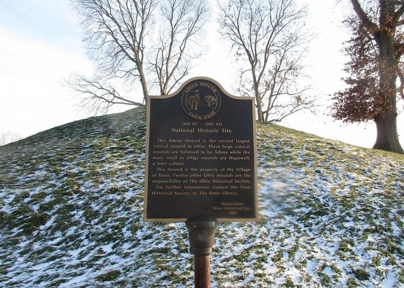
By Rev. Ronald Irick, December 19, 2016
Adena Mound Enon Ohio Marker
1 ► Ohio, Clark County, Enon, Indian Mound Estates — Adena Mound Enon Ohio — 1200 BC - 1000 AD — National Historic Site —  |
| On Indian Drive at Mound Circle, in the median on Indian Drive. | |||
| 2 ► Ohio, Clark County, Enon, Indian Mound Estates — Enon Adena Mound — |
| On Mound Circle at Indian Drive, in the median on Mound Circle. | |||
| 3 ► Ohio, Clark County, Enon, Indian Mound Estates — Enon Civil War Memorial — A New Addition — 150th Anniversary of the Original — |
| Near Dayton- Springfield Road (County Route 333) at Winding Dr.. | |||
| 4 ► Ohio, Clark County, Enon, Indian Mound Estates — Mad River Township Civil War Memorial — |
| Near Dayton-Springfield Road at Winding Drive. | |||
| 5 ► Ohio, Clark County, Medway — Benjamin Garver Lamme / Bertha Lamme — Lower Valley Pike Scenic Byway — |
| On Spangler Road at East Main Street, on the right when traveling north on Spangler Road. | |||
| 6 ► Ohio, Clark County, Medway — Medway in the 20th Century — Lower Valley Pike Scenic Byway — |
| On Spangler Road at East Main Street, on the right when traveling north on Spangler Road. | |||
| 7 ► Ohio, Clark County, New Carlisle — Bethel Township Civil War Memorial — |
| On Musselman Road at North Dayton- Lakeview Road (Ohio Route 235), on the right when traveling east on Musselman Road. | |||
| 8 ► Ohio, Clark County, New Carlisle — Gordon I. Henslee — Memorial to a Village Police Chief — |
| On South Main Street (Ohio Route 235), on the right when traveling north. | |||
| 9 ► Ohio, Clark County, New Carlisle — Honey Creek Presbyterian Church — Original Site — |
| On Dayton-Lakeview Rd (Ohio Route 235), on the left when traveling south. | |||
| 10 ► Ohio, Clark County, New Carlisle — 183 — Honey Creek Presbyterian Historical Marker — Registered Site #183 — Current Location of Historical Congregation — |
| On West Jefferson Street (Ohio Route 571), on the left when traveling west. | |||
| 11 ► Ohio, Clark County, New Carlisle — John Dillinger's First Bank Robbery — |
| On South Main Street (Ohio Route 235) at East Jefferson Street ( Route 571), on the left when traveling south on South Main Street. | |||
| 12 ► Ohio, Clark County, New Carlisle — John Paul, First White Settler in Clark County, Ohio — Also, First Casualty — |
| On Musselman Road, on the right when traveling east. | |||
| 13 ► Ohio, Clark County, New Carlisle — Veterans Memorial — |
| On Musselman Road west of Quick Road, on the right when traveling east. | |||
| 14 ► Ohio, Clark County, New Carlisle, Blair's Estates — 212 — Olive Branch High School — |
| On West National Road (U.S. 40) 0.2 miles east of Lammes Lane, on the right when traveling west. | |||
| 15 ► Ohio, Clark County, North Hampton — North Hampton Veterans Memorial — |
| On Troy Road (Ohio Route 41) 0.2 miles west of Dialton Road, on the right when traveling west. | |||
| 16 ► Ohio, Clark County, North Hampton — 5-12 — Springfield, Troy, & Piqua Electric Railway — |
| On Troy Road (Ohio Route 41) at Donnel's Creek, on the right when traveling west on Troy Road. | |||
| 17 ► Ohio, Clark County, South Charleston — G.W. Luckey Druggist — |
| On South Chillicothe Street at West Jamestown Road, on the right when traveling south on South Chillicothe Street. | |||
| 18 ► Ohio, Clark County, South Charleston — 243 — South Charleston Historic District — |
| On South Chillicothe Street just north of West Jamestown Street, on the right when traveling south. | |||
| 19 ► Ohio, Clark County, South Charleston — South Charleston Veterans Memorial — |
| On South Church Street at Woodward Street, on the right when traveling north on South Church Street. | |||
| 20 ► Ohio, Clark County, South Charleston — Veterans Memorial — |
| Near North Chillicothe Street (Ohio Route 41) north of Old Springfield Road (County Route 366), on the right when traveling north. | |||
| 21 ► Ohio, Clark County, South Charleston — Welcome to South Charleston Mural — |
| On South Chillicothe Street at West Jamestown Road, on the right when traveling south on South Chillicothe Street. | |||
| 22 ► Ohio, Clark County, South Vienna — Pleasant Township Veterans Memorial — McConkey Cemetery — Rural Clark County, Ohio — |
| On McConkey Road (County Route 369), on the left when traveling south. | |||
| 23 ► Ohio, Clark County, South Vienna, Asbury Estates — Asbury Veterans Monument — Rural Memorial in Old Cemetery — |
| On Jones Road (County Route 367) at Vernon-Asbury Rd (County Route 358), on the left when traveling east on Jones Road. | |||
| 24 ► Ohio, Clark County, South Vienna, Hollandia View — Buena Vista Tavern — The Historic National Road in Ohio — Nineteenth and Early Twentieth Century Travel Accommodations — |
| On Old National Road (U.S. 40) at Buena Vista road (County Route 92), on the right when traveling west on Old National Road. | |||
| 25 ► Ohio, Clark County, Springfield — A Relict from an Icy Past — |
| Near Croft Road, on the right when traveling east. | |||
| 26 ► Ohio, Clark County, Springfield — A. B. Graham — Founder of 4-H — |
| On Limestone Street, on the left when traveling north. | |||
| 27 ► Ohio, Clark County, Springfield — Asa Smith Bushnell — 1834 - 1904 — |
| Near Ferncliff Cemetery. | |||
| 28 ► Ohio, Clark County, Springfield — Bicentennials of the Northwest Ordinance and the U.S. Constitution — |
| On West Main Street at South Isabella Street, on the right when traveling east on West Main Street. | |||
| 29 ► Ohio, Clark County, Springfield — 11-12 — Brooks Lawrence — |
| On North High School Place at Miller Street, on the right when traveling north on North High School Place. | |||
| 30 ► Ohio, Clark County, Springfield — 2-12 — City Building — |
| On Fountain Avenue at North Market Place, on the right when traveling south on Fountain Avenue. | |||
| 31 ► Ohio, Clark County, Springfield — Clark County Memorial — |
| On Main Street at Lowry Avenue, on the right when traveling west on Main Street. | |||
| 32 ► Ohio, Clark County, Springfield — Clark County Revolutionary War Memorial — |
| Near W. McCreight Avenue. | |||
| 33 ► Ohio, Clark County, Springfield — Clark County Veterans Memorial — |
| On Cliff Park Road, on the right when traveling east. | |||
| 34 ► Ohio, Clark County, Springfield — Clark County Vietnam War Memorial — |
| On Cliff Park Road, on the right when traveling east. | |||
| 35 ► Ohio, Clark County, Springfield — 9-12 — Daniel Rudd — Journalist of Faith and Action / Layman of Faith and Action — |
| On East High Street east of South Spring Street ( Road 72), on the right when traveling east. | |||
| 36 ► Ohio, Clark County, Springfield — 1-12 — Davey Moore Park — |
| On Bill Wellers Way 0.1 miles east of Western Avenue. | |||
| 37 ► Ohio, Clark County, Springfield — David S. "Davey" Moore — November 1, 1933 - March 25, 1963 — |
| On South Limestone Street at East Clark Street, on the right when traveling south on South Limestone Street. | |||
| 38 ► Ohio, Clark County, Springfield — Dedicated to the Veterans of Clark County — |
| On E. Columbia Street, on the right when traveling west. | |||
| 39 ► Ohio, Clark County, Springfield — DeMint Memorial Park — |
| On Limestone Street (Ohio Route 41) at Columbia Street, on the right when traveling north on Limestone Street. | |||
| 40 ► Ohio, Clark County, Springfield — Discover the History — From the Ohio River to Lake Erie — Black history is American history. — |
| On Piqua Place at West Clark Street, on the right when traveling north on Piqua Place. | |||
| 41 ► Ohio, Clark County, Springfield — Discover the Hope — Hope & New Beginnings: Canadian Settlements — Black history is American history. — |
| On Piqua Place at West Clark Street, on the right when traveling north on Piqua Place. | |||
| 42 ► Ohio, Clark County, Springfield — Discover the Journey — Starting at the River's Edge — Black history is American history. — |
| On Piqua Place at West Clark Street, on the right when traveling north on Piqua Place. | |||
| 43 ► Ohio, Clark County, Springfield — Eliza D. Stewart — 1816 - 1908 — |
| Near West McCreight Avenue. | |||
| 44 ► Ohio, Clark County, Springfield — Esplanade/Fountain Square — |
| On Fountain Avenue, in the median. | |||
| 45 ► Ohio, Clark County, Springfield — First Battalion Third Marines Memorial — |
| On Cliff Park Road, on the right when traveling east. | |||
| 46 ► Ohio, Clark County, Springfield — First Tavern in Springfield — 1801-1924 — |
| On E Main Street (U.S. 40) at S Spring Street ( Route 72), on the left when traveling west on E Main Street. | |||
| 47 ► Ohio, Clark County, Springfield — Floral Center Of The World — |
| On E. Main Street, on the right when traveling west. | |||
| 48 ► Ohio, Clark County, Springfield — Gammon House |
| On Piqua Place at West Clark Street, on the left when traveling south on Piqua Place. Reported permanently removed. | |||
| 49 ► Ohio, Clark County, Springfield — George Rogers Clark — Namesake of Clark County — |
| On Main Street at Fountain Avenue, on the left when traveling west on Main Street. | |||
| 50 ► Ohio, Clark County, Springfield — H. A. "Harry" Toulmin Sr. — (1859 - 1942) — Offices at Suites 47 - 48 Bushnell Building — |
| On Main Street, on the left when traveling west. | |||
| 51 ► Ohio, Clark County, Springfield — Historic National Road — The Road That Helped Build America — |
| On West Main Street west of Snyder Street, on the right when traveling west. | |||
| 52 ► Ohio, Clark County, Springfield — James Demint — Founder of Springfield — |
| Near West Columbia Street (U.S. 40) just east of North Wittenberg Avenue, on the left when traveling east. | |||
| 53 ► Ohio, Clark County, Springfield — James Demint Cabin — 1799 - 1925 — |
| On East College Avenue, on the right when traveling east. | |||
| 54 ► Ohio, Clark County, Springfield — James Leffel — 1806 - 1866 — |
| Near West McCreight Avenue. | |||
| 55 ► Ohio, Clark County, Springfield — Jeremiah Warder and Ann Aston Warder — 1780 - 1849 and 1781 - 1871 — |
| Near West McCreight Avenue. | |||
| 56 ► Ohio, Clark County, Springfield — John “Tink” Mitchell — 1935 - 1994 — |
| On Linden Avenue at East Rose Street, on the left when traveling north on Linden Avenue. | |||
| 57 ► Ohio, Clark County, Springfield — John Dick — 1834 - 1906 — |
| Near West McCreight Avenue. | |||
| 58 ► Ohio, Clark County, Springfield — John Ludlow — 1810 - 1883 — |
| Near West McCreight Avenue. | |||
| 59 ► Ohio, Clark County, Springfield — John M. Temple — 43rd Infantry US Army — 12/10/31 - 02/21/99 — |
| On High Street at Limestone Street, on the left when traveling east on High Street. | |||
| 60 ► Ohio, Clark County, Springfield — C — Kenton's Stockade — Ohio Revolutionary Memorial Trail — |
| On Main Street (U.S. 40) west of Broadway Street, on the right when traveling west. | |||
| 61 ► Ohio, Clark County, Springfield — Lest We Forget — Clark County Revolutionary War Memorial — |
| On Cliff Park Road at North Fountain Avenue, on the left when traveling west on Cliff Park Road. | |||
| 62 ► Ohio, Clark County, Springfield — Madonna of the Trail — |
| On West Main Street (Old U.S. 40) at Fisher Street, on the right when traveling west on West Main Street. | |||
| 63 ► Ohio, Clark County, Springfield — Madonna of the Trail — |
| On West Main Street near Fisher Street. | |||
| 64 ► Ohio, Clark County, Springfield — Members of the Original Boys and Girls Agricultural Club — Organized January 15, 1902 — |
| On North Limestone Street, on the right when traveling south. | |||
| 65 ► Ohio, Clark County, Springfield — Merrifield Vicory — |
| On East High Street at South Greenmount Avenue, on the right when traveling west on East High Street. | |||
| 66 ► Ohio, Clark County, Springfield — Mile Markers — The Historic National Road in Ohio — |
| On West Main Street west of South Isabella Street, on the left when traveling west. | |||
| 67 ► Ohio, Clark County, Springfield — Oliver S. Kelly — 1824 - 1904 — |
| On Fountain Avenue, in the median. | |||
| 68 ► Ohio, Clark County, Springfield — Oliver Smith Kelly — 1824 - 1904 — |
| Near West McCreight Avenue. | |||
| 69 ► Ohio, Clark County, Springfield — Purple Heart Memorial — Combat Wounded Veterans — |
| On Limestone Street (Ohio Route 41), on the right when traveling north. | |||
| 70 ► Ohio, Clark County, Springfield — 7- 12 — Robert C. Henry — |
| On Center Street near West Clark St., on the right when traveling south. | |||
| 71 ► Ohio, Clark County, Springfield — Sherman Avenue Concrete Arch Bridge 1908- 2007 — |
| On Sherman Avenue, on the right when traveling west. | |||
| 72 ► Ohio, Clark County, Springfield — Simon Kenton — |
| On Urbana Road (Ohio Route 72) north of Route 334, on the right when traveling north. | |||
| 73 ► Ohio, Clark County, Springfield — Site of Simon Kenton's First Log Cabin Home in Ohio — |
| Near Urbana Road (Ohio Route 72) north of Route 334, on the right when traveling north. | |||
| 74 ► Ohio, Clark County, Springfield — Site of Springfield's First Church — 1805 - 1955 — |
| On Fountain Avenue at Main Street, on the left when traveling south on Fountain Avenue. | |||
| 75 ► Ohio, Clark County, Springfield — Snyder Park — |
| On Western Avenue at Grant Street, on the right when traveling north on Western Avenue. | |||
| 76 ► Ohio, Clark County, Springfield — Springfield — |
| On North Limestone Street (Ohio Route 72) just north of White Cliffs Court, on the right when traveling south. | |||
| 77 ► Ohio, Clark County, Springfield — Springfield Burying Ground — |
| On West Columbia Street (U.S. 40) 0.1 miles east of North Wittenberg Avenue, on the right when traveling east. | |||
| 78 ► Ohio, Clark County, Springfield — Springfield City Hall Bell — |
| Near Fountain Street, in the median. | |||
| 79 ► Ohio, Clark County, Springfield — Springfield VFW Veterans Memorial — |
| On East Main (U.S. 40), on the right when traveling east. | |||
| 80 ► Ohio, Clark County, Springfield — Tecumseh - the Great Shawnee Leader — |
| On Cliff Park Road, on the left when traveling west. | |||
| 81 ► Ohio, Clark County, Springfield — The A. B. Graham Building — |
| On Limestone Street, on the left when traveling north. | |||
| 82 ► Ohio, Clark County, Springfield — 3-12 — The Birthplace of 4-H — |
| On Limestone Street at Columbia Street, on the left when traveling north on Limestone Street. | |||
| 83 ► Ohio, Clark County, Springfield — The George and Sarah Gammon House — Historic Underground Railroad Site — |
| On Piqua Place just south of West Clark Street. | |||
| 84 ► Ohio, Clark County, Springfield — The K-9 War Dogs Memorial — |
| On Cliff Park Road, on the right when traveling north. | |||
| 85 ► Ohio, Clark County, Springfield — The Springfield Foundation Gateway Garden — |
| On South Limestone Street at East Pleasant Street, on the right when traveling east on South Limestone Street. | |||
| 86 ► Ohio, Clark County, Springfield — Theological Education at Wittenberg — |
| On East Campus Drive, on the left when traveling north. | |||
| 87 ► Ohio, Clark County, Springfield — 12-12 — Thomas W. Burton, M.D. — |
| On South Limestone Street (Ohio Route 75) at Miller Street, on the right when traveling south on South Limestone Street. | |||
| 88 ► Ohio, Clark County, Springfield — Underground Railroad Discovery Walk (circa 1810-1865) — |
| On Park Place at East Clark Street, on the right when traveling north on Park Place. | |||
| 89 ► Ohio, Clark County, Springfield — Union Soldiers Monument — |
| Near West McCreight Avenue. | |||
| 90 ► Ohio, Clark County, Springfield — United States Colored Troops — Interred Fern Cliff Cemetery - Springfield Ohio — |
| Near West McCreight Avenue (Ohio Route 41) near St Paris Pike, on the left when traveling west. | |||
| 91 ► Ohio, Clark County, Springfield — Veterans Memorial — |
| Near West McCreight Avenue. | |||
| 92 ► Ohio, Clark County, Springfield — Veterans Memorial — |
| On Cliff Park Road, on the right when traveling east. | |||
| 93 ► Ohio, Clark County, Springfield — Veterans Memorial — |
| On East Main Street at South Greenmount Avenue, on the right when traveling east on East Main Street. | |||
| 94 ► Ohio, Clark County, Springfield — Veterans Memorial Bench — |
| On Cliff Park Road, on the right when traveling north. | |||
| 95 ► Ohio, Clark County, Springfield — Vietnam Memorial Bench — |
| On Cliff Park Road, on the right when traveling east. | |||
| 96 ► Ohio, Clark County, Springfield — William Whiteley — 1834 - 1911 — |
| Near West McCreight Avenue. | |||
| 97 ► Ohio, Clark County, Springfield — Wittenberg Vietnam War Memorial — |
| On East Campus Drive, on the left when traveling north. | |||
| 98 ► Ohio, Clark County, Springfield — Wittenberg WW I Memorial — |
| On West Ward Street at North Wittenberg Avenue, on the left on West Ward Street. | |||
| 99 ► Ohio, Clark County, Springfield, Airpark Ohio — POW / MIA Memorial — In Tribute — |
| Near Peacock Road just south of Springfield Airport Road, on the right when traveling south. | |||
| 100 ► Ohio, Clark County, Springfield, Asbury Estates — Asbury Methodist Church — Memories in rural Clark County, Ohio — |
| On North Hampton Road 0.3 miles north of Troy Road ( Route 41), on the left when traveling north. | |||
1504 entries matched your criteria. The first 100 are listed above. Next 100 ⊳