1119 entries match your criteria. The first 100 are listed. ⊳
Historical Markers and War Memorials in Vermont
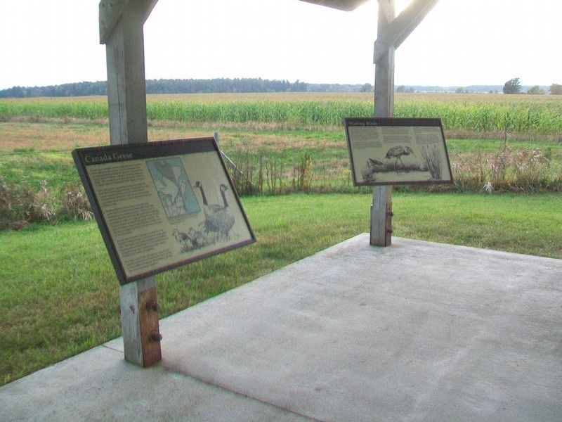
By William Fischer, Jr., October 7, 2017
Canada Geese Marker
1 ► Vermont, Addison County, Addison — Canada Geese —  |
| On Vermont Route 17W 1.7 miles west of Route 22A, on the left when traveling west. | |||
| 2 ► Vermont, Addison County, Addison — Chimney Point — |
| On Vermont Route 125 at Route 17, on the right when traveling east on Vermont Route 125. | |||
| 3 ► Vermont, Addison County, Addison — DAR John Strong Mansion — |
| On Vermont Route 17 1.4 miles north of Route 125, on the left when traveling north. | |||
| 4 ► Vermont, Addison County, Addison — Northern Terminal of the Crown Point Military Road — |
| On Vermont Route 17, on the right when traveling north. | |||
| 5 ► Vermont, Addison County, Addison — Snow Geese — |
| On Vermont Route 17W 1.7 miles west of Route 22A, on the left when traveling west. | |||
| 6 ► Vermont, Addison County, Addison — The Dead Creek Wildlife Management Area — |
| On Vermont Route 17W 1.7 miles west of Route 22A, on the left when traveling west. | |||
| 7 ► Vermont, Addison County, Addison — War Memorial — Victory • Peace — |
| On Vermont Route 22A at Route 17W, on the right when traveling south on Vermont Route 22A. | |||
| 8 ► Vermont, Addison County, Addison — Wetland Resources — |
| On Vermont Route 17W 1.7 miles west of Route 22A, on the left when traveling west. | |||
| 9 ► Vermont, Addison County, Bridport — Hathorne School — Bridport District Schoolhouse #1 — |
| On Vermont Route 125 at Basin Harbor Road, on the left when traveling west on Vermont Route 125. | |||
| 10 ► Vermont, Addison County, Bridport — War Memorial — |
| On Middle Road west of Route 22A, on the left when traveling west. | |||
| 11 ► Vermont, Addison County, Bristol — Bristol Civil War Memorial — |
| On North Street at Main Street, on the left when traveling north on North Street. | |||
| 12 ► Vermont, Addison County, Bristol — Bristol Remembers World War I — |
| On West Street (Vermont Route 17) at North Street, on the right when traveling west on West Street. | |||
| 13 ► Vermont, Addison County, Bristol — Bristol Veterans Memorial — |
| On West Street at North Street, on the left when traveling east on West Street. | |||
| 14 ► Vermont, Addison County, Bristol — Greenwood Cemetery Veterans Memorial — |
| On Stoney Hill Road (Vermont Route 17) east of Burpee Road ( Route 116), on the left when traveling east. | |||
| 15 ► Vermont, Addison County, Bristol — Holley Hall — |
| On West Street at South Street, on the right when traveling east on West Street. | |||
| 16 ► Vermont, Addison County, Bristol — In Memory of Pvt. Norman E. Wasley — Bristol Falls — |
| On Lincoln Road south of Route 116, on the right when traveling south. | |||
| 17 ► Vermont, Addison County, Bristol — Orris C. Manning Memorial — |
| On Vermont Route 125, on the right when traveling west. | |||
| 18 ► Vermont, Addison County, Cornwall, Bread Loaf — Cornwall Remembers — 1861-1865 — |
| On Vermont Route 30 at Fisher Street, on the right when traveling south on Vermont Route 30. | |||
| 19 ► Vermont, Addison County, Cornwall, Bread Loaf — William Slade / The Gag Rule — 1786–1857 / 1836–1844 — |
| On Seth Warner Memorial Highway, on the right when traveling north. | |||
| 20 ► Vermont, Addison County, Ferrisburgh — "Rokeby" — Home of Rowland E. Robinson Writer of Vermont Folklore — |
| On U.S. 7, on the right when traveling north. | |||
| 21 ► Vermont, Addison County, Ferrisburgh — Dairy Barn — |
| Near U.S. 7. | |||
| 22 ► Vermont, Addison County, Ferrisburgh — Ferrisburgh Academy — 1839-1846 — |
| Near U.S. 7. | |||
| 23 ► Vermont, Addison County, Ferrisburgh — Meet the Robinson Family — |
| Near U.S. 7. | |||
| 24 ► Vermont, Addison County, Ferrisburgh — The Great Convention — |
| On U.S. 7 at Middlebrook Road on U.S. 7. | |||
| 25 ► Vermont, Addison County, Ferrisburgh — The Historic Robinson Home — |
| Near U.S. 7. | |||
| 26 ► Vermont, Addison County, Ferrisburgh — The Robinson Farm — 1793—1961 — |
| Near U.S. 7. | |||
| 27 ► Vermont, Addison County, Ferrisburgh — Welcome to Rokeby Museum's Hiking Trails — |
| Near U.S. 7. | |||
| 28 ► Vermont, Addison County, Ferrisburgh — Your Questions Answered — |
| Near U.S. 7. | |||
| 29 ► Vermont, Addison County, Granville — The Corner School — Granville School District #10 — |
| On Post Office Hill north of Route 100, on the left when traveling north. | |||
| 30 ► Vermont, Addison County, Hancock — Honor Roll — Hancock Vermont — |
| On Vermont Route 100 at Taylor Meadow, on the right when traveling north on Vermont Route 100. | |||
| 31 ► Vermont, Addison County, Middlebury — Alexander Twilight Hall — 1867 — |
| On Academy Street north of Franklin Street, on the right when traveling south. | |||
| 32 ► Vermont, Addison County, Middlebury — Ancient Paths — |
| Near Main Street (State Highway 30) 0.1 miles south of Seymour Street, on the right when traveling south. | |||
| 33 ► Vermont, Addison County, Middlebury — Birthplace of Ray Fisher — |
| On Court Street (U.S. 7) at Creek Road, on the right when traveling south on Court Street. | |||
| 34 ► Vermont, Addison County, Middlebury — Charter House — |
| On North Pleasant Street (U.S. 7) at Main Street, on the right when traveling north on North Pleasant Street. | |||
| 35 ► Vermont, Addison County, Middlebury — Chipman Hill — People of the Landscape — |
| Near North Pleasant Street (U.S. 7) north of High Street, on the right when traveling north. | |||
| 36 ► Vermont, Addison County, Middlebury — 2 — Congregational Church — |
| On Seymour Street at North Pleasant Street (U.S. 7), on the left when traveling west on Seymour Street. | |||
| 37 ► Vermont, Addison County, Middlebury — Court Square — |
| Near Court Square (Route 7) west of Washington Street, on the right when traveling south. | |||
| 38 ► Vermont, Addison County, Middlebury — Emma Willard — Pioneer educator gave women first college training here — |
| On South Main Street (Vermont Route 30) 0.1 miles north of Porter Field Road, on the right when traveling north. | |||
| 39 ► Vermont, Addison County, Middlebury — Emma Willard Memorial — |
| On North Pleasant Street (U.S. 7) at Main Street, on the left when traveling north on North Pleasant Street. | |||
| 40 ► Vermont, Addison County, Middlebury — Frederick Douglass Launched The One Hundred Conventions — |
| On Court Square (U.S. 7) at South Pleasant Street, on the left when traveling west on Court Square. | |||
| 41 ► Vermont, Addison County, Middlebury — From Two Bridges to One Tunnel — |
| On Merchants Row at Main Street ( Route 30), on the right when traveling west on Merchants Row. | |||
| 42 ► Vermont, Addison County, Middlebury — Into the Earth — Looking Back — Marble Works 1898 — |
| On Maple Street near Printers Alley, on the right when traveling east. | |||
| 43 ► Vermont, Addison County, Middlebury — John Deere — Inventor of "The Plow that Broke the Plains" — |
| On Main Street 0.1 miles south of Mill Street, on the right when traveling south. | |||
| 44 ► Vermont, Addison County, Middlebury — Lazarus Park — |
| On Main Street (Vermont Route 30) north of Merchants Row, on the left when traveling north. | |||
| 45 ► Vermont, Addison County, Middlebury — Marble Works Memorial Bridge — |
| Near Mill Street just west of Park Street, on the right when traveling west. | |||
| 46 ► Vermont, Addison County, Middlebury — Marble Works Memorial Bridge — |
| On Maple Street west of Printers Alley, on the right when traveling west. | |||
| 47 ► Vermont, Addison County, Middlebury — Middlebury Civil War Memorial — |
| On Merchants Row at South Pleasant Street, in the median on Merchants Row. | |||
| 48 ► Vermont, Addison County, Middlebury — Middlebury Community House — |
| On Main Street (Vermont Route 30) at Seymour Street, on the right when traveling south on Main Street. | |||
| 49 ► Vermont, Addison County, Middlebury — Middlebury Falls — The Lure of Waterpower — |
| On Maple Street west of Printers Alley, on the right when traveling east. | |||
| 50 ► Vermont, Addison County, Middlebury — Middlebury Marble Town — The Hollowing of Frog Hollow — |
| On Maple Street at Printers Alley, on the left when traveling west on Maple Street. | |||
| 51 ► Vermont, Addison County, Middlebury — Middlebury War Memorial — |
| Near Court Street (U.S. 7) at Court Square, on the left when traveling west. | |||
| 52 ► Vermont, Addison County, Middlebury — Otter Creek Industrial Revolution — Roaring Waters, Thundering Mills — |
| On Maple Street at Printers Alley, on the right when traveling east on Maple Street. | |||
| 53 ► Vermont, Addison County, Middlebury — Proud Craftsmen from Many Lands — Looking Back — Marble Works 1898 — |
| On Maple Street west of Printers Alley, on the right when traveling west. | |||
| 54 ► Vermont, Addison County, Middlebury — Restoring Middlebury's Village Green — |
| On Main Street (Vermont Route 30) north of Merchants Row, on the left when traveling south. | |||
| 55 ► Vermont, Addison County, Middlebury — Samuel Miller, Esq. — September 30, 1798 — |
| On North Pleasant Street (U.S. 7) at Main Street, on the right when traveling north on North Pleasant Street. | |||
| 56 ► Vermont, Addison County, Middlebury — Site of Middlebury High School — |
| On Main Street (Route 30) at College Street, on the right when traveling south on Main Street. | |||
| 57 ► Vermont, Addison County, Middlebury — Spanning the Falls — Keeping Commerce Moving — |
| On Maple Street at Printers Alley, on the right when traveling east on Maple Street. | |||
| 58 ► Vermont, Addison County, Middlebury — Storrs Walk — |
| Near Vermont Route 125 east of Old Chapel Road, on the left when traveling west. | |||
| 59 ► Vermont, Addison County, Middlebury — The Addison County Courthouse — |
| On Court Street (U.S. 7) near Washington Street, in the median. | |||
| 60 ► Vermont, Addison County, Middlebury — The Battell Block — |
| On Main Street at Merchants Row, on the left when traveling south on Main Street. | |||
| 61 ► Vermont, Addison County, Middlebury — The Duclos Building — |
| On Main Street (Vermont Route 30) at Printers Alley, on the right when traveling south on Main Street. | |||
| 62 ► Vermont, Addison County, Middlebury — Town & Gown — |
| On Cross Street at Main Street ( Route 30), on the right when traveling west on Cross Street. | |||
| 63 ► Vermont, Addison County, Middlebury, East Middlebury — East Middlebury Iron Works — 1831-1890 — |
| On Vermont Route 125 west of North Branch Road, on the right when traveling east. | |||
| 64 ► Vermont, Addison County, Middlebury, East Middlebury — Site of Galvin Homestead — |
| On East Main Street (Vermont Route 125) east of U.S. 7, on the right when traveling west. | |||
| 65 ► Vermont, Addison County, Middlebury, Frog Hollow Area — Mill District — |
| On Mill Street west of Route 30, on the right when traveling west. | |||
| 66 ► Vermont, Addison County, Orwell — American Blockhouse – 1777 — Mount Independence State Historic Site — |
| Near Mount Independence Road, on the right when traveling south. | |||
| 67 ► Vermont, Addison County, Orwell — British Blockhouse - 1777 — Mount Independence State Historic Site — |
| Near Mount Independence Road, on the right when traveling south. | |||
| 68 ► Vermont, Addison County, Orwell — Burial Site — Mount Independence State Historic Site — |
| Near Mount Independence Road, on the right when traveling south. | |||
| 69 ► Vermont, Addison County, Orwell — Fort Ticonderoga and Mount Defiance — Mount Independence State Historic Site — |
| Near Mount Independence Road, on the right when traveling south. | |||
| 70 ► Vermont, Addison County, Orwell — Foundation -1776 or 1777 — Mount Independence State Historic Site — What do you think? - — |
| Near Mount Independence Road, on the right when traveling south. | |||
| 71 ► Vermont, Addison County, Orwell — General Hospital – 1777 — Mount Independence State Historic Site — |
| Near Mount Independence Road, on the right when traveling south. | |||
| 72 ► Vermont, Addison County, Orwell — German Hut – 1777 — Mount Independence State Historic Site — |
| Near Mount Independence Road, on the right when traveling south. | |||
| 73 ► Vermont, Addison County, Orwell — Heritage Travelers over the Years — |
| Near Mount Independence Road, on the right when traveling south. | |||
| 74 ► Vermont, Addison County, Orwell — Lake Champlain and the American Revolution — Mount Independence State Historic Site — |
| Near Mount Independence Road, on the right when traveling south. | |||
| 75 ► Vermont, Addison County, Orwell — Military Road — |
| On Mt. Independence Road, on the right when traveling west. | |||
| 76 ► Vermont, Addison County, Orwell — Mount Independence — Bastion of the Revolution — |
| Near Mount Independence Road, on the right when traveling north. | |||
| 77 ► Vermont, Addison County, Orwell — Mt. Independence Military Road — Route to Hubbardton, 1777 |
| On Vermont Route 22A at Main St (County Route 73), on the right when traveling south on Vermont Route 22A. Reported permanently removed. | |||
| 78 ► Vermont, Addison County, Orwell — Mt. Independence Military Road — Route to Hubbardton - 1777 — |
| On Vermont Route 22A at Route 73, on the right when traveling south on Vermont Route 22A. | |||
| 79 ► Vermont, Addison County, Orwell — Officers Quarters – 1776 — Mount Independence State Historic Site — |
| Near Mount Independence Road, on the right when traveling south. | |||
| 80 ► Vermont, Addison County, Orwell — Southern Battery – 1777 — Mount Independence State Historic Site — |
| Near Mount Independence Road, on the right when traveling south. | |||
| 81 ► Vermont, Addison County, Orwell — Southern Defense Trail — |
| On Mount Independence Road, on the left when traveling south. | |||
| 82 ► Vermont, Addison County, Orwell — Storehouse - 1776 — Mount Independence State Historic Site — |
| Near Mount Independence Road, on the right when traveling south. | |||
| 83 ► Vermont, Addison County, Orwell — The American Southern Defenses – 1776-1777 — |
| Near Mount Independence Road, on the right when traveling south. | |||
| 84 ► Vermont, Addison County, Orwell — Third Brigade Encampment – 1776 — Mount Independence State Historic Site — |
| Near Mount Independence Road, on the right when traveling south. | |||
| 85 ► Vermont, Addison County, Orwell — To Repel the Enemy — |
| Near Mount Independence Road, on the right when traveling south. | |||
| 86 ► Vermont, Addison County, Orwell — War Memorial — |
| On Vermont Route 73, on the left when traveling east. | |||
| 87 ► Vermont, Addison County, Orwell — World War Memorial — |
| On Main Street (Vermont Route 73), on the left when traveling east. | |||
| 88 ► Vermont, Addison County, Panton — Benedict Arnold — |
| On Arnold Bay Road 0.2 miles north of Pease Road, on the right when traveling south. | |||
| 89 ► Vermont, Addison County, Ripton — Blacksmith Shop — |
| On Vermont Route 125 east of Lincoln Road, on the right when traveling east. | |||
| 90 ► Vermont, Addison County, Ripton — Bread Loaf Inn — 1882 — |
| On Vermont Route 125 north of College Cross Road, on the right when traveling north. | |||
| 91 ► Vermont, Addison County, Ripton — Calvin Pier Tavern — Erected 1819 - Removed 1890 — |
| On Vermont Route 125, on the right when traveling west. | |||
| 92 ► Vermont, Addison County, Ripton — Chipman House — |
| On Vermont Route 125 east of Lincoln Road, on the right when traveling west. | |||
| 93 ► Vermont, Addison County, Ripton — Homer Noble Farm — |
| On Robert Frost Road 0.6 miles north of Route 125. | |||
| 94 ► Vermont, Addison County, Ripton — Rates of Toll — Ripton, VT. — |
| On Vermont Route 125 east of Lincoln Road, on the left when traveling east. | |||
| 95 ► Vermont, Addison County, Ripton — Ripton Armed Services Memorial — |
| On Vermont Route 125, on the right when traveling west. | |||
| 96 ► Vermont, Addison County, Ripton — Robert Frost — 1874 - 1963 — |
| On Vermont Route 125 just west of Frost Road, on the left when traveling east. | |||
| 97 ► Vermont, Addison County, Ripton — Robert Frost National Recreation Trail — Welcome to the Green Mountain National Forest — |
| Near Vermont Route 125 0.5 miles south of Goshen Road, on the right when traveling south. | |||
| 98 ► Vermont, Addison County, Ripton — Robert Frost Wayside — Robert Frost Country: Moments in Time — |
| On Vermont Route 125 at Robert Frost Road, on the right when traveling west on Vermont Route 125. | |||
| 99 ► Vermont, Addison County, Ripton — Robert Frost Wayside Area — Dedicated August 20, 1964 — |
| Near Vermont Route 125 at Robert Frost Road, on the right when traveling west. | |||
| 100 ► Vermont, Addison County, Ripton — Second Home of Daniel & Eleutheria Chipman — |
| On Vermont Route 125 east of Lincoln Road, on the right when traveling east. | |||
1119 entries matched your criteria. The first 100 are listed above. Next 100 ⊳