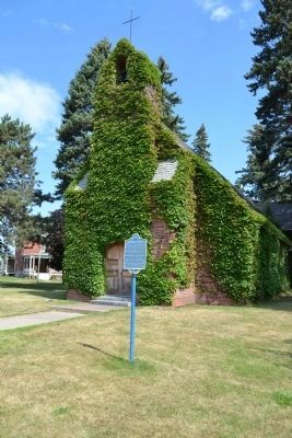
Dedicated on 24 October 1933
in memory of those stationed here
who gave their lives in WWI.
The project was sponsored
by the Churchwomen's League For
Patriotic Service. Costing $22,472.
It was constructed of
weathered brick from a . . . — — Map (db m47944) HM
The stately structures surrounding the parade oval are the facilities of Plattsburgh Barracks, an active U.S. Army Post until 1944. The original installation was built during 1893-97 on the site of a military outpost which was established during the . . . — — Map (db m76385) HM
On New York State Route 22 1.6 miles north of Adirondack Northway (Interstate 87), on the left when traveling north.
If you were here in the late-fall of 1812, you'd see neat lines of two-man tents stretching down to the Saranac River. Those canvas shelters, which
provided little protection against sleet, snow, and bitter winds, were filled with 700 soldiers . . . — — Map (db m140716) HM
Plattsburg Bay
has been designated a
REGISTERED NATIONAL
HISTORIC LANDMARK
under the provisions of the
Historic Sites Act of August 21, 1935
This site possesses exceptional value
in commemorating and illustrating
the history of the . . . — — Map (db m46524) HM
This monument was dedicated on July 6, 1912
to the memory of
Samuel Champlain
first European to behold our great forests and
lofty mountains, and first to traverse this inland
waterway, which later became so rich in fame.
Champlain was born in . . . — — Map (db m46525) HM
On Beekman Street at Court Street, on the right when traveling south on Beekman Street.
State Normal and Training School at Plattsburgh chartered 1889, first class graduated 1891. After 1929 fire, Normal Hall replaced by present building 1933. Dedicated as Hawkins Hall 1955. — — Map (db m106301) HM
On City Hall Place (U.S. 9) at Court Street, on the right when traveling north on City Hall Place.
The Village of Plattsburgh
elected its first officers at The
Ark, a popular hotel on May 2 1815.
Le village de Plattsburgh
a elu ses premiers officiers le 2
mai 1815 dans i hotel de renom The Ark. — — Map (db m115254) HM
On Cumberland Avenue 0.1 miles east of Sailly Avenue, on the left when traveling east.
The DeLord House, 1810-1913, A Social Hub During the War of 1812 La maison Delord 1810-1913: bastion de la vie sociale Durant la guerre de 1812 In August 1810, Henry and Betsey Delord purchased the house they would enlarge and their family . . . — — Map (db m110120) HM
On City Hall Place (U.S. 9) at Trinity Place, on the right when traveling north on City Hall Place.
Thomas Macdonough Monument This majestic memorial to the American naval victory at Plattsburgh in September 1814 was designed by John Russell Pope (1874-1937) and commands the park opposite Plattsburgh City Hall, also designed by Pope. . . . — — Map (db m110126) HM WM
On Brinkerhoff Street just east of Marion Street, on the left when traveling west.
over the British Fleet under Downie on Cumberland Bay Lake Champlain Macomb’s repulse of the British land forces under Prevost and in memory of the sailors and soldiers of the United States who gave their lives for their country in these engagements . . . — — Map (db m254298) HM
On Trinity Place west of City Hall Place (U.S. 9), on the right when traveling west.
Plattsburgh's oldest public
building. Reverend John Henry
Hopkins, who authored the hymn
We Three Kings was the rector
here from 1872-1877.
Le plus ancien batiment publique
de Plattsburgh. Ce fut le Reverend
John Henry Hopkins et . . . — — Map (db m115224) HM
This structure was the first of
three barracks built between 1893 -
1897. Each housed one infantry battalion
of 320 men. This barracks was first
occupied in June 1894 by companies D, F
and G of the 21st Infantry Regiment
transferred from Fort . . . — — Map (db m47380) HM
On Peru Street (U.S. 9) 0.1 miles south of New Jersey Street, on the right when traveling south.
1 of 3 forts built Aug. 1814
by Gen. Macomb & successfully
defended against British
assault in the Sept. 11, 1814
Land Battle of Plattsburgh.
City of Plattsburgh, Clinton Co. — — Map (db m46926) HM
On Margaret Street at Court Street, on the right when traveling north on Margaret Street.
Erected by the Clinton County
Gold Star Mothers in Memory of
Their Sons Who Made the Supreme
Sacrifice in World Wars I and II
[Roll of Honored Dead]
[Added panels for other wars?] — — Map (db m115225) WM
On Lake Street (New York State Route 9B) at U.S. 11, on the right when traveling north on Lake Street.
Near Site of David Mayo's sail ferry, 1805. Crossed Lake Champlain from the foot of Champlain St. to Windmill Point, Alburgh, VT. — — Map (db m234758) HM
On Montgomery Street, on the right when traveling east.
This Barge Canal Terminal Dock, built in 1916, represents the last chapter in a lively history of shipping improvements that connected Rouses Point with Canada, New York City and Buffalo through Lake Champlain. Shipping on the lake meant living on . . . — — Map (db m175646) HM
On Silver Lake Road at Route 3, on the right when traveling north on Silver Lake Road.
Caldwell Mine Site--1841. Supplied ore to forges along river & to Standish. Bowen-Williams operated 1863. 1871--A. Williams & C.O.&I. — — Map (db m108144) HM
On Adirondack Park Preserve (New York State Route 3) north of Hardscrabble Road, on the right when traveling east.
Saranac Iron Works. Catalan Forge--rolling mill. First forge on the River--1826. Baker-Hull-Hopper--World's best quality iron used in Civil War ironclads. Bowen-Signor closed 1887. — — Map (db m108145) HM
On Pleasant Street (New York State Route 22B) 0.1 miles south of Felton Road (County Route 40), on the right when traveling south.
The founder of Dawson City, Yukon
Territory, during the Klondike
Gold Rush. Married Katherine "Kittie"
Mason and bought this home in 1897. — — Map (db m194594) HM
On Pleasant Street (New York State Route 22B) at Norrisville Road (County Route 33), on the right when traveling south on Pleasant Street.
Organized in 1846 with service by
Rev. John M. Wever, first minister.
Church built and dedicated in 1847.
Services held until 1980's — — Map (db m194622) HM
Cemetery est. Nov. 21, 1876
resting place of many early
area families - Eels, Keet,
Mason, Merchant, Lobdell,
Ladue, Turner, Weaver — — Map (db m133082) HM
Catalan Forge Furnace - 1881
Standish (Williamstown) made brick-like blooms from one of Saranac River Mines
1886 - Replaced by blast furnace & ore from Lyon Mt. — — Map (db m57311) HM
On New York State Route 9 north of Lapham Mills Road, on the left when traveling south.
11 October 1776. Across this strait a small colonial fleet fought the British to a standstill causing a 3 day running conflict that delayed the British advance to divide the colonies. This action allowed time for the Americans to rebuild their . . . — — Map (db m108649) HM
On New York State Route 9 north of Lapham Mills Road, on the right when traveling north.
Est. by Robt. Platt ca. 1820
This busy Lake Champlain port
was an important transportation
hub for both people and goods
during the 1800's. — — Map (db m108681) HM
On New York State Route 9 0.4 miles south of Lapham Mills Road, on the right when traveling south.
Robt. Platt, Mem. NYS Assembly 1814-15, built this home in 1809 on 700 acres given by his father, Zephaniah, founder of Plattsburgh. — — Map (db m108682) HM
On New York State Route 9 north of South Junction Road, on the right when traveling south.
Erected in 1809 by Alfred Keith. First on Lake Champlain in northern NY State. Operated by Keith 1809-1822, Jacob Sax 1822 until destroyed by the flood of 1830. — — Map (db m108644) HM
On U.S. 9 (New York State Route 9) north of Champlain Drive, on the right when traveling north.
Catholic Summer School of America 1896-1941 on this site. Resort and educational campus with cottages, chapel, dining hall, auditorium & post office. — — Map (db m106622) HM
On New York State Route 9 at Old Dock Road, on the left when traveling south on New York State Route 9.
2000 acres settled in 1766 by William Gilliland (1734-1796) first named Janesborough, later Port Gilliland. A port for lake shipped goods c. 1820-1900. — — Map (db m108643) HM
On New York State Route 22, on the right when traveling west.
A War of 1812 military camp stood to the west of this marker. Many occupants died defending Plattsburgh and lie buried not far from here. — — Map (db m106841) HM
On New York State Route 9 north of South Junction Road, on the right when traveling south.
Site of first home raised by a European settler in the Town of Plattsburgh and Clinton County. Erected September 10-13, 1766 by William Gilliland (1734-1796). — — Map (db m108645) HM
On New York State Route 9 at South Junction Road, on the right when traveling south on New York State Route 9.
Erected c. 1820 by Jacob Sax. Sax family home c. 1820-1832, William Gilliland III (1812-1886) family 1845-1880, Day family 1881-1958. — — Map (db m108646) HM
On Lake Shore Road south of Dunn Road, on the right when traveling north.
1776. Benedict Arnold for twelve September days opposite Chazy readied his fleet and planned his strategy for the Battle of Valcour. — — Map (db m106264) HM
On Lake Shore Road 0.1 miles north of Reynolds Road, on the right when traveling north.
1776. Benjamin Franklin, Samuel Chase & Charles Carroll of Carrollton paused near here April 26 en route to Montreal as Delegates of Congress. — — Map (db m106115) HM
On County Route 71, on the left when traveling north.
Mechanics have known how to run machinery using the weight of falling water for centuries, but this sixty-foot drop at the head of AuSable Chasm proved difficult to harness. Early mills had to perch on the brink of the river, exposed to ice and . . . — — Map (db m136716) HM
Near Grandview Drive, on the left when traveling west.
“The fort is of wood, built in a most masterly manner. It has five Bastions, mounts 105 guns, and has casements for 4,000 Men, and to hold provisions de Guerre et de Bouche for four months. Within the Fort are good Stone Barracks for . . . — — Map (db m11442) HM
Near Grandview Drive, on the left when traveling west.
This tablet is erected by the Society of Colonial Wars in the State of New York AD 1912 to commemorate the capture of Fort St. Frédéric and the erection of this fortress AD 1759 by the British and Provincial Army commanded by General Sir Jeffrey . . . — — Map (db m9336) HM
On Bridge Road (New York State Route 185) at Adirondack Park Road, on the left when traveling east on Bridge Road.
On May 11, 1775 American
forces took possession of
Crown Point and 111
cannon of which 29, along
with 30 from Fort
Ticonderoga, made up the
noble train of artillery that
Henry Knox delivered to
Gen. George Washington to
force the . . . — — Map (db m162031) HM
On Grandview Drive, on the right when traveling west.
The most practical mode of travel and communication through the wilderness separating French Canada and British North America during the 18th century was by water. The Sorel (Richelieu) River, Lake Champlain, Wood Creek, and the Hudson River . . . — — Map (db m11434) HM
On Bridge Road (County Route 185), on the left when traveling east.
The North Country National Scenic Trail Stretching 4,600 miles through seven states, the North Country Trail is a premier hiking path that traverses, interprets and celebrates the unique natural, historic, cultural and ecological landscapes of . . . — — Map (db m126284) HM
Near Grandview Drive, on the right when traveling west.
Fort St. Frédéric consisted of an outer, bastioned limestone wall enclosing the Citadel, a four-story, eight-sided tower with walls twelve feet thick at the base. Cannon were mounted on each floor of the Citadel, and entry was gained by a . . . — — Map (db m11415) HM
Near Grandview Drive, on the left when traveling west.
On May 11, 1775 American forces took possession of Crown Point and 111 cannon of which 29, along with 30 from Fort Ticonderoga, made up the Noble Train of Artillery that Henry Knox delivered to Gen. George Washington to force the British out of . . . — — Map (db m126079) HM
On Sam Curran Road 0.4 miles east of County Route 7, on the left when traveling east.
Rogers' Rangers retreated on snowshoes through this valley Jan. 21, 1757 after ambush by the French at La Barbue Creek AKA Putnam's Creek — — Map (db m247334) HM
In 1927, the Lake Champlain Bridge Commission considered six possible locations in the southern Lake Champlain region for a new bridge. The commission chose the Crown Point-Chimney Point site because it provided the best geological conditions. . . . — — Map (db m126279) HM
When it opened in 1929, the Lake Champlain Bridge became the first modern highway bridge to cross 120-mile-long Lake Champlain. Promoted as “the new gateway” between New York’s Adirondacks and Vermont’s Green Mountains, the bridge . . . — — Map (db m126268) HM
Near Grandview Drive, on the left when traveling west.
These barracks were constructed in the fashionable Georgian style of the day, uncommon in the northern interior of New York in the mid-18th century. The soldiers’ barracks is composed of four dwelling units of four rooms. Each doorway opens into a . . . — — Map (db m11443) HM
On Grandview Drive, on the left when traveling west.
Following the French retreat from Crown Point in 1759, General Amherst embarked upon an ambitious plan to secure the area for Britain. An elaborate system of fortifications was begun on the Point; at times as many as 3,000 soldiers and artisans . . . — — Map (db m11437) HM
On Grandview Drive, on the right when traveling west.
In 1730, the French erected a small wooden fort at Point a la Chevelure, now Chimney Point, Vermont, thereby taking control of territory claimed by Great Britain under the terms of the Treaty of Utrecht (1713). The following year, construction of . . . — — Map (db m11435) HM
To the memory of the
heroic volunteers of Crown Point,
who gave their lives as a sacrifice
for their country and humanity,
in the suppression of the
Great Rebellion of 1861-1865.
This monument is erected by their
grateful fellow . . . — — Map (db m126316) WM
The white flag was the French naval ensign. It was also the flag flown over all forts that came under the royal authority in New France from the end of the seventeenth century until the British Conquest. — — Map (db m126270) HM
On Bridge Road (New York State Route 185) at Adirondack Park Road, on the left when traveling north on Bridge Road.
Crown Point is the site of two major 18th-century fortifications: France's Fort St. Frédéric and Great Britain's fort at Crown Point. The ruins of these forts have survived substantially unchanged since the late 18th century and have been . . . — — Map (db m162026) HM
The Lake Champlain Bridge Heritage Area includes Crown Point State Historic Site, the Lake Champlain Visitors Center, and the Crown Point State Campground in New York, Chimney Point State Historic Site in Vermont, as well as the bridge that . . . — — Map (db m126282) HM
On Penfield (Whitehead) Road at Creek Road (County Road 2), on the right when traveling north on Penfield (Whitehead) Road. Reported permanently removed.
Allen Penfield, Timothy Taft, and Allen Harwood pioneered the first industrial use of electricity in their iron works below the pond south of the marker. Thomas Davenport, the blacksmith of Brandon, Vermont, in 1833 bought the electro-magnet used in . . . — — Map (db m196073) HM
First bishop of the Diocese
of Ogdensburg was born in
this house May 21, 1817.
He was consecrated May 5,
1872 - died December 5, 1891. — — Map (db m136666) HM
On Court Street (U.S. 9) at Park Street, on the left when traveling north on Court Street.
The Men of Elizabethtown Who served in the World War 1917-1919
Harry Metcalf, Oliver Mitchell, Hardy Sweet, William Hanchett denoted as having died while in service.
further names were not transcribed
In Memory of the Men and . . . — — Map (db m137178) WM
On Court Street (U.S. 9) at Park Street, on the left when traveling north on Court Street.
John Brown’s body guarded by local citizens rested in this court house on the night of Dec. 6, 1859 on its way to burial at his home in North Elba. — — Map (db m136665) HM
On Lake Shore Road at Whallons Bay Road, on the right when traveling south on Lake Shore Road.
Called Roche Regio by Indians. Boundary between Mohawks and Algonquins. By Treaty of Utrecht conceded as limit of English Dominions. — — Map (db m283821) HM
On Lake Shore Drive (New York State Route 22) at Station Street ( Route 22), on the left when traveling north on Lake Shore Drive.
In memory of
those who gave their lives for their country
in World War I and World War II. They shall,
by their sacrifices, live forever among us.
We honor
the brave men and women of the Town of Essex
who served our country in . . . — — Map (db m108924) HM
Near Creek Road (County Route 2) at Whitehead Road, on the left when traveling west.
During the dramatic expansion of 1873, the Crown Point Iron Company built several new buildings below the upper dam. This
bend in the creek contains the foundations of a carpentry shop, a furnace (or foundry) building, and a sawmill. These . . . — — Map (db m195955) HM
Near Creek Road (County Route 2) at Whitehead Road, on the left when traveling west.
Charcoal fueled the iron industry. To produce 2,000 lb. of bloom iron, twice that amount of ore had to be mixed with 5400 lb. of
charcoal. Smelting of iron required a similar quantity of charcoal. Ore, charcoal and limestone were heated in a . . . — — Map (db m195996) HM
Near Creek Road at Peasley Road, on the left when traveling west.
Ore comes out of the ground mixed with sand and rock. Before it can be worked, it needs to be broken up (crushed) and separated from dirt and rock. In the early 1830's, Penfield and Taft made history by developing a magnetic ore separator charged . . . — — Map (db m195995) HM
On Creek Road (County Route 2) at Whitehead Road, on the left when traveling west on Creek Road.
The power of Putnam Creek drove the iron industry on its shores for over sixty years.
Although the structures disappeared nearly a century ago, many of the foundations remain visible today.
Follow the historic walking tour to discover the remains . . . — — Map (db m195856) HM
Near Creek Road (County Route 2) at Whitehead Road, on the right when traveling west.
The Gray's Atlas of Essex County printed in 1876 recorded the improvements made in "Irondale” after the Crown Point Iron Company built a narrow gauge railroad to carry ore from the mines to its new foundry complex on Lake Champlain. Here the path . . . — — Map (db m195936) HM
On Creek Road (County Route 2) 0.1 miles west of Whitehead Road, on the left when traveling west.
Ironville Historic District
has been placed on the
National Register of
Historic Places in 1974
by the United States
Department of the Interior — — Map (db m195858) HM
Near Creek Road (County Route 2) at Peasley Road, on the left when traveling west.
Sawmills and grist mills form the nucleus of every early 19th-century village. Allen Penfield purchased waterpower rights a few
hundred yards further down the creek in 1809 and promptly built one of each. The partnership of Penfield & Taft sawed . . . — — Map (db m195991) HM
Near Creek Road (County Route 2) at Peasley Road, on the left when traveling west.
Ore trains stopped in Ironville to drop their loads into the separator to be crushed and washed. Some of the "dressed ore"
traveled only a few hundred yards to the forge below the dam to be turned into "bloom iron.” The rest traveled down to the . . . — — Map (db m195990) HM
On Creek Road (County Route 2) at Whitehead Road, on the left when traveling west on Creek Road.
Historic Ironville Crown Point, NY
listed on the National Register of Historic Places in 1974
Penfield Homestead Museum
former
Second Congregational
Church built in 1843
PHM
penfieldmuseum.org — — Map (db m196076) HM
Near Creek Road (County Route 2) 0.1 miles west of Whitehead Road, on the left when traveling west.
Timothy Taft oversaw construction of the first dam at this site in 1828. The creek flowed north, then turned to the south to drop
over a natural rock ledge. Taft constructed two earth berms that came together at an angle to divert the main flow of . . . — — Map (db m195938) HM
Near Creek Road (County Route 2) at Whitehead Road, on the left when traveling west.
This stone lined pit marks the location of the scale used to weigh ore cars coming from the mines at Hammondsville, three miles to the west. The scale house beside the pit housed a heavy-duty car scale which measured the ore contents of each car . . . — — Map (db m195981) HM
On Creek Road (County Route 2) 0.1 miles west of Whitehead Road, on the left when traveling west.
Allen Penfield, Timothy Taft, and
Allen P. Harwood pioneered the
first industrial use of electricty
in their iron works below the
pond south of this marker.
Thomas Davenport, the blacksmith
of Brandon, Vermont, in 1833
bought the . . . — — Map (db m196069) HM
Near Creek Road (County Route 2) at Whitehead Road, on the left when traveling west.
The forge formed the heart of the operation at Ironville. The first forge had two fires fanned by a cold air blast generated with
falling water. It grew to eight fires by 1880. In 1848, Penfield kept his operation up to date by converting to hot . . . — — Map (db m195956) HM
768 entries matched your criteria. Entries 101 through 200 are listed above. ⊲ Previous 100 — Next 100 ⊳