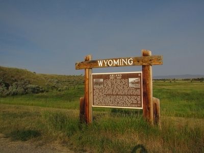
A few miles up Meeteetse Creek from here, stood one of the toughest settlements of Wyoming’s frontier history. The town was founded in the spring of 1884 by Victor Arland, a French businessman, and John Corbett, a buffalo hunter. From 1880 . . . — — Map (db m87608) HM
At this spot in 1904, brothers Charles and George Wilson, builders of the Cody-Meeteetse Road, constructed a rock dugout near Dry Creek Spring. The primitive accommodation stood halfway between Corbett Crossing on the Shoshone River to the . . . — — Map (db m87149) HM
In front of you stood the Administration Area which consisted of an H shaped Administration building, a small building to the right of the Administration building for the Block Managers Community Council offices, and a building to the south for the . . . — — Map (db m91181) HM
As you look through the site glass, you will see the only remaining root cellar of the original three. It is on private land and may not be visited. The evacuees cultivated farmland north of the living area, across the highway to the south and . . . — — Map (db m91173) HM
You are now overlooking the entire living area of the Heart Mountain Relocation Center. More than 10,000 men, women and children lived in the area bounded on your left by at the red brick home in there distance, the hill ahead of you, the hospital . . . — — Map (db m91219) HM
U.S. Senator Daniel K. Inouye (1924-2012) was a lifelong public servant. A veteran who nearly lost his life in brave service with the highly-decorated, all-Japanese American 442nd Regimental Combat Team in World War II, has been recognized for his . . . — — Map (db m91143) HM
As you look through the site glass, you see a concrete records vault, the only remnant of the high school that stood on this ground.
In early August 1942, the Heart Mountain project director hired Clifford D. Carter as superintendent and John . . . — — Map (db m91194) HM
More that 750 young men and women incarcerated during World War II at the Heart Mountain Relocation Center, despite being forced by the government to live in wooden barracks surrounded by barbed wire, left to serve their country in the U.S. Armed . . . — — Map (db m91608) HM WM
History
After the bombing of Pearl Harbor on December 7, 1941, many parts of the West Coast were declared military defense zones. The government ordered the removal of all persons of Japanese ancestry and the War Relocation Authority was . . . — — Map (db m91185) HM
September 1985
This memorial plaque is dedicated to the more than 750 internees who left Heart Mountain to serve in the U.S. Armed Forces during World War II, and to the memory of the 15 Heart Mountaineers who gave their live for our country. . . . — — Map (db m91188) HM WM
Rooted in decades of anti-Japanese and anti-Asian prejudice, the internment of 120,000 Nisei, American citizens of Japanese descent, and Issei, Japanese resident aliens, was triggered by the bombing of Pearl Harbor in Dec. 7, 1941.
Initiatives . . . — — Map (db m91169) HM
Directly in front of you was the hospital complex. The structures remaining are the boiler house and chimney, two slabs that were warehouse foundations, one building that was the kitchen and dining room, and one building that was the ambulance . . . — — Map (db m91171) HM
As you look through the site glass, to the left of the intersection of Highway 14A and Road 19 stood the Military Police complex and one of the guard towers. On the right side of Road 19 were the main gate and the train station. The Chicago, . . . — — Map (db m91172) HM
At this location, from 1942 to 1943,
Norman Y. Mineta,
Son of Kunisaku (Kay) and Kane Mineta and a U.S.
Citizen, was interned by the United States Government.
Harboring no bitterness, only an abiding love
of his country, he . . . — — Map (db m91139) HM
As you look through the site glass, you see the hill where the water reservoir stood. Across Highway 14A was the water treatment plant and adjacent to the military police complex was the sewage treatment plant. Directly across the intersection in . . . — — Map (db m91220) HM
As you look through the site glass, you see the camp swimming hole. After an internee Boy Scout drowned while swimming in the canal during the summer of 1943, the Administration ordered a large pit excavated just below the canal. The pit was lined . . . — — Map (db m91180) HM
The Shoshone National Forest provides a habitat for more Rocky Mountain bighorn sheep than any other national forest. Grazing on nutritious bunchgrasses, bighorn sheep evolved in open, high visibility habitats near steep, rocky cover, making it . . . — — Map (db m89018) HM
Stretching across 9,000 square miles, the Absaroka Volcanic Field forms one of the largest volcanic fields in the continental United States. Between thirty-five to fifty-five million years ago volcanoes in the Yellowstone region erupted, depositing . . . — — Map (db m87599) HM
The Mummy Cave rock shelter was home to Native Americans for nearly 10,000 years. The rock shelter formed when the Shoshone River undercut a vertical cliff and then migrated south. The shelter began filling with sediment and slopewash. The . . . — — Map (db m228370) HM
Red to Dead Trees live and die by natural processes. As you look across the landscape, you may see red needles or dead trees. Natural events such as drought, windthrow, and old age add stress to trees. In some places, where fire has been . . . — — Map (db m89032) HM
This valley has sustained life for thousands of years. Early Native Americans were drawn here to hunt buffalo, elk, deer, moose, sheep and bear. It has always been considered a unique place. The establishment of the nation’s first park and . . . — — Map (db m89027) HM
The Buffalo Bill Scenic Byway stretches 27.5 miles from the Shoshone National Forest boundary to Yellowstone National Park. Originally built in 1901, the byway spans the North Fork of the Shoshone River Valley and divides two vast wilderness areas: . . . — — Map (db m89038) HM
About 3,000 years ago, small groups of people camped here for a short time. In 1985, archaeologists found stone tools and thousands of bone fragments associated with two fire hearths. The excavation revealed that in winter, the people subsisted . . . — — Map (db m228459) HM
This "living room floor" of the Pagoda Creek archaeological site was perfectly preserved. More than 4,000 artifacts of chipped stone flakes, tools, and bone fragments were found where they had lain for nearly 3,000 years. The site was buried when . . . — — Map (db m228585) HM
Under proper lighting this spring shines like the blue-green gemstone, beryl. Its activity, and that of adjacent springs, was greatly altered by the 1959 earthquake. The violent agitation of the water is due to volcanic gases, mostly steam. The . . . — — Map (db m282417) HM
Other than the brief summer months spent carpeted by beautiful yellow pond lilies, this sliver of water seems rather insignificant. Looks can be deceiving!
As spring runoff empties into Isa Lake, the water swells and overflows it tiny borders. . . . — — Map (db m253768) HM
Why all the vivid colors? One word - sunlight. The brilliant blue of the water is caused by sunlight being scattered by mineral particles in the water. The spring often appears to have a blue haze hovering over it. This is caused by the steam . . . — — Map (db m253840) HM
With massive boulders up to five feet in diameter, the museum’s lower walls appear to rise out of a rocky outcrop. Other structural details – log beams, wooden shingles – relate to the surrounding forest. Wildlife exhibits featuring . . . — — Map (db m88467) HM
About 480,000 years ago, after the last caldera-forming eruption, lava flowing from the east covered this area. The lava hardened into erosion-resistant rock. Over time, superheated water rose through the hardened lava, altering and making it easier . . . — — Map (db m228140) HM
Scattered across this unusual landscape are hot springs – hot springs that are reshaping the mountain. Water, heated deep underground, rises to the surface. As it rises, the water percolates through buried limestone, dissolving calcium . . . — — Map (db m88449) HM
A Golden OpportunityWhen Yellowstone became the world’s first national park in 1872, only 300 people reached its borders.-----------------------------------------For decades, traveling to Yellowstone and other remote parks remained slow and . . . — — Map (db m88730) HM
The last of the structures built by the army (completed in 1913), the chapel added a finishing touch to the fort and was considered by far its most beautiful structure. The community held religious services in the troop mess hall, the post . . . — — Map (db m87140) HM
Here in Fort Yellowstone, a soldier lived with the rest of his company in the Troop Barracks (structure in front of you). A typical day began at 5:30 a.m. at the stable where the horses were fed and groomed. Activities could also include guard . . . — — Map (db m87142) HM
Yellowstone’s vast northern range is home to an amazing array of mammals. This wildlife community is one of the largest and most diverse of any on Earth! While visiting Yellowstone, you may see some of these animals. Remember, they are wild and . . . — — Map (db m88938) HM
West Thumb’s shoreline has suspiciously crater-like contours. Its underwater profile is dramatically deeper than the rest of Yellowstone Lake. Only a massive explosion could have formed West Thumb. Though the blowout occurred 125,000 years ago, . . . — — Map (db m88422) HM
A Photographer's Canvas
Artist Point offers a magnificent view of Lower Falls plunging 308 feet (93 meters). Framed by canyon walls, forest, and sky, the picturesque scene has been photographed countless times for more than a century. . . . — — Map (db m45265) HM
Living Color The vivid colors of Beauty Pool’s basin and runoff channels are created by microscopic lifeforms. Incredibly, these organisms survive and thrive in an environment that would be lethal to us and most other living creatures. . . . — — Map (db m88364) HM
this geyser, named for its 4-foot high cone, resembles an old fashioned beehive. Though its cone is modest by comparison to others in the Upper Geyser Basin, Beehive is one of the most powerful and impressive geysers in Yellowstone. The cone acts as . . . — — Map (db m46274) HM
This mudpot roared into existence in 1948, blowing trees out by roots and forever changing this once quiet forested hillside. A park interpreter named the new feature for its resemblance to a darkly colored “demon of the backwoods.” For . . . — — Map (db m88693) HM
Black obsidian (volcanic glass) “sand” gives this geyser basin its name. Oranges, greens, and other colors in and around the hot springs come from thermophiles (heat-loving microorganisms). While you walk the trail, watch for one of . . . — — Map (db m88865) HM
Sculpting Lower Falls
Reaching the Brink of Lower Falls overlook requires hiking a steep trail that winds down the canyon wall…a wall of hardened rhyolite lava…a wall exposed by the Yel1owstone River while excavating the canyon. . . . — — Map (db m45293) HM
Between a Rock and a Hard Place
From the Brink of Upper Falls viewpoint you can witness the power of the Yellowstone River as you watch millions of gallons (liters) of water plunging 109 feet (33 meters).
From the brink, notice the . . . — — Map (db m45291) HM
Mineral stains mark the sites of hot springs and steam vents in the canyon walls. For thousands of years,upwardly percolating fluids have altered the chemistry of the rocks, turning them yellow, red, white, and pink.
From the rim, the bright . . . — — Map (db m45266) HM
During their fighting retreat toward freedom in Canada, the non-treaty Nez Perce passed directly through Yellowstone National Park in August, 1877. Their route followed this creek. When outriders encountered a party of sightseers camped nearby, the . . . — — Map (db m39455) HM
The massive cone is a sign of old age. Eruption after eruption, probably for thousands of years, scalding water has deposited this silica mineral formation. By contrast, Old Faithful’s fledgling cone may only be a few hundred years old. Castle . . . — — Map (db m88374) HM
Across the meadow, a fire burned in the campsite of nine tourists on the night of August 23, 1877. The Cowan party had unknowingly camped near hundreds of Nez Perce men, women, and children who were under violent pursuit by the United States Army. . . . — — Map (db m86788) HM
Frothing and fuming as heat and gas rise from Yellowstone’s magma chamber, this muddy pool churns and cooks. Shaken again and again by earthquakes, the temperature beneath it rises and falls, transforming Churning Caldron. Roiling or Boiling? . . . — — Map (db m88689) HM
Hot springs create different water temperature environments for living things. Cistern Spring’s brown, orange, and green colors represent species of visible algae and bacteria, each requiring a different temperature environment. Only a . . . — — Map (db m89128) HM
Shake, then Bake Covered by dense forest until 1978, this hillside changed dramatically after a swarm of earthquakes struck the area. In spite of being jolted again and again, the trees remained standing, but met their demise soon afterward . . . — — Map (db m88682) HM
Hot springs are the most numerous type of thermal feature in Yellowstone. More than 10,000 are scattered across Yellowstone’s 2 million acres, but few are as hot and as intensely colored as Crested Pool. Water temperatures within the pool often . . . — — Map (db m88373) HM
From poachers to stagecoach robbers, soldiers were kept busy enforcing the law in Yellowstone. There were five stagecoach robberies in Yellowstone, with the last occurring on 1914. What is often considered the greatest stagecoach robbery of . . . — — Map (db m123146) HM
After the ice sheet on Yellowstone Lake breaks up in May and grinds downstream beneath Fishing Bridge, you can witness a spawning frenzy. Cutthroat trout lay millions of eggs in the riverbed gravel within sight of the bridge. Spawning season has a . . . — — Map (db m88135) HM
Daisy Geyser is part of an interconnected group of geysers and hot springs. Underground cracks and fissures allow water and heat to circulate between the various features in this group. When the activity of one feature affects the behavior of . . . — — Map (db m88380) HM
An unknown park visitor named this feature around 1912, perhaps due to the water that frequently surged from the cave like the lashing of a dragon's tongue. Until 1994, this dramatic wave-like action ofter splashed water as far as the boardwalk. The . . . — — Map (db m46269) HM
Millions of spine-shaped deposits surround Echinus Geyser. Iron, arsenic, manganese, and aluminum are all found in the acidic fountain of water that showers the landscape. With each eruption, these metals help build miniature rust-colored sinter . . . — — Map (db m89129) HM
Millions of spine-shaped deposits surround Echinus Geyser. Iron, arsenic, manganese, and aluminum are all found in the acidic fountain of water that showers the landscape. With each eruption, these metals help build miniature rust-colored sinter . . . — — Map (db m89130) HM
As the days grow short and temperatures dip, bull elk feel the nudge of autumn. Instinct and experience guide them. Ready to compete, bulls pierce the air with bugling – their distinctive mating calls. Gathering and Guarding a Harem . . . — — Map (db m88847) HM
A hot spring’s color often indicates the presence of minerals. In a clear blue pool, the water is absorbing all the colors of sunlight except one – blue, which is reflected back to our eyes. Here in Emerald Spring’s pool, another factor joins . . . — — Map (db m88440) HM
Morning Glory Pool is losing its brilliant color. Through ignorance and vandalism, people have tossed objects into the hot spring, clogging its vent and lowering the temperature. Brown, orange, and yellow algae-like bacteria thrive in the cooler . . . — — Map (db m88349) HM
Like wind, rain, and sunshine, fire is part of the Yellowstone ecosystem. Plants decompose very slowly in Yellowstone’s cool, dry environment. Fire speeds up this process. Wood and other organic material are turned into ash. Minerals and valuable . . . — — Map (db m88912) HM
A Special Place Yellowstone’s northern range is home to a large variety of plants and animals. It is unique – different from other areas in the park. What makes it different? • Elevations are 5,200 – 7,000 feet – lower than . . . — — Map (db m88954) HM
When Yellowstone was established in 1872, the fledgling park was viewed greedily by poachers, railroads, and mining interests. The nineteenth-century way of seeing wilderness as empty land on which to capitalize would need to change before these . . . — — Map (db m87112) HM
“This is the only point in the park where an extensive transformation of natural conditions by the work of man has been permitted. Yet, it was unavoidable here, and in yielding to this necessity, the effort has been made to provide a . . . — — Map (db m87127) HM
The National Park Service Act was signed on August 25, 1916. About one month later on September 30th, twenty-three soldiers were discharged from the army to be hired by the civilian agency as the first rangers in Yellowstone. Included with the . . . — — Map (db m87144) HM
Letting off Steam Listen intently for the hiss of steam escaping the mountain. Fumaroles are sometimes barely audible, but sometimes roar as steam rushes upward through narrow vents. during the 1800s, Roaring Mountain was, at times, heard four . . . — — Map (db m45383) HM
The hottest of Yellowstone’s geothermal features are fumaroles (steam vents). Fumaroles in Norris Geyser Basin have measured up to 280°F (138°C). A plentiful water supply would help cool these features; however, steam vents are usually found on . . . — — Map (db m88432) HM
When active, Giant Geyser is one of the largest in the world. Historic accounts describe Giant’s eruptions soaring to heights of 250 to 300 feet. However, recent eruptions have ranged from 200 to 250 feet. Giant Geyser displays cycles of activity . . . — — Map (db m88352) HM
Cascading to the Caldera This frothy veil of water plunges 84 feet (26 m), then tumbles toward the Yellowstone Caldera about ¼ mile (.4 km) downriver. As Gibbon Falls erodes the rock below, the waterfall forever grows higher and migrates . . . — — Map (db m88339) HM
The large boulder beside you was left by a glacier – the glacier that sculpted the broad valley you are standing in. A Cold Ride How did this boulder get here? Like many others scattered across Yellowstone, it was scraped from the . . . — — Map (db m88935) HM
Known for the height and beauty of its eruptions, Grand Geyser’s activity is linked with that of nearby geysers. An intricate sequence of events that takes place over 7 to 15 hours culminates in explosions of boiling water and steam from Grand’s . . . — — Map (db m88369) HM
Deep and Wide
The Grand Canyon of the Yellowstone River is…
• More than 1,000 feet deep in most places (305 m)
• Up to 4,000 feet wide (1,219 m)
• 20 miles long (32 km)
• Carved from old rhyolitic lava flows
• Thermally . . . — — Map (db m45298) HM
Changing with the Seasons All hydrothermal features change, but Grizzly Fumarole changes from day to day, and season to season, reflecting recent weather conditions. What is Hydrothermal? Hydro = Water Thermal = Heat During dry . . . — — Map (db m88698) HM
Grotto is perhaps the most unusual of Yellowstone’s geysers. Geologists believe that hundreds (or thousands) of years ago, Grotto Geyser emerged in a stand of dead or dying trees and, through time, deposited layer upon layer of siliceous sinter . . . — — Map (db m88445) HM
Protecting Yellowstone’s wildlife and natural wonders was the primary aim of the army. An important part of this duty was managing the growing visitation to the park and watching for “shady characters.” Park roads were once aligned so . . . — — Map (db m87139) HM
The American bison (Bison bison) symbolizes the spirit of the West. Few other animals inspire such awe and reverence. Hayden Valley, with its broad expanse of grasses and sedges, has been a home to bison for thousands of years. Nearly driven . . . — — Map (db m88482) HM
A Youthful Glow
The Grand Canyon of the Yellowstone River was born thousands of years ago, but is till young in geologic time.
After Yellowstone’s most recent icecap melted about 14,000 years ago, the Yellowstone River began . . . — — Map (db m45301) HM
Lodgepole pines thrive in Yellowstone’s harsh climate and thin volcanic soils. These hardy trees cover much of the park and depend on fire to help spread their seeds. Because fire are common in lodgepole forests, Yellowstone residents have learned . . . — — Map (db m88862) HM
In June and July these rapids fill with cutthroat trout heading upstream to spawn near the lake outlet. Spawning is a life-and-death event; here at LeHardy Rapids you can witness the fierce energy it takes for the species to survive. Watch pools at . . . — — Map (db m88346) HM
A Flourishing Forest Peering into the forest today, you may see signs of ranging storms. Ravaged by wind and later by the Fires of ’88, the forest here looked devastated. But lodgepole pines are well suited to Yellowstone’s harsh climate and . . . — — Map (db m88319) HM
Beginning in the early 1900s, fire towers were built across the nation to protect the forest resources from uncontrolled wildland fire. These towers were manned by rugged individuals who spent their days alone searching the horizon with . . . — — Map (db m89351) HM
During the season (June, July, August, September), life at the post was always busy with fire patrol, guarding the thermal features, flirting with the maids of the hotels and camps, and going to dances. There were sports as well. Baseball was . . . — — Map (db m87138) HM
At first glance, geyser basins may appear to be stark and lifeless places. Amazingly, they team with both microscopic and visible life year-round. Even the hottest thermal features contain tiny microbes that can live in one of earth’s most extreme . . . — — Map (db m88342) HM
Can you imagine living in a geyser? Thermophiles – microorganisms that thrive in heat –are perfectly adapted to living in geysers and their runoff channels. Some live where temperatures are hottest, while others reside in cooler areas. . . . — — Map (db m88434) HM
Welcome to Lookout Point
Lookout Point is popular for its lofty view. The trail to the overlook is about 145 yards (133 m) long, and includes 13 steps.
A steep descent to Red Rock will take you to the North Rim's . . . — — Map (db m45295) HM
Bison seem lazy and docile grazing in the sun. They are massive and look as if they can hardly move. Do not be fooled. They are wild animals. They can spring to their feet in an instant if they feel threatened. They can leap over fences and run 35 . . . — — Map (db m88859) HM
Twelve miles east, the waters of the Gibbon and Firehole Rivers join to form the Madison River. Flowing through the heart of this valley, rich waters nourish an abundance of wildlife. Trout eat their fill from bountiful insect hatches. Using keen . . . — — Map (db m88863) HM
When Alden Roseborough accepted the Mail Carrier’s position in 1895, a long and rugged road awaited. The route – 100 miles round trip – took him from Mammoth Hot Springs through remote northern Yellowstone National Park to Cooke City, . . . — — Map (db m87135) HM
Minute Geyser’s eruptions have changed dramatically. Its larger west vent (right) is clogged with rocks tossed in by early visitors when the park’s main road was near this trail – passing within 70 feet (21 meters) of the geyser. Minute . . . — — Map (db m88414) HM
In the late 1950s, Canyon Village was created near the Grand Canyon of the Yellowstone River. Its design and construction showcased a then modern-day plan to host a growing number of travelers. Following World War II, Americans longed for scenic . . . — — Map (db m88453) HM
Landslides are epidemic in this valley. In late spring and summer, storm clouds travel through the Gardner River canyon, striking Mt. Everts with brief but intense showers. The dry, layered cliffs have little protective vegetation. Loosened by . . . — — Map (db m123360) HM
After a steady ascent through whitebark pine and fir forest the trail reaches alpine tundra – a wind-scoured world of stunted trees and briefly blooming wildflowers. Mt. Washburn’s steep slopes and low groundcover are ideal habitat for . . . — — Map (db m89353) HM
Imagine walking on a densely forested trail to arrive at Mud Geyser – a trail once shaded by trees now criss-crossing the ground around you. Before 1978, Mud Geyser was hidden by forest except from a platform beyond this point! A Once and . . . — — Map (db m88686) HM
Explosive Change In 1870, explorers stood in awe as Mud Volcano spewed mud into the treetops, shaking the ground with each eruption. Two years later it was a pool of bubbling, muddy water. Mud Volcano has blown itself apart!While returning by a . . . — — Map (db m46272) HM
Upon its establishment in 1872, approximately 48 percent of Yellowstone’s waters were fishless. This did not go unnoticed. Stocking the park’s waters for anglers became a priority. The result? Over 310 million native and nonnative fish – some . . . — — Map (db m88393) HM
Beautiful and Bizarre
As you walk through Norris Geyser Basin, you may feel as if you are encountering another world. In the basin—far below the towering peaks of the Gallatin Mountains—water accumulates underground. Heated . . . — — Map (db m45316) HM
In this raw, acidic land where iron and arsenic abound, thermophiles and extremophiles – microorganisms that live in heat and other extremes – inhabit geysers and hot springs. Many pools are opalescent, or cloudy. Look for murky . . . — — Map (db m88437) HM
The sweeping view before you is named for its porcelain-like appearance – smooth sinter deposited by centuries of thermal activity, continually glazed by minerals, hot water, and living microorganisms called thermophiles. Norris Note • . . . — — Map (db m88439) HM
384 entries matched your criteria. Entries 101 through 200 are listed above. ⊲ Previous 100 — Next 100 ⊳