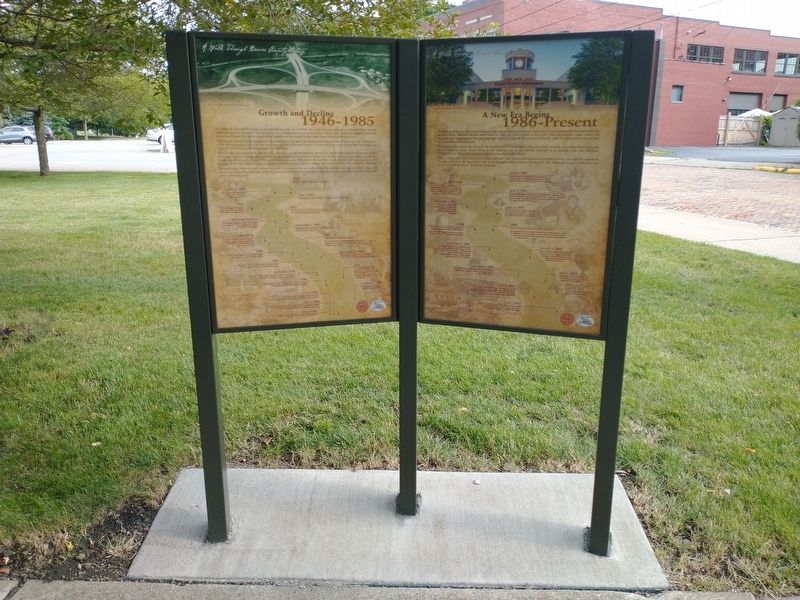
As county life attempted to return to normal following the end of WWII, the county was once again in an economic boom, and the
emphasis turned to recreation. This period saw the establishment of our county parks, a new county airport in Chippewa, . . . — — Map (db m177007) HM
Home of the noted state and national political leader is near here. He rose, between 1856-1887, from local and state offices to United States Senator. A Republican Party leader from 1887 until his death in 1904. — — Map (db m40241) HM
Founded 1796 in home of Abraham Powers. Old stone church built 1800 north of here on Shenango Road. First interment in cemetery 1798. Following a fire in 1848 and ue to growth in church a red brick church was built in 1857 here on Old Sandusky Trail. — — Map (db m133) HM
A Christian liberal arts college which was founded by the Reformed Presbyterian Church of North America in Northwood Ohio in 1848. Was moved to Beaver Falls in 1880 to a site provided by the Harmony Society. Old Main built 1880 with native stone. — — Map (db m136) HM
Founded 1859 as Homewood Junction of Pittsburgh, Fort Wayne and Chicago and Erie and Pittsburgh Railroads. Named for Ironmaker James Wood.
Incorporated in 1910. Post Office was known as Racine Pennsylvania. Historic Saint Cloud Hotel, . . . — — Map (db m49401) HM
Operated between January 19, 1896 and 1927. One of the shortest and most unusual trolley car lines in the United States. The line operated with one car built by J.G. Brill of Philadelphia. A dummy car counterbalanced by scrap metal ran on a parallel . . . — — Map (db m49425) HM
The church was founded by a small group of people under the leadership of Reverend Jordan D. Brown, in 1893. The church was chartered in 1919. Ground was broken for the present church in 1926 under Reverend G.E. Sallie. The mortgage was burned in . . . — — Map (db m51801) HM
Constructed in 1903 as the County's first library building. The building funds were furnished by an Andrew Carnegie grant and the site and maintenance by the citizens of Beaver Falls and the Big Beaver Falls School District. — — Map (db m135) HM
Built 1872 on land owned by John McKinley. Pupils in grades one to eight attended here 1873-1929. Purchased by McKinley School Historical Society of Chippewa in 1992. School house now serves as a museum. — — Map (db m50884) HM
Settled in 1795. Named for the Cannel coal found here. Mine opened 1838. Homestead of Ira Mansfield, mine owner, author and state senator. Producer of shale oil for many years. Harmony Society built a railroad in 1850 to ship coal and oil to distant . . . — — Map (db m49422) HM
In 1808 Samuel Caughey bought from Peter Crowl 15 acres of land house stables and saw mill for 1200 dollars here on the Little Beaver. In 1812 he built a grist mill. He gave it to sons James and Samuel Jr in 1820. It was in operation until 1876. — — Map (db m51799) HM
Brush Run Seceder Church James Duncan first pastor, held services in a 5 x 12 tent, later a log cabin. In 1811 a two acre cemetery created. The church relocated in 1848 as United Presbyterian church near Darlington, with B.F. Sawyer as pastor. — — Map (db m51798) HM
This monument was erected in 1887 to honor Daniel Leasure, who was an American Soldier that served in the Union Army as a Colonel and Brigade Commander during the American Civil War. Mr. Leasure attended Greersburg Academy across the street from . . . — — Map (db m120956) HM WM
Formerly Greersburg 1804-1830. Second Borough in the County 1820. First Presbyterian Church 1797. First Free Presbyterian Church 1847. First Greersburg Academy 1802. First lighted Polo Field in United States 1938. Important relay and supply station . . . — — Map (db m48087) HM
In 1821 Matthew Elder built the first woolen factory in this area and bought wool from miles around. He ran a large general store with an extensive trade. He also ran a flax seed oil mill. In connection with his brother William, he ran a grist mill. — — Map (db m49424) HM
First permanent structure of Mount Pleasant Presbyterian church. Structure built in 1808. The church and site was purchased by John McCowin in 1861 and remodeled into a home. Property purchased by Sarah E. Seanor in 1909 and still owned by her heirs. — — Map (db m49418) HM
George Foulks frontiersman built saw and gristmaills. Jesse Martin owned for some years. Reuben Watt and sons James and Thomas also ran it. The iron bridge placed on National Register June 22, 1988. — — Map (db m62684) HM
Protesting the slave holding decree of 1845 the Free Presbyterian Church was formed, and followers led by Reverend A.B. Bradford erected this beautiful church in 1847 after the Civil War in 1867 a jointure was made with the reformed presbyterians . . . — — Map (db m122307) HM
Captured by Indians in 1780. Escaped to help country. Outstanding character bold woodsman. Furbuyer Indian Scout and thrifty businessman. Married C. Ullery 1796. Built stone house, mills, and first brick house in area later known as Fennel House. — — Map (db m49423) HM
Established with funds collected by Reverend Thomas E. Hughes erected 1802 chartered 1806 by the Pennsylvania State Legislature as Greersburg Academy ratifying it the first academy west of the Allegheny Mountains. — — Map (db m48136) HM
Site of one of the first mills built on the Little Beaver River. Erected by Robert and Mary McMinn in 1796-1797. Mary was said to be the first white woman to settle in the Darlington area following the treaty with the Indians in 1795. — — Map (db m49417) HM
First site of the church where
Reverend Thomas E. Hughes was
ordained August 28, 1799 first
communion service north of
the Ohio River September 1, 1799
the Erie Presbytery organized
at this location April 13, 1802. — — Map (db m204315) HM
Founded in Cannelton by John White in late 1800's. Owner of coal and clay mines, friend of Harmonists, he was superintendent of Darlington Cannal Coal Railroad. Cemetery marked by Italian marble statue depicting White's daughter. — — Map (db m49421) HM
Built by Thomas Sprott in 1804 on land granted him in 1802 by the Commonwealth of Pennsylvania. Named "Sprotts Delight," it overlooked the borough of Greersburg, laid out on the lands of Sprott, Greer, and Martin. — — Map (db m49419) HM
Levi Dungan, first settler of Hanover Township, blazed out a 1000 acre tract in 1772. The log cabin and a fine spring were surrounded by the stockade. His wife, Mary Davis, journied by horseback to Philadelphia in 1789 to secure the land patent. — — Map (db m49701) HM
Famous resort and health spa initiated in the late 1790's. The "Frankfort House" serviced patrons in the summer months for over a century and closed in 1912. The waters contained fifteen different minerals thought to have medicinal qualities. — — Map (db m49700) HM
Mill Creek was an important part of pioneer life during the early settlement of Hookstown and the surrounding area. Numerous saw mills, woolen mills and grain mills utilized the water power of Mill Creek to operate, thus the basis for its name. — — Map (db m53892) HM
Early Methodist Episcopal Church circa 1832. Ground given for church use and free burial plot. Deeded in 1834 by Mathias Hook. Hookstown's founder and a Revolutionary soldier who is buried here.
Summer subscription school held here in 1859. — — Map (db m49699) HM
Established in 1859 by George Washington Cook. Operated by the Cook family until 1918. Then sold to the Flemings. Bought by Christy and Morrow in 1919. Known as Shippingport Ferry until (last trip April 1964), bridge built across Ohio River. — — Map (db m51427) HM
Monaca's oldest cemetery founded 1808 by Anthony Baker, Monaca's first settler. First burial 1810[.] Last 1868. Burial site for Revolutionary and Civil War vets. Purchased 1901 by Baldwin Family for railroad spur. Saved by court injunction in . . . — — Map (db m256559) HM
Home of Grace Greenwood (Sara J. Clarke Lippincott, 1823-1904), pioneer woman correspondent, poetess, and authoress. While living here during the mid-19th Century, she wrote many of her popular juvenile stories. — — Map (db m134) HM
On this site in 1865-66 a tabernacle was erected by the pioneers. Built of local brick, lumber and stone. It was of pioneer architecture with a large assembly hall, gallery, full basement, a tower and large bell. This building was used for church . . . — — Map (db m75614) HM
In a landmark ruling on April 12, 1937, the US Supreme Court upheld the constitutionality of the National Labor Relations Act in the case of the National Labor Relations Board v. Jones & Laughlin Steel Corp. The company had fired unionized workers . . . — — Map (db m40244) HM
Rivers:
1785/1964 - With the opening of the Indian lands on the north side of the Ohio River, ferries began operating
to carry settlers and goods across. Some of the earliest included: Chrisler's Ferry (Shippingport) and Thomas
Smith's . . . — — Map (db m177039) HM
The Borough of Rochester owes its existence to a group of hardy pioneers who recognized the area's potential and made their homes here. Their settlement laid the foundation upon which a group of entrepreneurs would shape Rochester into one of the . . . — — Map (db m304376) HM
The history of the settlement of Rochester centered around the efficient transportation of goods and people. Technological advances in steam and electric power led to speedy and safer travel that brought a rapid succession of new settlers and . . . — — Map (db m304529) HM
Fall 1764 – British Colonel Henry Bouquet, then commander of Fort Pitt, led an army of 1,500 into
the Ohio country to help quell an Indian uprising known as "Pontiac's Rebellion.” The army encamped
along the Tuscarawas Trail near the present-day . . . — — Map (db m177030) HM
The Beaver Division of the Pennsylvania Canal System was one of the most important developments in early Beaver County history. This combination of a canal and slack water navigation system began at the mouth of the Beaver River and extended to . . . — — Map (db m206673) HM
The most important factor that drove the growth of industry in Beaver County was the dedication of
the workforce in producing the best quality product. These dedicated workers, led by men of great
vision and ambition, helped make American . . . — — Map (db m177025) HM
You Are Now Entering Old
No Man's Land
Colorado Kansas 37th Parallel
Called "No Man's Land" until 1890
Known Then as
Beaver County
Became the Panhandle of Okla. Statehood 1907
Texas State Line 36° 30" Parallel
The . . . — — Map (db m93483) HM
Sports have always played an important role in the lives of Rochester residents whether they have been participants or spectators. Rochester High School has maintained a well-rounded athletic program with athletes continually striving to improve . . . — — Map (db m304375) HM
A typical mining town at the foot of the San Francisco Mountain was fed by the fabulously rich Horn Silver Mine. By 1885 over $60,000,000 in zinc, copper, lead, silver, and gold were hauled away by mule train and the Utah Central Railroad. Water was . . . — — Map (db m78264) HM
Patriotism has aiways been a Beaver County trait, and it was no different when the Civil War exploded on the scene. Eleven of the
270 regiments that the State of Pennsylvania raised contained one or more companies composed of Beaver County men, and . . . — — Map (db m176994) HM
As in any busy commercial town, people began to turn to entertainment to fill their non-working hours, and Rochester provided its citizens with many opportunities through the years. Patrons could visit the Grand Opera House for vaudeville acts, . . . — — Map (db m304347) HM
Burial place of Harmonist Society, 1805-15. Graves were not marked. The stone wall was built in 1869, after the Harmonists had returned from Indiana and settled at "Old Economy," in Beaver County. — — Map (db m40434) HM
First home of Harmony Society, founded 1804, by George Rapp and German followers. In 1814 moved to New Harmony, Indiana, and settled at Economy in present Ambridge, Beaver County, in 1825. — — Map (db m40359) HM
For Honorable Judge Daniel Agnew, 1809-1902. Eminent jurist, author and respected citizen. Judge of the 17th District 1851 to 1863; then appointed to Pennsylvania Supreme Court, becoming Chief Justice in 1873. His home, where he resided over 60 . . . — — Map (db m40227) HM
Maintained by the
Pennsylvania Historical
and Museum Commission
as a State memorial to the
Harmony Society
Organized February 15, 1805
Dissolved December 15, 1905
These buildings erected 1824-1831, . . . — — Map (db m40721) HM
1851 - Rail service came to Beaver County with the Ohio and Pennsylvania Railroad operating
along the north bank of the Ohio River.
1855 - The Stone family built the first of two houses on this site that were later acquired by the P&LE
for the . . . — — Map (db m176913) HM
One of the first river bridges constructed in Beaver County was the Big Beaver Tall Bridge, which connected the thriving manufacturing town of Bridgewater with its smaller suburb of "East” Bridgewater in 1815. This wooden, covered bridge lasted just . . . — — Map (db m206720) HM
Organized Baptist work in the Oklahoma Panhandle began Aug. 5, 1894 when the Pleasant View Baptist Church was founded with 8 charter members 1½ mi. N and 1½ mi. E of here. Meetings were in the Pleasant View school house until after the . . . — — Map (db m55272) HM
During the last quarter of the 19th century, and through the first half of the 20th century, Rochester, "The Hub of Beaver County," was also the hub of the Beaver County glassmaking industry. Through the course of this period, Rochester was home . . . — — Map (db m304772) HM
This monument erected by the people of Beaver County to honor the men from this county who served their country during the World War
The funds were contributed by Beaver County and popular subscription
In the lists of names on these . . . — — Map (db m274188) WM
This wagon is a reproduction of the wagons used by the Mormon Settlement to travel from Omaha Nebraska to Salt Lake City Utah. It traveled the entire trail in 1997 being navigated by Vern & Carol Condie sponsored by the Beaver County Travel Council . . . — — Map (db m274186) HM
Edward T. Guymon was born in Illinois in 1859. At 21 he moved to McPherson, Kansas from Coatsburg, Illinois. Story is he sold a cow for $22 to pay his fare west. He loaded coal for the Santa Fe Railroad as a clerk and partner for the Star . . . — — Map (db m55265) HM
Townsite planned on Rock Island Railroad survey by
Inter-State Land & Town Co. in 1900.
Rock Island Railroad built through Oklahoma Panhandle 1901.
Town founded as Sanford Post Office 14 June 1901, changed to
Guymon Post Office on 29 June . . . — — Map (db m55267) HM
The post office of Loretta was established May 7, 1898. It was moved to the Texas-Okla. line and the name was changed to Texhoma on Nov. 12, 1901.
The Panhandle of Okla. was called No Man's Land. It was owned by Spain in 1541, . . . — — Map (db m78864) HM
Just after the turn of the century, large industries recognized the advantages of locating within the county, and began moving here. Some,
like the steel companies, chose plots of ground along the Ohio River and began building not only their . . . — — Map (db m177001) HM
Beaver County industry and life were booming as the country became involved in WWI. Once again, we were well represented as Beaver
Falls native Colonel Joseph H. Thompson was awarded the Medal of Honor for his heroism. As the war drew to a close, . . . — — Map (db m177004) HM
The Little Giant: The Pittsburgh and Lake Erie Railroad, established in 1875, connected the steel centers of Conellsville, Pittsburgh, and Youngstown, Ohio. Only 120 miles long, the P&LE served most of the major industries in the region, . . . — — Map (db m19960) HM
Historic Landmark
Pittsburgh & Lake Erie Railroad Station
Designed by R. P. Forsberg, operated from 1897 to 1985
served as Beaver County 911 Center from 1986 to 2010
Opened as Beaver Station Cultural & Event Center in 2015
Historic . . . — — Map (db m231095) HM
In recognition of
Mildred Arbutina Pappas
1915 - 2002
Because of her determined drive to preserve our heritage she launched a letter writing campaign, beginning in 1972 and extending into 1977, which resulted in rescuing the Vicary . . . — — Map (db m304022) HM
No. 255
Erected 1959
The Grist Mill
Minersville was settled in 1859 for the purpose of opening lead mines. Nelson S. Hollingshead built a grist hill on this site in 1871. It was operated by water diverted from the Minersville . . . — — Map (db m240540) HM
Beaver Territorial Courthouse is considered one of the finest examples of Pioneer architecture. The architect, K.A. Kletting, designed the building in the Queen Ann style with Victorian overtones. The courthouse was constructed under the direction . . . — — Map (db m75581) HM
This early sawed log farm cabin (circa 1890-1900) was relocated to this site from the small hamlet of Manderfield located 5 miles north of Beaver. Manderfield was known as Indian Creek in pioneer days. The Beaver Chapter of the sons of The Utah . . . — — Map (db m127201) HM
Prior to the 17th century, the area we know today as Beaver County was inhabited by the Monongahela People, of whom we
know little. These early natives disappeared from the area sometime in the early 1600s.
The earliest European visitors to the . . . — — Map (db m176915) HM
The Lincoln Mine
No. 17
Erected March 20, 1937
First lead mine in Utah
Five miles N.E. of here, discovered 1858, by Isaac Grundy, Jesse Smith, Tarlton Lewis and Wm. Barton. These men and Sidney Tanner,
John Blackburn, Edwin . . . — — Map (db m240538) HM
Captain William Vicary Mansion has been placed on the National Register of Historic Places in 1974 by the United States Department of the Interior. — — Map (db m303922) HM
This unique structure was
repurposed from the turret roof of this 1890 mansion
located nearby at 199 Beaver Street. The stone steps
are now a landscape wall. It was built by Civil War
veteran and prominent attorney James Cunningham
and . . . — — Map (db m176903) HM
(Front):
Time capsule and bridge memorial
Dedicated July 4, 1988
To be opened July 4, 2049
(Rear):
Beaver County, Pennsylvania
Rochester-Monaca Bridge
Built 1928-1930
Commissioners
Arthur W. Coombs-William . . . — — Map (db m304119) HM
[Caption]: Utah’s Patchwork Parkway offers travelers a diverse patchwork of colors, cultures, and climates.
[Caption]: Photo below: Sheep Grazing Photo above: Utah’s Patchwork Parkway
For centuries people and animals have . . . — — Map (db m261537) HM
This is the oldest surviving courthouse designed by George P Washburn of Ottawa. Before coming to town, Washburn had worked for the Kansas City architectural firm of Cross and Taylor where he supervised construction of Union railroad depots . . . — — Map (db m67586) HM
America is a great country because of our God given rights, and it is the Constitution - the supreme law of the United States - that declares our rights, and it is protected by our military.
Each person enlisting in an armed force of the . . . — — Map (db m304257) WM
Situated on the northernmost point of the Ohio River at the mouth of the Beaver River, Rochester was positioned to become one of the main terminals of transportation in Beaver County. With the installation of the Beaver Division Canal and . . . — — Map (db m304284) HM
Remarkable General Abner Lacock, Beaver County's first justice of the peace, a statesman in Pennsylvania and national government, a decision-maker in the War of 1812 and Rochester resident, had little opportunity for formal education. Yet the . . . — — Map (db m304677) HM
This period of our county history saw the establishment of early industry and the infrastructure that would support it. Prior to this time,
ferries, not bridges, had been used to move wagons and people across the rivers. Boat building- first . . . — — Map (db m176918) HM
Beaver County was built by the labor of many generations of people who moved here to begin a
new life. It began with the earliest pioneers who braved the wilderness and its dangers to clear the
land for farms, on which they built a foundation for . . . — — Map (db m177024) HM
During this period, new industries popped up such as Mayer China and the Keystone Driller Company, along with many others. The
rise of these industries created a demand for a rapid increase in transportation, which was partially answered with the . . . — — Map (db m176998) HM
Despite the threat of Indian attack and the hardships of life on the frontier, early white settlers began trickling into the area south of the
Ohio River, attracted by fertile farmland, river transportation, and an abundance of natural resources. . . . — — Map (db m176916) HM
Hall Of Famers
Vito "Babe” Parilli -
Hometown: Rochester
Member of College Football Hall of Fame
Super Bowl Champion
Mike Ditka - Hometown: Aliquippa
Member of College Football Hall of Fame & Pro Football Hall of . . . — — Map (db m264818) HM
182 entries matched your criteria. Entries 101 through 182 are listed above. ⊲ Previous 100
Thin black lines indicate changes in relevance. Between each pair of lines entries are ordered geographically but all have the same relevance.
* Inflectional forms of words are their plurals, singulars, and possessives as well as gramatical tenses and similar variations.