575 entries match your criteria. Entries 101 through 200 are listed.⊲ Previous 100 — Next 100 ⊳
Entries Containing the Phrase «district of columbia»
This list will also include matches for inflectional* forms of the words. The following noise* word you entered was ignored: of. If this word is required for a successful search, go to the Advanced Searches page and use the Google Search from there.
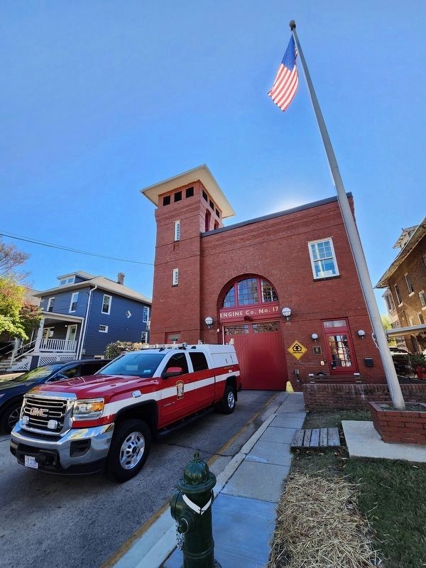
On Monroe Street Northeast east of 12th Street Northeast, on the right when traveling east.
Dedicated in memory of the longest serving member of Engine Company 17, Wagon Driver Jackson H. Gerhart.
He was appointed on Feb. 3, 1963 and retired on Sept. 30, 1994. He succumbed to injuries sustained in the line of duty while operating . . . — — Map (db m111800) HM
On Georgia Avenue Northwest (U.S. 29) at Underwood Street Northwest, on the right when traveling south on Georgia Avenue Northwest.
This busy section once was a "Country Road" to Washingtonians looking for peace and recreation. If you drove by here a century ago, you would have passed woods and large estates, and might even have seen fox hunters. Across Georgia was the . . . — — Map (db m72813) HM
On 11th Street Northwest north of Monroe Street Northeast.
For nearly a century, between 1862 and 1962, streetcars in Washington, D.C. carried people across the District. The first streetcars were drawn by horses and could only carry people short distances, but the introduction of the electric streetcars, . . . — — Map (db m111927) HM
On I Street Northwest west of 20th Street Northwest, on the right when traveling west.
Built in 1802 This house was the home of James Monroe Lieutenant-Colonel in the American Revolution
While Secretary of State and of War under Madison, and for the first six months of his administration as fifth President of the United . . . — — Map (db m97526) HM
On 21st Street Northwest near P Street Northwest, on the left when traveling north.
Before the city built a bridge over Rock Creek at P St., this area was a favorite fording place. In fact, it was here that the Baltimore Light Dragoons and French units led by Lafayette, Count Rochambeau and Duc De Lauzan crossed Rock Creek . . . — — Map (db m98789) HM
On F Street Northwest east of 19th Street Northwest.
Here lived for a time
John Marshall
1755 - 1835
Officer in the Revolutionary War 1775 - 1781
Envoy to France 1797 - 1798
Secretary of War - 1800
Secretary of State - 1800
Chief Justice of the United States 1801 - 1835
. . . — — Map (db m111747) HM
On 28th Street Northwest 0.1 miles south of R Street Northwest, on the right when traveling north.
Samuel Davidson, a Scot of original character, purchased the site and built Evermay, 1792-1794, with proceeds of the sale of lands he owned which include part of the present site of the White House and Lafayette Square. Davidson was buried in a . . . — — Map (db m33792) HM
On Potomac Street Northwest south of O Street Northwest, on the right when traveling north.
Born Scotland 1625 - Died Maryland 1717
Patentee of Rock of Dunbarton
Member of the House of Burgesses
Commander in Chief of Provincial Forces of Maryland
In grateful recognition of his services "upon all incursions and disturbances of . . . — — Map (db m110022) HM
On Q Street Northwest east of 28th Street Northwest, on the right when traveling west.
The site was part of a tract called “The Rock of Dumbarton” patented 1703 by Ninian Beall.
The house was probably started 1799 by Samuel Jackson. It was completed 1805 by Joseph Nourse, first Registrar of the Treasury. He sold the . . . — — Map (db m95765) HM
Near R Street Northwest east of 29th Street Northwest, on the left when traveling east.
In memory of Ann Lillie Mackall, friend of Rose O'Neal Greenhow and brave-hearted Confederate courier, who Died December 12, 1861, Aged 22 years — — Map (db m68745) HM
On R Street Northwest just east of 6th Street Northwest (U.S. 1), on the right when traveling west.
Shaw Historic Bike Tour
Asbury Dwellings
Howard Theatre
Industrial Bank of Washington
True Reformer
Lincoln Theatre
Whitelaw Hotel
Thurgood Marshall Center
Sweet Daddy Grace
Mary McLeoud Bethune
Carter G. Woodson
Blanche . . . — — Map (db m150840) HM
On Martin Luther King Junior Avenue Southeast north of V Street Southeast, on the left when traveling north.
A Celebration of the 100th anniversary of the women's suffrage movement through the perspective of three artists. The mural commemorates the 19th Amendment securing women's right to vote.
Onward and Upward We Go
Candice S. Taylor . . . — — Map (db m266757) HM
Near Alabama Avenue Southeast east of Massachusetts Avenue Northeast, on the left when traveling east.
This small work was one of the defenses begun in the fall of 1861 on the ridge east of the Anacostia River. It was named after Admiral Samuel DuPont, a commander of the South Atlantic Blockade Squadron. Eight guns and one mortar comprised its . . . — — Map (db m46425) HM
On Water Street Southwest south of 6th Street Southwest. Reported missing.
To your left across Water Street is the Thomas Law House, now a community center for the Tiber Island cooperative. The Federal style house was designed by William Lovering in 1794 for businessman Thomas Law and his bride Eliza Parke Custis, . . . — — Map (db m130911) HM
Near West Basin Drive Southwest at Independence Avenue Southwest. Reported permanently removed.
At this site will be erected the Martin Luther King, Jr .Memorial. The memorial will embody the man, the movement and the message. It will honor this 20th century visionary who brought about change through the principles of nonviolence and . . . — — Map (db m208) HM
Near Constellation Plaza 0.1 miles east of Wallace Street, on the right when traveling east.
"This tree dedicated to Colonel James McHenry Secretary of War under Presidents Washington and John Adams and for whom Fort McHenry was named in 1798 when it was offered to the Federal Government." — — Map (db m145548) HM
On Crain Highway (U.S. 301) at Port Tobacco Road (Maryland Route 6), on the right when traveling south on Crain Highway.
11.8 miles West near Ironsides, MD. Oldest church in Charles County. Served by thirty rectors through 257 years. Present building erected 1732. Visited by George Washington 1771. Restored by Governor Smallwood 1791. — — Map (db m36840) HM
Near Darnestown Road (Maryland Route 28) 1 mile north of Beallsville Road (Route 109), on the right when traveling north.
Black men — both free and enslaved — were called upon to fight in the Civil War which ultimately led to the dismantlement of slavery, that ‘peculiar institution.’
As the Civil War dragged on, the state newspapers exaggerated that the . . . — — Map (db m295574) HM
On University Boulevard West (Maryland Route 193) north of Eisner Street, on the right when traveling north.
The Royal Ambassadors of the Southern Baptist Convention made possible this memorial by their gifts and dedicated it to the memory of Luther Rice on August 14, 1963 during the
Third National
• Royal Ambassador Congress • — — Map (db m114892) HM
On University Boulevard West (Maryland Route 193) north of Eisner Street, on the right when traveling north.
Luther Rice has been described as a denominational statesman. His critics--and they were many--would probably have labeled him a "Baptist politician"! Rice had the traits both of the polished diplomat and the grass-roots office seeker. He was . . . — — Map (db m114891) HM
On North Fairfax Street south of Cameron Street, on the left when traveling south. Reported permanently removed.
From March 26 through April 20, 1755, the town of Alexandria served as the center of operations for Major General Edward Braddock, commander-in-chief for British forces in North America. He chose the finest house in town, John Carlyle's, as his . . . — — Map (db m156495) HM
On 6th Street South east of Long Bridge Drive, on the right when traveling east. Reported damaged.
Fort Runyon was the largest in area of 164 Civil War forts and batteries built in Virginia, Maryland, and the District of Columbia. The Defenses of Washington, as they were known, formed a 37-mile ring around the capital as protection from . . . — — Map (db m134983) HM
Near Enon Church Road (Virginia Route 746) at Point of Rocks Road, on the left when traveling west.
Thousands of African-American troops served in the Army of the James under the official designation of United States Colored Troops (USCT).
Maj. Gen. Benjamin F. Butler was a strong proponent of the use of African-American troops and had more . . . — — Map (db m180820) HM
After Virginia seceded from the Union on April 17, 1861 the District of Columbia was on the dangerous border between the divided states. Because of the city’s importance, the Union Army immediately occupied Northern Virginia, which allowed troops to . . . — — Map (db m47967) HM
On Independence Avenue Southwest east of West Basin Drive Southwest, on the right when traveling east. Reported permanently removed.
Historic Trees. You are standing near two of the most important cherry trees in Washington, D.C. These Yoshino Cherries (Prunus x yedoensis) are among the 3,700 trees of various species that grow in East and West Potomac Park and on the . . . — — Map (db m215) HM
On 7th Street Southwest at Water Street Southwest, in the median on 7th Street Southwest.
Located at 7th and Water Streets SW, the District of Columbia morgue was built in 1904 and demolished in 1939 when the city morgue moved to a more modern facility. — — Map (db m120942) HM
On Wharf Street Southwest south of Maine Avenue Southwest, on the left when traveling north.
On March 23, 1956, Elvis gave his first and only performance in the District of Columbia at Pier 4 on the S.S. Mt. Vernon, a cruise steamer operated by the Wilson Line. — — Map (db m216136) HM
On Union Street just south of Gage Street, on the right when traveling north.
The U.S. Arsenal was established here in 1827. Several of its commanders became prominent in the Civil War, including Capt. James Ripley, who became a Brigadier General and Chief of the Army's Ordnance Department; Lt. Robert . . . — — Map (db m186100) HM
On The Walk of History north of Main Street (Maryland Route 725).
The Walk of History
“We walk in the footsteps of those who went before us.”
The 300th anniversary of the founding of Prince George’s County Maryland, was celebrated on April 23rd, 1996. Three hundred years before, in . . . — — Map (db m32566) HM
On Jefferson Street at Washington Street, on the right when traveling west on Jefferson Street.
Through blurred eyes we find the strength and courage to soar beyond the moment. United, we look to the future knowing we can never forget the past. — — Map (db m69529) WM
Near South Christopher Columbus Boulevard south of Spruce Street, on the right when traveling north.
The casket
containing the mortal remains
of the
American "Unknown Soldier"
who gave up his life in the
World War
rested upon this hatch
during its transfer
from
Le Havre, France, to the National . . . — — Map (db m290111) HM
Near East Market Street (Virginia Route 7) at Sycolin Road Southeast, on the right when traveling east.
District of Columbia
• Howard University - District of Columbia
• University of the District of Columbia - District of Columbia
Maryland
• Bowie State University - Bowie, Maryland
• Coppin State University - . . . — — Map (db m291565) HM
On Mount Royal Terrace at North Avenue (U.S. 1), on the right on Mount Royal Terrace.
1846-7-8 Erected by the Maryland Association of Veterans of Mexican War 1903 [tablet 2]
Association of the Veterans of the Mexican War 1846-7-8
Surviving members 1903 Of the Army.
John A. Reese, Samuel C. Love, John A. Love, John . . . — — Map (db m81626) HM
On Pennsylvania Avenue Northwest north of East Executive Avenue Northwest, on the right when traveling east.
The White House is the oldest public building in the District of Columbia, and 1600 Pennsylvania Avenue is the most famous address in the United States. Here every president except George Washington has led America's government. The White House . . . — — Map (db m204114) HM
Near Oxon Hill Road (Maryland Route 414) south of Harborview Avenue, on the right when traveling north. Reported missing.
Resistance to slavery took many forms – some more extreme and more cruel than others. In November 1834, house slave Judah, a 14 year-old, girl confessed to fatally poisoning three of Dr. Bayne’s children and attempting to set fire to Salubria, his . . . — — Map (db m117030) HM
On Ox Road (Virginia Route 123) at Workhouse Way, on the right when traveling north on Ox Road.
In the nearby Occoquan Workhouse, from June to December, 1917, scores of women suffragists were imprisoned by the District of Columbia for picketing the White House demanding their right to vote. Their courage and dedication during harsh treatment . . . — — Map (db m167974) HM
On River Road Northwest at Western Avenue Northwest, on the right when traveling south on River Road Northwest.
Civil War Defenses of Washington 1861-1865. No visible evidence remains of Fort Bayard, which stood at the top of this hill. Named for Brig. Gen. George Bayard, mortally wounded at the Battle of Fredericksburg on December 13, 1862. — — Map (db m124) HM
On Quackenbos Street Northwest near 13th Street Northwest, on the left when traveling east.
Dedicated September 1936 in memory of The Grand Army of the Republic by the Daughters of Union Veterans of the Civil War 1861-1865 — — Map (db m49526) HM
On 14th Street Northwest at Pennsylvania Avenue Northwest, on the right when traveling north on 14th Street Northwest. Reported damaged.
George Washington appointed French engineer and Revolutionary War veteran, Pierre L'Enfant, to come up with a plan for the new country's capital city in 1791. L'Enfant's plan was bold and innovative. He imagined broad avenues, perfect for . . . — — Map (db m272792) HM
On K Street Northwest east of 9th Street Northwest, on the right when traveling east.
This majestic building was opened in 1903 as the Central Public Library, popularly known as the Carnegie Library because Andrew Carnegie donated funds to build it. From the start Central was open to all. Mary Church Terrell and historian John . . . — — Map (db m18794) HM
On N Street Northwest west of 7th Street Northwest, on the right when traveling west.
Immaculate Conception Catholic School has been placed on the National Register of Historic Places by the United States Department of the Interior September 23, 2003 First school built in 1864 Present school built in 1908 B. . . . — — Map (db m27549) HM
Near Woods Trail, on the right when traveling north.
Nature
There is delight in the hardy life of the open. There are no words that can tell the hidden spirit of the wilderness, that can reveal its mystery, its melancholy, and its charm.
The nation behaves . . . — — Map (db m308478) HM
On MacDill Boulevard Southeast at Brookley Avenue Southwest, in the median on MacDill Boulevard Southeast.
This aircraft, of a type used extensively in Southeast Asia air operations, is dedicated to all the courageous airmen who gave their lives in honor during that conflict. — — Map (db m63898) HM
On 17th Street Southwest north of Independence Avenue Southwest, on the left when traveling north.
Here in the presence of Washington and Lincoln, one the Eighteenth Century father and the other the Nineteenth Century preserver of our nation, we honor those Twentieth Century Americans who took up the struggle during the Second World War and made . . . — — Map (db m4392) HM
Near Fort Foote Road at Jessica Drive, on the right when traveling south. Reported permanently removed.
Follow this path to the earthworks of Forte Foote.
Fort Foot was named after Flag Officer Andrew Hull Foote, a Union naval hero mortally wounded at Fort Donelson, Tennessee, on February 14, 1862. — — Map (db m194178) HM
On Blue Ridge Parkway (at milepost 422.4), 0.9 miles north of Lake Logan Road (State Highway 215), on the left when traveling south.
Commercial logging and devastating wildfires scarred the forests of America in the early decades of the 1900s. To repair the damage, the United States Forest Service began the "Penny Pine" program in the 1930s, encouraging people to donate a penny . . . — — Map (db m123299) HM
Near Fords Landing Way north of Wharf Street, on the right when traveling north.
On January 22, 1791, George Washington appointed Andrew Ellicott and Benjamin Banneker to survey the boundaries of the "District of Columbia," to be the home of the Federal government of the United States. The President instructed the surveyors . . . — — Map (db m299712) HM
On Acorn Drive 0.1 miles south of Oak Grove Road (County Route 606), on the left when traveling south. Reported missing.
Racing the pursuing Confederate cavalry for the safety of the Union lines at Petersburg after accomplishing most of its mission, Gen. James H. Wilson's command reached Ream's Station about 7 a.m. June 29. Two brigades of Gen. William Mahone's . . . — — Map (db m13774) HM
On Georgetown Pike (Virginia Route 193) at Chain Bridge Road (County Route 3563), on the right when traveling west on Georgetown Pike.
Two 18th-century roads intersect just west of here: Sugarlands Rolling Road (now Georgetown Pike) and Little Falls Road (now Chain Bridge Road). Several historic structures stand near the fork: Langley Toll House (ca. 1820); Langley Ordinary (ca. . . . — — Map (db m2328) HM
On East Main Street (U.S. 60) just west of North 12th Street, on the right when traveling west.
Spottswood W. Robinson III, a Richmond native, fought against Jim Crow laws that made African Americans second-class citizens. An attorney, he worked for the Virginia NAACP and the NAACP Legal Defense and Educational Fund and helped to argue a . . . — — Map (db m173660) HM
On 14th Street Northwest south of Corcoran Street Northwest, on the right when traveling south.
Dominican Mural: "Quisqueya Comes With Me"
This mural marks a historic milestone as the first collaboration between the Government of the District of Columbia and the Government of the Dominican Republic, a joint effort to . . . — — Map (db m287959) HM
On Heritage Island Trail Northeast east of Anacostia Riverwalk Trail, on the right when traveling east.
History
The Anacostia River was once nearly a mile wide, and the channel was deep enough for ocean-going ships to travel and trade. By 1850, the river had silted in from erosion caused by deforestation and farming, and was no longer . . . — — Map (db m237162) HM
On Kingman Island Trail Northeast south of Benning Road Northeast, on the left when traveling north. Reported damaged.
History
The Anacostia River was once nearly a mile wide, and the channel was deep enough for ocean-going ships to travel and trade. By 1850, the river had silted in from erosion caused by deforestation and farming, and was no longer . . . — — Map (db m237153) HM
On Pennsylvania Avenue Northwest at 13-1/2 Street Northwest, on the left when traveling west on Pennsylvania Avenue Northwest.
His fervor for justice, fairness, and equality led him to become a champion of the people.
Marion Barry, Jr., held elected office in the District of Columbia for 35 years. He was elected President of the District of Columbia School Board in . . . — — Map (db m114749) HM
On Independence Avenue Southwest east of 9th Street Southwest, on the right when traveling east. Reported permanently removed.
Welcome to Earth Day Park Earth Day Park is a living example of the United States Government’s commitment to environmentally conscious landscape design and use of renewable resources. As part of the celebration of Earth Day 1994, President . . . — — Map (db m99344) HM
On Farrow Parkway at South Kings Highway, on the right when traveling north on Farrow Parkway.
On April 22, 1968, the 354th Tactical Fighter Wing was replaced at Myrtle Beach Air Force Base by the 113th Tactical Fighter Wing, a former District of Columbia Air National Guard (ANG) unit which had been recalled to active duty January 26, 1968. . . . — — Map (db m102130) WM
On 19th Street near K Street, on the right when traveling north.
An African American suffragist who helped found the National Association of Colored
Women in 1986 and served as its first national president. In addition, she was a
founding member of the National Association of College Women.
In 1950, she . . . — — Map (db m171453) HM
On Alaska Avenue Northwest at 16th Street Northwest, on the right when traveling north on Alaska Avenue Northwest.
On May 30, 1920, Memorial Day, a crowd including many veterans gathered at this intersection to dedicate the first of 507 Norway maples that would make up DC's 16th Street World War I Tree Memorial. Assistant Secretary of War Benedict Crowell . . . — — Map (db m243284) HM
On 15th Street Northwest north of L Street Northwest, on the left when traveling north.
On Trinity Sunday, June 11, 1876 the first Black Catholic Church in Washington District of Columbia was dedicated under the patronage of Saint Augustine, Bishop of Hippo in Africa. Saint Augustine Church stood on this site until 1947. The present . . . — — Map (db m29509) HM
On 12th Street Northwest at L Street Northwest, on the left when traveling north on 12th Street Northwest.
The original Messer Building was developed by James A. Messer and occupied a portion of this site for over half a century until 1989. The Messer family, early Scottish immigrants who settled in the District of Columbia, have left their mark as . . . — — Map (db m88823) HM
On Pennsylvania Avenue Northwest east of 17th Street Northwest, on the right when traveling east. Reported permanently removed.
The White House is the oldest public building in the District of Columbia, and 1600 Pennsylvania Avenue is the most famous address in the United States. Here, every President except George Washington, has conducted the government of the Nation. . . . — — Map (db m10127) HM
On E Street Northwest just west of 19th Street Northwest, on the right when traveling west.
The cornerstone for this building was dedicated in a traditional Masonic ceremony on September 5, 2002, in the presence of students, families, faculty, alumni and neighbors of The George Washington University and Robert H. Starr, 33°, Grand Master, . . . — — Map (db m188626) HM
On 35th Street Northwest close to P Street Northwest, on the right when traveling north.
Herron-Moxley House
76 Fayette Street
has been placed on the
National Register
of Historic Places
by the United States
Department of the Interior
1853 — — Map (db m255237) HM
On 29th Street Northwest just north of Dumbarton Street Northwest, on the left when traveling north.
Mt. Zion United Methodist Church, the First Black Methodist Church in Washington, D.C., founded October 16, 1816, is designated a District of Columbia Historic Landmark. It was listed in the National Register of Historic Places on July 24, 1975. — — Map (db m177949) HM
On O Street Northwest just west of 36th Street Northwest, on the right when traveling east.
The Alumni House is an old Georgetown structure which appears in the survey of the District of Columbia as early as 1861. It was renovated by Georgetown University in 1951 for the purpose of becoming headquarters to the Georgetown University Alumni . . . — — Map (db m211972) HM
Near Wisconsin Avenue Northwest 0.1 miles north of Massachusetts Avenue Northwest, on the right when traveling north.
This memorial was erected in 1907 by the Society of Colonial Wars in the District of Columbia to mark the road over which on April 14, 1755 a division of the British Army under General Braddock marched on its way to Fort Duquesne. — — Map (db m55534) HM
On Georgia Avenue Northwest (U.S. 29) south of Euclid Street Northwest, on the right when traveling south.
Miner Teachers College, which operated here from 1914 until 1955, was the principal school training black teachers in the city for more than 70 years. Named for Myrtilla Miner (1815-1864), a white educator who founded Miner Normal School in 1851, . . . — — Map (db m114359) HM
On Beach Drive Northwest 0.3 miles north of Shorham Drive Northwest, on the right when traveling north. Reported damaged.
From the point of this sign, east up the hill to Adams Mill Road, is 1.7 acres of National Zoological Park land that once formed part of the Union Benevolent Association Cemetery. The District of Columbia's Walter Pierce Community Park now occupies . . . — — Map (db m188749) HM
Near E Street Southeast at Potomac Avenue Southeast, on the right when traveling east.
This path is the official Ward 6, September 11, 2001 Memorial honoring and remembering those who lost their lives during the terrorist attacks in New York City, Washington, DC, and Pennsylvania. It was designed to be a sensory experience to . . . — — Map (db m211917) WM
On D Street Southeast at 4th Street Southeast, on the right when traveling west on D Street Southeast.
The first public school for colored children of the District of Columbia. Named Little Ebenezer and located within the boundaries of the Capitol Hill Historic District. Designated a Category II Landmark by the Joint Committee on Landmarks April 29, . . . — — Map (db m116119) HM
On 4th Street Southeast north of D Street Southeast, on the left when traveling south.
As our nation celebrated its 200th anniversary in 1976, Ebenezer United Methodist Church celebrated 138 years of service to God, humanity, country, home, and community. This model is a replica of Little Ebenezer, the frame church that stood on this . . . — — Map (db m116122) HM
On 4th Street Southwest at O Street Southwest, on the right when traveling south on 4th Street Southwest.
Harbour Square, completed 1966, contains seven historic dwellings. Development of the historic structures was initiated by James Greenleaf in the early 1790's. The financier sold individual lots to Thomas Law for the "Barney House" and the Lewis . . . — — Map (db m148959) HM
On Wharf Street Southwest just east of Riley Street Southwest, on the left when traveling east.
Originally constructed in 1809, the original wooden structure opened as a toll bridge that spanned the Potomac River, connecting the District of Columbia with Virginia—now carrying rail traffic as part of the 14th Street Bridge complex. — — Map (db m204405) HM
Near John F. Kennedy Memorial Highway (Interstate 95) north of Maryland Route 543, in the median.
General Washington resigned his commission at Annapolis, December 23, 1783. American Revolution officially ended by Congress meeting in Annapolis, January 14, 1783. District of Columbia given to Nation, 1791. Francis Scott Key wrote "The . . . — — Map (db m25) HM
On Forest Glen Road (Maryland Route 192) at Rosensteel Avenue, on the left when traveling east on Forest Glen Road. Reported missing.
Near this spot was the home of Daniel Carroll, member of the Second Continental Congress and of the Federal Constitutional Convention. He was a Representative from Maryland in the first United States Congress and served as one of the three . . . — — Map (db m168741) HM
On Osage Street at Edmonston Road, on the left when traveling west on Osage Street.
General Edward C. Carrington (1825-1892) purchased the Yarrow land tract consisting of 150 acres and the home called Sportland for $59,000 on 9 September 1869.
In 1846, he organized Captain Carrington’s Company, 1st Regiment Virginia Volunteers . . . — — Map (db m50403) HM
On Annapolis Road (Maryland Route 450) at Baltimore Lane when traveling south on Annapolis Road.
A suburb established by progressive African Americans who worked in the District of Columbia. Platted in 1908 along a stop of the WB&A Electric Railway. Developed by Lawyer Educator, Civil Servant and activist Thomas Junius Calloway. Vice President . . . — — Map (db m72043) HM
On Easton Denton Road (Maryland Route 328), on the left when traveling north.
Attained freedom and devoted his life and talents to the abolition of slavery and the cause of universal suffrage. Visited England in 1845 and in 1859. Won many prominent friends abroad and at home. Was U. S. Marshall for the District of Columbia . . . — — Map (db m87682) HM
On Talbot Street (Maryland Route 33) at Mill Street, on the right when traveling north on Talbot Street.
Born on Tuckahoe Creek, Talbot County; lived as a slave in St. Michaels area, 1833-1836. Taught self to read and write, conducted clandestine schools for blacks here. Escaped north, became noted abolitionist orator and editor. Returned 1877, as U.S. . . . — — Map (db m3732) HM
On North Dr.. 0.2 miles Circle Dr., on the left when traveling east.
Andrew V. Bobal, New Jersey 2nd Lt. AAF, May 5 1916, - Charles D. Dintaman, District of Columbia Sgt. AAF December 1 1913,- Leslie D Gilliland, Kansas Flt O. AAF October 26 1921,- James Goldsmith, New York Sgt. AAF November 28 1919, - Marion O . . . — — Map (db m192719) WM
On Reed Street at Reed Street just off Bremer Street when traveling south on Reed Street.
This Box Car was a restoration project of the Grand Voiture du N.H. of the Forty and Eight. This Box Car is one of the 49 Freedom cars sent by the French Government to each one of the 48 states and one to be shared by District of Columbia and . . . — — Map (db m19825) HM
On North Edenton Road Street at King Street, on the right when traveling north on North Edenton Road Street.
Sorority Founder. Teacher One of Nine Founders of Alpha Kappa Alpha (AKA), First Greek-letter Society for African American Collegiate Women (1908). English Teacher in Public Schools and Colleges in Pennsylvania, North Carolina, and the District . . . — — Map (db m226512) HM
575 entries matched your criteria. Entries 101 through 200 are listed above. ⊲ Previous 100 — Next 100 ⊳
Thin black lines indicate changes in relevance. Between each pair of lines entries are ordered geographically but all have the same relevance.
* Inflectional forms of words are their plurals, singulars, and possessives as well as gramatical tenses and similar variations.
* A noise word is a word that has been deemed too common to index. “The,” “to,” and “then” are examples of noise words. You will find a full list on the Advanced Searches page, in the Rules and Options link of the Keyword Search.